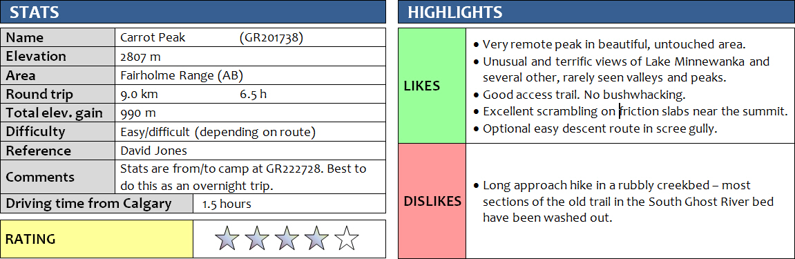
21 August 2016
With Richard
After our failed attempt to summit Saddle Peak the day before, Richard and I aimed for the little known “Carrot Peak” on the second day of our weekend camping trip in the Southern Ghost Wilderness area. Carrot Peak is mentioned in David Jones’ new 2015 climbing guidebook “Rockies Central”, but it doesn’t say much other than that it has two summits (north and south, the south summit being the higher one) and that the southern slopes offer an easy descent off the mountain towards South Ghost Pass. Apparently the first recorded ascent was made only in 1991 by climber John Martin.
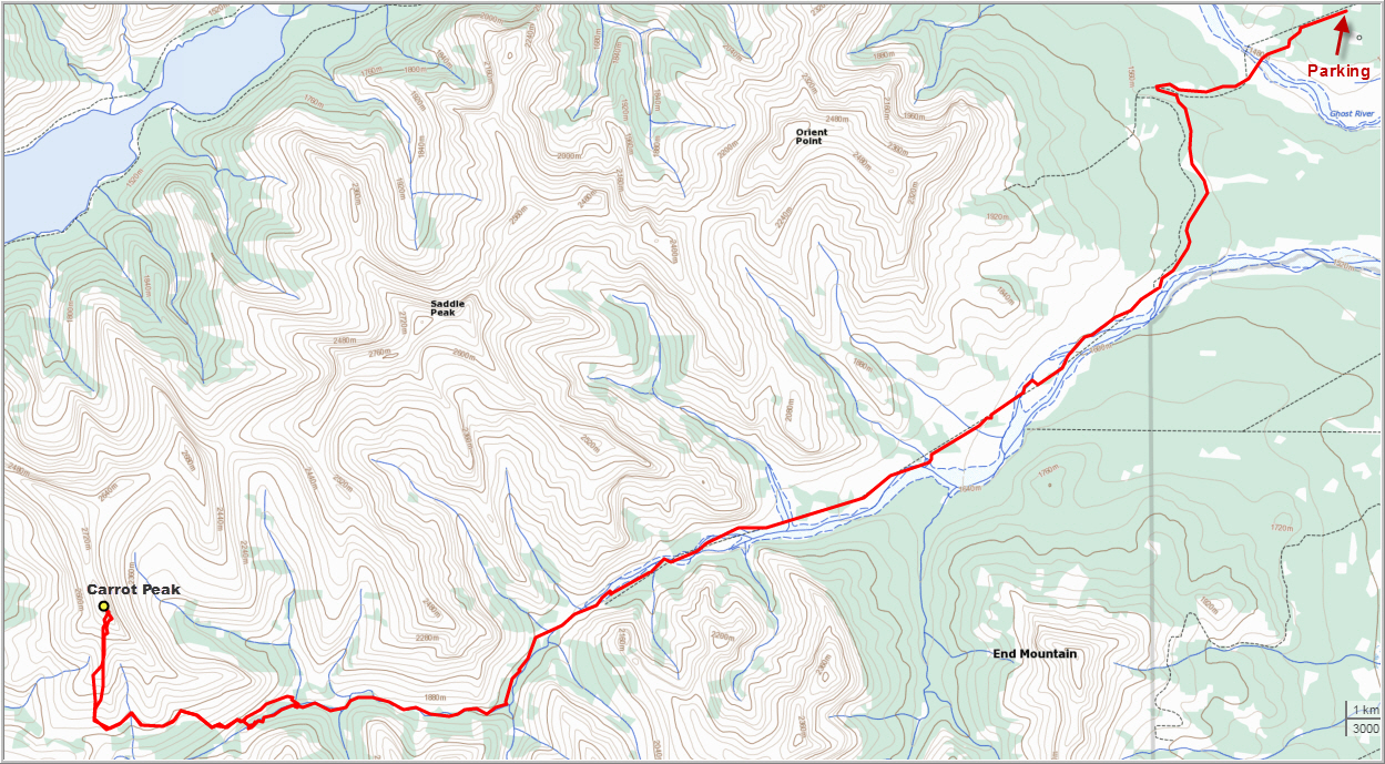
We were still quite tired when we woke up at 6am; after all we had hiked for 14 hours and a total of 30 km and 1800 m elevation gain the day before in our bid to reach Saddle Peak (we got turned around a mere 200 m horizontal distance from the summit by a huge vertical cliff). After a hearty breakfast with raisin bagels and carpaccio, courtesy of Richard, we set off and headed west further up the South Ghost River valley.
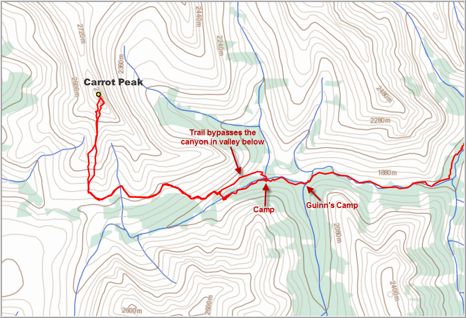
Compared to the wide plain that this dried out river forms further downstream, the valley was now quite narrow and canyon-like features soon appeared, forcing us to hop over huge boulders and large puddles of crystal-clear water molded into the rock. It was a beautiful place – peacefully quiet and untouched, with no traces of a trail or cairns or any human activity for that matter. Our progress was awfully slow, however. The gorge kept getting narrower and the cliffs on either side steeper, and we had to start climbing up steep ledges on the side to circumvent large pools of water that blocked our way. We soon reached a point where we could go no further (without going for a swim, that is!). I pulled out the very basic description of the South Ghost River trail in Gillean Daffern’s Kananaskis Country Trail Guide and we quickly realized our mistake: the actual trail was above us on the right, paralleling the canyon on the northern side of the valley. So we headed straight up the steep, grassy slopes, bushwhacking through moderately dense forest until – to much, much relief! – we squarely hit a good trail some 50-100 m higher than the valley bottom. In fact, we could’ve saved ourselves a lot of time and energy as we later found out that this trail originated right at our campsite (our camp was located at GR222728, 500 m west of Guinn’s Camp which sits at GR227728).
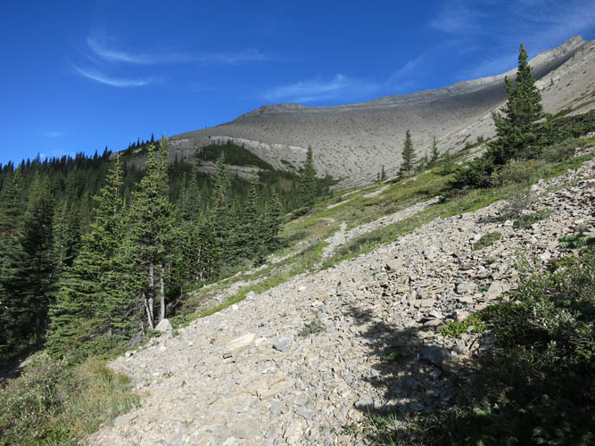
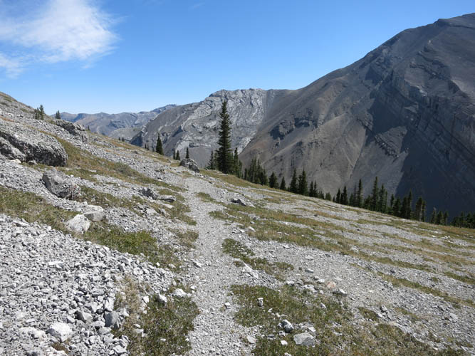
Now on a good trail, the remainder of the approach was a breeze. It felt reassuring and comfortable to be on a good path for once, and Richard and I really were finally allowed to simply set one foot in front of the other and enjoy our hike in the South Ghost Valley without having to worry too much about the route. After rising steeply through the forest, the trail started to level off at treeline and then slowly gained elevation as it wound its way across beautiful Alpine meadows and short patches of trees. It eventually petered out just as we were about to get a glimpse of South Ghost Pass, which lay hidden below us behind a rise.
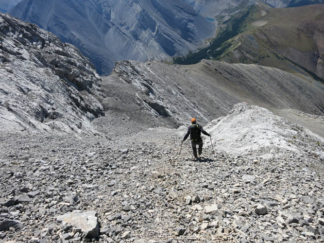
Where the path ended, we simply started ascending a broad, open slope of lush green grass to our right – the south side of Carrot Peak. Our ascent was quick and pleasant and brought us to a broad rocky ridge that narrowed as we got higher. Soon we had the steep summit mass of the south peak in front of us: there was a short but exposed ridge section to overcome before we could tackle a succession of steep, smooth limestone slabs to the top. A much easier way would’ve been up a scree gully to the left, and both the exposed ridge and the steep slabs could be avoided that way. That was our option for the descent and we felt that going up it would be fun to explore some scrambling challenges. The light grey limestone is excellent for scrambling with lots of small cracks and knobs offering solid holds. A lot of the moves relied on friction holds, and we were both glad the soles of our boots were still in good shape. A good grip makes a big difference here! I really enjoyed this part – some of the best scrambling I’ve done in a while.
It took us about half an hour to get through this section, then the summit cairn of Carrot Peak suddenly popped up right in front of us. There was no register, so I placed the one I had brought. In true style, Richard and I celebrated our first and only summit of the weekend with fresh carrots (yes, sounds really lame, but much to our regret now all the whiskey and beer had been used up the night before…). I loved the views of Lake Minnewanka from up here. Rarely seen aspects of Stenton Peak and Mount Pechee were also quite interesting to look at. The traverse to Carrot Peak’s north summit, perhaps 500 m away, appears to be no walk in the park and we didn’t even consider it, mostly because of time constraints. The ridge is spiked with vertical cliffs in places and the elevation loss does not seem to be insignificant. It appears, however, as though the south summit was indeed slightly higher in elevation and therefore the true summit.
The return to camp was unexpectedly fast. What helped a lot was our “alternative descent” off the summit mass. We saved much time and energy by taking the scree gully on skier’s right of the limestone slabs that we had climbed up earlier. We bypassed the narrow ridge on rubbly ledges on the right side below and then used a wide scree slope to skier’s left of our grassy ascent slope to quickly slide down the southern side of the mountain. Once back on the trail, it was an easy and extremely enjoyable hike in sunny, hot weather back to our camp, where the path ended.
It was 230pm now and we still had to hike out of the valley to our car and drive back to Calgary. We had a quick lunch and packed up our tent, then embarked on the arduous slog back down the South Ghost River. There are sections of the old road that are still intact – they are often hard to find, but once on them the going was much easier on the feet than all that loose rubble in the riverbed. With sore feet and our backs aching under the burden of our heavy packs, we finally got back to our car around 830pm after a good 5 hour hike. It was a price we were happy to pay for two fabulous days of exploration and adventure in a beautiful and pristine corner of our Rockies backyard.
DISCLAIMER: Use at your own risk for general guidance only! Do not follow this GPX track blindly but use your own judgement in assessing terrain and choosing the safest route.
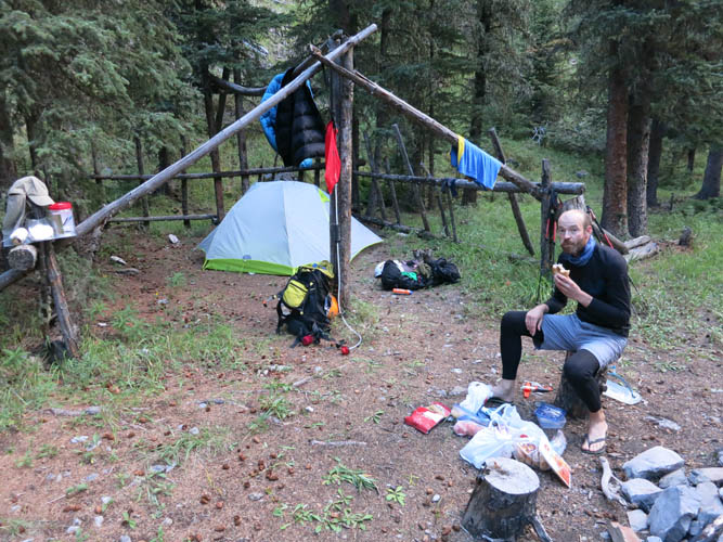
Early morning breakfast at our camp (500 m west of Guinn’s Camp): bagels with ham, plus some granola bars. Not a luxury meal, but more than enough to get you started for a great day ahead!
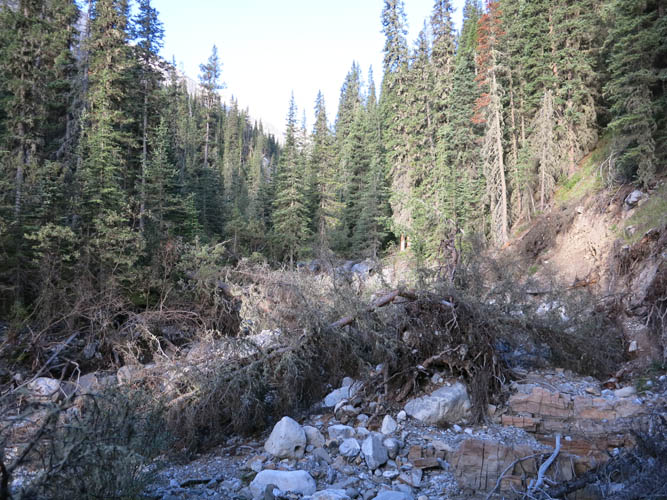
This is NOT the right way to South Ghost Pass. We should’ve simply taken the path that starts right at our camp and climbs high above the valley on its northern side. Instead, we spent the first hour in this battlefield!
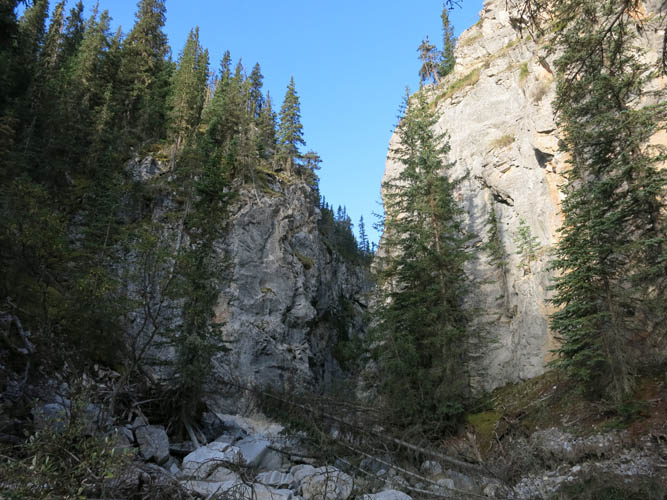
The canyon narrows dramatically a short distance from our camp (heading west).
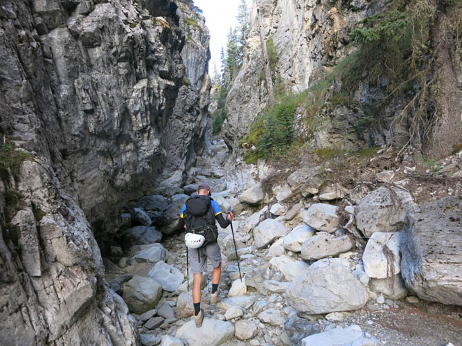
Richard making his way through the narrow winding gorge.
Much better: on the good trail high above the canyon on the north side of the valley.
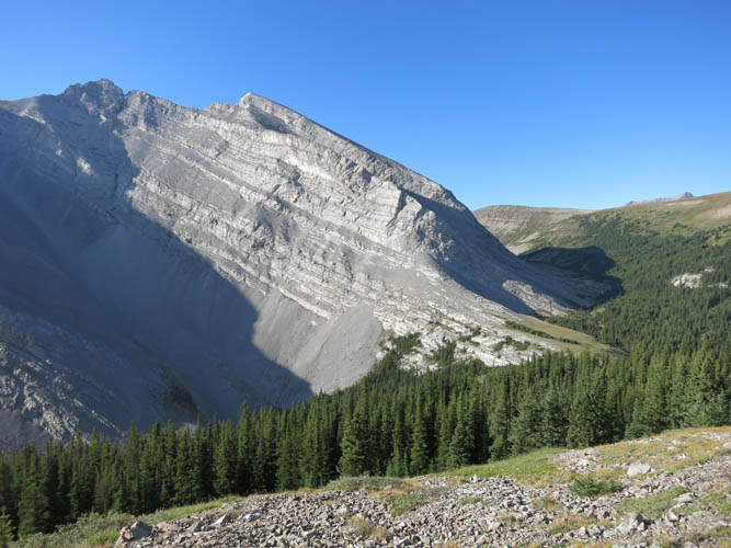
An outlier of Stenton Peak to the south.
A lovely Alpine cirque. Really reminded me of Switzerland.
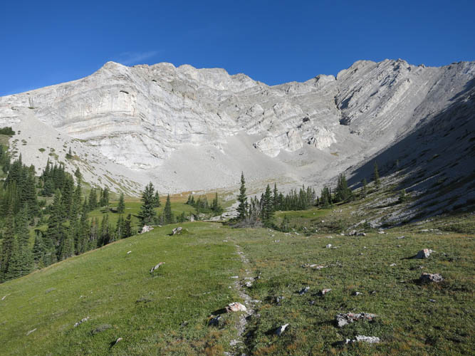
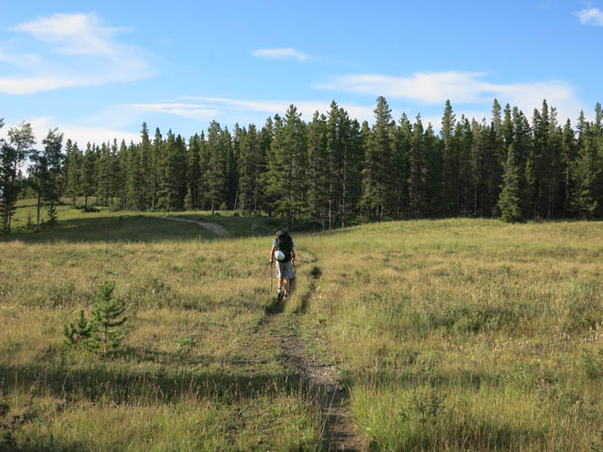
Heading up the grassy south slope of Carrot Peak. Stenton Peak is the high point in the background.
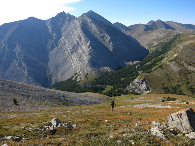
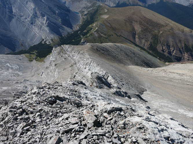
We reach the N-S ridge that leads to the summit in the background.
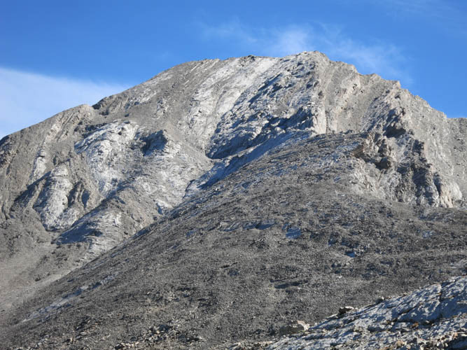
Close-up of the summit mass. A fun but challenging ascent (difficult scrambling) can be had on the slabby part in the centre, pretty close to the ridge crest. The scree slopes immediately to the left of the slabs are an easy descent option.
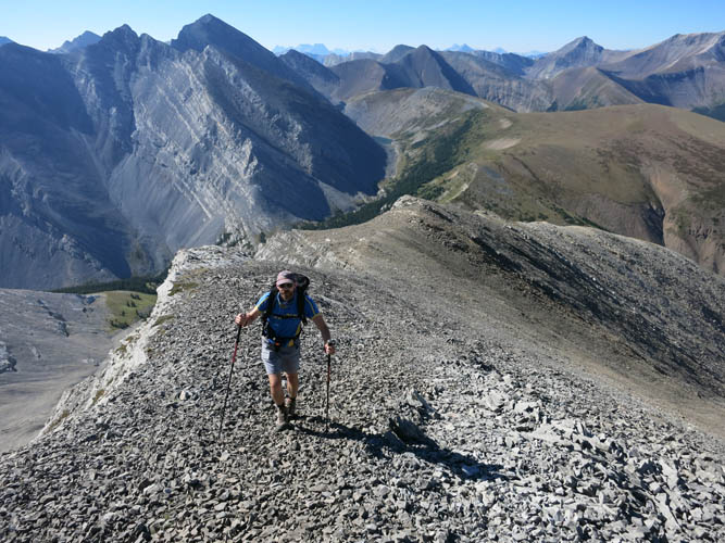
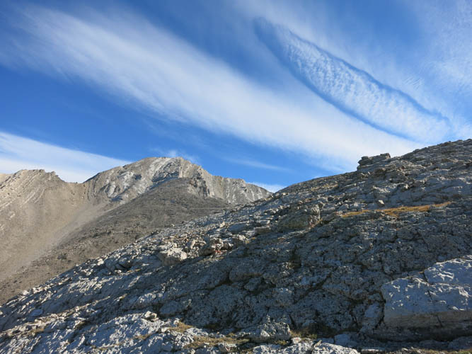
Coming up the ridge (looking back south).
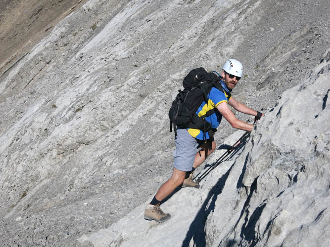
Richard tackling the steep limestone friction slabs.
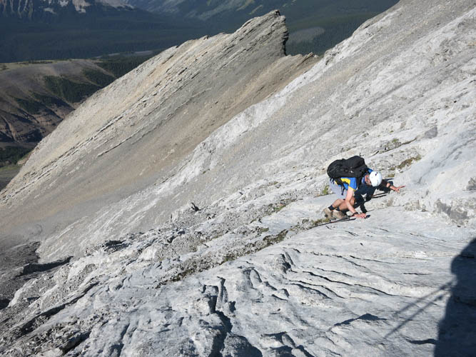
It’s steep here!
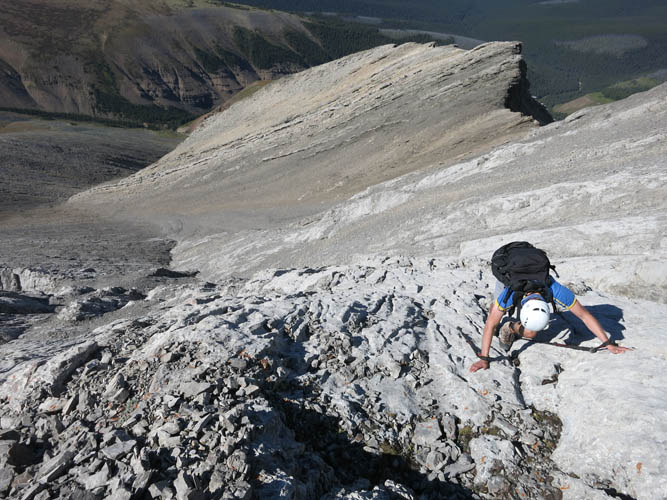
The rock is solid and holds are good. With careful foot placement and smart route finding, the challenge is broken down into manageable steps.
Looking back down the slabs from near the summit.
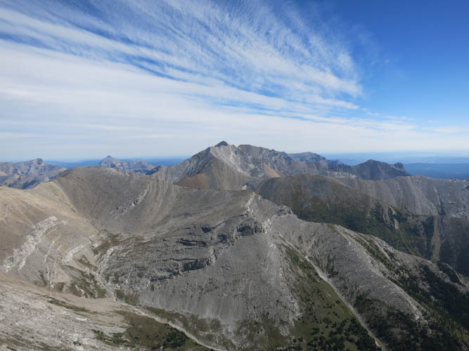
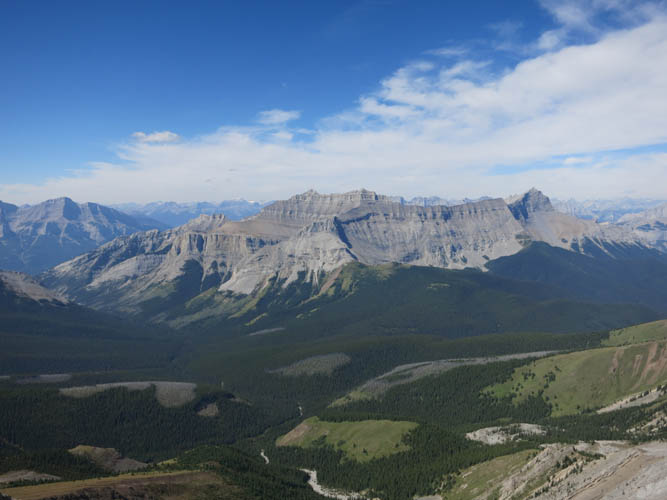
The highest mountain far to the east is Saddle Peak, which we unsuccessfully attempted to climb the day before (coming within a mere 400 m of the summit!). We eventually ascended it a month later.
A zoomed in view of the west ridge leading up to Saddle Peak.
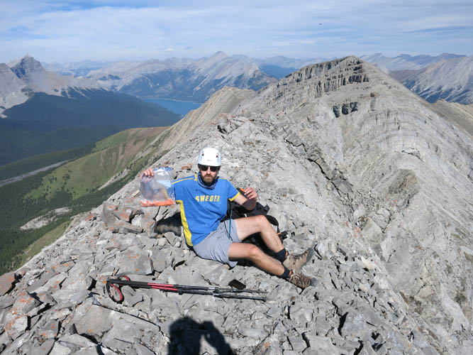
Obligatory carrot break on Carrot Peak 🙂
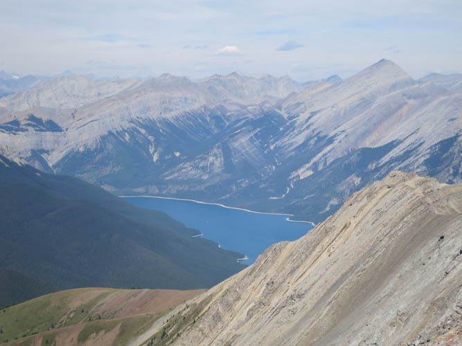
Lake Minnewanka to the NW. Mount Aylmer is the big mountain on the right.
Views of the South Ghost River valley below. Our campsite is on the right end of the slanted grassy ridge in the middle.
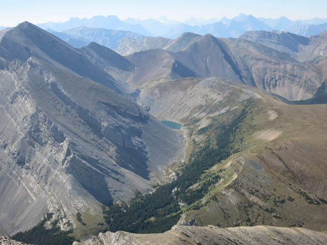
Stenton Lake. South Ghost Pass is at bottom right just out of the field of view.
End Mountain (left) and Association Peak (right) loom on the horizon in the distance.
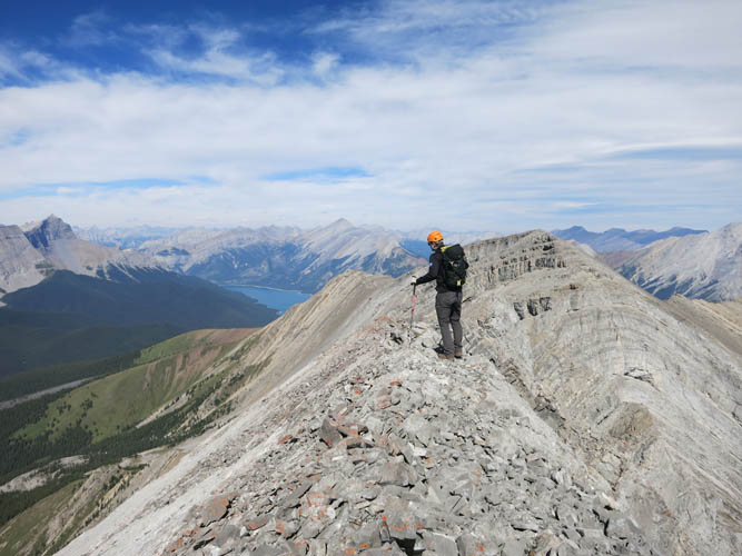
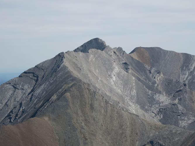
The south and main summit of Carrot Peak. The imperceptibly lower north summit is above the set of cliffs just to my right.
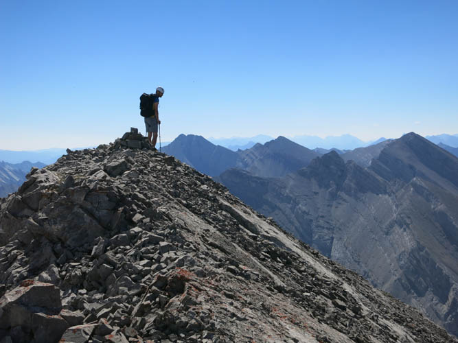
Richard at the summit.
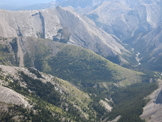
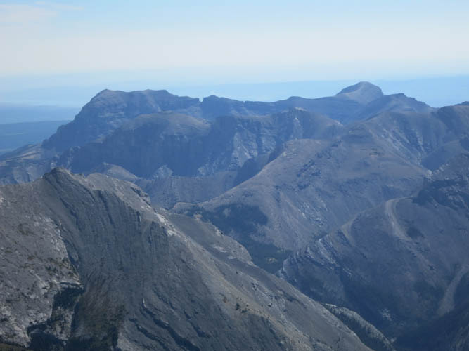
Beyond the broad forested valley hiding Carrot Creek is Mount Peechee (centre), with Mount Girouard and Mount Inglismaldie along the same massif on the right.
Descending the easy scree gully to skier’s right of the limestone slabs.

This is the broad scree slope to skier’s left of our grassy ascent slope lower down. Some nice scree sliding here for a quick way down.
Back on the good trail above the South Ghost River valley.
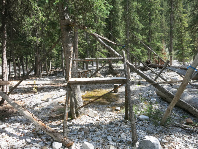
Guinn’s Camp. There appears to be some flood damage, probably due to the June 2013 deluge.
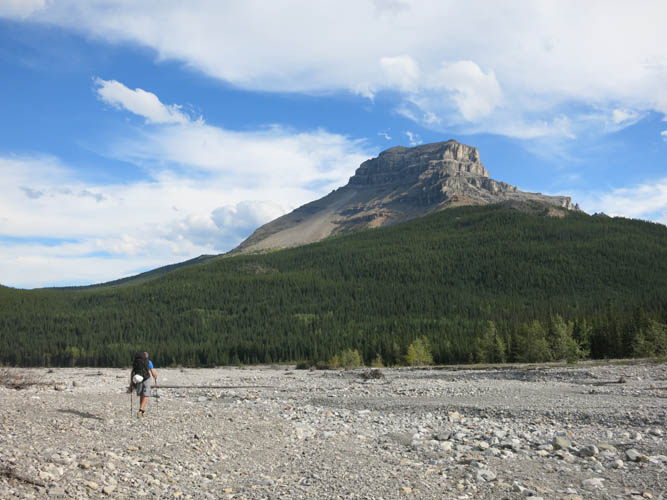
Hiking back out of the South Ghost River valley past End Mountain.
It has been a long and adventurous day!