Dutch Creek Area, AB, Canada
14 August 2019
Solo
Short and simple ridgewalk
My main objective for this trip was actually Funnel Peak along the Continental Divide. But because it takes more than 3 hours just to drive into the area, the last 18 km on a rough pot-hole dotted mud road, it only makes sense to combine two or more objectives in the area and camp at one of the many scenic spots along Dutch Creek. Grassy Ridge, which I only knew about from the map in my hiking app, was a good choice for a short (almost too short!) warm-up hike the day before tackling Funnel further west.
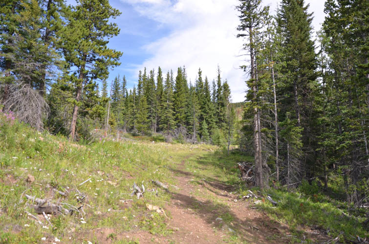
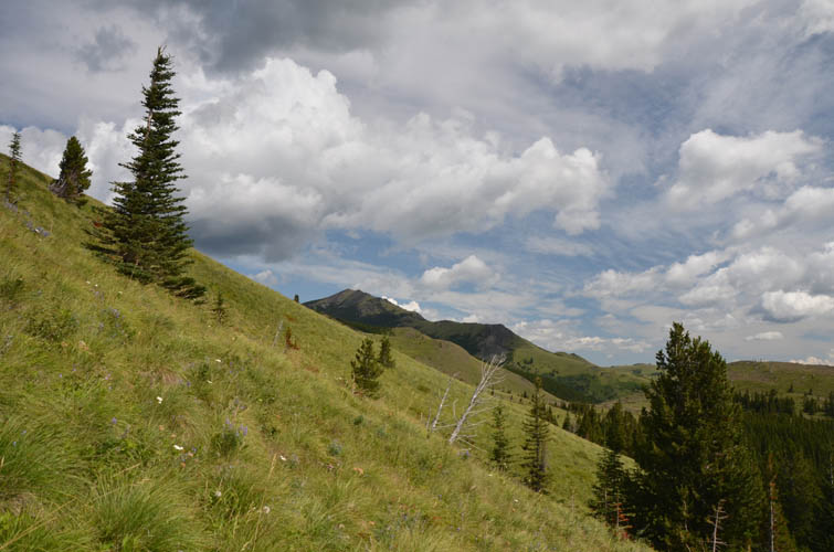
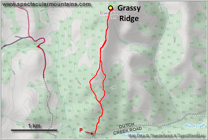
After the long drive in from Calgary (see Funnel Peak for details), I parked at the start of an old logging track and headed up the hillside. This ridge is clearly not on the radar of hikers and even OHV enthusiasts (of which there generally seem to be many in the area), as evidenced by the overgrown nature of the logging tracks leading up the ridge. The only occasional visitors appear to be cows.
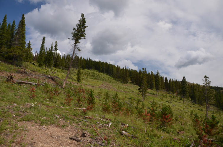
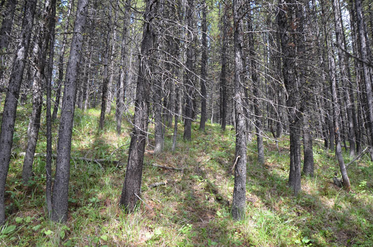
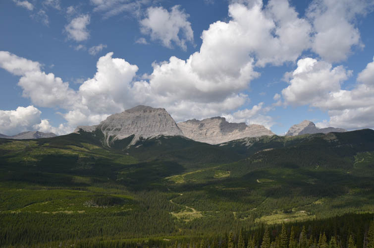
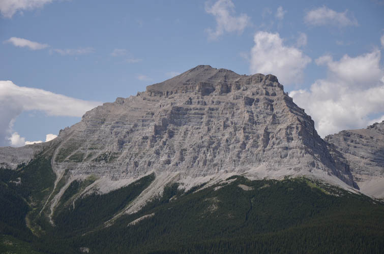
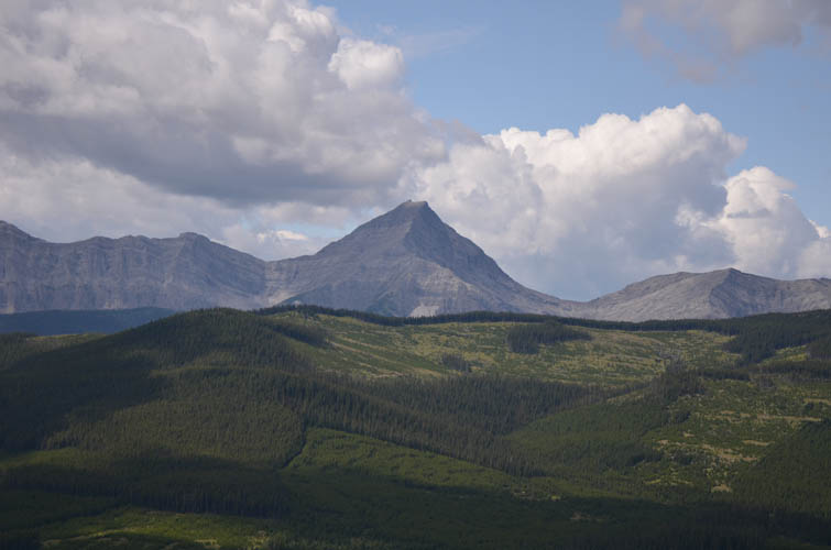
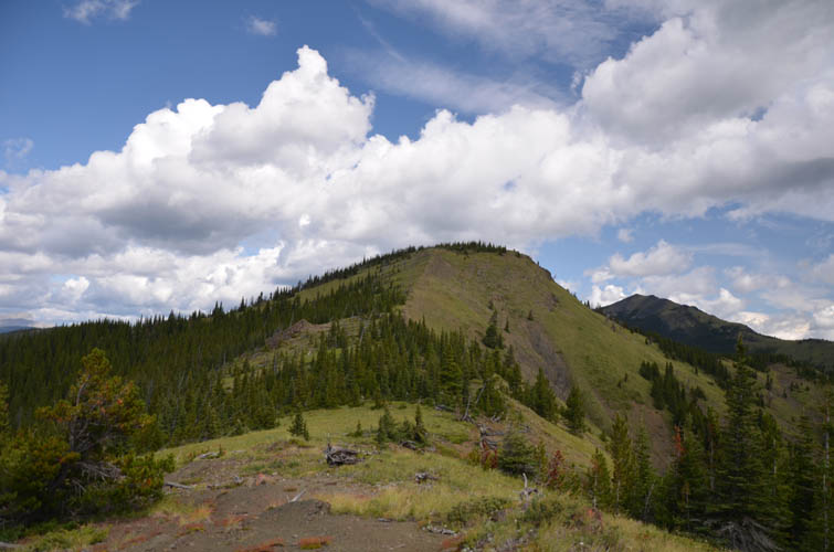
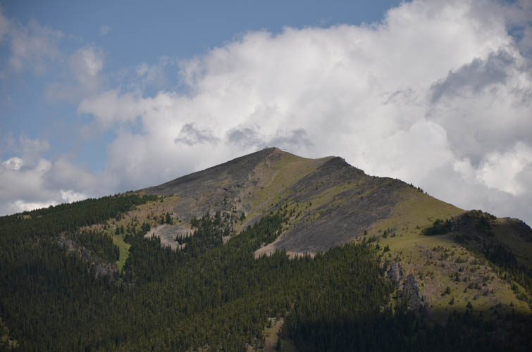
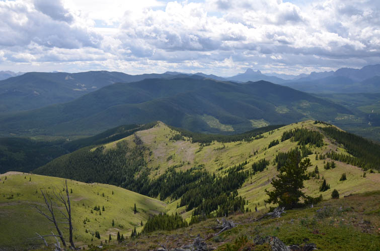
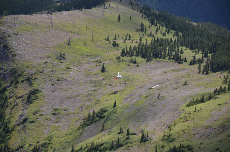
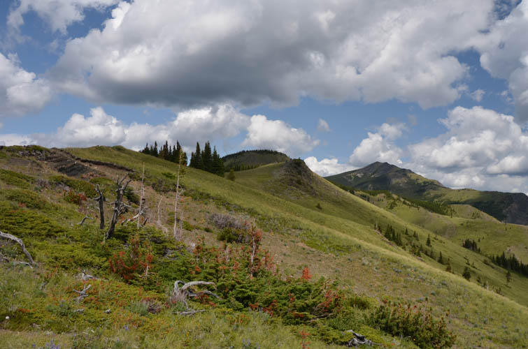
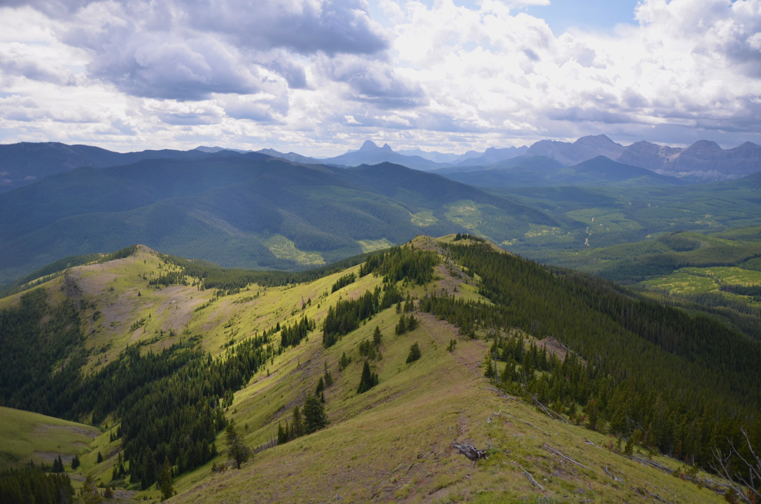
The rough track I followed fizzled out at the edge of the forest higher up. I then took a faint trail through the woods which soon emerged on an open hillside again from where I was able to hike up to the ridge top. From here I could see the remainder of the gentle ridge leading up to a high point not far in the distance. It’s literally just a grassy ridge with a few patches of pine trees here and there. Easy and pleasant hiking, but to be honest the views didn’t blow me away. Sugarloaf Lookout, which sits right behind in the background and can probably be reached from Grassy Ridge as well, looks (and is) far more interesting an objective simply because it’s bigger and offers more variety of terrain.
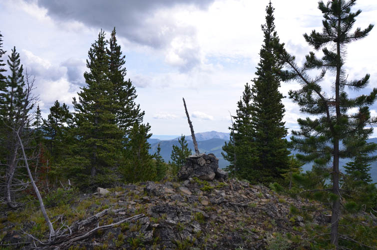
After an easy stroll up the ridge I reached the weathered summit cairn at the treed high point. Interestingly, the elevation given on my map for Grassy Ridge summit is 1979 m, while my GPS read 2138 m – a 160 m difference! Just east of the summit is a nice open area that offers decent views of Sugarloaf and the wooded hills to the east.
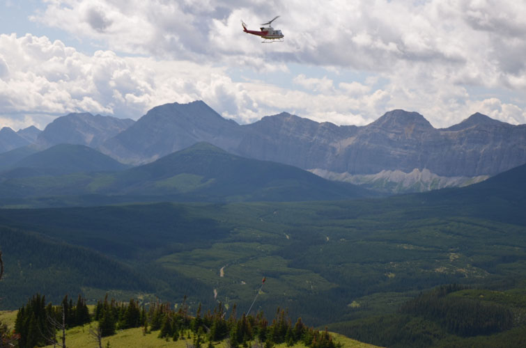
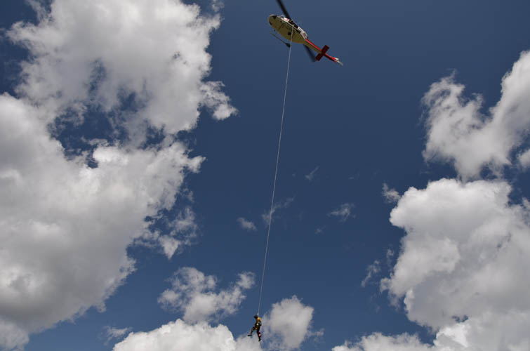
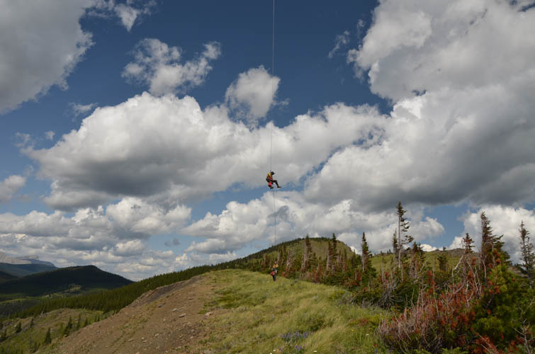
I was all lost in my own world of thoughts on my hike back down the ridge when, out of the blue, a noisy helicopter suddenly showed up and stopped above the ridge top right in front of me only a few hundred metres away. After hovering perhaps 50 m above the ground for several minutes, I watched in amazement how a rope was thrown and several guys started rappelling down in quick succession. “I don’t need a rescue!” was all I could think… It turns out these guys were in the middle of a training exercise for the Helitrack-Rappel unit of Alberta wildfire fighters. I guess they were just as surprised as I was about our chance encounter on this lonely ridge in the middle of nowhere.
|
Elevation: |
2138 m (my GPS) |
|
Elevation gain: |
550 m |
|
Time: |
2.5 h |
|
Distance: |
6.2 km |
|
Difficulty level: |
Easy (Kane), T2 (SAC) |
|
Reference: |
No info was available to me |
|
Personal rating: |
2 (out of 5) |
NOTE: This GPX track is for personal use only. Commercial use/re-use or publication of this track on printed or digital media including but not limited to platforms, apps and websites such as AllTrails, Gaia, and OSM, requires written permission.
DISCLAIMER: Use at your own risk for general guidance only! Do not follow this GPX track blindly but use your own judgement in assessing terrain and choosing the safest route. Please read the full disclaimer here.