28 July 2017
Solo
After scrambling up Gould Dome the day before, today’s goal was to bike, hike and scramble Tornado Mountain. The spot I had chosen for my camp was a reasonably suitable starting point for both objectives and it only made sense to combine the two mountains as the drive from Calgary is long and the access road quite rough. Not something I want to do twice if I don’t have to!
Edit August 2019: The rough access track that branches off to the north from the Dutch Creek Road at the T junction is now closed to motorized traffic, as kindly reported by Geoff Hardy. This means you’ll have to camp/park here and then bike/hike an extra 2 km or so (up to the point where I camped). There are dozens of large berms and ditches along the track now, making a bike approach from this side much more difficult and slower than before.
I awoke at 6 am, still a little sore from the day before but eager to get an early start on another hot day – the forecast called for 31 degrees C! It was surprisingly chilly in the morning, my hands and head were frigid. What better breakfast than a Nutella sandwich and a hot cup of coffee then!?
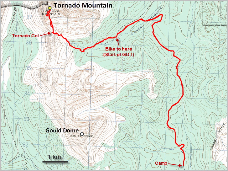
The route to Tornado Mountain has been described in detail by So Nakagawa, Sonny Bou and in several other internet reports. The approach along the access road is a lengthy one and I was glad I had my mountain bike to shorten it a bit, although the track is quite rocky in parts, making for a bumpy ride. There are lots of ups and downs and I had to push my old bike up several of the steeper sections. Nobody else was around and my shouts to warn off any bears that might be in the area were echoing off the forest unanswered… This is a beautiful, but eerily empty area.
After about an hour and a half on my bike I reached the new bridge over South Hidden Creek. Turning left on the South Hidden Creek access road, I cycled west for another 1.5 km before ditching my bike in the woods where the road intersects with the Great Divide Trail. The GDT had been recently maintained and I really enjoyed hiking along it. It makes a lot of twists and turns at the beginning, but this is by far the most efficient way to gain Tornado Col, the saddle that sits at 2470 m immediately south of Tornado Mountain.
Initially the GDT is mostly in the forest, but about two thirds of the way up it emerges into a beautiful alpine bowl with lush meadows and rocky outcrops. Finally, Tornado Mountain is in full sight! Just before reaching the col, I heard a loud yell… to my great surprise, two backpackers were waving at me from above, probably just as happy to see another soul in this remote place as I was. Darren, a Californian, had started in Waterton 8 days ago while Kaz, the crazy Japanese, had been on the trail for 4 months and walked all the way from Mexico! I find it immensely interesting and rewarding to talk to fellow outdoor enthusiasts when out on the trails, especially people like these two that can teach you a lot from their own experiences.
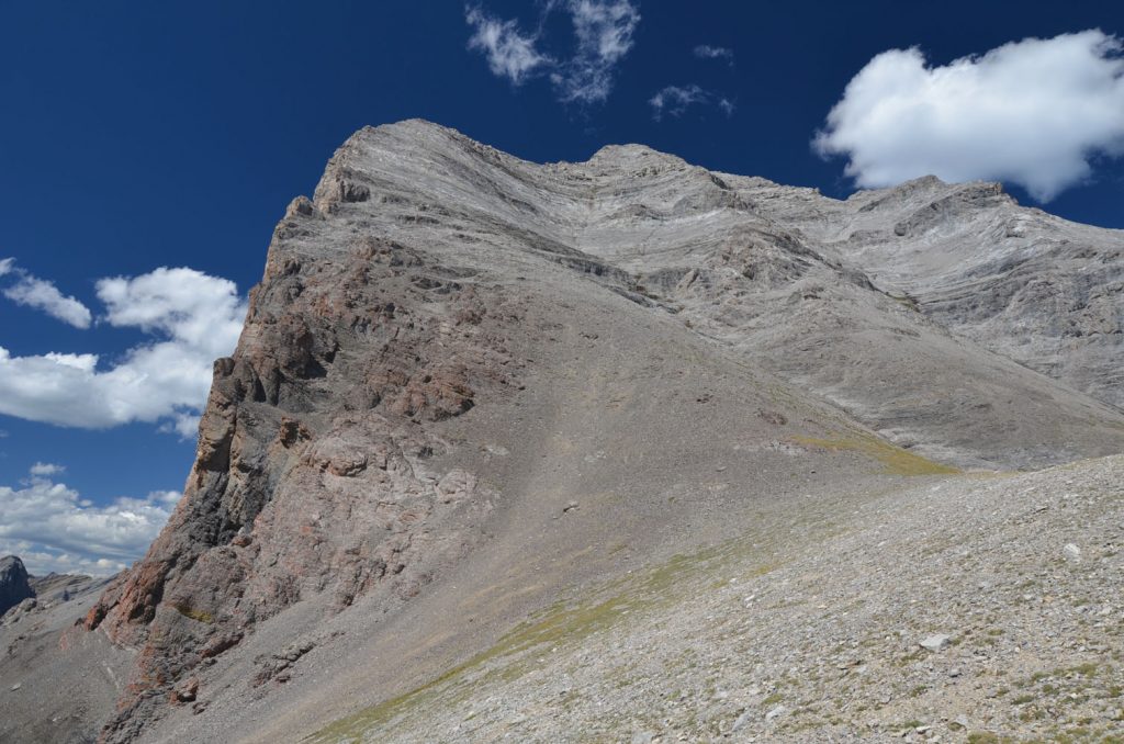
There were now about 600 elevation metres left, almost all of it off-trail and most of it in scrambling terrain. The south face of Tornado looks pretty intimidating from the saddle – it really doesn’t seem like there is a direct route up, but of course there is. Sticking to So’s recommendation to start off in the main gully, I found the scrambling here to be quite straightforward and very enjoyable. Even the grey and dark rock bands he mentions can be tackled head on in the middle of the gully, although a few difficult moves and a considerable amount of route finding are involved. Much of the terrain consists of rock steps, some water-worn slabs, and a few friction moves. There is a lot of rubble everywhere, so I took my time and moved slowly. Once past the two problematic cliff bands I expected to meet up with some sort of trail that is supposed to traverse from where the south ridge levels off across one of the rubbly platforms, but I never found anything. The easiest option seemed to be to veer right towards the SE ridge where there were one or two cairns. Instead, I stuck to my main gully and simply kept heading up, which worked just as well.
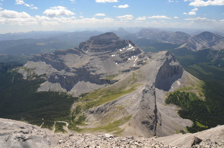
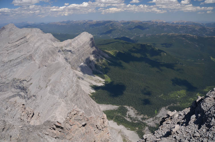
The summit register was surprisingly busy – Tornado sees about a handful of visits every year, a lot more than I had expected considering the long approach! It was a bit hazy due to the distant forest fires that were raging in BC and Banff, but that didn’t take away from the spectacular panorama that can be enjoyed from this lofty vantage point. I love the views of the many unnamed peaks to the north, with one particular ramp-like mountain standing out right at the eastern edge of the Front Ranges. To the south, a craggy and complex-looking ridge with many cliffs and ledges leads to Gould Dome and a small intervening peak in between. Looking west, beyond Funnel Peak, the large coal mine in BC is definitely an eye sore, but part of the complicated interplay of mining, forestry, recreation and conservation that have made this beautiful part of the Rockies both accessible and vulnerable at the same time.
Just like the day before on Gould Dome, I was lucky with the weather again. A few clouds, but no risk of rain and certainly no harrowing “tornado-like” conditions that the early explorers Morrison Bridgeland and Arthur Wheeler had experienced on their two ascents in the early 1900s.
For a slightly faster return, I chose a zig-zag route down the SE face of the mountain to take advantage of as much loose rubble as possible, avoiding the more difficult downclimbs in the gully. There isn’t much good scree, though, and stumbling down these slopes is a slow and clumsy affair.
Once back at the col, the rest of my return was a breeze. There is still about 200 m of elevation gain to overcome on the bike ride back, but it’s fun and definitely faster than on the way in. A great day out in the beautiful High Rock Range!
DISCLAIMER: Use at your own risk for general guidance only! Do not follow this GPX track blindly but use your own judgement in assessing terrain and choosing the safest route. Please read the full disclaimer here.
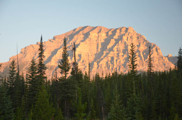
Like a mountain of gold, Gould Dome glows in the early morning light as seen from my camp site.
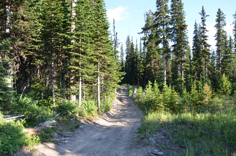
The access track leading to the Great Divide Trail (GDT) is mostly in the forest.
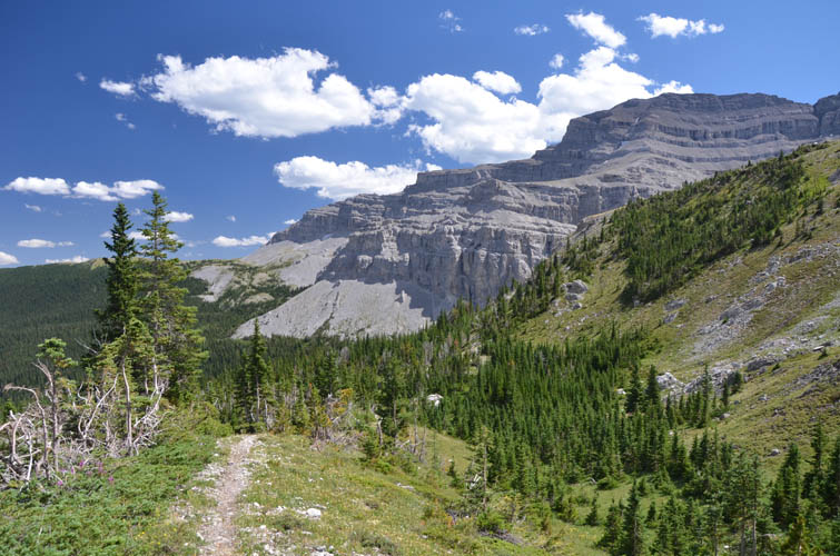
First sight of Tornado Mountain.
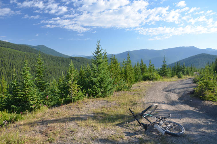
Taking a break along the access road. My trusted bike is not the most comfortable, but has never failed me – at over 20 years old!
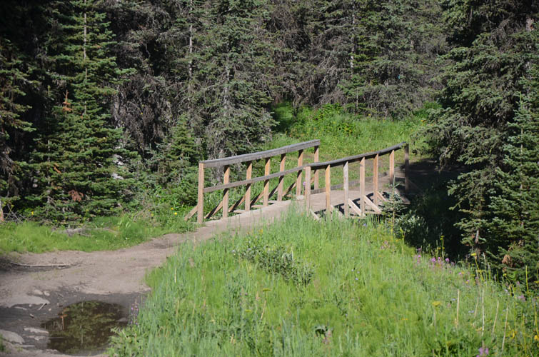
A new bridge has been installed over South Hidden Creek.
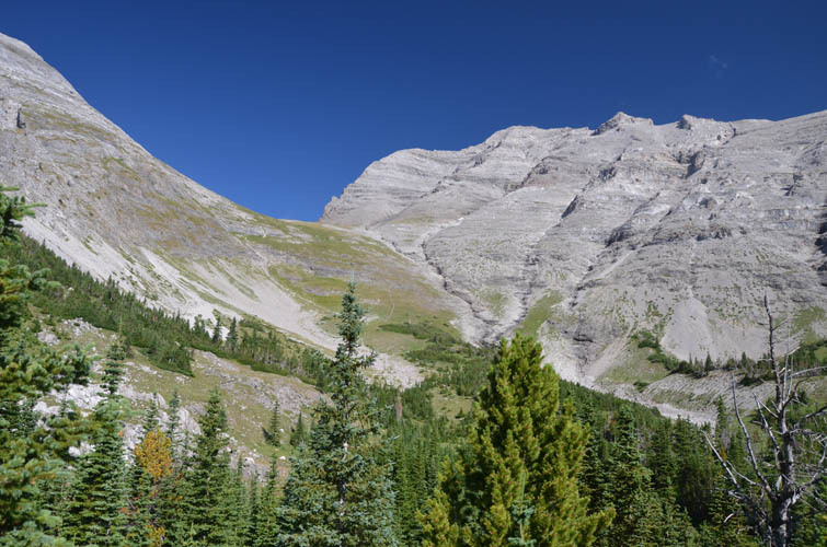
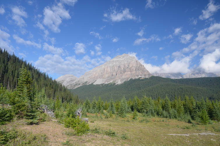
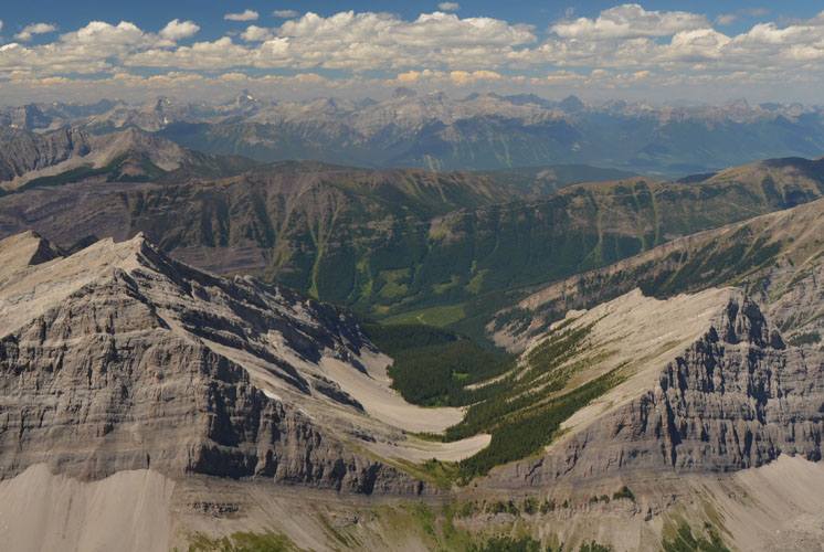
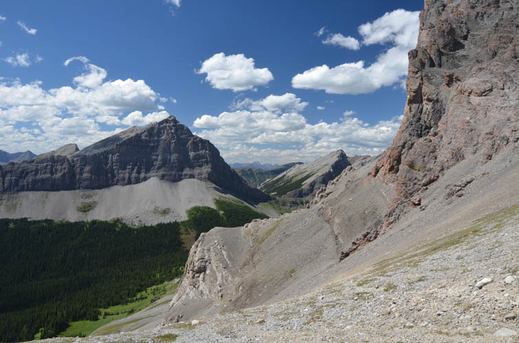
Lovely views from the GDT over the broad basin that sits SE of Tornado Mountain (right).
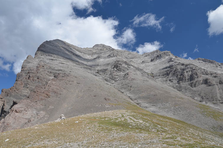
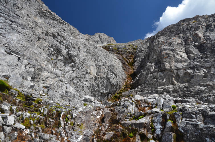
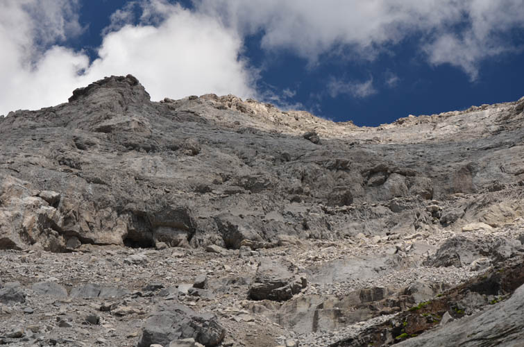
From Tornado Col, it’s still 600+ elevation metres to the summit. The standard route follows the obvious gully in the centre of the photo (trending diagonally to upper left).
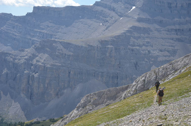
The only people I meet all day: two long-distance thruhikers that travel the GDT.
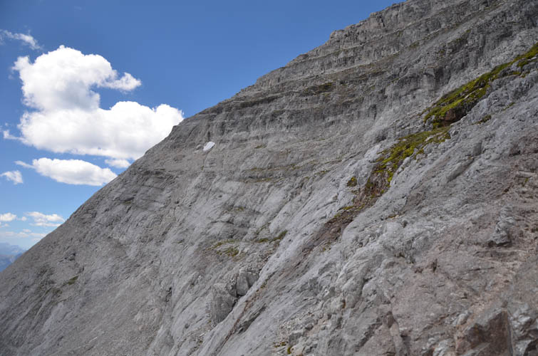
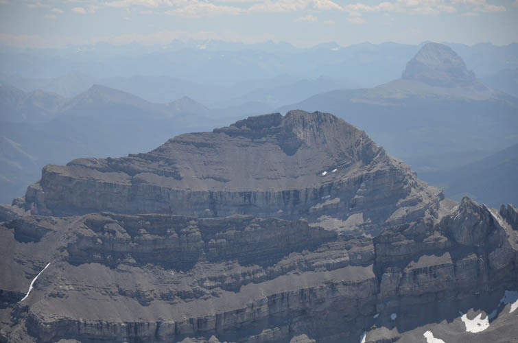
Funnel Peak boasts an impressive wall on its eastern side.
Inside the access gully towards Tornado summit: some enjoyable scrambling on good rock here.
Parts of the route are steep and on friction slabs.
Looking back down the access gully towards the SW. It’s steep, but looks more frightening than it really is.
Typical terrain in the gully.
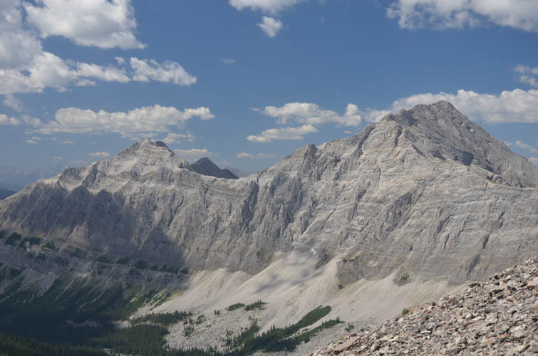
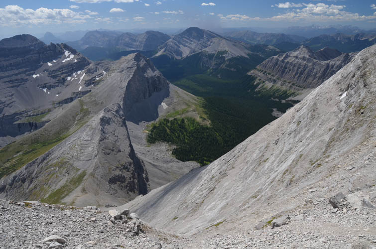
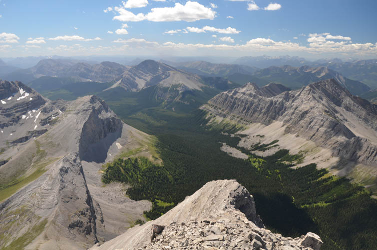
A nice view of the connecting ridge to Gould Dome in the south.
The GDT runs somewhere down in this valley.
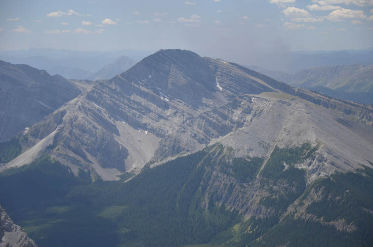
Close-up of Funnel Peak.
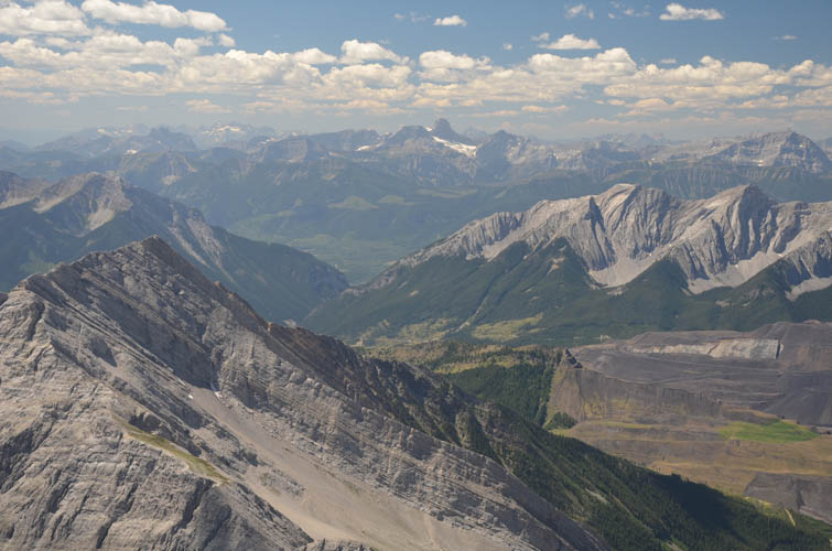
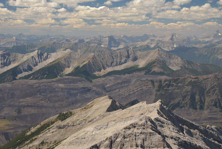
The open pit coal mine west of here is quite noticeable.
Countless peaks on the BC side to the west.
Doesn’t this valley look inviting? It would probably take a long time to get there…
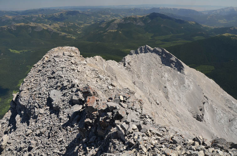
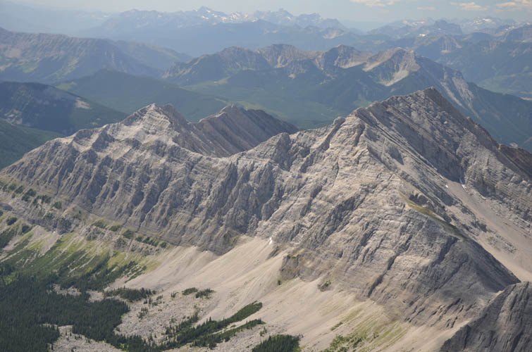
Tornado Mountain’s east ridge is craggy and steep. The summit cairn is quite substantial.
This distinctive ramp-like peak to the north does not have a name as far as I’m aware.
Looking back at Gould Dome, I remember scrambling along its crumbly summit ridge from left to right across the gap yesterday. Crowsnest Mountain on the right.
Back down to the col.
It’s just a joy to be hiking on such a well-built trail as the GDT again!