
Graubünden, Switzerland
28 August 2017
Solo
What a joy! There are many Schwarzhorns in Switzerland (and beyond!), but this popular 3147 m Davos landmark is one of the most frequently hiked 3000ers in the entire country. The Schwarzhorn is also known to offer one of the best sunrise experiences in the Alps, so some folks don their headlamps and start in the middle of the night to time their summit arrival with the first rays of sunlight around 6 am in the summer.
Sure enough, as my parents and I started off on the very well-trodden trail at 8:30 am, a slightly tired-looking pair of hikers was just getting back, having enjoyed a cloudless sunrise a few hours earlier. It was supposed to be a cloudy day with a chance of rain, but none of us wanted to forgo another precious day in the mountains during our 2-week vacation in Switzerland. While my parents set off to hike some moderate elevation trails from the Flüela Valley to the Grialetsch Hut, a catered Alpine chalet surrounded by imposing glaciers, my plan was to ascend the Schwarzhorn followed by a scramble up nearby Piz Radönt, then join them at the hut for lunch or on the descent down to the Dischma Valley. Thankfully it all worked out perfectly, but I did have to work for it and there was certainly no time to dawdle.
My rabbit and pace-maker on the way up to the Schwarzhorn was a young teacher in his 20s who was racing up the mountain – without a pack or water, just to check out the route in preparation for a sunrise hike for a group of school kids the next day. The trail is in great shape and gently rises up to a pass, where it turns right and steepens for the final section up the rocky south ridge of the mountain. Most of the ridge is broad and the path is so easy to follow, it’s really just a hike.
Trying to keep up with my younger and undoubtedly fitter fellow hiker was a challenge. It seemed the harder I tried to catch up with him, the faster he got… In the end I had to remind myself that hiking isn’t about how fast you are, it’s about experiencing every moment and every inch of nature around you intently. So I gave up trying to rush up this mountain and just enjoyed the trail, the sound of the pebbles crackling under my boots, the crisp morning breeze, and the few scrambly sections where I could get my hands dirty – all immensely rewarding things. Eventually I reached the large wooden summit cross, about an hour and a half after starting on the trail, huffing and puffing but happy to enjoy some good views as the sun re-appeared through the grey curtain of clouds. My Swiss friend had been patiently waiting for me, perhaps curious to find out who’d been following him, and we sat together chatting away and trying to identify the nearby peaks and valleys.
After a delicious Mandelgipfeli (almond croissant) and signing the heavy summit book that is kept in a metal box attached to the wooden cross, we descended back to the pass and down to the intersection with another trail that contours across the high valley below. While my friend continued down the main trail, I turned right and down a steep path into a large rocky plain. It was slow going here – the path was sometimes difficult to see in the sea of light grey chunks of rock, and walking over the boulders was cumbersome. Eventually I reached the Fuorcla Radönt, a high pass at the end of Piz Radönt’s east ridge. The trail now slowly descends towards the Grialetsch Hut, but travel is pretty slow at the beginning as there are several stretches where boulder hopping is required again.
Although the east ridge of Piz Radönt might be a possible scramble route, I surmised that the easiest route described in the SAC guide – a chute up the south face – was my best bet to make it up the summit. Leaving the trail, I hiked up grassy slopes and scree to aim for the distinctive talus cone directly below the mountains vertical south face. Again, there is a section with large angular boulders strewn about here that is actually quite tricky to cross as many of them are unstable and will shift as you put your weight on them. I tried to follow the described route on the left side of the talus cone directly up to a jagged rib, but backed off just below the crest as the rock got too steep and the holds were poor. Losing a little bit of elevation, I attained the rib a few metres lower and then scrambled over steep friction slabs into the long, steep gully that sits between this rib and the east ridge. To my surprise there were neither cairns nor any boot prints, and the gully was steep and rubbly – mostly moderate scrambling with perhaps a few difficult steps. Once I came out on the east ridge, all that was left was a short scramble over a slanted rock slab and and easy walk to the summit.
Quite a few people make it to the top, most as part of an E-W ridge traverse. I counted about 20 odd entries for 2017 alone. Many probably use the nearby Grialetsch hut as a base to explore the surrounding peaks and Piz Radönt is the closest one to the hut.
My summit stay was again very short as I really wanted to make it down in time to meet my parents at the hut (and get a free lunch!). I left at 13:15, but it took me a whole hour to scramble back down the rubbly gully and then over the annoying boulder field and rolling meadows to reach the trail again and make it to the hut. The friendly lady in the restaurant informed me that my parents had left about half an hour earlier. Well, the thought of sitting down on the sunny patio enjoying a plate of Rösti (hash browns with bacon and a fried egg) and a cold beer was certainly tempting… especially with this view! In the distance across the high alpine plain, one can admire large glaciers hanging off the north side of Piz Vadret and Piz Sarsura, with Piz Arpschella looking like an easy and inviting target for the scrambler. I sat down on the grass by the little tarn that acts as a fresh water reservoir to the chalet and wolfed down some sausage and buns. As much as I would’ve loved to while away some more time in this magical place, I also wanted to catch up with my parents and join them for the rest of the hike.
The trail from the Grialetsch hut down to the tiny hamlet of Dürrboden in the Dischma Valley is absolutely lovely and worth a day hike in itself. With the familiar ringing of cow bells in the background, I really enjoyed ambling down the path past gurgling creeks and rolling meadows. When I caught up with my parents, we were only half an hour away from Dürrboden, where the local (and only) restaurant serves as the perfect spot to finish a very rewarding day – with coffee, cake and a cold Rivella, a fizzy lemonade made with herbs and milk protein, Switzerland’s national soft drink.

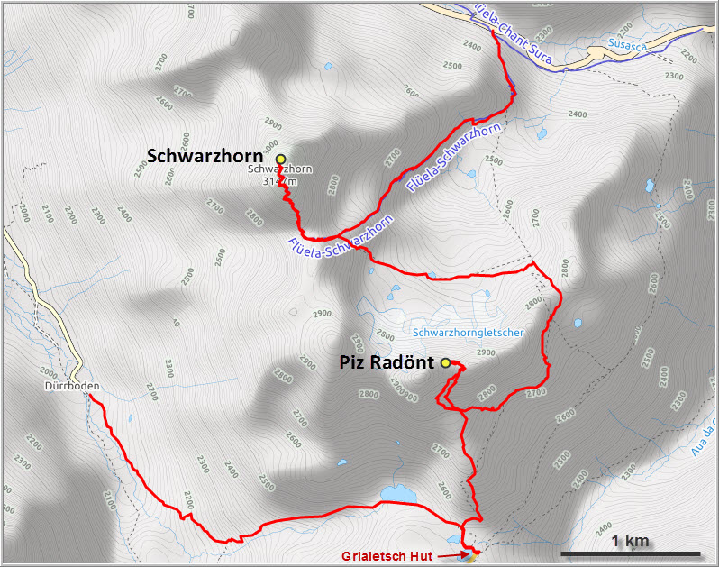
DISCLAIMER: Use at your own risk for general guidance only! Do not follow this GPX track blindly but use your own judgement in assessing terrain and choosing the safest route.
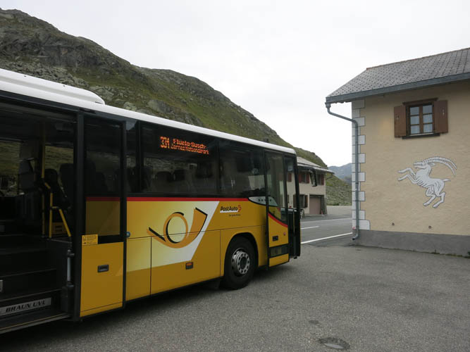
Arriving by “Postbus” near the trail head.
A well-trodden trail leads up the east side of the Schwarzhorn.
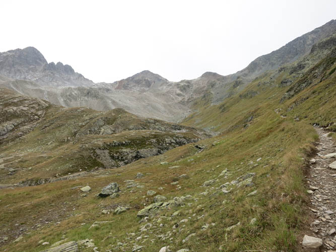
Not the best views of the ascent valley yet as it’s still overcast.
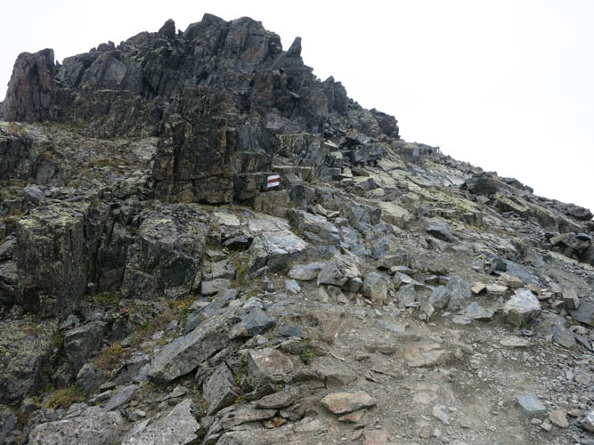
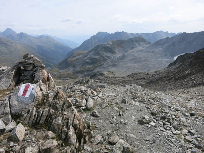
The main route goes up the south ridge of the Schwarzhorn and is clearly marked by white-red paint. There are a few easy scramble sections such as this one.
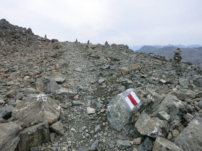
Near the summit the terrain flattens out. Tons of little cairns here!
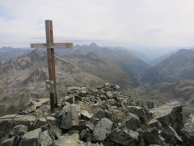
Schwarzhorn summit cross.
Looking south.
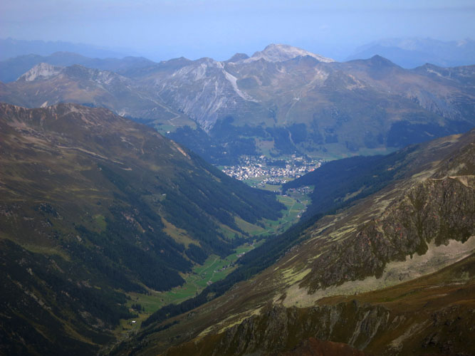
This is the Dischma Valley, with the town of Davos at its northern end.
South of there, the mountains are generally steeper and more glaciated.
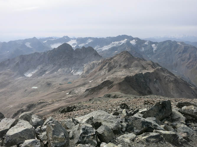
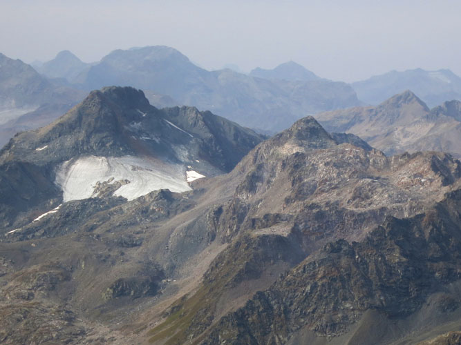
Piz Sarsura just left of centre. Directly below is Piz Radönt.
The Flüela Wisshorn is a fantastic scramble across the valley to the east.
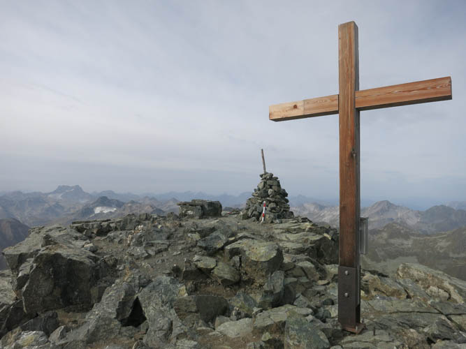
Another shot of the summit cross with cairn behind.
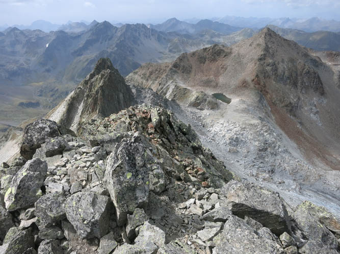
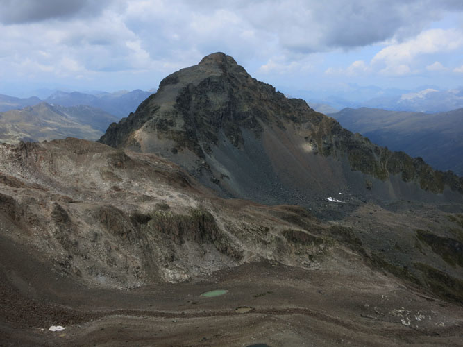
Next stop: Piz Radönt, the black peak on far left in front. The highest peak on the horizon on far right is Piz Vadret (3229 m).
Heading back down the south ridge of the Schwarzhorn. The col below is called “Schwarzhornfurgga”.
Looking back up the south ridge from near the col, now in the sun!
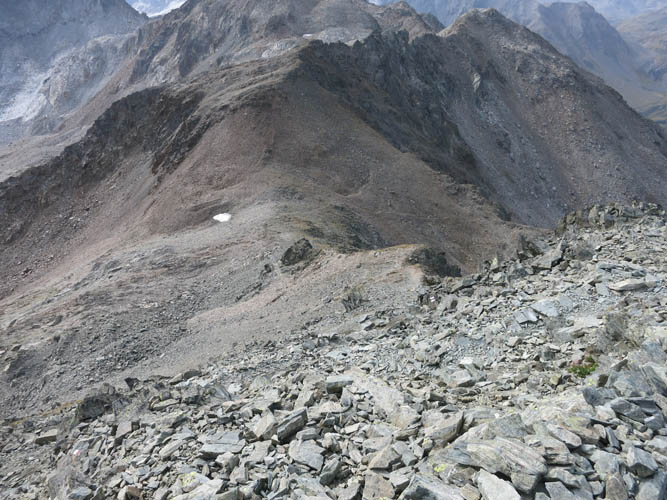
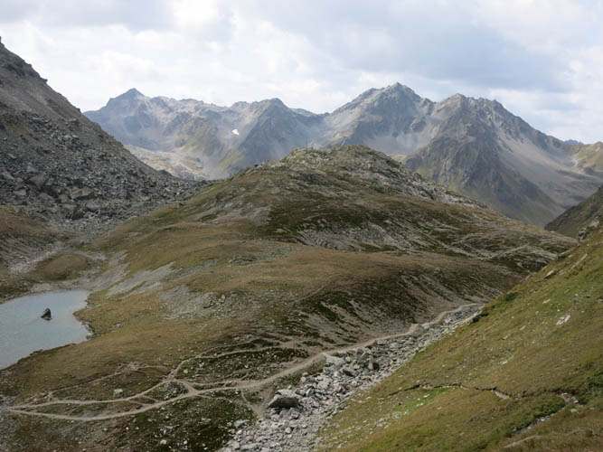
A secondary trail contours around the rocky high valley between the Schwarzhorn and the Piz Radönt.
The Schwarzhorn from the high valley below.
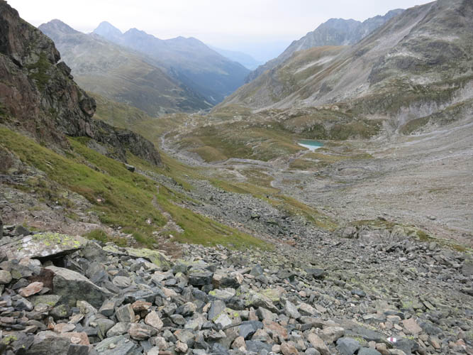
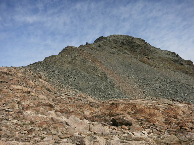
At the next pass, the Fuorcla Radönt, completely different views open up.
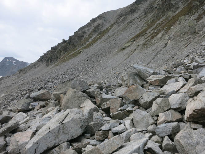
The trail is actually difficult to follow just south of the pass where a field of huge boulders needs to be traversed.
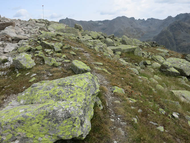
A tall pole near these lichen-covered rocks helps hikers to find the path again.

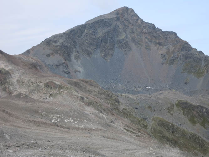
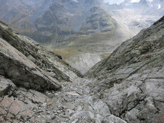
The impressive south face of Piz Radönt. I aimed for the little v-shaped notch on the right. This notch gets dangerously steep right at the top, so just below the notch I scrambled to the right over a rib and into a gully behind.
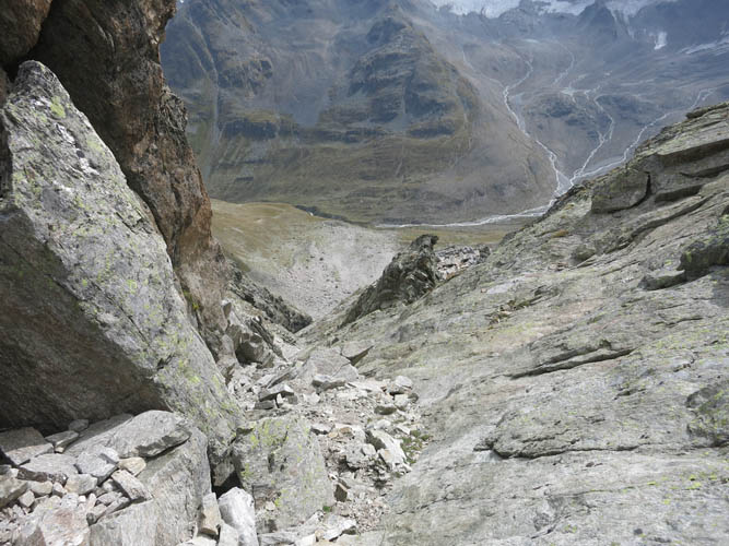
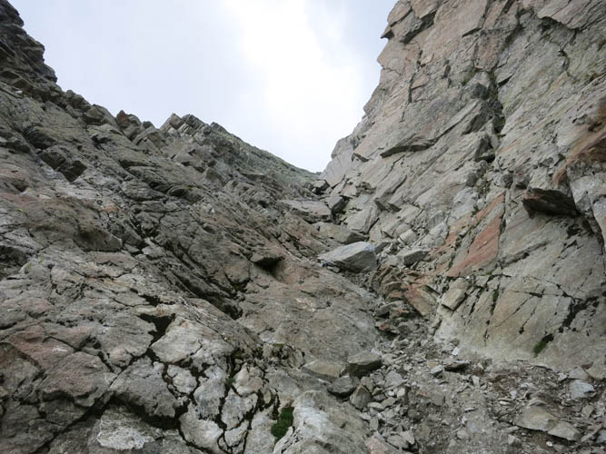
In the gully behind the rib. It’s steep and a bit exposed here.
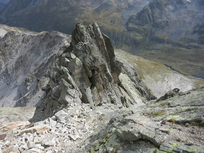
The gully (right) leads up to the summit ridge. From here it’s only a short distance via slabs to the summit.
The pointy summit of Piz Radönt.
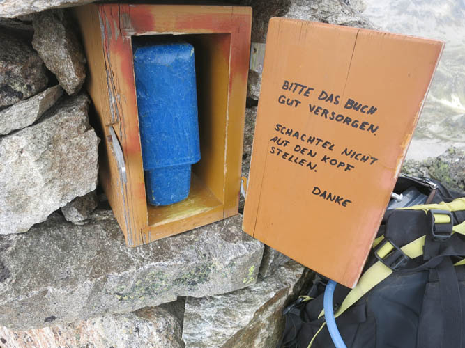
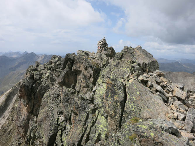
Pretty solid summit register! “Please look after the book. Don’t place upside down! Thanks.”
The west ridge of Piz Radönt is a technical climb.
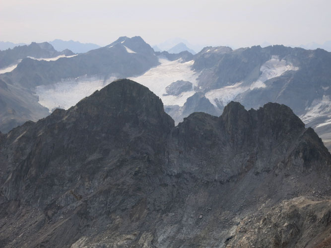
Piz Sarsura (3175 m)
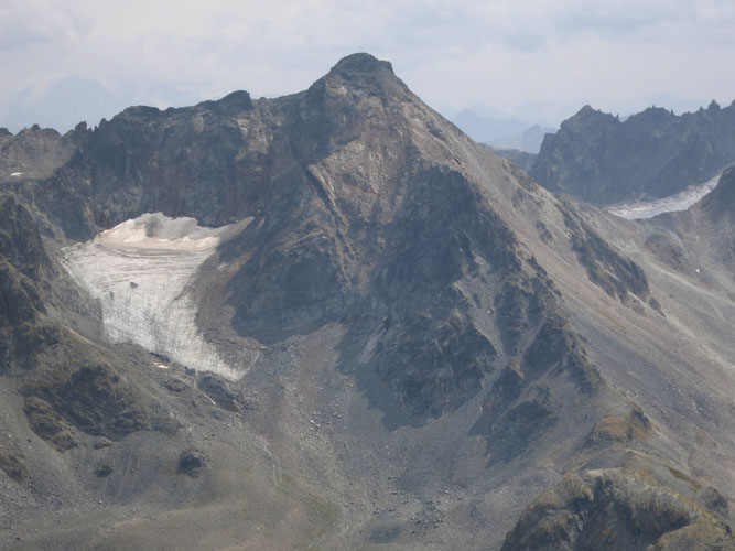
Piz Sarsura Pitschen (3132 m)
And the aptly named Schwarzhorn (“black horn”).
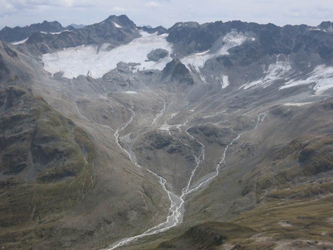
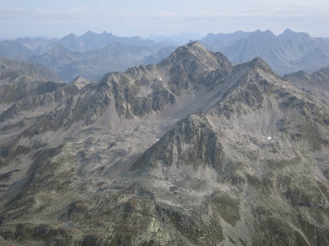
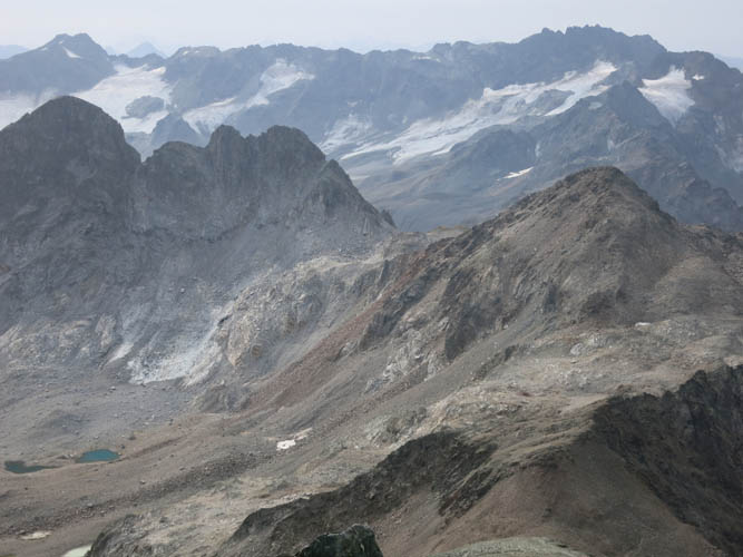
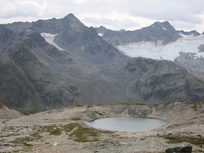
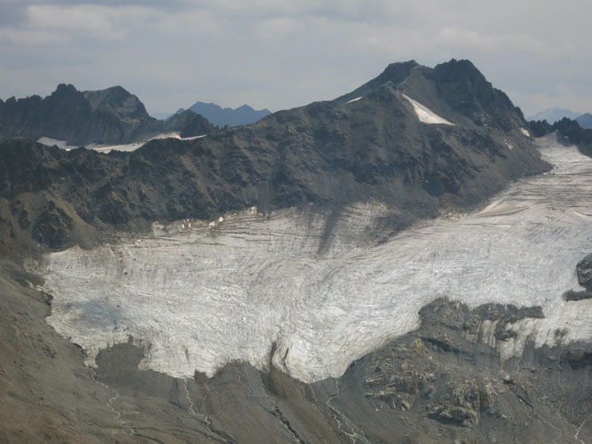
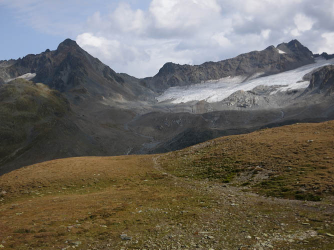
Much of this large glacial valley was once covered in ice. Only the uppermost parts of the glacier (“Vadret da Grialetsch”) remain.
Scrambling back down the gully.
View up the gully. Pretty crumbly rock here.

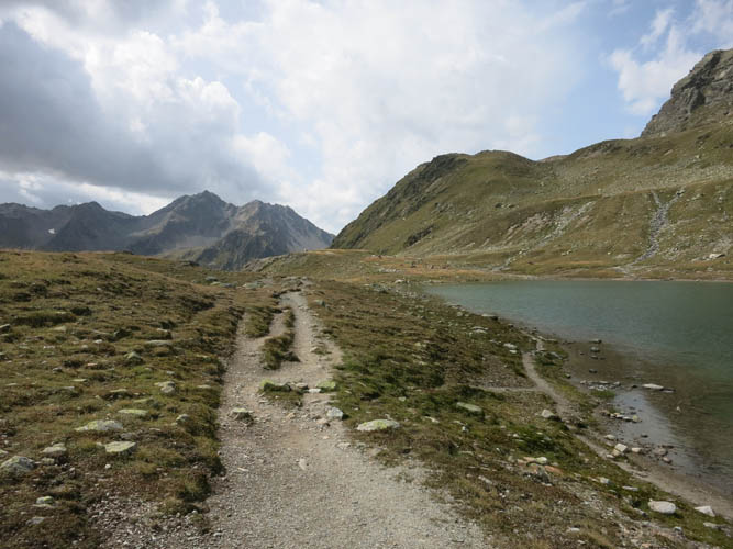
Chamanna da Grialetsch – the Grialetsch hut, a convenient rest stop in gorgeous surroundings.
Green meadows and small tarns characterize the landscape up here. The four peaks in the distance to the west are (L to R): Augstenhüreli, Leidhorn, Bocktenhorn and Sattelhorn, which I traversed a few days earlier as part of a very enjoyable ridge scramble.
And breathtaking views of craggy peaks and glaciers. These two are Piz Sarsura Pitschen (L) and Piz Sarsura (R).
What a terrific day!
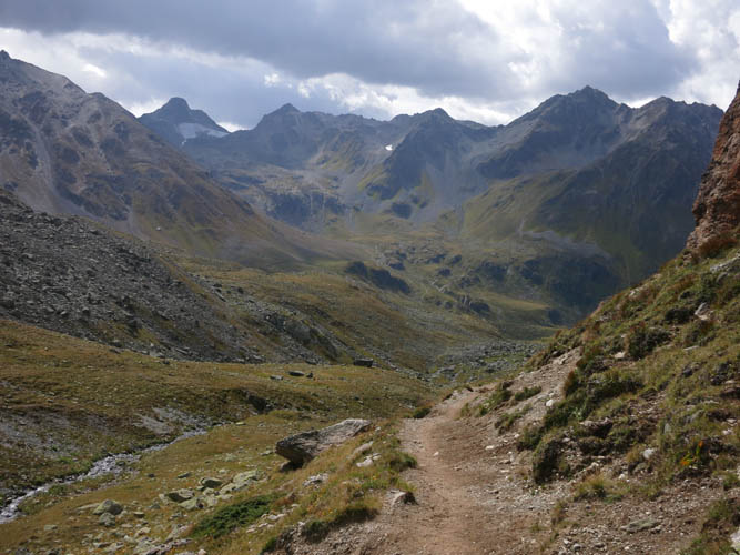
An excellent trail takes me back down into the Dischma Valley.