Choman, Iraq
16 November 2018
Solo
A winter adventure on Iraq’s second highest mountain
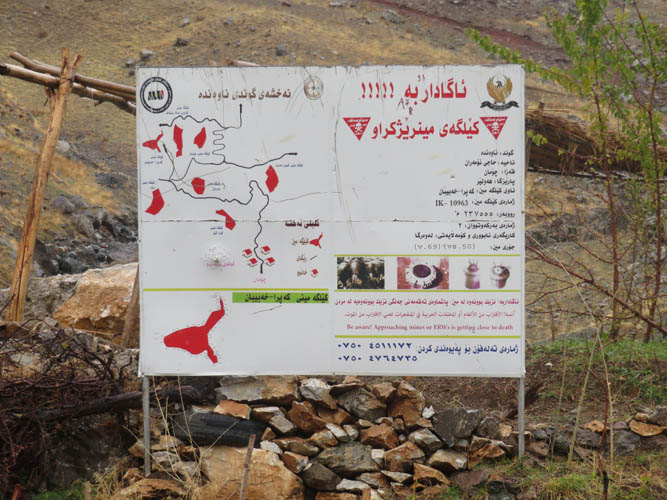
Warning: Multiple minefields exist around Halgurd mountain. Always stay on beaten tracks and established routes, or better yet hire a local guide. Before considering an ascent, check with the local authorities on the current security situation – the Turkish military has been known to target PKK (Kurdish militant group) positions in the region.
At 3607 m elevation, Halgurd is officially Iraq’s second highest mountain. It is eclipsed by only a few metres by Cheeka Dar, which sits just 6 km northeast of Halgurd right on the Iranian border and is therefore much more difficult to access. Halgurd is climbed relatively often, perhaps because it is the highest mountain entirely contained within Iraq. There is even a British adventure company offering trips up the mountain (secretcompass.com) and I wouldn’t be surprised if there are others by now.
However, compared to peaks of similar stature in Europe or North America, Halgurd is completely and utterly different. Though technically easy (most of it is hiking with perhaps some easy scrambling), the mountain’s challenges are serious and thorough planning is required before making an attempt (see details at the end of this article).
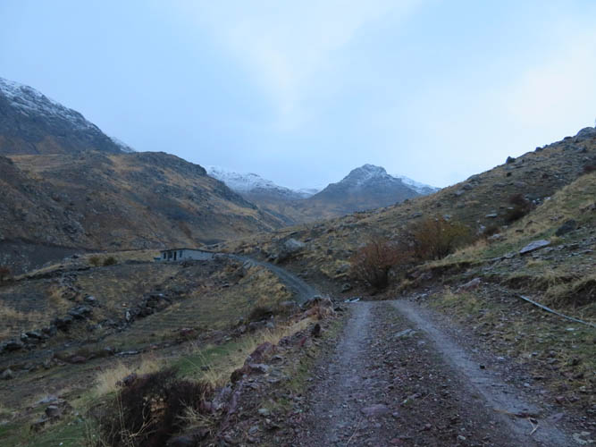
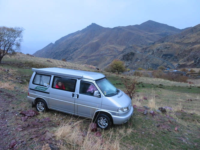
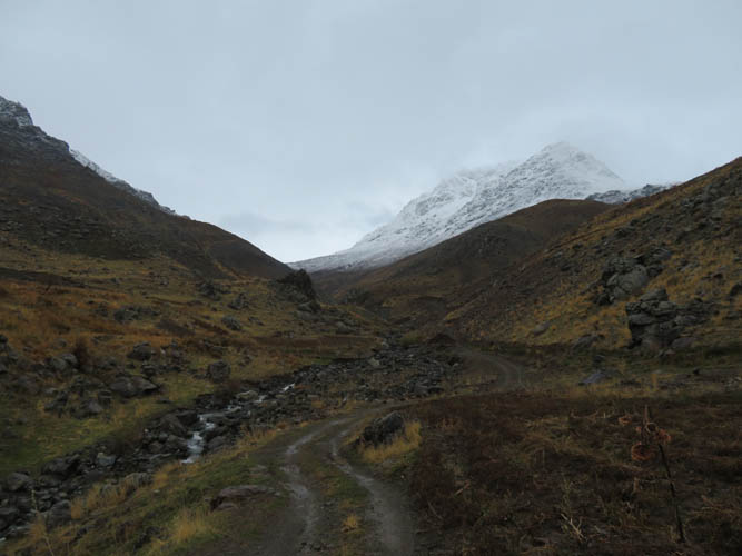
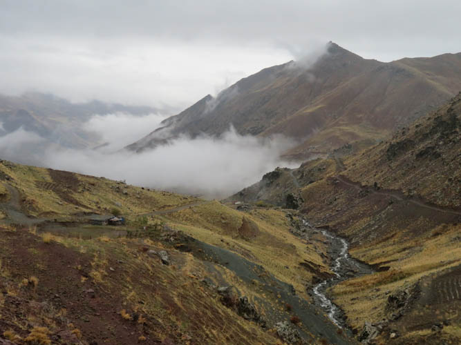
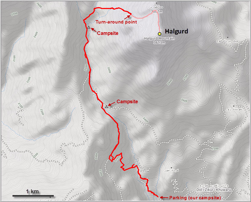
This was supposed to be my last climb during our visit to Iraq, but it fell short of the summit due to massive amounts of snow amongst other factors. My spirits were still high the day before when we managed to drive our 2WD diesel van high up along the muddy access roads from the town of Choman to an elevation of 1870 m, far above the last settlement, before washouts prevented further progress. We found a nice and quiet place to park our car for the night, with not a soul around.
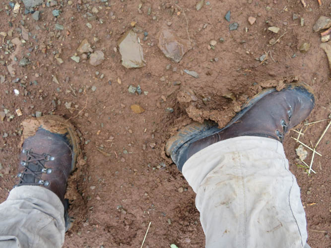
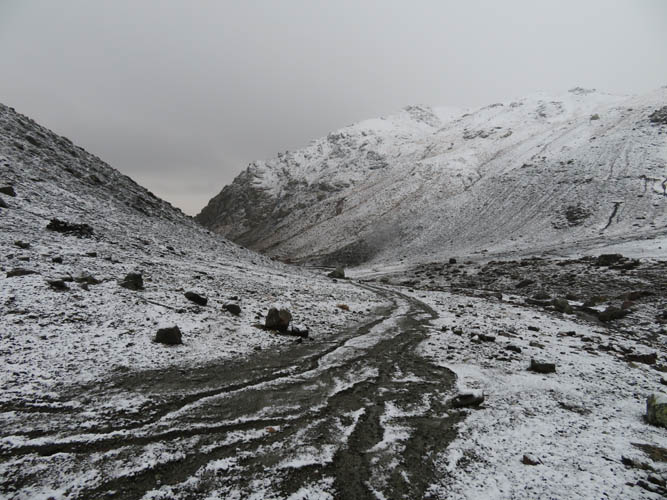
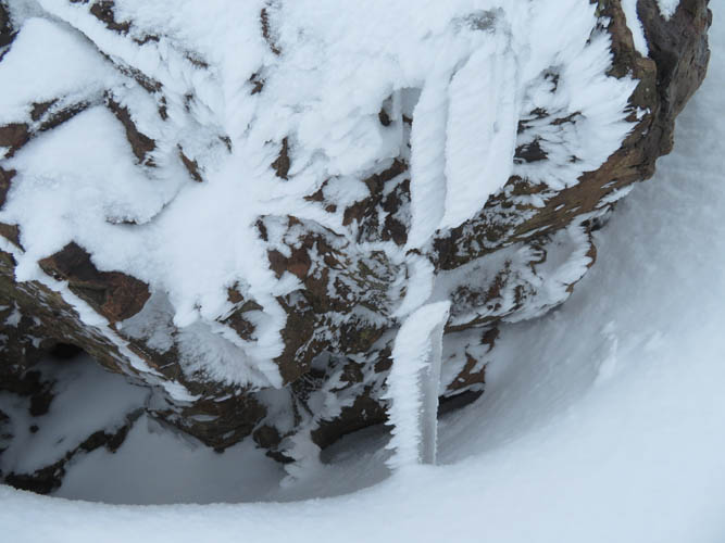
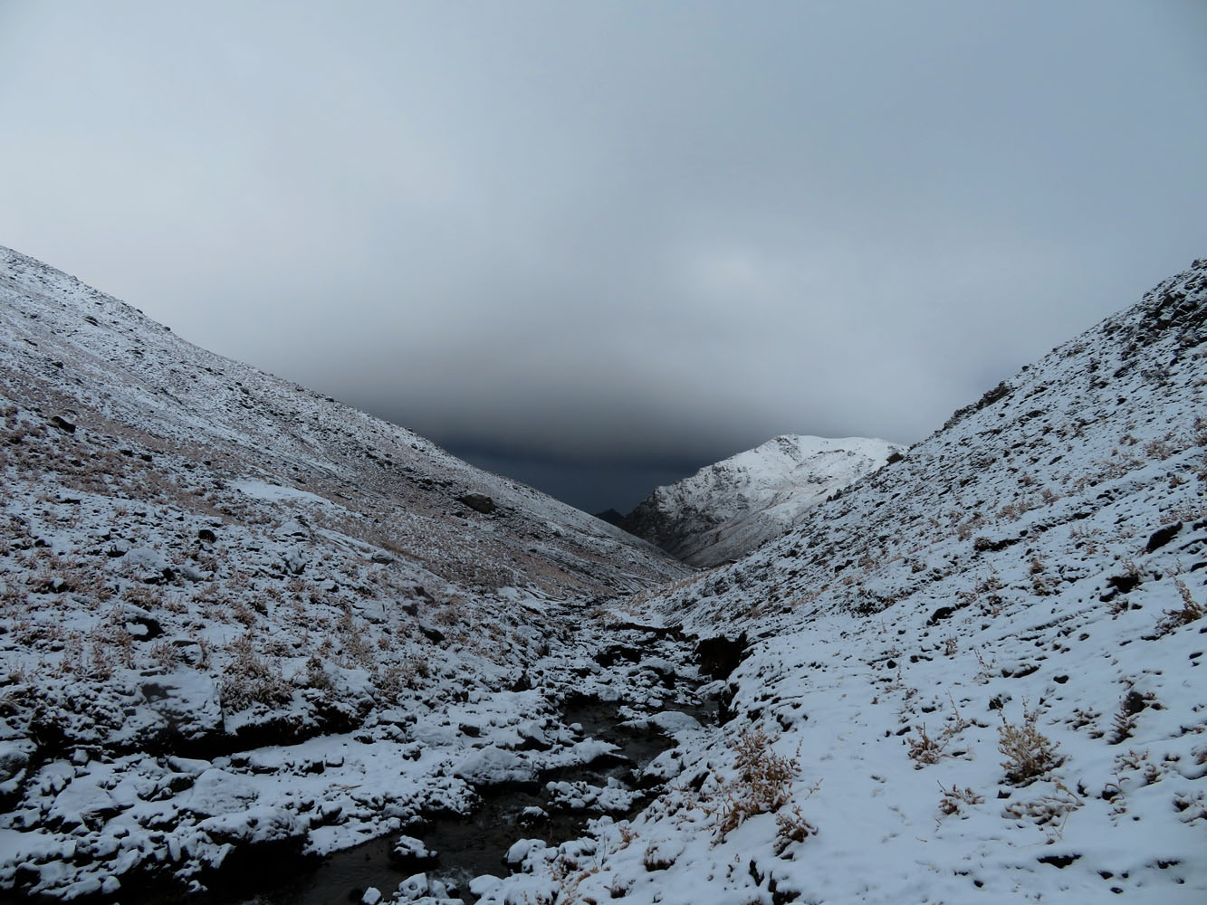
The weather didn’t look promising when I arose at 5:30 AM the next morning. It was very cloudy, cold and there was a constant drizzle making me wonder why I would even attempt the climb on such a miserable day. But I packed up and set off anyway, following the dirt track higher on the right (east) side of a small creek before a washout forced me to jump to the other side and continue on another track. These dirt roads were in pretty poor shape and definitely undriveable due to heavy erosion, with rocks strewn around and water-worn gullies in places. For the hiker, they were just fine, except for the annoying red clay mud that kept sticking to my boots, making my feet three times heavier!
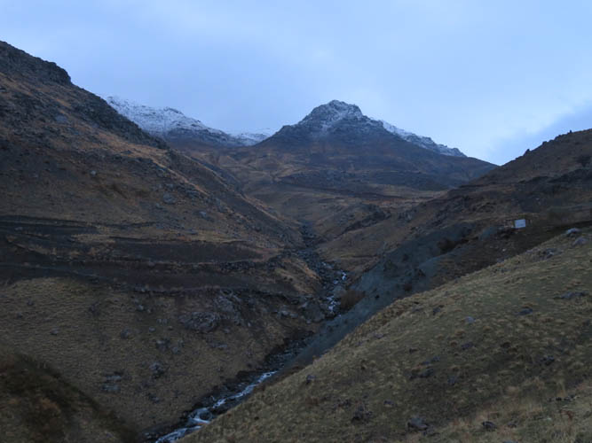
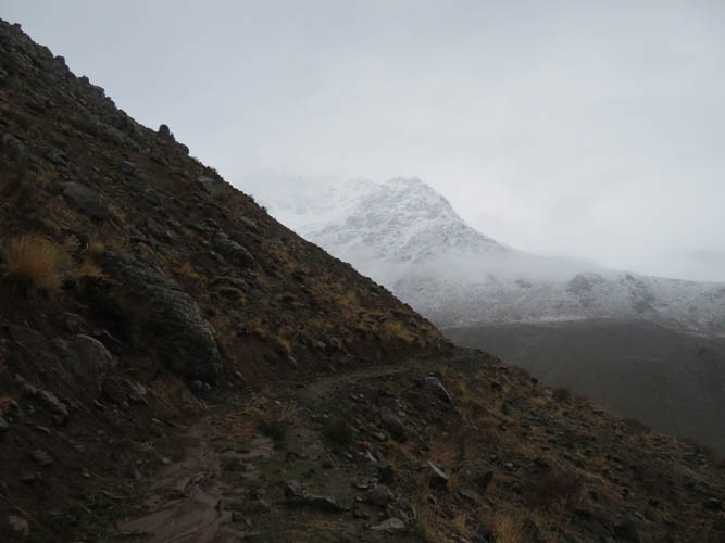
After steadily gaining elevation, I followed another higher track that came in from the left, paralleling the creek. After a few kilometres the road veered left, away from the creek, and a small trail appeared instead. I had just passed the snowline (2400 m) and it wasn’t easy to see where exactly the trail went. Thankfully, my maps and GPS tracks helped me stay on course.
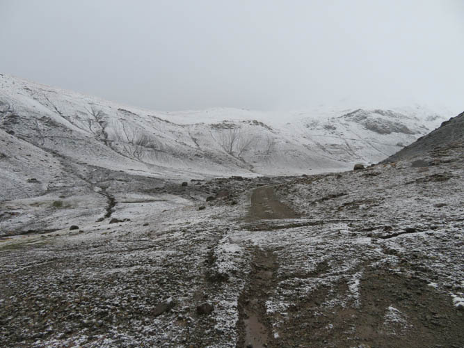
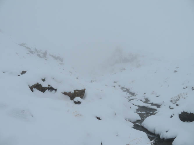
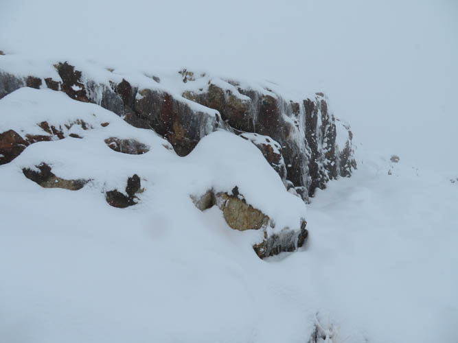
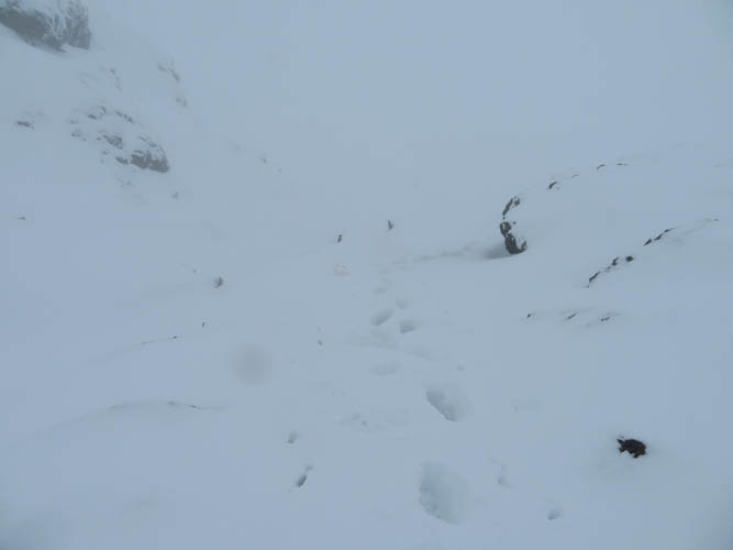
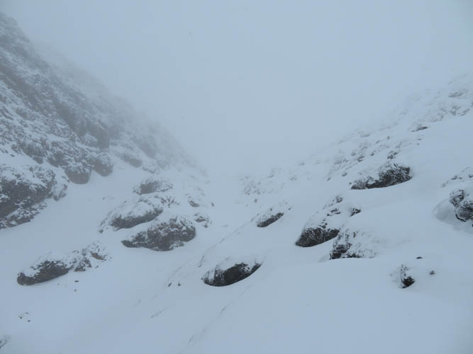
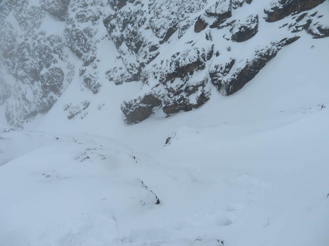
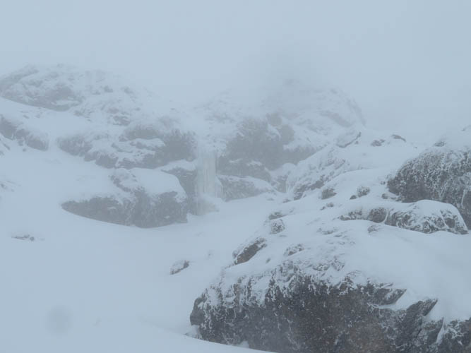
As I put my head down and plodded up the long valley, the snow was getting thicker, the clouds denser, and my hands colder. At around 3000 m, I changed out my wet gloves for the extra pair I had brought, put in some hand warmers, and donned my gaiters. There really wasn’t much to see: visibility hovered between 100 and 200 m, my field of view limited to grey clouds and white ground, with a few black rocks sticking out. No fun, I thought, but well now I might as well go to the summit.
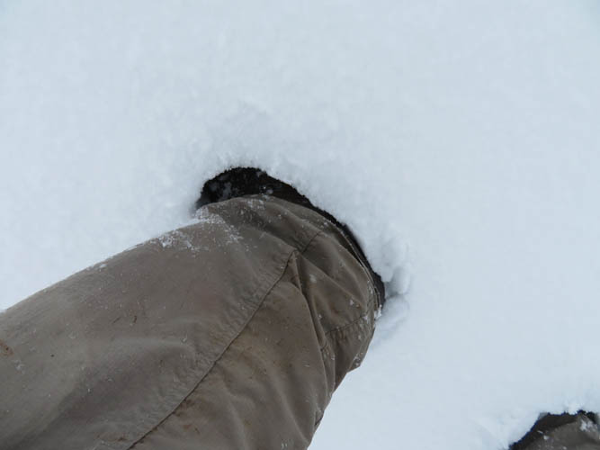
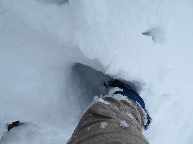
Where the route makes a sharp bend to the right (east) I started encountering worryingly deep patches of soft snow. I was sinking in knee-deep in places and it was only getting worse the higher I went. The terrain also got steeper and my progress significantly slowed. Now at around 3200 m, I was in a steepish gully surrounded by ice-covered rocks, ploughing through waist-deep snow – uphill. The last 500 m distance had taken me about an hour, plus a huge amount of energy. I pulled out helmet and ice axe and tried to climb along the rocks on the sides instead, but unexpected ice and deep snow holes underneath made it a risky exercise. At 3250 m, just 350 m below the summit, I decided to call it quits. The snow was just too soft and deep and this was definitely no fun anymore! It was also becoming a bit too risky for my liking, especially being solo.
On the long walk back down to the car I couldn’t help but wonder why on Earth I’d be doing something as strenuous and unpleasant as this. Perhaps it is the tease of the challenge, both physical and mental, or the personal satisfaction of having the privilege and simply being in a position to climb one of the highest peaks in Iraq. Or maybe just unreasonable stubbornness and overzealous ambition to stick to my dreams and climb what I wanted to climb, no matter how miserable the conditions were. It probably was a combination of all of the above. But I suppose what matters is that I am happy with my choices – to have gone out there and given it a try, AND to have aborted the climb when I reached my limits. It was a great challenge, a great learning experience, and now I have a good reason to come back to Kurdistan and climb Halgurd in the summer!
That same night we had a brief moment of worry and scare. We were already fast asleep in our van when, at the stroke of midnight, we were awoken by an extremely bright light shining down on us from high above somewhere on the mountain. There were no settlements above us and I hadn’t seen a soul all day, so it was with a great deal of trepidation – even fear – that we were watching that light steadily moving closer to us. Perhaps the Kurdish military? The PKK? Or even some local thugs? This moment brought back bad memories of an encounter several weeks ago when an angry villager with a flashlight approached our car at night and started shooting several rounds only 20 m away from us. Now once again we saw someone approaching, but had no idea who. The light was moving fast and within minutes reached our car, but I could only make out a dark figure with a big rifle. I quickly threw on some clothes, grabbed my flashlight, and stepped out. “Merhaba!” I shouted into the dark… After a few seconds I received a friendly “Hello!” in return as a smiling face stepped in front of me. It was a local hunter who introduced himself by the name of Hussein from the nearby village of Nawanda. My heartbeat instantly dropped and I breathed a sigh of relief. When Wen heard our friendly banter, she crawled out of the car and offered him some bananas and drinks. After explaining what we were each doing up here in the middle of the night, he took some selfies with us to show his friends, wished us a good night, and then he was off into the dark again…
Practical information – things to consider before climbing Halgurd:
1) Logistical. If you don’t have your own car, the journey to get here can be long: by bus/taxi from Erbil to Choman (3-5 hours) plus an overnight stay, then hire a local 4WD (usually with a guide) to drive up along one of the access roads up the mountain. Even with your own car, it’s a tough drive on these mud roads (highest point we got to was 1870 m elevation). There are quite a few military checkpoints along the main road to Choman and depending on how credible you come across as a “mountain tourist” these might involve some delays if you travel on your own.
2) Security. The mountainous region of northern Kurdistan bordering Iran and Turkey is known to harbour militant camps and hideouts of the PKK, the Kurdistan Workers’ Party, considered a terrorist organization in the west. The Turkish military frequently bombs their positions, both in Turkey and northern Iraq, including the area around Halgurd mountain. Keep up-do-date with local news and check with the local authorities before heading out.
3) Landmines. This is by far the biggest concern. Several minefields dating back to the Iraq-Iran war are known to be present on the slopes of Halgurd. Going off-trail is thus a big no-no. There are official warning signs with a vague map of their location, but even if you avoid these areas there is always a risk of mines having shifted position due to rain, erosion and washouts.
If unsure about the route or any of the above, the best idea is to go with tour agency or hire a local guide. A good choice for a guide from Choman would be Omar and Reband (www.vikurdistan.com), whom we ran into on our way back through town as they were just wrapping up a tour for a couple of French tourists. They’re really friendly chaps, speak excellent English, and know the mountain well.
|
Elevation: |
Summit: 3607 m (official) |
|
|
Highest point reached: 3247 m (my GPS) |
|
Elevation gain: |
1410 m |
|
Time: |
7.5 h |
|
Distance: |
16.8 km |
|
Difficulty level: |
Moderate (Kane), T4 (SAC) |
|
Comments: |
Stats above refer to my attempt only |
|
Reference: |
Local maps |
|
Personal rating: |
3 (out of 5) |
DISCLAIMER: Use at your own risk for general guidance only! Do not follow this GPX track blindly but use your own judgement in assessing terrain and choosing the safest route. Please read the full disclaimer here.