25 January 2015
With Richard, Trevor and Wen
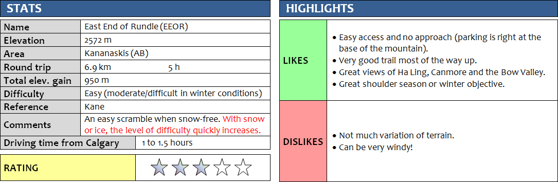
This was my second time up East End of Rundle (EEOR). Trevor had done it probably at least 10 times before; I think this must be his favourite “repeat” trip. Only Richard and Wen had never been up this mountain, if you can call it a “mountain” that is. EEOR is really just the easternmost sub-peak of the 10 or so high points along the massive Mount Rundle, which stretches all the way from Canmore to Banff.
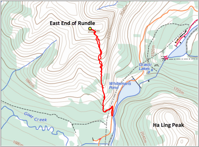
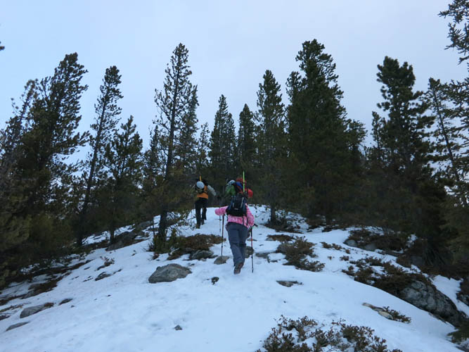
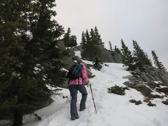
It was one of the windiest days I’ve ever experienced in the mountains! Our car was shaking in the parking lot and it felt like we were walking straight into a wind tunnel with a jet engine blowing at us when we started our hike in the morning. The first part of the trail is in the trees which, to our great relief, offered good protection from the wind. The trail quickly gains height and follows the edge of the main slope trending north. As soon as we got out of the trees, we started walking like drunkards again, getting whipped around by strong gusts of constantly changing force and direction. No wonder we were the only ones on the trail!
After passing through broad, open grassy slopes we reached the steepest part of the hike and the crux of the day near the upper part of the mountain. The snow had been soft lower down, but here it was icy and hard. We had to use our ice axes to overcome a very short (perhaps only 20 m) but slippery and steep section below a cliffband. This part was quite the challenge for Wen – it was her first time to handle an ice axe and she wasn’t used to this kind of terrain. She was slipping and sliding repeatedly, but kept on trying (the consequences of a slide were fairly harmless as there was a gentle run-out into deeper snow). Stubborn as she is, she wouldn’t give up and eventually, with much swearing and cursing, her persistence paid off and she made it up that damn icy slope! A short cliffband followed, where we had to tramp along a narrow ledge single-file through deep snow using our ice axes for support. Around the corner was the summit ridge, normally an easy walk up but now with all the snow and wind it felt more taxing. The ridge appears to narrow in the last few metres before the summit with some noticeable exposure. I think this was largely due to the snow and slippery conditions, which limited our route options on the ridge. There were a few noticeable cornices hanging over the ridge that we were particularly keen to avoid. In summer, I don’t remember this being challenging at all.
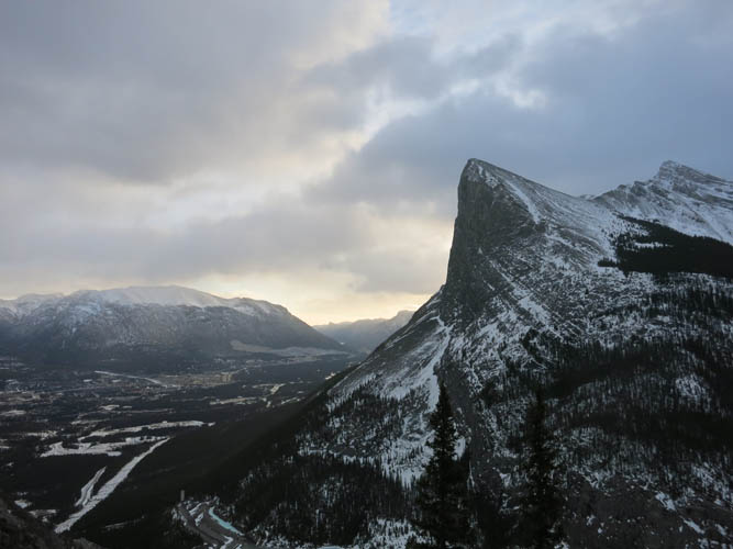
The views of the remainder of the Rundle massif and the Bow Valley below were simply fabulous from the summit. However, it was also uncomfortably cold and windy up here so after a brief summit celebration we quickly retreated. One the way down, one other group passed us. They had no ice axes and were very lightly dressed for these conditions (sneakers!). It never ceases to surprise me how many people I run into that are obviously underequipped or underprepared. A little peak like EEOR might be an easy hike throughout most of the year, but it can quickly turn into something much more demanding and risky if conditions aren’t ideal. All it takes is a bit of snow, ice and perhaps some wind!
DISCLAIMER: Use at your own risk for general guidance only! Do not follow this GPX track blindly but use your own judgement in assessing terrain and choosing the safest route.
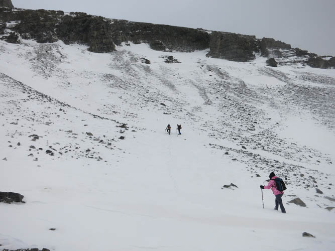
The hike starts off pretty steep. No time to warm up here, it’s straight up!
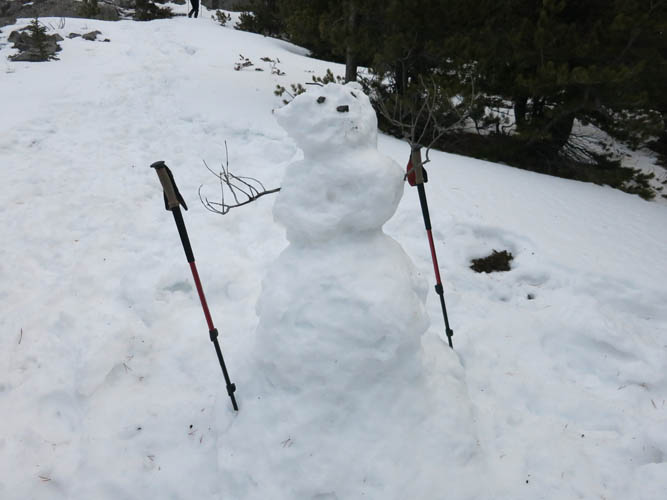
A wind-battered snow man greets us. EEOR is a popular hike, even in the winter, but today this fellow was the only guy we saw on the way up.
It’s consistently steep almost the whole way up.
Ha Ling Peak.
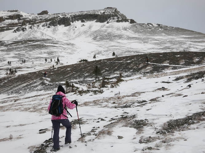
A short flat stretch opens up the rest of the route.
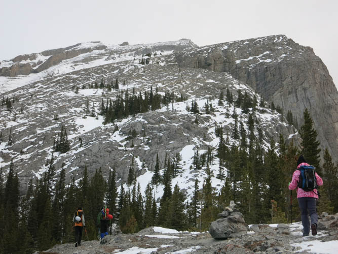
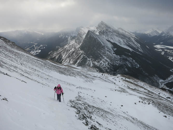
We approach the cliffband via a gentle, grassy slope.
Richard and Trevor lead the way. We can never really catch up with them it seems!
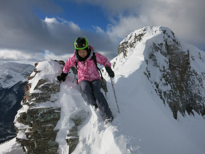
Wen tramping up the last stretch of the snow slope, just before it got icy and slippery.
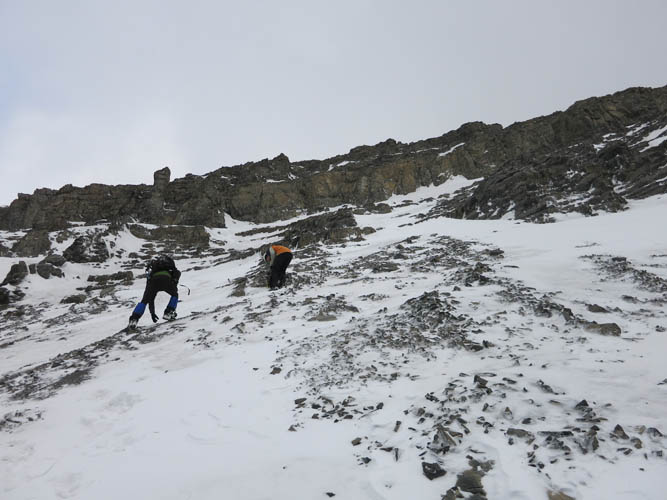
Time to bring out the ice axes!
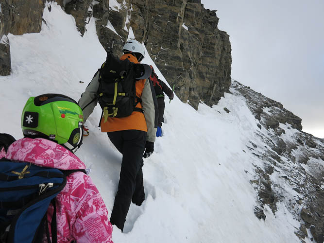
Along a snow-covered ledge through the cliffband.
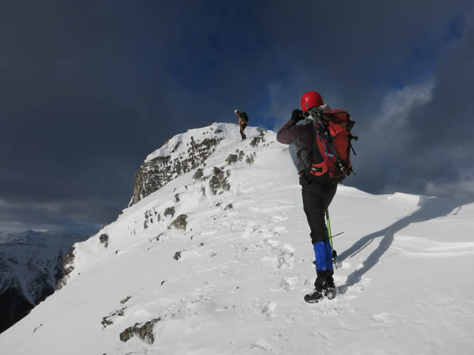
Around the corner behind the cliffs, it’s just a short walk up to the summit.
Snow cornices are treacherous and Richard takes his time scoping out the safest path.
It is a gorgeous winter day (minus the wind!).

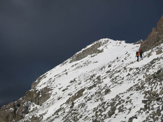
The last bit is the trickiest.
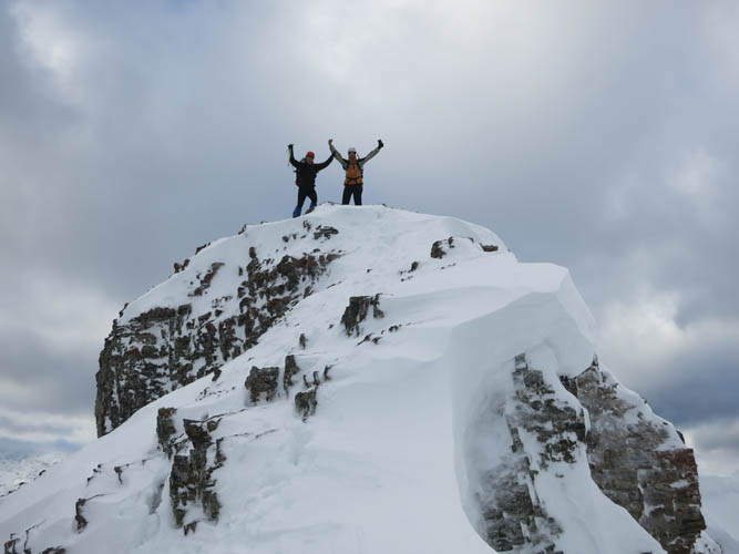
Success!
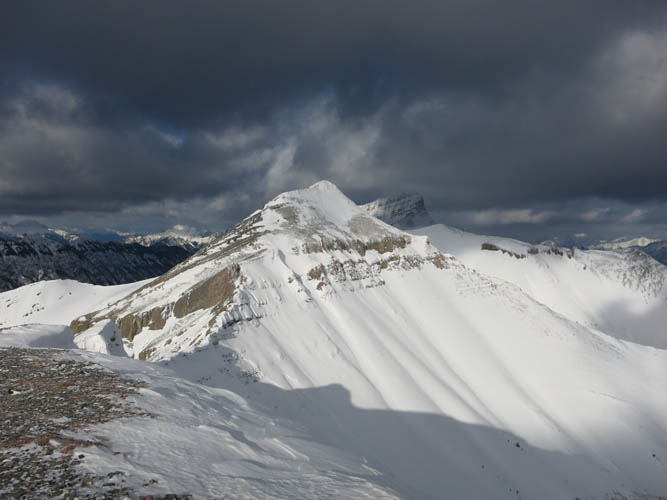
I love the contrast between the dark clouds and the bright white snow lit up in the sun.
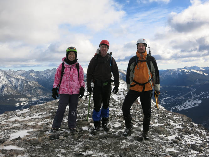
Summit shot
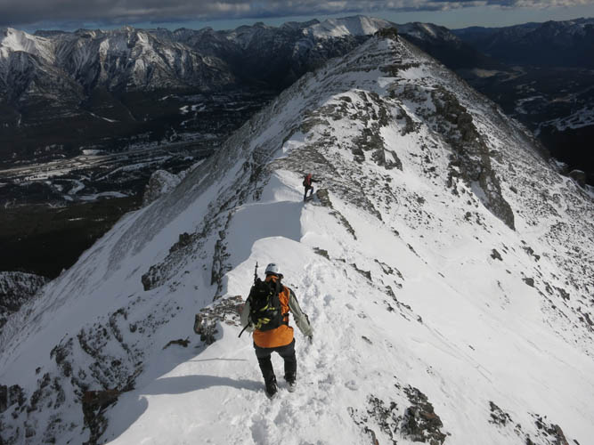
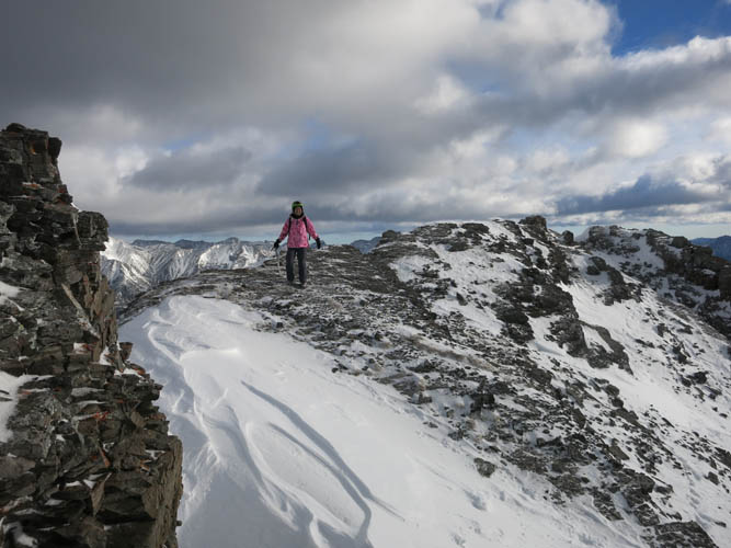
Descent along the summit ridge.
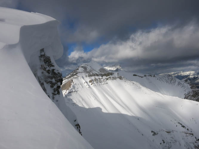
One of the many cornices along the ridge.
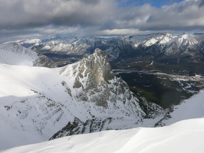
Looking down the Bow Valley with Canmore on the right.
Carefully retracing our steps.
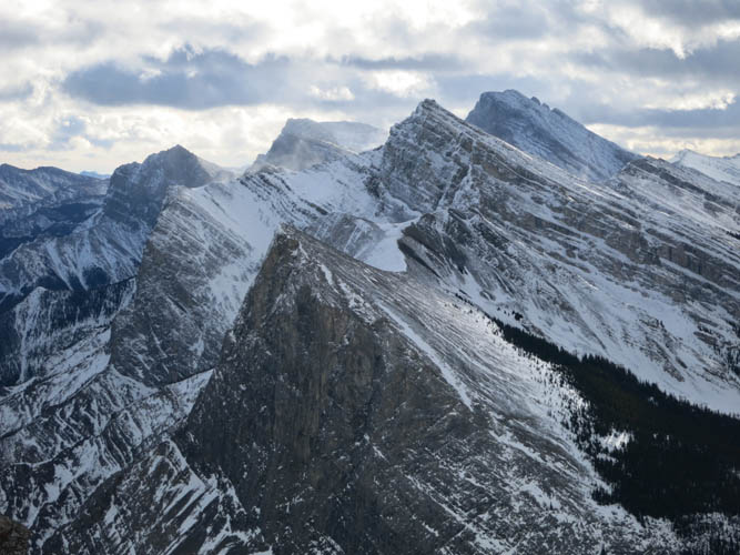
To the east of us are Ha Ling Peak (front) and Mount Lawrence Grassi (behind and to the right).