Sulaymaniyah, Iraq
31 October 2018
Solo
A different type of crux: mine fields in Iraq
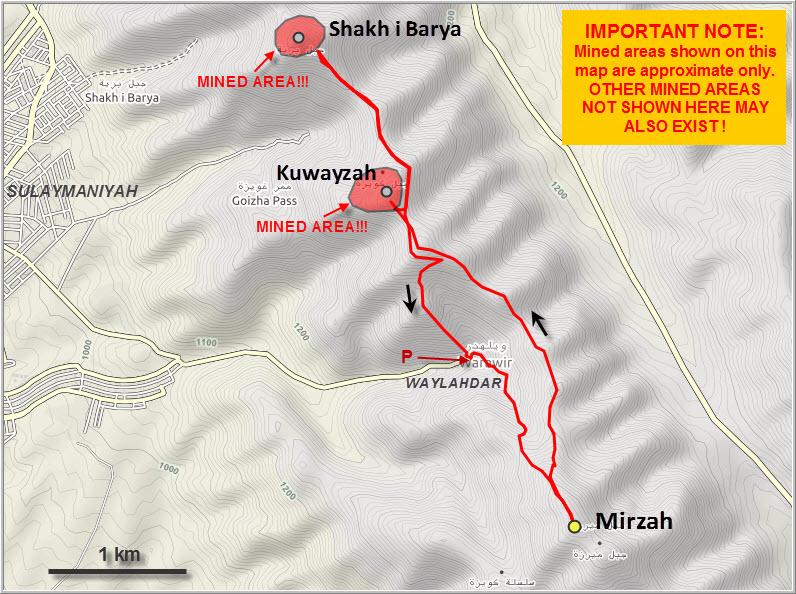
Warning: Landmines and UXO’s are present along the ridge north of Jabal Mirzah, north of the village of Waylahdar. The route from Waylahdar to Mirzah summit is clear, but avoid all other areas along this ridge.
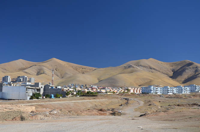
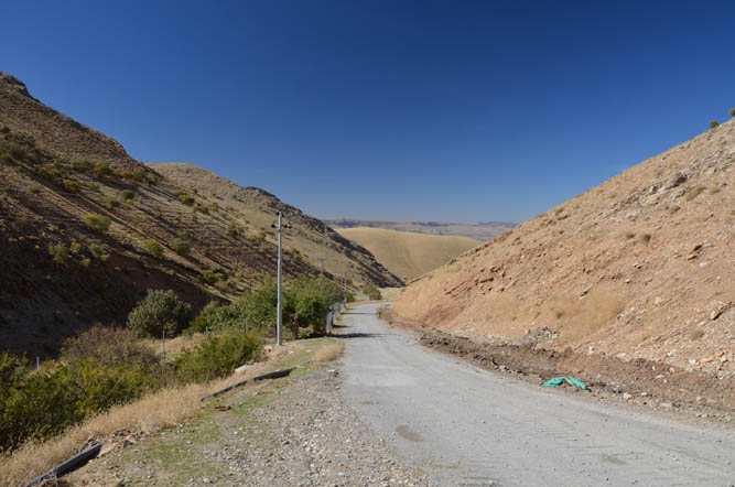
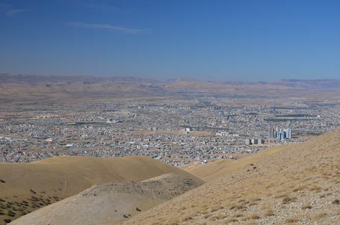
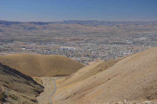
My first proper hike in Iraqi Kurdistan and quite the introduction! When I drove out the city centre from our hotel I thought that the crux of the trip would be navigating my way through the terribly congested streets of Sulaymaniyah… None of the maps I had available to me (Google, maps.me, Gaia, etc) were up-to-date and I ended up taking a circuitous route to reach the village of Waylahdar, only 5 km east of Sulaymaniyah. It took me more than an hour and a half. The village is also shown on many maps by the name of “Warawir”.
I originally planned to start my hike up a gentle grassy ridge a few km away from the village, but two local guys who happened to drive by on the otherwise deserted asphalt road advised me to park in the village. “To avoid an encounter with Ali Baba and the 40 thieves!”, as they put it. They also assured me that there were no landmines in the area and that I was welcome to hike along the rounded peaks and ridges as I pleased. Great!
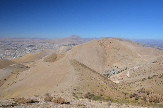
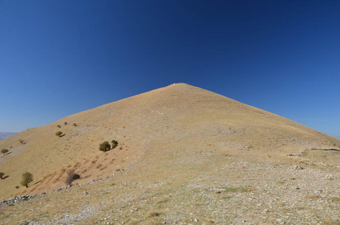
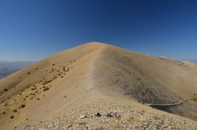
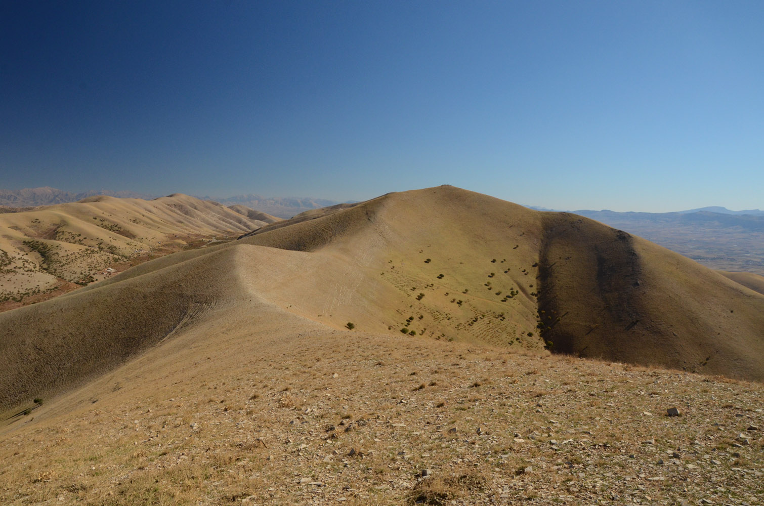
Jabal Mirzah, my main objective for the day, is the southernmost peak of the long ridge that overlooks the city of Sulaymaniyah to the east. From Waylahdar, it was a short hike along sheep trails through a small valley and an easy ridge top to the broad summit. Nobody else was around and the only evidence of human activity up here was a rudimentary enclosure made of rocks that encircles the highest point. The views of Sulaymaniyah below were certainly worth the minimal effort of getting up here. After all, it’s only about 400 elevation metres from the village to the top!
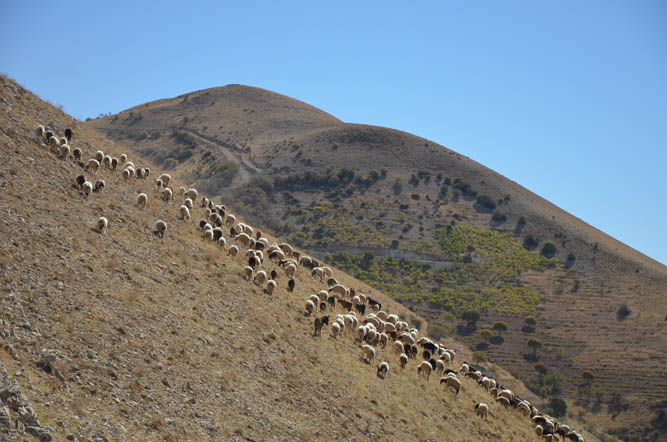
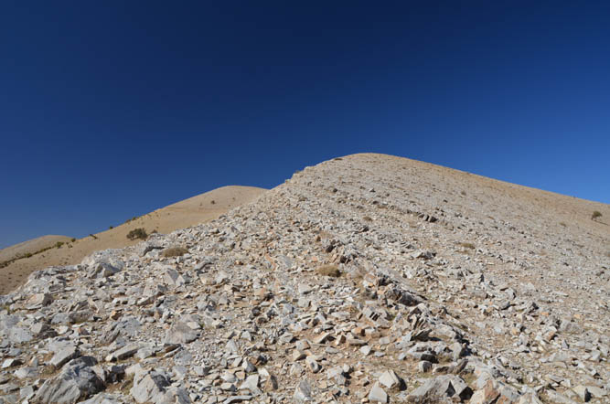
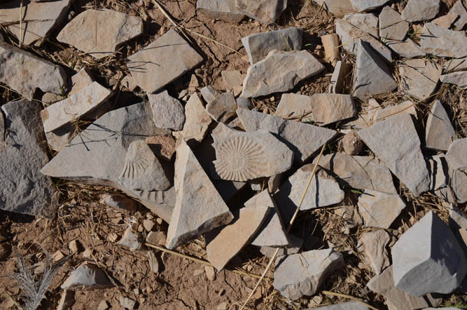
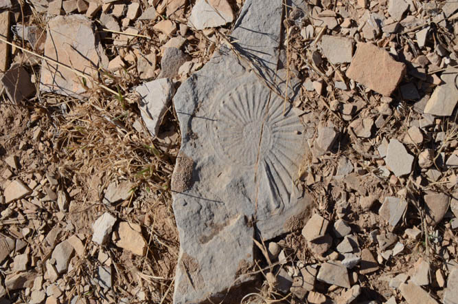
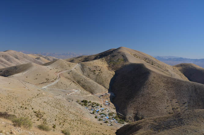
After paying Jabal Mirzah a visit, my plan was to follow the undulating ridge north to two other named summits – Jabal Kuwayzah and Shakh i Barya. The traverse along the ridge was fun, especially since I kept getting distracted by the many ammonites I found in the limestone that the ridge is made of. These ancient sea creatures are common in the fossil record, but it doesn’t happen very often that you come across them in such abundance!
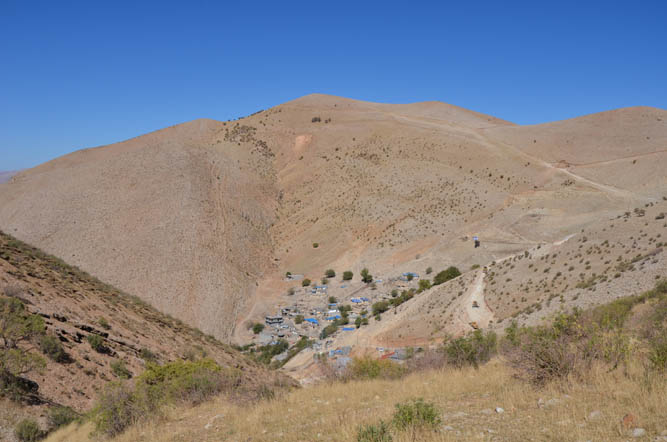
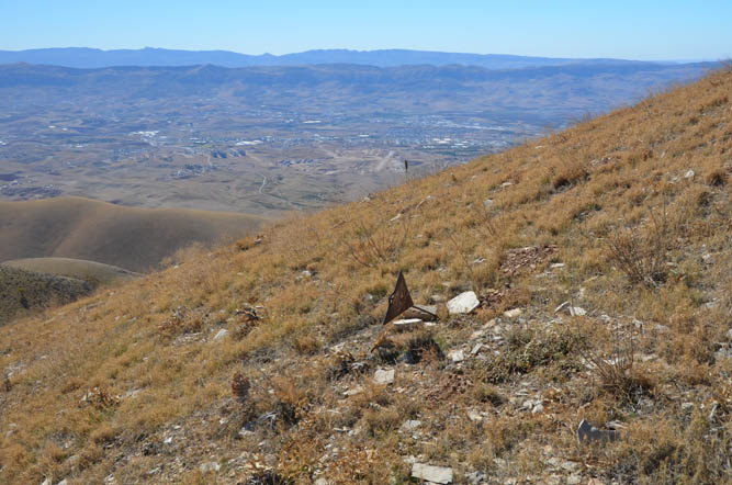
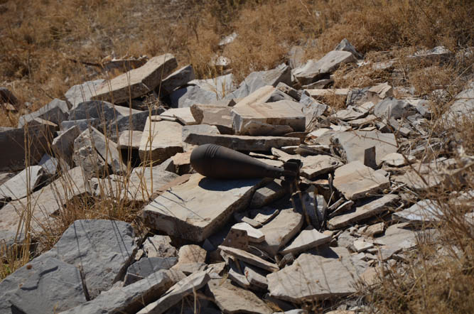
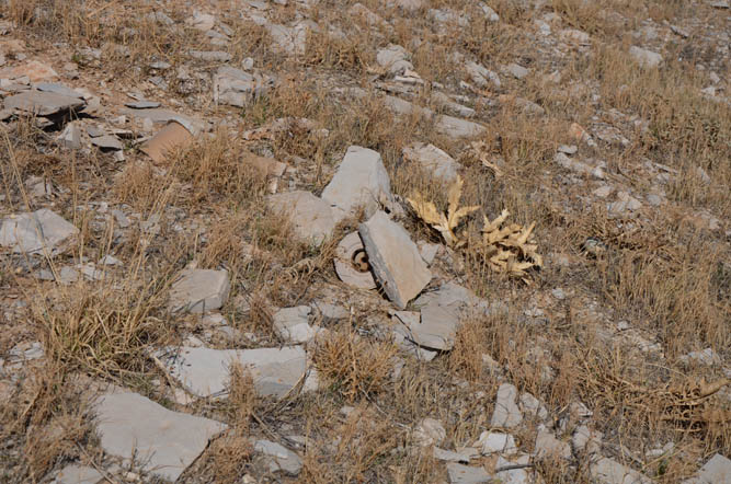
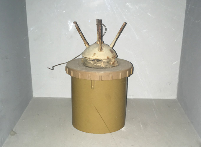
I was in great spirits and kept hiking along the many ups and downs of the ridge towards the summit of Jabal Kuwayzah. Sadly, this is where the fun ended… The real crux presented itself: LANDMINES! I have to admit, I had a momentary lapse of common sense when I approached the black triangular signs that appeared to encircle the mountain on the grassy slope, a mere 30-40 metres below the summit. I could make out another rudimentary structure made of rocks at the top, but bigger in size, almost fortress-like. I couldn’t really tell what the signs were showing, but it did cross my mind that they might be markers warning of the presence of mines. Many of the signs were tilted or broken. I kept on walking for a few metres until the faded depiction of skull and bones was unmistakable. I froze and carefully looked around me: only metres away uphill was a round grey plastic object stuck behind a rock. That stereotypical “mine look”. I have no idea if it was still active or left there as a deterrent, I didn’t care. I carefully retraced my steps to get out of this sketchy area and hiked back to the last saddle before the summit. On the way down, I passed by a mortar round sitting on a rock. I couldn’t believe it! I was on a hill so close to the city yet the area still hadn’t been cleared of mines and UXO’s.
Back at the saddle, I thought about my options and decided to contour around Jabal Kuwayzah along a faint trail and head to the third peak along the ridge. Unfortunately, it was the same story here: once again there was a row of black triangular signs surrounding the summit mass, about 50 metres below the top. I’d definitely had enough for the day and decided to just head back the way I came and get back to my car. After running into two mined summits, I certainly wasn’t in the mood for hiking anymore.
The obvious moral of the story is: don’t simply head out there and hike in an area unknown to you. Ask the locals, but double and triple check with other people to make sure the area is safe and free of mines. I hadn’t run into any people on the ridge top, but if I had, they would’ve probably advised me to stay well clear of those last two peaks. For this particular area, Jabal Mirzah makes for a nice, short, half-day hike, but the ridgeline to the north is best avoided entirely.
| Elevation: | 1646 m (my GPS) |
| Elevation gain: | 810 m (incl. additional hiking) |
| Time: | 4.5 h |
| Distance: | 10.2 km |
| Difficulty level: | Easy (Kane), T2 (European) |
| Reference: | No route information was available to me prior to trip |
| Personal rating: | 2 (out of 5) |
DISCLAIMER: Use at your own risk for general guidance only! Do not follow this GPX track blindly but use your own judgement in assessing terrain and choosing the safest route.