Al Harajah, Saudi Arabia
1 April 2019
Solo
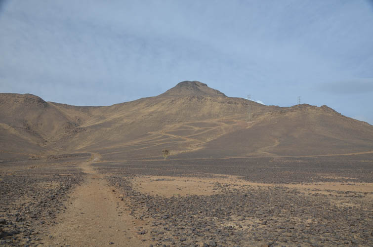
Volcanic basalt cone
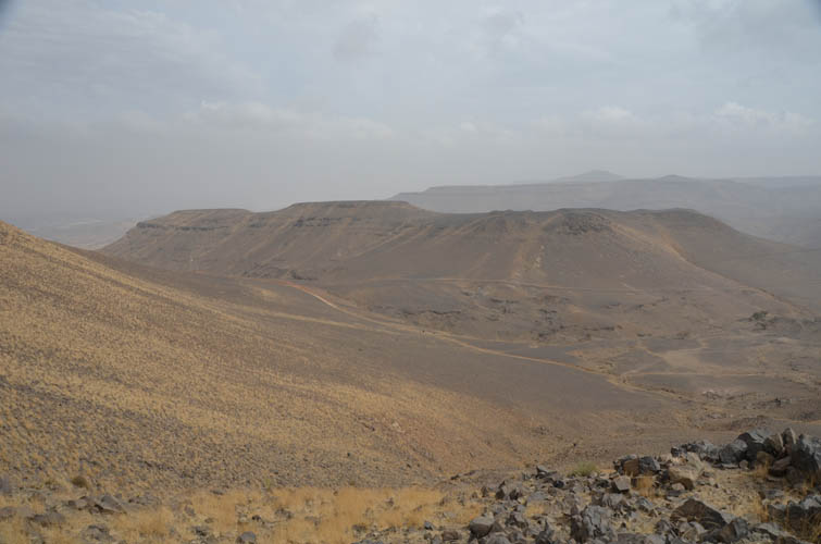
After hiking up Jabal Ferwa and nearby Natfa earlier in the morning, I drove a short distance via the town of Al Harajah to the western slopes of Jabal Mushrif. This peak stands out as a gentle volcanic cone and appears similar in elevation to Jabal Ferwa to the west, which is supposedly the highest point in the country. But is Ferwa really higher? No better way to find out than to go there and check the elevation myself…
The limitations of using a standard recreational hiking GPS device (in my case a Garmin etrex 30) to measure and compare elevations of peaks that may differ by mere metres are quite obvious. Having neither the time nor the interest in lugging around expensive technical equipment, all I usually do is calibrate my device at an official survey point and then hope that there won’t be any significant weather changes that might affect my barometer readings. Usually, this works quite well and my GPS’s elevations are typically within 5-10 metres of the known elevation of a summit. Measurements of cumulative elevation gain on the other hand are a whole different problem…
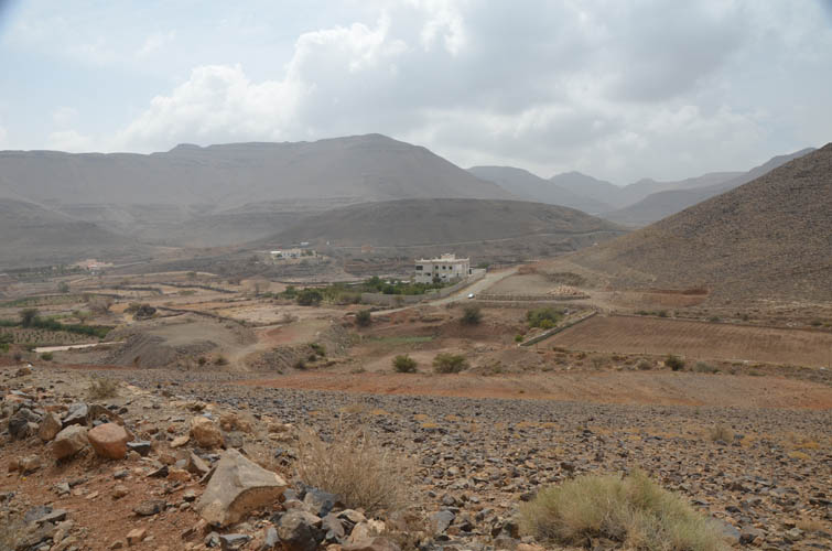
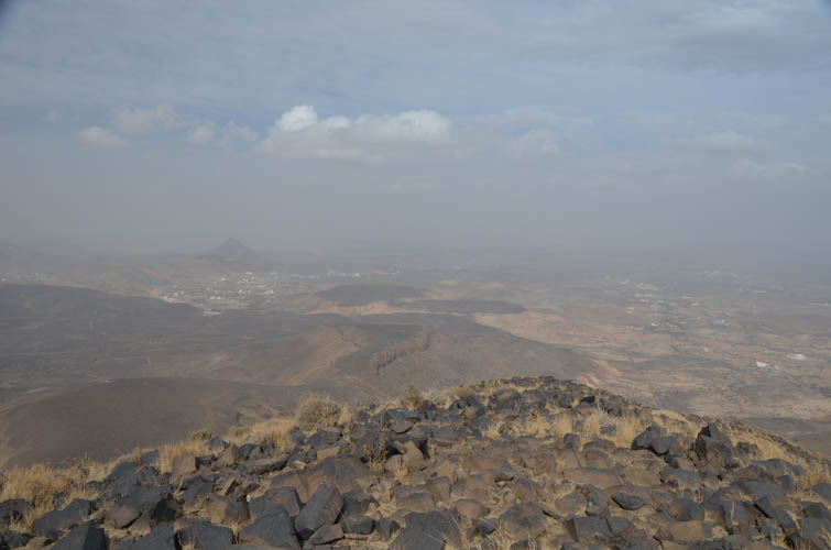
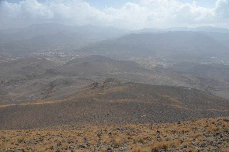
Jabal Mushrif is once again a name I didn’t find on any map but one that was conveyed to me by a Saudi living in one of the local villages at the foot of the mountain. When I drove along the small asphalt road around the west side of the peak I was surprised by how densely populated the area is. There are small clusters of houses everywhere and it’s sometimes hard to tell where a village starts and ends. I was fully expecting to be surrounded by curious villagers when I parked my car by a farmer’s field across from a stately villa, but to my surprise there was not a single soul around.
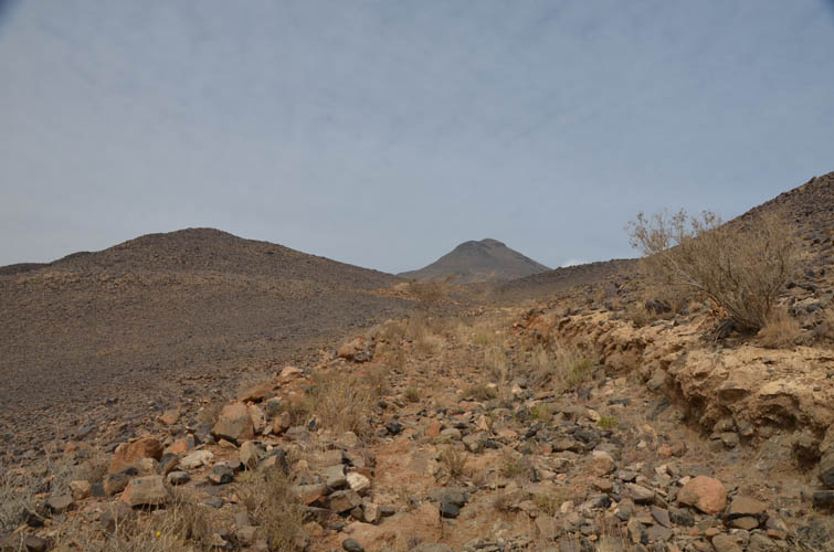
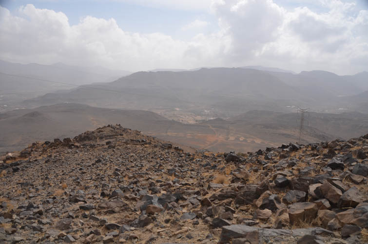
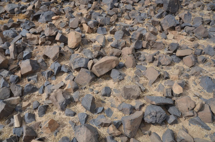
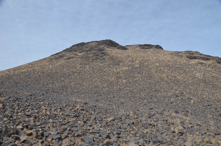
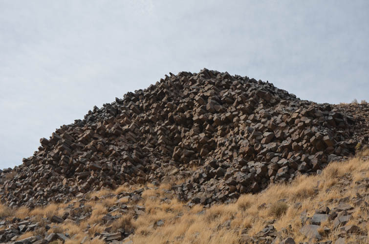
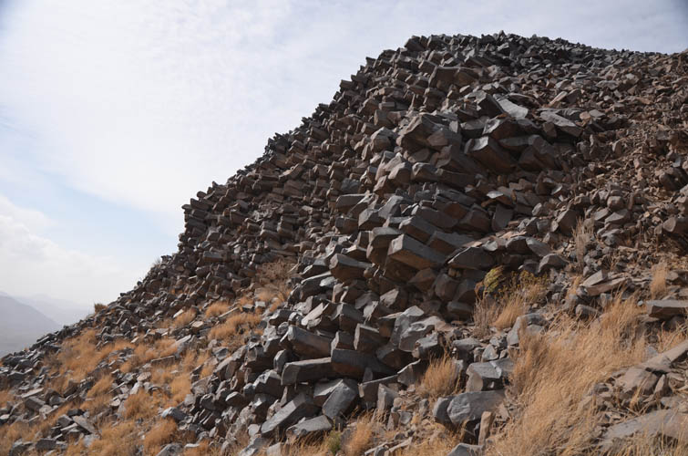
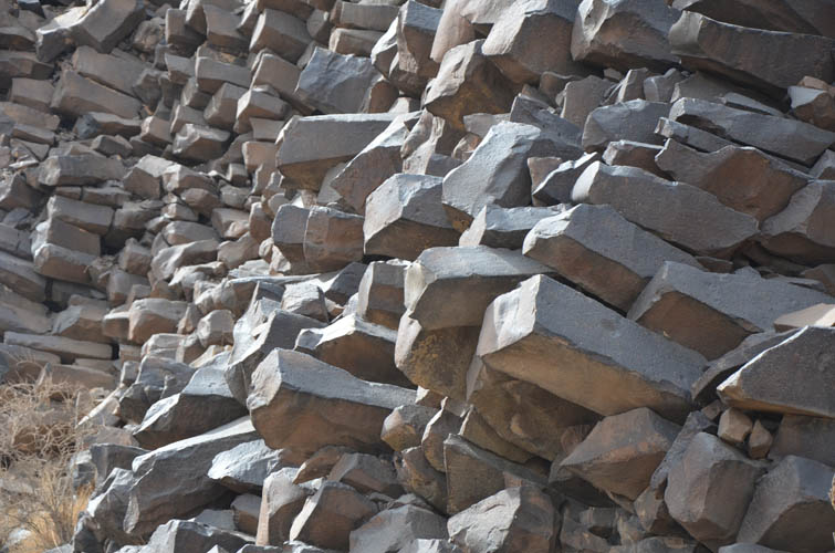
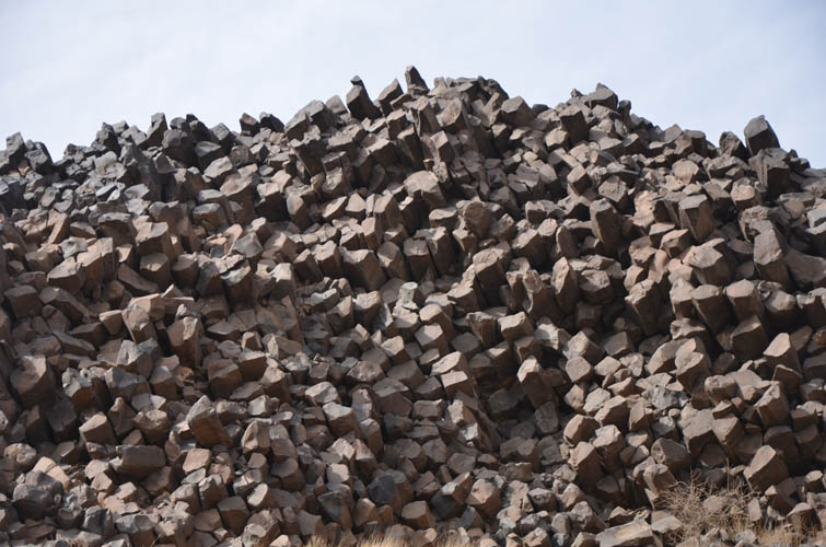
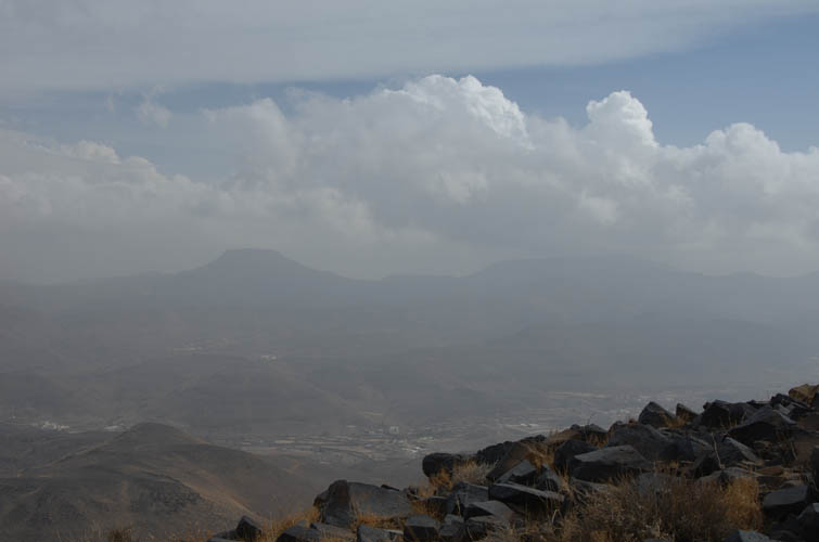
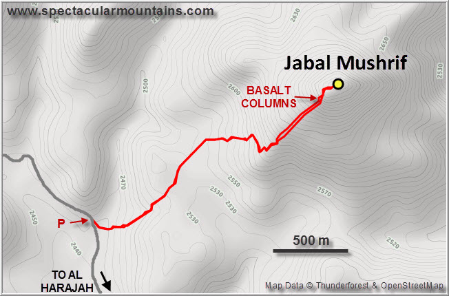
There are probably many different feasible routes up Jabal Mushrif, so the one I picked may not have been the best. It certainly worked out very well and there was a path about three quarters of the way up. After passing by a couple of fields I encountered a rough track, probably an old utility road to access a powerline higher up. I followed the track and soon came onto a sort of plateau where dozens of donkeys were grazing on whatever meagre shrubs they could find. Other than the donkeys the area was completely empty with no people in sight. There were a few other paths coming in from different directions but the main track continued up the slope in zig-zags underneath a powerline. The track went over a shoulder and then dropped down the other side so I left it and headed up a broad open ridge towards the summit. The whole ridge is covered with small chunks of black angular rock – basalt, a type of extrusive volcanic rock. I soon discovered where it all came from: several large outcrops of in-situ basalt columns appear just below the summit, the source of the debris. It was annoyingly windy as I got closer and the terrain is pretty unpleasant to hike on, but these formidable basalt outcrops were a pleasant surprise. It is indeed rare to find sites where you can see such well-preserved polygonal basalt columns up close. The Giant’s Causeway in Ireland comes to mind as probably the most famous example of this geological peculiarity. Another good outcrop I remember well is on the Gangolfsberg in Germany’s Rhön Mountains.
It was gusty and uncomfortable on the summit, so I just stuck around just long enough to take a proper GPS reading and wolf down a quick second lunch. The summit elevation came out at 2856 m, significantly lower than Jabal Ferwa which thus remains uncontested as the area’s tallest mountain. After my break I headed back down the same way, stopping by the basalt column outcrops again, and got back to my car only two hours after setting off earlier in the afternoon.
|
Elevation: |
2856 m (my GPS) |
|
Elevation gain: |
460 m |
|
Time: |
2.0 h |
|
Distance: |
5.1 km |
|
Difficulty level: |
Easy (Kane), T3 (SAC) |
|
Reference: |
No info was available to me prior to trip |
|
Personal rating: |
2 (out of 5) |
NOTE: This GPX track is for personal use only. Commercial use/re-use or publication of this track on printed or digital media including but not limited to platforms, apps and websites such as AllTrails, Gaia, and OSM, requires written permission.
DISCLAIMER: Use at your own risk for general guidance only! Do not follow this GPX track blindly but use your own judgement in assessing terrain and choosing the safest route. Please read the full disclaimer here.