7 September 2017
Solo
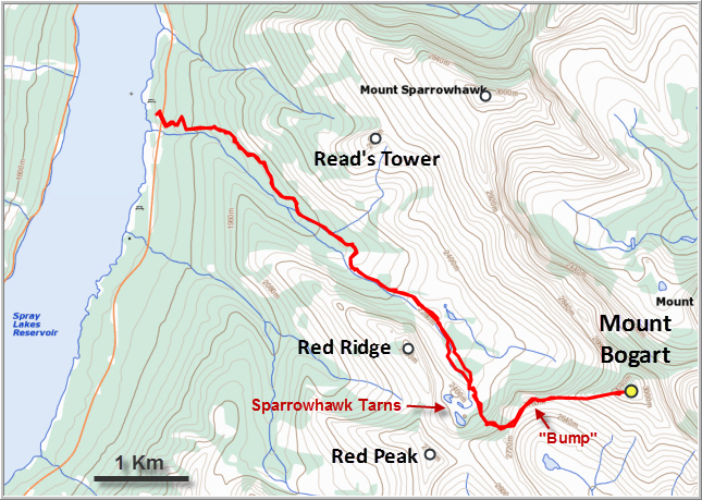
Two main routes have been established up this mountain. The original route described by Alan Kane that approaches from the east via Ribbon Creek seems to have fallen out of favour in recent years; instead, most people now chose the arguably more scenic west route outlined in Nugara’s More Scrambles in the Canadian Rockies book.
I chose a very hot September day for this outing with peak temperatures of 33°C – not ideal, but I was eager to get out to the mountains again and I actually don’t mind the heat. It was also a very smoky day; the many forest fires in parts of BC and Alberta were still raging and obscuring the skies in large parts of the mountains.
The west route up Mount Bogart struck me as a very enjoyable and straightforward outing, and one that isn’t as difficult as I had expected from Nugara’s description. From the “Sparrowhawk” parking lot on the Spray Lake road, I enjoyed a pleasant stroll on a very good path that steadily gains elevation. You can make really good time here as it’s at a very gentle angle and almost impossible to get lost. Much of it is in the forest at first, but once out of the trees beautiful views of the rocky upper valley open up, with the imposing Mount Sparrowhawk to the left and the long Red Ridge to the right. I really liked the area up here – a bit rugged-looking but charming at the same time. It reminded me of a typical high valley in the Alps. And I had it all to myself, probably because it was so stifling hot!
At the end of the valley there is a collection of small ponds called “Sparrowhawk Tarns”, which are normally a fairly popular destination for day hikers. Today, because of the heat of the past few weeks, they were almost all dry. I remember glancing down from neighboring Red Peak with Phil back in early June this year, when the tarns were still frozen and the valley was covered in snow. What a different sight in later summer.
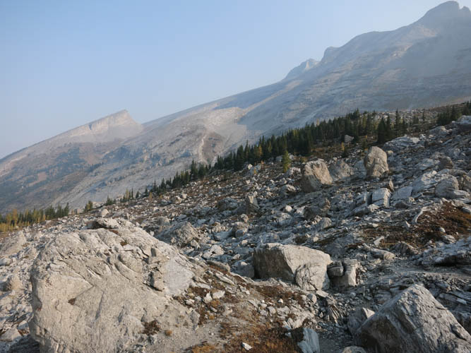
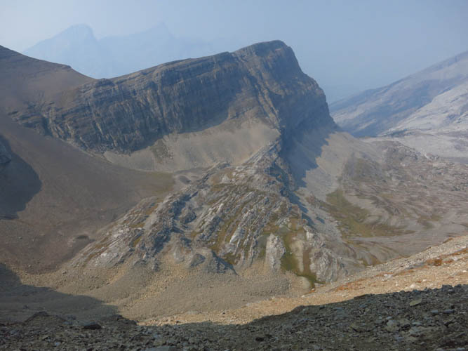
While the beaten trail ends at the tarns, there are occasional faint tracks that continue up a scree ramp on the left side of the ponds – the scramble route up Bogart from the west. The scree was very loose in places, but overall I had expected worse. It wasn’t too bad and before I knew it I was up on the col between Red Peak and Bogart. Standing up here and looking back at Red Peak, it becomes quite clear that a traverse between the two would involve climbing down one or several steep vertical cliffs, which is definitely not scrambling anymore.
From the col to the summit of Mount Bogart it was a long and pleasant ridge walk with one significant bump right at the beginning that I went all the way up and down (as Nugara points out, sidesloping to avoid the extra elevation gain would be possible but not worth the effort). About half way up past the bump the ridge consists of some pretty neat slabs of rock where flat, tilted bedding planes have been exposed. Fractures and joints criss-cross these beds and form interesting patterns on the surface. Just past the slabs is a steep, vertical rock band – the crux. I went around the right side for about 20-30 metres and then scrambled up the first possible weakness I could see. It was short and only involved perhaps two or three difficult steps – that was it for scrambling on the entire trip! The rest was again just a hike along the steepening ridge to the summit.
A ton of crawling flies and buzzing insects of all types greeted me on the summit cairn. Attracted by the salt and stink of my sweat, they immediately descended upon me and my gear as I sat down. The stifling heat and the lack of any wind probably had them aim for the highest point they could find in the area! As expected, the views were a disappointment. I couldn’t see much farther than Sparrowhawk and Ribbon Peak, almost everything else was obscured by smoke.
My return trip was fast and straightforward as it’s exactly the same route. Downclimbing the crux at the cliff band was the only real challenge, but overall I have to say that Bogart seemed technically easier than I had anticipated. It’s mostly a hike and a long ridge walk, and even the crux is avoidable by circumventing the rock band on the right. A very enjoyable hot summer outing and a good solo objective.
DISCLAIMER: Use at your own risk for general guidance only! Do not follow this GPX track blindly but use your own judgement in assessing terrain and choosing the safest route.
Mount Nestor on the other side of Spray Lake is barely visible in the haze – lots of smoke from nearby forest fires pollutes the air.
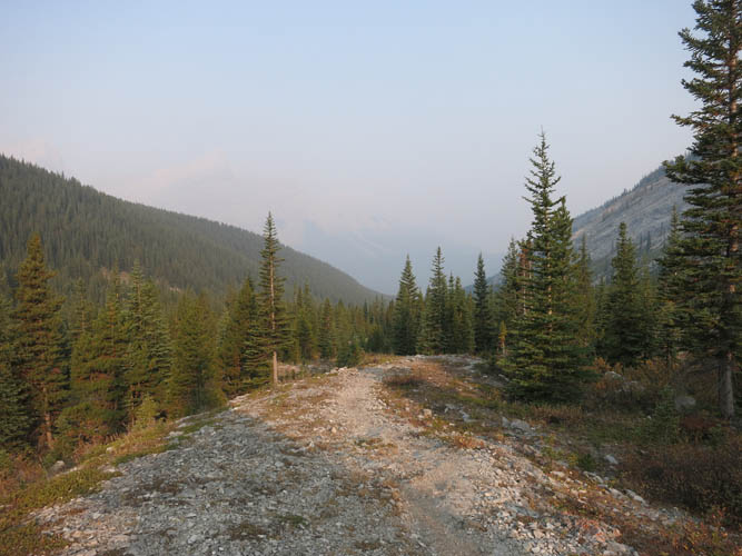
A very good trail leads up the valley to Sparrowhawk Tarns.
To my left are Mount Sparrowhawk (far right), one of my favourite outings in this area, and Read’s Tower (left).
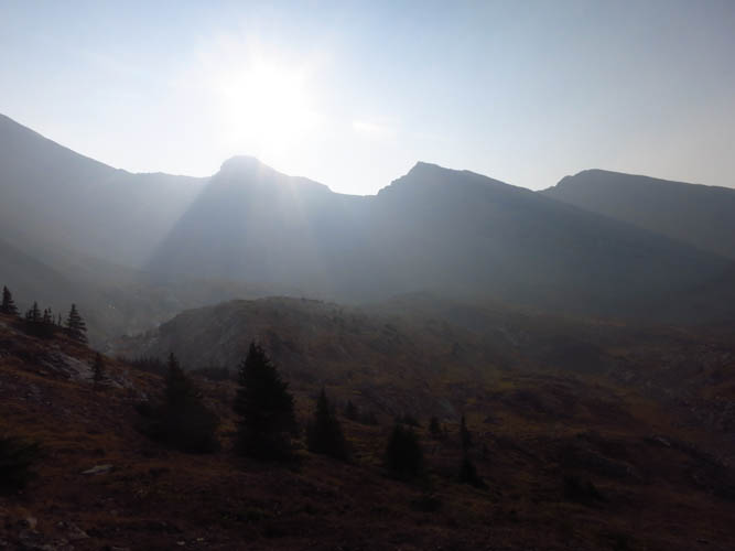
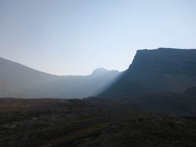
The sun barely manages to break through the smoky air above the silhouette of Red Ridge.
Looking back down the upper valley – looks like the Alps here!
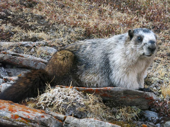
There are lots of marmots up here.
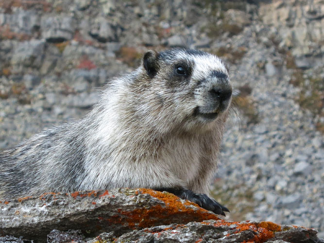
The grey fur provides a good camouflage!
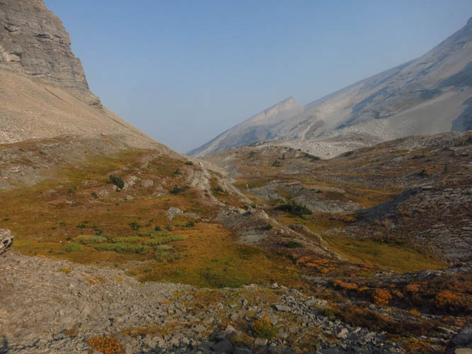
Nearing the end of the valley – sun, smoke and rock.
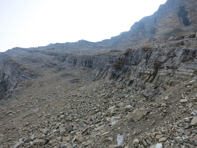
The scree ramp up to the col between Red Peak and Mount Bogart. Lots of scree here, but if you follow the most prominent tracks it’s not too bad.
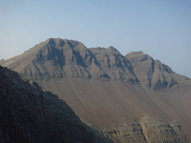
Looking back at Red Peak: lots of crumbly rock on this mountain.
View west from the col towards Red Peak (right) and a steep, near-vertical cliff that would make a scramble connecting Red Peak and Bogart impossible.
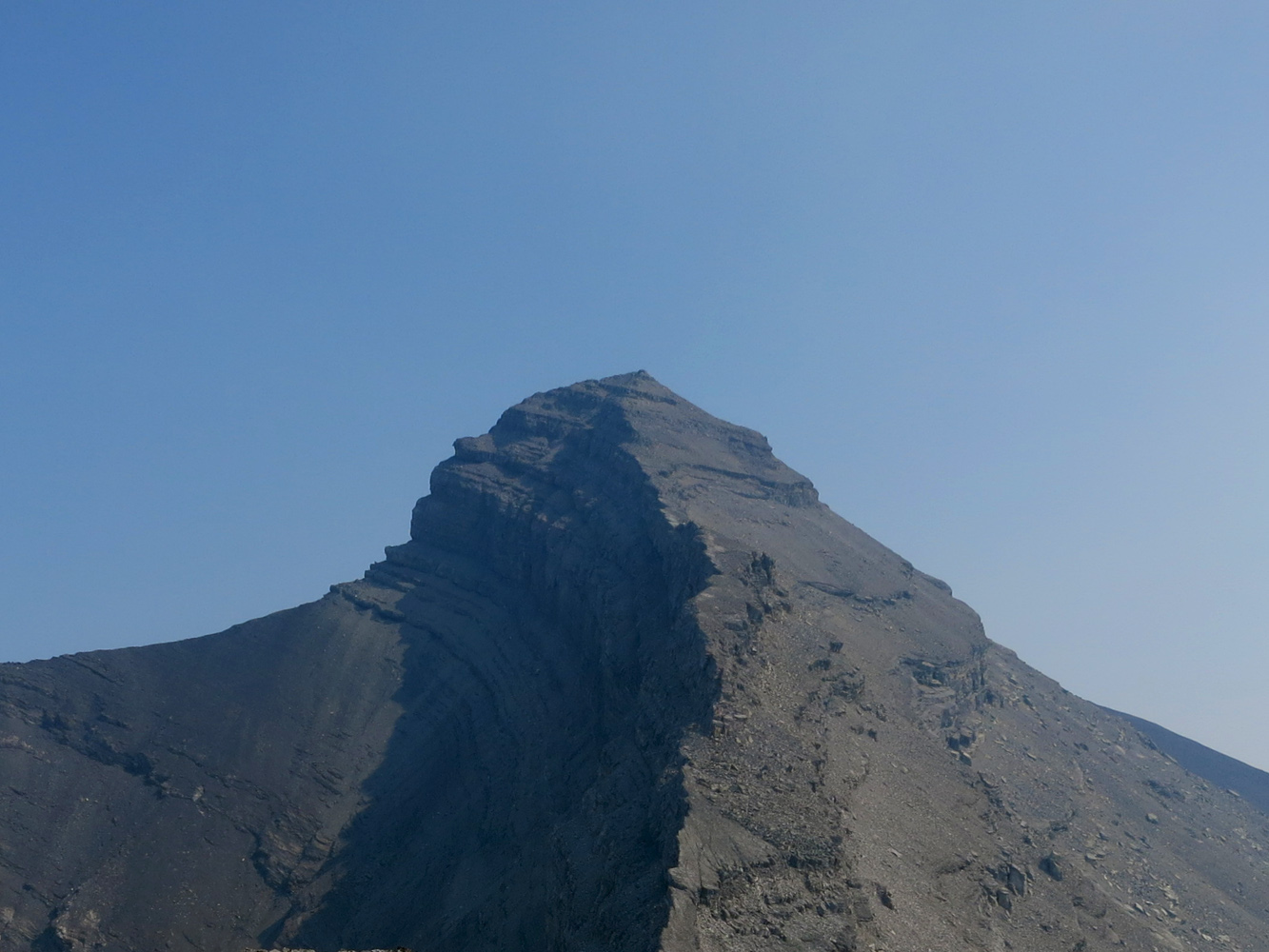
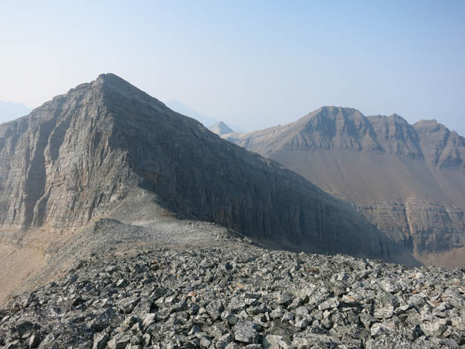
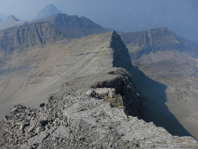
First proper view of Mount Bogart from the “bump” along the ridge. Lots of loose, rubbly rock here.
The “bump” looks impressive from the east side! It appears much steeper than it actually is (an easy scramble).
Again, looking west towards the bump in the middle, with Red Ridge on the right and Red Peak just to the left of the bump. The route here follows some nice flat slabs of rock.
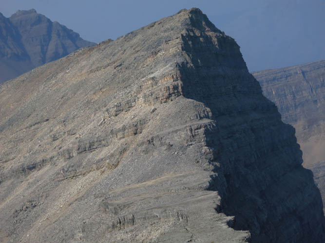
Nearing the summit of Bogart.
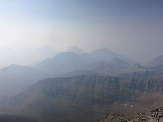
Not much to see from the summit today: persistent smoke from nearby forest fires obfuscate the view.

Ribbon Peak to the east.
Mount Sparrowhawk is barely visible to the north.

A view of the fractured bedding planes on my return.
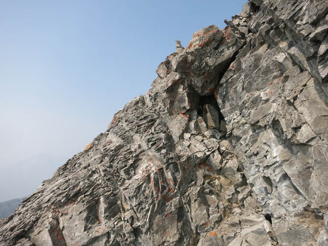
This is the crux at the rock band from below (note the flimsy cairn above).
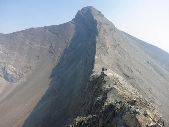
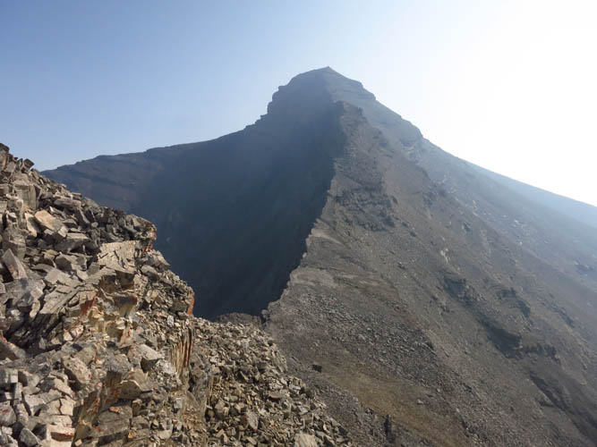
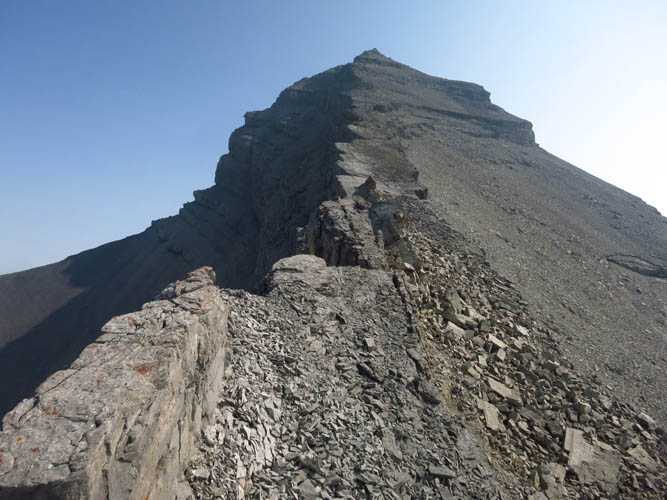
The slender ridge towards Mount Bogart looks quite elegant from the top of the “bump”.
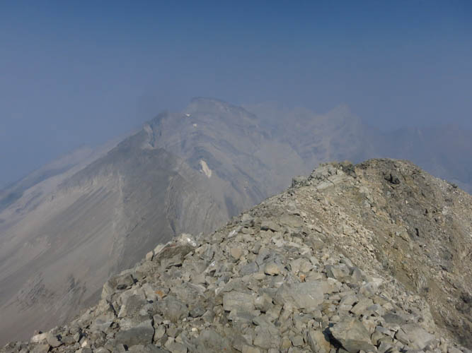
Looking down the scree ramp towards the dried up Sparrowhawk Tarns below. The high point of Red Ridge is in the back.