Steg, Liechtenstein
25 July 2018
Solo
A fine ridgewalk to the top of Liechtenstein
An absolutely beautiful but rarely done traverse of a series of peaks along two main ridges in the small principality of Liechtenstein. The trip is long and strenuous, but affords fantastic views over large parts (most?) of this tiny Alpine country. I loved the mix of easy hiking, fun ridgewalking, and difficult scrambling on a variety of terrain, ranging from dense forest to green meadows and craggy ridges.
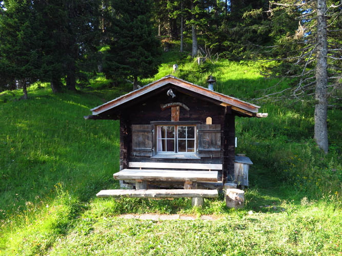
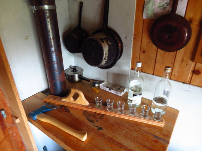
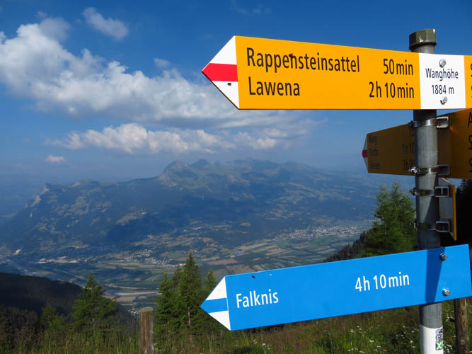
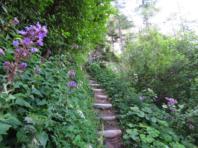
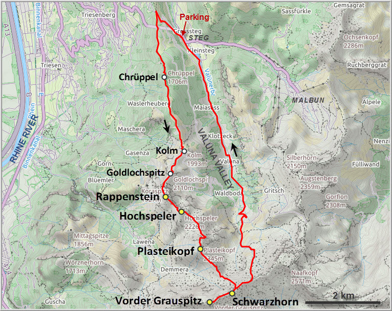
Our base was the small municipality of Steg at 1300 m elevation where the long south-north ridge starts. The Falknis-Steg trail can be accessed here and follows part of this ridge, which for the first while is mostly in the forest. The Chrüppel (or Krüppel) is the first named point along the ridge (the “summit” is actually hidden in the trees behind, no trail here), but doesn’t really constitute a peak as such. The little wooden hut, a sort of emergency shelter with beds and mini-kitchen, had a tasty surprise in store: a bottle of local plum schnapps with a row of shot glasses lined up – “help yourself!” said the visitor book. It was only 10 am but I thought a little boost of energy wouldn’t hurt J. Very tasty indeed.
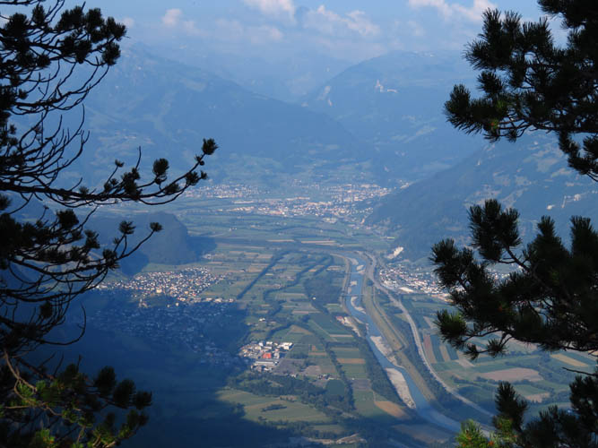
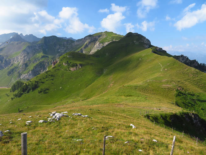
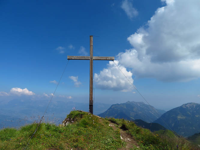
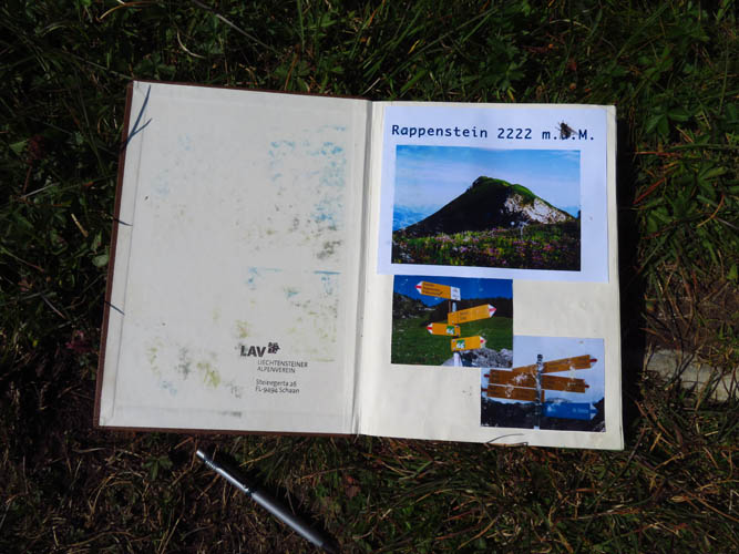
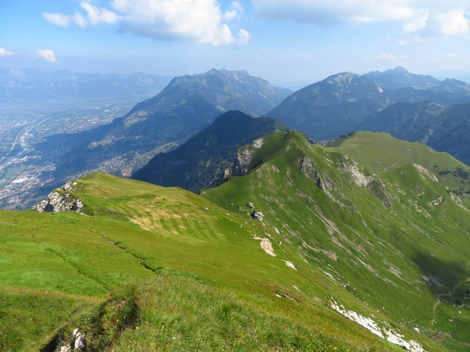
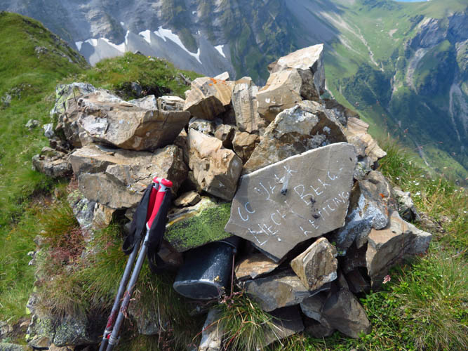
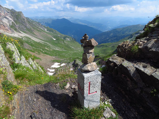
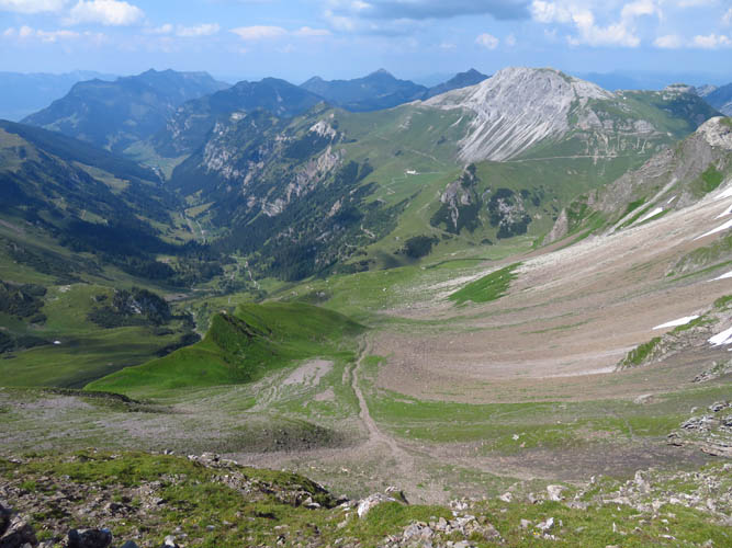
The undulating trail leaves the forest behind at another high point called Kolm, where you start getting some great views of the Rhine Valley to the west and the grassy Valüna Valley to the east. After another minor high point (Goldspitz), the first proper summit of the day is reached: Rappenstein, also called Rappastein. I had the scenic summit to myself but saw several groups of people taking a break at the large wooden cross later on. The main trail ends at Rappenstein and very few hikers seem to venture beyond to the next summit – Hochspeler. It’s easily reached on a faint path in the grass.
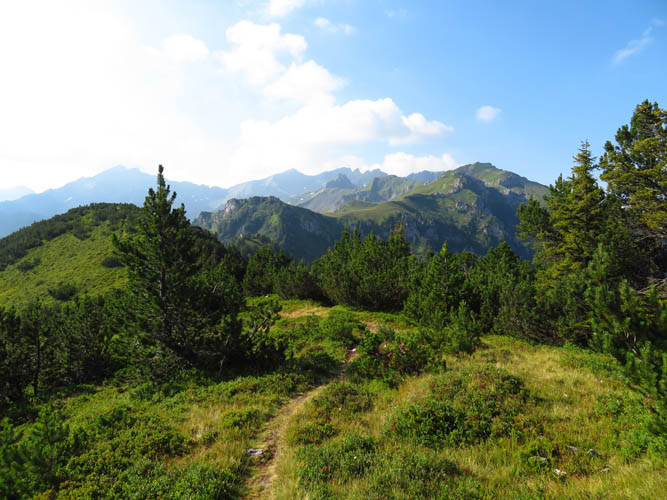
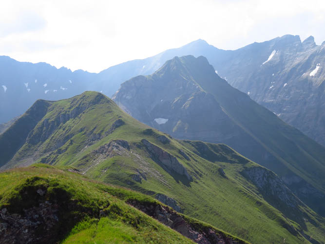
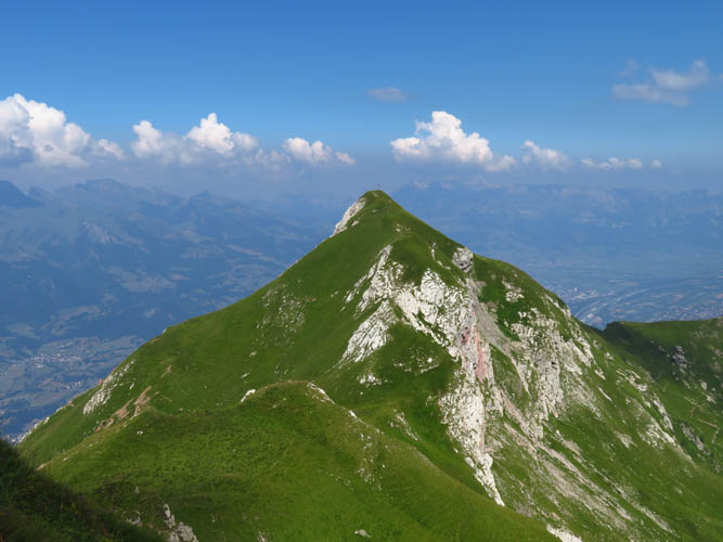
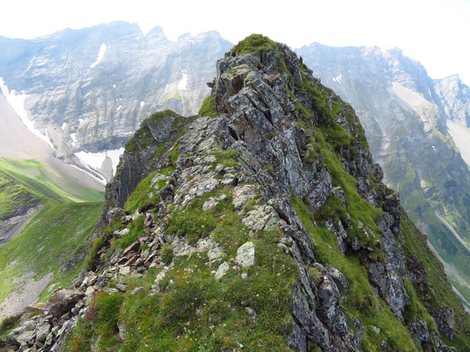
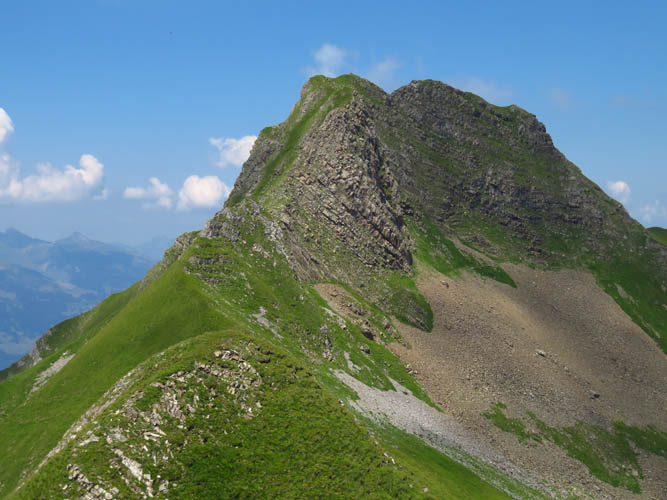
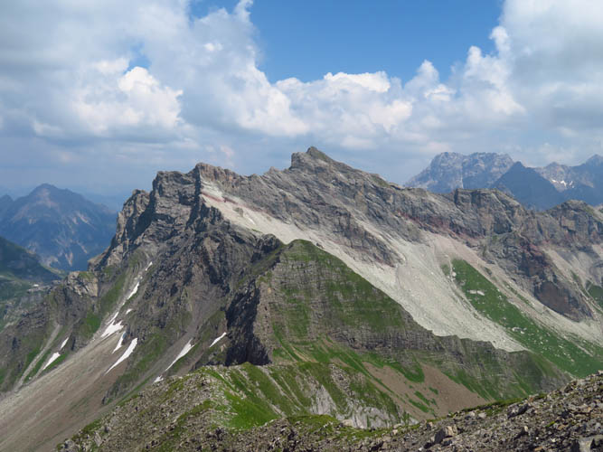
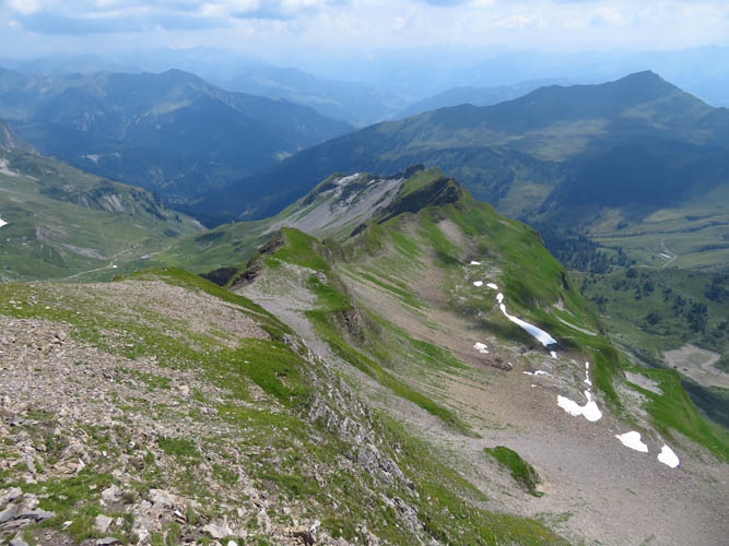
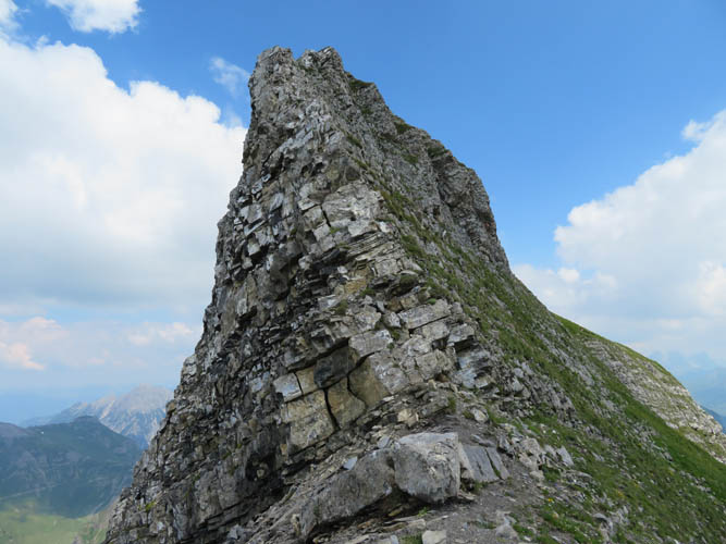
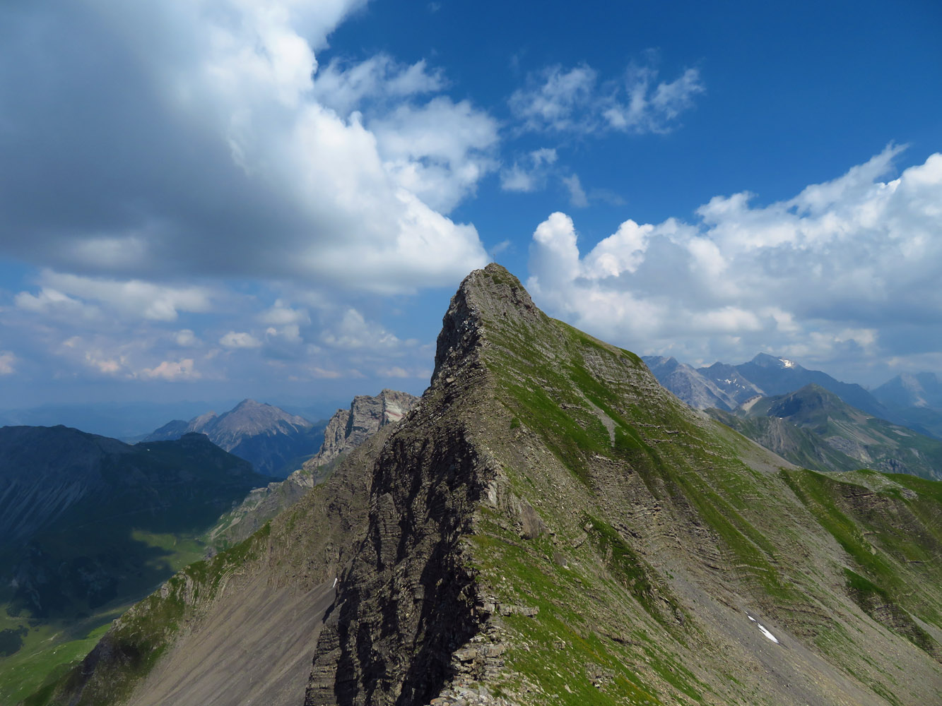
Once I left the grassy summit of Hochspeler behind me, the terrain became more interesting – at least to me: some routefinding was now required to navigate on and off the rocky ridge, bypassing the steepest parts on the right (west). The near-vertical cliffs of the mountain in front of me, Plasteikopf, looked daunting at first, but as other trip reports have pointed out, there’s a fairly easy route that loops around the left (east) on a game trail. Once around the cliffs it’s simply a steep hike up a grassy slope to the false summit. To get to the true summit I had to make a few more difficult moves on a short stretch of exposed ridge, which surprised me a little since I hadn’t expected this kind of scrambling here. Most likely there is an easier way to access the true summit, perhaps by circumventing the exposed section lower down on the east side.
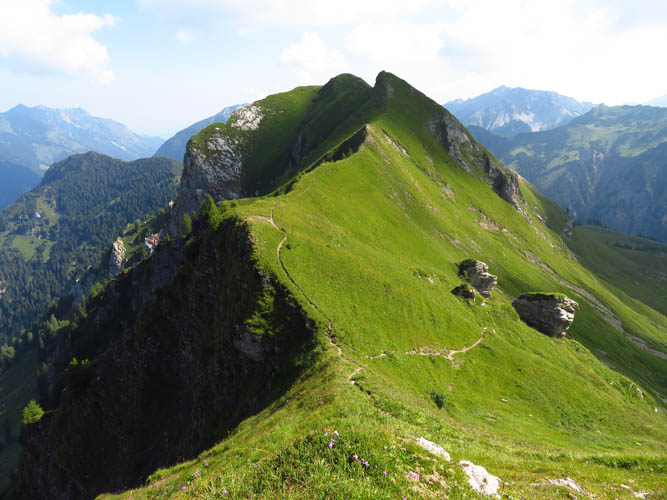
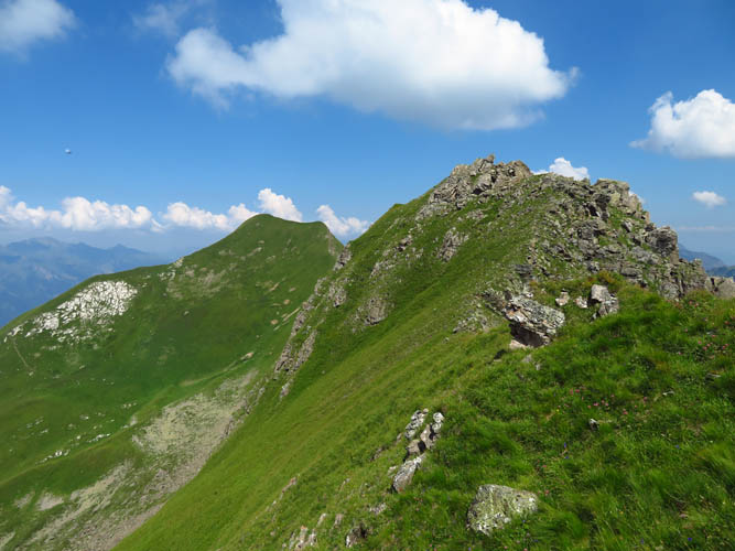
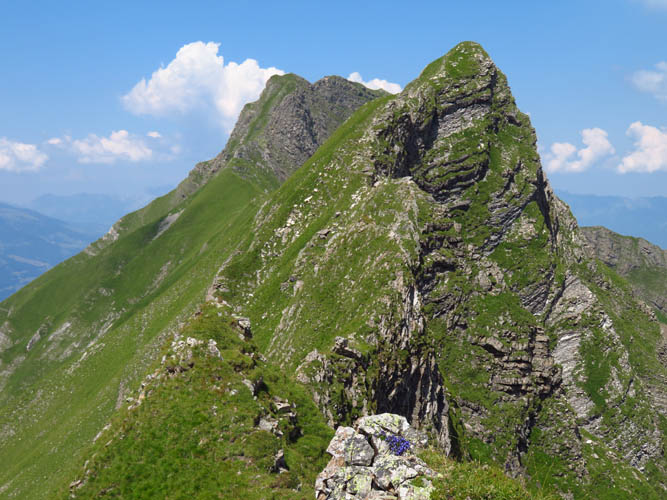
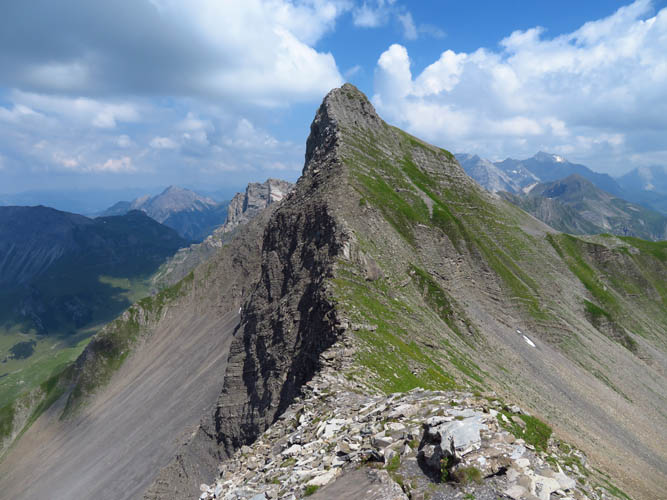
A steep, grassy ramp splits the ridge on Plasteikopf’s south side and provides an elegant way off the summit. I now followed another game trail that stays immediately to the right (west) of a jagged section of ridge that has many small dips and rises. After some time I decided to head up to the ridge crest and check it out – lots of fun scrambling here, even though it’s definitely more time-consuming.
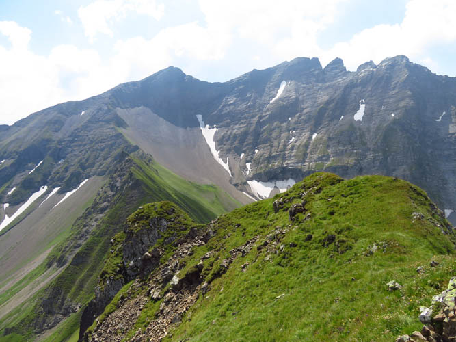
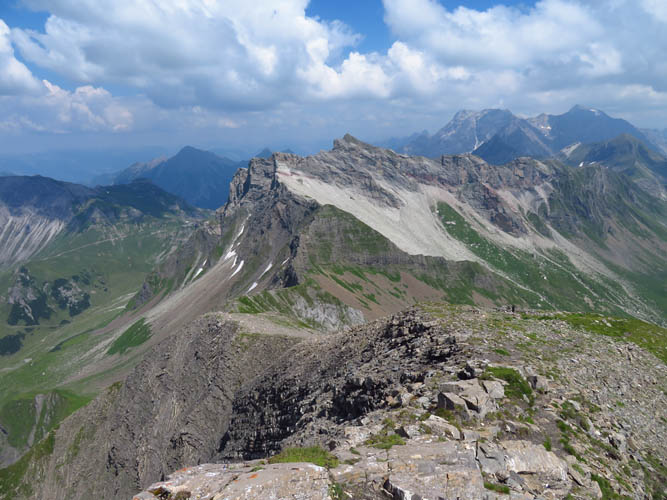
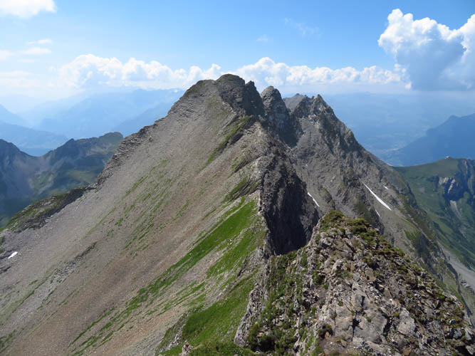
I now had the final big ascent ahead of me to reach the east-west ridge that forms Liechtenstein’s natural border with Austria to the south. The rib leading up to the ridge appeared steep and not without its challenges, but once again all problems resolved themselves and it turned out to be an easy plod.
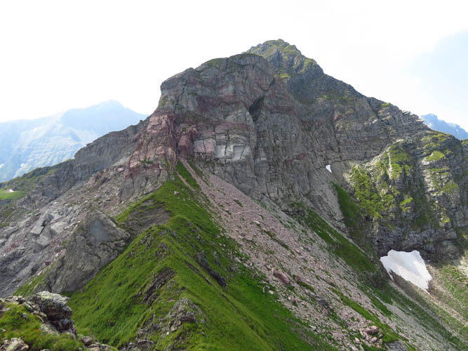
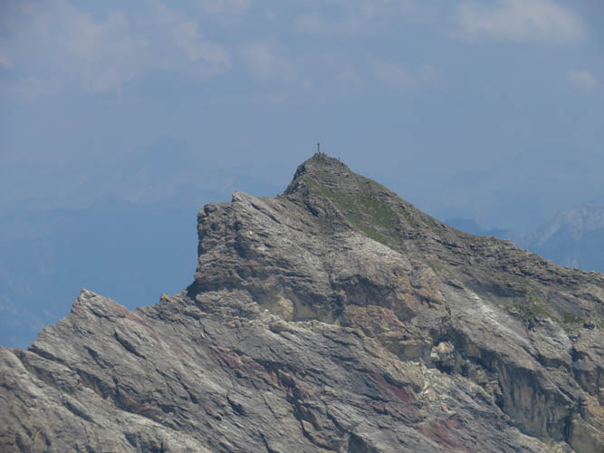
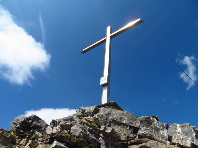
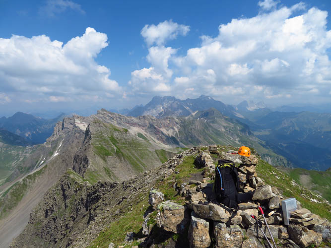
A beaten trail greeted me on the summit ridge to the Schwarzhorn (aka Hinter Grauspitz), attesting to the popularity of this mountain amongst hikers, most of whom seem to approach from the Austrian side which is said to be more straightforward and shorter. The thick register book at the wooden summit cross provided further confirmation: there had already been a couple of parties up here today. It was 2 pm now, and I really needed a nice lunch break before tackling the final and most difficult stretch.
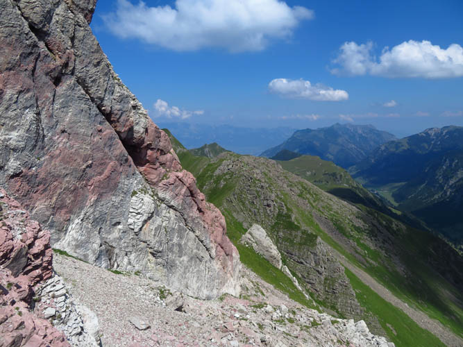
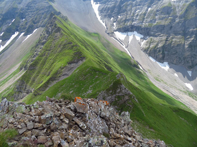
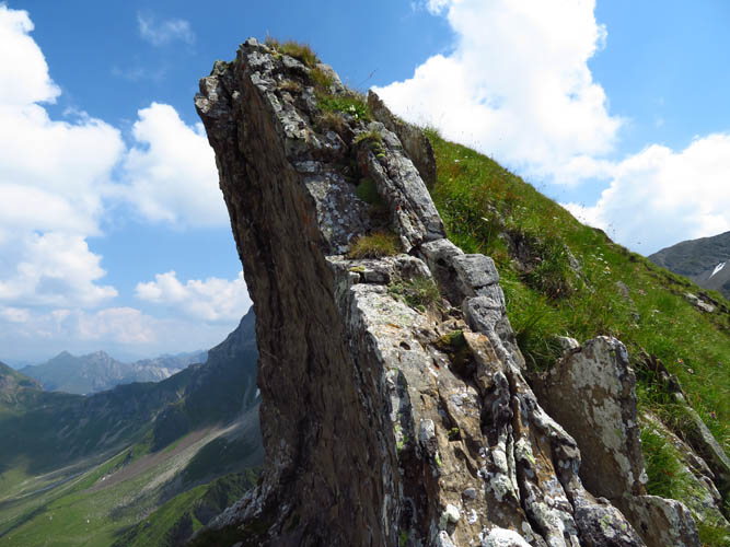
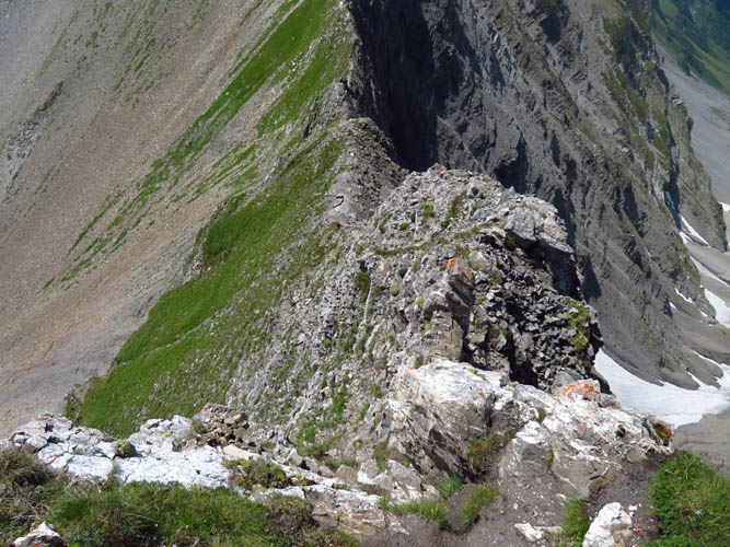
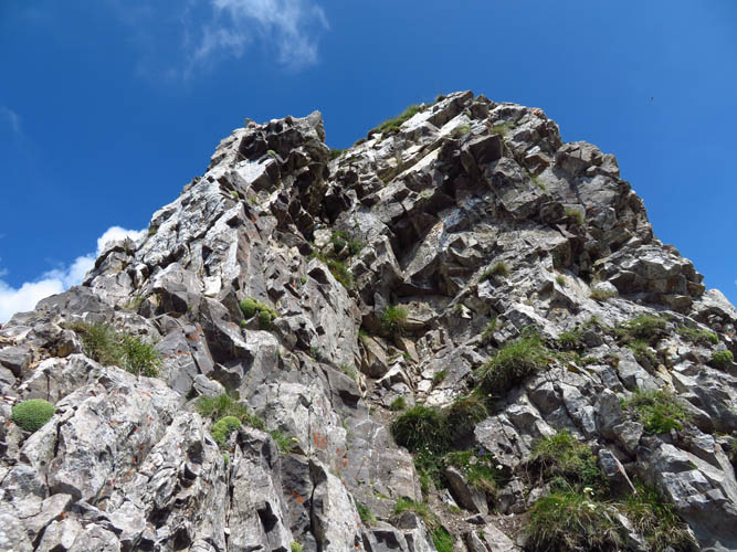
Right behind the summit the ridge just drops off to the west for several 10s of metres before levelling out again. However, what looks quite airy from the top is actually not that bad. Once you put your nose into it and break it down, as always, it becomes manageable. There is really only one 3-4 m section that is difficult, right in the uppermost part, where a short downclimb is required on decent holds – the crux. A long reach certainly helps here, and of course climbing down is always more difficult than climbing up. Past the crux, the remainder of the drop-off is a series of steps right on the ridge crest or just to the left (south).
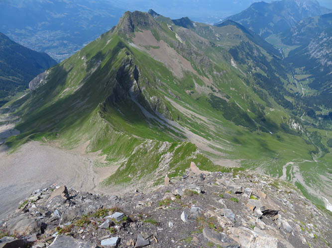
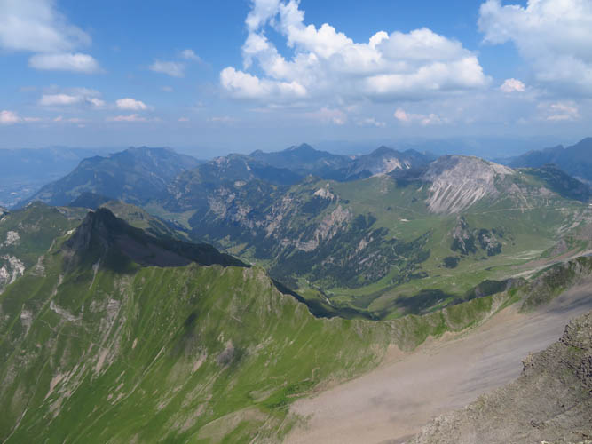
I felt some degree of relief that the crux had been manageable. Reading people’s reports is one thing, but trying it out yourself is quite another and you just never know until you put your hands on it yourself of course. Continuing along the ridge, I found the rest of the scramble quite enjoyable, a mix of hiking and easy to moderate scrambling. The Vorder Grauspitz summit, the highest point in Liechtenstein, is also becoming a popular objective it seems, at least judging by the summit register. Many people come up directly from the scree slopes on the Austrian side, while others bypass the crux along the ridge behind the Schwarzhorn by contouring around the steep grass slopes on the south side. It was a bit hazy so I didn’t get the best summit views, but I was glad I had made it all the way here and could finally start my descent.
The simplest way to get back to Steg is to backtrack to the Schwarzhorn (the crux was slightly easier this time, going up of course), follow the ridge down to a col, and then turn left (north) and head down on scree and meadows into the Valüna Valley where a gravel road and hiking trails easily lead back to the village. I had already run out of water for the last hour when I came down the scree slopes below the col; luckily there was a trickle of water in the almost-dried out creekbed, just above a herd of cows grazing nearby, and I was able to replenish my water supply for the long walk back.
I really enjoyed this traverse and can recommend it to anyone who likes long hikes mixed with various styles and levels of scrambling. One of the best days I’ve had in the Alps!
| Elevation: | Rappenstein: 2222 m (official), 2211 m (my GPS) |
| Hochspeler: 2226 m (official), 2218 m (my GPS) | |
| Plasteikopf: 2345 m (official), 2348 m (my GPS) | |
| Schwarzhorn: 2574 m (official), 2563 m (my GPS) | |
| Vorder Grauspitz: 2599 m (official), 2593 m (my GPS) | |
| Elevation gain: | 2000 m |
| Time: | 10.5 h |
| Distance: | 20.3 km |
| Difficulty level: | Rappenstein, Hochspeler: Easy (Kane), T2/T3 (SAC) |
| Plasteikopf, Schwarzhorn: Moderate (Kane), T4 (SAC) | |
| Vorder Grauspitz: Difficult (Kane), T5/T6 (SAC) | |
| Reference: | Local maps, trip reports on hikr.org |
| Personal rating: | 5 (out of 5) |
DISCLAIMER: Use at your own risk for general guidance only! Do not follow this GPX track blindly but use your own judgement in assessing terrain and choosing the safest route.