Ya Ha Tinda, AB, Canada
19 January 2020
With Trevor
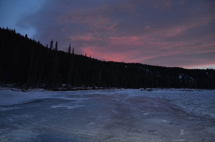
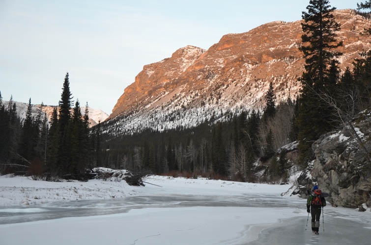
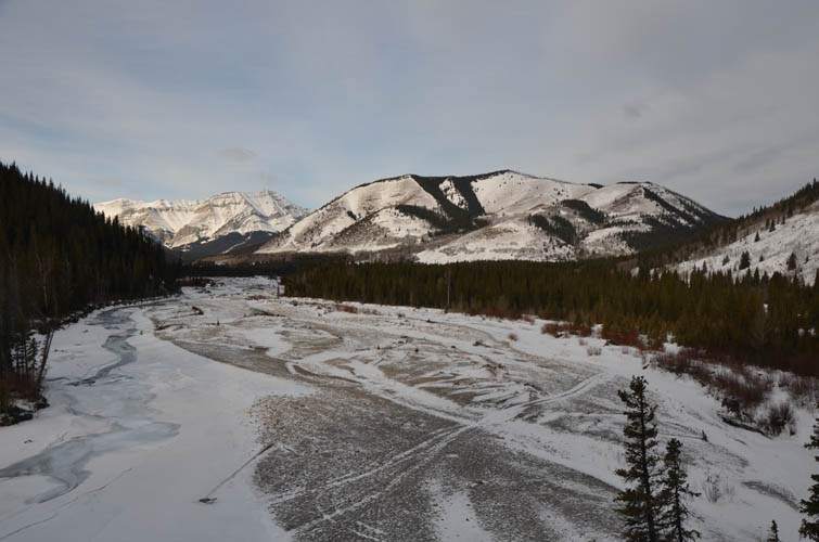
Walking on the frozen Panther River
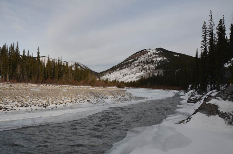
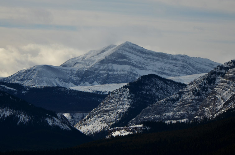
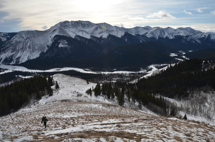
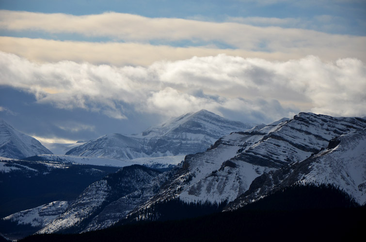
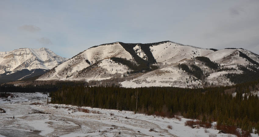
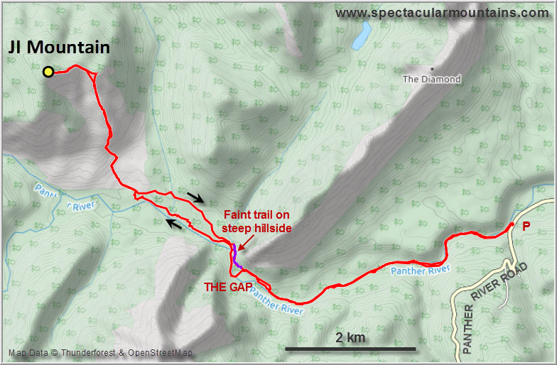
Trevor and I have crossed many frozen-over creeks and rivers before, but neither of us have ever hiked on top of a frozen river for a significant distance. This was to be the special appeal of today’s trip: walking in and out for several km on the iced up Panther River to get to JI Mountain. This minor peak in the heart of the Panther Corners area is named after two strips of trees that perfectly form the letters J and I on its grassy south slopes (it’s also locally known as JI Hill). The Panther Corners area is one of lovely rolling hills and golden meadows surrounded by rocky ridges and snow-capped mountains. The Panther River flows through the southern part of it, coming in from Banff National Park in the northwest and exiting through “The Gap” in the south.
The “normal” way for hikers to access the area, i.e. in late summer and fall, is by crossing the knee-deep waters of the Panther River at a ford by the gravel road about 6 km west of the Panther River Lodge. There are horse trails on the other side that go through forest directly to The Gap, where the river makes a sharp bend and comes up right against the steep slopes of a ridge on the right (east) side. Here you either have to ford the river again twice, or you can avoid getting your feet wet by sidesloping on a faint game trail that hugs the steep slope on the right. There’s also a fairly new horse wagon trail that crosses the Panther River about 3 km east of the lodge and ends at The Gap – see more details on this in my Dormer Mountain trip report.
In the middle of winter, an exciting alternative and unique experience is to walk right on top of the frozen Panther River all the way to The Gap and possibly even further. This only works and is only safe if the ice is substantially thick and coherent enough, of course. After the province experienced a sustained deep freeze with temperatures well below -20°C for more than a week, we were confident enough to give it a go – and it worked!
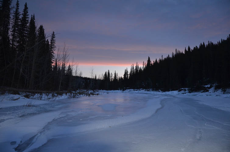
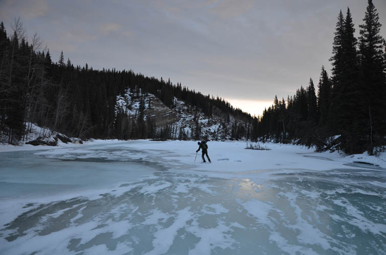
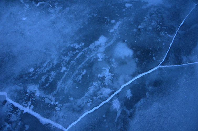
It was an exceptionally pleasant morning when we started our hike: temperatures were just above zero, there was no wind, and the skies were mostly clear. For the first few km the entire surface of the Panther River was covered in a thick layer of ice of varying color and hardness, ranging from clear/very hard to white/moderately hard and greenish blue/soft. The surface was anything but flat – there were cracks, small dips and domes, hollow layers of wind-carved ice flakes, crumpled up fragments of ice sheets, and raised levees with water flowing inside. The crackling of our spikes on the ice changed whenever we would hit a different type of ice, a mesmerizing sound that echoed off the walls of the river valley as we hiked upstream. Our microspikes were a must for this adventure – without them we would’ve slipped and tripped on every second step. They also made the walking super easy and effortless as there is very little resistance and you barely have to lift your feet!
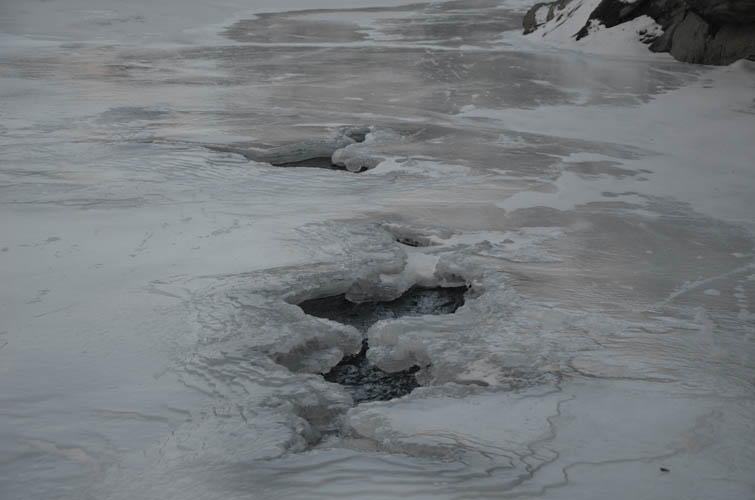
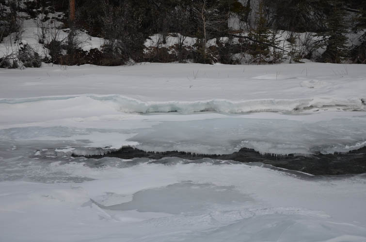
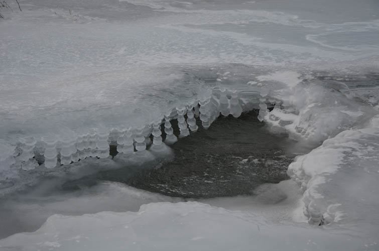
After the first few km open holes started to appear on the surface. The ice was at least 30-40 cm thick, but unlike a lake a river is of course a dynamic system where water flow and ice formation change interdependently. We came across some bizarre ice sculptures where water flow had broken through the ice and flooded parts of the surrounding surface. There were crystal-clear ice sheets with serrated edges, strings of bulbous icicles hanging into the water around an opening, tilted plates of fractured sheets, and a new layer of thin ice that had formed on top of water flowing over the older thick layer of ice. What a weird but interesting world of its own!
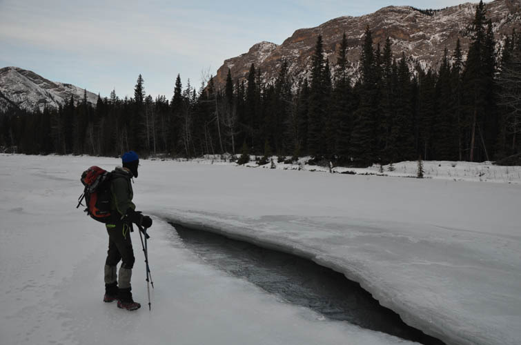
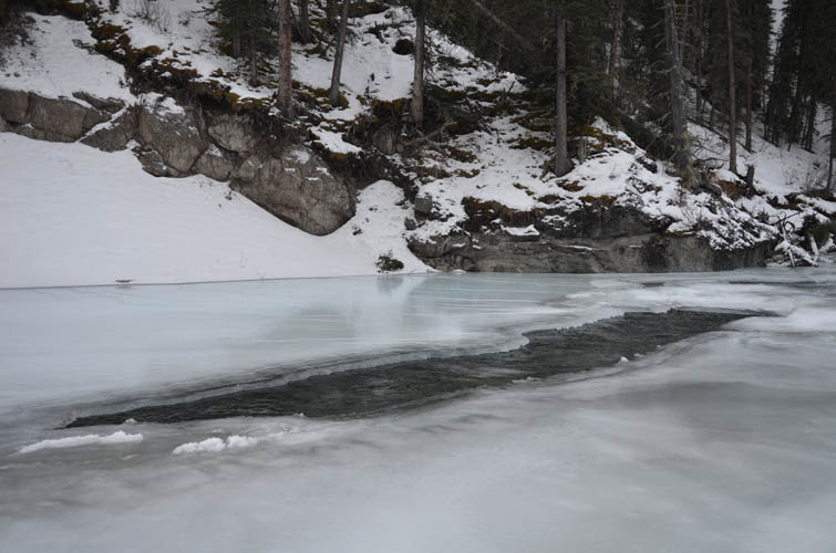
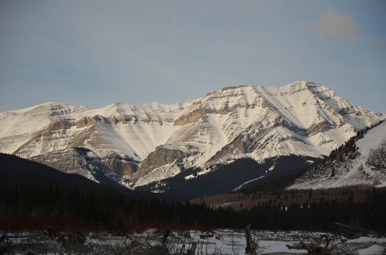
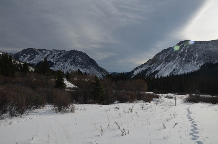
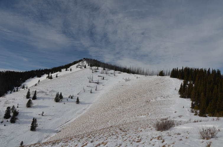
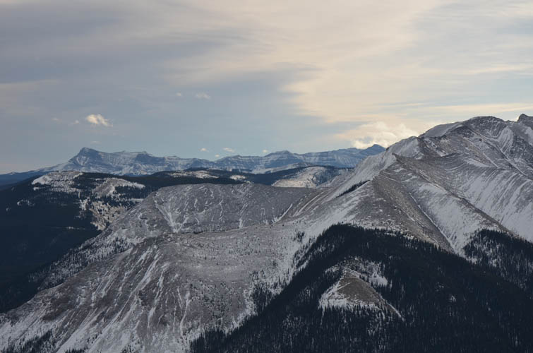
The closer we got to The Gap, the more holes there were, until eventually there was more open water than ice. For some strange reason much of the ice at The Gap had melted, perhaps because of the prevailing mild winds that are forced through this funnel-like feature. We climbed the right embankment to the new wagon trail and hiked it for a short distance, then took the narrow game trail around the edge of the steep ridge that forms the eastern side of The Gap (this ridge carries the local name of “The Diamond”). While not overly difficult, snow made this short traverse a bit tricky.
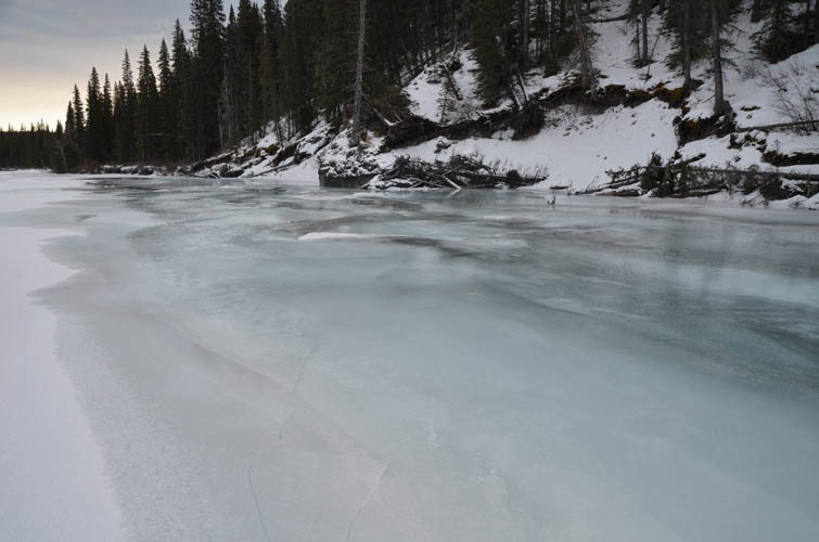
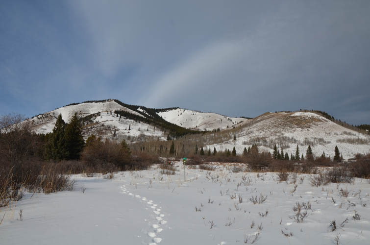
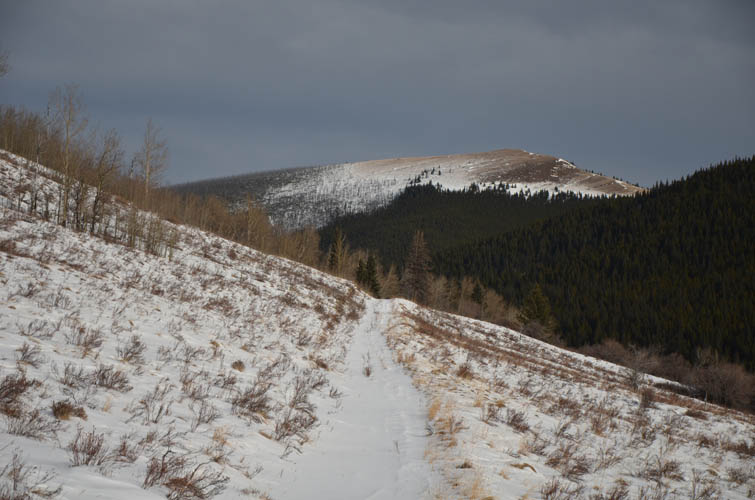
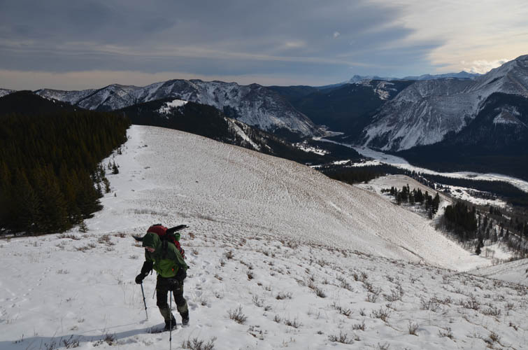
After passing through The Gap, the Panther River was largely frozen over again so we stayed on the ice for another 3 km before joining the wagon trail in the meadows to the north. From here it was easy to scope out a route to the top of JI Mountain: follow wagon trails to the northeast for a short distance, then head up a grassy rib that curves around to the summit ridge which easily leads to the top. The open slopes were a pleasure to ascend, with hardly any snow remaining on south-facing aspects. Nonetheless, we were exceptionally sluggish going up – perhaps because of the long approach and concentration on the ice that had sucked the energy out of us, or maybe because all the thermal layers we were wearing now proved counterproductive.
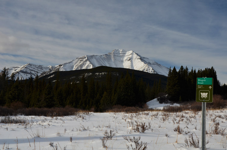
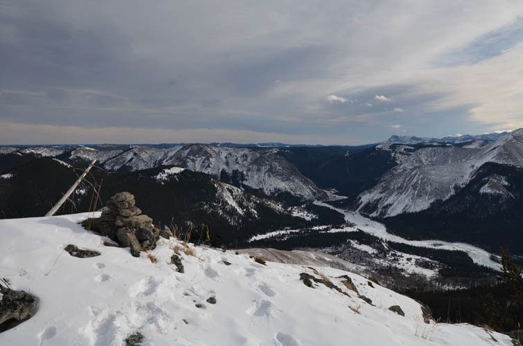
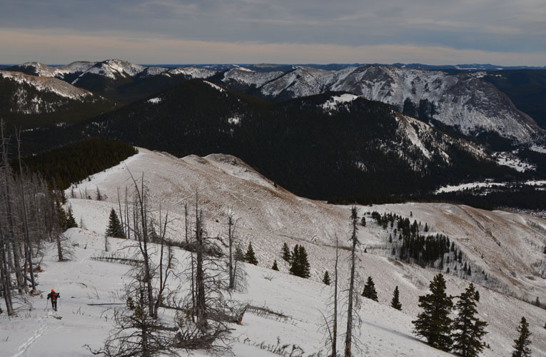
The reward for the long hike in was a wonderful panorama of the area from the small rocky outcrop at the top crowned by a dainty cairn. We sat down and took a nice long rest, enjoying the terrific views to the south. The view to the north and northeast is mostly blocked by trees but a horse trail seems to continue through the forest on the NW side. Because of all the trees JI Mountain feels a little more like a hill, but at 2152 m it eclipses The Diamond by more than 100 m and is only 50 m lower than Mount Minos!
Our return route was almost identical to the approach, except that this time we took the wagon trail back to The Gap and crossed it over ice and on a narrow horse trail on the west side. Now that we were more confident about the integrity of the ice, we made great time following our tracks on the river back to the car.
Warning: I think a trip report like this should come with a big fat warning for anyone thinking of repeating this or something similar. Hiking on a frozen river can be extremely dangerous. The risks of breaking through and being swept under the ice by strong currents cannot be underestimated. Water temperatures near freezing will cause instant hypothermia, reducing your chances of survival to a very short window (max. 1-2 minutes) if you can’t get out right away. Water levels in the Panther River ranged from ankle deep to more than a metre and a half as far as we could see in openings in the ice. A prolonged period of very cold temperatures (ideally below -20°C) is necessary for thick ice to form, and even then it can be thin or unstable in certain places. Don’t ever attempt this alone and if in doubt take the horse or wagon trails instead – they may be slower, but are definitely safer.
For a detailed map of the area, including all existing trails and many possible scramble routes, see the Ya Ha Tinda & Surroundings Trail Map on Avenza (a free mapping app for offline navigation and tracking). The map is also available in print at MapTown or GearTrade.
|
Elevation: |
2152 m (my GPS) |
|
Elevation gain: |
730 m |
|
Time: |
8.5 h |
|
Distance: |
21.5 km |
|
Difficulty level: |
Easy (Kane), T3 (SAC) |
|
Comments: |
See warning above! Possible avalanche risk on parts of the mountain if snow cover is thick enough. |
|
Reference: |
Own routefinding |
|
Personal rating: |
4 (out of 5) |