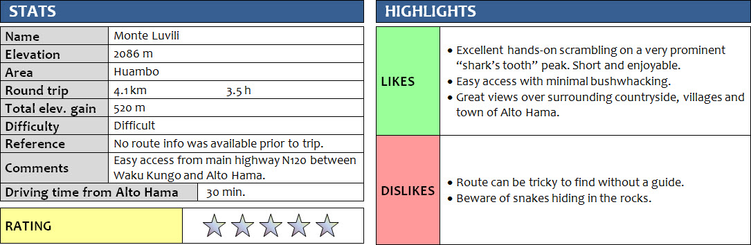
Central Highlands, Angola
14 + 15 January 2018
Solo
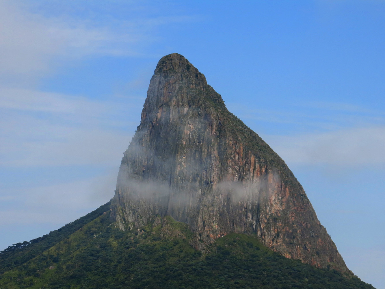
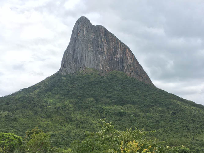
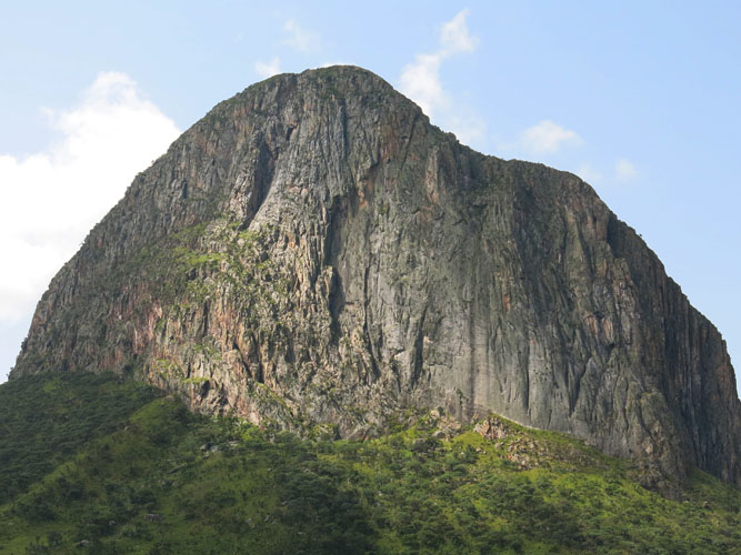
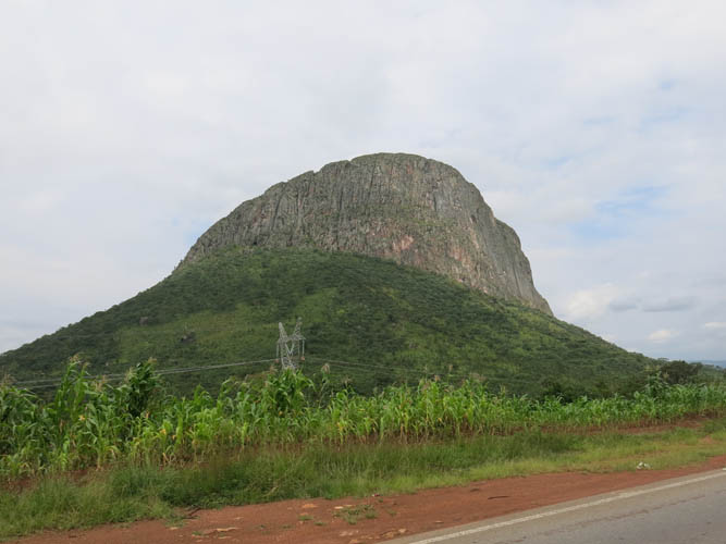
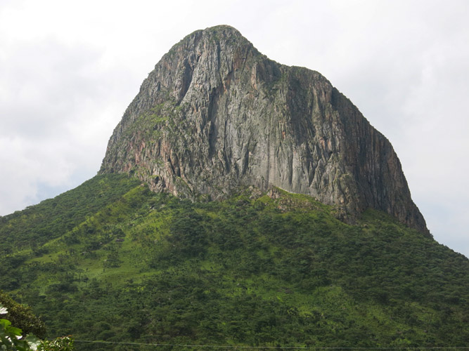
Monte Luvili is a relatively small but highly distinctive peak that resembles a shark’s tooth visible from the main highway between Luanda and Huambo, Angola’s biggest cities. As a scrambler, it is impossible not to marvel at the sheer cliffs surrounding the peak as you drive by, and wonder whether it’s feasible to scale it even though all sides look forbiddingly steep. Monte Luvili is the erosional remnant of an old volcanic intrusion and represents one of the biggest monoliths in the world (a very large, massive, single chunk of rock). It is sometimes also called “Lubiri”, but the locals I met in the area all refer to it by the name of Luvili.
It took me a day and a half to try to find a way to access this peak, while in the end the climb only took three and a half hours. A day earlier Constantin, my local motorcycle driver, and I had our first attempt but failed. During the 30 minute drive from the nearby town of Alto Hama, where I was based, we had asked a few locals who confirmed that there was a way up the west ridge. Unfortunately, nobody was able to give us detailed directions or knew of anyone who could guide us up. We drove up to the saddle along the highway where the south face of Luvili was in full view. An old man walking along the highway laughed when we told him we wanted to go up there. He excitedly pointed at the start of the west ridge again… No, there was apparently no trail, but it was possible to scramble up.
Only one way to find out of course! We parked Constantin’s motorcycle by the road and headed straight for the west ridge, first down a rough path along some fields into a dip, then back up through light forest and bush. Constantin was worried about cobras in the area and used a stick to beat the bushels of grass in front of us to drive away any snakes that might hide in the undergrowth. When we got to the start of the west ridge, the steepness of the rock took us by surprise. It was tough, tricky scrambling, and didn’t look promising. We weren’t even sure this was the correct route and Constantin wasn’t feeling comfortable – he wasn’t used to this kind of terrain and the flimsy shoes he was wearing also didn’t help. My sturdy hiking boots and gardening gloves I had brought gave me a lot more grip on the rock, an unfair advantage. We decided to turn around and try to find a different way up…
Unfortunately, there was no other way. We spent the next 3 hours basically circumnavigating the entire mountain, bashing through the bush on the upper part of its vegetated slopes, just below the steep rock face that entirely surrounds the monolith. There was simply no way up! Tired and disappointed, we made it back to the bike in the afternoon and just wanted to go back to town and take a nap.
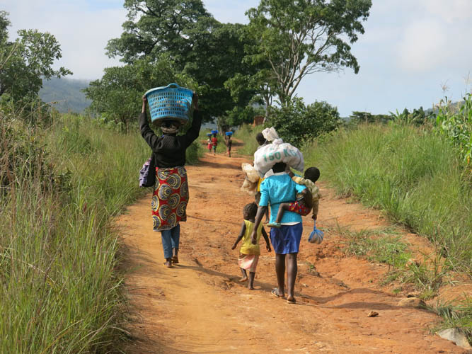
Not willing to give up on the first try, I asked Constantin to take me back the next day to give it another go. There had to be a route up somewhere! After driving there from Alto Hama again, we met a fellow by the road who claimed to know someone in a nearby village who had scaled the peak before, a guy by the name of Abel. Perhaps he could guide us or at least show us the way? We decided to drive into the village of Malungu at the foot of Monte Luvili to try to find Abel. It was a bumpy ride along a confusing maze of narrow little dirt tracks. The villages here are often quite spread out, with clusters of huts here and there that are connected by washed-out dirt paths criss-crossing fields and grazing grounds. The tracks are too small for cars, so most people just walk. Very few can afford a motorcycle or even a bicycle in places like this. Everyone we met was extremely friendly, returning our greetings with big smiling faces. We had to ask for Abel a few times to eventually track down his 8-year old daughter, who joined us on our bike to find her dad in a nearby field… Yes, he confirmed, he had climbed Luvili three times before, and it was a tricky climb, but for some reason he wasn’t interested in climbing it again, even in exchange for a generous guiding fee I offered. Well, that’s how it goes sometimes. On our way out of the village we met about 30-40 more people but none had ever been up Monte Luvili before or knew the route. In the end, I decided to search for the route again but alone this time – after all it was my last chance and I was already here.
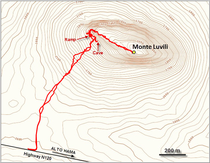
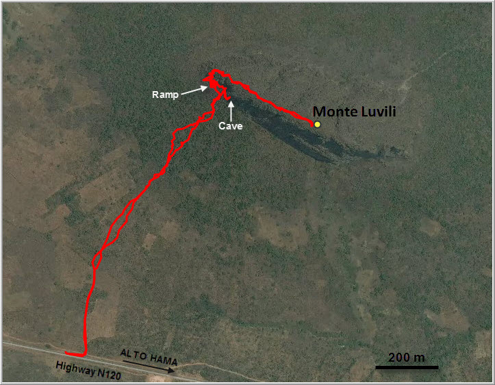
We parked the bike at the same place by the highway where we had left it the day before and I took off while Constantin found a shady place to wait for me. I followed the same route through the fields and bush to the start of the steep cliffs, aiming a little further east this time. There was a large cave entrance that’s visible from the highway right at the bottom of the cliff – very tempting to explore, but people had warned me not to enter caves and cracks in the rock as cobras like to hide in them. After a bit of searching further left (west) of the cave I then stumbled upon a grassy ramp, which offered a steep but elegant way to reach the crest of the west ridge, including a few slightly exposed scramble moves. Once I saw a bare wooden stick propped up by rock on the ridge, I knew I was on the correct route! Some difficult but very enjoyable scrambling on good, solid rock followed before the ridge became slightly less steep and the scrambling got easier. I tried to stay as close to the crest as possible but there were plenty of spots where detours around large boulders, overhangs or dense bush were necessary, making the terrain a bit confusing in parts. There were no cairns (and no trail), and building them in regular intervals was both reassuring and helpful later on during the descent.
It was another hot and humid day and I was perspiring profusely as I made my way up the ridge. The routefinding was challenging but fun, and I was entertained by views of the broad plains to the north, with Malungu and other tiny villages below me, and of the hills and ridges to the south. Drenched in sweat but excited and happy, I reached the summit after about 2 hours from the highway. To my surprise there were not one, but about five or six large cairns up here although all of them looked quite weathered and old. I was expecting a pointy and sharp summit, yet the ridge here was actually pretty flat and even. I headed over to the largest and presumably highest pile of rock where I took a nice break while glancing down the steep south face.
The descent was just as enjoyable as the ascent, facilitated by all the little cairns I had built. Downclimbing the crux near the end of the ridge required some care, especially along several steep drop-offs that had to be negotiated. Again, my hiking boots and gardening gloves helped greatly. My hiking poles were also useful, but only on the lower vegetated slopes to scare off any potential snakes and to keep myself from tripping in the uneven terrain.
Back at the highway I found Constantin waiting with two locals guarding a small telecom antenna by a small shack. They were overjoyed when I told them I had found a route, and my summit shots of the surrounding landscape and their tiny antenna station from above literally made them laugh! I think they were also genuinely happy to see that a foreign visitor was here in this beautiful part of their land enjoying himself in nature. We celebrated with soft drinks and cookies and I thanked them for waiting for me before heading back to Alto Hama. The imposing Monte Luvili had been a challenge for me with its tricky routefinding and demanding scrambling on the west ridge. For its size, this little peak certainly packs a punch! It was perhaps because of these very challenges that I enjoyed the outing so much – one of my most memorable and exciting trips in Angola.
Notes on costs, logistics and security:
- This climb can be done without technical gear (ropes, harnesses), but it’s not an easy scramble and certainly NOT a hike. Only attempt if you’ve done very difficult scrambling before and are comfortable with climbing up steep, exposed rock without protection. The consequences of a fall on the lower part of the ridge are severe injury or death.
- Snakes hiding between the rocks and in the bush pose an additional risk.
- As far as I’m aware and as confirmed by locals, there is no risk of landmines in this area, but always double-check before going off the beaten track in Angola.
- Cost of a bus ride from Alto Hama to trailhead: ca. 500-1000 kwanzas (1-2 euros).
- Contacting the local Soba (Chief) of Malungu a day or two before to make arrangements for a guide is recommended.
- Alto Hama, Hotel Pensão Hama: 5000 kwanzas (11 euros).
- Daily buses go from Luanda to Alto Hama: ca. 10-16 hours, 6300 kwanzas (13 euros). Huambo to Alto Hama takes 1 hour and costs 1000 kwanzas (2 euros).
DISCLAIMER: Use at your own risk for general guidance only! Do not follow this GPX track blindly but use your own judgement in assessing terrain and choosing the safest route.
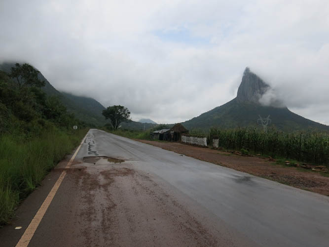
First look at Monte Luvili as we approach on the highway from Alto Hama to the south.
The weather doesn’t look promising…
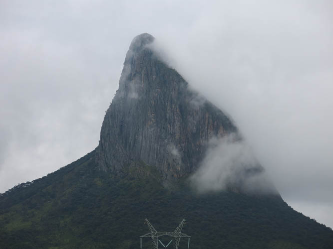
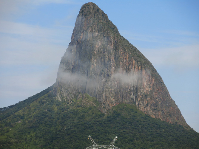
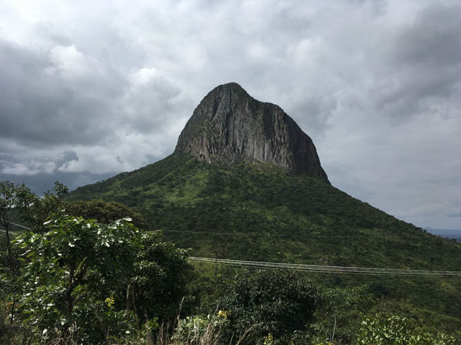
Looking straight at the crazy steep south face from the highway.
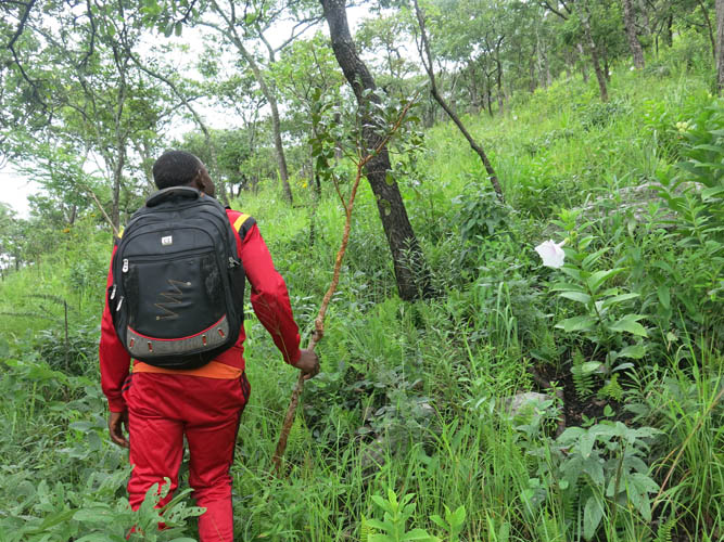
Constantin bashes his way up the slope. It rained earlier this morning and the wet bush has us soaked in minutes.
We reach the edge of the ridge, but most of it looks impossibly steep.
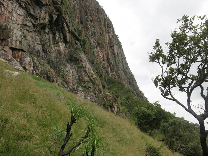
Things don’t look any better on the north side.
View from the east, at the end of a frustrating day when we encircled the entire mountain.
Another attempt the next day: the weather is looking much better today!
Clear view of the south face.
On the way into the village of Malungu to find a guide – to no avail, it turns out.
Back at the saddle on the highway, I decide to give it another try alone.
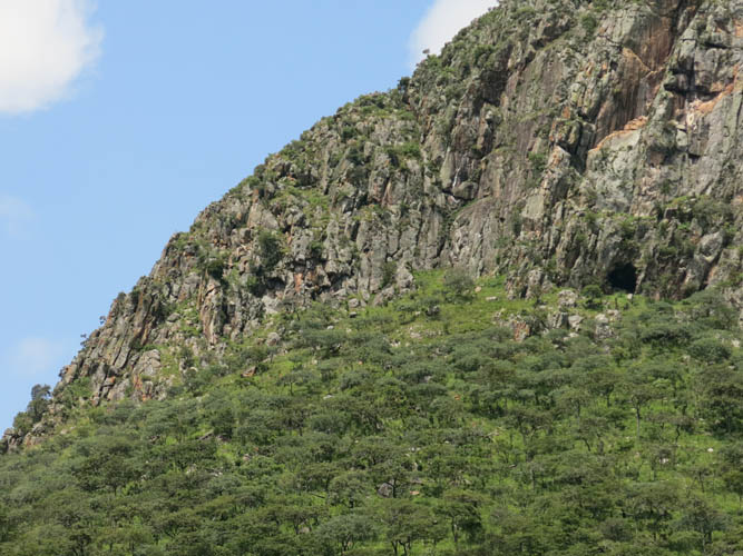
The key to access the west ridge is a steep, grassy ramp seen here in the left part of the picture. The black spot at the base of the cliff on the right is the entrance to the cave.
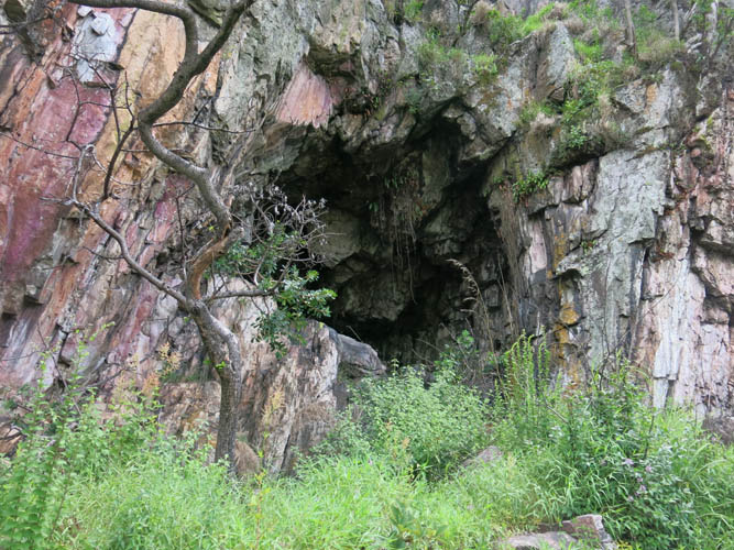
The cave entrance. Probably not a smart idea to go in there… snake alert!
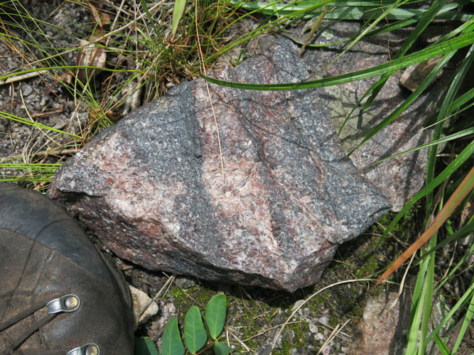
The monolith consists mostly of granite. Fresh, unweathered pieces such as this one are rare.

Underneath the rock, a scorpion is hiding.
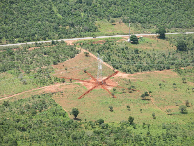
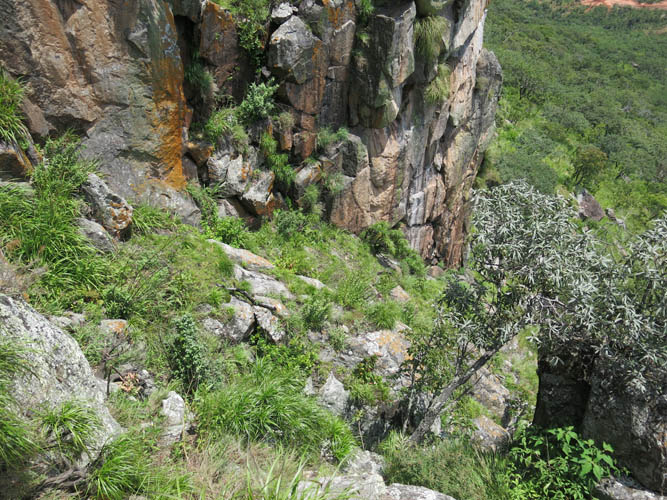
View from near the cave back down to the highway and the little antenna station where Constantin is waiting for me. In the middle is a brand new electricity post, part of an ongoing project by the Chinese to construct a major powerline from Luanda to Huambo.
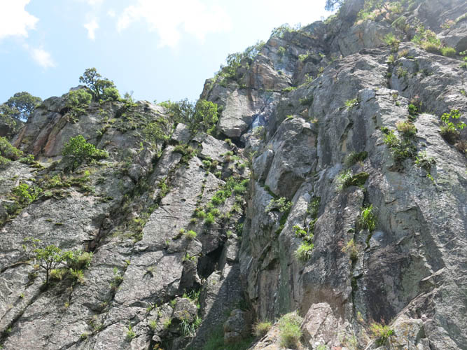
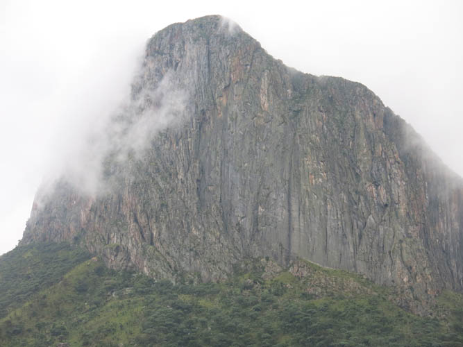
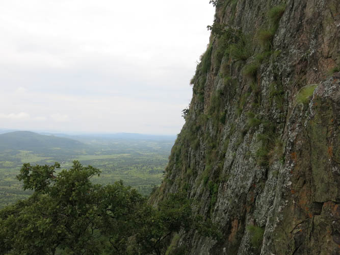
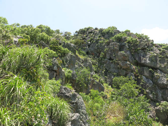
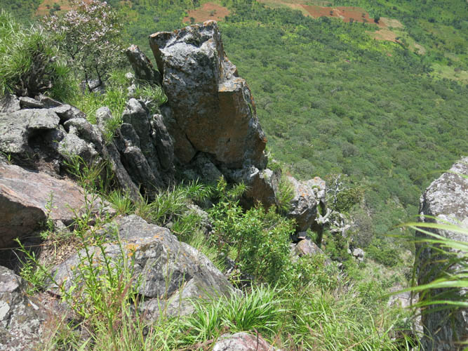
Almost the entire south face looks like this up close: too steep to scramble!
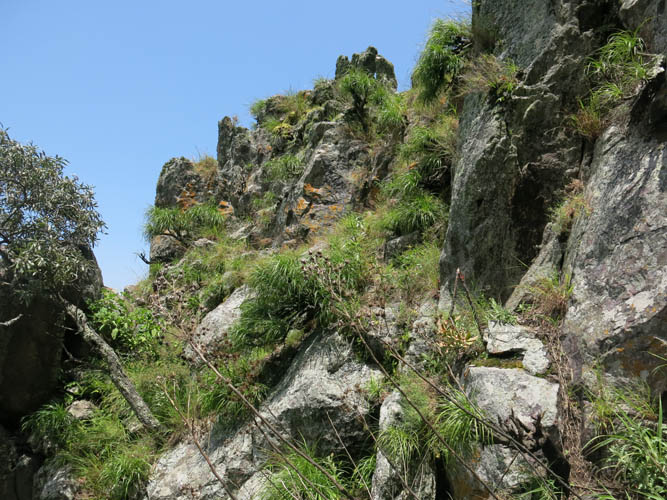
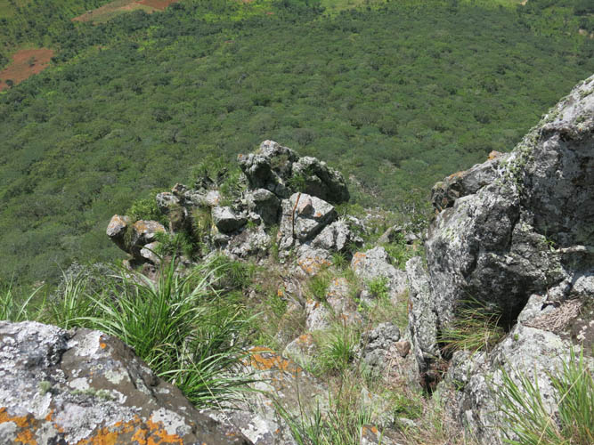
Finally, a break in the cliff – a grassy ramp leads up to the ridge crest.
On top of the ridge, looking down the other side to the NW.

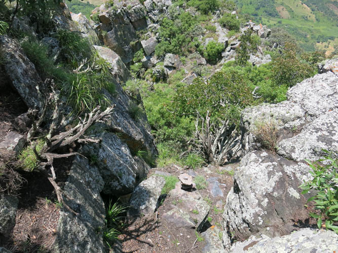
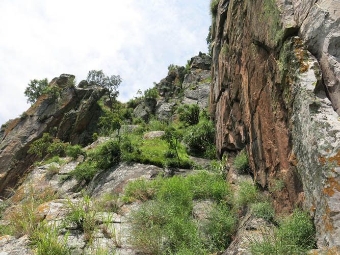
The ridge is initially quite steep and exposed.
Lots of vegetation here, too.
Half-way along the ridge towards the top.
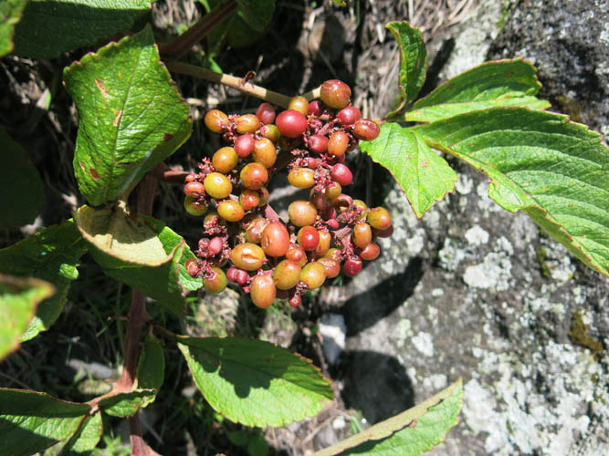
Grape-like berries, the only type of fruit I saw. Probably not edible…
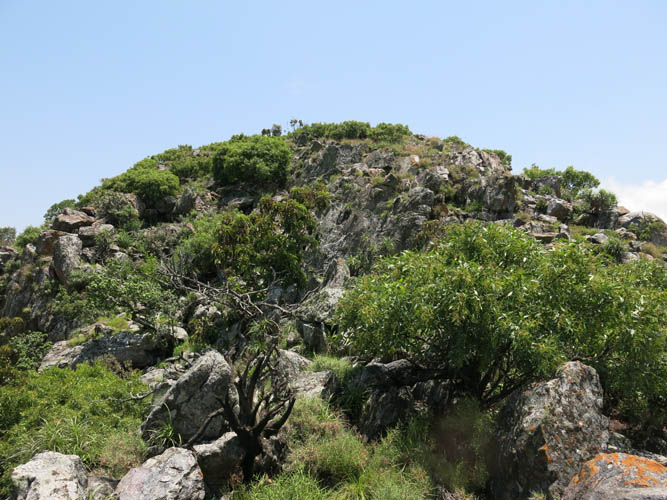
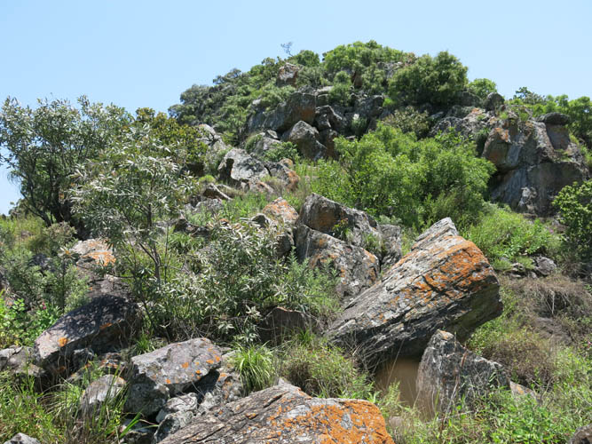
Nearing the summit, the ridge flattens out.
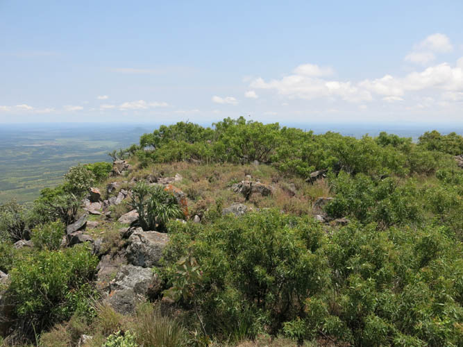
The flat summit ridge.
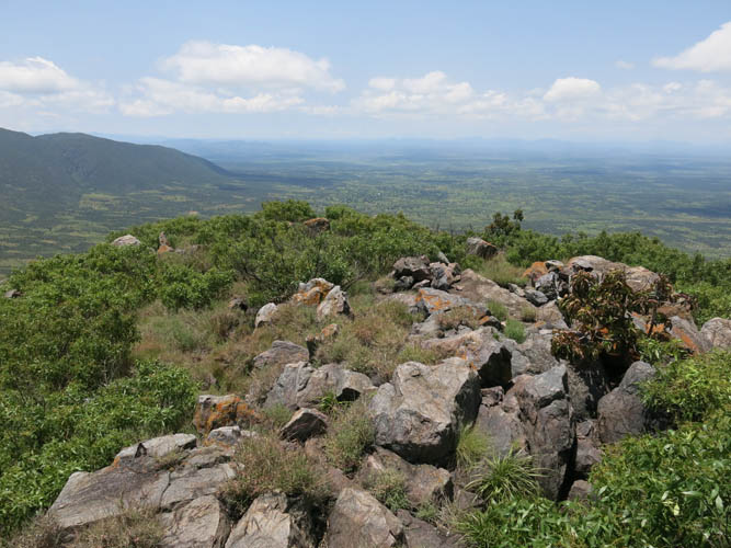
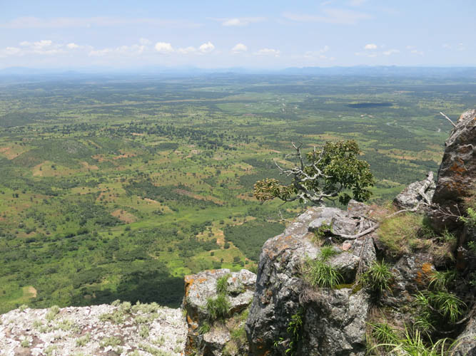
Looking back west from the summit.
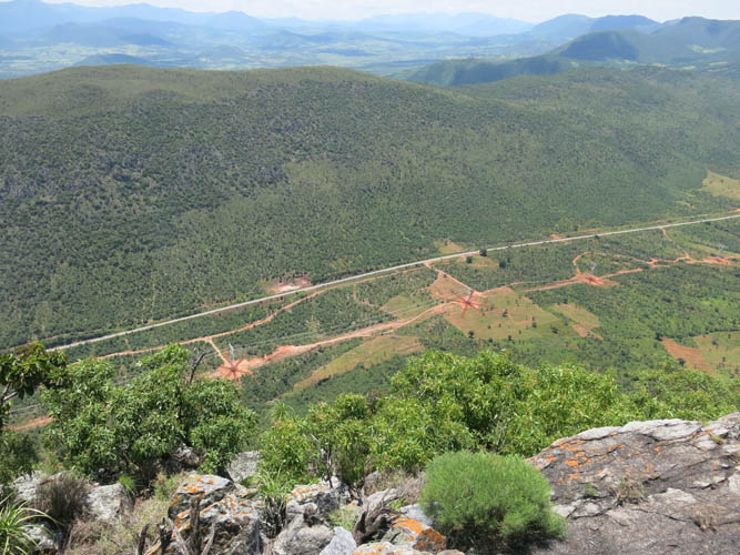
It’s a huge vertical drop on the south side, where the main highway and new powerline posts are visible.
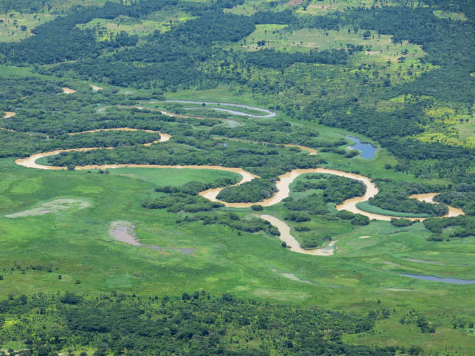
The braided river bed of the Keve River to the north.
Descent down the ridge.
Exposed section near the bottom.
A few more careful steps…
…then off to the left down the grassy ramp.
Looking back up the grassy ramp.
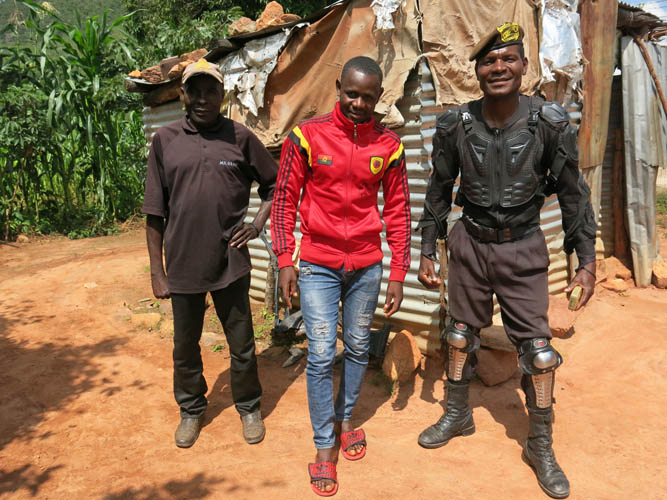
Constantin (middle) and the two security guards by the highway.
Another look at this beautiful peak.
Can’t get enough of this view!
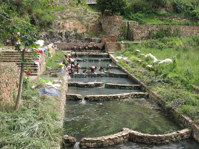
Quick stop at Aguas Quentes hot springs a few kms to the east, where locals bathe and wash their clothes.