Rhön Mountains, Germany
21 February 2018: Direct route
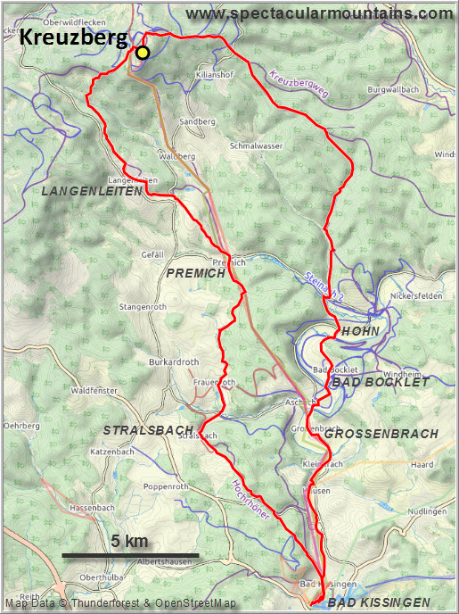
2 January 2022: Sandberg variation
Long-distance hiking at home
Solo
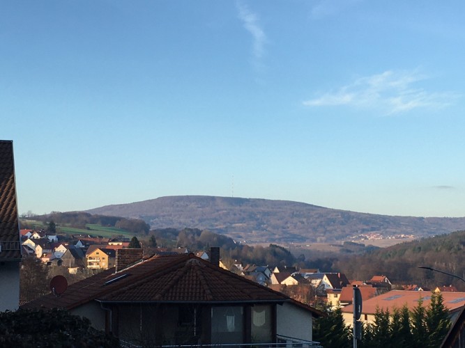
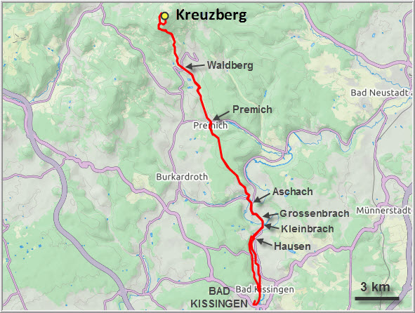
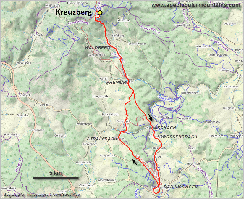
There are many ways to reach the summit of the Kreuzberg, but hiking from the spa town of Bad Kissingen certainly isn’t the shortest. However, having grown up in this picturesque little northern Bavarian town, I thought it was high time to conquer our local landmark “mountain” myself on foot, there and back from door to door so to speak. At 927.8 m official elevation, the Kreuzberg is the highest accessible peak in Lower Franconia and the second highest in the Rhön Mountains (#1 is the Wasserkuppe at 950 m, located in the neighboring State of Hesse). While none of these are particularly high and, one might argue, barely qualify as “mountains”, they offer an abundance of terrific hiking opportunities both in summer and winter.
Thousands of people visit the Kreuzberg every year, most by driving up the narrow asphalt road almost all the way to the top where a restaurant with savoury Franconian dishes and freshly brewed beer awaits. It’s all part of the Franciscan Kreuzberg Monastery, which dates back to 1692 and has been brewing its own beer since 1731. Three types of beer are available, but the famous Kreuzbergbier is the star – an amber coloured, unfiltered, Märzen-style brew, famous enough to entice huge crowds of tourists to make the pilgrimage up this popular mountain. Interestingly, in the past the monks served their tasty beer to pilgrims free of charge, who in turn would leave a generous tip. Today there’s no more free beer anymore, sadly, but it’s still very reasonably priced at 2.60 euro per pint.
The hike itself isn’t very difficult, no matter what route you take, as the terrain is mostly flat and the grade gentle. The main challenge really is the distance. Only at the end does it get a bit steeper when the trail ascends the final few hundred metres through forest to the broad summit cupola.
I left my house at 715 am and enjoyed a lovely morning walk with crisp air and chilly temperatures around -6°C, which is considered quite cold in this region. Following a mixture of walking paths and narrow asphalt roads on the western bank of the Saale river, I headed north through the villages of Kleinbrach and Großenbrach to Aschach. Aschach is best known for its small castle (and according to my mum also for its excellent hair salon!), which is quite a pretty sight in the glowing morning light. It took me about 2 hours to get here and I was ready for a second breakfast, but unfortunately the local bakery was closed for the week…
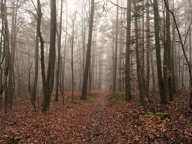
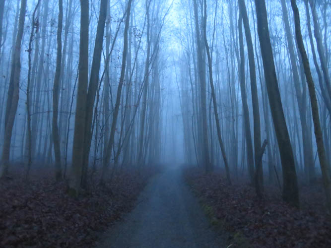
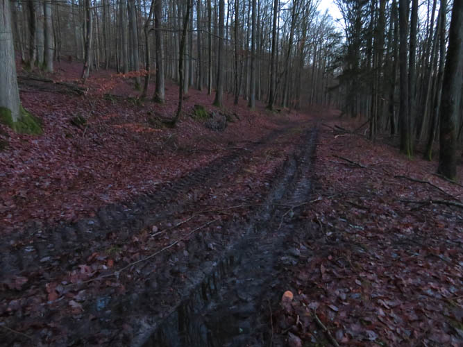
From Aschach, the most direct route towards the Kreuzberg is a track that slowly rises through the forest and ends in the village of Premich after about 6 km. This stretch was quite dull as it’s almost entirely in the trees with no views whatsoever. The only respite from the monotony was the Naturlehrpfad just outside of Aschach, a sort of interpretive trail that explains all kinds of interesting tidbits about the local flora and fauna. For example, amongst the 18 types of spiders common to the area, only one is poisonous and potentially dangerous to humans: the Dornfinger (yellow sac spider).
After dropping down into Premich I once again had many different route options to continue to the Kreuzberg. I decided to take the most direct route, which took me on a nice little track (partly paved) slightly uphill to Waldberg, a picturesque village at the foot of the mountain. It was 11 am now as I walked past a mobile meat shop from a nearby butcher was selling cold cuts and wieners to locals as the village is just too small to sustain its own shops.
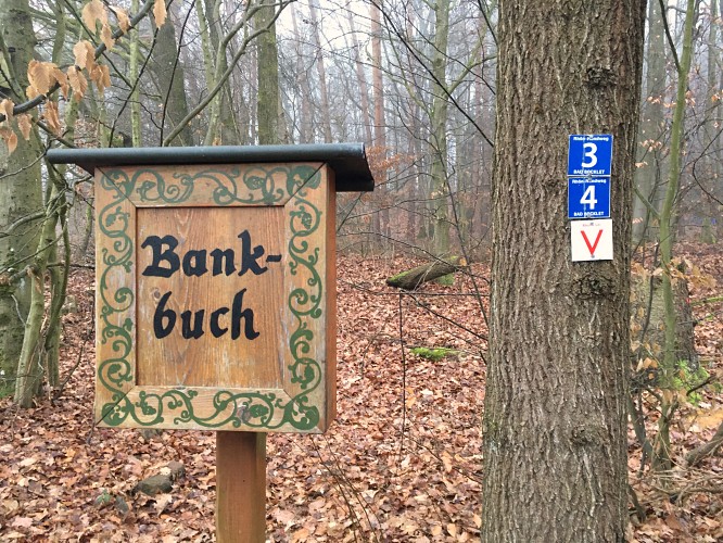
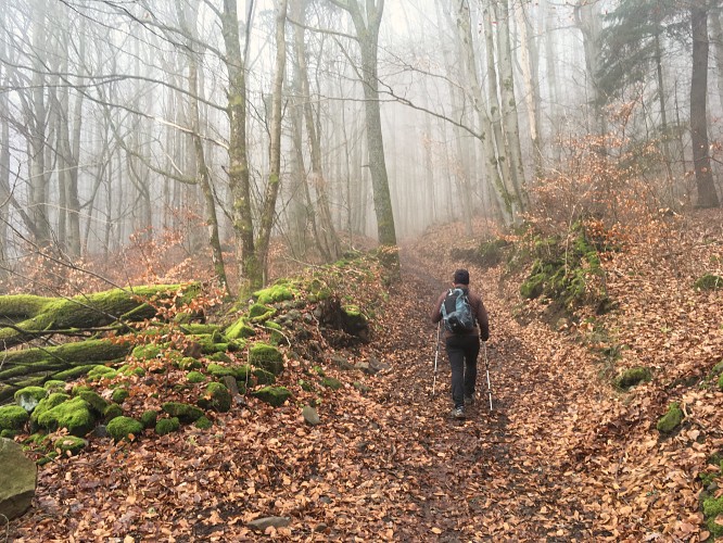
The last stretch was the most arduous. Hiking through the rolling hills north of Waldberg, I soon entered the forest where the trail rose steeply, passing numerous other trails and forest tracks en route. I’m always surprised how well marked the trails are in this region; there’s a sign or sticker at every intersection so there’s no way you can get lost, even if you don’t carry a map or GPS. I had both, but really didn’t need it.
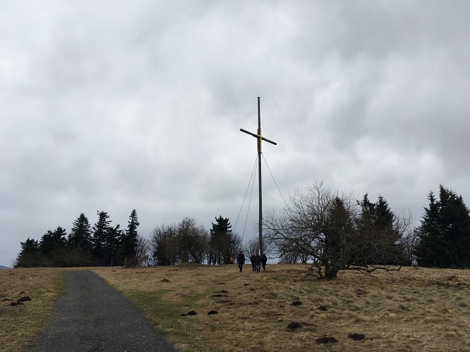
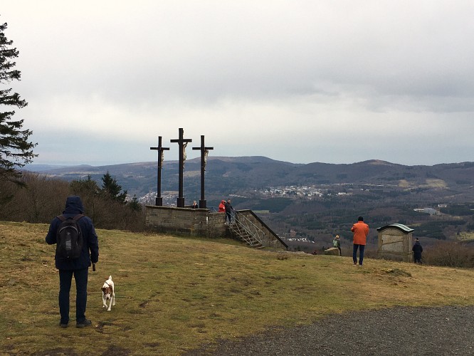
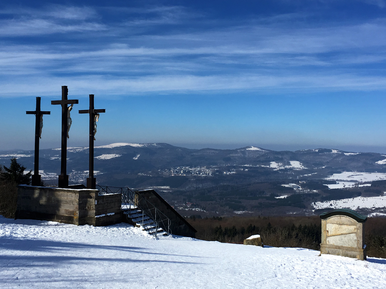
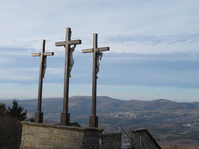
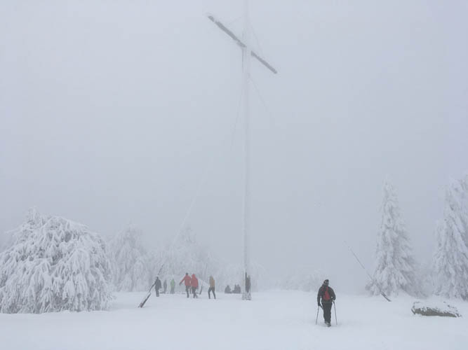
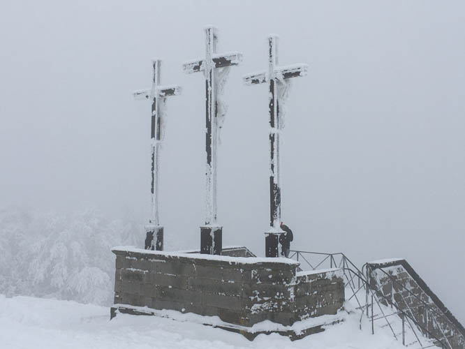
The very visible snow line today was at around 600 m elevation. Not much fresh snow had fallen in the past week and the trail was well-packed all the way up, attesting to the popularity of this hike. Some sections were iced up and required detours, adding a bit of fun to my day. I knew I was close to the summit when I started seeing and hearing people – lots of them! – walking along the main path that connects the monastery with the summit. A huge telecommunications tower tops the mountain, but the actual summit is graced by a large wooden cross. Kreuzberg in German means “Cross Mountain” after all. A lookout platform with three more crosses nearby offers wonderful views of the landscape to the north and northeast, dominated by gently rolling hills and valleys, so different from the Canadian Rockies that I’m used to. This is easy, comfortable hiking country, where you can even get a warm meal and a beer at the top!
Other than the terrific views and the satisfaction of having made it all the way here, my highlight of the day was an opulent lunch of pork roast with dumplings and red cabbage, washed down with a mug of the iconic Kreuzbergbier. My parents had driven up to join me for a very enjoyable lunch break, although we all felt a bit squeezed sitting in a stuffy room packed with dozens of other merry visitors (most, I suspect, had come for the beer, not the monastery or summit).
My muscles were aching badly when I got up and out of the warm, cozy room to embark on the long return journey. I just wasn’t used to hiking long distances anymore! But somehow I got back into “hiking mode” and just kept walking, with very few breaks, until I reached Bad Kissingen again around 6 pm. I had never hiked 50 km in one day before, and I certainly felt it! The last 10 km were the toughest, my legs were hurting but I just couldn’t stop and sit down as getting up again would’ve been even more difficult. It was a lovely hike and a great challenge at the same time, one I can highly recommend even if it’s just the beer that draws you up the mountain!
DISCLAIMER: Use at your own risk for general guidance only! Do not follow this GPX track blindly but use your own judgement in assessing terrain and choosing the safest route.
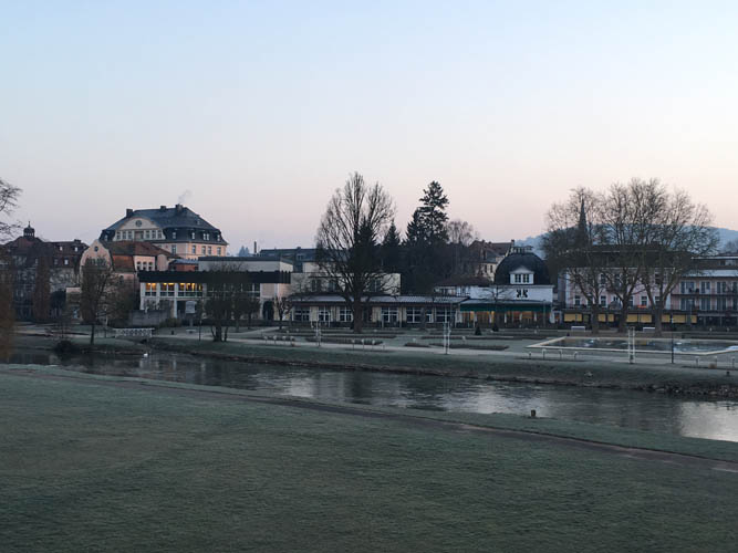
Start of the tour at dawn in the spa town of Bad Kissingen. Frost covers the Rosengarten park by the river Saale.
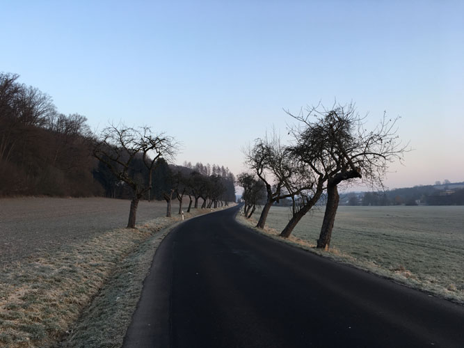
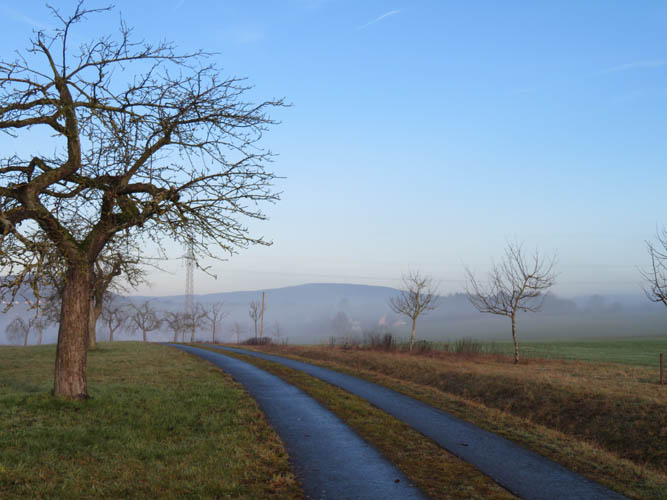
Part of the hike is along small countryside roads that see little to no traffic.
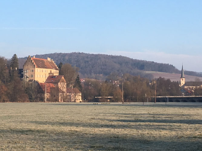
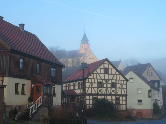
The Castle of Aschach is a magnificent sight in the early morning light.
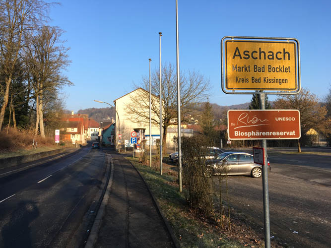
Entrance to the small village of Aschach.
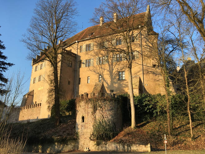
Another view of the castle. It has a museum, restaurant and cafe inside.
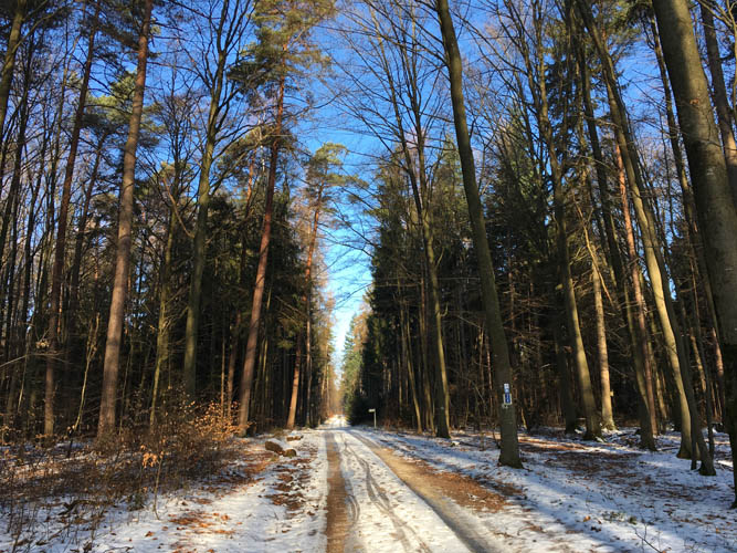
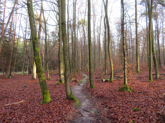
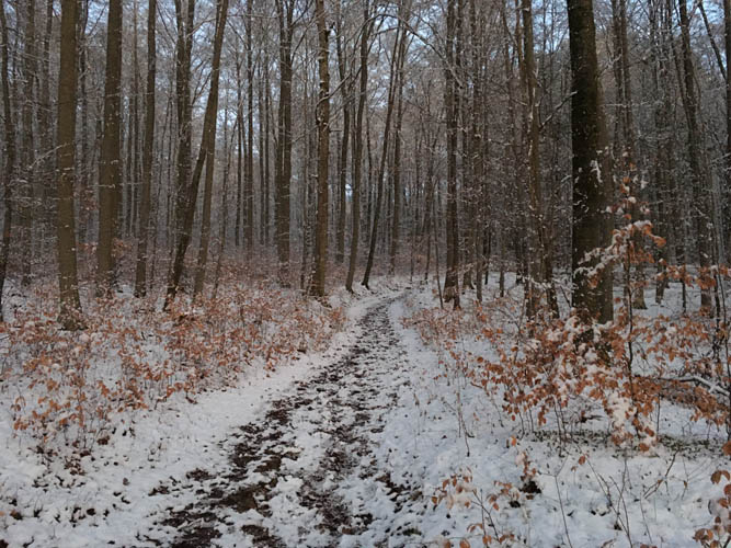
A thin layer of snow (and in places ice) covers the long forest track between Aschach and Premich.
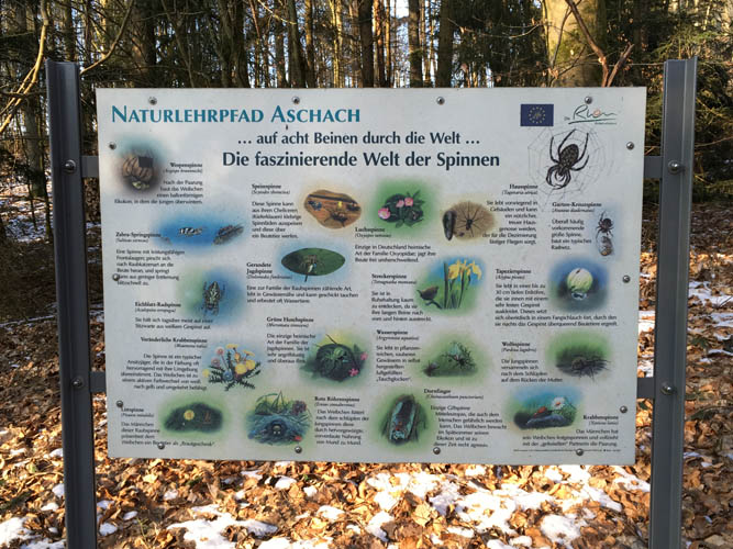
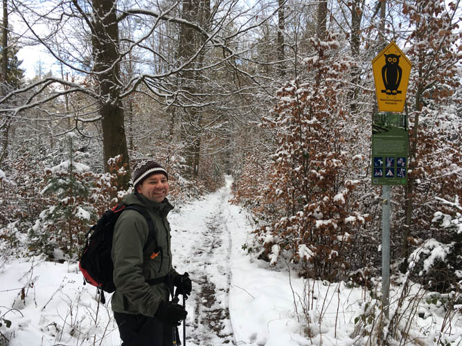
A very informative and well-designed interpretive trail is located along the track just outside Aschach. This post talks about the different types of spiders that occur in the region.
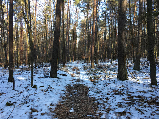
On the hiking trail near Premich.

Lots of trails here!
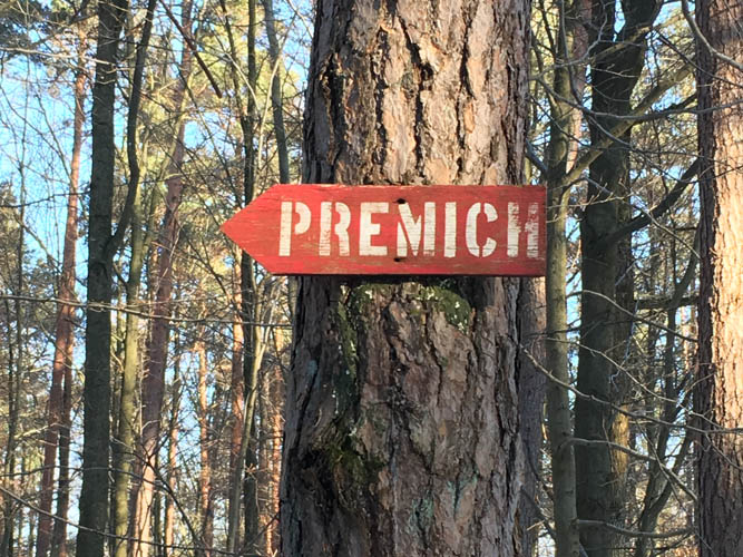
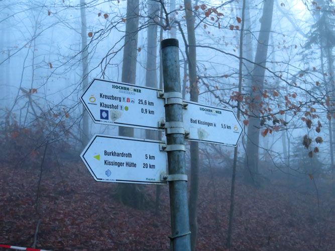
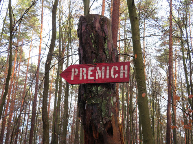
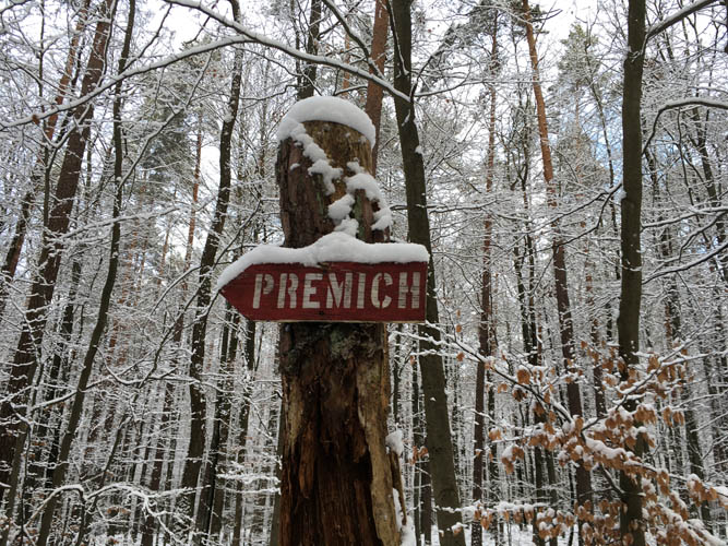
An old wooden sign pointing towards the village of Premich.
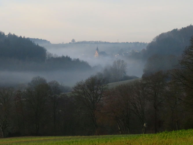
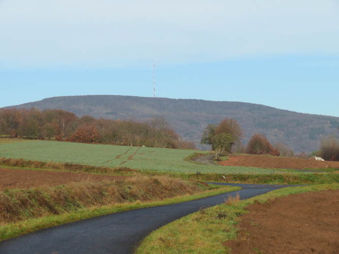
Emerging from the forest outside Premich, the Kreuzberg comes into sight for the first time. The summit is still more than 10 km away!
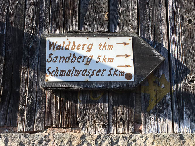
An old wooden sign in Premich with distances to nearby villages.
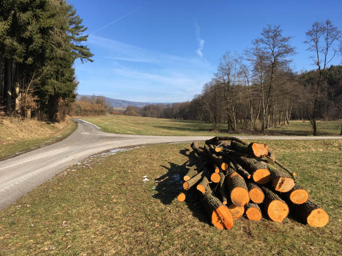
Along the way to Waldberg.
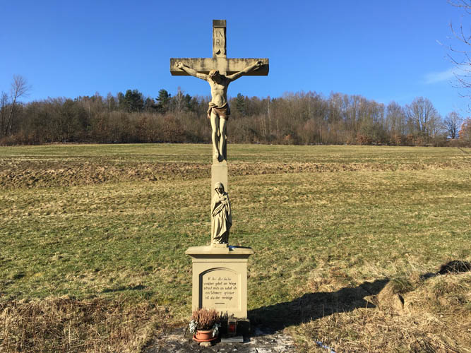
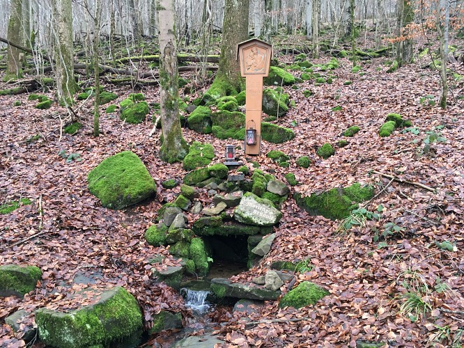
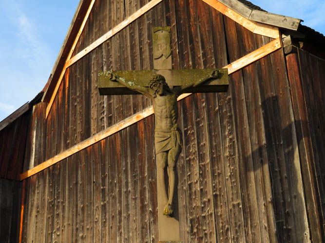
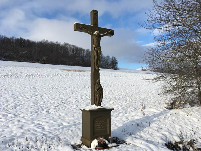
A crucifix made of sandstone – very common in this region.
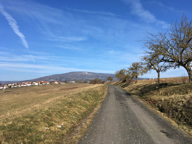
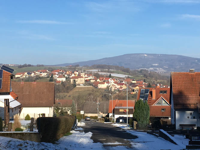
View towards the Kreuzberg, with the village of Waldberg on the left.
Waldberg.
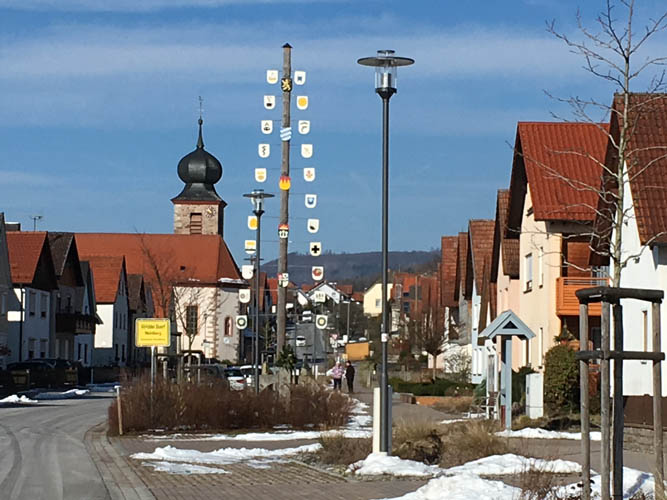
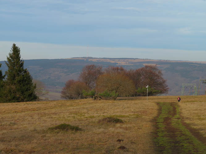
Across a small valley lies the small village of Sandberg.
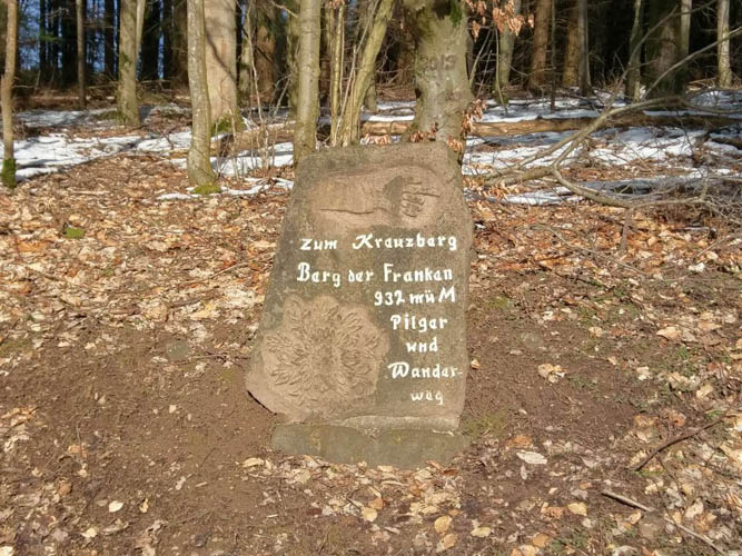
An engraved rock serves as a waypoint where the hiking trail enters the forest: “To the Kreuzberg, mountain of the Franconians, 932 m above sealevel, hiking and pilgrimage trail”.
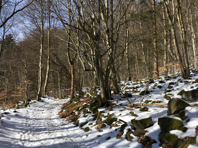
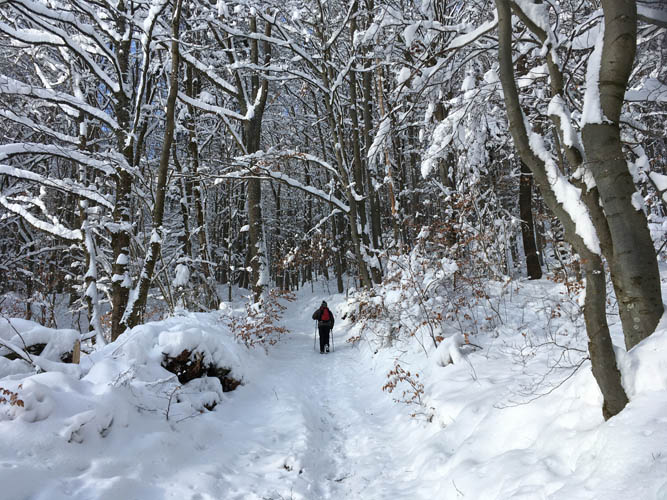
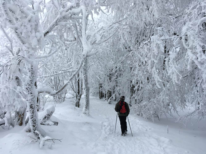
Although the trail is well packed, I’m the only one plodding up this morning.
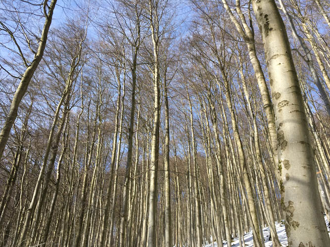
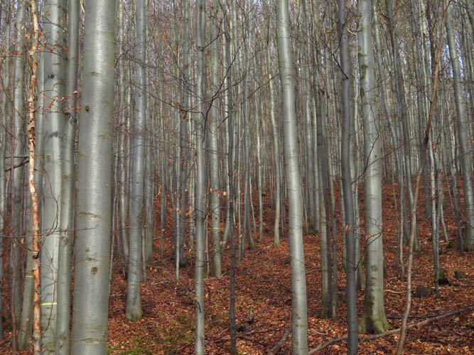
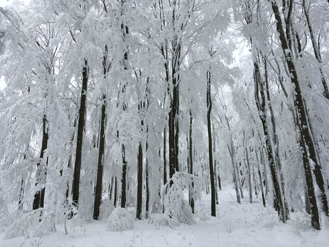
Beautiful beech trees.
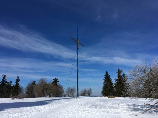
A large wooden cross marks the broad summit.
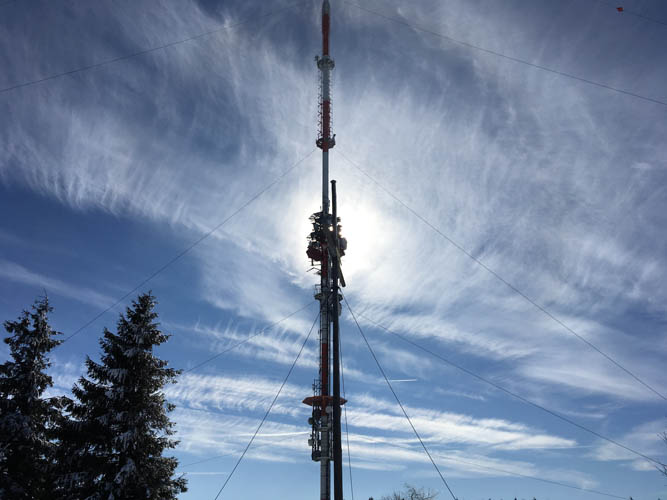
A huge telecommunications tower nearby stands over 200 m tall.
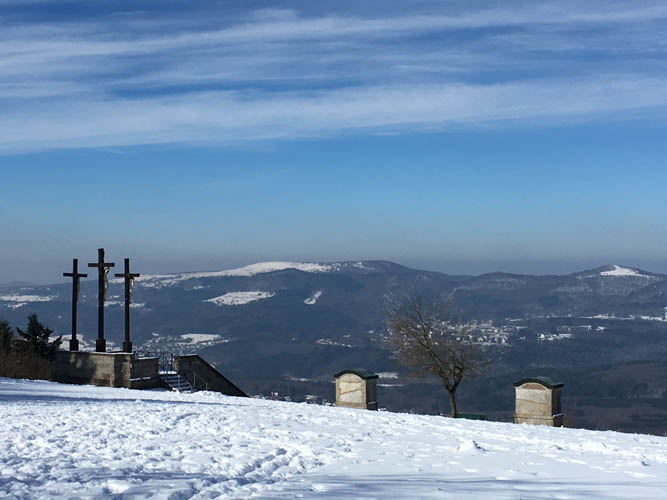
Views from the summit to the northwest, with lookout platform on the left.
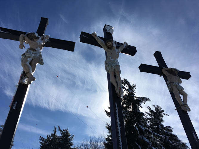
The famous three crosses at the lookout platform.
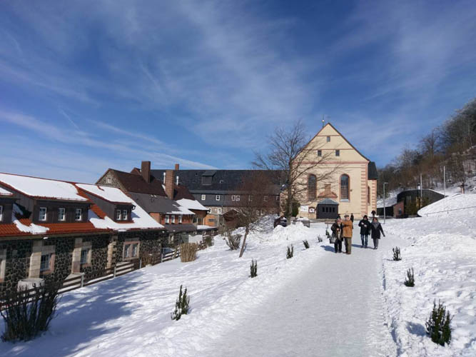
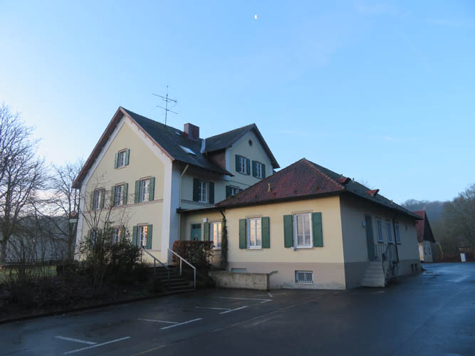
Kreuzberg Monastery
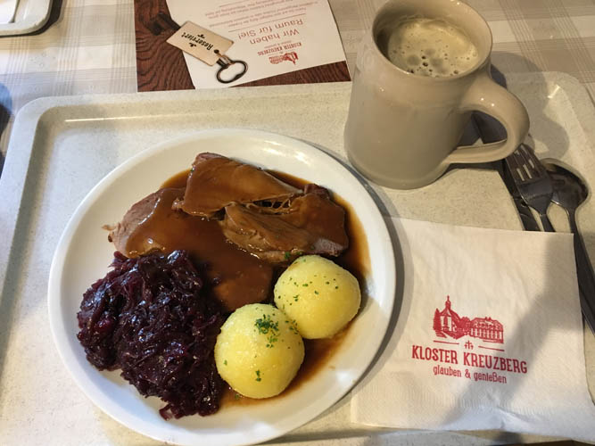
Schweinebraten mit Klößen und Rotkraut (pork roast with dumplings and red cabbage), the ultimate Bavarian meat dish! Served with a cold pint of Kreuzbergbier.
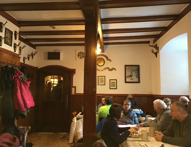
The monastery restaurant is always busy!
Kreuzberg – The Big Loop
19 December 2019
Solo
My second trip to the Kreuzberg, the highest point in the Rhön Mountains of northern Bavaria. Two years ago, I walked all the way from my house to this popular local destination and back on the most direct route, an easy hike on good trails but certainly not a walk in the park at about 50 km return distance. This time around I was feeling energetic and decided to try out a different route, making a loop that took me through different villages and landscapes but also added some extra distance.
One of the issues with long winter hikes is, of course, the limited daylight hours. I ended up spending about 5 of the 13 hours in the dark… not ideal, but once in a while hiking in a dark forest with only the light of your headlamp to focus on certainly has its own appeal.
The first segment from my home town of Bad Kissingen to the village of Langenleiten was perhaps the most enjoyable. After an easy forest walk past the Klaushof countryside inn to the village of Stralsbach, I followed established hiking trails to Frauenroth and on to Premich. I didn’t see anyone else on the trails. From Premich a lovely high level traverse leads to Langenleiten, with good views of the Kreuzberg and the surrounding hills and valleys. Unlike two years ago, there was no snow around this time and I enjoyed a sunny and relatively warm day with a high of 12 degrees.
From Langenleiten the trail runs north and eventually veers northeast towards the Kreuzberg, steadily gaining elevation in the process. It’s all in the forest and a rather monotonous affair with hardly any views. A single trail runner came racing down the path when I climbed the last and steepest stretch.
I did resist the temptation of a summit brew – not an easy feat considering there’s a brewery attached to the famous monastery right at the top and the beer is absolutely delicious (the recipe hasn’t changed since 1681!). However, I still had about 30 km to cover on my way back, so after a quick lunch in the sun and a visit to the summit cross I was off again.
The return route I had picked turned out to be a big disappointment. For hours I saw nothing but trees, following boring forestry roads and muddy paths until the sun finally set. To make matters worse, I also ended up in a small valley (Schmalwassertal) with no trails whatsoever where I was forced to walk along a narrow curvy road for a couple of km. Traffic was busy enough that without my flashing headlamp this would’ve been outright dangerous.
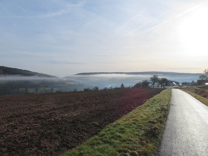
In the tiny village of Hohn I finally found the first bench to sit on after leaving the summit. By this time, after about 45 km, I was feeling my legs but more so my sore feet. It was super dark, the ambient light of the night sky obscured by a persistent layer of fog that had settled in the valleys. All I could see for the next few hours were the halo of my headlamp and the wafts of warm air from my breath. As much as I would’ve loved to enjoy my surroundings more, it had a bit of a meditative effect and helped thwart the discouragement that sometimes comes with seeing too far ahead.
I took my last break in Großenbrach, with only 9 km to go. It was uncomfortably chilly by now as the dampness was getting under my skin. Everything was wet on the outside because of all the fog. A strange thing happened when I got up after about 10 minutes: I started shaking uncontrollably, my whole body shivering as if I’d been exposed to the cold for hours. Well, my body was telling me something – rest up, that’s enough now! Or at least warm up! Thankfully the feeling disappeared about 10 minutes later when I was back in my rhythm again. I switched to auto-pilot mode and took no more breaks until I got home around 8:30 PM, exhausted but glad to have made it.
In terms of scenery and overall hiking enjoyment, I would definitely favour the direct route as per my first trip. While the hike via Stralsbach and Frauenroth this time around was quite pleasant on the way in, the return trip was largely a boring forest walk and is not recommended.
|
Elevation: |
928 m (official), 927 m (my GPS) |
|
Elevation gain: |
1440 m |
|
Time: |
13.0 h |
|
Distance: |
57.6 km |
|
Difficulty level: |
Easy (Kane), T1 (SAC) |
|
Reference: |
Local maps |
|
Personal rating: |
2 (out of 5) |
NOTE: This GPX track is for personal use only. Commercial use/re-use or publication of this track on printed or digital media including but not limited to platforms, apps and websites such as AllTrails, Gaia, and OSM, requires written permission.
DISCLAIMER: Use at your own risk for general guidance only! Do not follow this GPX track blindly but use your own judgement in assessing terrain and choosing the safest route. Please read the full disclaimer here.


Kreuzberg – Winter Combo
9 January 2021
With Christoph
Third time on my quasi-annual pilgrimage up the Kreuzberg and back, but first time in company – and very good company at that. My buddy Christoph spontaneously decided to join me on this +50 km winter hike into the Rhön Mountains and back, door to door.
Out of the numerous official and unofficial pathways you can follow in the area, we took what in my opinion is the most scenic route on the way in, and the most direct on the way out. Basically a combination of routes from my previous outings as described above.
What made this trip today quite special were two things: Firstly, it was really enjoyable to have company for such a long and at times mundane hike. Christoph and I chatted away for almost the whole trip, filling the day with entertaining conversations and forgetting about the pain in our heavy legs on the way back. Secondly, we were in full winter mode (by local standards), the landscape covered in a blanket of snow, which is actually a rare thing to witness these days. While many decades ago a white Christmas was the norm, snow has become less and less common throughout the years thanks to global warming.
Hiking during Covid times is an interesting experience. There was almost nobody we saw on the trails on our way in. Then there were a ton of people on the broad summit area of the Kreuzberg, despite the fact that the famous brewery and restaurant were closed! But it is accessible by car of course, and most people are simply too lazy or not used to long winter hikes. And on our way back we once again saw very few people. Perfect for physical distancing, except at the few bottlenecks on the summit.
We completed the trip in just over 11 hours, with over 51 km distance and a surprising 1450 m of total elevation gain. We were both impressed with our time, which was in part because we couldn’t take any long breaks – it was simply too cold to linger for long. And of course, sadly, there was no beer at the brewery to distract us!
|
Elevation: |
928 m (official) |
|
Elevation gain: |
1450 m |
|
Time: |
11.5 h |
|
Distance: |
51.5 km |
|
Difficulty level: |
Easy (Kane), T1 (SAC) |
|
Reference: |
Local maps |
|
Personal rating: |
4 (out of 5) |
NOTE: This GPX track is for personal use only. Commercial use/re-use or publication of this track on printed or digital media including but not limited to platforms, apps and websites such as AllTrails, Gaia, and OSM, requires written permission.
DISCLAIMER: Use at your own risk for general guidance only! Do not follow this GPX track blindly but use your own judgement in assessing terrain and choosing the safest route. Please read the full disclaimer here.
Kreuzberg – Sandberg variation
2 January 2022
With Christoph
My annual long-distance hike up the Kreuzberg in the Bavarian Rhön Mountains, and the second time my friend Christoph joined me for this full-day outing. It’s great to have such good company on long hikes like this where you have ample time to chat on drawn-out flat stretches. Today we enjoyed a dry and partially sunny day with no snow at all.
The Kreuzberg is of course hardly a “mountain” as such, more of a big hill, but the appeal lies in the variety of routes that are possible in this region. There is an abundance of trails, forest pathways, small roads and bike tracks one can combine to make this a never-ending exercise in route variations. The other draw, of course, is that we could do it “door-to-door”. There is something strangely satisfying in starting and ending a hike right at your own house, especially if it takes you relatively far away and up a “mountain” :).
Today, we chose to hike in via a forest trail northwest of the Klaushof, then up the regular route, while for the return we decided to swing by the small village of Sandberg, which is definitely worth the minor detour. What an interesting place: this village has got to be one of the “longest” in the entire region. The houses here neatly arranged on either side of a long street that seems to go on forever. Other than having a popular trailhead for the trek up the Kreuzberg nearby, the village is known for its chocolate and cake factory that makes a huge variety of absolutely delicious cakes sold right on the premises. Unfortunately, it was closed when we passed through.
Another great day out and a good way to wipe out some of those built-up holiday calories.
|
Elevation: |
928 m |
|
Elevation gain: |
1400 m |
|
Time: |
11.0 h |
|
Distance: |
50.9 km |
|
Difficulty level: |
Easy (Kane), T1 (SAC) |
|
Reference: |
Local maps |
|
Personal rating: |
4 (out of 5) |
NOTE: This GPX track is for personal use only. Commercial use/re-use or publication of this track on printed or digital media including but not limited to platforms, apps and websites such as AllTrails, Gaia, and OSM, requires written permission.
DISCLAIMER: Use at your own risk for general guidance only! Do not follow this GPX track blindly but use your own judgement in assessing terrain and choosing the safest route. Please read the full disclaimer here.