3 July 2016
With Trevor
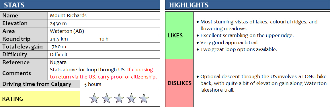
Mount Richards is probably my favourite scramble in Waterton to date. Trevor and I were going to do the Hawkins Horseshoe loop, but Akamina Parkway was unexpectedly closed to traffic so after going through some maps in an outdoor store in town we spontaneously changed our objective to Mount Richards. Stupidly, we hadn’t brought any of the scrambling guidebooks (lesson learnt: have a plan B and ALWAYS bring at least one of the books!). They didn’t have Nugara’s guide at the store, so we had to rely on memory (I read the description a long time ago) and cell phone pictures of the Gem Trek map.
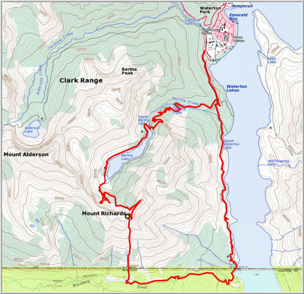
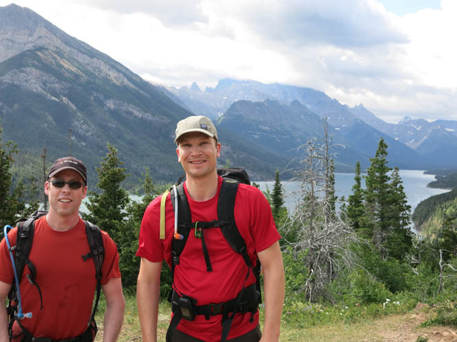
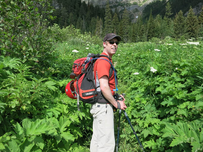
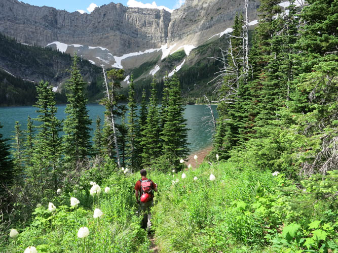
Fortunately, the approach was easy and straightforward. We parked at Bertha Lake trailhead and started up the excellent trail through lush, vibrant green vegetation, passing a few dozen hikers on the way who had all come to enjoy a brilliant Saturday out in the mountains. At Bertha Lake we contoured around the right side of the lake, although looking back it probably would’ve been a little quicker to choose the left side. There is a good trail all around the lake: the left side tends to be rockier, whereas the right side where we were was full of beautiful flowers that made the trip quite memorable by itself. One type of white, tall flower that was lining the lakeshore trail in full bloom was particularly neat to look at: Common Beargrass. These 1 metre high sticks look like little lamps guiding us along the path! At the back of the lake I found a short scree slope that I ascended to reach a small hidden bowl right underneath the vertical cliffs, while Trevor hiked through grassy terrain a bit further left to join me at the start of the bowl.
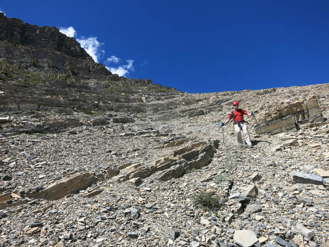
We had now left all the hikers on the trail behind us and were the only people wandering through this quiet and peaceful little valley. There are lots of interesting geological features to be found here, mostly in the large chunks of rock that have come down from the cliffs above. Some great examples of stromatolites (ancient algal build-ups that look like fossilized cow pies), karst (fresh water solution features) and higher up in the shale scree slope I even found some trilobite trace fossils called Cruziana. The brown shale was fairly loose and soft and therefore tedious to ascend, but it would probably make for a convenient and quick descent option. I tramped up the rubble while Trevor was smarter and stuck to the treed part of the slope further left. When we finally put the scree slope behind us and reached the ridge top, we were blown away by the stunning views of Waterton Lake down the east side and Bertha Lake down the west side.
The ridge top is marked by a large cairn – the final destination for a hike called “Richards Ridge”. Our destination, the summit of Mount Richards, was only a few hundred metres to the south, but it took us another 2 hours to get there! The ridge here abruptly ends in steep vertical cliffs that cannot be scrambled, so after scrambling some 100 metres on the fairly exposed ridge crest we veered left and angled diagonally downward through the trees, following the line of least resistance without trying to lose too much elevation. Around a corner there was an obvious ramp below a cliff where a faint trail had formed and this led neatly to the backside of the mountain where it was mostly moderate scrambling straight up all the way to the top. There were a few short sections here and there that might qualify as difficult scrambling, but most if not all were avoidable. The key really is good routefinding and both Trevor and I agreed that Mount Richards really could be a moderate scramble if you only take your time and look for the easiest route.
The summit panorama was nothing short of breathtaking, even better than the Richards Ridge highpoint which sits 200 m lower. There was a canister with a (wet) register that is in dire need of replacement, with a few entries but this is certainly not the most popular scramble in the area.
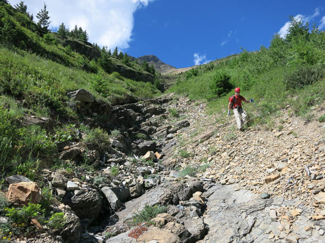
For the descent, we thought the quickest option would be to head straight south on open slopes to Boundary Creek Trail, crossing the invisible Canada-US border en route, then head east to link up with Waterton Lakeshore Trail and then follow it back to Waterton along the west side of the lake. This all worked perfectly, but it was a long and in the end fairly exhausting hike, with all the ups and downs along the lakeshore trail that we didn’t really expect at all (>300 m of additional elevation gain on this trail section). The southern slopes of Mount Richards also took longer to descend than we had anticipated – it was easy scree near the top, but then required careful tiptoeing on rubble-strewn slabs in a narrowing gully further down. Boundary Creek trail was a joy to hike. The creek valley is teeming with lush vegetation and the trail was pretty overgrown in most places. Clearly, this area doesn’t see many visitors – we didn’t see a single other person here! There were also no park wardens or border police officers (we spent a good 2 hours on the US side). At the borderline on Waterton Lakeshore Trail, there are two obelisks demarcating the 49th parallel and a sign advises hikers coming from the Canadian side to immediately report to the Goat Haunt Border Post a few km further south. Since we had come from a different direction and were heading north, we didn’t bother of course.
When we got back home and I read the full description in Nugara’s guidebook I realized that we had missed out on all the scrambling opportunities along the north ridge! The ascent route we took was most likely easier and faster, but less challenging and less hands-on (actually it was just a hike). It was beautiful to hike around Bertha Lake and into the hidden upper valley, so I’m perfectly happy with our choice. As for the descent, I’m pretty sure the easiest and quickest way would not be the US route, but simply returning the same way we came up, taking advantage of the soft brown scree on the west slopes below Richards Ridge. Overall, this was an immensely enjoyable and gratifying trip that makes me really appreciate the stunning natural wonders that Canada has to offer and that sit on our doorstep just waiting to be explored!
DISCLAIMER: Use at your own risk for general guidance only! Do not follow this GPX track blindly but use your own judgement in assessing terrain and choosing the safest route.
Waterton Lake.
Bertha Falls.
The vegetation along the trail to Bertha Lake is really lush at this time of the year.
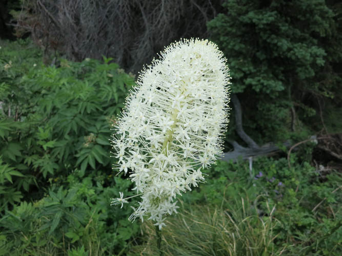
Common Beargrass.
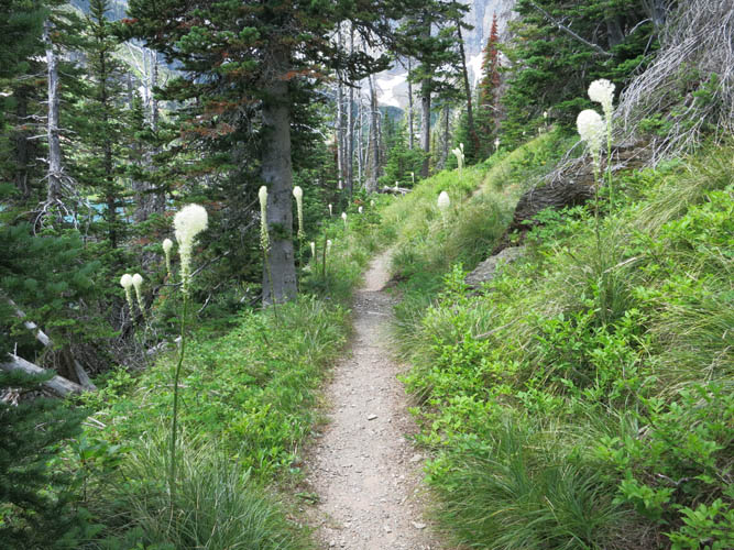
Like lampposts, these flowers line the trail around Bertha Lake.
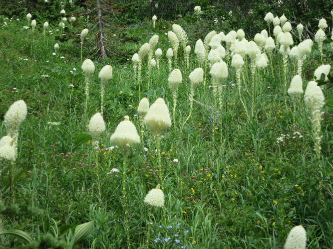
Common Beargrass seems to really flourish up here.
Bertha Lake.
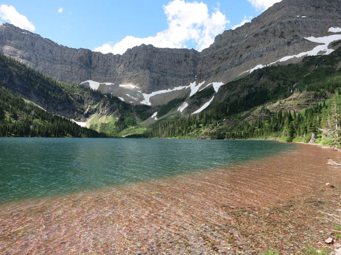
Beautiful red, blue and green colours at Bertha Lake.
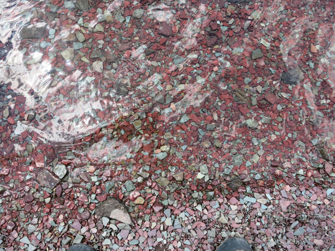
The shallow lakebed consists of red and grey argillite (shale).

Looking back (north) at Bertha Lake from the backside.
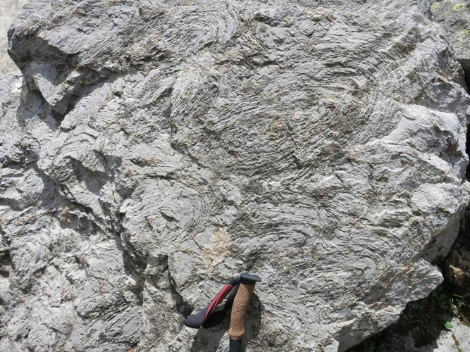
Stromatolites – ancient algal build-ups.
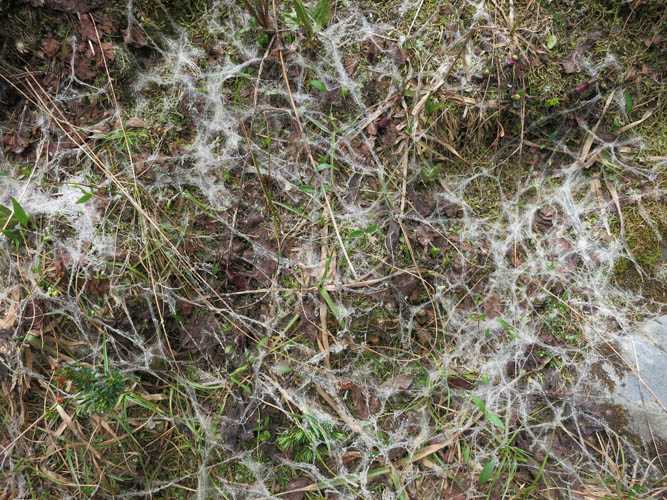
A network of fungus (snow mold) covers the grass near a melting snow patch.
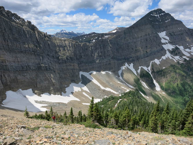
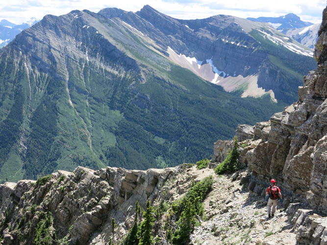
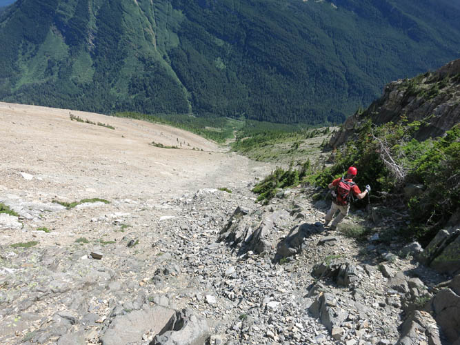
We came up the scree valley below the cliffs. Trevor (in red, lower left) is making his way up the final shale slope.
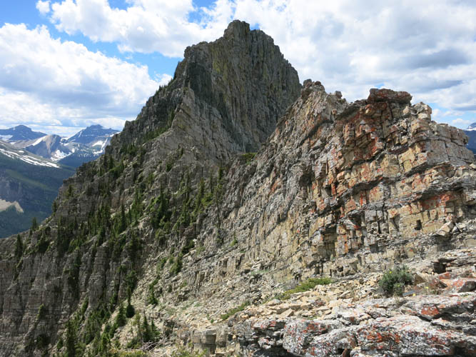
Mount Richards looks like a dangerous climb from this vantage point. The mountains in the background are all in the US.
Middle Waterton Lake peeks through to the NE.
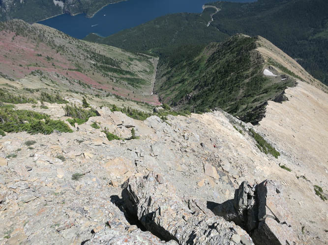
To avoid the vertical cliffs on the ridge, we traversed along narrow ledges across the steep treed slopes on the east side of the mountain.
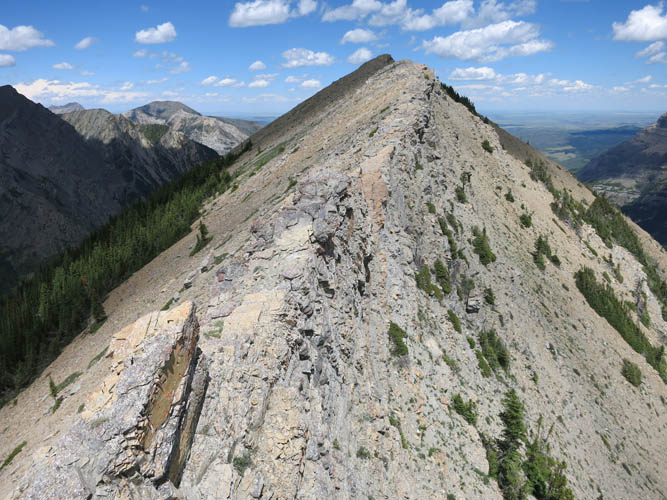
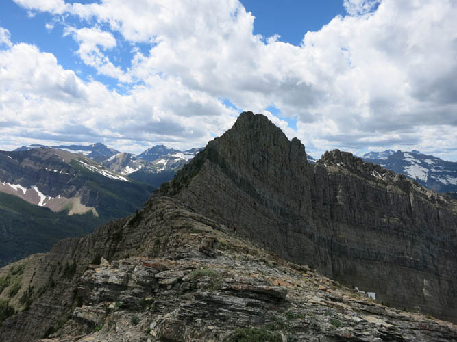
Looking back at Richards Ridge.
Trevor enjoying some fun scrambling along the ridge.
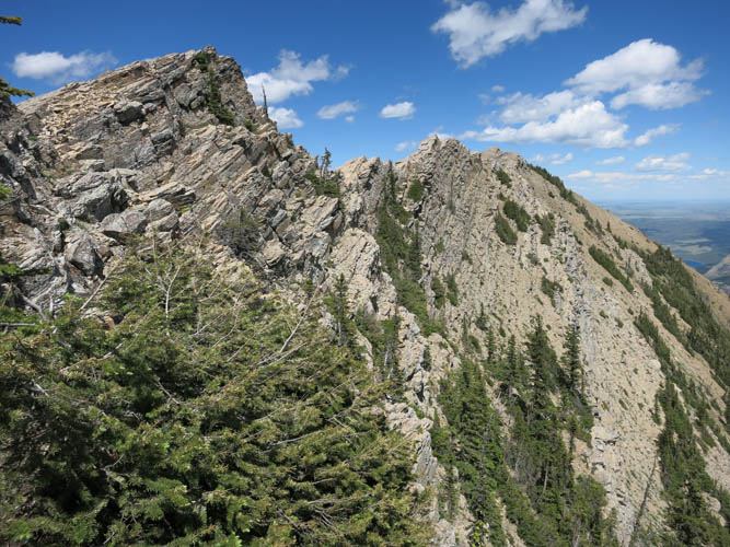
Along the traverse on the east side, looking back to Richards Ridge.
The last part of the traverse is a pleasant downhill walk on a faint trail below a cliff.
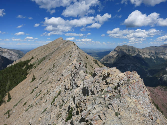
Scrambling up the south side of the mountain, with Waterton Lake below.

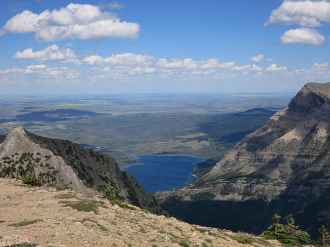
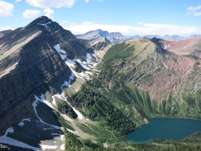
What a gorgeous view of Bertha Lake from the summit of Mount Richards! The scree valley where we hiked up is on the left and bottom of the picture.
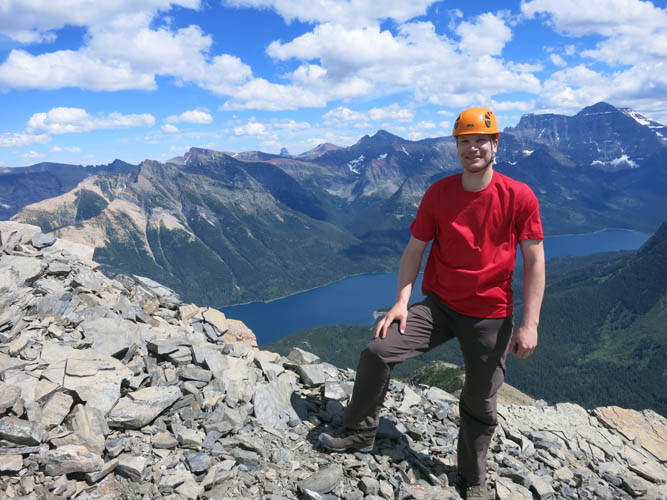
Summit shot with Waterton Lake behind.
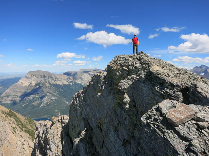
On top of the world!
Bertha Lake.
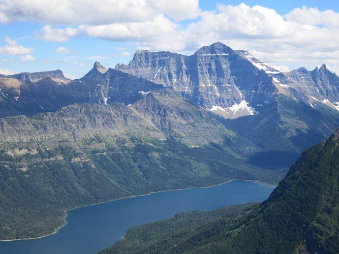
Waterton Lake and the mighty Mount Cleveland. All of this is in the US.
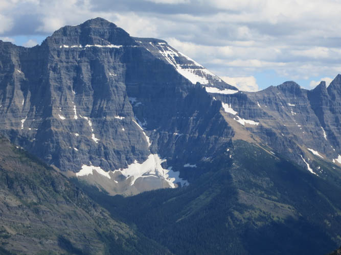
A closer look at Mount Cleveland.
Heading south along the main drainage. Boundary Creek in the US is at the bottom of the valley.
It’s quick going in the upper part of the gully/drainage on easy scree.
In the lower part, our pace is slowed due to steep, rubbly terrain, rising heat, and increasing tiredness!
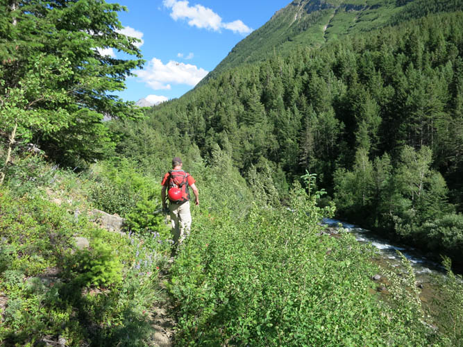
Pleasant hiking along Boundary Creek Trail.
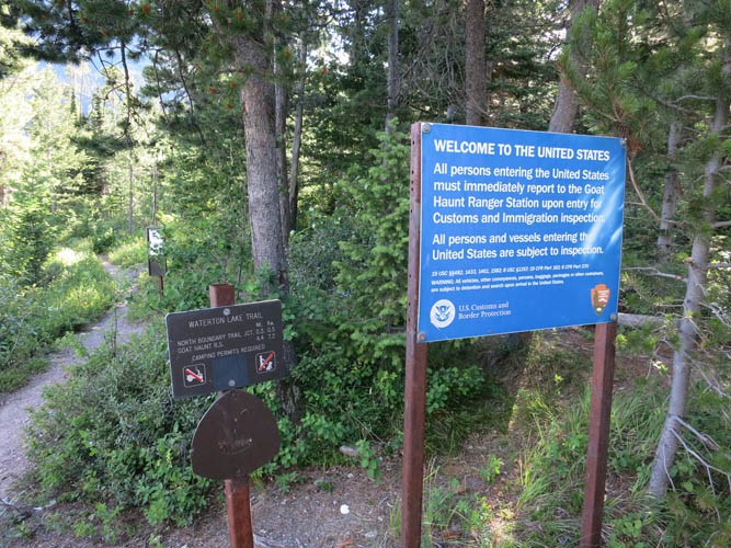
The official US-Canada border along the Waterton Lake trail.
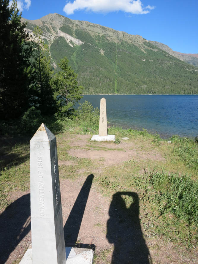
The border is demarcated by obelisks. In the forest across the lake you can see a cutline that marks the continuation of the 49th parallel.
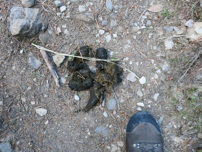
Bear scat on Waterton Lake trail. The area is known for its abundance of bears – carrying bear spray is a must! Fortunately, we did not run into any… this is all we saw of them.