16 December 2015
With Wen
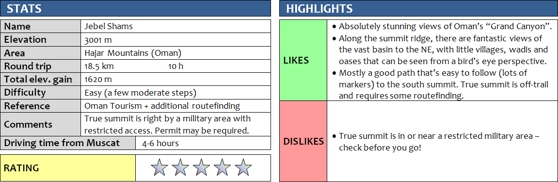
What a beautiful hike! This is one of my all-time favourites, even though only very little scrambling is involved and it’s really mostly an extended walk. Ever since planning our Oman trip, Wen and I had firmly set our eyes on conquering Jebel Shams (Mountain of the Sun) in the Western Hajar Mountains – the highest mountain in the Middle East! Accounts of the actual elevation of its true summit vary but the most commonly quoted height is 3009 m above sea-level (Ministry of Tourism, Oman). My own GPS recorded an elevation of an even 3000 m at the highest point we could reach, right at the fence guarding a military base on top of the peak.
We were lucky to be able to do this hike in the winter when temperatures were around 10-20 degrees, perfect for this day-long outing. I can’t imagine how hot it must get during the summer months, but apparently it’s still preferable to the unbearable heat down in the plains at that time. We even saw pictures taken in January that showed the upper reaches of the mountain completely covered in snow, although that seems to be a rare phenomenon.
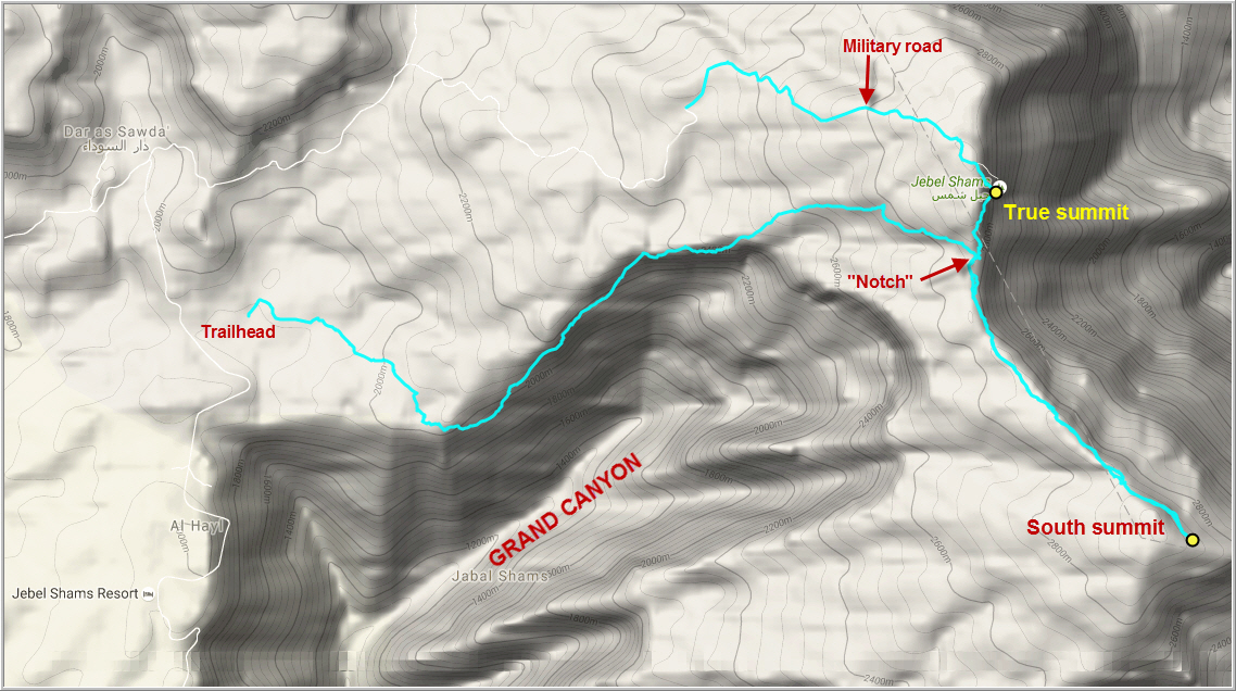
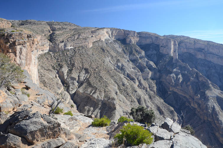
Our base was the lovely Jebel Shams Resort Hotel, which isn’t really a resort as such, but a collection of small chalets and Arabian-style tents clustered around a main building with restaurant and even a small outdoor swimming pool. The whole complex sits atop a flat plain at about 2000 m elevation not far from the edge of the “Grand Canyon” – also called “Wadi Ghul” – Oman’s biggest and most impressive canyon that is up to 1000 m deep, up to 3 km wide, and some 6-7 km in length. We spent a couple of nights here and found this place to be the perfect base for our two endeavours, Jebel Shams and the so-called “balcony walk”, a superb 2-3 hour hike along a ledge on the inside wall of the canyon to a small abandoned village – highly recommended in itself!
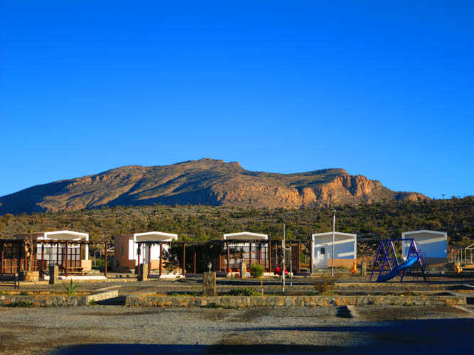
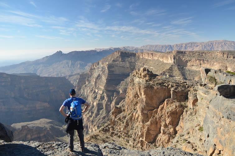
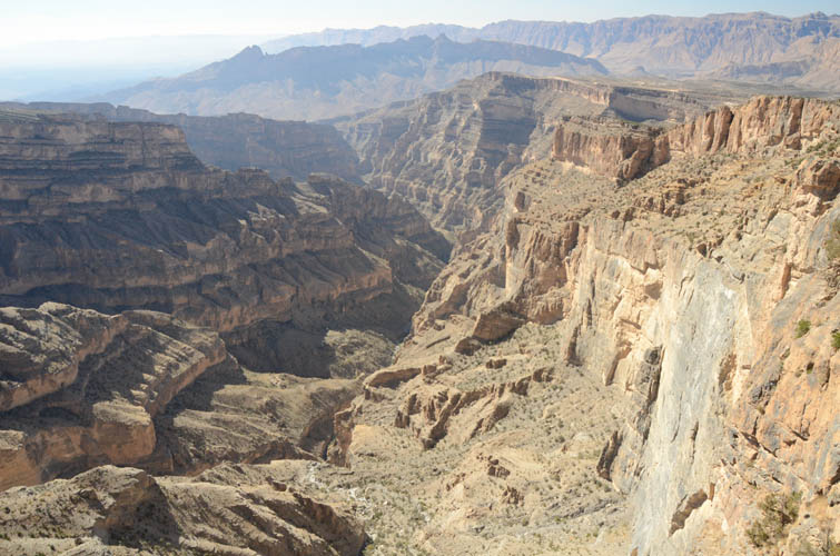
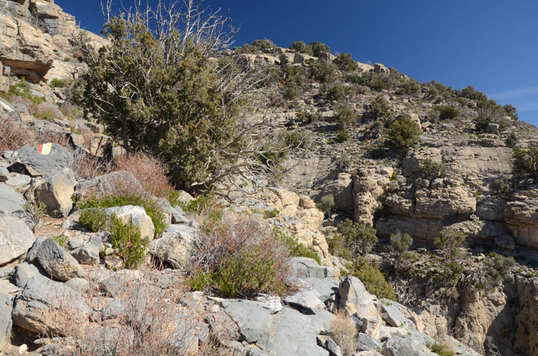
We knew that the hike to the south summit of Jebel Shams would be a long outing and given that we were not really in shape, and that we (ok mostly it was me!) were also keen on making it to the true summit of the mountain, we found that spending the night before the hike at the hotel really made sense. Around 7 am we were on our way and drove the couple of km to the trail head. This trail is officially called W4 in the Oman Ministry of Tourism brochure. There are flag-style markers painted red-white-yellow on rocks all over the place, yet we still managed to get lost for the first few hundred metres, following a narrow wadi instead of crossing the flat plain and heading toward the rim of the canyon. Once we found the correct trail, it was pretty much smooth going all the way from here. The markers would appear in regular intervals every 50-100 metres or so and were really helpful as the trail wasn’t always obvious – there is a lot of rock and little in terms of soil or vegetation where a clear path could form itself. For the first few hours we hiked along a gently rising plain full of lowly shrubs and the odd juniper trees. Then we reached the edge of the plain and caught our first glimpse of the canyon – what a sight! The “Grand Canyon” stretches far into the distance and its numerous vertical cliffbands dropping down a thousand metres into a small, verdant valley far below is truly a dramatic sight. With the sun still at low angle in the morning, we were treated to a fine display of sunshine interacting with the dark and slowly moving shadows cast by the gorge that is so deeply carved into the rock. The next section of the hike was one of my favourite parts. The trail led us right along the edge of the canyon to the northeast, then turned east along a wide ledge above one of the cliffbands, abruptly ending in a notch at the edge of the main summit ridge. This time we enjoyed beautiful vistas of the vast basin to the east and northeast, which lay more than 2000 m below us. We had our lunch here – some sandwiches we had made from the hotel breakfast buffet, plus some fruits, chips and… you guessed it… chocolate!
It took us quite a while to this point (some 4 hours), but we still had several hours to go to reach the south summit. The path now turned south, steadily rising parallel to the ridge over a seemingly never-ending series of ups and downs. It was getting quite warm now with the sun blasting down on us and not a cloud in sight and we found this part quite exhausting. It was just really long and at some point the tedium got to us – it was more and more of the same shrubby terrain, but not much in terms of views on this stretch. There was one short cliff to overcome, which presented a welcome distraction and a fun if short-lived scrambling opportunity. Some more flat terrain and gentle ups and downs followed before we eventually reached the large cairn of the south summit at 2997 m, complete with a tattered Omani flag!
After another well-deserved break with glorious views all around, we followed our route back to the notch where we had first reached the summit ridge in the morning. From here, the true summit wasn’t visible, but we had seen it from higher up the ridge to the south. A big white ball next to a couple of buildings sits right at the highest point of Jebel Shams: a radar installation with observatory by the Omani armed forces. Of course we knew that the military area was off-limits, but I figured as long as there were no signs, no fence or no guns pointed at us we could still venture a bit further along the ridge to see where it got us. We left the trail from the notch and started climbing up a steep, rocky slope interrupted by several short cliffs. I quite enjoyed scrambling up here; it was easy to moderate scrambling on good rock and we had to find our own route. Here and there there were faint white paint markers on the rock, guiding us through some of the trickier sections. Perhaps this represents an old hiking route? Or maybe it was meant for the soldiers? The white markers quickly led us to the top of the north ridge and we suddenly had the military installation right in front of us. There were no barriers or signs, in fact there was no sign of life with the exception of a lonely donkey who, at the sight of a brightly dressed Asian and German, got scared and quickly scuttered away. We kept walking until we were right at the edge of the compound, which is surrounded by a fence. We moved to the highest point along the fence, where the ridge drops off in a sheer vertical wall to the east. My GPS read exactly 3000 m – and the highest we could get in Oman and the entire Middle East!
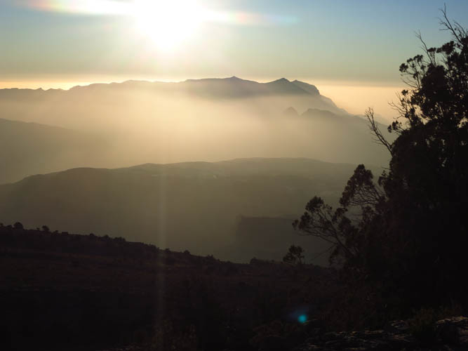
It was certainly a great feeling to be standing up there, but we were also a bit nervous about being so close to a military area and, not wanting to cause any trouble, we didn’t linger and quickly started heading down again. It was quite late by now, around 5 pm, and the sun was going to set soon. Our legs were also starting to feel the long hike and we were quite keen on getting back to our hotel, looking forward to wolfing down a nice warm dinner. With the sun setting around 6 pm at this latitude, we came prepared with headlamps and were ready to hike out in the dark. My map showed a dirt road originating from near our hotel and leading up to the military base. Perhaps a faster and easier way down? Definitely turned out to be true! After a short traverse on some steepish terrain below the military complex we hooked onto the gravel road and started hiking down towards the setting sun in the west. It was a beautiful sight to be looking down onto the silhouette of far-away peaks and mountain ranges as the rock around us turned golden red and the sun disappeared in a glowing ball of orange. I cannot imagine how many amazing opportunities there must be for hiking and scrambling in Oman – just so many impressive looking peaks and ridges to explore! Jebel Misht to the northwest looked particularly enticing and on my next visit to Oman I will surely make plans to conquer this beautiful mountain.
Usually, when you enjoy a gorgeous sunset from atop a mountain on your way back down, you either have to bivouac and sleep an extra night in a tent high up, or you still have a long and arduous night hike ahead of you. It was somewhat strange and lucky that neither was the case for us. Our hike ended here, involuntarily, because we ran into a pick-up truck with a bunch of Omani soldiers who insisted on driving us back down to their base lower down on the mountain, and eventually to our hotel. It was a weird and unique experience in itself, and one we really value because it was another great example of the amazing hospitality that is shown to strangers by the Omani people. Instead of questioning us what we were doing on “their” road at this time in the evening, they invited us to join them for dinner in their little guard house. We were offered chicken burgers, fries, salad and soft drinks while we sat on the floor, chatting with the five soldiers that man this station at the entrance gate to the restricted section of the road. There were absolutely no suspicions from their side as to what we were doing, and showing them our tourist maps, our hiking gear, and even our GPS probably helped, and all this gained their trust. We spent a couple of hours discussing everything from Omani society to mint leaves growing behind the house to world politics… Who would’ve thought that our hike would end like this!? I think it was a brilliant example of Omani, German and Canadian cultures coming together and trying to learn from each other as opposed to giving each other grief. A very harmonious and insightful gathering that was enjoyed by all of us. The leader of the group insisted on driving us back to our hotel, despite our assurances that we could easily follow the road and walk the last 2-3 hours. We got back to our tent around 9 pm – 12 hours after setting off in the morning!
For others wanting to do this hike, I can highly recommend it but must add that it’s not to be taken lightly. It’s a very strenuous outing and might take you the whole day, so bring plenty of water (at least 4 litres!) and food, sunscreen, a sunhat, extra layers and gloves (in the winter), as well as a headlamp in case you have to hike back in the dark. As for the excursion to the “true summit”, it’s a lot more involved than the south summit as there is no proper trail and requires some scrambling up cliffs. There is also a chance you might get in trouble by coming close to that military area depending on who or what you run into, so on the whole I don’t recommend it. The most beautiful parts were along the marked hiking route anyway: the hike along the edge of the platform overlooking the Grand Canyon and the “notch” where the summit ridge drops off to the east are the most spectacular sections! And best of all, we didn’t see a single person along the entire hiking route so you’re most likely to have it all to yourself!
DISCLAIMER: Use at your own risk for general guidance only! Do not follow this GPX track blindly but use your own judgement in assessing terrain and choosing the safest route.
Jebel Shams from our hotel.
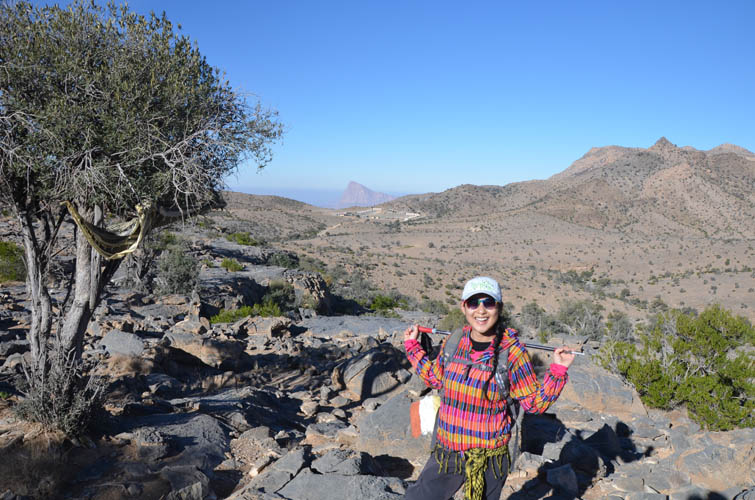
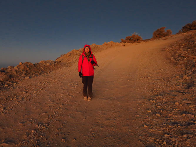
At the trailhead. It’s still cold early in the morning!
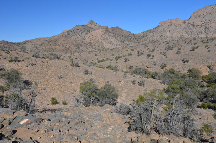
The path is clearly marked by yellow-white-red painted markers.
Heading up gentle plains past juniper trees.
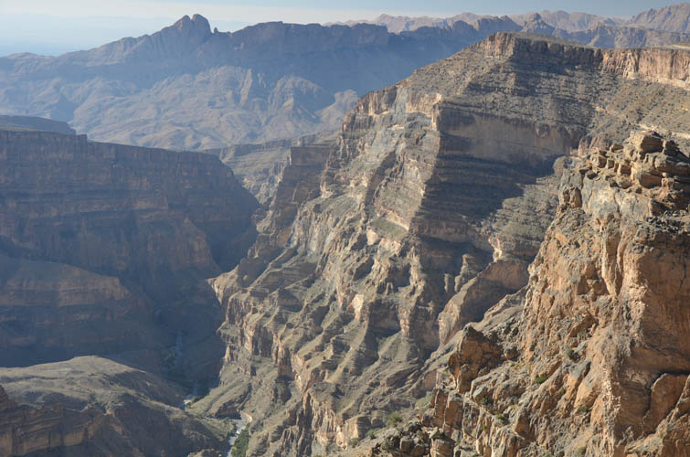
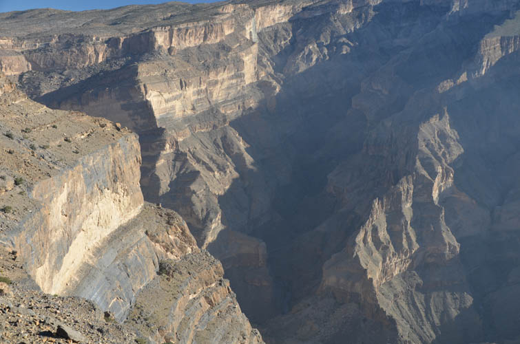
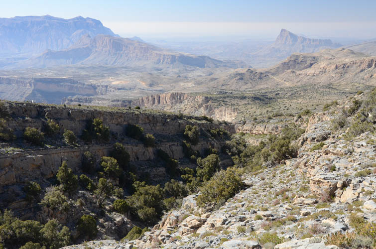
The Grand Canyon of Oman.
We spent a lot of time gazing down the abyss here.
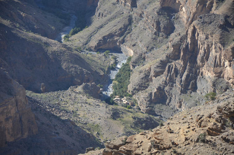
There are several small villages down at valley bottom.
Perfect photo opportunity!
This is looking backward form inside the canyon wall – on our “balcony walk” a day after.
Another view form inside the canyon (the day after).
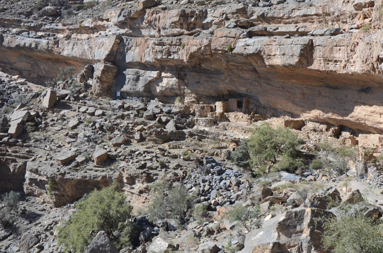
The abandoned village that’s perched against the cliffs inside the canyon (photo taken the day after).
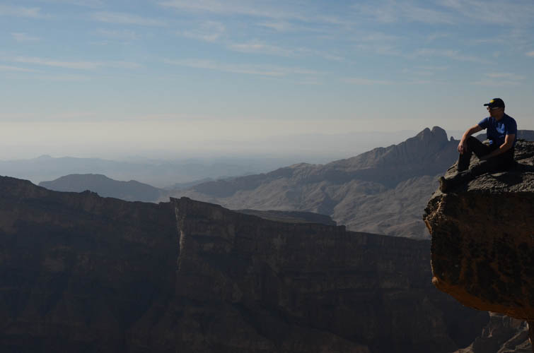
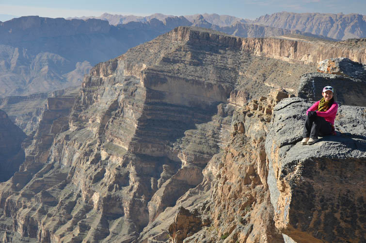
Sitting at the edge of the canyon.
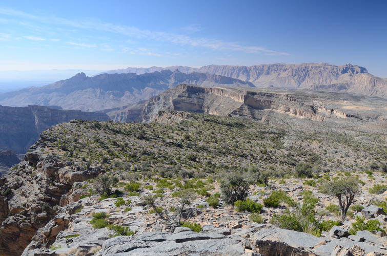
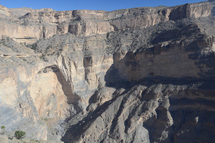
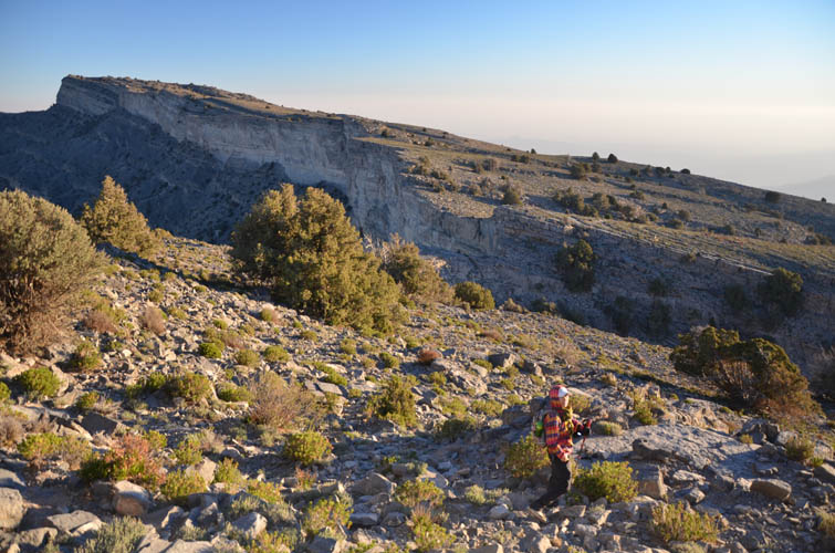
Much of the hike follows the northern rim of the canyon.
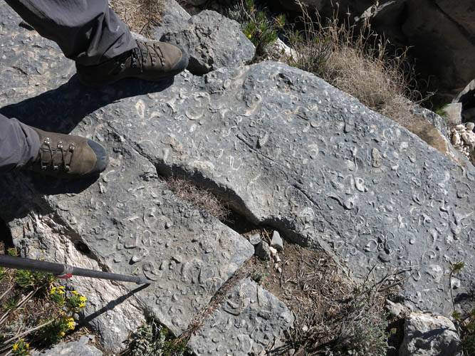
We tramp across a fossil bed.
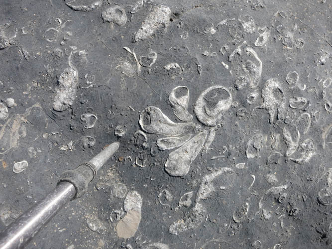
This used to be the sea floor! Fossil shells (mostly gastropods) embedded in limestone.
Heading towards the summit ridge. The military station at the true summit can be seen at the horizon on the left.
Another spectacular look down the canyon.
The path leads through rocky terrain.
Looking back west. Jebel Misht in the distance on the right.
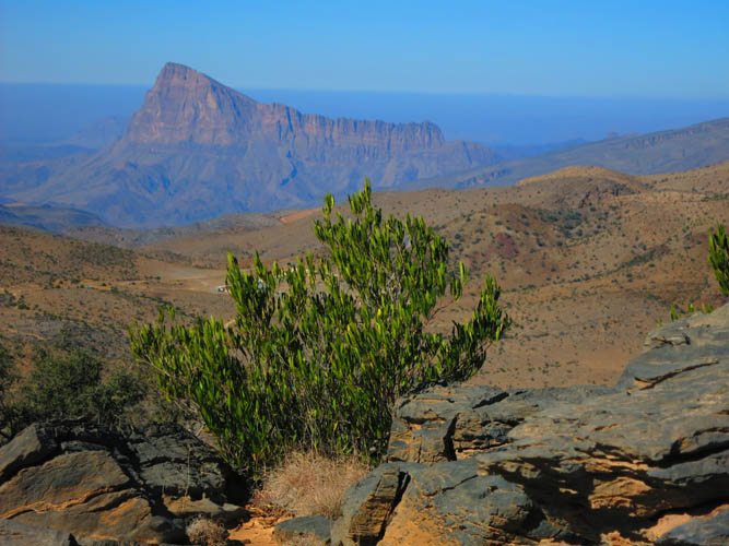
A rare patch of green, Jebel Misht in the background.
Looking down to the SW.
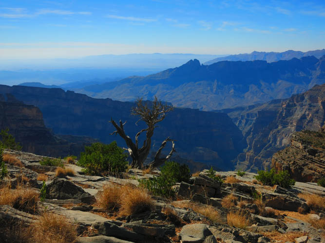
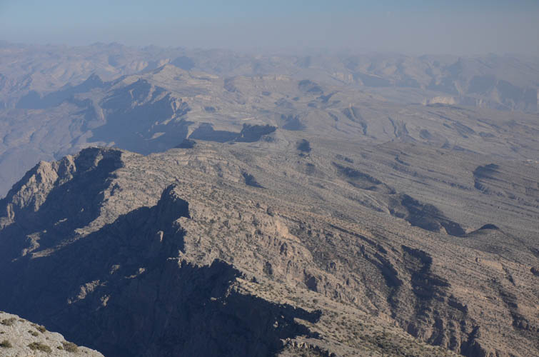
At the notch: a vast expanse of valleys and mountains opens up far below us to the east.
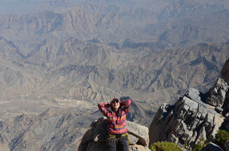
Wen enjoying the gorgeous views!
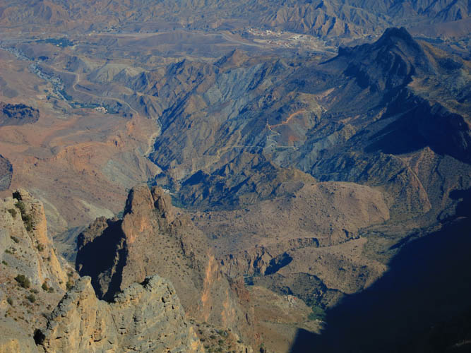
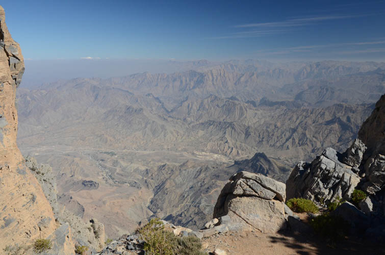
Windy roads and small mountain villages far below us.
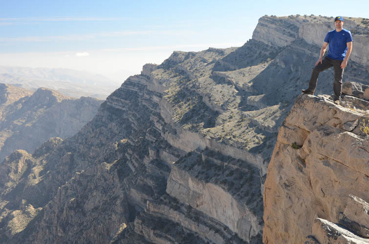
The eastern edge of the summit ridge is quite steep.
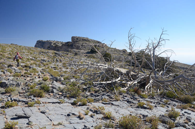
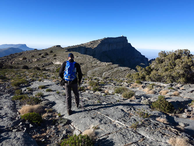
Heading along the ridge to the south summit.
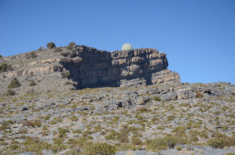
Looking back north at the military installation with it’s “golf ball” at the true summit of Jebel Shams.

Nearing the south summit along the crest of the ridge.
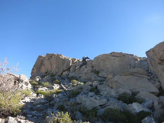
A short cliff offers the only hands-on scrambling along the south ridge.
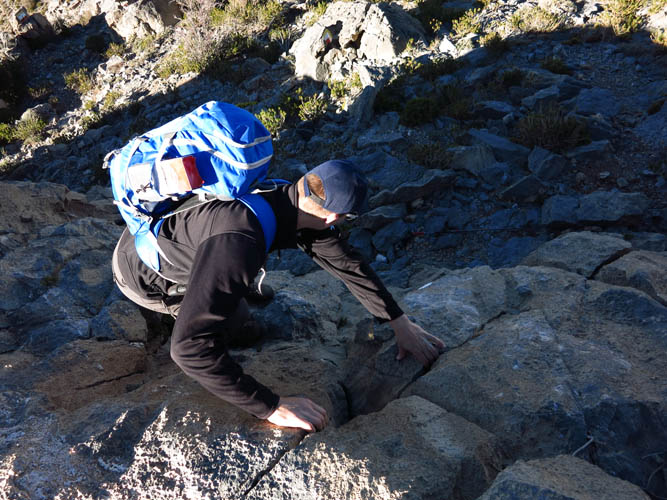
At the cliff.
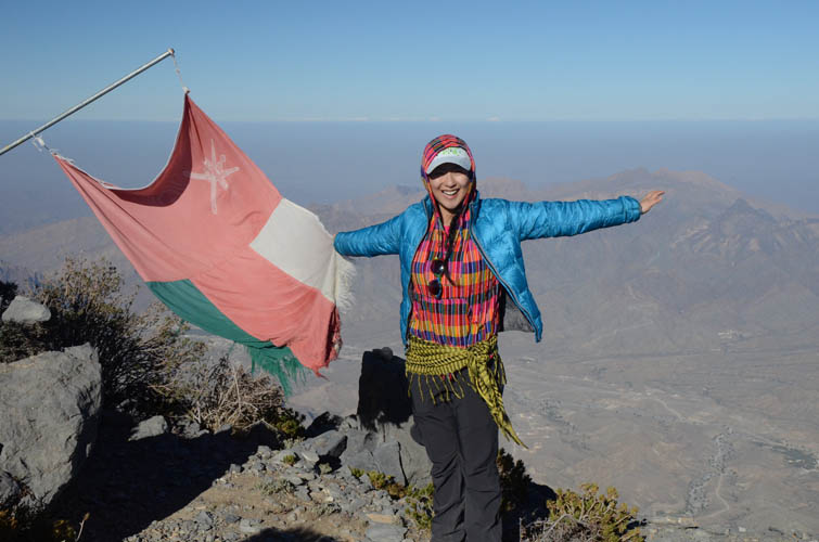
Holding up the flag of the Sultanate of Oman on the 2997 m south summit of Jebel Shams.
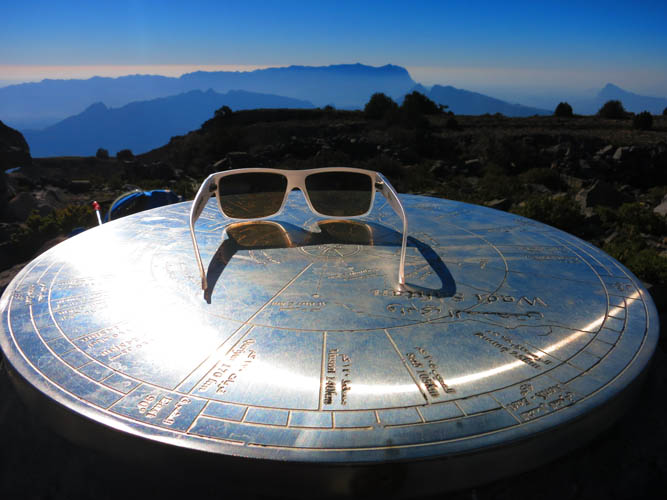
The large summit cairn is adorned with a dial showing all major geographical features in the vicinity.
Views to the SE.
Heading back along the south ridge.
And on towards the true summit, which is only metres higher than the south summit, but still a good hike away.
The sun is already starting to go down.
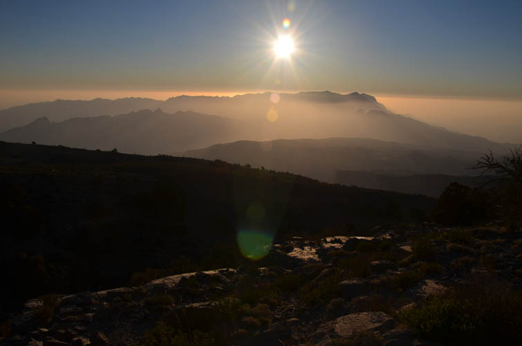
Mountain silhouette to the west.
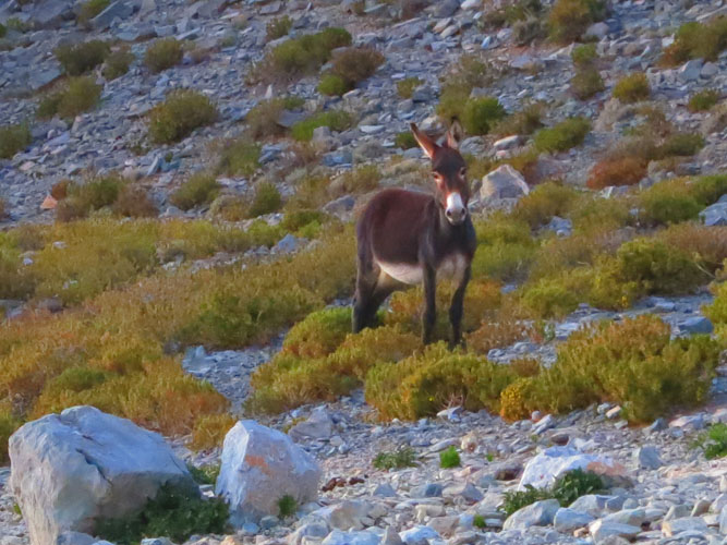
Our slightly frightened wild donkey friend.
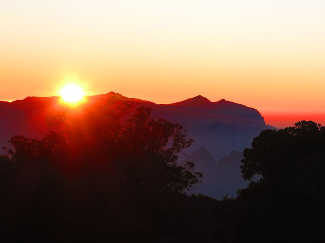
Sunset.
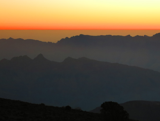
Alpenglow, Oman-style.
Hiking back down the military road in the fading light.