29 December 2014
With Tilo
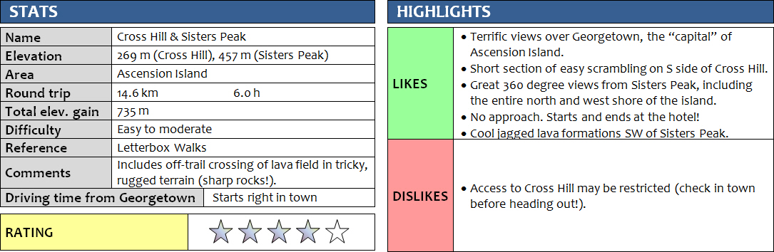
It’s questionable if Cross Hill and Sisters Peak qualified as “mountains” if they were located anywhere else, but on Ascension Island they certainly do. The island is so small and isolated that anything sticking out a few hundred metres above sea-level feels and looks like a mountain here! If done in combination, the two peaks offer some wonderful hiking, a tiny bit of scrambling, and certainly a good, sweaty work-out.
For Tilo and me, Cross Hill was our first target on our 10 day trip to the island. It’s basically the first little peak right behind Georgetown, the main settlement and “capital” of Ascension Island. Cross Hill derives its name from the fact that a cross was apparently found here in 1693, and today a large, modern metal cross at the top can still be seen from far away. Getting up this minor peak is easy. We simply followed the main road “left” of the Hotel Obsidian (the only hotel on the island!) in the direction of “Fort Bedford”, a small defense installation on the lower slopes sporting two bright white cannons that were mounted here in 1941. Nearby is the old “Victorian Cannon” that dates back to about 1865. After passing these remnants of recent history, we left the path and simply started climbing the shrubby northwestern hillside all the way up. There’s also a road that winds its way up from the south, so to make it even simpler one could just follow the road, although we heard that there are “Access Restricted” signs along this road. I’m still not quite sure if you’re actually allowed to hike up Cross Hill or not!
The entire ascent took us a mere 45 minutes, and we didn’t even hurry. Great views of Georgetown from the top, considering this is such a minor bump only! From Cross Hill, it’s pretty straightforward to continue to either Lady Peak to the SE, or Sisters Peak to the east. We decided to descend along the south “ridge” of Cross Hill – not really a ridge, but a narrow rocky shoulder with lots of loose rubble (no path here). Further down we followed a gully with very short but enjoyable sections of hands-on scrambling. There were tons of golf balls strewn across the rock here! And we eventually figured out why… Ascension Island’s only golf course is located at the bottom of Cross Hill on the north side – dubbed the world’s “worst golf course” where the “green” is called the “brown”. Perhaps the odd expat living here can’t help but take a few old golf balls up Cross Hill and test out their swing from the top.
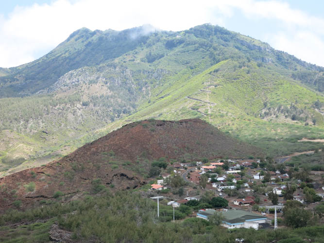
At the bottom of the gully we reached the short road connecting Georgetown with Two Boats, the only other settlement on the island. Here, Tilo decided he had enough for our first day and headed back to the hotel, while I continued for another 4 km up the slowly rising road to Two Boats. This is a quaint little village, very picturesque and definitely on the green side with plenty of trees and pretty blossoming hedges around people’s yards. It’s also cooler than Georgetown owing to its location at 270 m above sea-level. Two Boats is on a broad saddle at the foot of “Green Mountain”, at 859 m the tallest peak on the island. To the west is the dry and barren Sisters Peak and a good beaten path leads up its rocky lower slopes and through scree higher up to the summit. I had a quick refreshment at the “Two Boats Club”, a popular bar and hang-out for expats complete with swimming pool. Then it was about a 1-hour trudge in the midday heat to the top of Sisters Peak at 457 m. The route is described in “Letterbox Walks”, a book with some 30 different hikes all around the island. The people behind this guide had the nifty idea of placing a letterbox at the summit or destination of each hike, together with a rubber stamp unique to each outing (all with very neat designs characteristic of each area). Hikers can then “stamp” their guidebook as a very unique memory of their trip, and as physical proof they’ve actually earned their bragging rights!
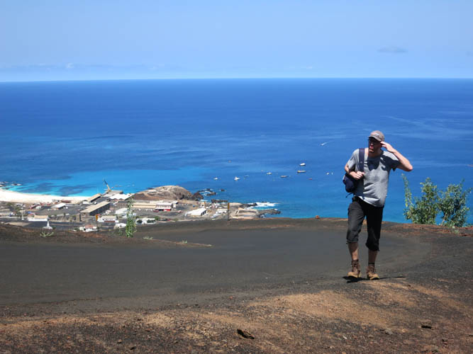
The views from Sisters Peak are obviously even more far reaching than those from Cross Hill. You can scan almost the entire north coast of the island, including the massive “golf balls” of the BBC Atlantic Relay Station. To the west, Georgetown can be seen in the distance across the soft ochre and red-brown hues of undulating hills and plains, the view partly blocked by Cross Hill. A collection of half-collapsed craters with funny names like “Broken Tooth” pop up to the northeast in a dry, desert-like moonscape. I found it somewhat surprising that I had this entire peaceful landscape seemingly to myself up here. There was nobody else, and that was quite ok. Of course, on an island with a population of some 800 souls, it was hardly a surprise to be alone on these barren peaks, despite the small size of the island. The summit register was full of entries and it seems that many locals hike up Sisters Peak quite regularly (perhaps this is what Prairie Mountain is to Calgarians!?).
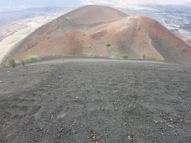
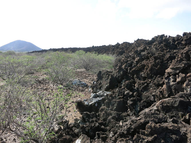
To make a loop out of my trip I descended along the broad south ridge of Sisters Peak, my aim being to link up with the road somewhere near the golf course again. The well-beaten path disappeared soon after the summit, but the soft scree that makes up the bulk of this little mountain was super easy to walk on. Further down there was a steep section of soft, black scree and it was an absolute joy to be “scree-skiing” down the fine, deep rubble. It’s all of volcanic origin and the rocks are sharp, but this is where good solid boots and long pants help in case of a slip. At the bottom of the long scree slope I hit a small lava field that I still had to overcome to make it to the road. This was probably the trickiest section, albeit not overly difficult. The terrain here can simply be described as “messy”: when this lava field formed not long ago, the flowing stream of hot magma solidified quickly, leaving behind a pile of jagged, contorted chunks of black rock with irregular holes, pits and sharp edges. I slowly made my way across this interesting chaos, careful not to lose my balance as there were certainly no paths to be seen anywhere in the lava field. There was very little shade here and I was sweating profusely as I crossed the black rock that intensified the already scorching sun in the afternoon.
Back on the road it was an easy stroll back to the hotel. One advantage Ascension Island’s small population is that you really don’t have to worry about traffic here. Yes, there are the odd drink-driving incidents that have tragically led to car crashes in the past, but generally it’s quite safe to drive and even walk on the roads here simply because there aren’t many cars around. And another beautiful thing of being on such an isolated island is that almost everyone knows each other and people greet you everywhere, no matter who you are, tourist or local. I was offered several rides as I walked back into Georgetown and my refusal to accept a lift probably caused some bemusement. I was back at our hotel room just in time for a nice cold shower, a delicious dinner, and a refreshingly cold pint of British ale!
DISCLAIMER: Use at your own risk for general guidance only! Do not follow this GPX track blindly but use your own judgement in assessing terrain and choosing the safest route.
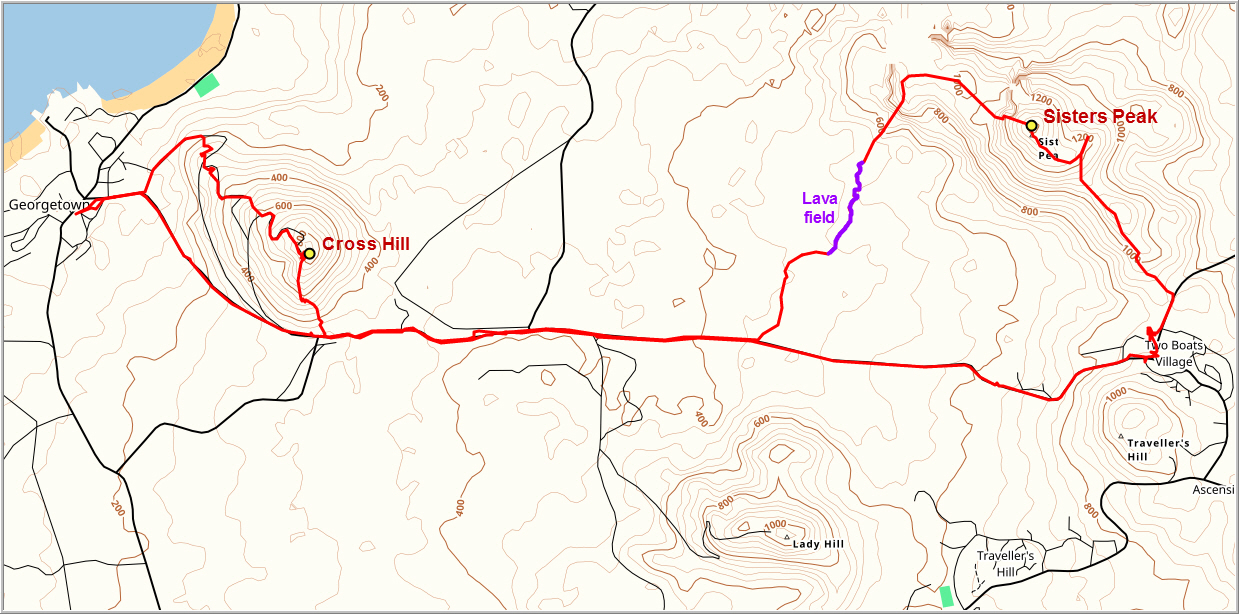
The Obsidian Hotel in Georgetown, with Cross Hill behind.
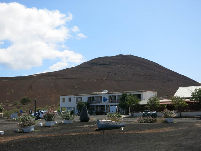
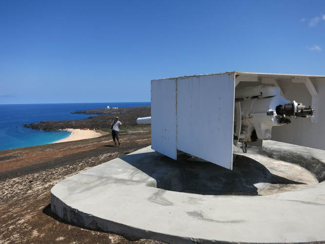
Ascension Island’s only football pitch! The breeding grounds of the famous Ascension Island turtles are right next door on Long Beach. The “golf ball” in the back is the BBC Atlantic Relay Station.
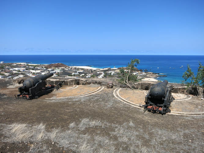
The Victorian Cannons overlooking Georgetown.
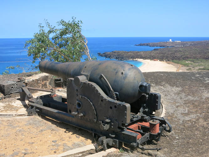
How did they get this heavy thing up here?
The more modern-looking cannons of Fort Bedford.
Tilo trudging up the volcanic rubble… this part of the island is definitely hot and barren!
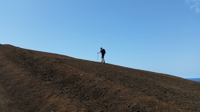
Tilo’s shot of me grunting up the scree slope.
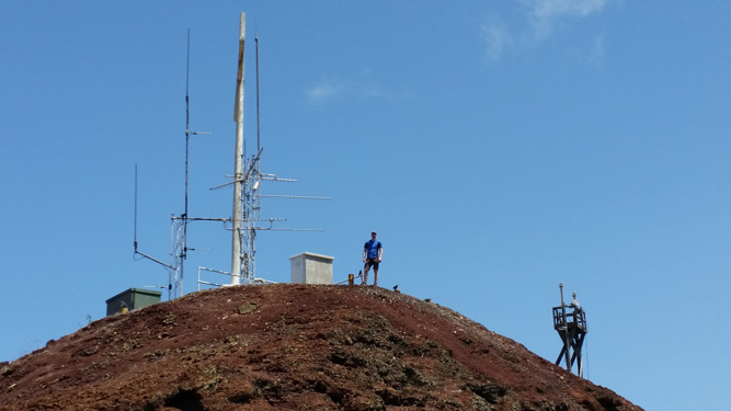
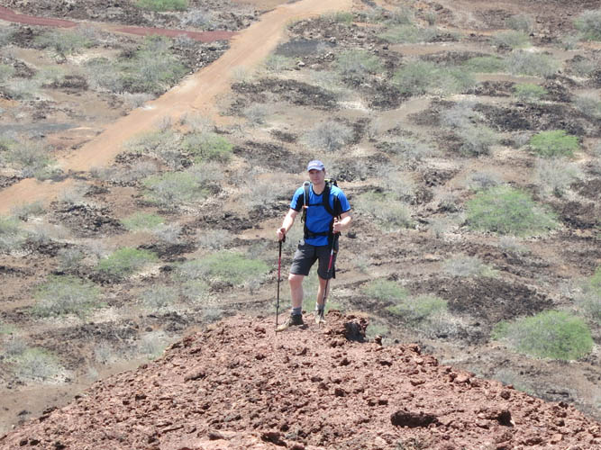
At the top of Cross Hill.
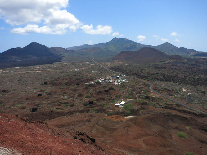
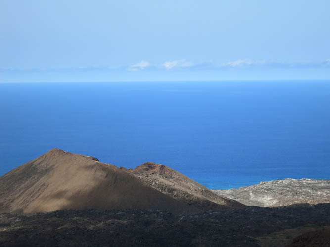
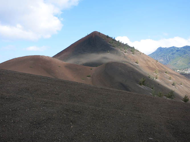
The view towards Green Mountain in the distance. On the left is Sisters Peak.
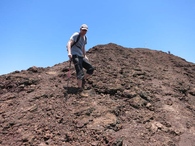
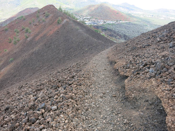
Heading down the south ridge.
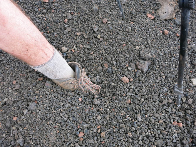
The terrain is loose and unstable – typical for volcanic sediments.
Tilo descending the ridge.
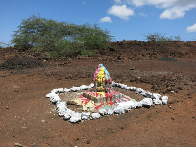
“The Rock” at the base of Cross Hill. Many years ago someone introduced a custom for all those expats who’ve been to the island far too long and never wish to return. On the day of their departure, they must dump a bucket of paint on this rock for their wish to come true.
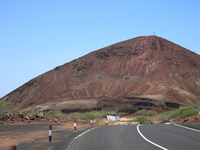
Cross Hill from the road towards Two Boats.
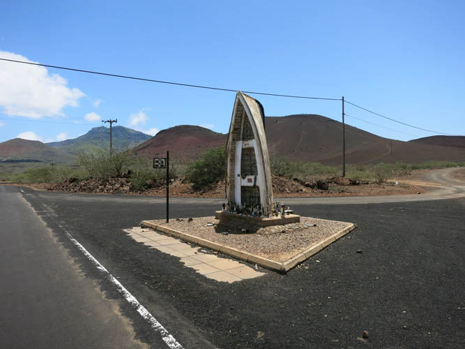
Between Two Boats and Georgtown is One Boat. It’s literally a boat sticking out of the ground at a road intersection.

Apparently, people from the local golf club adorn the boat with their trophies.
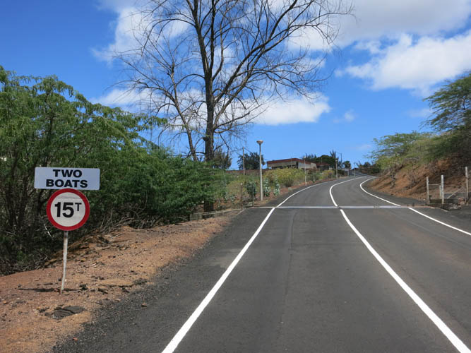
Two Boats is a proper settlement some 5 km east of Georgetown.
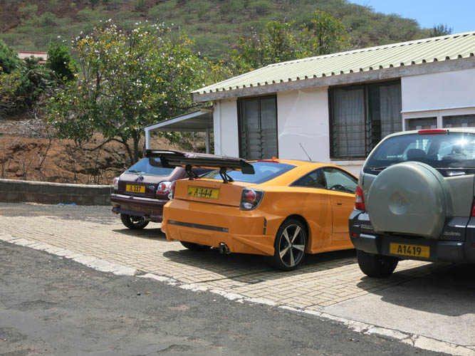
Even here some locals like to ride in style.
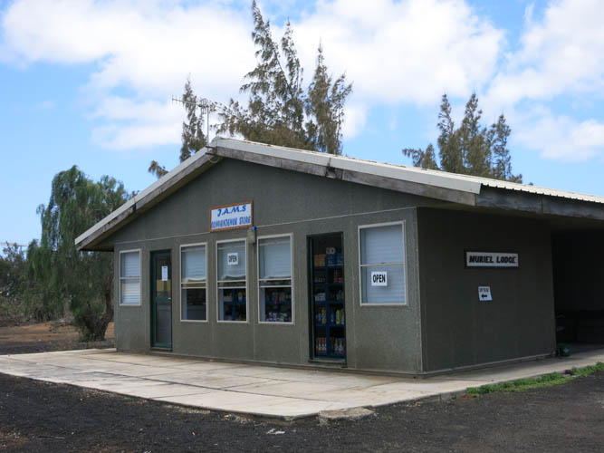
The only grocery shop in Two Boats.
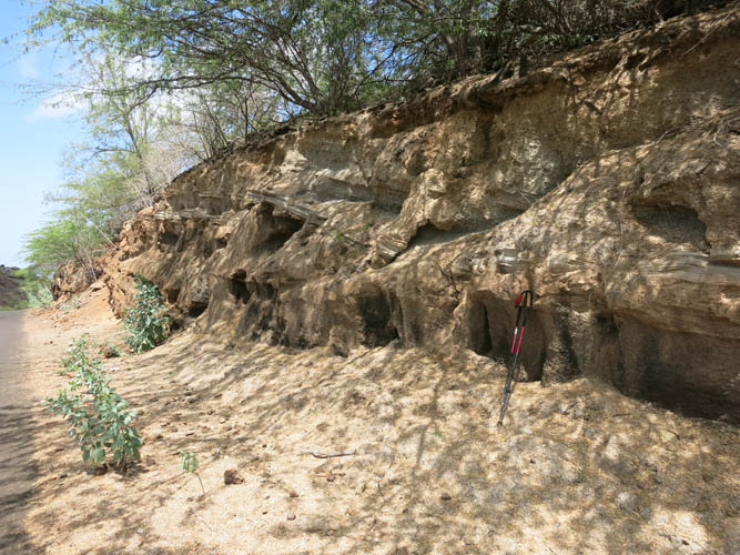
Interesting outcrop of stratified volcanic ash at a road cut.
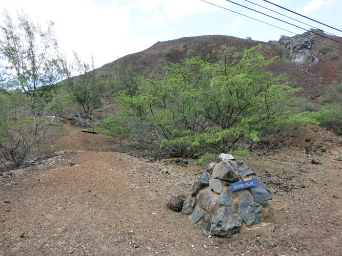
A cairn marks the start of the trail to Sisters Peak.
Looking back at Green Mountain and Two Boats below.
Paths have been scoured into the soft scree on the side of the mountain.
It’s a popular trail!
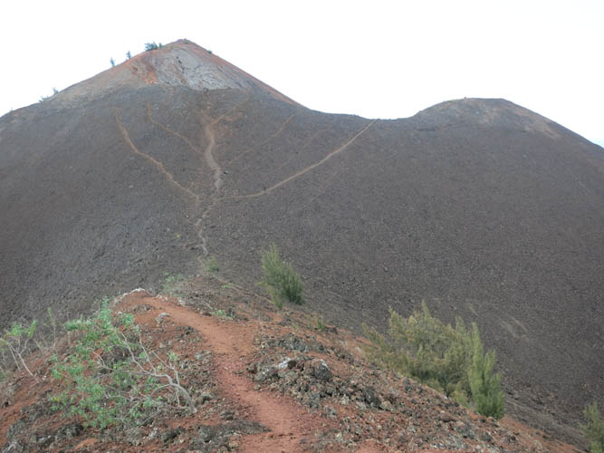
Looking NE towards “Broken Tooth”, a half-collapsed volcanic crater.
Some sections are quite steep.

Beautiful hues of red, brown and green.
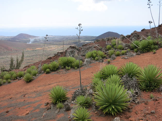
These plants only seem to thrive in one particular spot near the summit of Sisters Peak.
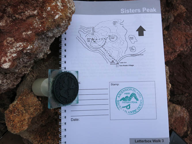
Summit stamp complete with logbook.
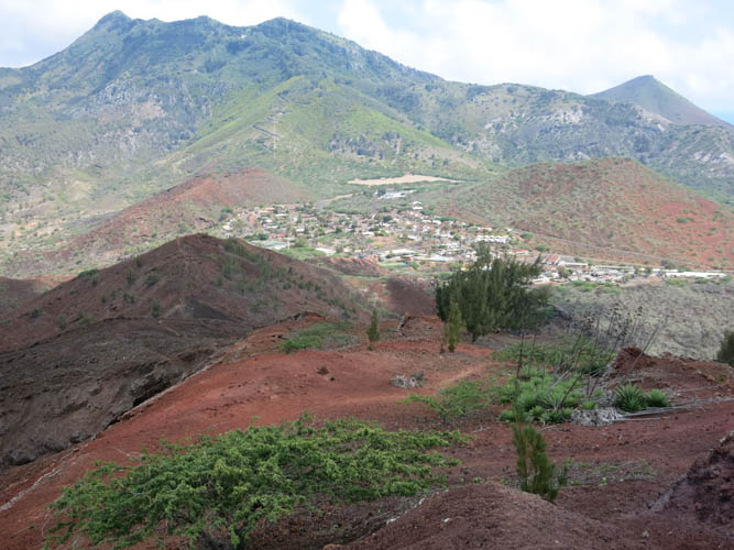
This is the way I came up. Two Boats is nestled between Green Mountain and Sisters Peak.

Impressive crater landscape to the NE.
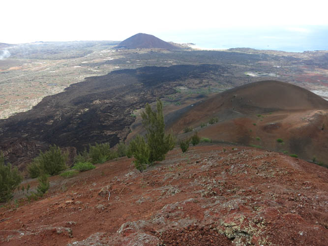
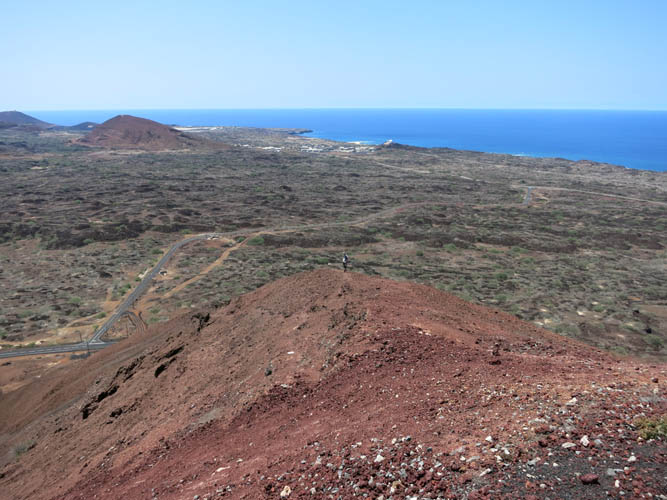
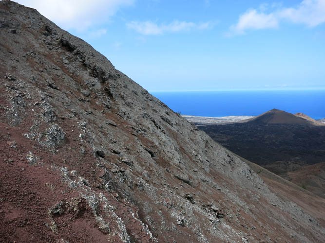
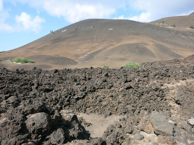
I head down the west side of Sisters Peak. The long, black band below is the lava field I will have to cross to get back to the road. Cross peak in the background.
Super fast scree skiing!
The rubble is soft and deep. Good boots and poles definitely help here!
Landforms are rarely craggy here. Because of the soft rock that breaks down so easily, the hills and peaks tend to take on rounded and smooth shapes.
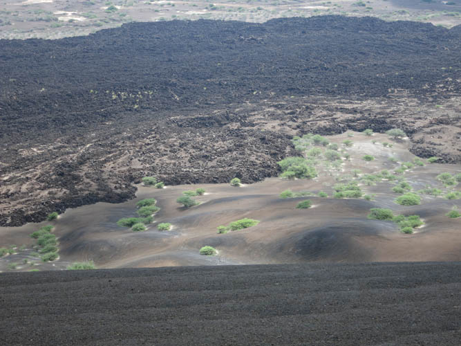
Looking down the black lava field.

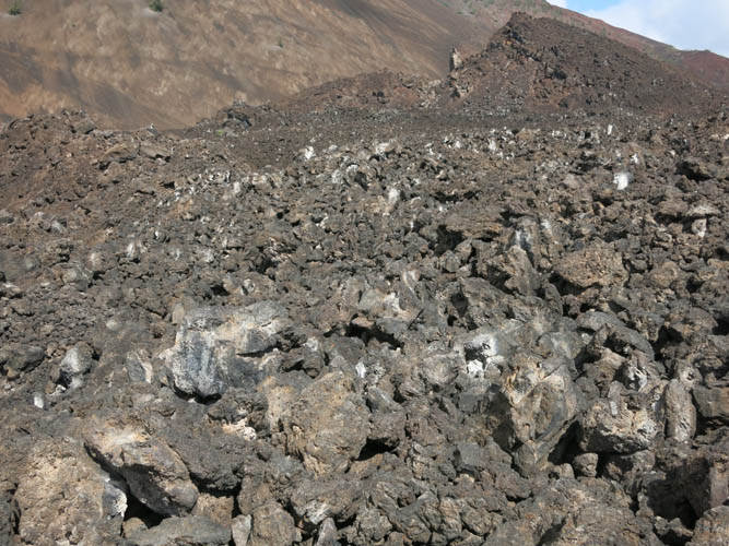
The terrain abruptly changes from smooth scree to jagged lava.
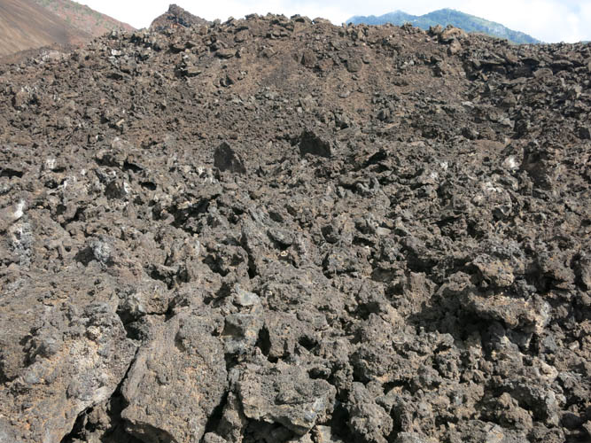
What a mess!
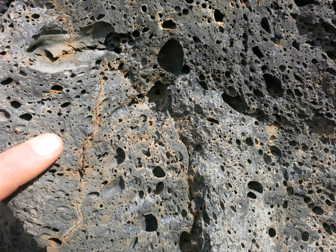
Gas bubbles in the molten rock have left large round pores behind.
It took me a few minutes to slide down the scree earlier (see white line in the middle of the hill), but now progress is painfully slow.
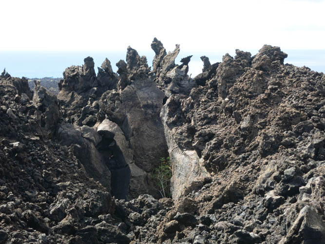
Wild and surreal looking formations hide in the lava.
Thankfully, this field is only some 100-200 metres wide, otherwise I would not have attempted it!
At the edge of the lava field on the other side.