20 August 2016: Attempt via W ridge. Didn’t quite make the summit, 400 m away!
17 September 2016: Successful ascent via N ridge/valley.
With Richard
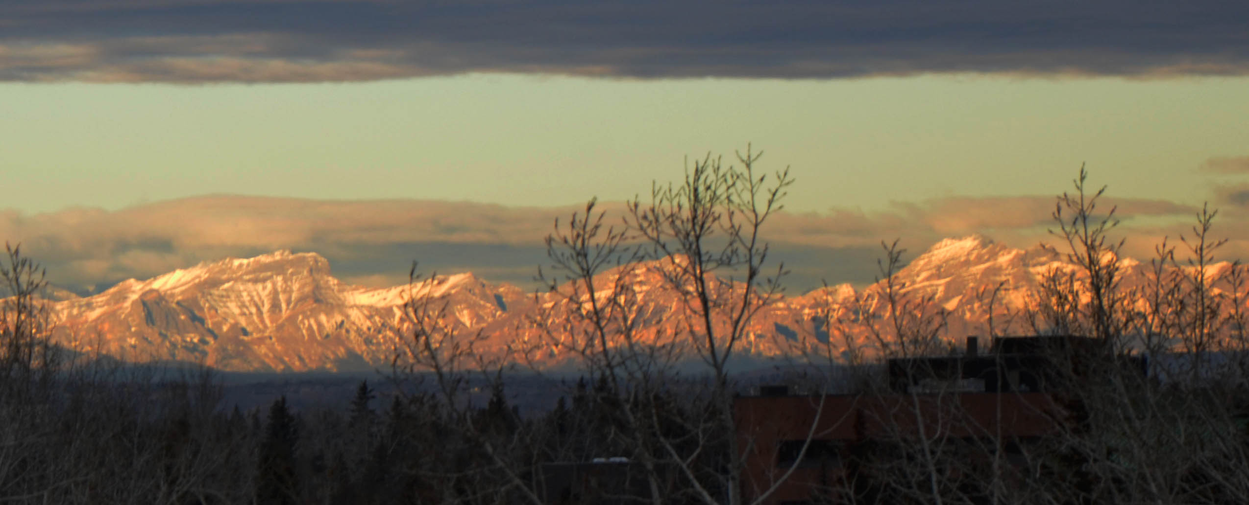
Winter panorama of front range mountains as seen from my balcony (February 2016). Saddle Peak, Orient Point, Mount Costigan (left to right).
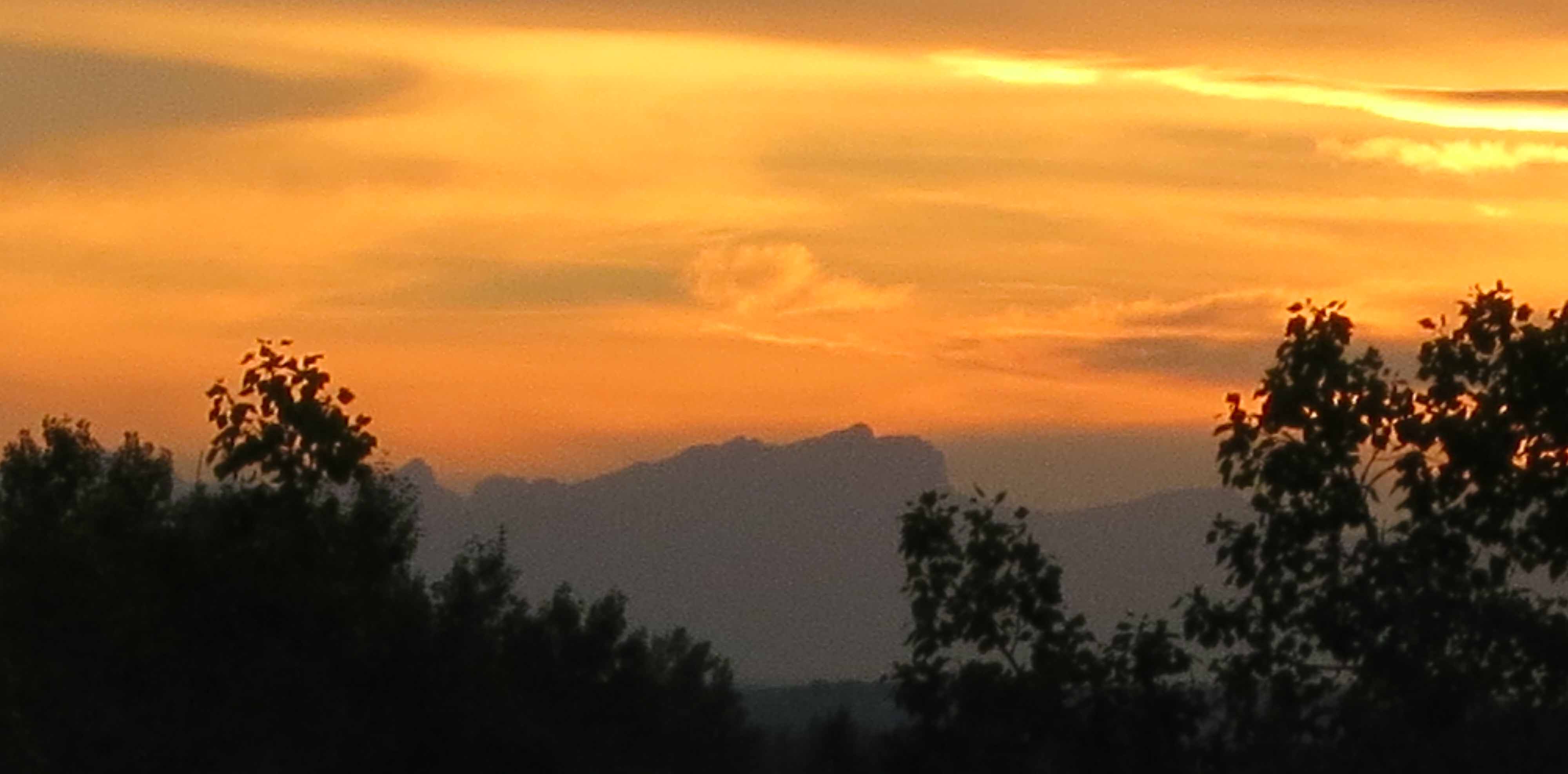
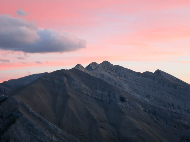
Saddle Peak at sunset, two days before our first attempt (August 2016).
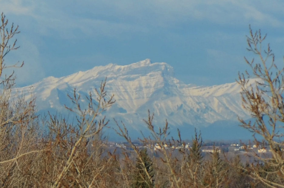
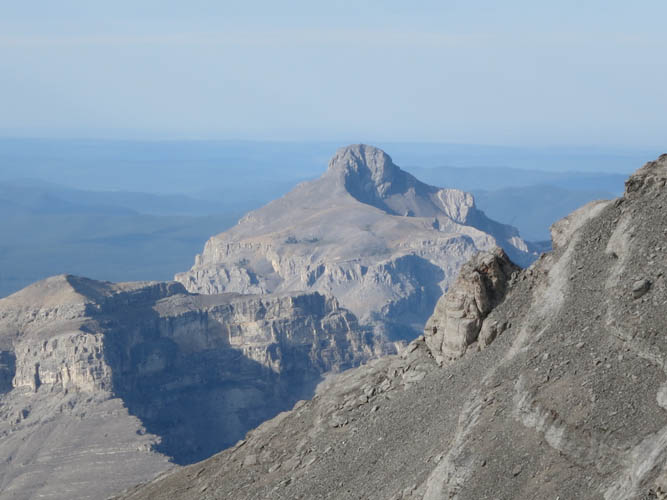
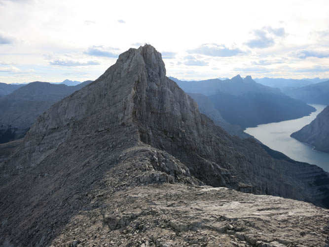
Close-up of Saddle Peak with its characteristic sharp drop-off on the right side (February 2015).
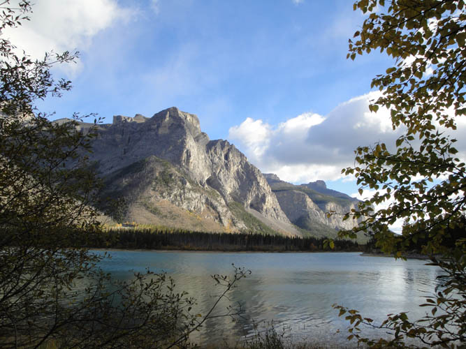
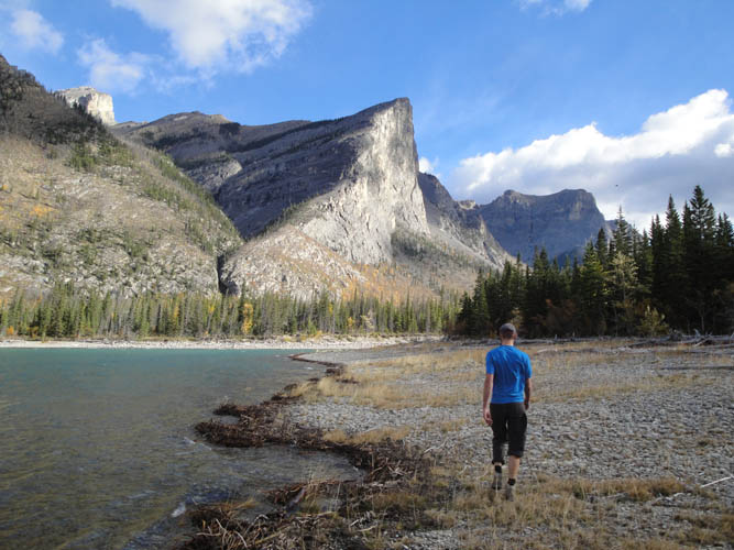
Saddle Peak has been teasing me for a long time. The characteristic shape of the mountain, with its sharp drop-off on the right side, makes this 2849 m tall summit an easily recognizable feature of the mountain silhouette when looking west from Calgary. And today, after years of staring at this big brooding beast of a mountain from my balcony in Calgary, Richard and I finally managed to climb it! Our modest accomplishment did not come without its fair share of trouble, pain and even failure, however.
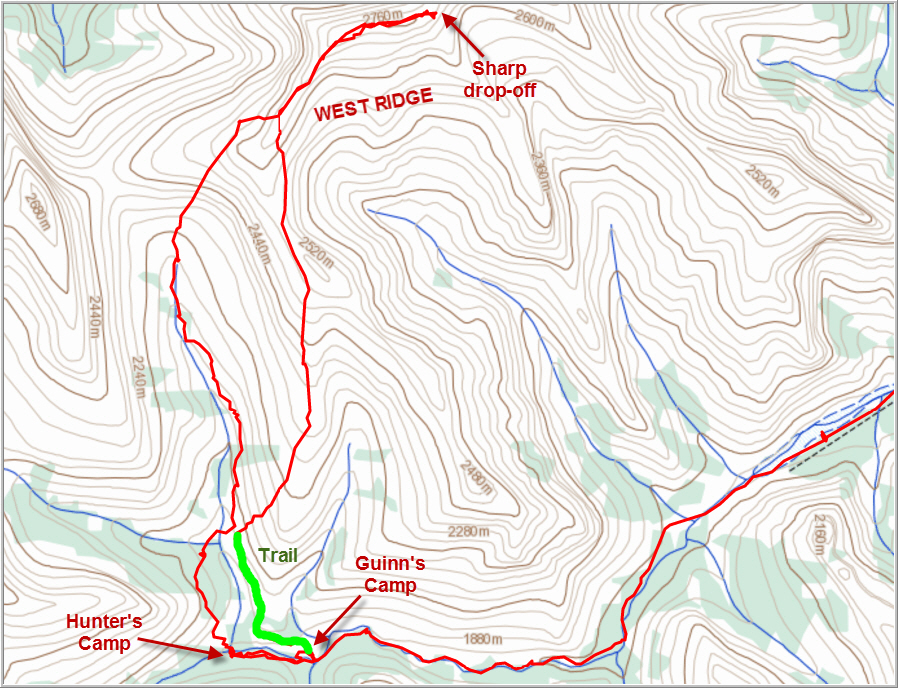
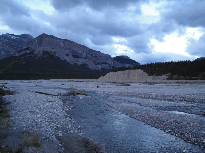
Our first attempt at ascending Saddle Peak was about a month earlier, the day before scrambling up Carrot Peak. Richard had graciously offered to join me on a weekend camping trip up the South Ghost River valley near the end of August. We had hiked up this barren, dried-out riverbed full of light grey pebbles – more of a wadi than a river! – for five hours before setting up our tent at a small hunter’s camp, about 15 km up the valley. Curiously, we had completely walked through Guinn’s Camp (GR227728), our original intended camp site, and continued another 500 m to find a site equally suitable for pitching a tent (GR222728), with a small creek only 20 m nearby. Guinn’s Camp itself is certainly bigger but appears to have been badly damaged in recent floods. It does still have an intact food storage contraption complete with ladder, though, something our camp didn’t have.
After setting up and having a quick lunch, we embarked on the possible scrambling route that I had sketched out based on prior research of photos from nearby peaks and by studying satellite images: the plan was to head up the valley to the north of our camp, then follow the west ridge which seemed to gently rise all the way to the summit (when viewed from peaks to the south, e.g. South Ghost Peak and Stenton Peak). I also knew that the late Rick Collier had attempted to reach the summit via the SE ridge, only to be turned around by a vertical cliff just before he reached his goal.
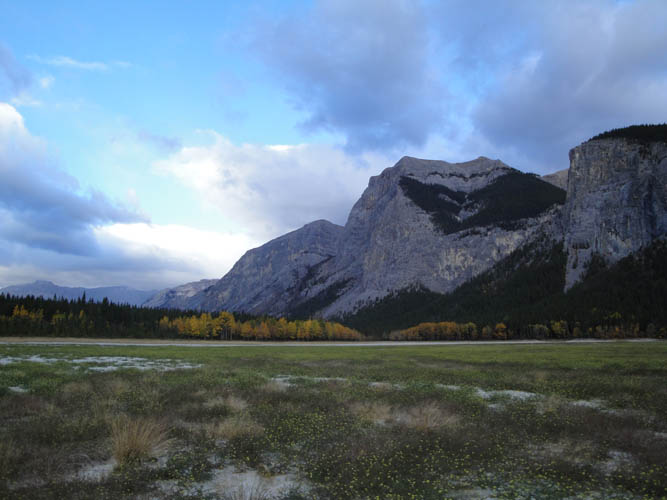
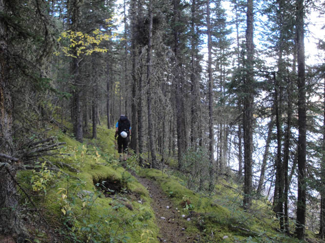
Today was just not our day. We immediately got off course when we erroneously followed a trail leading north that then turned west, the wrong direction. The consequence for us was a lengthy bushwhack through forest on the western hillside of the valley before we finally gained valley bottom after an hour or so. The route is described in Gillean Daffern’s Kananaskis Country Trail Guide Vol. 3 as an optional hike (#22A), but it seems even here the forces of the 2013 floods gushing down the valley have altered the landscape and hiking possibilities for the worse. We found hiking in the creek bed to be a terrible idea, with lots of shrubs and unstable boulders in the way. Instead, we followed a faint animal trail on the eastern side of the valley for a while, but it eventually petered out and we were forced back through the bush into the creek. Higher up, the going was easier and after ascending a wide, open, grassy slope we finally reached the high col with gorgeous views of Lake Minnewanka and all the impressive mountains towering around it. It was already 4 pm at this point and we had been hiking for a full 9 hours already.
A much-needed energy refueling break gave us the necessary push to embark on the long west ridge scramble, which we were hopeful we could complete in a couple of hours as an enjoyable ridge walk. Of course it was anything but easy! There were countless east-facing cliffs along this ridge (most unseen when approaching from the west) that required us to constantly backtrack and regain unnecessary elevation loss. The scrambling was tricky in places on unstable, rotten rock – mostly moderate to difficult in terms of technical level. There were no animal trails to guide us, so no wonder everything was loose and crumbly. What made it worse were the many false summits: I remember counting at least four. Every time we thought we had the summit in sight, it was a false alarm and our high hopes were dashed again. We kept going like that for quite some time, increasingly concerned about being out here so late. By the time it was 6 pm we finally arrived at the last false summit and could see the main peak ahead of us with a small summit cairn on top. It was only 400 m away, but there was a nasty-looking vertical knife-edge ridge right in front of us. I carefully scrambled along the downsloping flake, perhaps half a metre wide, to another point some 100 m ahead while Richard stayed behind. It was probably with a mixture of disappointment and relief when he heard me shout back to him what I found: the ridge ended in a 20 metre vertical precipice at a massive cliffband that wrapped around the ridge on both sides, with no way to scramble it down safely. This was definitely roped climbing terrain, so after taking some pictures and staring at the summit in front of me for a minute I turned around and joined Richard for our long descent back to our camp.
We found a more efficient route along a grassy ridge back down to the valley, which greatly alleviated our return despite running out of water half way down. It wasn’t until 10pm that we reached our camp – thirsty, exhausted, and slightly vexed about putting in all that effort with no summit to show for. Nonetheless we both agreed that it had been a hugely rewarding adventure and we had enjoyed exploring these remote valleys and ridges and challenging ourselves both physically and mentally in the process.

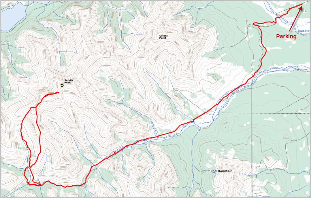
DISCLAIMER: Use at your own risk for general guidance only! Do not follow this GPX track blindly but use your own judgement in assessing terrain and choosing the safest route.
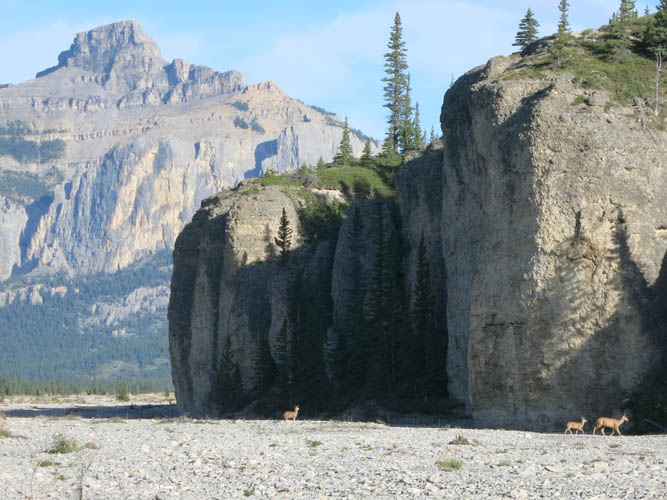
Deer cross the completely dry Ghost River in the early morning. Phantom Crag in the background.
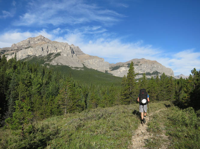
The first part of our hike is on a very good trail. Orient Point can be seen on the left.
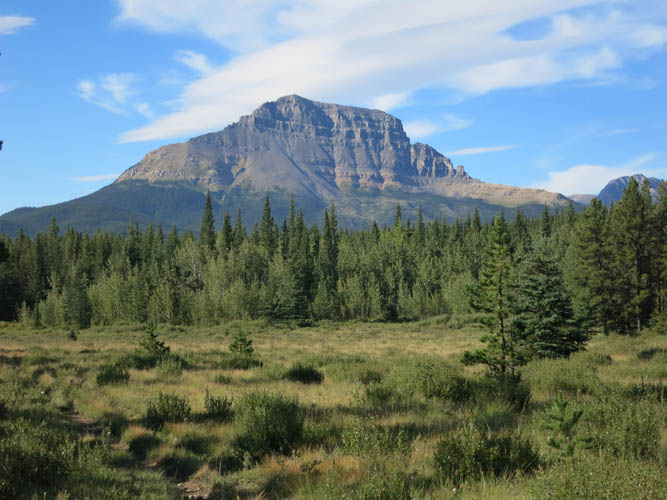
Lovely meadows with End Mountain as a backdrop.
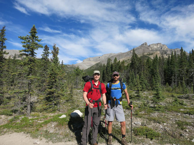
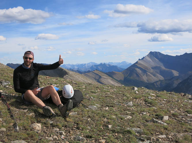
One of the rare pictures we have of the two of us!
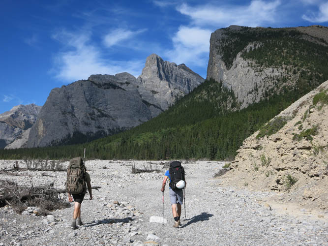
We meet a hunter, who joins us on the 3-hour plod up the barren South Ghost River bed.
The old road, seen here in the foreground, has been washed out in most places.
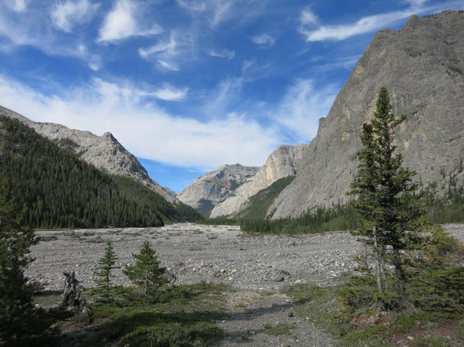
Huge cliffs flank the valley on the right.
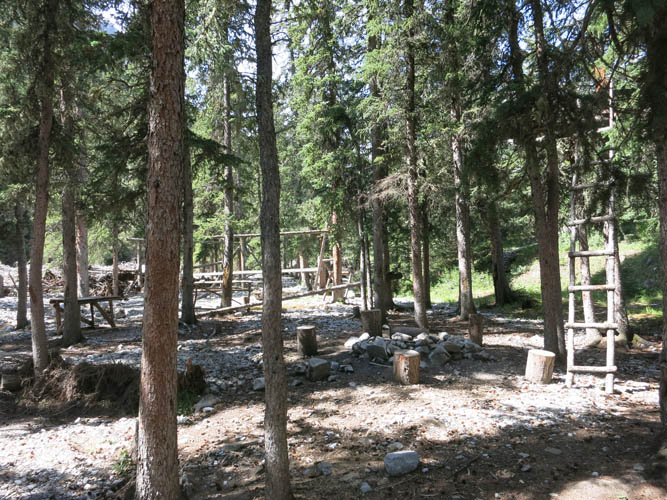
Guinn’s Camp.
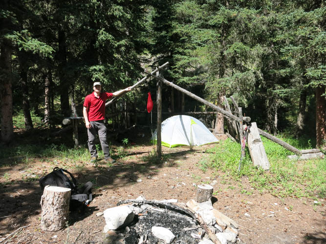
A smaller site about 500 m further west, where we decided to set up camp.
We start out on the wrong side of the N valley. You can see an existing trail on the other side, where we should’ve started (this was our descent route).
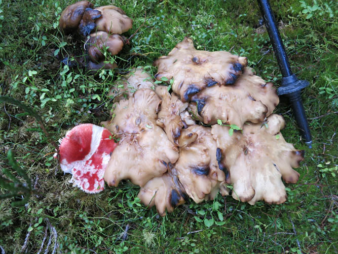
Strange mushrooms abound in the lush forest.
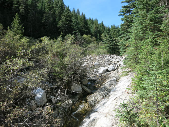
In the creek bed of the N valley, progress is initially slow owing to lots of shrubs and deadfall.
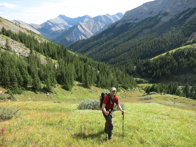
In the upper part of the N valley we ascend a wide grassy slope without obstacles.
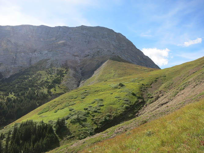
What a beautiful landscape here. Reminds me of the Swiss Alps.
Almost at the top of the high col.
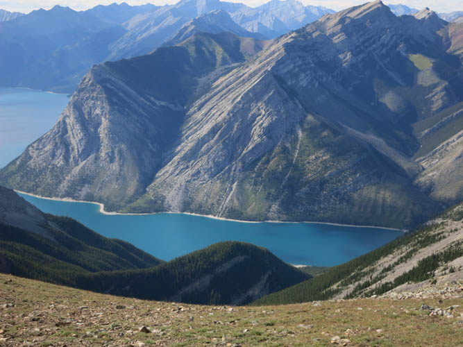
After a few hours of slogging, we are rewarded with this view of Lake Minnewanka to the north.
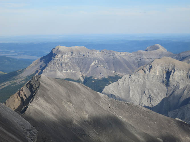
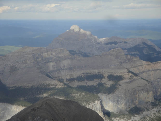
Impressive Mount Costigan lies north of the lake.
This is probably the mental high point of the day… after this, the challenges started piling up!
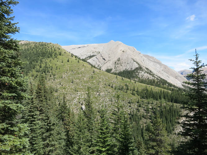
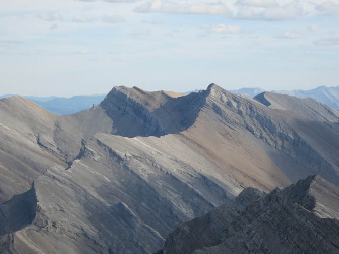
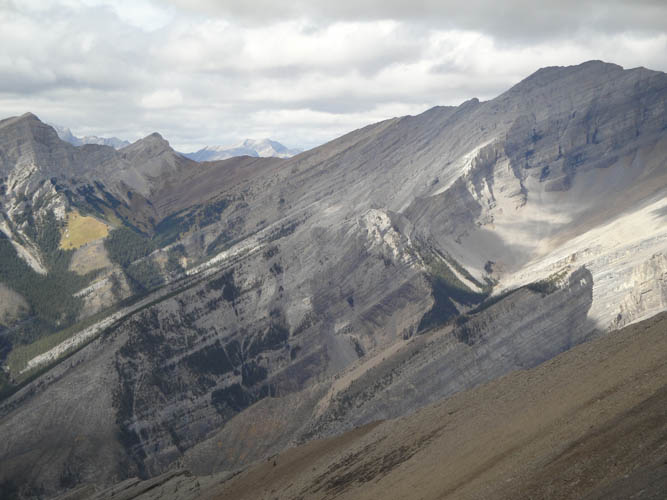
Mount Townsend (left) and Stenton Peak (right) in the distance.
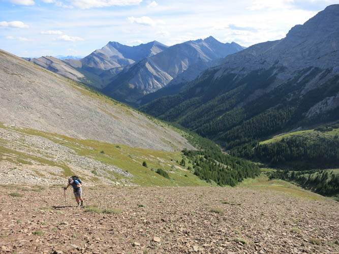
We start up the west ridge. Here is the first scrambling of the day on fractured but solid rock.
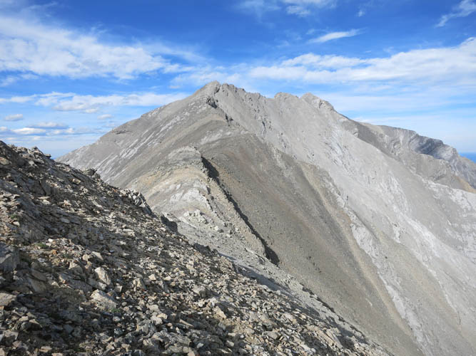
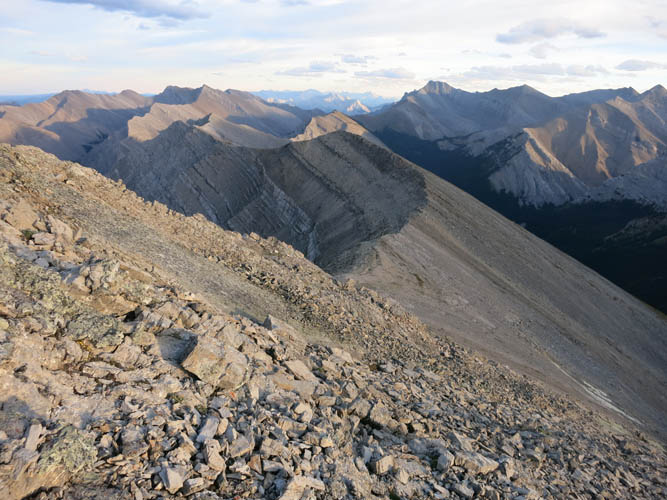
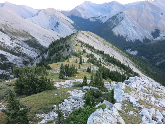
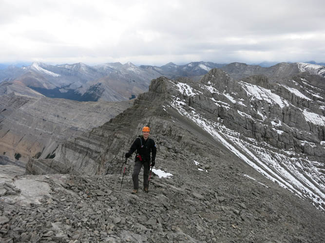
View of the ridge looking east. Lots of ups and downs!
A look towards the SE.
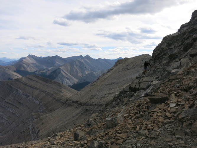
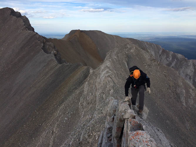
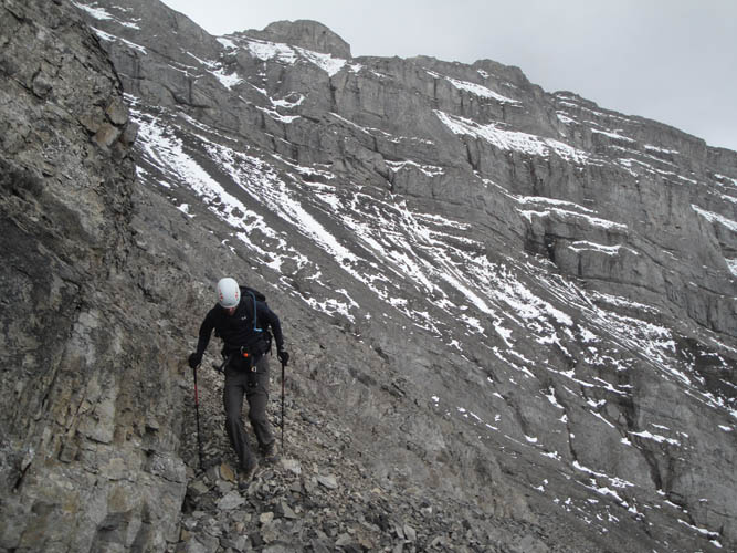
The ridge narrows and the terrain gets steeper and the rock crumblier. Richard is slowly scrambling around a cliff here.
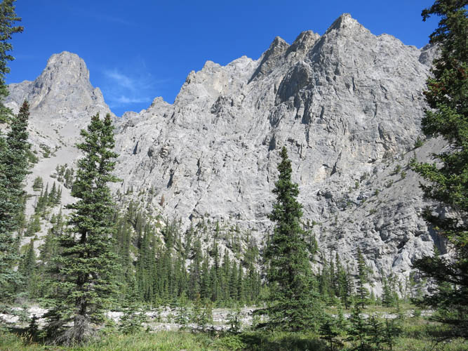
South Ghost Peak to the SE. I took a photo from the opposite vantage point exactly 3 years ago.
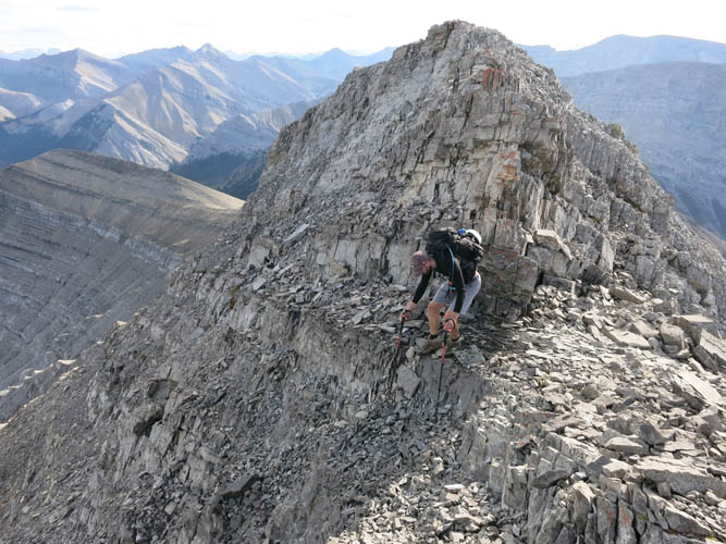
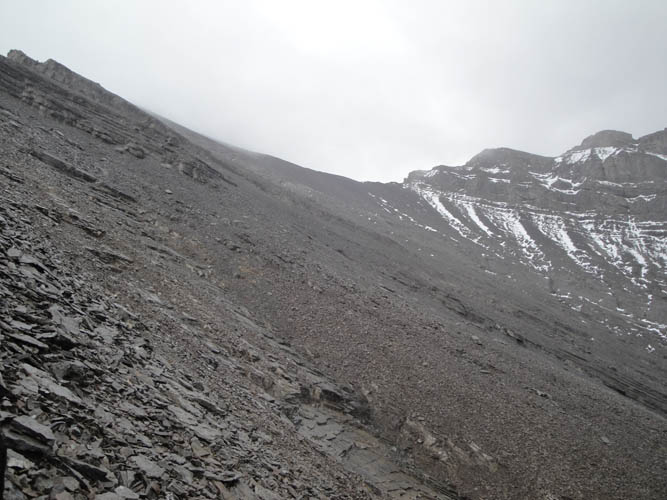
The west ridge holds many surprises in store for us: lots of drop offs on the east side require careful downclimbing or time-consuming bypassing on the right (south) side.
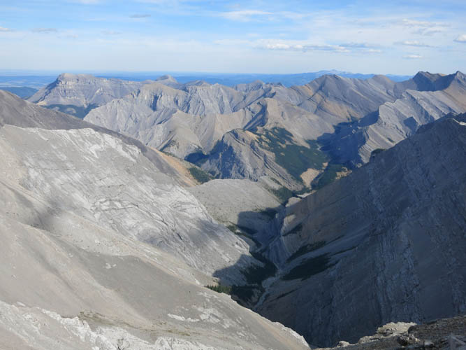
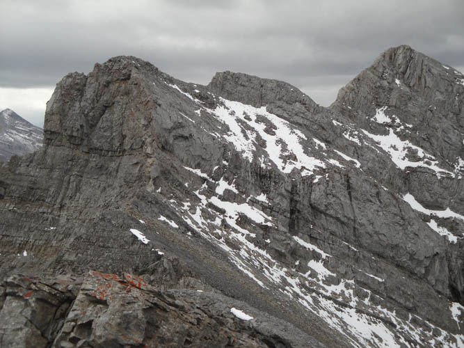
A sweeping view of the long ridge connecting End Mountain (left) and Association Peak (right).
Lake Minnewanka gets bigger the higher we climb.
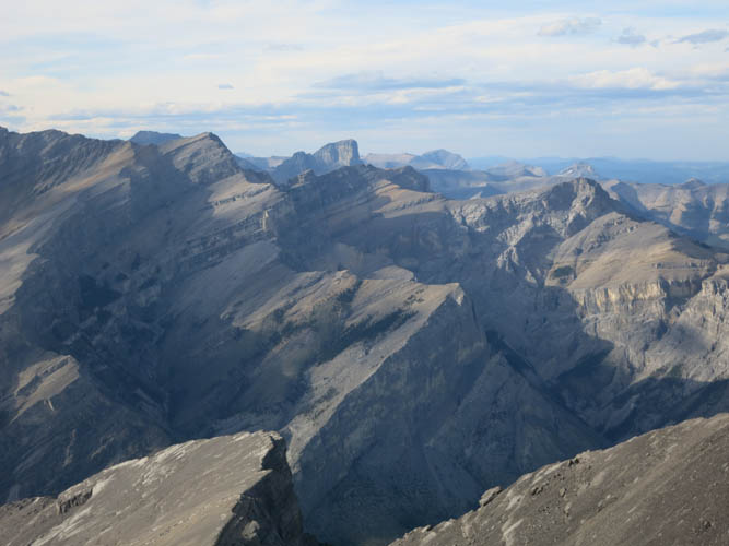
To the north are a myriad of peaks, all with west-dipping strata as is typical for the Front Ranges.
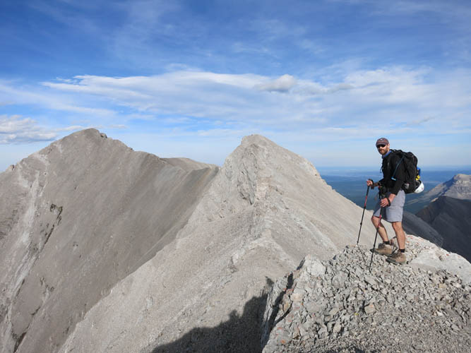
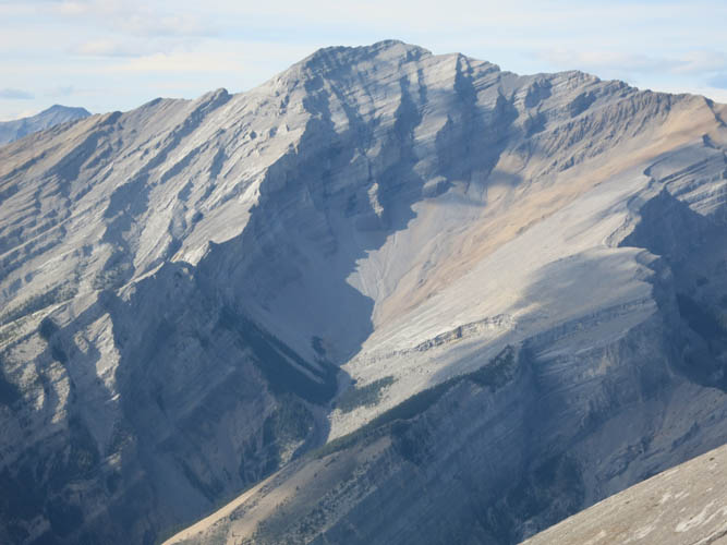
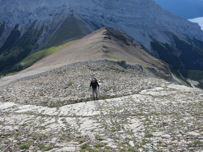
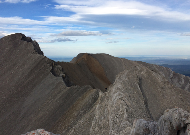
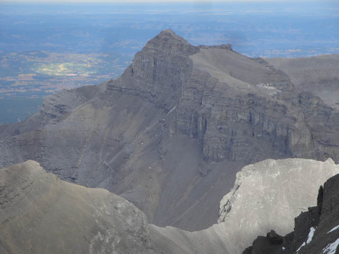
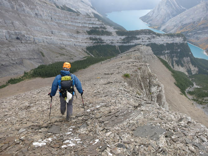
After several false summits, the true summit of Saddle Peak finally comes into sight on the far left!
A narrow and exposed spine appears to be the last difficult hurdle.
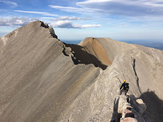
The summit is tantalizingly close!
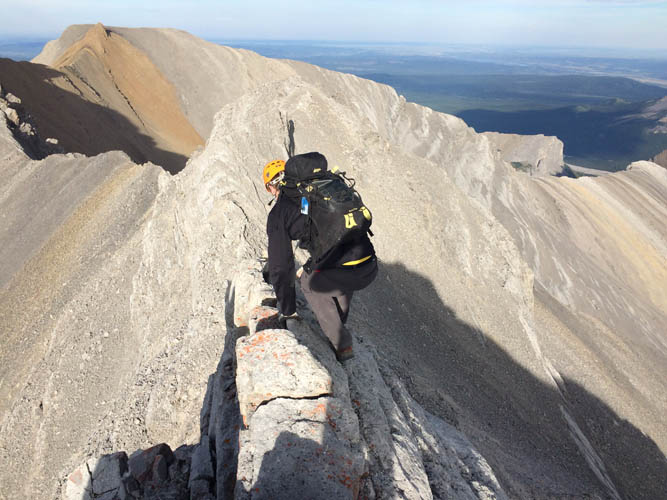
But this is as far as I get, while Richard is waiting for me before the narrow vertical spine. A huge vertical cliff separates me from the rest of the ridge to the summit.
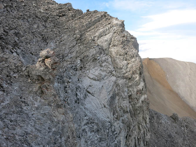
Part of the cliff on the south side. No scrambling here!
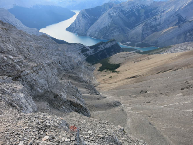
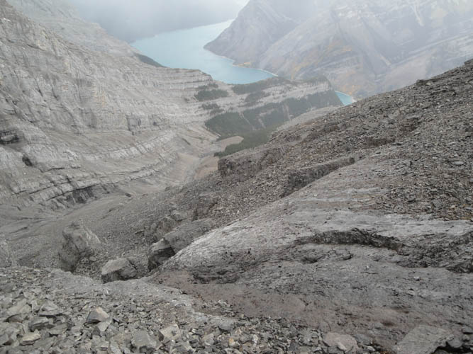
Scoping out the valley to the north, which would prove to be our successful ascent route a month later.
Richard at the top of the crag before the spine.
No choice but to return. It’s already past 6pm and the sun is starting to set.
On our return, we chose a more pleasant route along this gentle N-S trending ridge.
Here is a look back (north) at the undulating west ridge with its many bumps and drop-offs.
Our descent ridge is a pleasure compared to the crumbly, rotten rock we had to contend with on the W ridge.
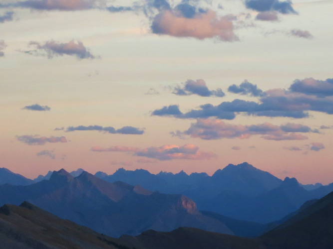
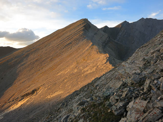
Alpenglow.
Sunset in a most tranquil and scenic place.
17 September 2016, Successful ascent of Saddle Peak
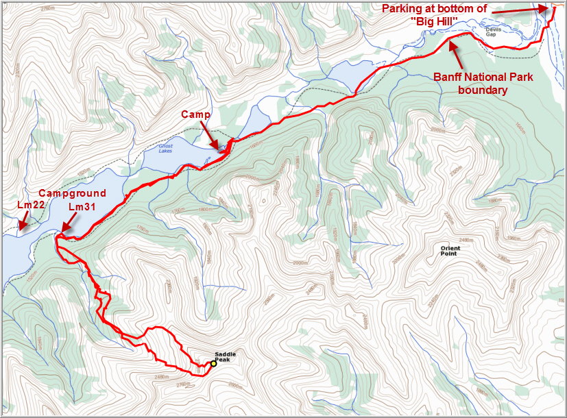
Failure offers an opportunity for success. This opportunity came four weeks later when both of us had time for a weekend exploration trip again. This time we approached from the Lake Minnewanka side to the north of the mountain. There was a basic description by Rick Collier and Mardy Roberts, who had successfully ascended Saddle Peak in what was called a “possible first ascent” of the mountain on 14 June 1993 (they found no cairn on the top). Their route originated from campground Lm31 by the lake and then led up the north valley. There wasn’t much detail however – the route was simply described as an easy ascent with some bushwhacking lower down and scree and snow to the top. I can now say that it is certainly much more involved than it sounds!
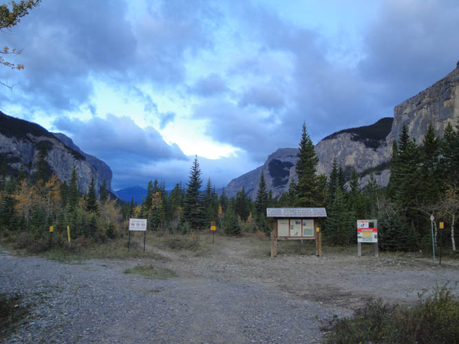
With the days getting shorter in mid-September, Richard and I decided on an “early” start, leaving Calgary at 6am on Saturday, September 17th. We parked our car at the bottom of the “Big Hill” at the end of the TransAlta Road in the Ghost and started hiking, fully loaded up with camping gear, at 730am on the dot. This was one of the times when I wished I had a full 4WD like a jeep or G-wagon as that would’ve allowed us to drive through the shallow river (the water was barely up to our ankles) and all the way to the Banff National Park boundary on reasonable gravel roads. But it didn’t matter – we both quite enjoyed the hike, having never been to this area before, and time just flew by while we chatted. There is a really good horse trail that leads from the park boundary to the Ghost Lakes, where the path splits. We took the left arm and continued for another 2 km before dumping our camping gear and having an early lunch after about 2.5 hours total hiking time.
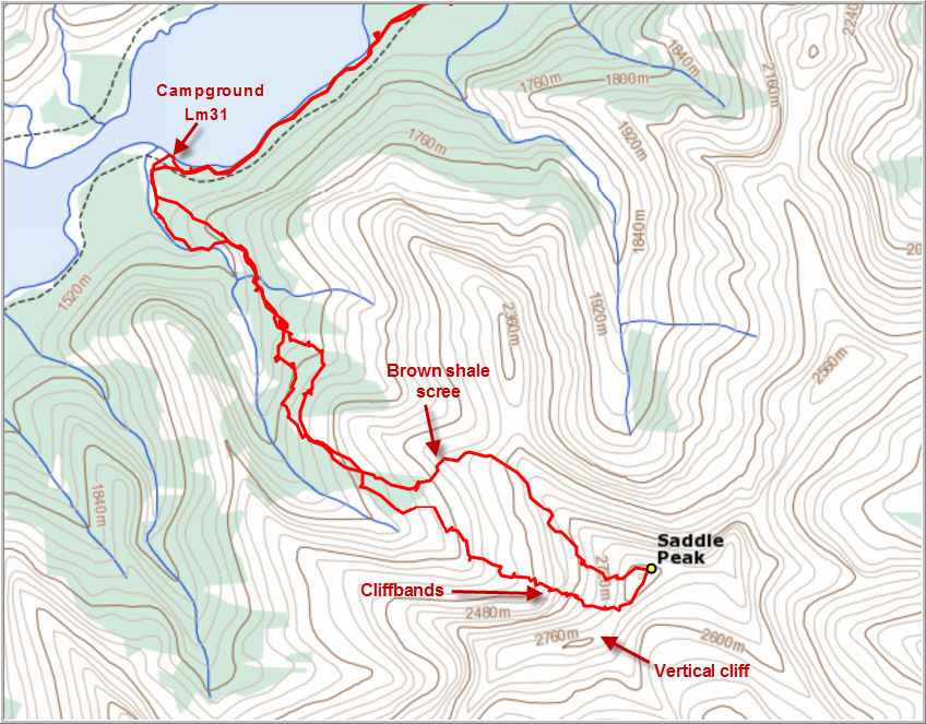
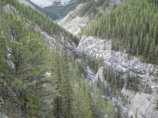
When we set off around 1030am, our spirits were still high: our bags were much lighter having left our tents and sleeping bags behind, and we were happy we still had the whole day ahead of us for our climb. But our motivation soon started to crumble… After leaving the good trail at campground Lm31 on the south shore of Lake Minnewanka, we first bashed up a rubbly creek for a few hundred metres and were then forced into the forest on the east side as the valley narrowed significantly and short but steep cliffs with waterfalls started to appear. We started sidesloping in the forest, with light to moderate bushwhacking, trying to bypass the waterfalls below us, but the obstacles in the narrow creek appeared to multiply as we got higher. So we ended up sidesloping for the next three hours, traversing numerous washouts and scree slopes along the way that were tricky to varying degrees but all very unpleasant on the feet. A month earlier, when we had looked down this valley from the ridge near the summit, it had all looked so easy and innocent! And there we were, fighting our way through the trees and across slippery slopes of rubble. After about half the elevation was gained, we finally caught up with the creek bed, which had by now diminished into a slabby gully with just a trickle of water flowing down the middle. At least we had no shortage of water here! The step-like slabs in this gully were the only section of scrambling that was actually enjoyable, but it was far too short. Soon, we were faced with a series of cliff bands. The terrain looked complex and intimidating from below, but as usual if you break it down there is normally an easy or at least manageable way through. Patches of fresh snow certainly made it a bit more challenging that it would’ve been in dry conditions. We stuck close to the centre of the gully and enjoyed some more difficult hands-on scrambling to overcome the cliffs. After that it was all miserable scree and loose blocks of sharp rock the entire way to the summit ridge. We looked up the steep cliff along the ridge that had thwarted our summit bid a few weeks earlier – definitely not in the realm of scrambling! Fortunately, from where we were now, it was just an easy plod up more scree to the top.
Waiting for us at the summit was a very weathered-looking cairn with a black plastic register. The booklet inside bore the names of only two parties in more than 23 years: the original ascent party in 1993 (Rick Collier/Mardy Roberts) and one other person in 1998. Quite astounding, given the prominence of this mountain in plain view of more than a million people!
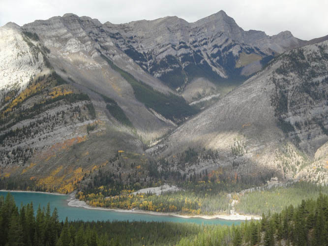
Despite the lengthy and arduous ascent, we were hugely elated to be sitting on top here. As expected, the views were wonderful from the summit, which sits at just under 2850 m according to my GPS. We could look down the entire length of the South Ghost River valley to one side, from Stenton Peak to End Mountain, and down Lake Minnewanka on the other, with Mount Costigan and Mount Aylmer behind. Even Blackrock Mountain and Devil’s Head were clearly visible from here. In the west dark clouds were moving in fast and we could feel the temperatures drop and the wind picking up. Time to get down!
Unfortunately, there was no quick and easy way down this mountain. The scree was terrible for scree-skiing and hiking down was basically just as slow as going up. To avoid the difficult cliff bands in the centre of the gully we stuck more to the right (east) side of the upper slopes on descent. There were some scree ramps that elegantly zig-zagged through the cliffs and easily brought us to the lower brown shale slopes where we enjoyed a very short stint of scree sliding back to treeline. The remainder of the descent was almost as tedious as going up: sidesloping, bushwhacking, sidesloping, tiptoeing over steep washouts, and more bushwhacking and sidesloping. We made it back to the the lake and our gear just as the sun was setting around 830pm and then hiked for another half an hour before calling it a day. We had at least another 5 km to go to reach the campground we had booked, but we were cold, tired, and it was completely dark now (Lm31 would’ve been our preferred spot, but that campground was closed due to a bear warning, so we had booked campground Lm22 on the north shore instead). After erring around for 20 minutes trying to find the trail to the north shore of the lake in the dark, we gave up and decided to set up camp. There was a nice flat spot on a small peninsula jutting out into the lake, a pretty decent spot to pitch a tent. By the time we finished dinner it was 10pm, but then Richard pulled out his surprised treats: marshmallows and a flask of whiskey to celebrate our accomplishment! A long and strenuous day had come to an end and we certainly felt both relieved for putting this ordeal behind us and content for having finally conquered this beast.
As post-script to those interested in climbing Saddle Peak: Overall, I would not rate the route we took as technically difficult if you’re adept at route finding, especially if you choose our descent route for both going up and down through the cliffbands. On the other hand, it is a LOT of work to get up there and it’s not exactly enjoyable. There is simply too much scree, too much sidesloping and too much bushwhacking involved, so I really can’t recommend it to anyone.
DISCLAIMER: Use at your own risk for general guidance only! Do not follow this GPX track blindly but use your own judgement in assessing terrain and choosing the safest route.
A month later and a few hundred metres further north, there is some water in the Ghost River bed but we manage to cross over logs and rocks with our boots on.
Entrance to Banff National Park at Devil’s Gap.
The first dried out Ghost Lake.
A good trail leads along the south shore to campground Lm 31.
The second Ghost Lake.
We are the only people around.
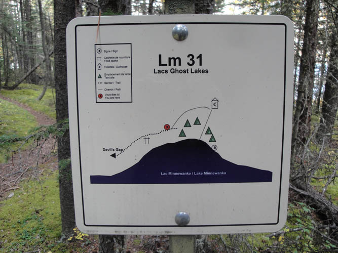
Entrance to campground Lm 31. It was closed at the time due to a bear warning.
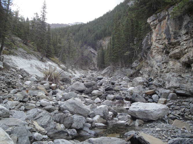
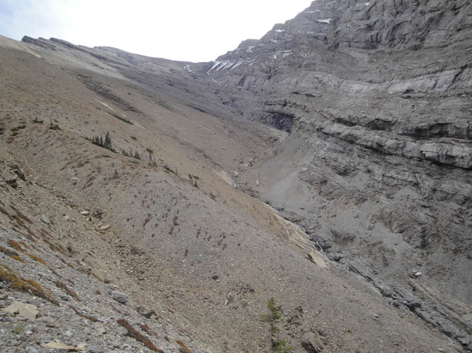
The lower part of the ascent drainage.
Soon we are forced high up the left (east) side above the drainage, which is now full of cliffs and waterfalls.
Fall colours are starting to appear.

Lots of cumbersome sidesloping through washouts.
In the upper part, the valley opens up.
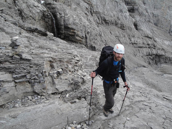
The gully offers some enjoyable but short-lived hands-on scrambling.
Looking back at Mount Costigan.
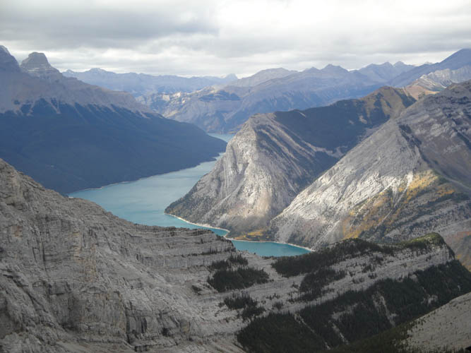
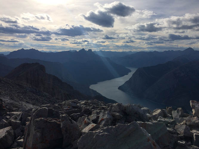
Lake Minnewanka.
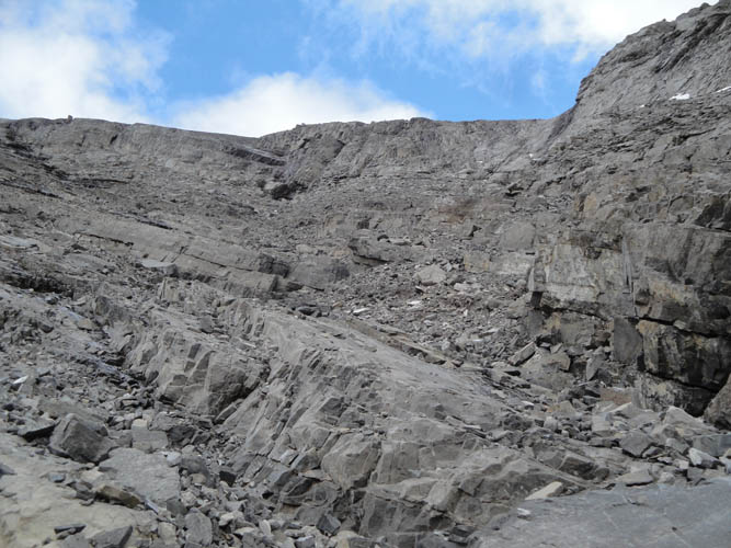
The terrain gets complex with steep ledges and cliffs.
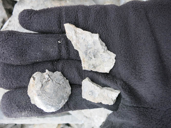
Fossils in the rock: a whole brachiopod.
The last part is a slog on miserable chunky rubble.
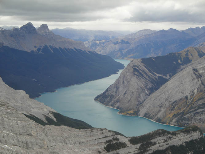
Fine views of Lake Minnewanka.
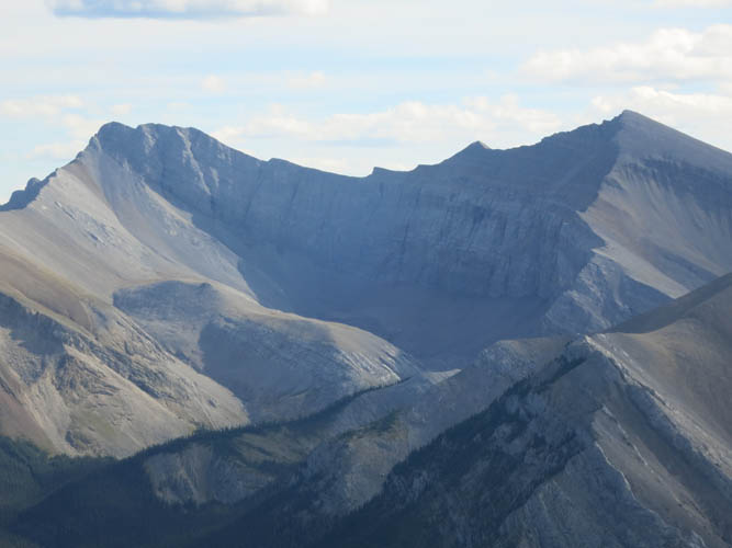
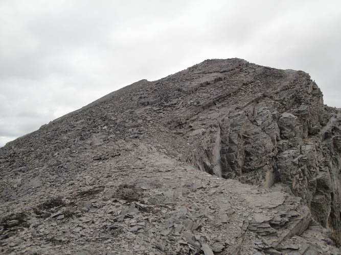
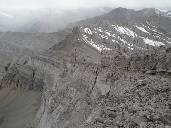
Finally on the summit ridge. This is the cliff that thwarted our summit attempt a month earlier (looking west).
Happy to be almost there!
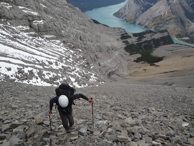
The last section is a simple plod up a scree slope.
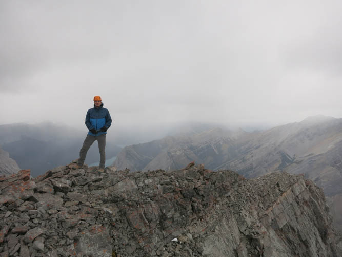
On the summit of Saddle Peak.
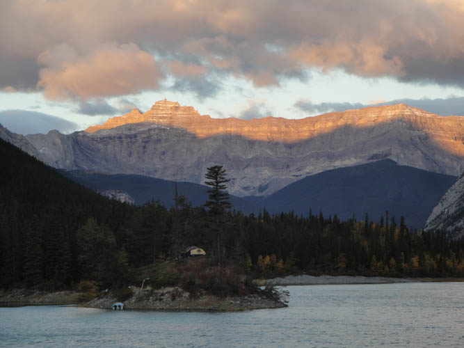
The tip of Blackrock Mountain catches the last rays of sun before the clouds move in completely.

On the horizon far in the distance to the SE is Moose Mountain.
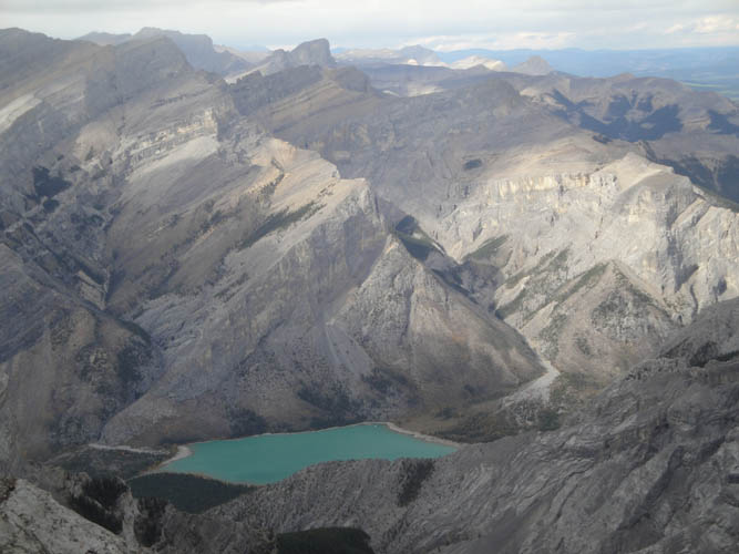
One of the Ghost Lakes to the north.
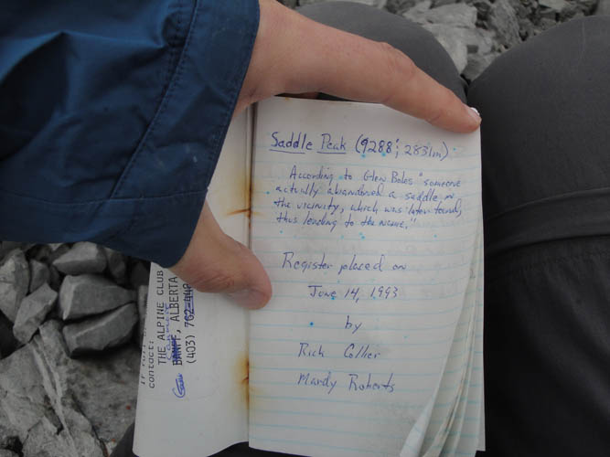
The original summit register and first entry by Rick Collier and Mardy Roberts from 1993.
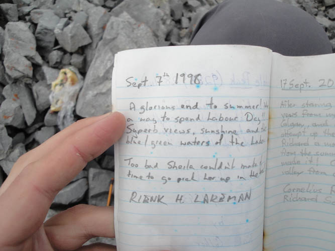
And the only other entry – 18 years ago!
A look a the steep drop off on the south side of the west ridge.
The clouds have moved in… time for descent.
Working our way back through the cliffs.
Lots of scree. We found no cairns and no animal trails anywhere.
It’s a long way back to the lake!
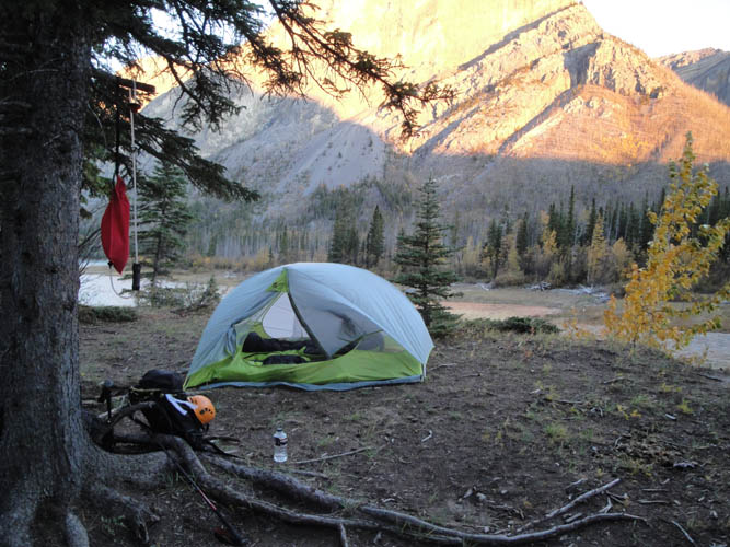
I took this shot of our improvised campsite the next morning. What a windy place, the tent was rattling the whole night! That’s what happens when you have to find a spot to camp in the dark.
Mount Pechee at dawn.