5 November 2016
Solo
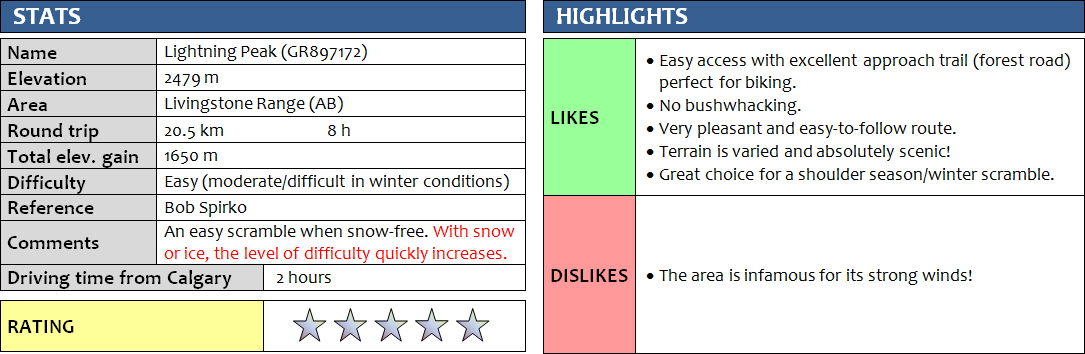
There is almost nothing I didn’t like about this trip and this is indeed one of the finest outings I’ve had this whole year. Bob Spirko recommends “Lightning Peak” as an enjoyable scramble, and how right he is! He is also the one who first found and described a straightforward route up the mountain from the Forestry Trunk road, and who gave the peak this very fitting name. Lightning Peak sits about half way between Thunder Mountain to the north and Center Peak to the south along the arrow-straight Livingstone Range.
There was neither thunder nor lightning, fortunately, when I went up the mountain in early November. Instead, I had a simply brilliant day with sun, blue skies, and a balmy 12 degrees when I set out in the morning.
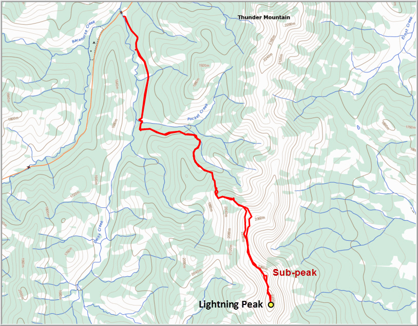
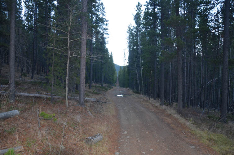
The description Bob Spirko provides on his website is spot-on. I biked the first 4.5 km along narrow forest roads. The first 3 km were more or less flat, with a few ups and downs across two small streams that I either rode through or rock-hopped. The second stretch was in excellent shape, a flat, gently rising road that’s perfect for bikes (especially the fast ride down!). I stashed my bike in the trees at the start of the drainage (cairn) and followed it on the left-hand side for >200 m, where another cairn and orange flagging marks the start of the “spur” – basically a faint trail that leads up the crest of a treed ridge.
From here on, the rest of the route is obvious. I followed the treed ridge, always sticking to the highest part and guided by a few cairns and a hint of a path here and there. The route took me past the “bluffs”, through a short section of light forest, and up to a small viewpoint from where the rest of the way up to the main ridge can be seen. Amazingly, there was almost no snow along the entire length of this hike. Instead of crossing a small gully to a parallel ridge higher up, as Spirko suggests, I stuck to the ridge I was on and followed it almost to the top of the summit ridge, which worked just as well. En route, there was an interesting outcrop of a fossil-rich bed containing abundant brachiopods and a large, phallus-shaped trace-fossil (some type of burrow).
The last stretch leading up to the main ridge was the steepest and the wind was really picking up here. I huddled down in the last patch of trees to take an early lunch break and put on my winter jacket and hat. After spending the last month in Germany with more schnitzel and beer than I should’ve had, I was worried I might be out of shape. Thankfully, my legs were fully cooperating and I was making good progress despite going at a leisurely pace and taking lots of photos. It was such a gorgeous day that I simply couldn’t help but stop for pictures every time a new beautiful scene appeared – and there were many of them! There is something really special about the mountains in the winter, that contrast of white snow and dark rock against a backdrop of deep blue sky and the sun. And with the sun being lower in the winter months, the light tends to be more gentle and warm.
From where I hit the top of the main ridge, the summit of Lightning Peak was still about 2.4 km and over an hour of hiking away to the south. The route along the ridge first passes through a broad grassy saddle, then veers SE for a short stretch where a sub-peak or false summit has to be climbed. This was the only section with some hands-on scrambling. It’s very enjoyable and in the summer it would probably be rated easy, perhaps lower-moderate in places. I had a bit of snow on north and east-facing aspects that limited my options for movement. As a result I had to stick to the narrowest part of the ridge, which in places was slightly exposed, raising the difficulty level to perhaps moderate to lower-difficult, but nothing too alarming. I had brought gaiters, microspikes and an ice axe, however in the end there was no need to use any of them.
At the top of the sub-peak, which is just 20 m lower than the true summit, I took a good look down the north face as continuing along the crest of the ridge was not an option anymore. To my surprise, I saw fresh footsteps some 30 m below me in the snow. Perhaps another hiker making their way up Lightning Peak? This person, it appeared, had approached from the plains down below to the east of the ridge (which made sense as there is a wellsite road almost leading right up to the base of the mountain). From above, I could see the footsteps leading south towards the summit, circumventing the exposed part of the ridge. Thinking I might just follow in the steps of a fellow hiker, I scrambled down to join the tracks, only to discover that it wasn’t from a hiker – these were fresh bear prints!
I wondered if the bear had come up here to perhaps look for a den to start its long winter hibernation. There seemed to be a number of caverns and cracks in the rock quite suitable for this purpose. Regardless, I had no choice now but to follow in its tracks as this beast turned out to be perfectly adept at routefinding its way along the crest of the ridge. Fortunately, just before I reached the summit of Lightning Peak, the tracks veered off to the south – it seemed that this bear had no aspirations for peak bagging after all.
On my way back I paused to admire the large rock arch mentioned by Spirko that sits just below the summit ridge on the west side of the mountain. Quite impressive and bigger than the window on Mount Tyrwhitt I’m sure! I found more bear tracks in the snow, so I decided to quickly move along, yelling and keeping my bear spray at the ready. Instead of re-ascending the sub-peak all the way, I found a faint animal trail along its left (west) side that worked out pretty well. The entire route back from the summit ridge down to the forest was now bathed in the soft, warm light of the afternoon sun. An absolutely joyful hiking experience in a landscape of splendid beauty. One of the most enjoyable trips for me this year and one I can highly recommend!
DISCLAIMER: Use at your own risk for general guidance only! Do not follow this GPX track blindly but use your own judgement in assessing terrain and choosing the safest route. Please read the full disclaimer here.
The forest road – ideal for biking.
A faint trail leads straight up the crest of this gentle ridge through light forest.
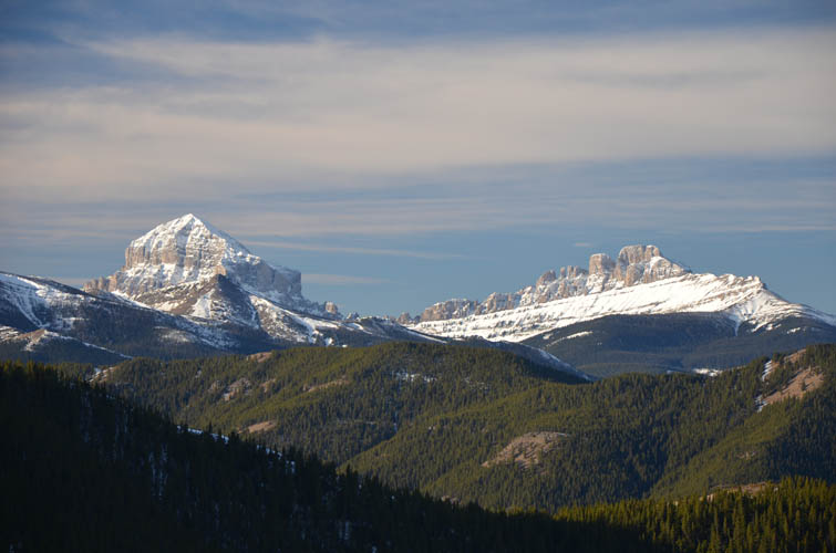
Crowsnest Mountain (left) and the Seven Sisters.
A beautiful viewpoint about half way up.
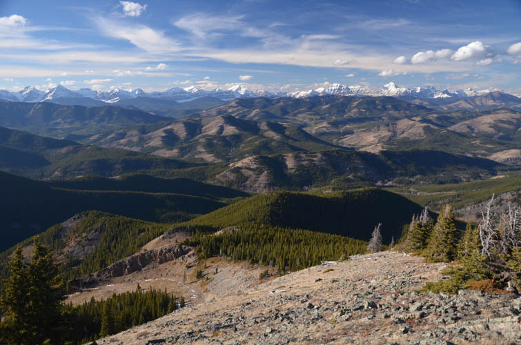
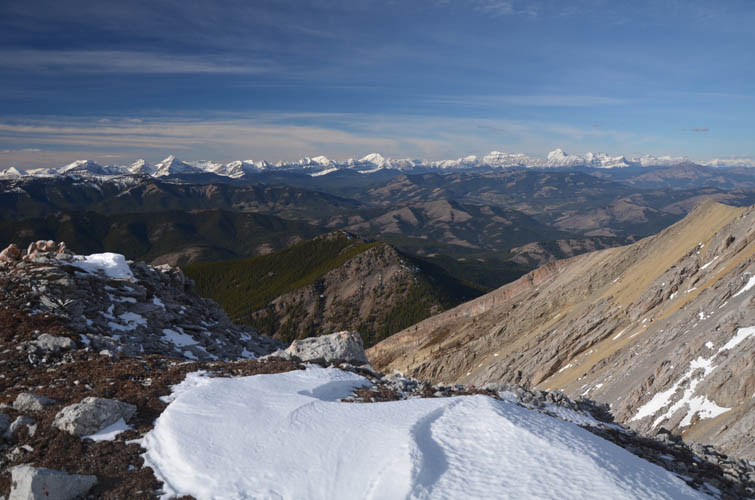
The remainder of the route up to the summit ridge, as seen from the viewpoint above.
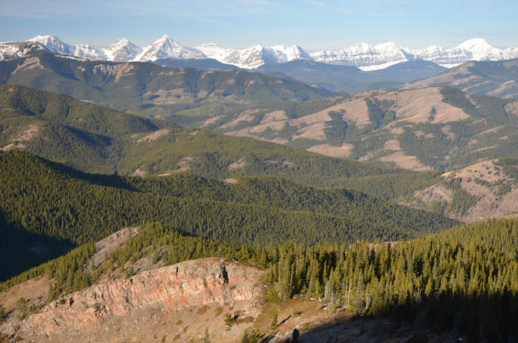
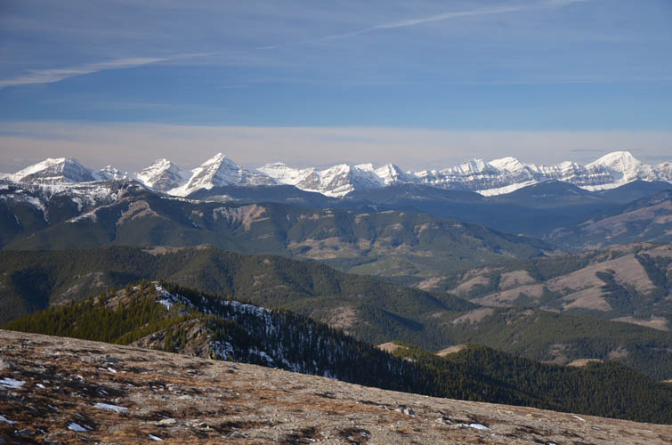
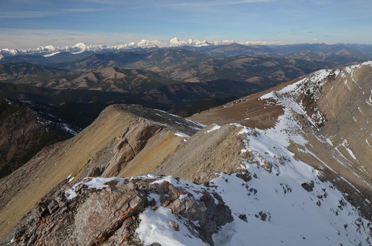
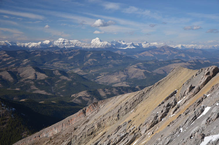
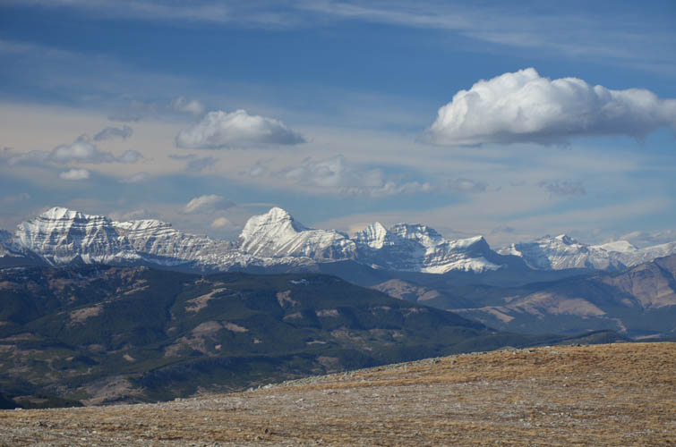
There is not much between here and the High Rock Range, that line of snow-capped peaks on the horizon. Most of them are unnamed; the prominent snow dome on the far right is Mount Erris.
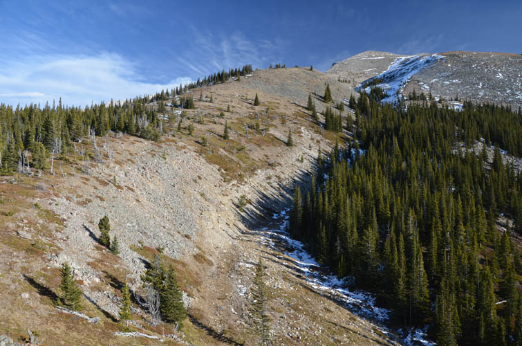
The route follows the crest of this undulating ridge at the edge of the trees.
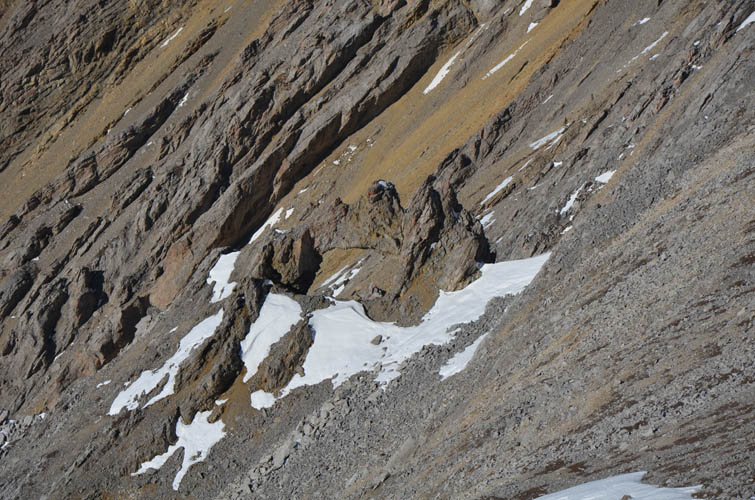
The last section before the main ridge is reached. My line follows the snow-free rib on the left, but you can also angle right across the snow (if there isn’t too much of it – this could potentially be an avalanche-prone slope!).
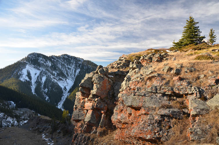
Thunder Mountain to the north. Amazing how little snow there is for this time of the year!
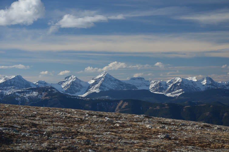
Three beautiful unnamed mountains of the High Rock Range to the west.
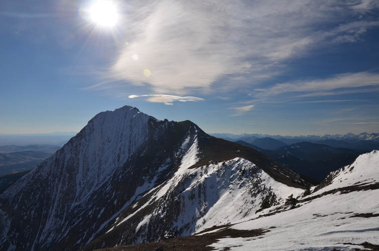
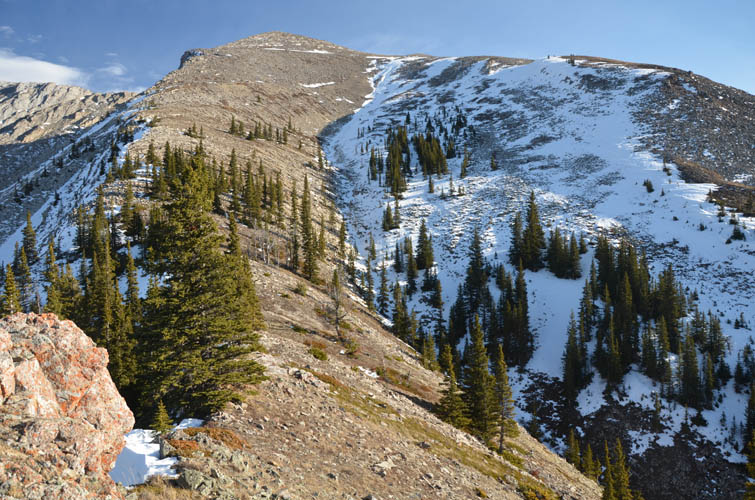
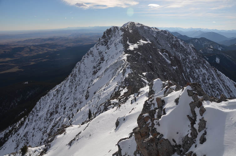
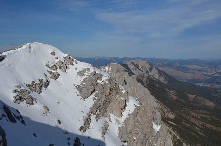
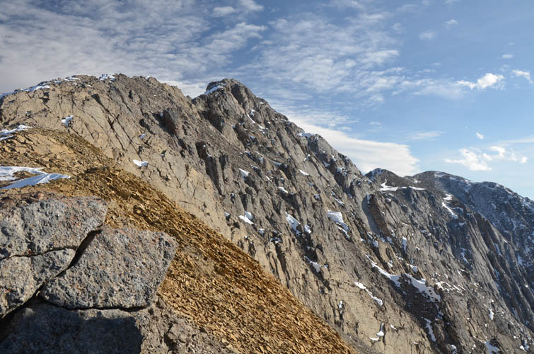
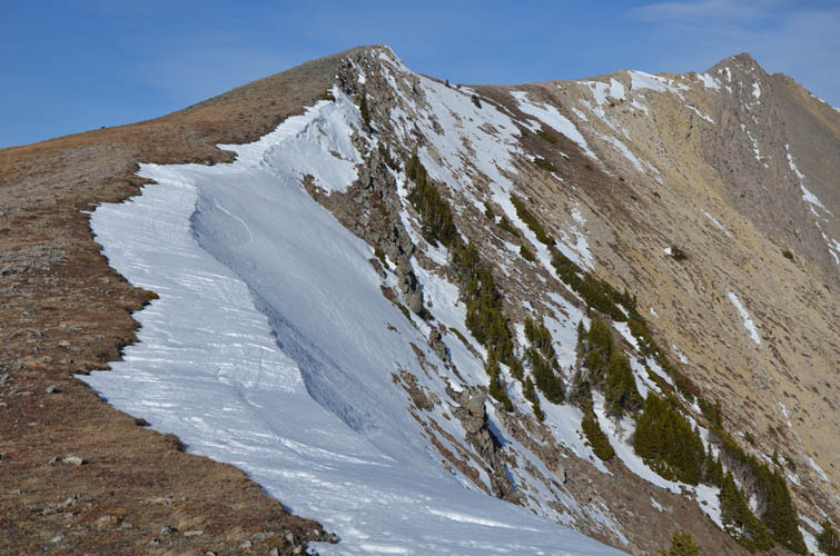
The false summit (sub-peak) to the south.
Another view of the sub-peak. The ridge is snow-free, except for the last section.
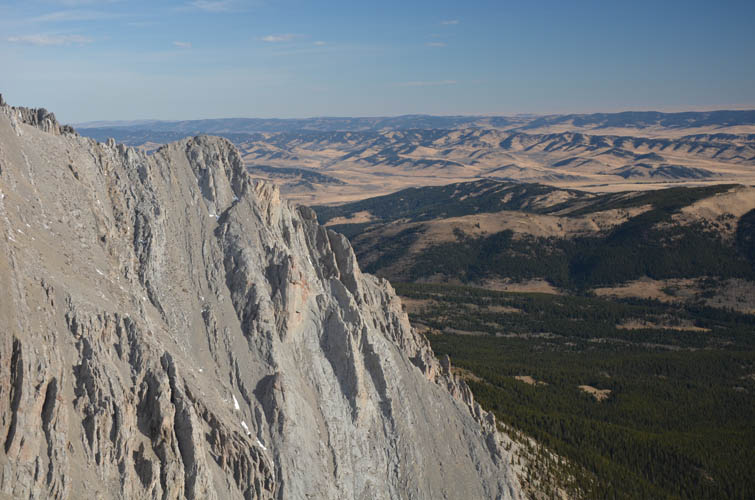
The edge of the Rockies.
What a nice day to be out!
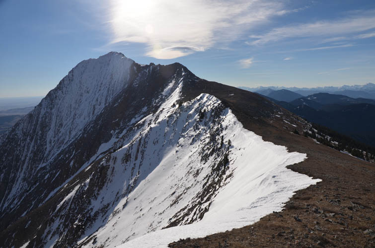
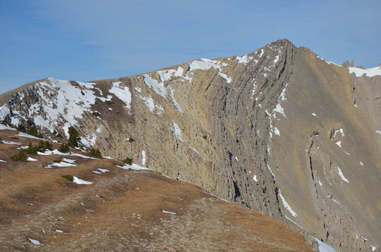
From the sub-peak, the scramble section is clearly visible. With the snow, careful routefinding is necessary.
Looking south from the sub-peak to the summit of Lightning Peak. Bear paw prints are visible in the snow in the lower left corner.
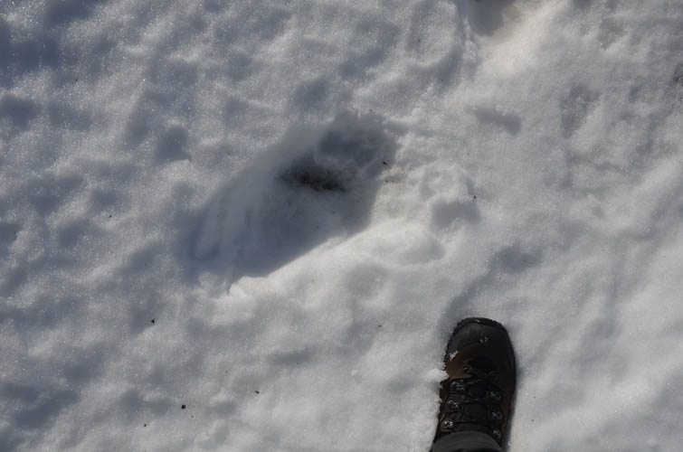
Bear prints!
Looking back (north) at the sub-peak along the ridge.
Only patches of snow remain here.
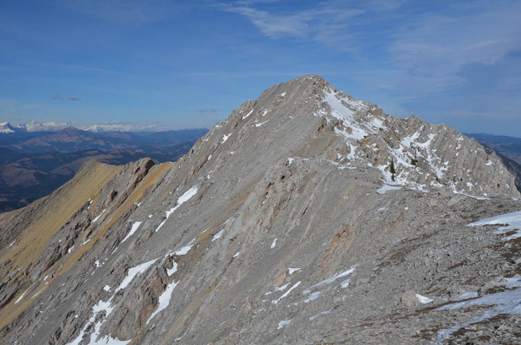
This is looking north along the length of the Livingstone Range from the summit.
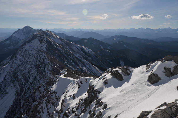
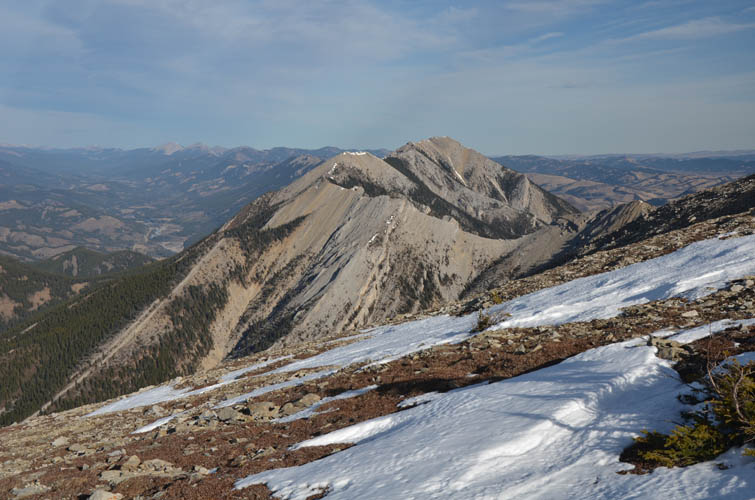
The ridge continues south towards Centre Peak, the high point on the left.
Some scramblers have followed the entire length of the ridge.
The rock arch.
Tornado Mountain stands out just below the cloud in the middle.
On the way back, I skirt around the highest part of the sub-peak by following a faint animal track through these cliffs.
Back across the grassy saddle.
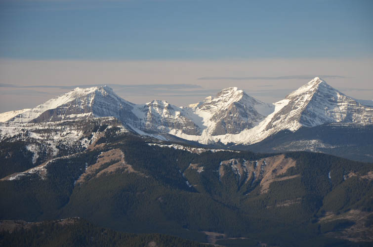
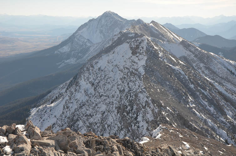
Gould Dome, Tornado Mountain and Beehive Mountain (left to right).
Splendid views all around!
The last section of the main ridge before I head down again.
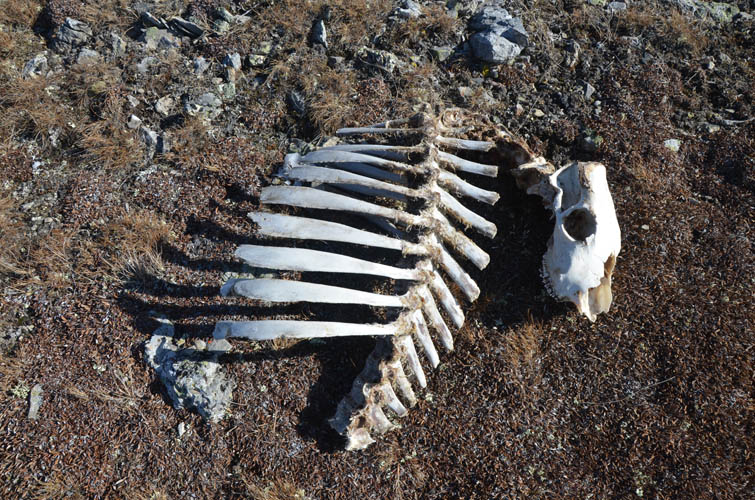
The melting snow has revealed this skeleton – not sure what it is.
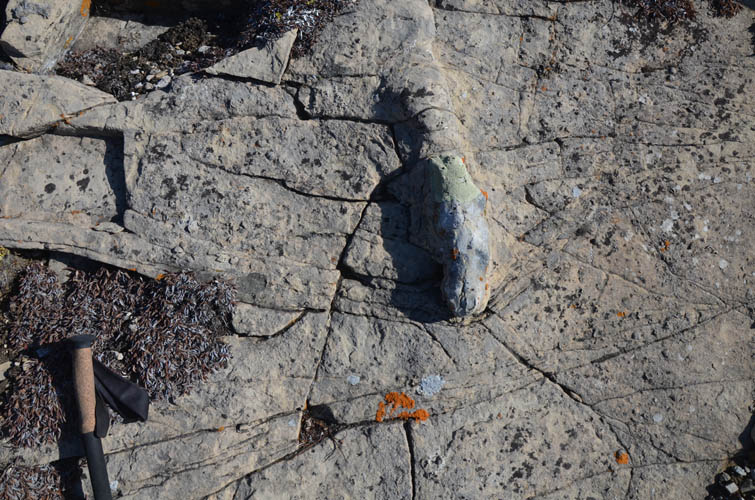
A strangely shaped trace fossil (probably some sort of burrow) in a bed full of brachiopod shells.