2 February 2017
With Trevor
Winter ridge walks can hardly get better than this. Ram Mountain combines the magical scenery of winter wonderland on a long, undulating ridge with gorgeous views of the Front Ranges over a green sea of rolling foothills. It’s a solitary mountain island sticking out in front of the main range, just like Moose Mountain, Blackrock Mountain, or Limestone Mountain.
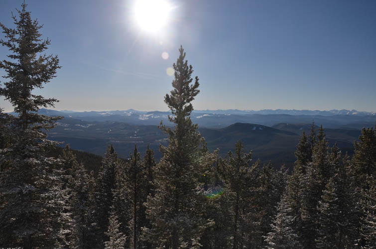
The long, 3.5 hour drive from Calgary was definitely worth it today, but good weather is a must to fully enjoy this hike. We had sun, blue skies and not a cloud on the horizon all day – perfect for an extended ridge walk and great for taking photos!
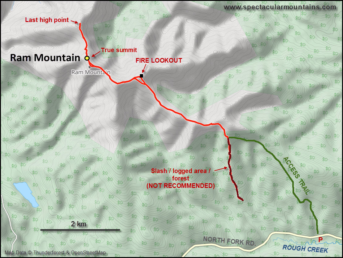
There is a track leading up the SE side of the mountain that’s sometimes used by snowmobiles. We thought about going up here, but then found a brand-new logging road that rises up a short distance on the south side of Ram, ending in the middle of the forest. (Update Oct. 2021: The logging road has since been reclaimed and there is apparently a lot of slash on the initial approach described here. Use the regular track that starts further east right from the road instead – see green approach track on map below. Thanks to Bert Blankenstein for this info!). For the first hour and a half we tramped up knuckle-deep snow through light forest, with intermittent easy bushwhacking, glad to have left our snowshoes in the car. We basically just went straight up until we intersected the OHV track, where we turned left (north). Here, the going was a lot slower due to knee deep soft snow, but thankfully this section was short and we soon reached the main ridge. Gorgeous views of the foothills and the Front Ranges in the distance greeted us and followed us for the rest of the day on a beautiful extended ridge walk.
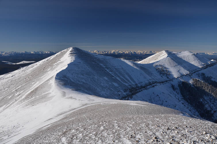
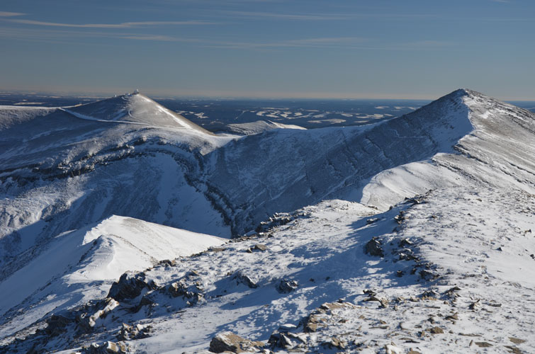
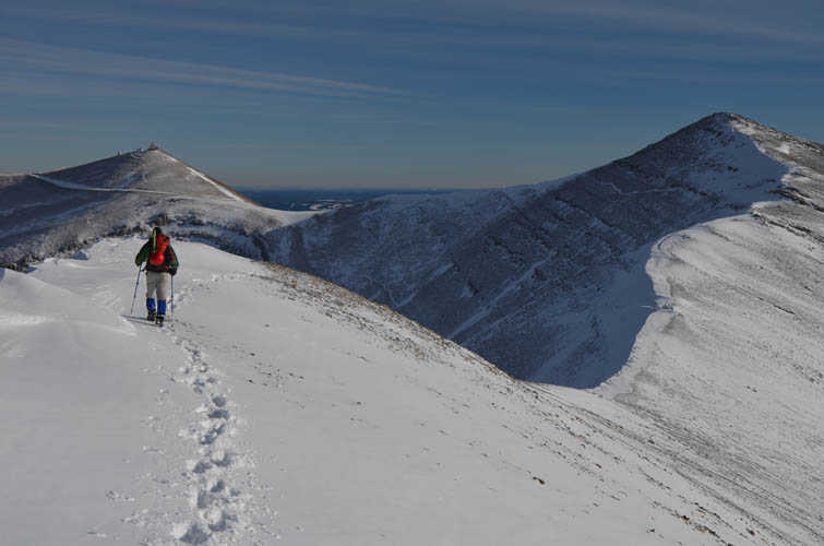
After contouring around a small bump, we arrived at the fire lookout on the first high point at 2160 m. The perfect place for a scenic lunch with million-dollar views on the helicopter landing pad! From here, the entire length of the northern part of the ridge can be seen. The second high point coming in at 2177 m is just a short distance away, but a brief stretch with an icy snow spine cresting the ridge made things a bit tricky and required very careful tiptoeing – the only real challenge of the day. Another short plod and we were at the highest point of the massif, a double summit with the highest elevation measured at 2178 m, just one metre higher than the previous bump.
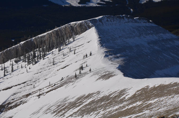
We enjoyed the walk so much that we decided we might as well continue to the last high point to the north (2137 m), a craggy looking outcrop with a neat brown cliff consisting of an ancient reef complex. Getting there involved significantly more elevation loss than we expected, including a few “hands-on” scramble moves, but nothing difficult. From this last vantage point, marking the northern end of Ram Mountain, your eyes are drawn to another ridge to the north which stretches out to Coliseum and Shunda Mountain near Nordegg. Despite temperatures around -15°C, the near absence of any wind and the warming power of the sun in a cloudless sky made it downright pleasant to sit down and lounge around for a while in this terrific spot.
For the return we opted to make things simple: just follow the ridge back and retrace our steps would be the easiest and probably most enjoyable way. A couple of bumps on the ridge could be bypassed on the sides, including the fire lookout site. The way back was just as enjoyable and I could’ve easily spent more time wandering along this lovely ridge! Nevertheless, keeping the long drive back to Calgary in mind, we put on a steady pace and made it back to the car within 2.5 hours of leaving the northernmost high point.
This is a delightful ridge walk that’s perfect for clear, sunny, and windless winter days!
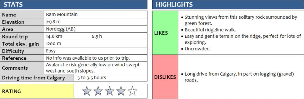
DISCLAIMER: Use at your own risk for general guidance only! Do not follow this GPX track blindly but use your own judgement in assessing terrain and choosing the safest route.
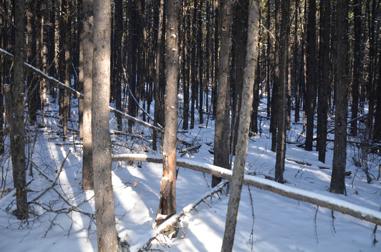
The first part is through light forest. No snowshoes needed!
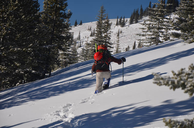
Trevor struggling through a short section of deep snow. This is on one of the trails that lead up to the ridge top.
A perfect day to be out!
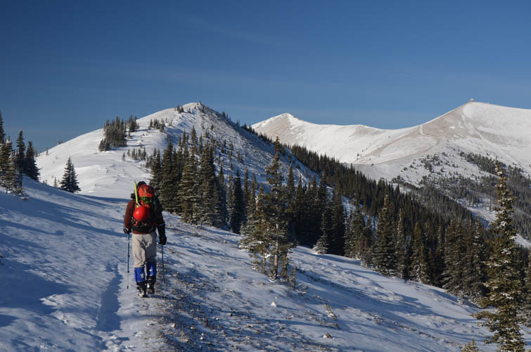
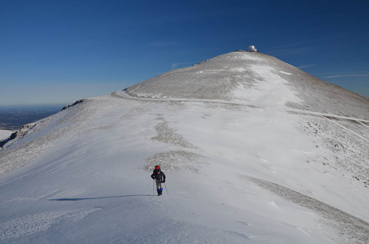
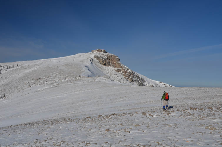
The fire lookout comes into view on the horizon (far right).
Much of this ridge is wind-swept and the snow cover is thin.
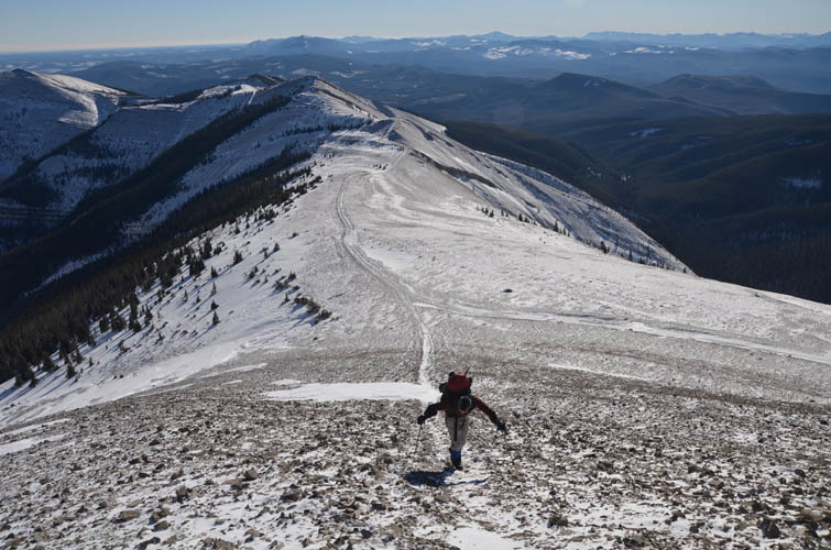
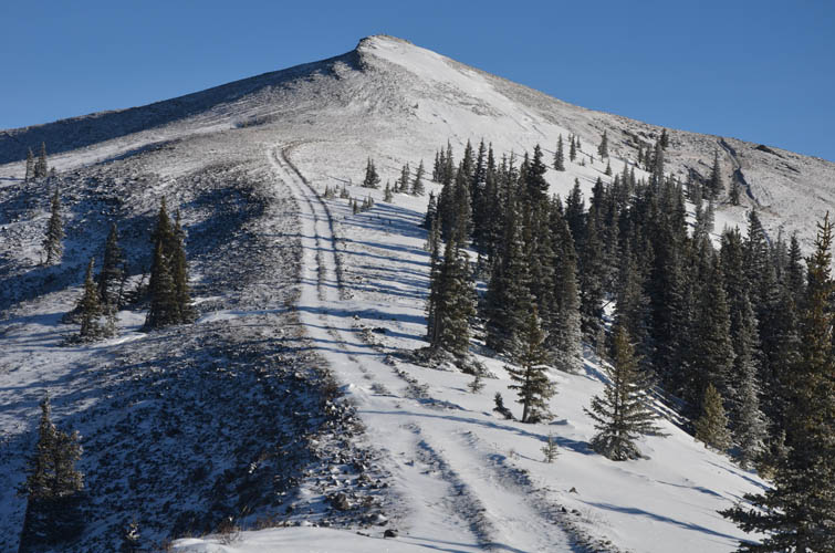
Tramping up the last steep bit to the fire lookout.
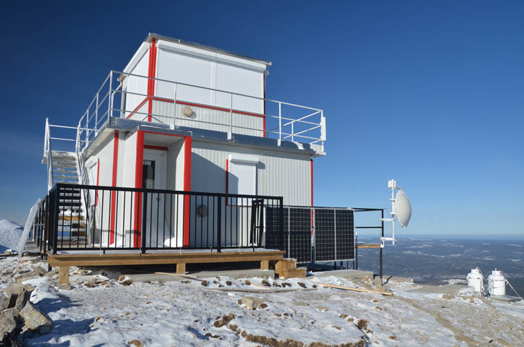
Ram Fire Lookout.
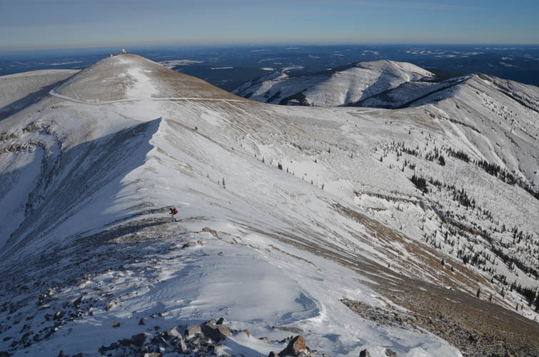
View from Ram Fire Lookout: it’s a beautiful ridge walk on gentle terrain.
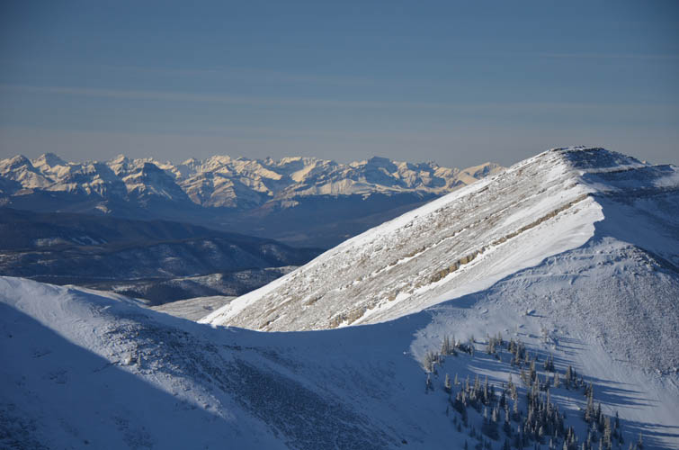
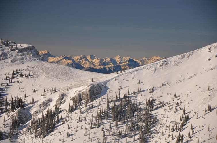
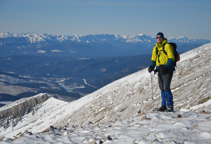
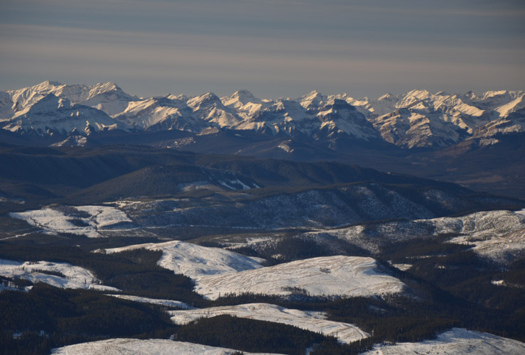
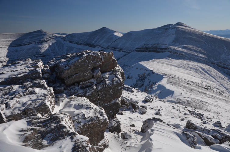
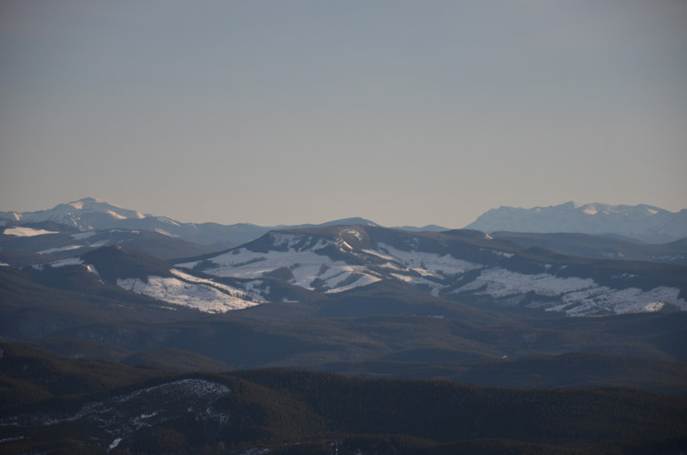
The Front Ranges loom in the distance to the NW.
Trevor coming up, fire lookout behind.
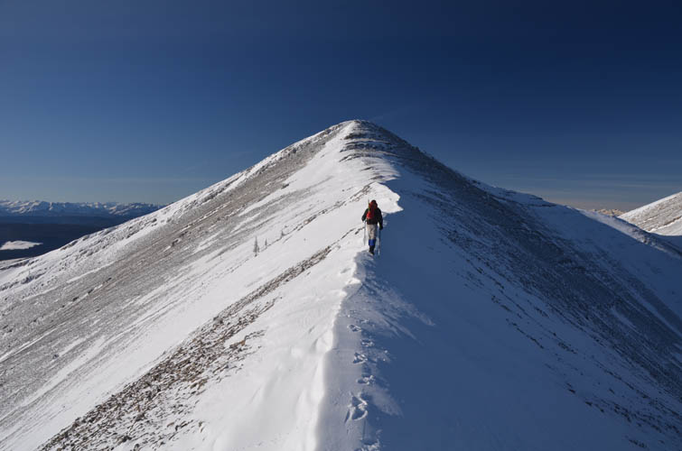
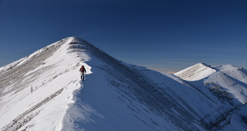
A short but tricky section where the snow has formed a knife-edge crest along the ridge: don’t slip here!
Couldn’t have asked for better views!
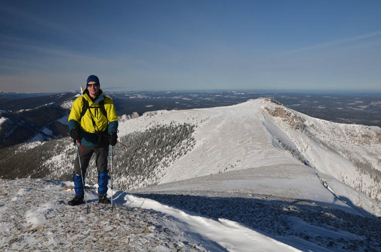
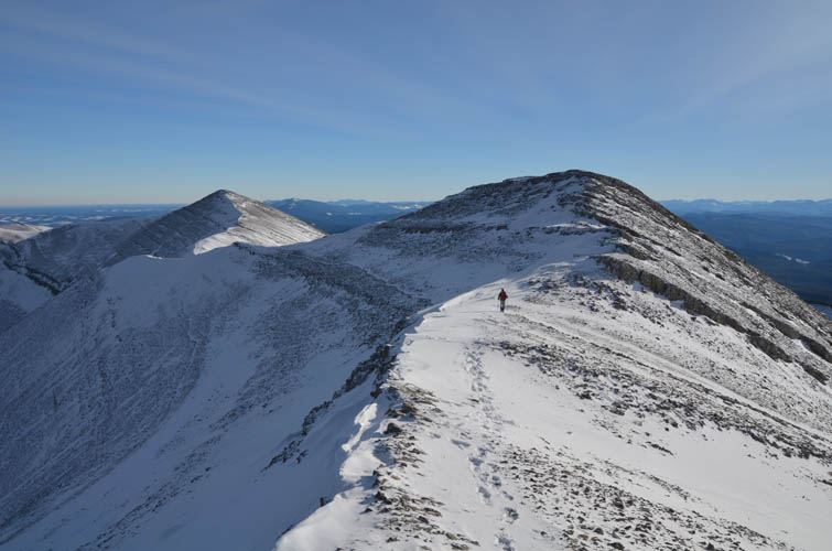
The double summit is in view now. Highest elevation measured by my GPS is 2178 m (right point of double summit in centre of photo).
Looking back along the ridge.

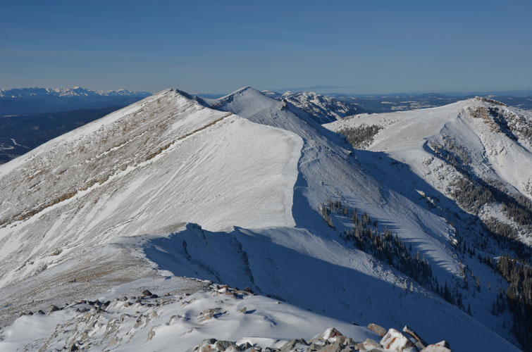
A few more ridges continue to the NW, ending in Coliseum Mtn and Shunda (Baldy) Mtn as seen on the horizon.
Looking west.
The last high point to my right is a short distance away but necessitates quite a bit of elevation loss and regain.
Beautiful snow-rock formations.
Trevor heading to the brown outcrop, the last high point along the ridge.
Looking back along the ridge from the brown cliff.
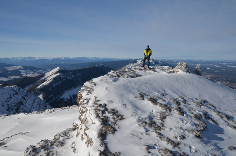
The perfect spot!
Time to head back. Here, Trevor is about to bypass the bump by following a faint animal track on the left.
A thoroughly enjoyable ridge walk.
On the last stretch of ridge on Ram Mountain.
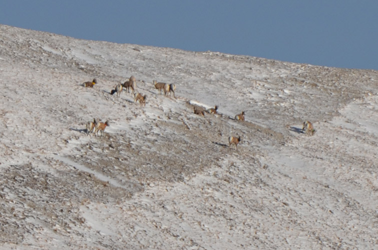
A group of bighorn sheep.
Just before this bump we turn right onto a trail contouring the side of the mountain to get back into the forest.
Limestone Mountain (left) and the Ya Ha Tinda area are to the south.