
20 July 2016
Solo
Mount Erris had several surprises in store for me. This was my first time in the Dutch Creek area north of Crowsnest and I found the landscape here to be absolutely stunning. Of course it didn’t hurt that the weather was in my favour with gorgeous blue-bird sunny skies all day! I just didn’t expect this area to be so lovely and I was pleasantly surprised by the variety of mountains and ridges that all looked different but unique in their own way.
Twice I thought I would have to abort this trip. The first time was while driving on the rough and narrow access road along Dutch Creek heading west. It was a beautiful sunny day, but the rains from days before had left the many potholes filled with water, and the puddles kept getting bigger the further I drove. It got to the point where the entire road was flooded in a muddy mess, but the puddles were all shallow and thankfully Wen’s trusted CR-V made it through no problem.
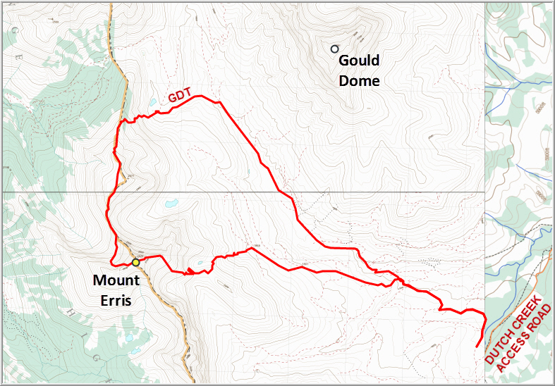
I parked at a spot where the road got really rocky, but later I realized I could’ve easily driven another 2.2 km to the NW and parked where a lively creek crosses the road, barring any further progress by car. From here I followed the rough track in the valley, enjoying lovely views of Mount Erris to the west and the dramatic west face of Gould Dome to the east. I was able to put on a good pace on this fairly flat trail, slowed only by a number of creek crossings (I counted a total of 4) that involved the tedium of doffing and donning boots and socks each time.
Eventually I reached the Great Divide Trail (GDT) and followed a short portion of it to the west before jumping onto steep, grassy and partially treed slopes that took me straight up the long ridge north of Mount Erris. I had mapped out a route in Google Earth that I thought might make for an interesting loop, taking in both the ridge north of Mount Erris plus an ascent of the mountain itself. My plan was to then backtrack from the summit to the col immediately north of Erris, then head down hopefully easy scree slopes past a small lake back into the valley to the east. The level of detail that can be seen in Google satellite images is amazing, but needless to say it is rarely ever sufficient for detailed planning of climbs and scrambles. Today, however, I was in the mood for exploration and accepted the challenge of uncertainty…
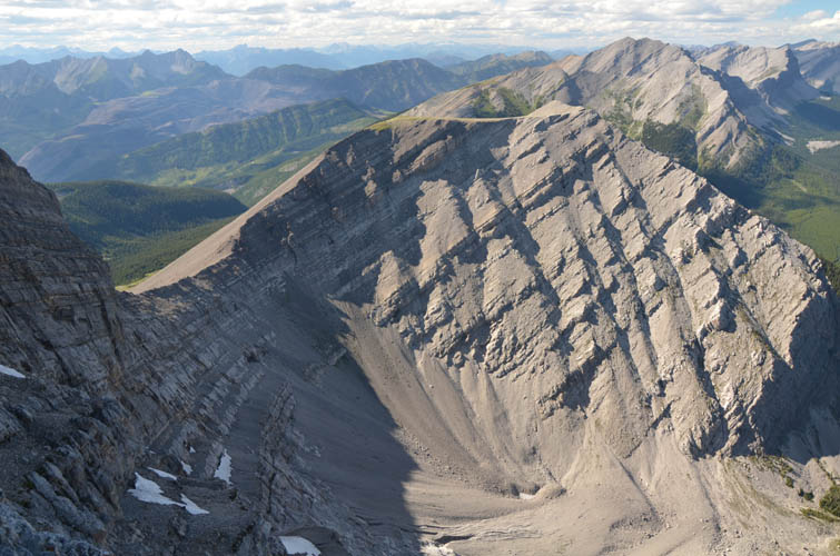
After reaching a high point and a broad plateau along the ridge, the easy part of the ascent was basically over. I had a clear view of Erris’s north face for the first time, and it looked pretty intimidating! From this vantage point the north face certainly seemed to be more of a climb than a scramble: it was steep and appeared to have too many step-like cliffs. It just looked nasty. I could now also take a good look at the col with the scree slope I had planned for my descent: a near vertical cliff at the top of the col destroyed any hope of climbing down here safely. As I stood here on the ridge looking at the big mountain with its steep north face, I realized that my trip would probably end here and I’d have to go all the way back the way I had come… Unless there was maybe some circuitous way of sneaking my way up the face on its west-dipping strata. I hesitated a bit, but then decided to at least give it a try. Getting to the north face involved some tricky sidesloping on smooth friction slabs and patches of loose, steep scree. Once at the base of the east face, I managed to clamber up a promising looking bedding plane that appeared to form a ramp all the way up to the summit. I followed that ramp, now just an easy trod on rubbly rock as far as I could – and to my great relief it did indeed come out just a few metres below the summit, which was an easy scramble away!
The views from the top were stunning, especially to the south where the long, sinuous ridge that makes up the bulk of the High Rock Range continues into the Crowsnest area. The plastic register had details of the intial ascent party (Topographical Survey, 1913) and was placed by Rick Collier et al. in 1992. The only other entries were a lone scrambler in 2005 and another party in 2007, but the latter cheekily admitted they had flown in by helicopter. Not exactly a popular mountain!
Had I known of Rick Collier’s trip report (and I shall check his accounts next time thoroughly!), I would’ve probably ascended Mount Erris the way I ended up descending it. It was much easier and shorter! I headed down easy scree to the crest of the east ridge, which I then followed with intermittent moderate scrambling down to treeline. A short stint through light forest led me to a nice logging road, which eventually connected back with the road where I had started my trip in the morning. The whole tour took 10.5 hours, which is probably 3 or 4 hours more than if you were to climb Mount Erris directly from the east. However, I enjoyed every hour of it, including all the challenges that can make a trip so much more memorable!

DISCLAIMER: Use at your own risk for general guidance only! Do not follow this GPX track blindly but use your own judgement in assessing terrain and choosing the safest route.
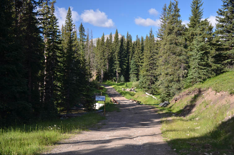
The start of Dutch Creek access road.
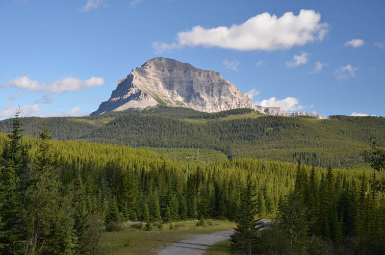
First view of Mount Erris from where I parked.
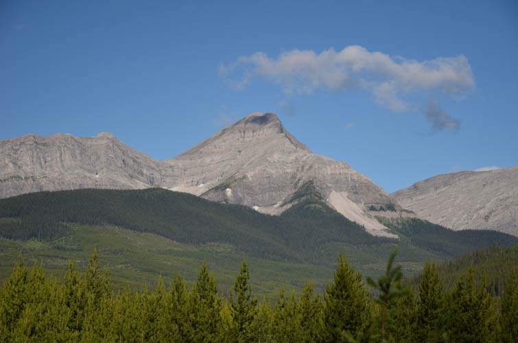
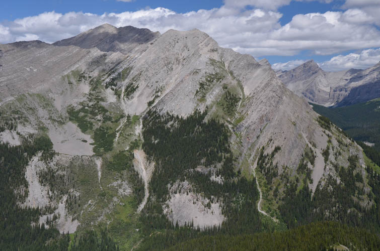
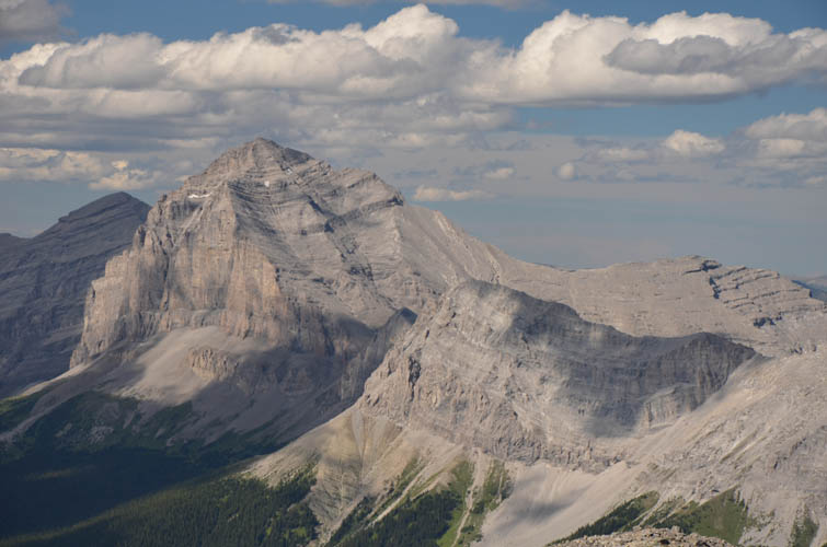
Gould Dome. From here this intriguing peak reminds me of Crowsnest Mountain.
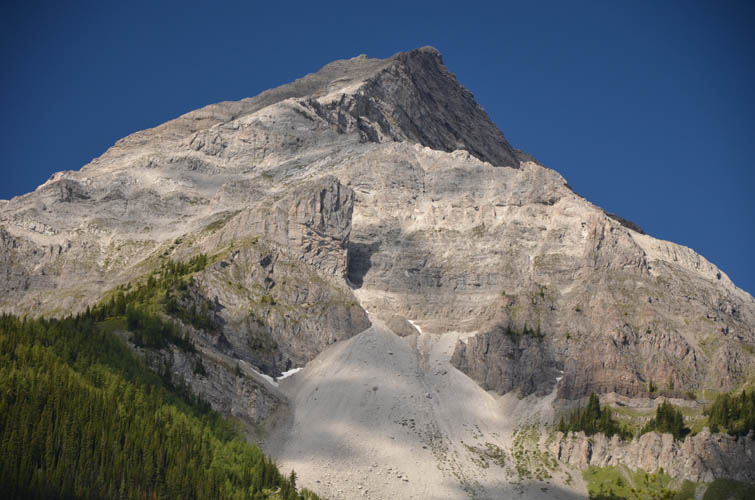
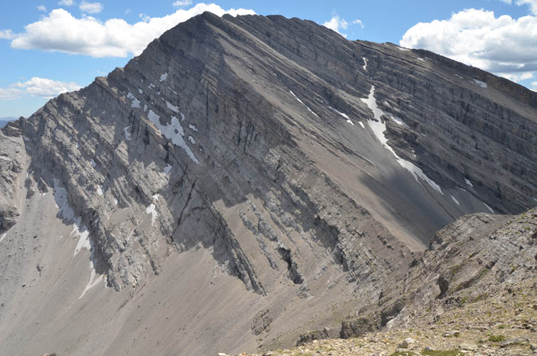
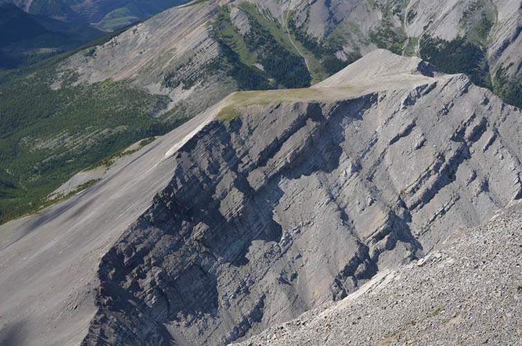
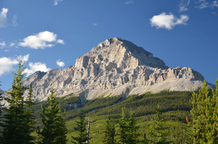
A closer look at Mount Erris’s east face. The descent (and normal ascent) route goes up the gentler left side and then along the ridge.
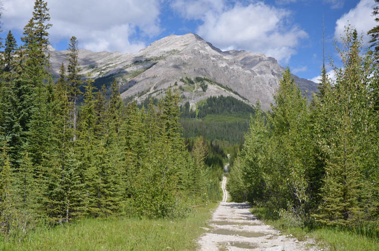
Hiking along an excellent trail towards Funnel Peak in the distance.

The steep west face of Gould Dome.
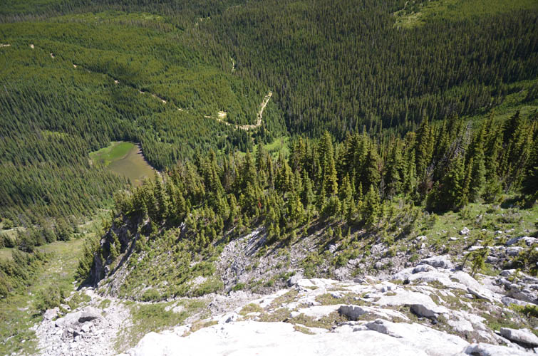
A small part of the GDT (Great Divide Trail) is now far below me as I ascend the eastern slopes of a ridge north of Mount Erris.
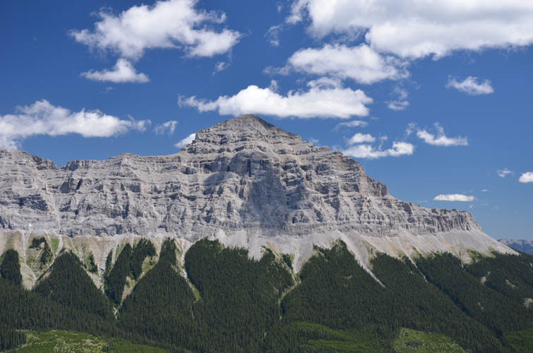
Funnel Peak
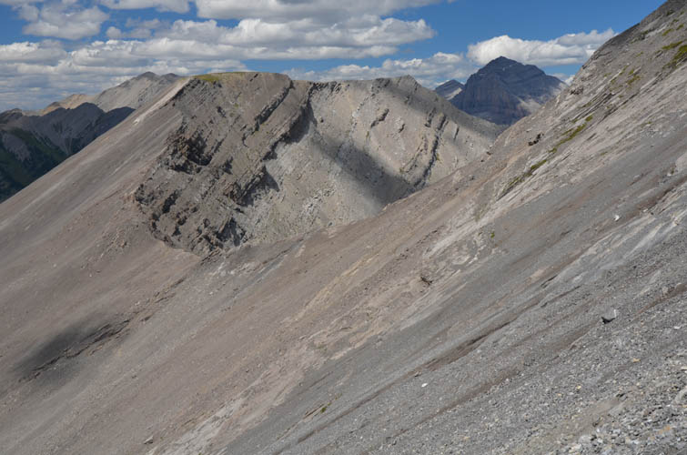
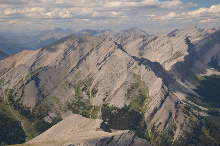
Gould Dome from the ridge north of Mount Erris.

There’s even a large cairn on this ridge!
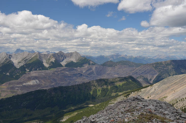
A huge open pit coal mine (Line Creek Mine) can be seen to the NW, with Mount Lyne behind.
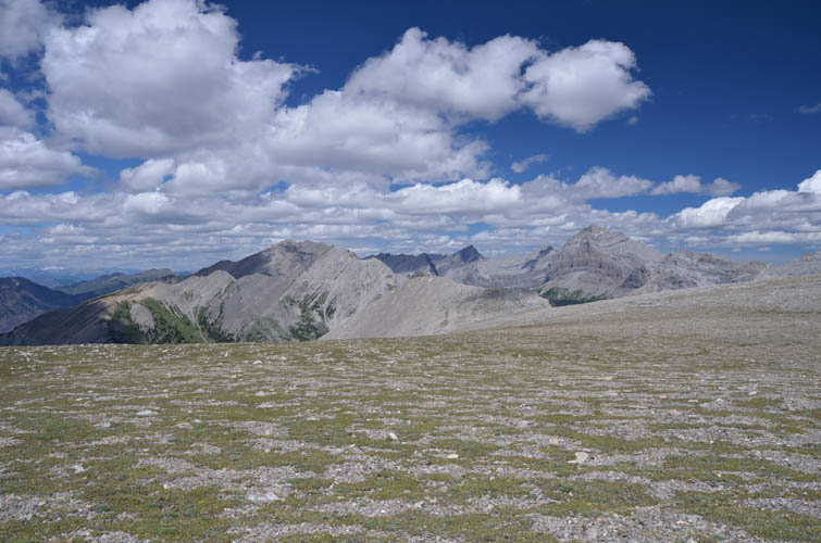
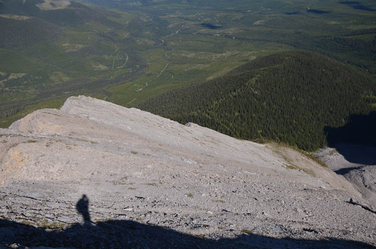
On the flat plateau between Erris and the ridge.
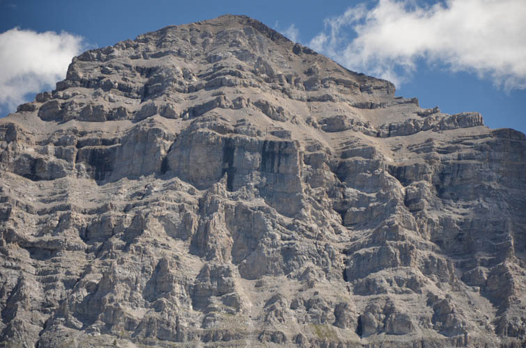
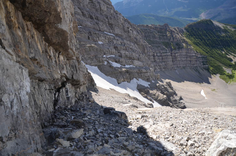
The north face of Mount Erris comes into view: not what I expected!

But there is a route: first sideslope along steep slabs and scree to a snow gully, then veer left up a ramp that has formed along the west-dipping bedding planes.
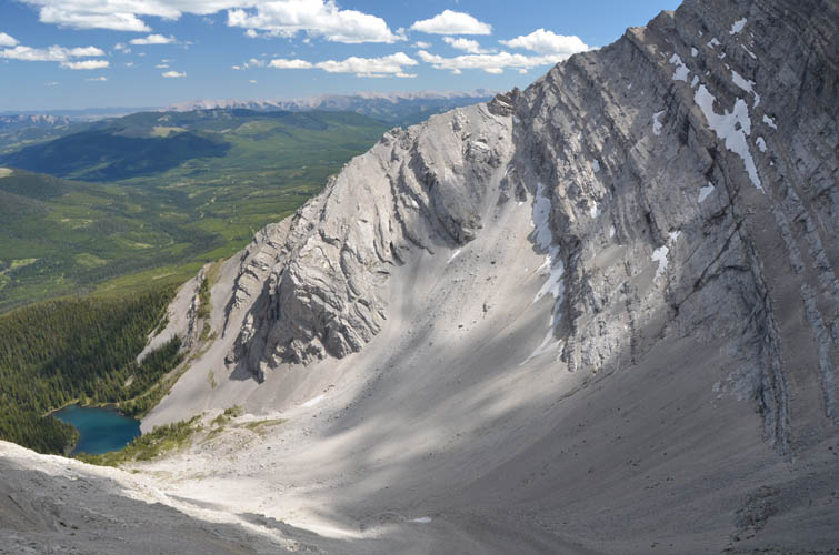
View down the bowl below the col, which sits between the ridge and Mount Erris.
Looking back (north) at the col during the sidesloping traverse.
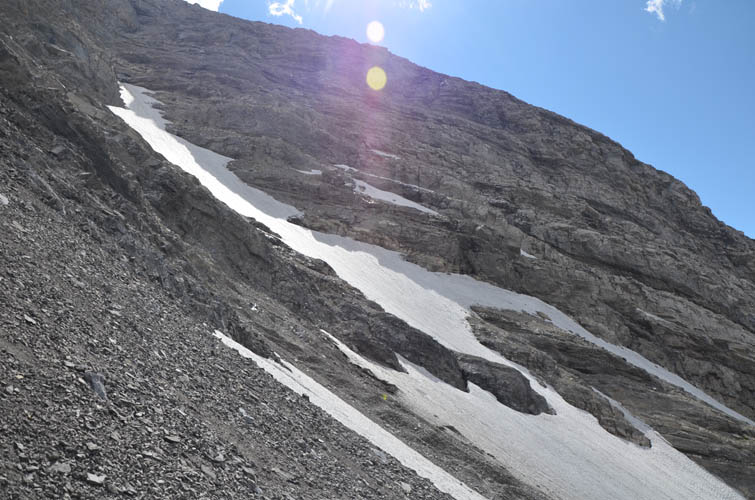
Just above these snow patches it is possible to access the ramp via steep, rubbly terrain.
On the ramp.
Looking back down the ridge where I came from.

The summit of Mount Erris!
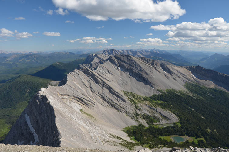
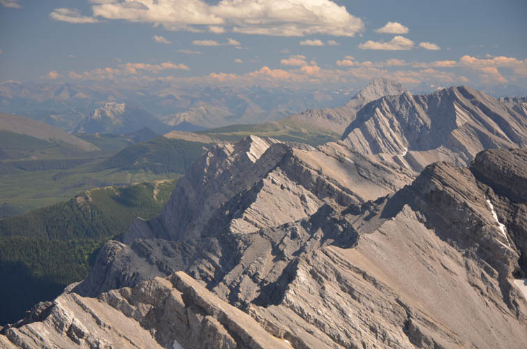
Brilliant views unfold to the south. A typical Front Range chain of peaks with gentler west-dipping strata and a sharp easterly drop-off.
This would make for an interesting ridge walk!
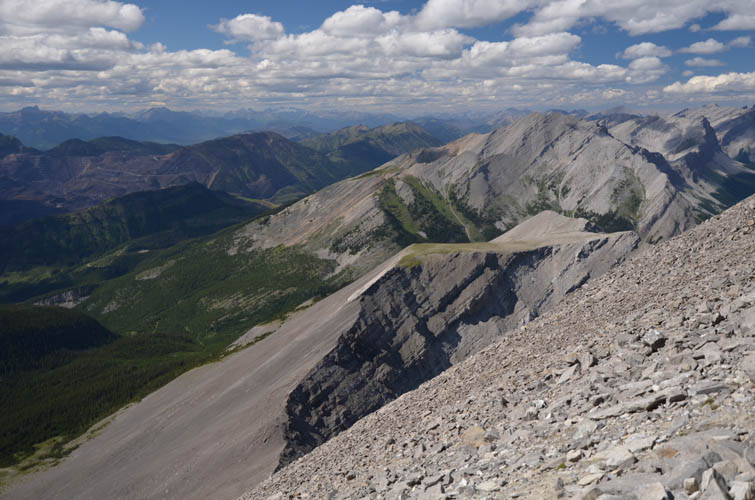
To the north, I can see the large grassy plateau where I stood a few hours earlier, wondering whether I would have to abort.

Thunder Mountain forms part of the Livingstone Range in the east.
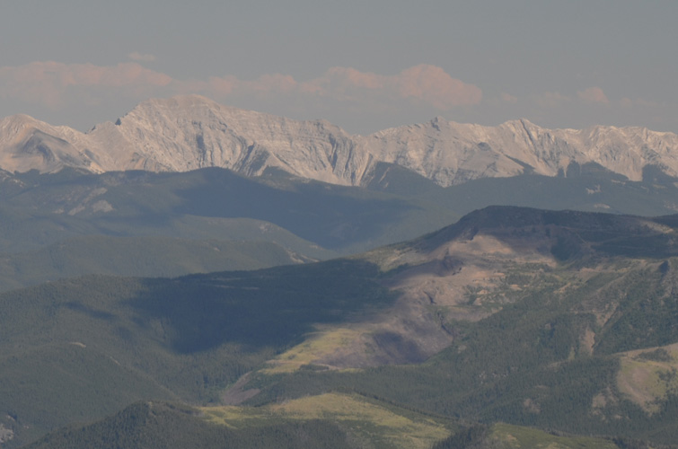
Further south in the Livingstone Range are Centre Peak (left) and Caudron Peak (right).
This is what I came up here for!
Another look at the rarely ascended Funnel Peak to the north.
And ominous sounding Tornado Mountain.
Time to head down – this time via the ridge and scree slopes on the east side of Mount Erris.
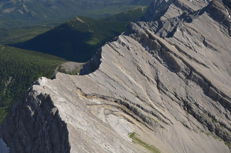
Part way down, I glance back north at the ridge where I had come from. The cliff at the col is definitely not a scramble route.
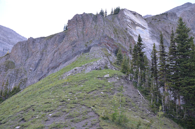
Down the lower reaches of the mountain back into the forest. A few steep cliffs added some spice here, but I think they can probably be avoided around skier’s right.
Evening view of Gould Dome.