
2 August 2014
With Richard
There are several things that puzzled me about Mount Charles Stewart. One is that no one ever seems to bother ascending this peak, despite being one of the highest mountains in close proximity to Canmore. The other one is the strange rumour I heard of people flying in by helicopter, landing on a nearby meadow to get married on this mountain. When Richard and I had a full day available for another exploratory tour this August long weekend, we decided to do the former (climb the mountain, not fly in and get married!). Our intended route would lead us up Buffalo Point first (also known as “Princess Anne” or “Charles Stewart South”), then along a crumbly narrow ridge to the main summit of Mount Charles Stewart. Credits go to Grant/Granticulus from ClubTread for valuable tips and comments, as well as a 2005 Rocky Mountain Ramblers route description, which greatly helped in our preparations and choice of route.
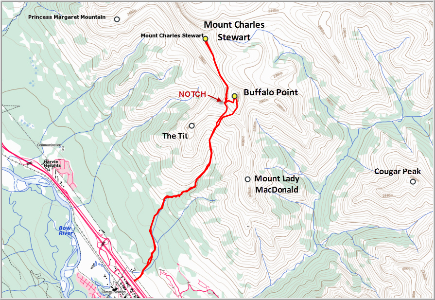
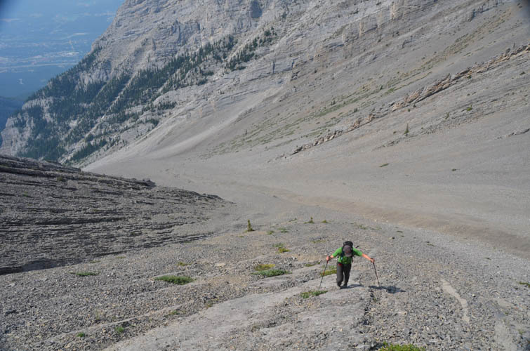
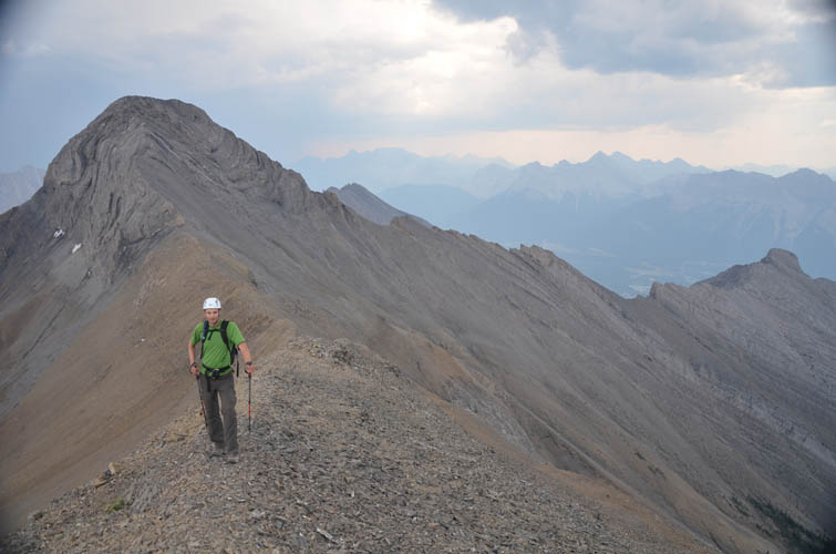
We parked at the Stoneworks quarry and headed up to the canyon – an impressive sight and worth a visit on its own. Unfortunately, “Johnny’s Trail” that leads up to it has been mostly degraded to a mere rubble field by the 2013 floods. Beyond the canyon the rubble gets even worse and there is no more path at all. We were amazed by how much elevation we gained in the approach by tramping up this dried up creek bed. By the time we reached the lower slopes of the N-S ridge connecting Mount Lady MacDonald and Buffalo Point, we were already up 600 m. What followed was a tedious slog up loose scree, but bits of firm rock sticking out of the rubble made progress easier. After a few hours we made it up to the ridge and shortly after stood on top of Buffalo Point, complete with a golden plaque explaining the origin of the name (see photo below). The views were fabulous and the scree slog suddenly seemed worth the effort, as is so often the case when you reach the summit and are overwhelmed by the gorgeous scenery all around you.
The first objective of the day was achieved but the relief was short-lived – the hardest and most unpredictable sections were yet to come. The exciting part of the day was now to start… we knew very little about the possible route up Mount Charles Stewart. One account from fellow member Granticulus suggests that following the ridge all the way to the summit of Charles Stewart is doable but involves difficult scrambling. The only other account we had was by the Ramblers who in 2008 ascended the peak using ropes along sections of the ridge coming down (north of) Buffalo Point. In their description, they mentioned that on their way back they avoided the climbing section by traversing around the summit block of Buffalo Point around the NW to a notch along the ridge between Squaw’s Tit and Buffalo Point. This is the route we followed, and it posed no major problems but wasn’t without obstacles. We dropped down toward the west from the summit of Buffalo Point along loose rubble and reached the notch in about 15 minutes, losing 150 m of elevation along the way. From the notch, the traverse back to the north ridge involved some unpleasant sidesloping and several tricky rock ribs that had to be overcome (moderate to difficult scrambling). The terrain here is very loose and rubbly, so we proceeded slowly and carefully.
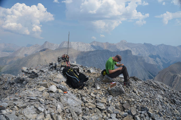
Once we reached the north ridge, it was an easy and enjoyable ridgewalk through the col and up to within 200 m horizontal distance of the summit of Charles Stewart. The gentle ridge up to this point really fooled us; there we really thought we had this mountain in the bag already, not knowing what it had in store for us. The last section is basically a knife-edge ridge of near-vertically tilted strata made up of very crumbly, rotten rock. “Flaky” comes to mind, and this flaky rock was now crumbling under our boots as we tiptoed and crawled across this ridge. It got down to about a foot wide and at one point became so steep that we decided to circumvent the narrowest and highest part to climber’s left (west), where a crack led up to a steep and exposed friction slab. The friction slab turned out to be the crux (one of many on the ridge) and after another 50 m of tiptoeing on narrow crumbly rockbands the ridge widened and it was an easy plod up to the summit. A nice-looking cairn and fully intact register made for a nice surprise, but even more so the contents of the register: the brand-new booklet contained nothing except an “FA” entry from Bow Valley in September 2011. Granted, others have ascended this peak before (e.g. the aforementioned Ramblers group and Granticulus; Rick Collier also did it from the east ridge), and I always wonder how many people actually look for and sign a summit register.
Under the impending doom of a returning storm with pitch black clouds and roaring thunder in the distance, we opted to try out a safer if less challenging route back. The plan was to simply avoid any super-exposed ridge flakes by going around on either the right or the left side – and it worked! Descending from the summit towards the west for about 50 m, it was possible to traverse underneath a steep cliff band back towards the south, paralleling the ridge which lay on climber’s left. Now this surely isn’t the most elegant route, but inclement weather or a strong aversion to steep rotten ridges may be reasons enough to try this alternative. Not all of the steep ridge can be avoided, though. At some point I regained the narrow ridge, while Richard was now on the east side of the ridge about 20-30 m directly below me, traipsing up and down narrow ledges that were not as exposed but not without their own difficulties. We eventually returned to the gently sloping portion of the ridge and retraced our tracks back to the notch along the Squaw’s Tit-Buffalo Point ridge. From here, a short stretch of scree skiing provided some much needed relief on our way back down into Stoneworks Canyon.
Overall this trip cannot really be recommended if you’re looking for a fun and interesting scramble. There is simply too much scree and loose, rubbly rock involved, and the final scrambling section to Mount Charles Stewart on the ridge is seriously exposed on very unstable and crumbly rock. Perhaps more interesting routes to the summit of Charles Stewart will one day be described, for example accessing the west slopes through the valley from the WSW, or perhaps even from the NW ridge as part of a traverse from Princess Margaret Mountain.

DISCLAIMER: Use at your own risk for general guidance only! Do not follow this GPX track blindly but use your own judgement in assessing terrain and choosing the safest route.
Stoneworks Canyon
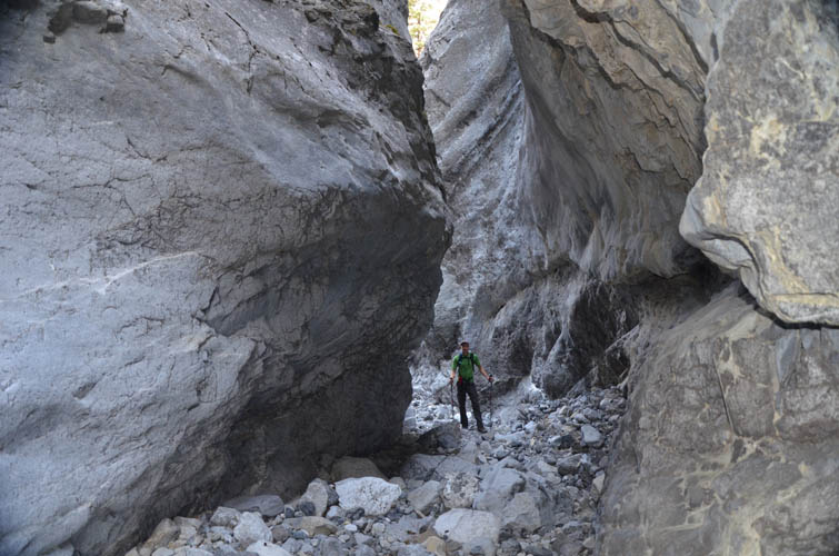
Half-way up the valley, our first objective comes into view: Buffalo Point (aka Princess Anne). The prominent notch to the left was our access gate to the ridge north of Buffalo Point that eventually leads to Mount Charles Stewart.
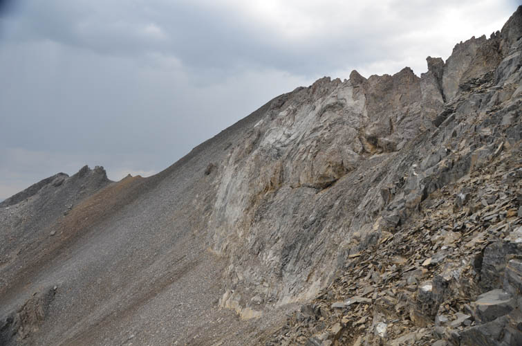
TONS of scree here!
Ribs of solid rock provide much better footing here.
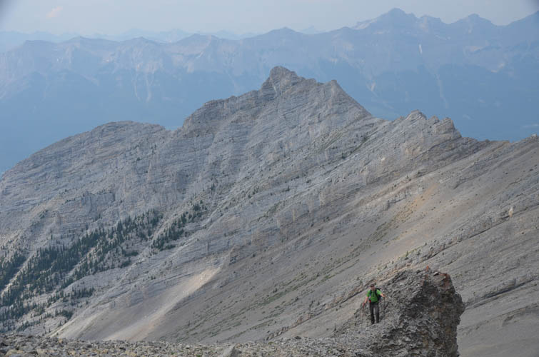
Richard on a rock promontory, with “The Tit” behind. The sprawling ridge on the horizon is Mount Rundle.
A jagged ridge connects south with Mount Lady MacDonald. I tried it once from the Lady Mac side, but about half way in this picture there was a vertical drop-off with significant exposure that was more than a scramble. I didn’t investigate dropping down on the slanted (west) side, perhaps there is a way around this obstacle.
On the summit of Buffalo Point.

Summit plaque of Buffalo Point.
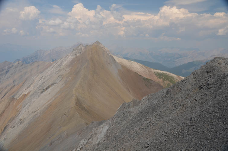
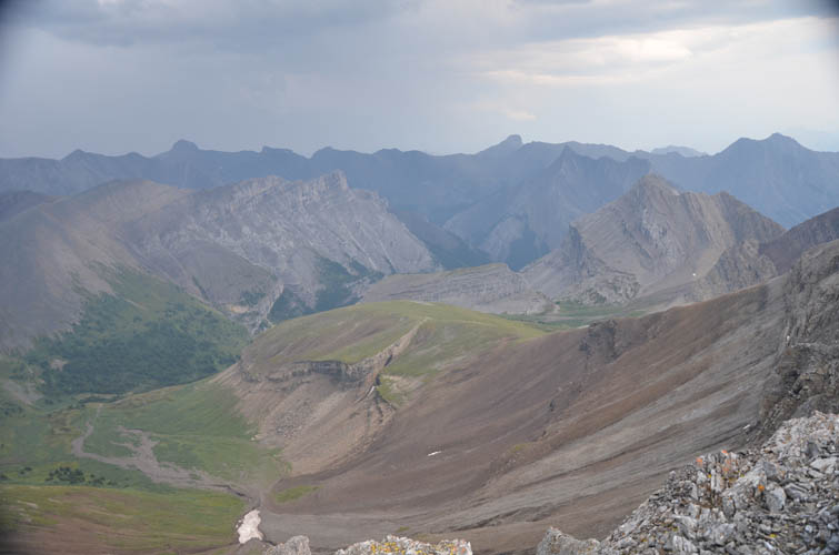
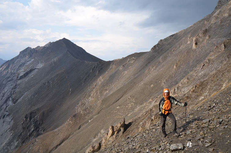
A considerable loss of elevation is involved in traversing north to Mount Charles Stewart, whose summit is not visible in this photo.
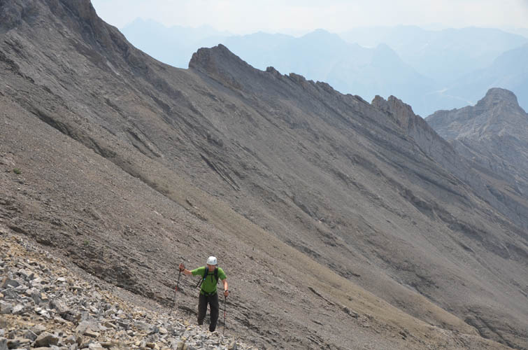
Looking back at the notch along the ridge between the Tit and Buffalo Point. Lots of sidesloping on this traverse.
Looking north along the ridge between the two mountains.
Someone built a huge cairn near the col here.
Looking back at Buffalo Point with the Tit on the right.
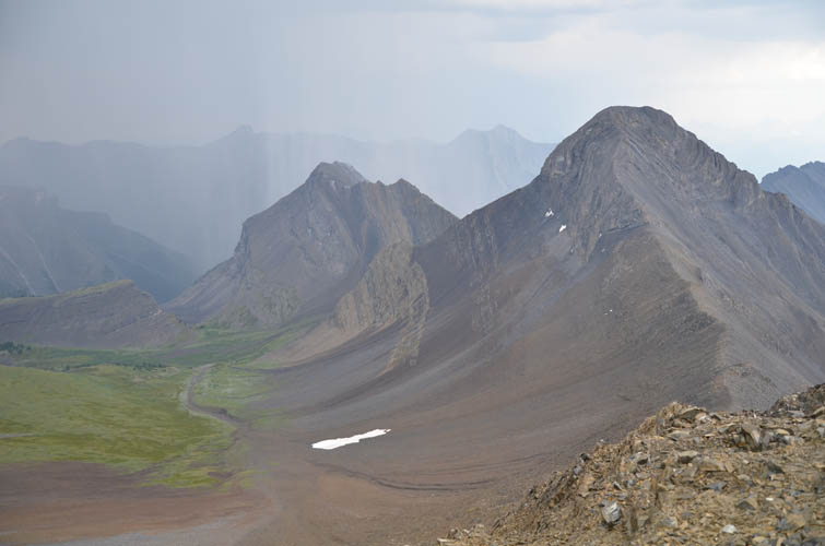
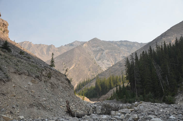
A beautiful secluded valley east of Buffalo Point. Rain showers are starting to move in.
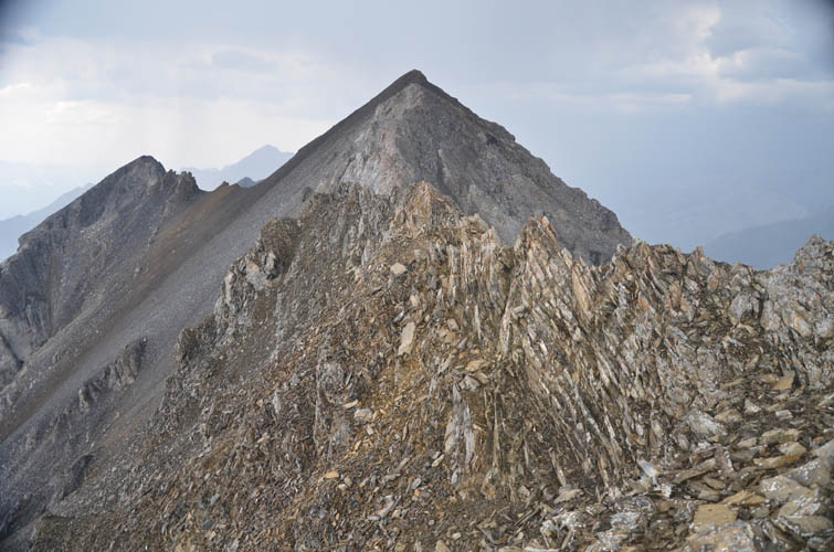
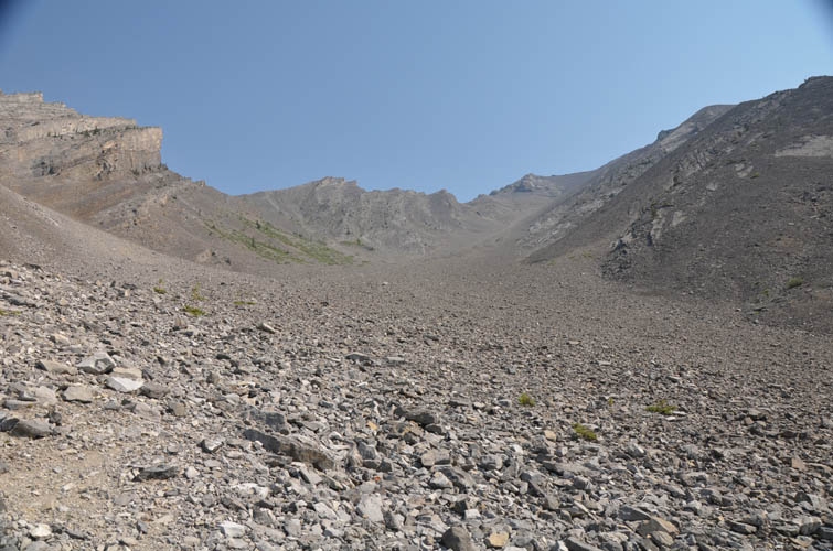
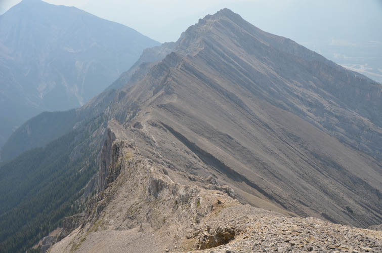
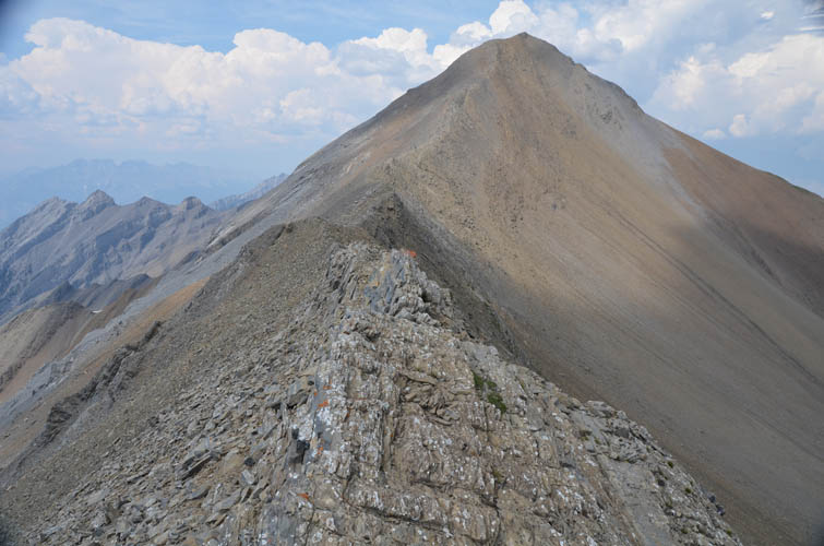
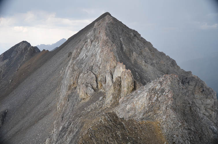
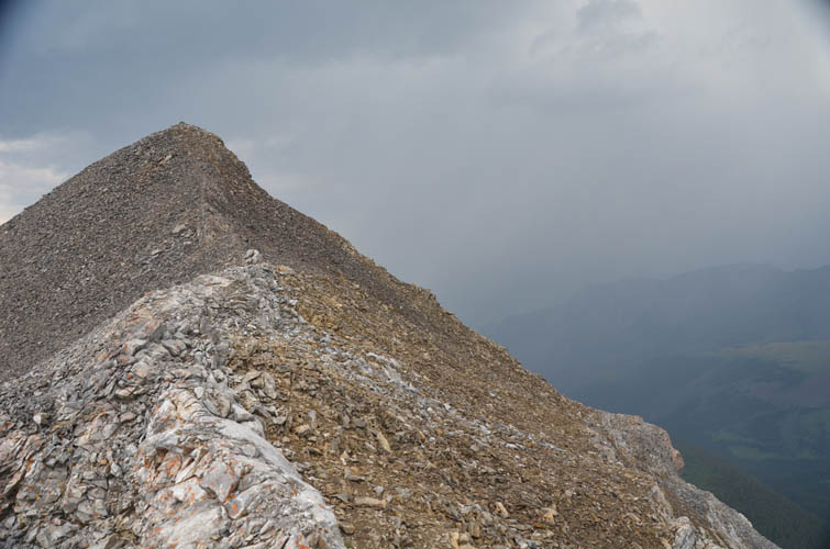
The start of the rotten ridge leading up to Charles Stewart’s summit, which is now visible at the far end.
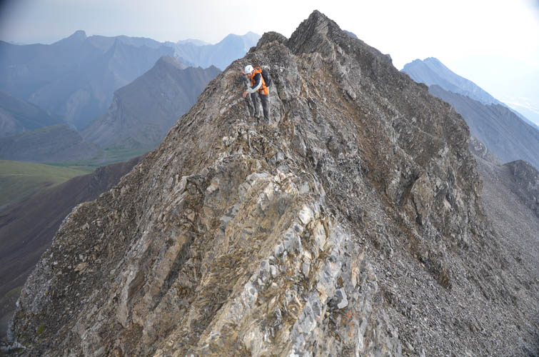
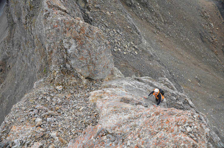
Richard tackling one of the difficult sections along the crumbly ridge.
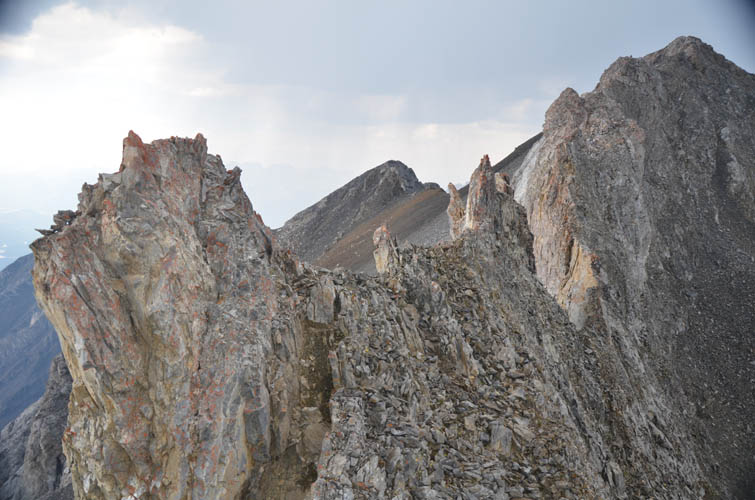
The ridge is super narrow and exposed for the last few hundred metres.
Flaky, steep and loose. This part can be avoided by traversing on scree below to the left (west).
The crux of our trip: a steep friction slab. As before, this can be bypassed via scree on the west side, shown in the right of this photo.
Narrow ridge just past the crux.
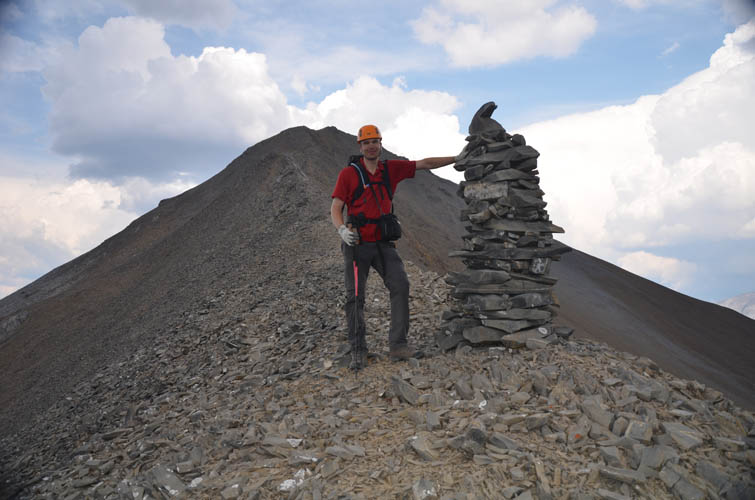
At last, the summit is within easy reach.
A look down the pretty valley to the east.
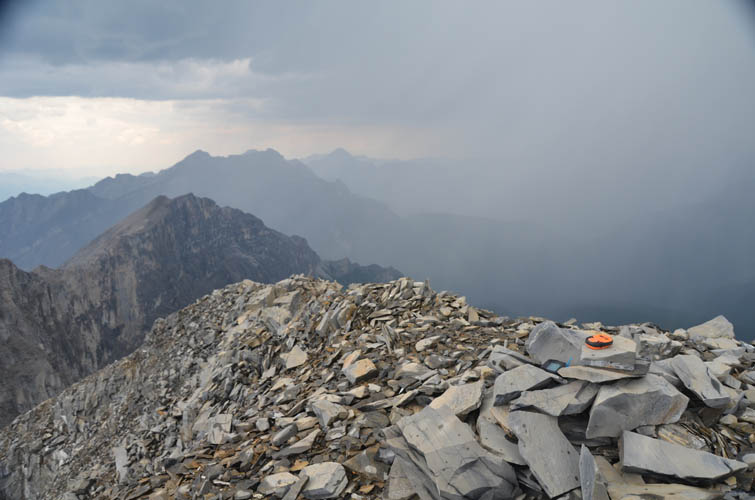
The summit of Mount Charles Stewart. Dark thunder clouds are moving in.
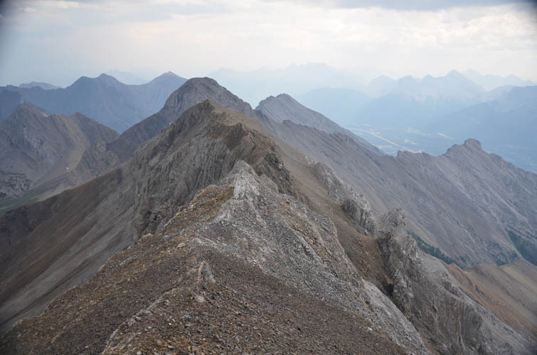
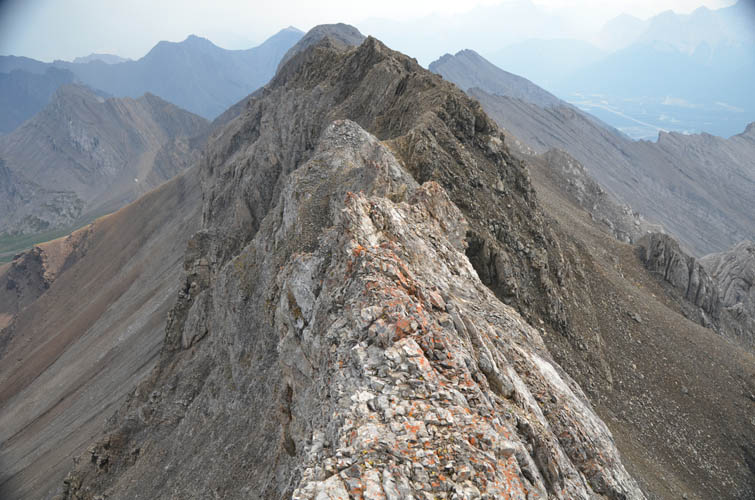
A look back at the ridge where we came from. On return we bypassed the first part of the ridge on the brown scree on the right.
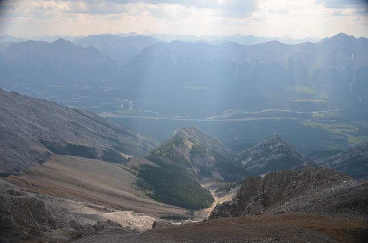
The Bow Valley below us to the west.
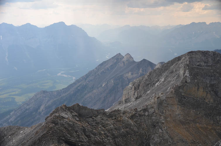
Princess Margaret is the pointy double summit to the NW.
Traversing below the initial section of ridge (looking back at the summit, which is just around the ridge up the scree slope).

Then I’m back on the ridge crest. Richard is trying to bypass it along the eastern side now, but it’s also tough going.
After the rain has passed and the sun is out again, we are almost back at the notch.