
10 April 2017
With Wen
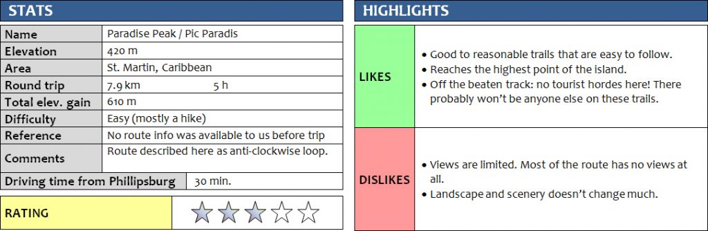
Paradise Peak, or Pic Paradis as it’s locally called, is the highest point of the Caribbean island of St. Martin and located near its geographic centre on the French side of the island. We picked it as our first mountain hike during our Caribbean vacation – although frankly, this can hardly be called a “mountain”. With an elevation of a mere 420 m above sea-level (according to my GPS; officially 424 m), it’s definitely not as impressive to look at as other island summits like Mount Liamuiga on St. Kitts or Nevis Peak on neighboring Nevis.
There is a good road that goes up the NW side of the peak almost all of the way, so the vast majority of visitors drive up and then walk a short distance to the top. A small estate called Loterie Farm with a restaurant, pool, zip-lining, etc. can also be visited en route. We chose to hike up from the east side, where a rough trail has been cut through the bush. Apparently this is called the “Moho Trail”.
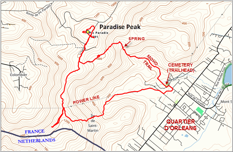
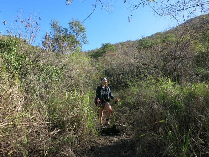
The trailhead is at a small cemetery near the western end of the town of Quartier d’Orléans (French Quarter). After some 100 m, the trail splits and we followed the right branch as indicated by orange flagging. After that it was almost impossible to get lost as there was only one path to follow. The trail is in good condition but the rapidly encroaching vegetation shows that it’s seldom used. It starts out flat and then slowly but steadily gains elevation. It was hot and dry and we really felt the stifling heat as we passed through shady forest and thorny shrubs. Just before we arrived at an old mineral spring with a disused collection basin, a short section of steep rock slabs across the trail presented a nice challenge. A rope has been fixed here to help people up the often slippery rock for a few metres and although you could easily scramble up this section, the rope certainly makes it easier. We would’ve loved to splash some cold water onto our faces but there wasn’t any water flowing at the time. Relying on our trusted 3 litre camelback instead, we continued along the steep trail, which then flattened out in a dry shrubby area before descending slightly back into the forest. After hiking up a small gully we emerged from the trees at a broad ridge a few hundred metres south of the summit. For the first time we enjoyed some views on this hike: from here you could scan over the town of Orléans, with the treed hills and coastline behind.
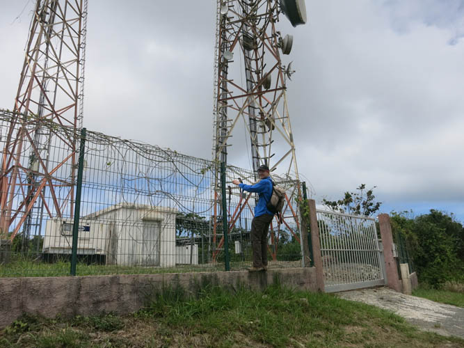
The trail along the ridge was surprisingly good and led us past a luxury mansion perched on the hillside up to a large radio tower sitting atop the highpoint of Paradise Peak. There is a somewhat hidden viewpoint on the tower’s west side that offers nice vistas of Marigot, the “capital” of French Saint Martin, and the western coastline. We circled the radio tower and then made our way to a nice viewpoint overlooking the eastern coast, including views of Tintamarre Island and Orléans. The perfect lunch spot!
What to bring for lunch on holiday mountain trips has long been a topic of discussion and experimentation for me. If you’re staying in a hotel or hostel and don’t have access to a full kitchen or a well-stocked supermarket, what do you bring for lunch if you’re out hiking the whole day? I am someone who needs his lunch, no matter how easy or short the day, so I always make sure to bring something of high caloric value. Other requirements for a holiday mountain lunch are that it has to be cheap, reasonably tasty, and it shouldn’t go off if it’s hot outside. Bananas are perfect in tropical countries, as are granola bars, but for something savoury you’d ideally want some sort of locally prepared meal which of course isn’t always available on the day of your hike. My solution so far has been very simple and basic: a can of tuna (preferably in oil for extra energy), some bread, and a small can of corn or baked beans if I can find it. Cans are not the most efficient and environmentally friendly type of food to lug up a mountain considering you have to bring back all the garbage, but in many places your choices are very limited.
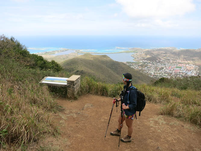
After a tasty tuna-bread-corn lunch supplemented by some bananas and oranges, we headed back along the main ridge towards the south, continuing along the very good trail which soon entered the forest again. The trail, which is marked occasionally by orange dots on rocks, then gradually becomes rougher as it rises and contours around the west side of the ridge and passes a vegetable orchard near a high point. The forest is noticeably greener and the climate more humid on the west side of the ridge. A wooden sign marks the intersection where another trail branches off down the west side to the village of Colombier. We didn’t feel like continuing along the ridge, so we backtracked a bit and then turned right (east) onto a smaller path that we had spotted earlier right underneath a power line mast.
The path was fairly rudimentary (marked with white reflectors stapled to tree trunks), but turned out to be a great choice for an alternative descent and to complete a loop hike. Sections of the trail were fairly overgrown, others steep and muddy (no ropes), requiring some hands-on scrambling moves here and there. Thorny bushes and lots of spider webs added to the flavour. It doesn’t surprise me that this route hardly sees any foot traffic, as most casual hikers probably would have a terrible time here!
There was only one trail intersection along the way, where we turned left to get down to the bottom of the valley, then past a few ramshackle huts back into the outskirts of Orléans. This trip was a great hike and a bit of a surprise given the complete solitude on a generally very built-up and crowded island. We didn’t see a single person all day! Despite the lack of views and rough trails for most of the route, this makes for a very enjoyable hike provided you’re equipped with a pair of sturdy hiking boots and a sense of adventure.
Note: We strongly suggest to bring good, sturdy hiking boots and lots of water (at least 3 litres per person) on this hike. Also recommended are extra sunscreen, a hat, long-sleeved shirt and long pants to help protect your skin from the bush.
DISCLAIMER: Use at your own risk for general guidance only! Do not follow this GPX track blindly but use your own judgement in assessing terrain and choosing the safest route.

The start of our hike, with the main ridge leading up to Paradise Peak in front of us.
Orange blazes mark the trail.
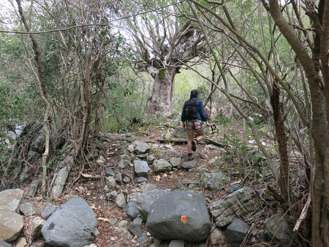
Parts of the trail follow old stone walls that have been reclaimed by the forest.
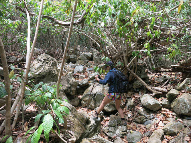
The first hour or so is mostly in a dry, hot creek with lots of boulders.
Typical views of the trail higher up. Cacti and thorny shrubs line the path.
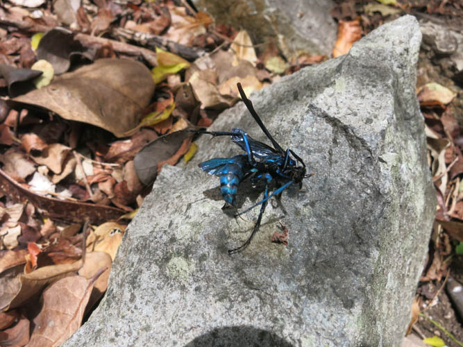
A dead insect of some sort with a striking blue colour. It’s about 4 cm long and 1 cm across!
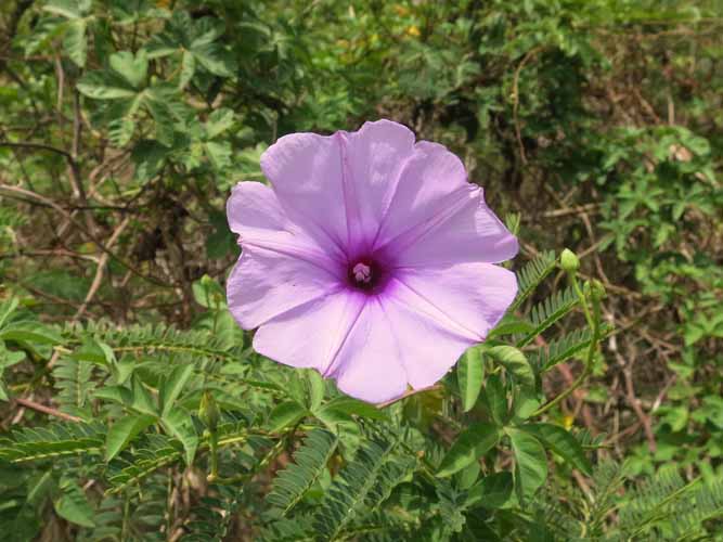
Occasionally, a beautiful flower blossom peaks through the bush. This one is perhaps from a wild sweet potato plant?
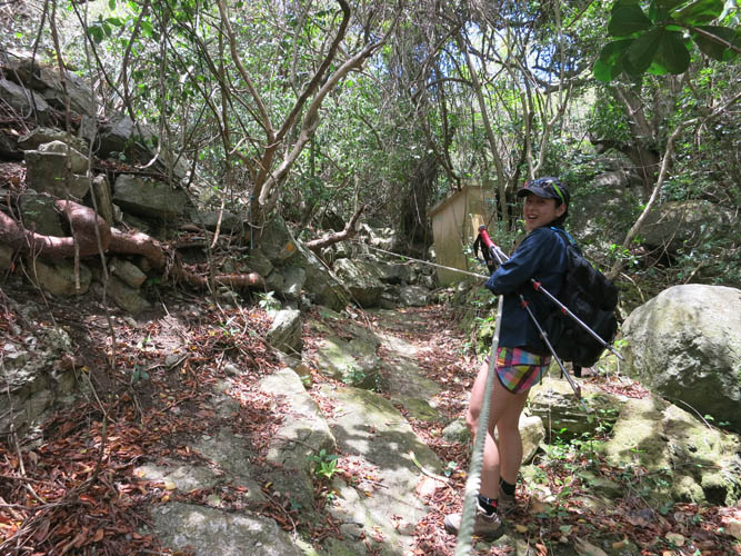
Near the spring, there is a rope that helps to get up some slippery rock slabs along the trail.

At the main ridge. The radio tower marks the summit.
Pic Paradis, the highest point on St. Martin!
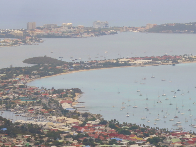
Looking towards Marigot, capital of French St. Martin, on the west side of the island. The peninsula in the far distance is already on the Dutch side.
There’s also a beautiful viewpoint overlooking the east coast of the island.
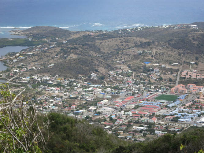
Quartier d’Orleans, the small town where we started our hike in the morning.
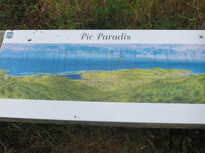
Close-up of the plaque highlighting all the landmarks seen from here.
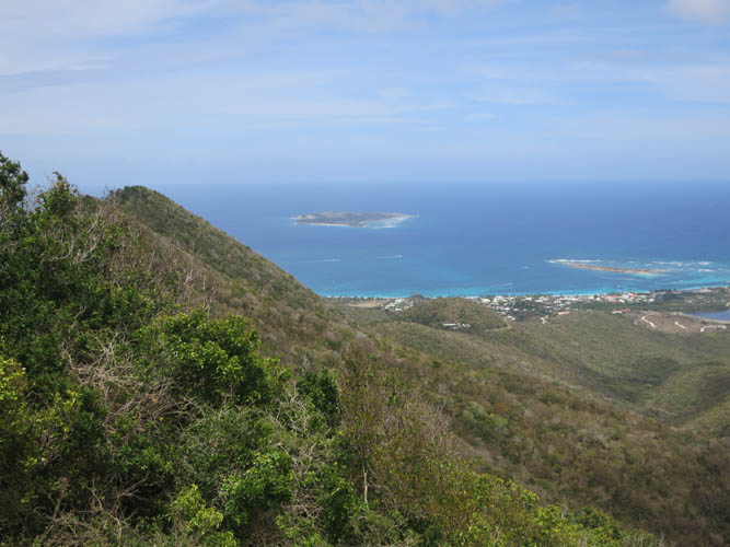
Tintamarre is an uninhabited island east of St. Martin.
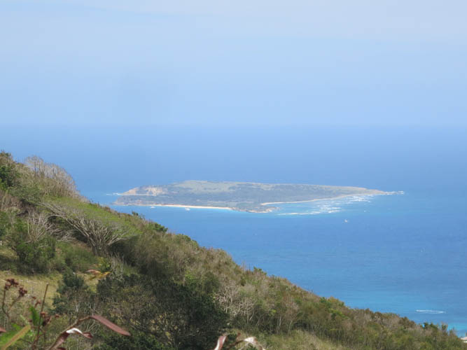
Close-up of Tintamarre. Appears to be a favourite spot for anchoring yachts along the long, sandy beach.

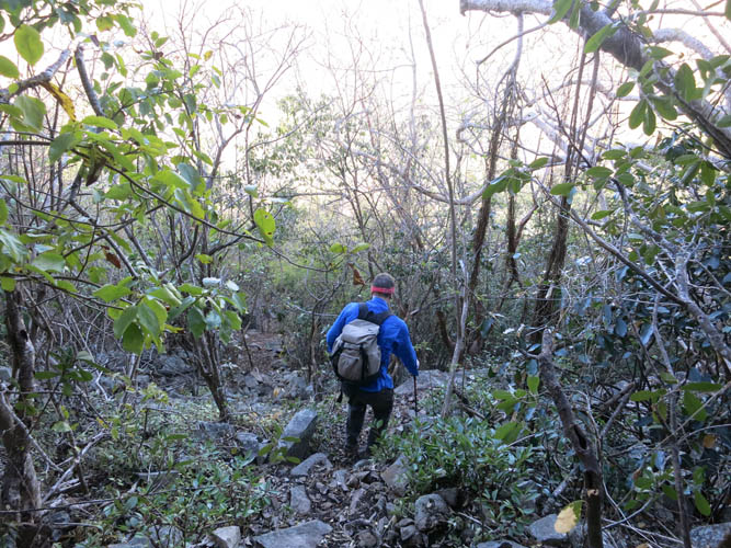
Heading south along the main ridge.
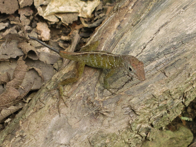
Lots of salamanders up here!
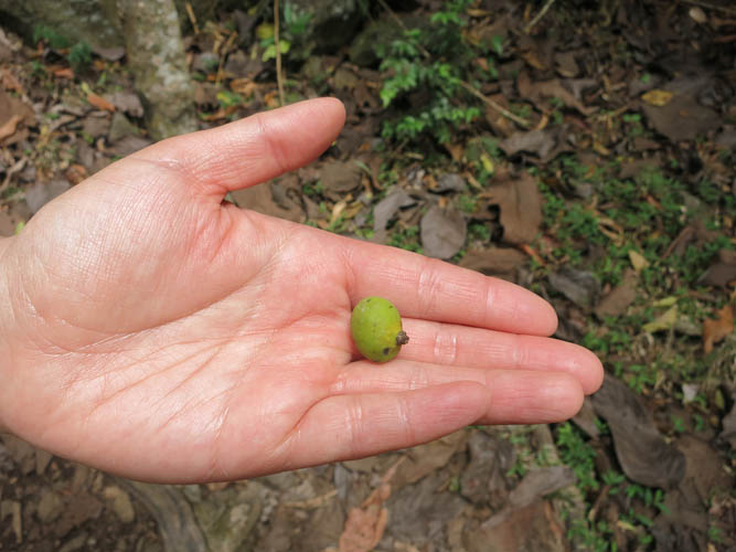
And mango trees! This baby mango looks tiny.

Looking back at the main ridge and the peak’s summit on the left.
Our descent route is rough and steep most of the way, and a hands-on affair in many spots.
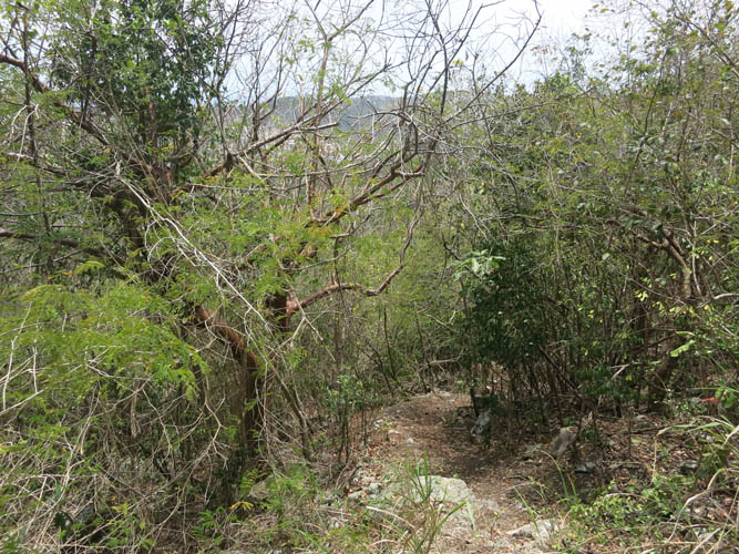
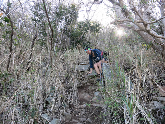
Although the trail is rough, it’s easy to follow.
Almost back down in the valley!
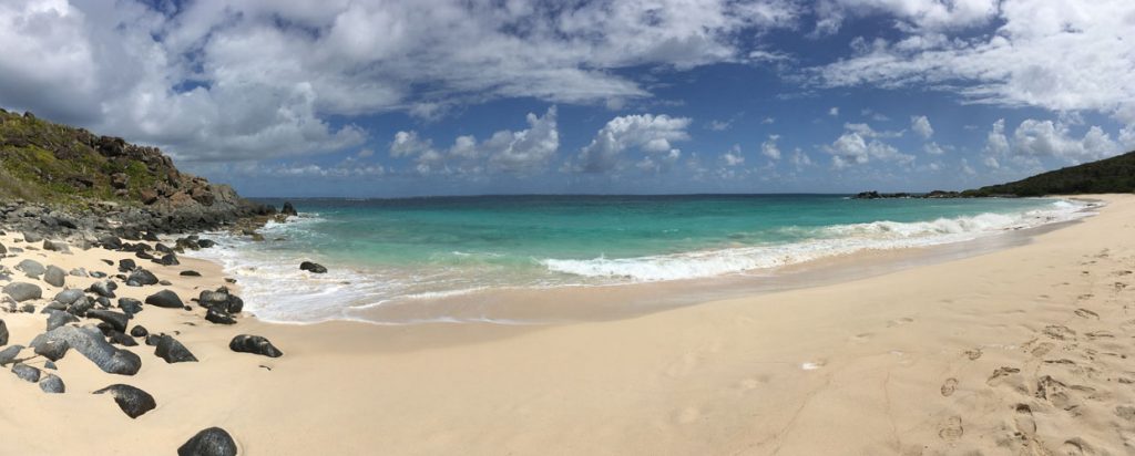
What better way to end a hot, sweaty hiking day than on a beach like this? Petite Baie at the northeastern tip of the island is simply spectacular!