26 April 2017
With Wen
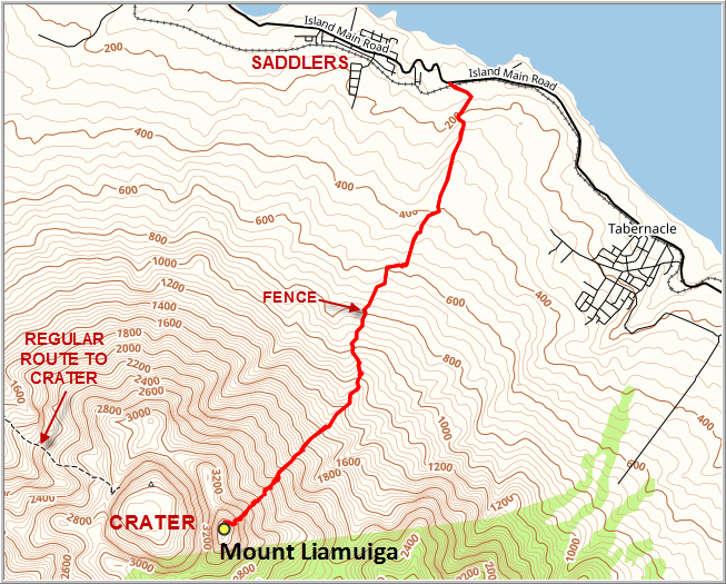
Mount Liamuiga (pronounced lie-ah-MEE-gah) is a dormant stratovolcano that rises 1163 m above sea-level, the highest point in the small Caribbean nation of Saint Kitts & Nevis. There is a well-established route that goes up the west side of the mountain, but that path only reaches the rim of the crater and not the summit itself. To reach the true summit of Mount Liamuiga, one has to take a rarely used trail up the eastern slopes, a route most people including even islanders don’t seem to know about.
Armed with a machete and a GPX track provided by the very informative SKN Trails website, we had no issues finding the trail from the main island road at Harris Village. The description on the SKN site wasn’t exactly encouraging and there were stern warnings about the lack of a path, dense bush, and extremely steep and dangerous rocky sections and missing ropes. We braced ourselves for the worst and in the end found the hike to be very doable, although it has to be said it’s actually a scramble in places and certainly not the kind of outing a casual hiker should do.
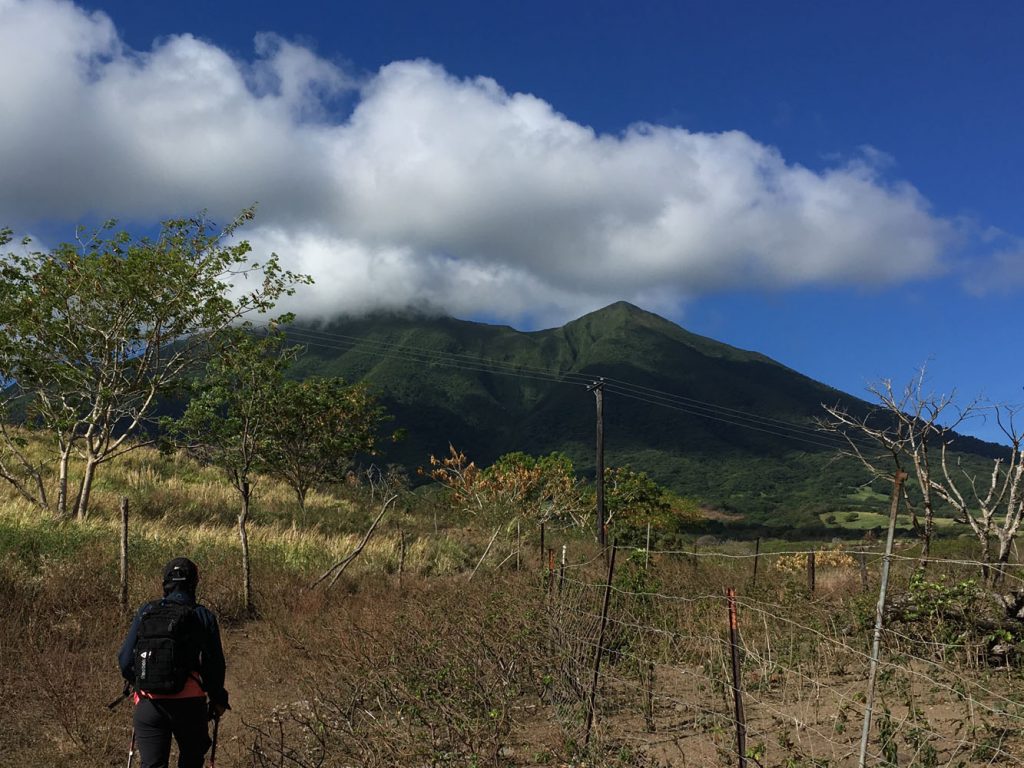
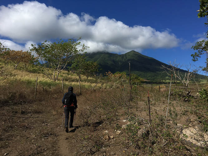
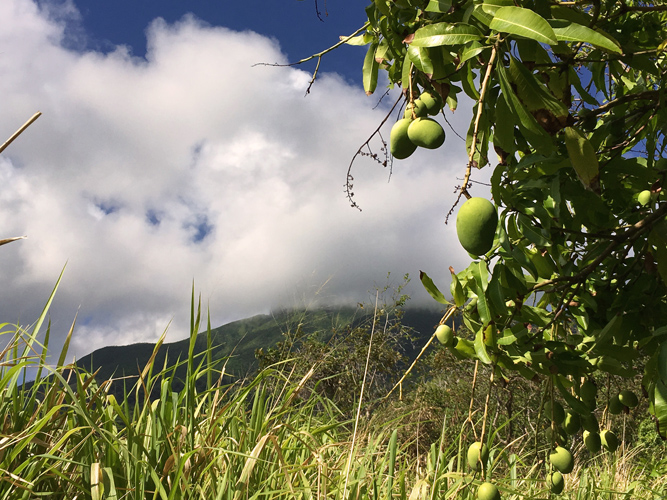
It was a gorgeous day and we really enjoyed the leisurely approach along the dirt tracks from the main island road through cane fields and mango trees. Mount Liamuiga looks very imposing from any angle on the island, but it is especially impressive when its jagged summit mass appears through the ever present clouds that hover around the massif.
As soon as we linked up with the actual forest trail we noticed the abundance of blazes marking the route, including red and yellow tape around tree trunks and red flagging. What a relief we found the trail so easily! We were certainly delighted about not having to do any route finding and really enjoyed our forest walk. Flat terrain soon changed into a broad ridge and the slope got steeper. The ridge became quite narrow and great care was required here not to slip off the sides, which were now quite steep. There is a short section where the ridge is very narrow and for a few metres appears to consist of only roots suspended above nothing, but it’s not too challenging if you tread carefully.
Eventually, the ridge peters out and the trail makes a sharp left and continues up a steep gully filled with boulders, roots and fallen trees. We quite enjoyed this section – it’s a dark and damp place that made us feel like we are in some sort of bewitched fairy tale world, and it’s a nice change from pure forest and it’s also easy to make good progress here and gain elevation fast. We took a much needed break at the end of the gully path with tasty Kittitian pound cake, peanuts and bananas. As before, the path here was flagged very well and easy to follow. Some of the flags looked quite new and I really wonder how long it will take for the forest to reclaim its terrain. If the path isn’t used a lot, it will probably overgrow very quickly and the flags might fall off or become eaten up by the bush.
Past the gully, the slope got steeper and we soon encountered the first of many roped sections. The ropes all seemed to be in reasonable shape and they certainly held my weight, although I tried to avoid using them wherever possible. Wen found them to be very helpful, mostly because her reach is much shorter than mine. Most of the ropes were installed in places where the trail overcame some sort of steep obstacle, mostly over rocks and/or roots. These were wet, muddy and slippery spots, and you had to be really careful as a slip could easily lead to injury, if not necessarily death (exposure is limited in most of these places).
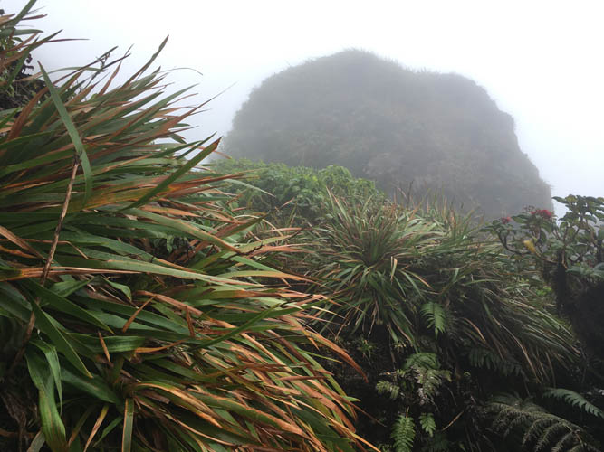
Finally, after many hours of scrabbling up mud, rock and roots, we emerged from the tunnel of vegetation and got some short-lived views through the thick, fast moving clouds just below the summit. The flora noticeably changes up here, with shorter trees and more ferns and shrubs. It also got colder and mistier as we climbed higher to the rim of the crater. Unfortunately, all we could see was thick green bush and a few lichen-covered cliffs.
After some 6 hours, we reached the final roped section that loops around the west side of the crater rim in thick and steep bush and then shortly leads up to the summit of Mount Liamuiga. A black US mailbox greeted us on top of the rocky knob, with a new register inside that was placed by a group of hikers on January 21, 2017. The only other entry was by a group of locals, probably mostly youngsters, from the village of Tabernacle on April 14, 2017. This explained why we had been lucky to find the track in such good condition with new flagging! On the flipside, we were annoyed to see quite a bit of garbage strewn around the summit… empty water bottles, candy bar wrappers, etc… we cleaned up as best as we could, but it seems clear that some people do not know that nature is there for all to enjoy and everyone should respect that.
We didn’t expect to have any views as we knew that the mountain is shrouded in clouds most of the time, so we weren’t too disappointed about topping out in the clouds. After a good rest and an incredibly tasty tuna and corn lunch, we headed back. Retracing our steps was easier, but with every hour that passed our concentration waned and we started to slip and slide more and more. The last hour of our trip was in the dark – quite a magical experience in itself, hiking with headlamps and listening to the growing sounds of the forest – birds, crickets, bugs, all playing their part in the jungle concert.
This was a long, exhausting, but hugely fascinating and rewarding trip that I would classify as a jungle scramble – it’s more than a hike, but not a classic rock scramble. A wonderful St. Kitts experience indeed.
Note: This is not a good choice for the casual hiker. Route finding can potentially be a problem as the trail isn’t used often and can overgrow quickly; many sections are very steep and slippery near the top and if something happens you’re far away from help, so a guide is recommended. If you attempt this hike, make sure to bring plenty of water (absolute minimum 3 litres per person, better yet 4 litres), high-energy food, a long-sleeved shirt and long pants to protect yourself from the bush, an extra layer to keep warm on the top, a flashlight or headlamp in case of a late return, and last but not least a pair of garden gloves which make climbing up and down the ropes and clinging on to trees and roots much, much easier. Also highly recommended are a hiking pole and a pair of good, sturdy hiking boots.
DISCLAIMER: Use at your own risk for general guidance only! Do not follow this GPX track blindly but use your own judgement in assessing terrain and choosing the safest route.

A beautiful Anglican Church by the seaside marks the start of our route.
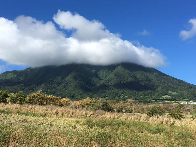
Mount Liamuiga’s upper reaches seem to be constantly covered in clouds.
Only rarely do the clouds clear up enough to grant a quick peek at the high points of the mountain. In this photo, the summit is still hidden behind clouds on the left.
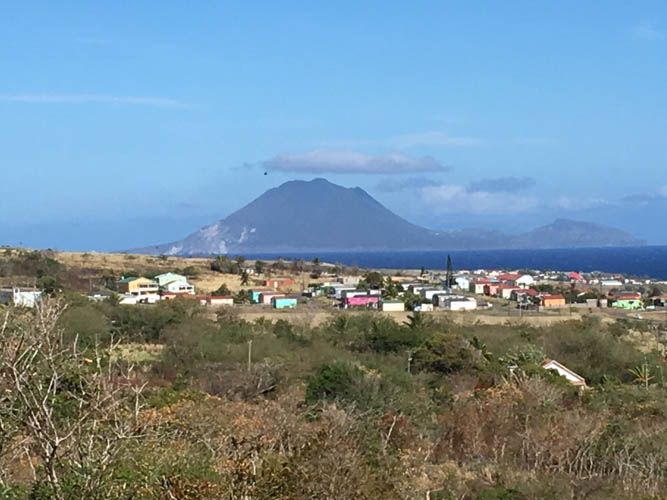
“The Quill” on neighbouring Sint Eustatius (Dutch Caribbean), at 602 m the second highest mountain in the Kingdom of the Netherlands, looks like another great objective in the area.
Mango trees line our approach trail.
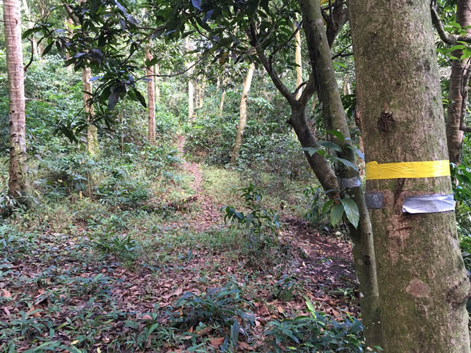
Most of the trail is well-marked, especially at the beginning.
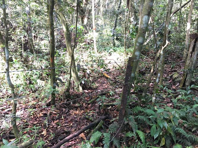
An old fence, the only one crossing the trail.
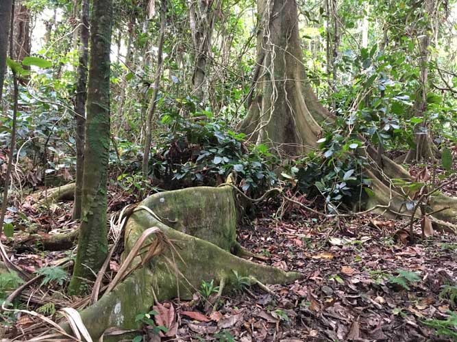
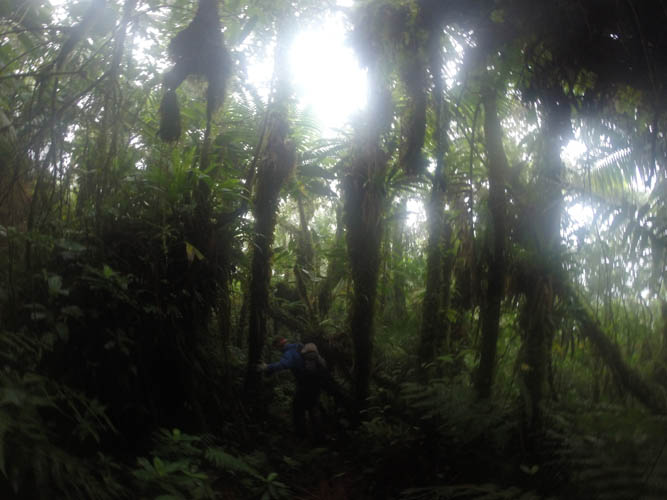
Fantastic jungle scenery.
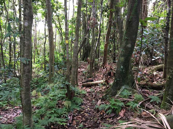
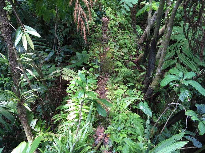
Much of the first half in the forest looks like this. Not too dense, but it gets more muddy and slippery the higher you go!
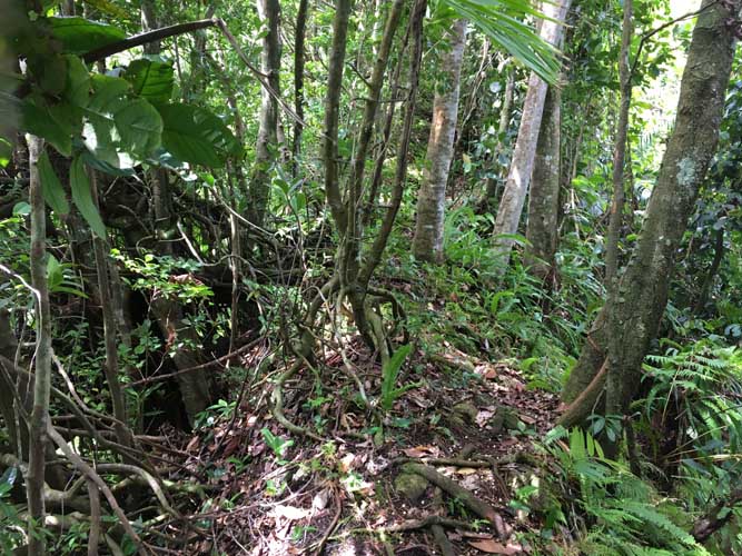
And the bush gets denser and more humid.
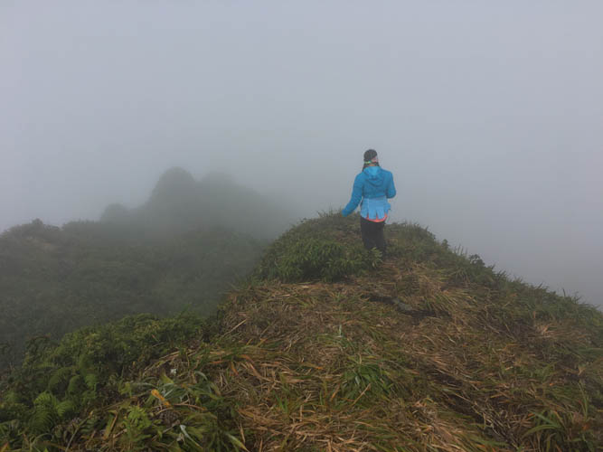
The short ridge section where the trail narrows to a few feet, with steep drop offs into the green abyss left and right…
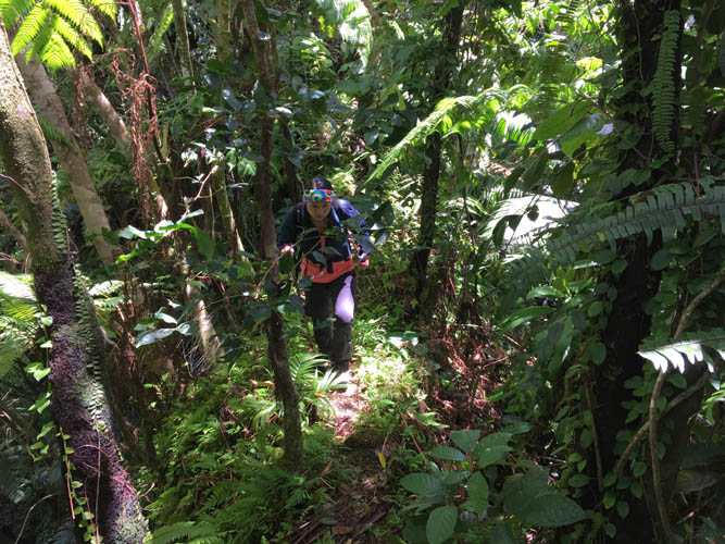
Wen coming up another narrow part of the ridge.
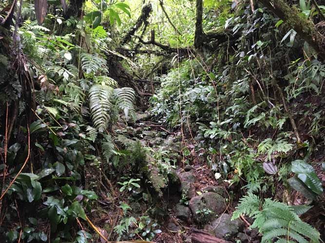
In the muddy gully. Lots of wet roots and fallen branches across the trail here.
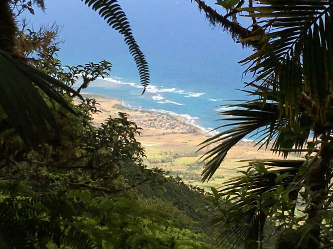
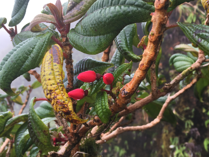
One of the rare views through the canopy.
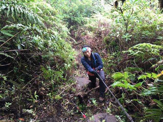
There are quite a few ropes along the upper part of the trail. They really help as the rock is so muddy and slippery here.
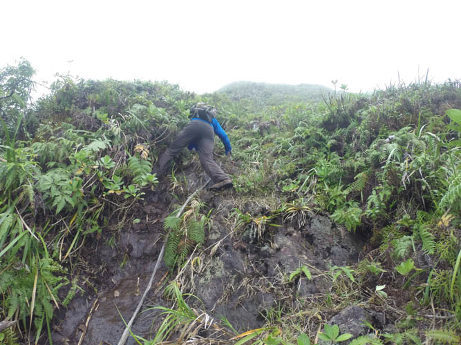
It’s steep!
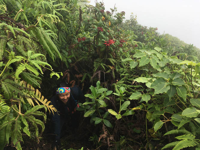
The landscape changes as we break out of the forest into a sea of ferns and thick bushes.

Easy to see how quickly a jungle trail can overgrow!
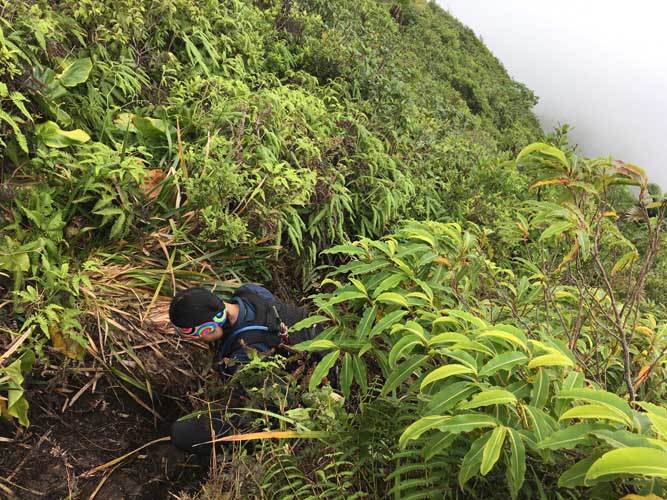
In some parts the abundantly lush vegetation turns the trail into a tunnel.
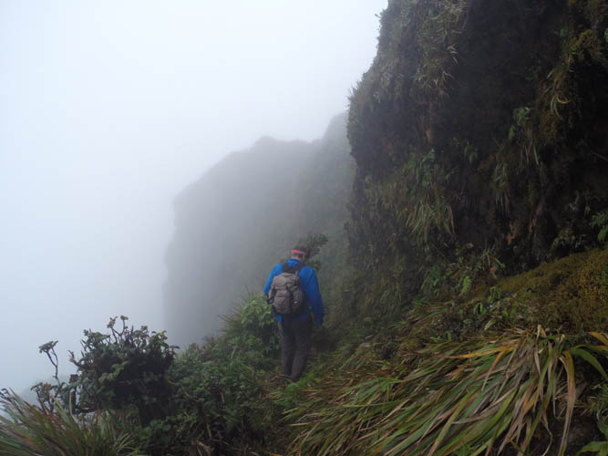
Coming up to the cliffs along the summit crater.
Everything is wet up here. No wonder, we are in the middle of the clouds!
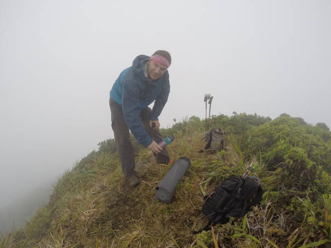
Nearing the true summit of Mount Liamuiga.
A black US mailbox with a plastic bottle contains the summit register. We were the third party in 2017. Not exactly a popular mountain!
Going down took much longer than expected… it’s so easy to slip on wet grass and mud!
Half way down, everything including our camera is soaked and completely caked up with mud. A true jungle experience!