28 April 2017
With Wen
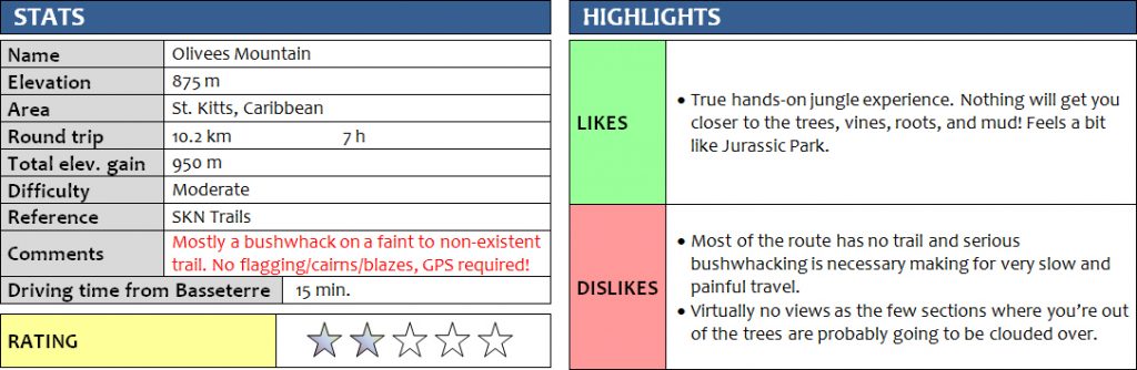
Despite being the third highest peak on St Kitts, Olivees Mountain (also sometimes erroneously spelled “Oliver” or “Olivier”) does not appear to be a destination for peakbaggers and we found almost no information on the mountain when we did some research for our second climb on the island. The peak is clearly shown on the glossy tourist maps handed out for free upon arrival in St Kitts, but no hiking trails are shown and the friendly staff at the tourist office in Basseterrre hadn’t even heard about it. The only information we could find was through the SKN hiking website, which is probably the best source of hiking info for the island. The site features a hike up the so-called “Fischorski Trail”, which more or less leads up to the summit.
Sounds all great, if it wasn’t for one major catch: this “trail” isn’t really a trail at all! There are very faint indications of a previously existing track here and there, but these tend to peter out and higher up the mountain they disappear completely in the thick bush…
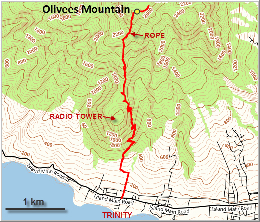
We caught a minibus, popular with islanders and a very inexpensive way to get around St Kitts, to the settlement of Trinity just NW of Basseterre where we started our trip. From the main island road, we walked straight up the hill through a residential area and then followed a rough road that leads to the radio tower above the village. The road allows you to gain the first 400 m of elevation in about an hour. It was a slog though: there was hardly a breeze to give you a break from the oppressive heat and views were limited. Only two spots along the switchbacks offered some glances of the sugar cane fields and Basseterre below, with Nevis island in the background.
A small opening in the bush on the side of the road marks the turn-off from the radio tower road to the “trail”, which we enhanced with some pink flagging to make it more obvious. Then the bushwhacking started! Once we entered the forest, we were pretty much on our own, following whatever faint smattering of a path that our mind imagined was in front of us – or, more often, wasn’t. There were no blazes or flagging to mark the route, so we initially relied on our GPS to guide us along the track we had loaded on our phones. It soon became evident that this was truly an abandoned trail that hasn’t seen a good boot trample in a long time.
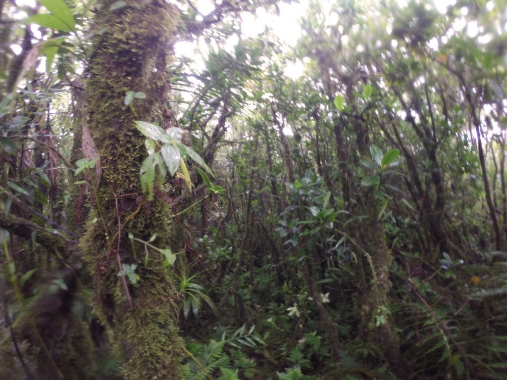
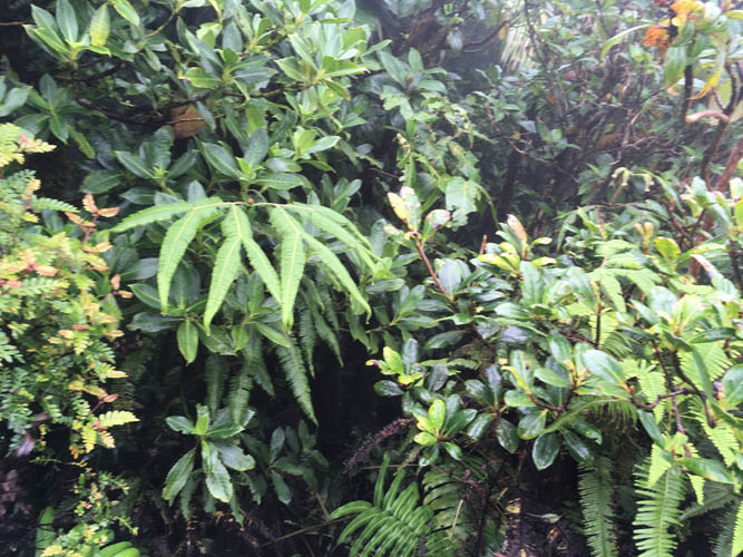
Thankfully, the first section in the bush was through fairly light forest and even without a path we made decent progress. We gradually gained elevation along a broad ridge at a very gentle grade. There were no views, but the occasional breeze brought some respite from the heat. The higher we went, the more humid and denser the forest became. Once the ridge levelled out, we found ourselves in what looked like an enchanted forest, a lush labyrinth of fern-covered trees, roots and vines, their outlines blurred by the slowly moving mist.
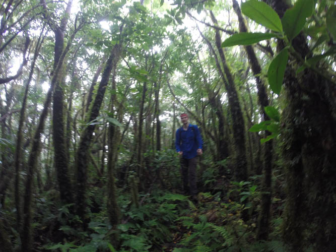
Soon our pace slowed significantly when the ridge dropped and the bush grew denser and more difficult to penetrate. We reached a small col where the ridge was flanked by steep drop offs on both sides and we had to be careful not to step onto patches of foliage with no support underneath. The ridge rose again, then suddenly narrowed to only a few metres wide, but all of it was overgrown with some of the nastiest bush I’ve ever seen. What really struck me was that there was no rock to be seen as every inch of this mountain appears to be covered in vegetation. Thick shrubs and ferns, two to three metres tall, with loose roots and vines in the undergrowth, gave us a bushwhacking experience of a lifetime! In some places you could tell where the previous trail had been (the bushes had a slight indentation), but this didn’t really help. I simply bulldozed through the foliage while Wen started to grow increasingly impatient with this self-imposed suffer marathon – quite understandably so. Thankfully, the super nasty section didn’t last long and gave way to the “normal” level of bushwhacking, which now was a relief to us. To our surprise, one steepish drop along the ridge had a rope attached to trees, which made sliding down the mud in this part slightly easier. We caught brief glimpses of the ridge ahead, but views were very limited to non-existent as everything was covered in dense clouds.
Past the rope, all and any indications of a past trail were gone. We fought our way through another nasty section and then topped out at 885 m at a point that I consider to be the summit of Olivees Mountain. It was all treed and there were no views whatsoever – probably the most disappointing summit experience we’ve ever had. To make sure we had actually reached the highest point we continued for another few hundred metres but the ridge just kept dropping and we really had enough of slipping and sliding through the bush by now. Just to add to the misery, it also started pouring at this point – we were completely soaked and half covered in mud.
Having made the summit, the only goal now was to head back as quickly as possible. We skipped our planned summit lunch and focused our minds on routefinding the same way back we came. There was more sliding on mud, slipping on wet roots, pushing and shoving through shrubs and trees, but it was a lot easier now that we were able to follow our fresh tracks. It reminded me a little of breaking a trail when snowshoeing in the Canadian Rockies! And the jungle trail on St Kitts surely will be overgrown again in a matter of weeks.
This was an exercise in endurance and determination, not an enjoyable hike. I was grateful I got to experience the true rain forest in all its roughness, but it’s an experience I wouldn’t repeat. Without regular traffic and blazes clearly marking a path, Olivee Mountain will never be a destination for hikers keen to explore the island’s peaks.
Note: This is not a good choice for the casual hiker. Route finding can potentially be a problem as the trail isn’t used often and can overgrow quickly; many sections are very steep and slippery near the top and if something happens you’re far away from help, so a guide is recommended. If you attempt this hike, make sure to bring plenty of water (absolute minimum 3 litres per person, better yet 4 litres), high-energy food, a long-sleeved shirt and long pants to protect yourself from the bush, an extra layer to keep warm on the top, a flashlight or headlamp in case of a late return, and last but not least a pair of garden gloves which make climbing up and down the ropes and clinging on to trees and roots much, much easier. Also highly recommended are a hiking pole and a pair of good, sturdy hiking boots.
DISCLAIMER: Use at your own risk for general guidance only! Do not follow this GPX track blindly but use your own judgement in assessing terrain and choosing the safest route.
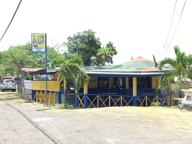
Chimney’s Bar along the main island road – there always seems to be a bar at the start of the hike 🙂
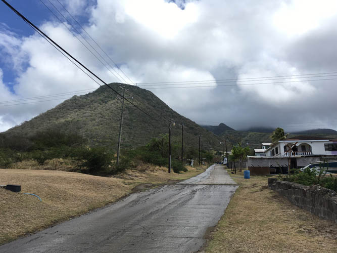
From the road, only the Radio Tower is visible. Olivees Mountain is completely hidden in the clouds.
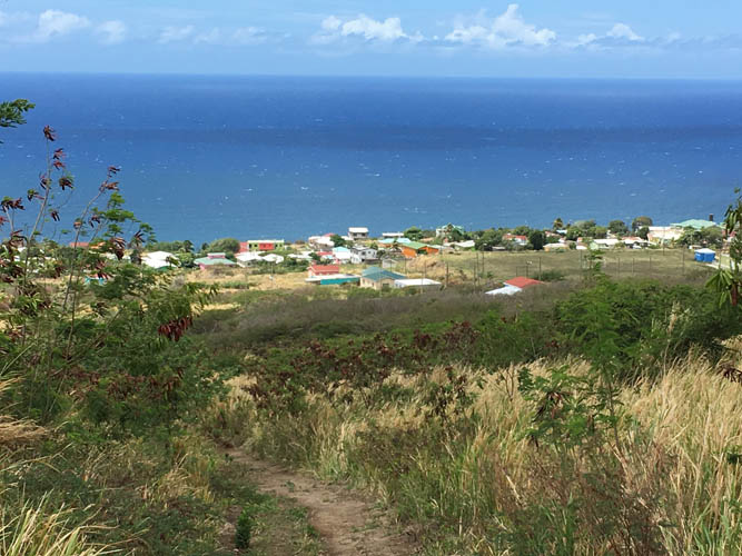
A look back at the coastline of St. Kitts.
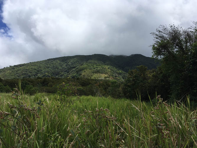
A view of the long way ahead through the bush, as seen from the col between the Radio Tower and Olivees Mountain.
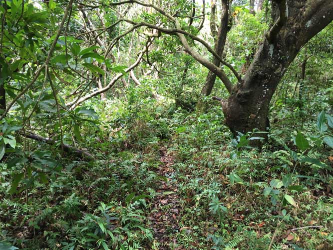
A faint trail is visible at the beginning…

…only to disappear soon after.
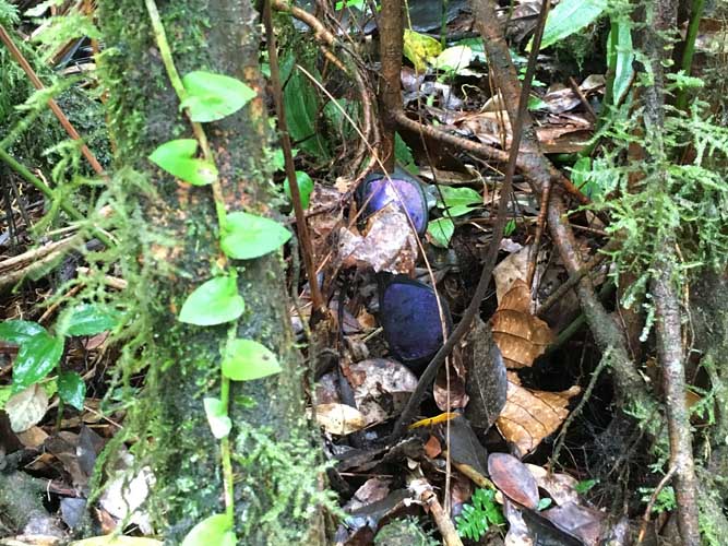
The only trace of human activity we found: a pair of old, weathered sun glasses.
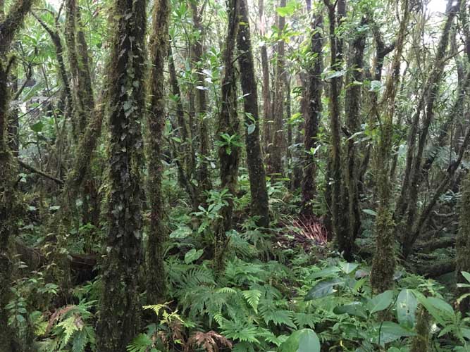
Enchanted forest.
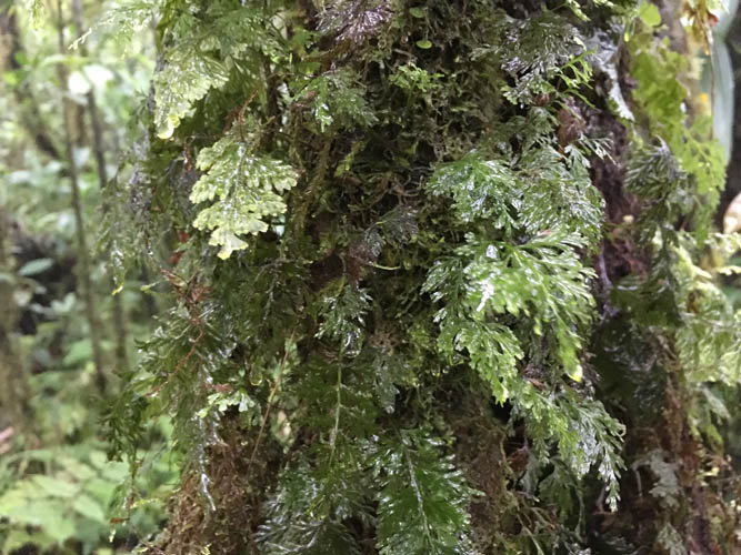
Impossible not to get wet here!
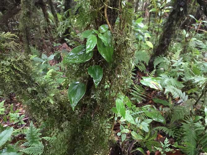
Lush fern growth on tree trunks.
Thick bush to struggle through. Yes, this is where the trail is supposed to be!

Muddling along in the bush – definitely no more trail here, not even a hint!
Near the “summit” in the rain. Time to turn around and head back for that much needed shower!