2 June 2017
With Richard
A few weeks after hiking up Whistler Mountain in the Castle area, Richard and I decided to pay this beautiful area another visit. Large parts of the Castle were officially designated a Provincial Park in February 2017, which brings it in line with the same level of environmental protection as afforded to Kananaskis, for example. I think this is a very positive step that will help safeguard the treasures of nature found in this enchanting and ecologically sensitive region.
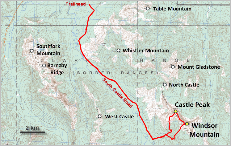
We followed the excellent description by Dave McMurray on his website and had no trouble locating the trailhead (now marked by blue flagging and a small cairn) after riding in along the South Castle Road for about 13.7 km. There were a number of small streams that we had to cross, either by riding directly through the water or by rock-hopping, and thankfully we never had to take off our boots.
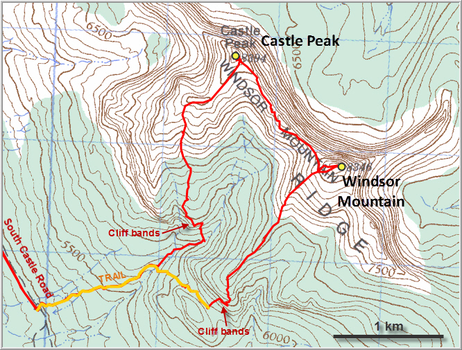
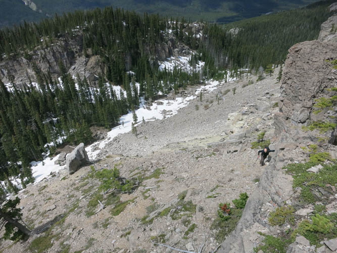
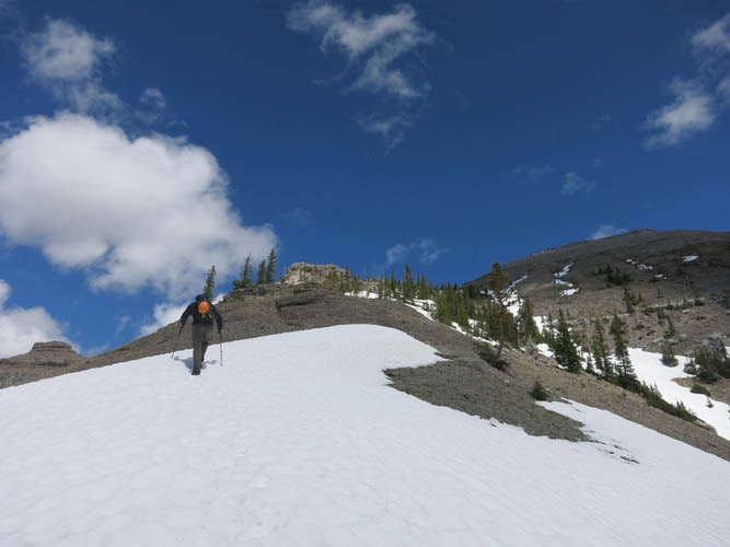
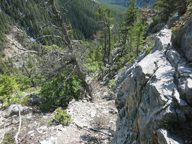
The trail leading up the eastern slopes of the valley is in fairly good shape and not too difficult to follow, but I can imagine that in the height of summer with all the flourishing vegetation it could be quite overgrown in places. The path goes straight up the hillside through light forest, then descends to a small drainage, before rising again to a small saddle underneath a steep cliff band. There was still lots of snow left here (more than a metre deep in some spots!), but we managed to follow the trail to its high point underneath the cliff. A steep ramp in the cliff offered a quick and direct way up, and after crossing a boulder field we used this break to gain a minor treed ridge.
From the top of the ridge, views of Windsor Mountain and nearby Castle Peak opened up for the first time. Our objective didn’t look very far, and it really wasn’t! The last hurdle to overcome was a small saddle between the ridge and the upper slopes of Windsor Mountain, which was full of deep snow still lingering between the trees here. Fortunately, the snow had hardened enough to allow for easy travel and kick-stepping higher up. The last 30 minutes were simply a steep slog on open slopes to the summit, no scrambling necessary.
What a view from the top! I couldn’t get enough of the sight of Victoria Peak to the east with its mesmerizing display of red, grey, brown and green colour hues. The drop down the east side of Windsor is exhilarating to say the least – it’s a vertical wall that goes straight down for hundreds of metres! True to Castle nature, it was a very windy day and it was quite uncomfortable at the summit so we huddled down in a slightly wind-sheltered spot a few metres behind the cairn.
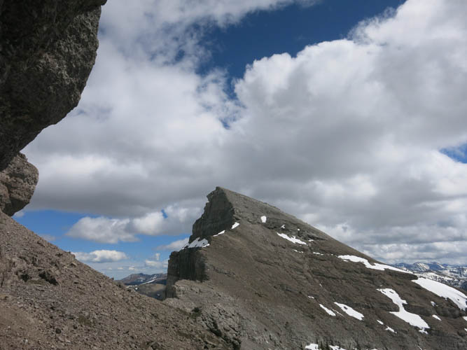
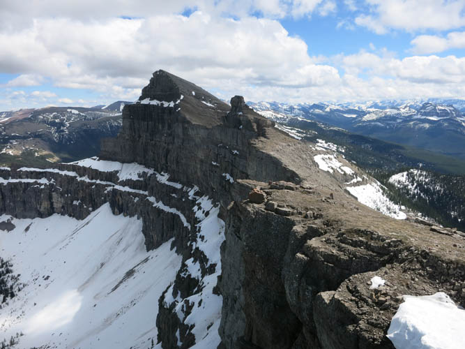
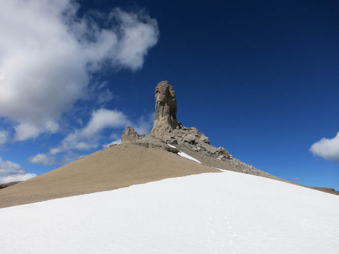
We were also rewarded with brilliant views of Castle Peak – that famous landmark of the area that is recognizable from far away like a bunch of sore fingers sticking out of the rock. Its cockscomb shape is unmistakable and I’ve always wanted to see it up close, knowing very well that a summit bid was reserved to those with ropes and harnesses only. As we stood here on Windsor Mountain, Castle Peak looked so tantalizingly close… why not traverse over and inspect it in more detail?
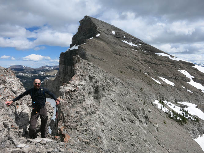
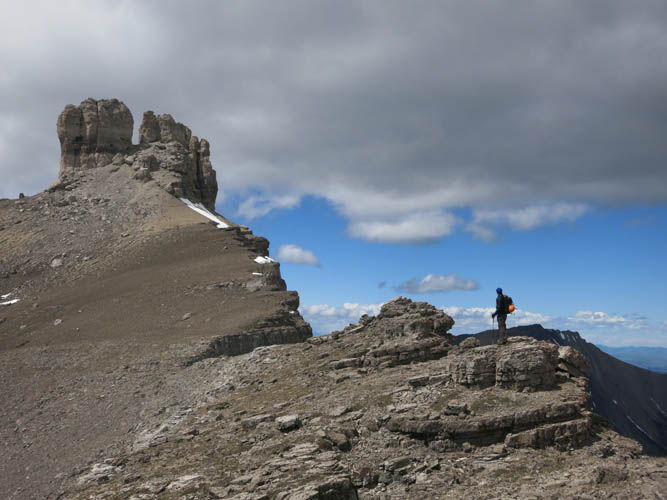
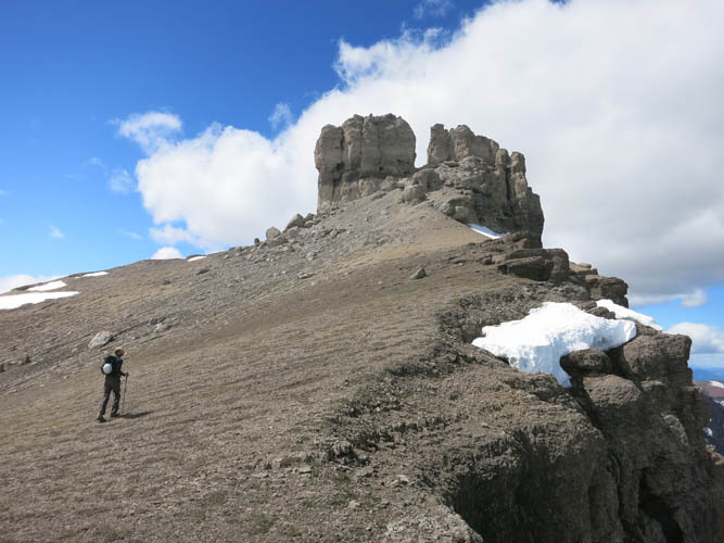
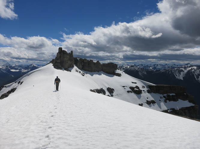
The whole ridge from Windsor Mountain is simply spectacular, with many steep cliffs, rock bluffs and crags that seem difficult to negotiate from afar, but are actually quite manageable once you’re there. Richard and I were surprised how easy it was to hike along this sharp, step-like ridge. There was even a faint game trail to help guide us along. It took no more than about 45 minutes from the summit of Windsor to reach the base of Castle Peak. I scrambled up to the notch between the fingers and was instantly blasted with what felt like a jet stream: the gap acts as a perfect funnel for the never ending winds here. My GPS measured 2530 m – perhaps 10-15 m below the summit – which is as far as us scramblers can get on this peak. True summit or not, it was a sense of immense satisfaction just to be up here, soaking in the beautiful views of the ridge leading up to Windsor Mountain, and looking up the steep vertical pillars of Castle.
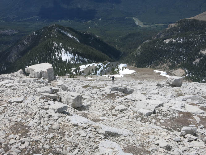
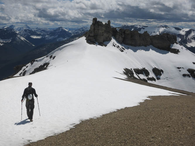
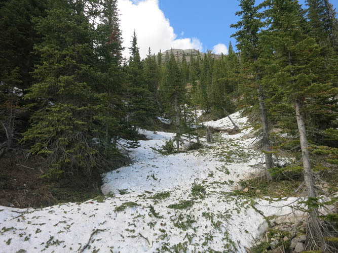
A gentle, snow-capped ridge leads towards the southwest, where we descended in a gully that we had spotted during our ascent earlier in the day. The snow in this south-facing gully was in perfect condition for a rapid but safe glissade downhill – hard enough not to sink in, but soft enough to allow us to easily control our speed. Lower down the gully abruptly ended in a steep, rocky drop-off and we were forced to deviate to the left and carefully route-find our way through ledges and cliffs to be able to reach the small valley below. From here, it was only a few hundred metres of hiking along the creek to link up with the trail again that we had taken in the morning.
This was a fabulous outing with incredible views that are hard to beat, especially if combined with a loop past Castle Peak. The bike ride is long and quite energy-draining by itself, but all this hard work is definitely worth it. Highly recommended!

DISCLAIMER: Use at your own risk for general guidance only! Do not follow this GPX track blindly but use your own judgement in assessing terrain and choosing the safest route.
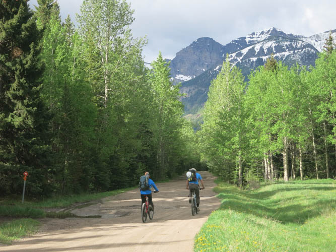
An easy but long bike ride starts our day. Stephan, another scrambler whom we met at the trailhead, joins us for the first part to the Whistler Mountain trailhead.
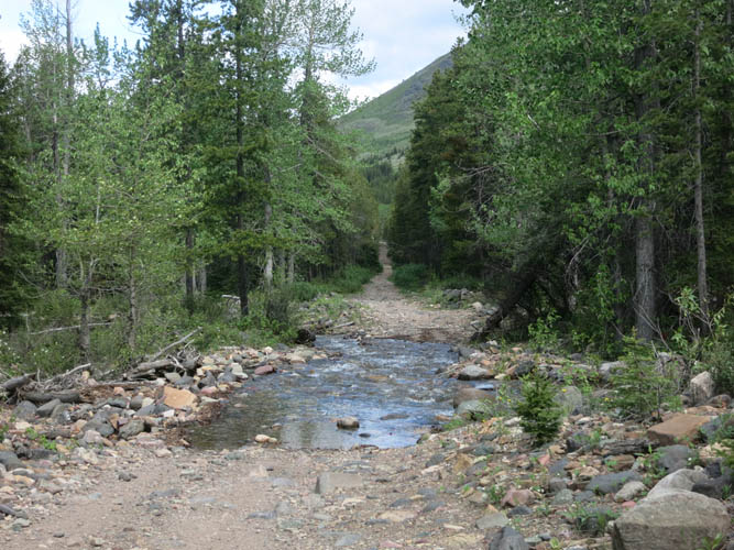
Several creeks run across the South Castle Road, but most of them are easily crossed.
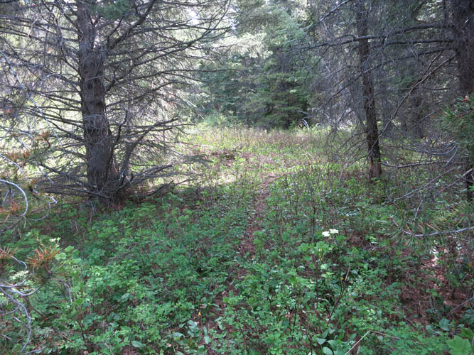
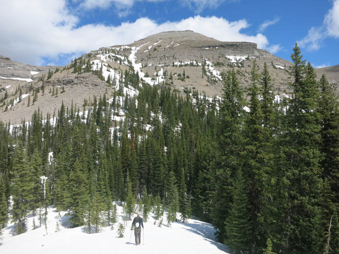
The trail leading up to Windsor Mountain is faint in places, but not too difficult to follow.
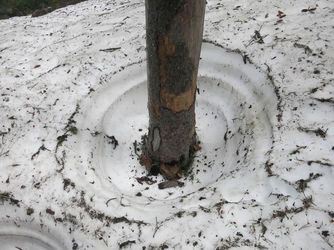
Deep snow lingers in some places – more than a metre thick!
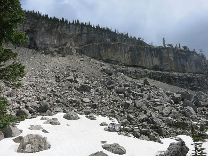
This is the break in the cliff that we used to gain the ridge.
Richard coming up just below some cliffbands. The trail follows the low point where the snow has accumulated below.
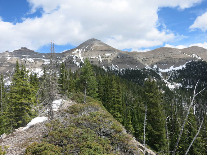
First views of Windsor Mountain from the treed ascent ridge.
From the ridge, we spot a possible descent gully on the other side of the small valley to the north (the curved thin snow line left of centre). It’s filled with snow, allowing for a quick glissade downhill.
A snow-filled saddle sits between the ridge and the summit.
Kick-stepping our way up some snow patches towards Windsor.
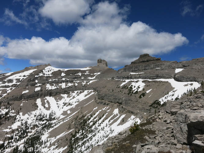
Fabulous views of the ridge connecting to Castle Peak open up.
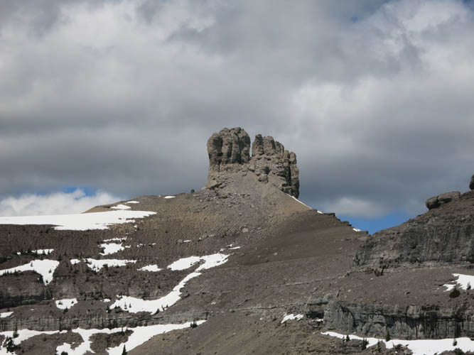
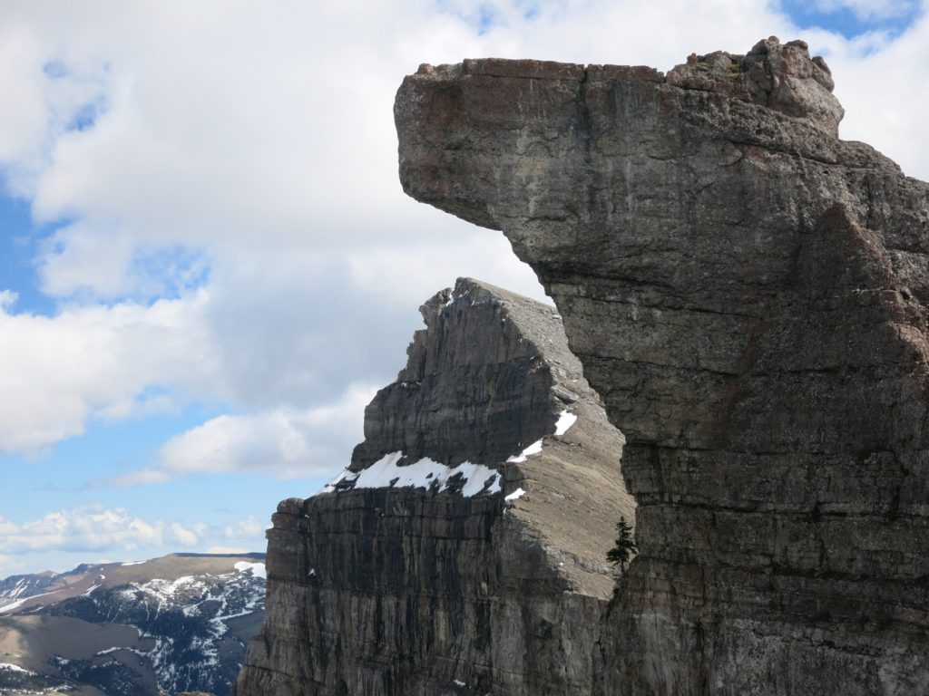
Close-up of Castle Peak.
Richard slogging up the open summit slopes to the top of Windsor Mountain.

Another beautiful view of Castle Peak.
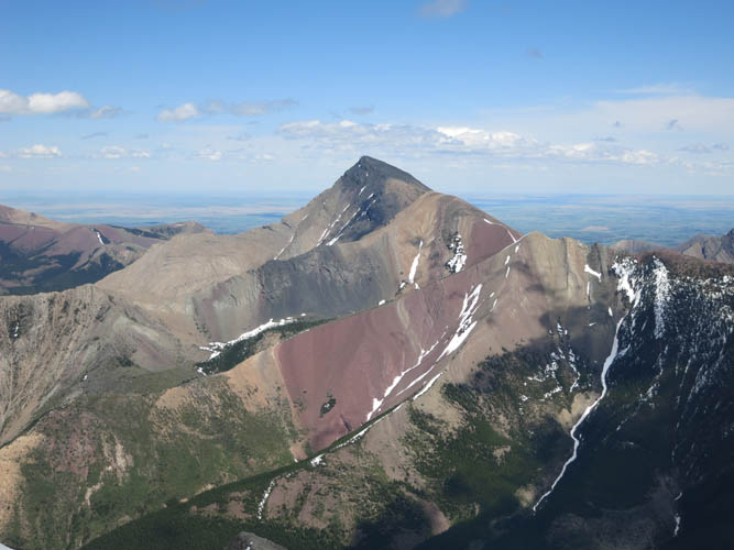
Victoria Peak is a super scenic and colourful mountain!
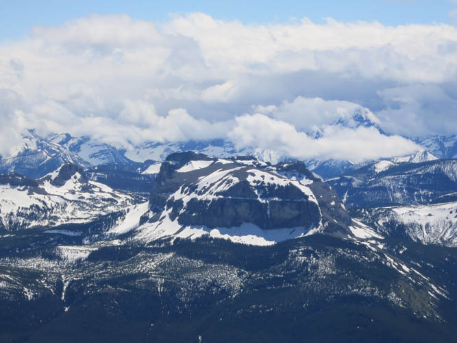
Mount Matkin lies to the SE.
Looking back at Windsor Mountain along the ridgewalk to Castle.
It looks like a slanted pyramid, doesn’t it!?
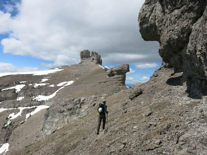
Heading towards Castle Peak.
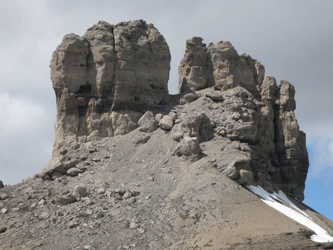
Castle Peak reminds me of teeth and fingers and a cockscomb all at the same time…
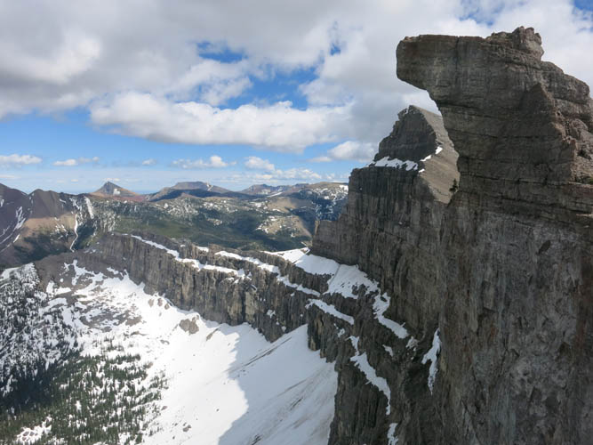
Views of the precipitous drop off the east side of Windsor Ridge.
This ridge really is one of the most scenic I’ve ever seen!
Looking back along the ridge.
Almost there!
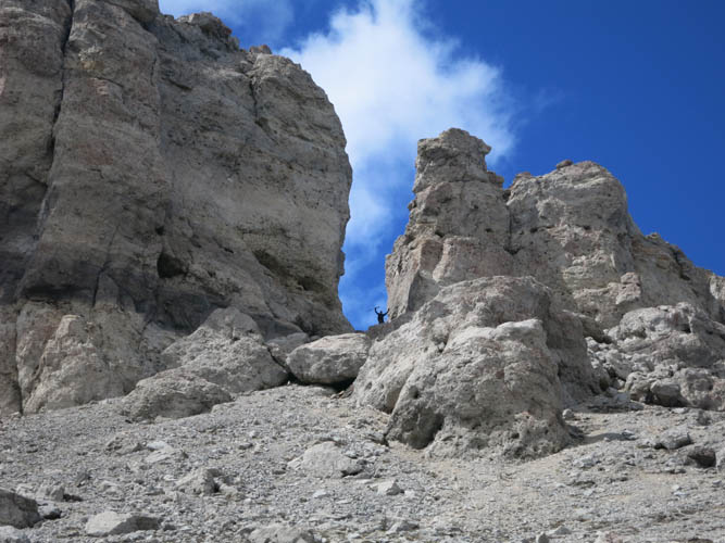
At the notch. This is as high as you can scramble.
Heading down the SW ridge.
What a fantastic view of Castle!
Perfect conditions today 🙂

Windsor Mountain looks like a shark’s tooth from here.
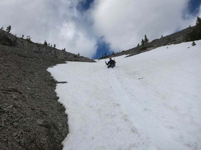
A fun glissade down the south gully makes for a quick descent.
The lower part of the gully looks a bit messy.
Negotiating cliff bands lower down.