28 May 2017
With Phil
Orient Point has been the most enjoyable scramble for me this year. Unlike neighboring Saddle Peak, this Front Range peak is a thoroughly pleasant affair that to me stands out with its variety of terrain and challenges along the way. It can also be easily done as a day trip from Calgary.
Phil and I had been talking about Orient Point for a long time and today we finally took our chance, wanting to do “something shorter”. Of course, it didn’t end up being “short” by any means, but every moment of those 11 hours was worth it and enjoyable (ok, maybe not the part where rain squalls and thunder descended upon us near the end).
There aren’t many previous trip descriptions to go by, but Sonny Bou’s helped a great deal and was enough for us to plan our day. Having been up the east end of Orient Point before in 2010, I knew there was a good horse trail that leads from the Ghost River almost directly to the start of the south ridge. Our first obstacle was the Ghost River itself: with all the spring run-off coming late this year, the often dry river bed was carrying abundant water and we had to don and doff our boots twice and wade two separate streams that had developed parallel to each other. It was a lovely morning with clear skies, and the ice cold water only helped us wake up and get a kick-start for the longish approach to Orient Point’s massive eastern cliffs that can be seen from as far away as Calgary.
The horse trail was just as I remembered it from years before, nicely leading us into a charming area of rolling alpine meadows complete with a little viewpoint overlooking the Ghost and South Ghost Rivers below, with End Mountain dominating the southern horizon. The trail got fainter as we turned south, parallel to the cliffs, then eventually we left it and sidesloped on grassy terrain for a short while, heading straight towards a break in Orient Point’s south ridge.
Hiking up the south ridge was simply a delight. Yes, it was a bit of a steep slog at times, but with the sunny weather and the fine scenery around us we were in great spirits and forgot all about the sweat and heavy legs, dues we were more than willing to pay for such prime hiking. We kept wondering if there was a route up Orient Point’s east face, where in places it appeared as if the numerous alternating cliff bands and ramps could potentially offer a circuitous route up. Our exploratory desires were distracted when we came upon that large, 20-30 m high cliff that now stood in our way along the south ridge. On my previous outing I had simply bypassed it on the far left (west) side, where you could scramble up through scree and boulders. This time, a conspicuous cleft in the cliff with a several large chockstones drew our attention and invited us to investigate further. It turned out to be a tunnel of sorts, almost a mini-cave, filled with hardened snow that had settled on an incline and with a tiny opening at the end. We kick stepped our way up the snow as the tunnel got narrower and narrower and barely managed to squeeze through the hole at the end, pushing our packs in front of us to get out of the chute. We emerged on a rubbly step in the cliff and a few more moderate/difficult scrambling steps were necessary to complete our “shortcut” through the cliff. In the end it would’ve probably been much faster to simply go around it, but this detour was way more fun!
An open slope of scree and boulders easily led to Orient Point’s east summit, which was as far as I had made it on my last trip several years ago. There are fantastic views of the Ghost and surrounding peaks from this vantage point and I think this makes for a great destination by itself. Our final objective today was the true summit of course, so we continued northwest towards a large, black cliff band that guards the summit block and contains the crux gully – or several, as it turned out. On the way up we simply tackled the first gully that looked reasonable: a narrow crack that required some stemming and squeezing, with good firm rock but very little in terms of hand holds. Thankfully, we found a much easier alternative on descent not far away, as squeezing down this crack would’ve been uncomfortable to say the least.
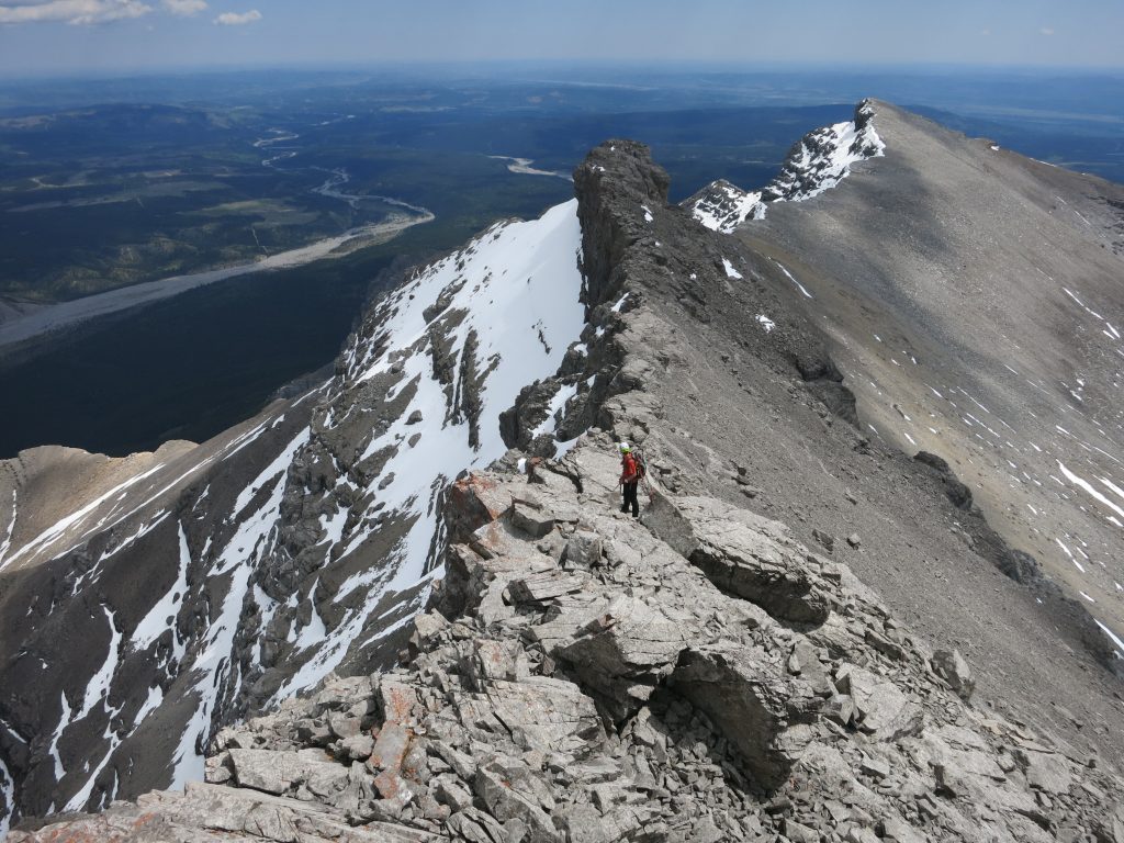
Above the gully we headed straight for the summit ridge, which offers delightful scrambling and many options to vary levels of difficulty and exposure at your leisure. The spicier parts can be easily avoided on climber’s left; for more fun and challenge, the ridge is best tackled head-on. As expected, the views from the summit were magnificent as there are so many unnamed little peaks and ridges in this area that are rarely seen. We had trouble picking out some of the names although we had both hiked in the Ghost before several times.
The easiest and fastest way to descend Orient Point is probably to simply retrace your route and go back along the summit ridge, find the easier gully (marked by a cairn and no more than moderate scrambling) and then head back down the south ridge again. We wanted to check out the “alternative” descent route through the south drainage, so after coming down the easier gully we left the ridge and descended into the broad bowl below us, veering to skier’s left all the while in order to avoid the many cliffs that are all over this impressive valley. It took quite a bit of route finding but eventually we made our way through the cliffs and down into the bottom of the drainage, where patches of snow provided some relief for our knees and sped up our descent.
It was a long but pleasant hike back to the South Ghost River valley, made easier by grassy benches on either side of the drainage. Not long after we had turned onto the partially washed out track in the South Ghost, it started to rain and a fast-flowing river combined with the ominous rumbling of nearby thunder drove us into the bush on the north side of the river bed where we had to contend with some light bushwhacking until we reached a good horse trail again. As is typical for Alberta thunderstorms, it only took about half an hour for the whole circus to stop and the sun to warm us up again, as if nothing had happened! We were a bit concerned about the increased water levels for the final crossing through the Ghost River, but thankfully our worries were unfounded and we made it back to the car without any issues.
DISCLAIMER: Use at your own risk for general guidance only! Do not follow this GPX track blindly but use your own judgement in assessing terrain and choosing the safest route.
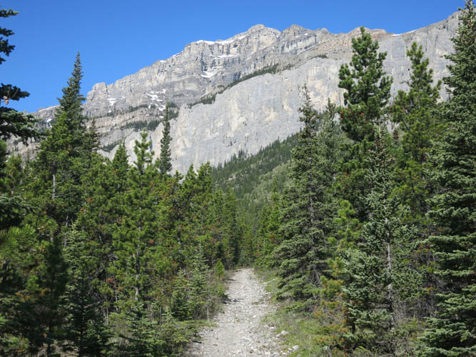
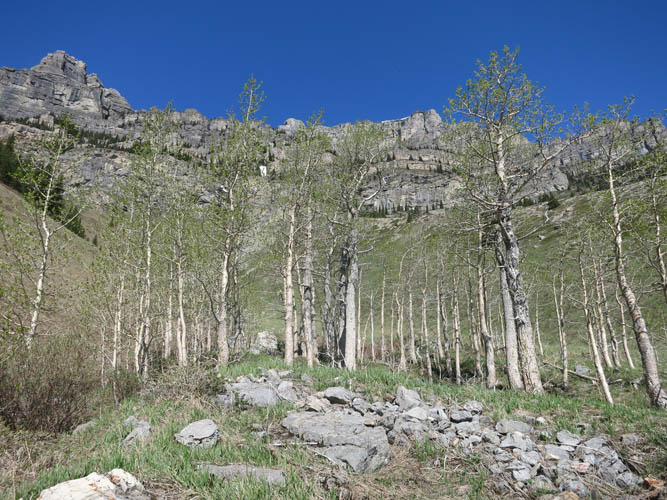
A good horse trail leads towards the east face of Orient Point.
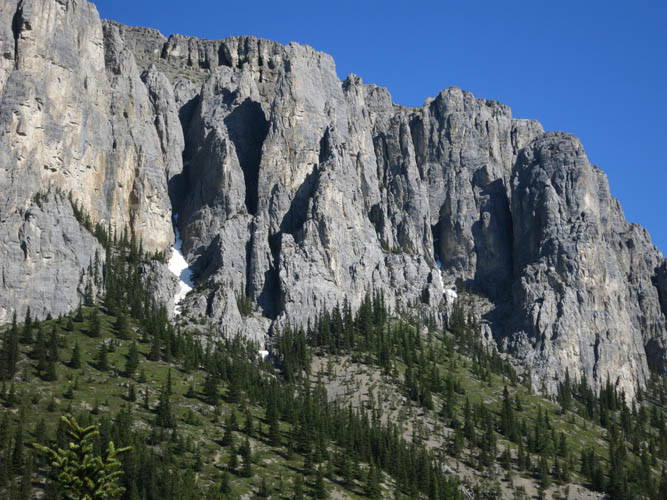
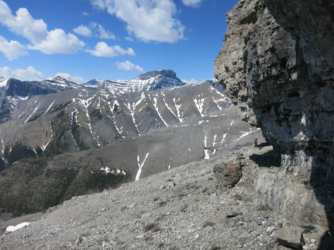
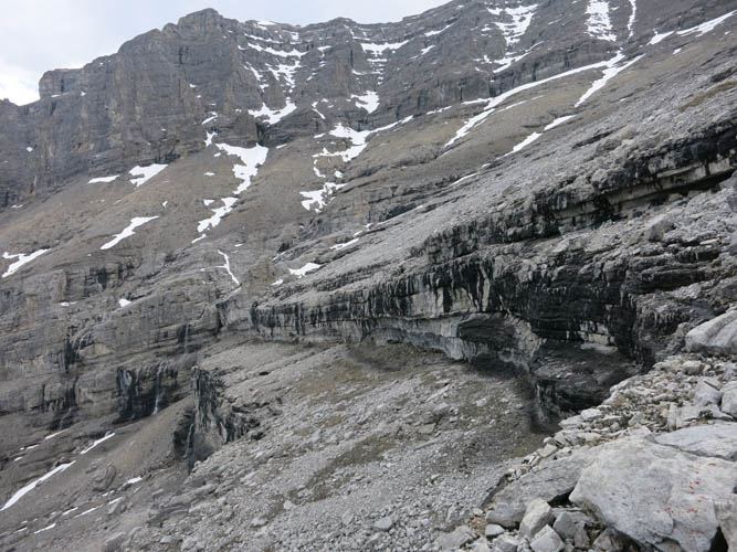
Impressive cliffs on Orient Point’s east face.
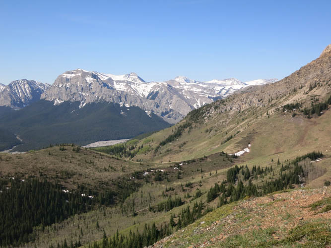
Below the cliffs, gently rolling hills and meadows dominate the landscape.
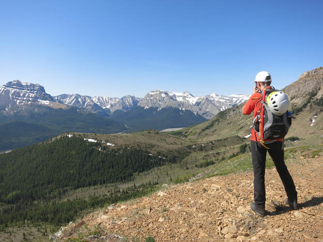
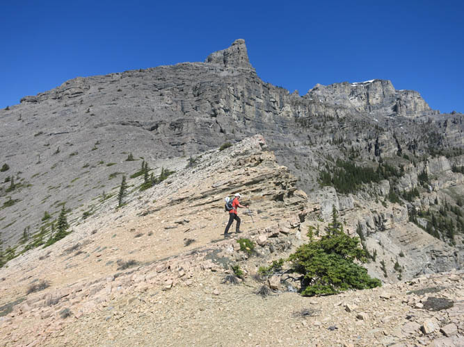
Phil looking SW towards the break in the south ridge (just left of his arm), where there’s an easy way up. End Mountain is visible on far left.
Looking up the steep cliffs of the east face.
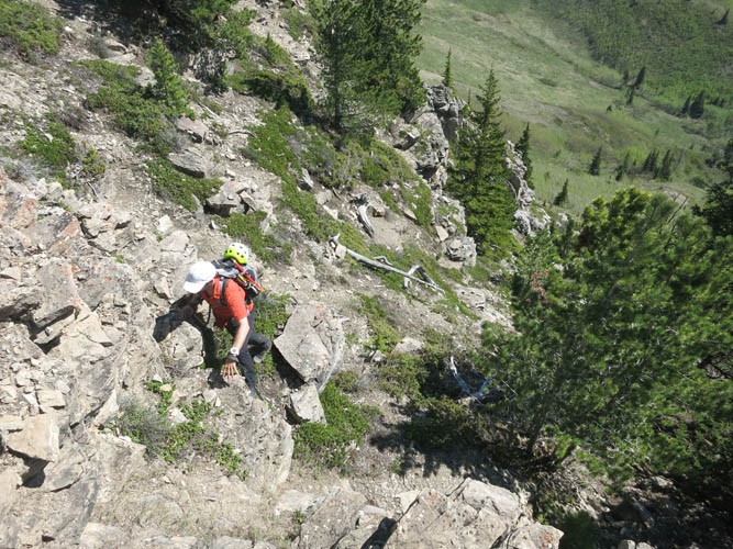
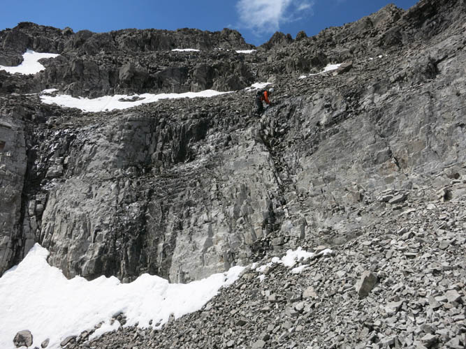
Phil scrambles up the break in the cliff to gain the south ridge.
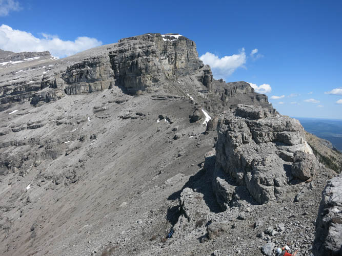
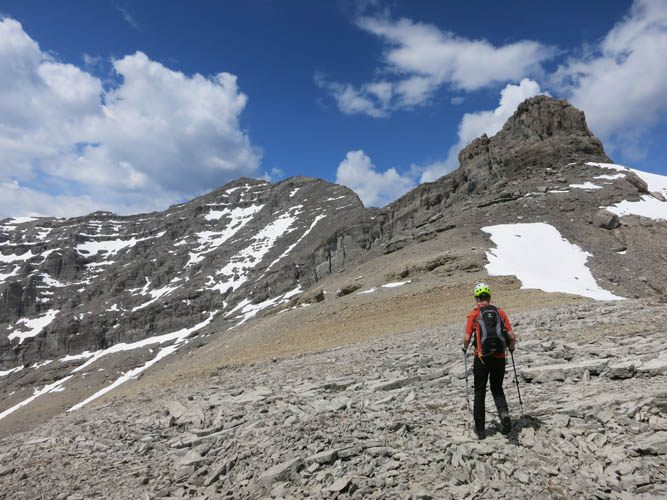
Looking up the south ridge.
There must be a route up the east face! Looks like complicated terrain.
Views back down the south ridge towards the South Ghost River.
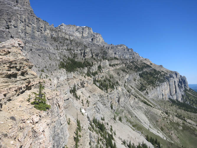
A massive cliff bars our way. The only way to circumvent it is to climber’s left.
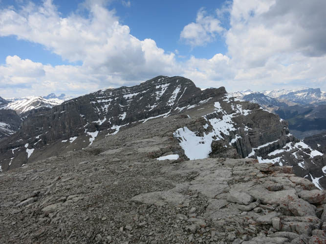
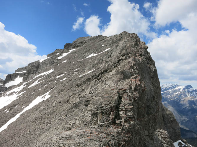
More interesting features along the ridge. The big cliff at the top contains the “tunnel”, situated in the left part of this photo.
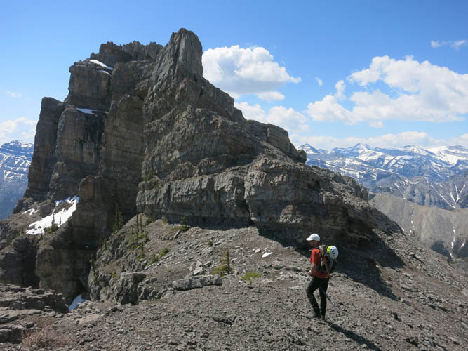
A rock crag along the ridge.
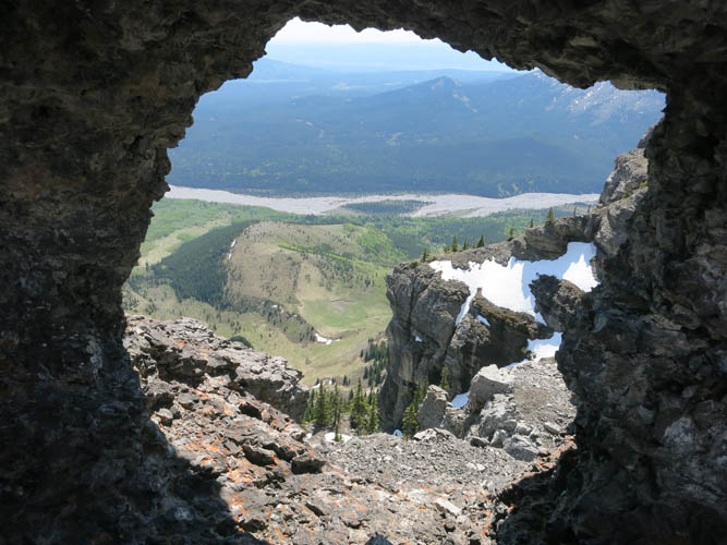
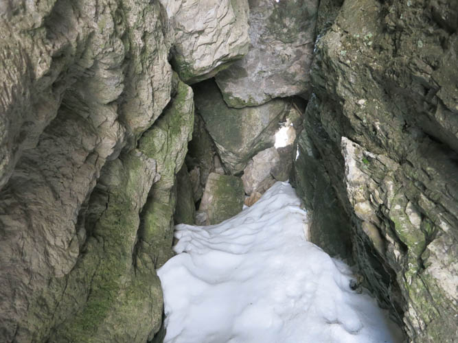
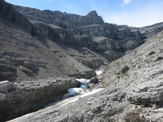
Looking through a rock window towards the South Ghost River.
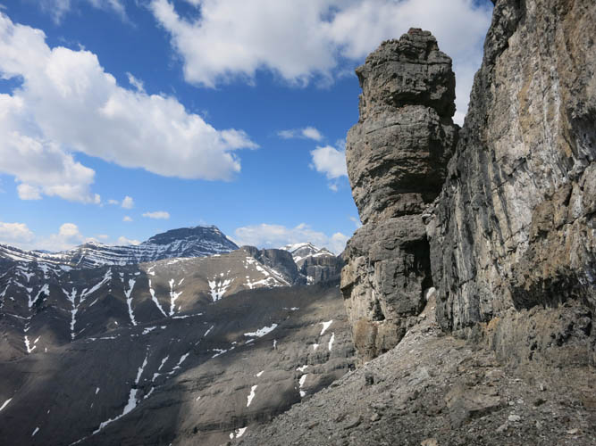
The tunnel sits at the base of this tower, right along the wall of the cliff.
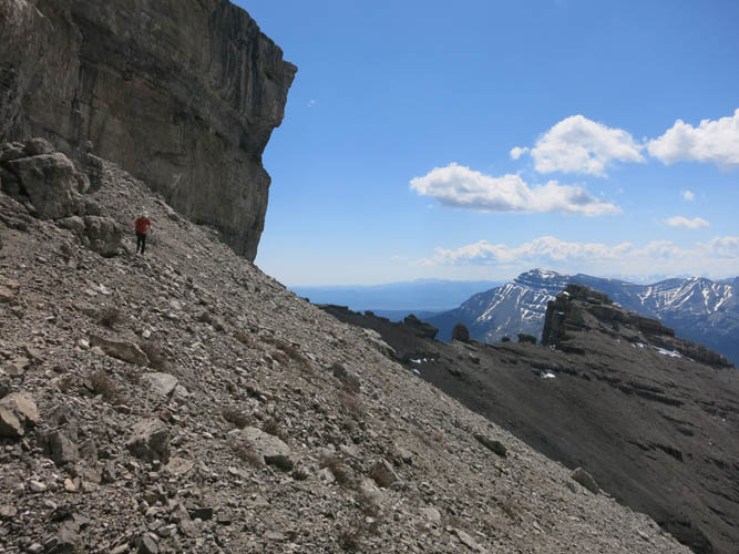
Phil traversing scree and boulders underneath the huge cliff.
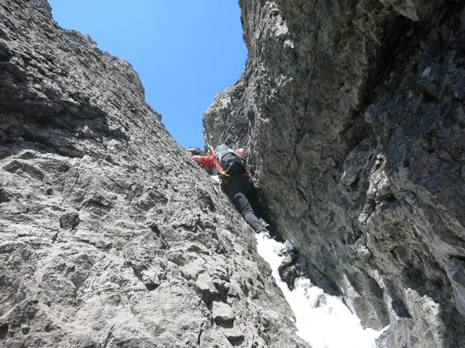
Inside the tunnel. The opening at the end is quite small.

It looks like Phil is buried in rock… the opening is just big enough for one person to squeeze through.

A few more difficult steps and we’re through the cliffs.
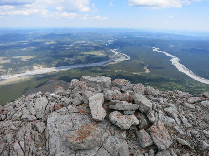
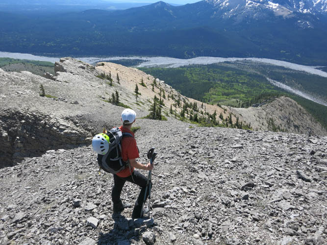
View from Orient Point’s east summit.
Heading NW towards the true summit.
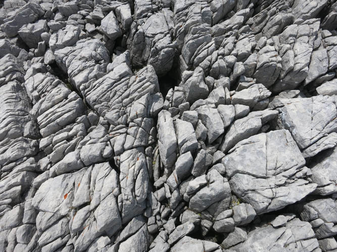
Severely fractured rock – typical for limestone or dolostone.
Towards the summit mass.
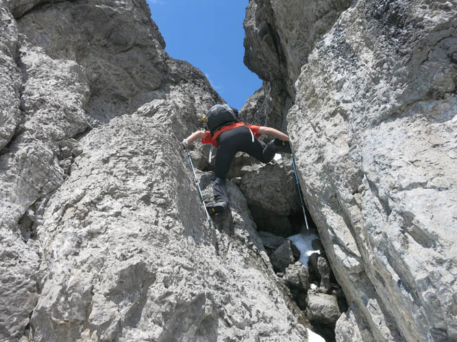
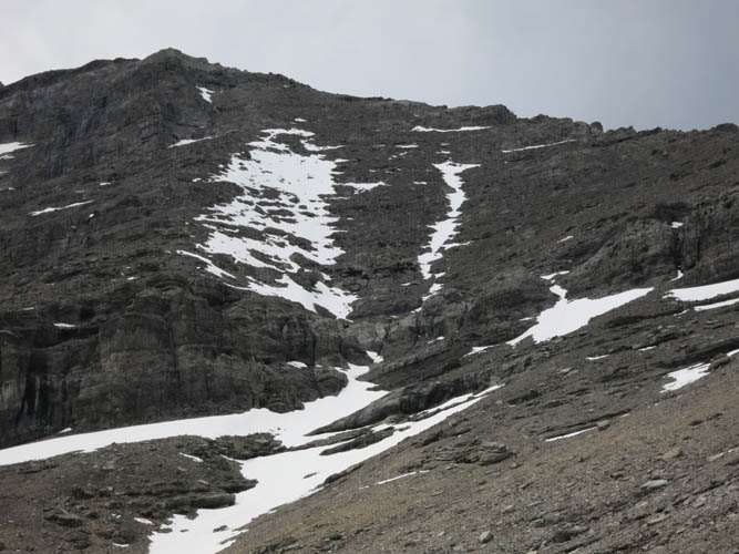
We ascend the first gully we find – a steep and commiting scramble.
Part way up the gully, the crack starts to narrow and tilt sideways.
Summit ridge.
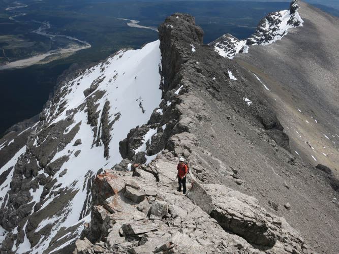
Lots of potential for fun scrambling here!
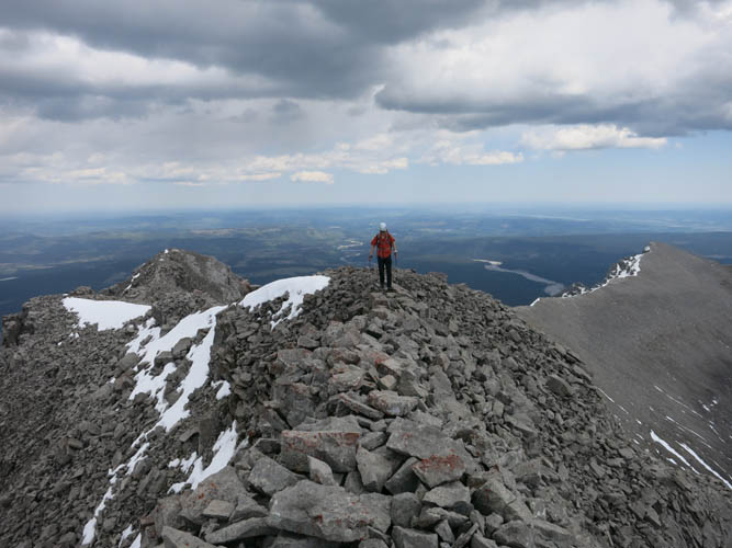
Nearing the summit.
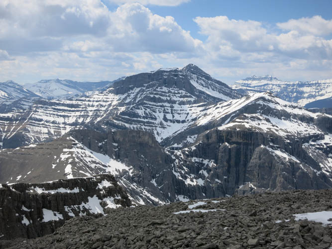
Saddle Peak looks big and complex from here. It’s about 200 m higher in elevation.
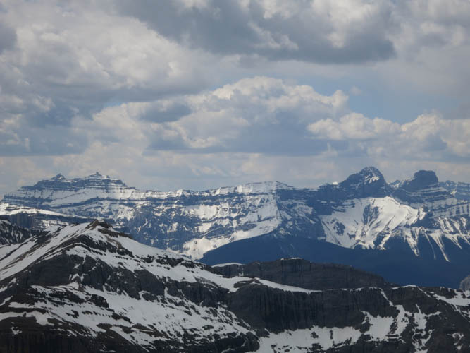
Further afield are Mount Peechee, Girouard and Inglismaldie (L to R).
You cannot miss the characteristic shape of Devil’s Head!
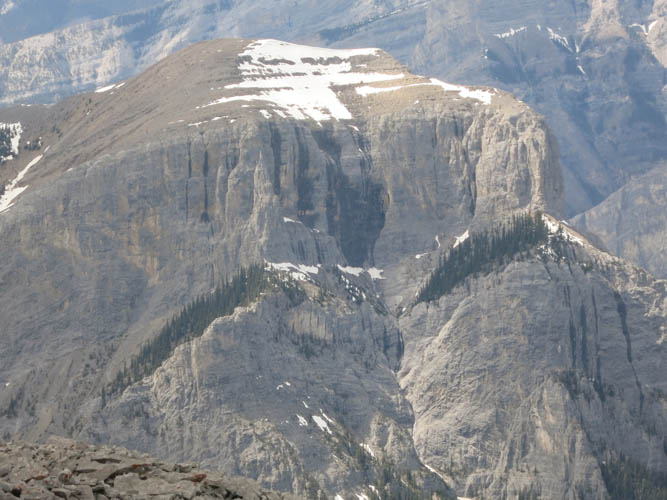
Lots of steep cliffs and crags in this area.
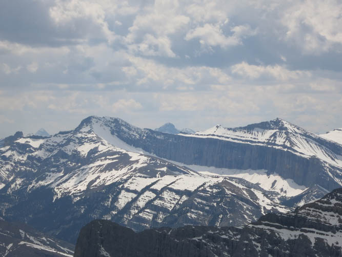
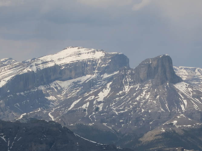
The east faces of Mount Townsend (L) and Stenton Peak (R) are still full of snow.
Our descent route involves scrambling down some moderate cliffs and gullies.
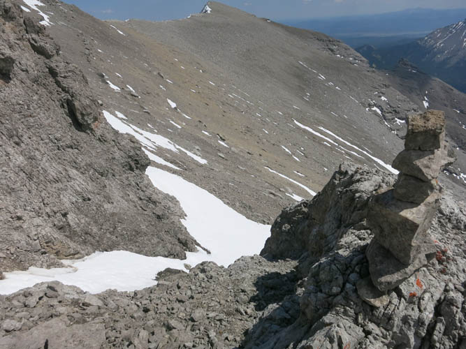
This is looking down the proper ascent/descent gully, complete with cairn. It’s no more than moderate scrambling here.
View back up the summit and the cliff band below: the moderate access gully is just above the large snow patch on the right.
Numerous cliff bands require bypassing on skier’s left upon descending the south drainage.
Looking back up the south drainage.
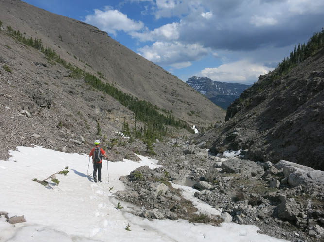
Late spring is a good time to scale Orient Point. There isn’t much snow left now, but whatever snow patches remain greatly help on the descent.