31 May 2017
Solo
This trip had several pleasant surprises in store for me. The peak is unnamed on all of the maps I had consulted during the planning stage, so I was puzzled to discover several buildings at its summit when I was hiking in the valley below on my way to Onion Peak the day before. Later I found out that the officially named “Falls Fire Lookout” is one of the trips described in Mike Potter’s book Fire Lookout Hikes in the Canadian Rockies.
The camp site I had picked for my 2-day getaway was the perfect starting point for a hike up to the lookout: it sits right at the end of the Hummingbird Road and the start of a creek that drains the southwestern valleys of the mountain. After an energizing breakfast of hot coffee and Nutella bread, I was on my way exploring again around 730 am. There is a faint trail along the south side of the drainage, but it has several washouts along the way and doesn’t seem to be used much (closed to horse and OHV traffic). Just about where the trail started to peter out, I climbed up a steep, rocky ridge that appeared to rise straight up towards the bigger southwest ridge of the peak. It was a beautiful calm morning – almost no wind, which is unusual here, and slightly overcast skies. Feeling quite energetic today, I made good progress and really enjoyed the scrambling on good rock along this little ridge. The lookout site was within sight all along my hike and I kept wondering if the observer had noticed this lone scrambler coming up their way.
My ascent ridge had little in the way of obstacles, it was mostly easy to moderate scrambling and any dicey parts could be easily circumvented. The same was the case for the southwest ridge, which was characterized by a few more prominent ups and downs and a short traverse across a firm snow patch. After a final slog up a large scree slope, I was standing at the summit right next to the lookout station and it was only 945 am.
Perhaps the lookout person was having their breakfast, I wondered? I was curious, but didn’t want to be nosy or trespass. Active fire lookouts are private residences and the person working there obviously has a job to do and should therefore not be disturbed by visitors. After enjoying the views for a while and making a quick call home (there is indeed spotty cell phone reception up here!), the fire lookout observer stepped out of their house and waved a friendly good morning to me. We had a delightful conversation, chatting away the rest of the morning as I was the only visitor around. I learnt that lookout observers typically start their work in April or May and stay up on the mountain non-stop for 4 to 5 months before going back to civilization. They’re also required to stay within a 45 min radius of the lookout, so they can’t go too far exploring nearby ridges and peaks. Energy comes from solar panels and two large propane tanks, water mostly from a rain water filtration system. A helicopter visits at least once a month to bring food and other supplies. The observer stays in touch with the operators and other towers by radio – there is no internet up here, but an intermittent cell phone signal exists. So what do you do all day when things are quiet and there’s not much to do, I ask? Read, meditate, and enjoy the peace and quiet of the beautiful mountainscape, is the answer. Now, I can totally get that!
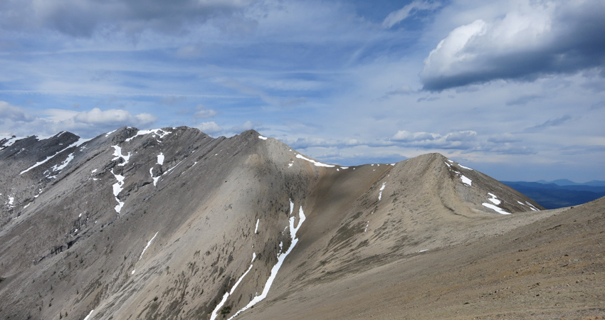
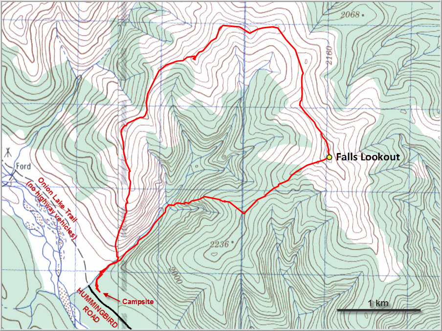
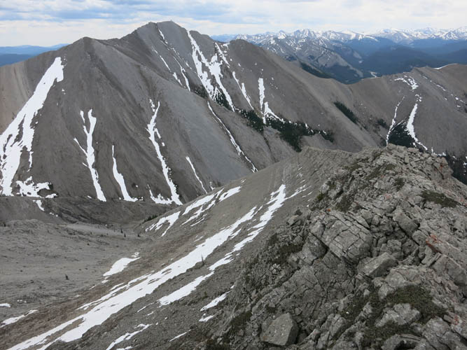
After this lovely encounter and a lengthy break I continued northward, aiming to do a big loop along the horseshoe-shaped ridge. The “normal” route up to the lookout appears to be from the valley to the south where a trail has formed that day hikers sometimes use, as the fire observer told me. The ridge to the north and northwest, in contrast, only has bits of faint game trails here and there, and there are a lot of ups and downs! I really enjoyed this ridge walk. It was very scenic and entertaining, with everything from soft brown shale spread across a gentle saddle to craggy and steep limestone cliffs to a narrow ridge spine that offers some fun moderate scrambling with many variations possible. At one high point I was staring down a very steep and exposed portion of the ridge, with smooth steep slabs to my left. I was able to bypass this section by going around the right (north) of the ridge crest, where scree and snow allowed for an easier way around.
At its western extremity the ridge eventually evolves into a rounded hillside covered in grass and dead trees (from a prescribed burn years ago). There isn’t much deadfall, however, and I quickly reached my original ascent drainage and connected up with the faint trail again. All in all this was a highly enjoyable loop with some fun scrambling, varied terrain, and great views. My round trip time of 7 hours included almost 2 hours of chatting with the fire lookout observer at the top, so it’s short enough to be done as a day trip from the city.
DISCLAIMER: Use at your own risk for general guidance only! Do not follow this GPX track blindly but use your own judgement in assessing terrain and choosing the safest route.
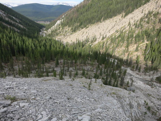
A view back down the approach drainage. The start of Onion Lake Trail near my campsite is just visible a few kms down this valley.
The ridge is mostly bare rock with good grippy slabs.
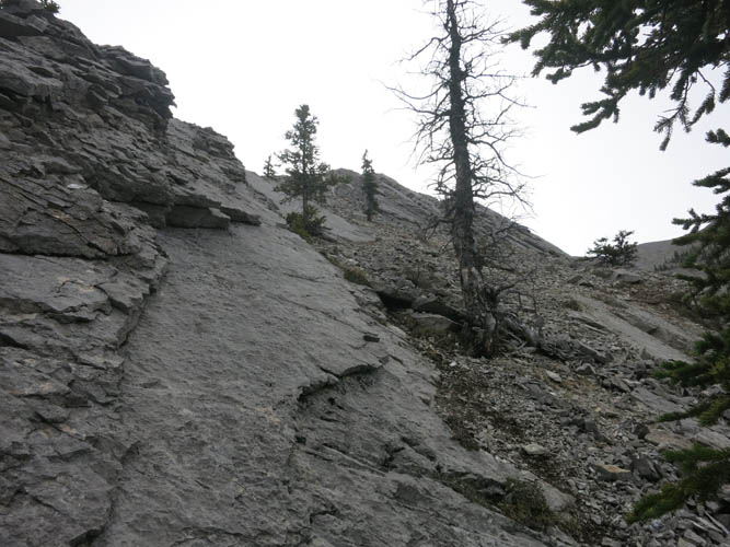
The sun starts to poke through as I ascend this fun little ridge.
Looking back down. Steep but not difficult.
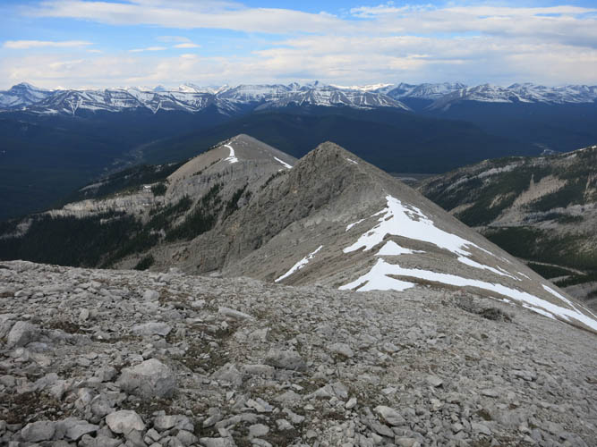
Once on the main west ridge, the lookout can now be reached via an easy hike, with minimal scrambling.
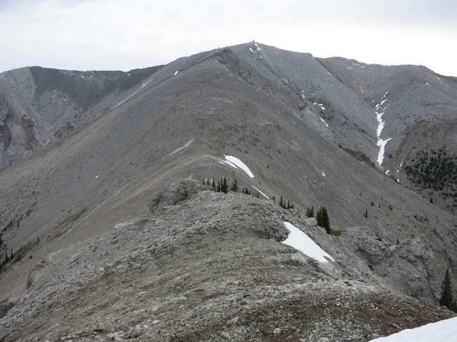
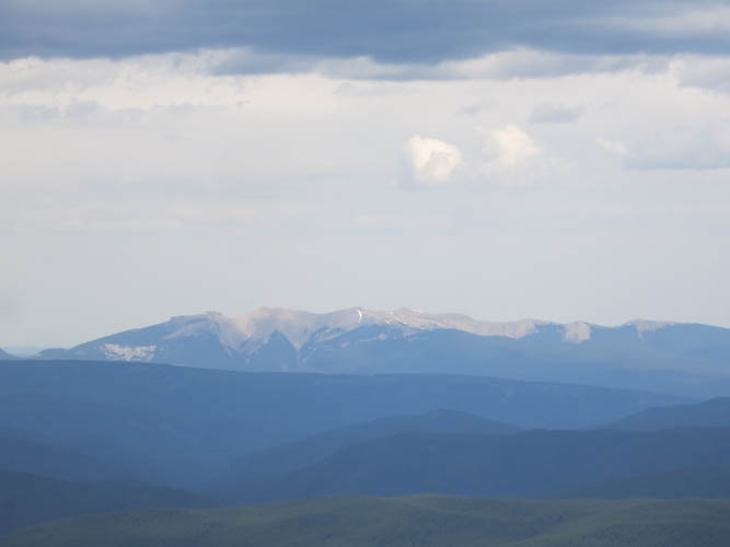
Whelk Peak lies far to the SW.
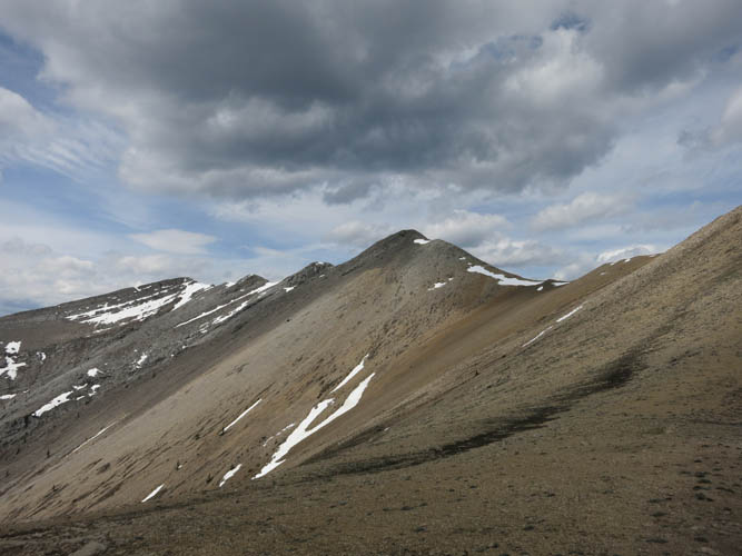
This is looking back down the west ridge. The last stretch consists of dull scree.

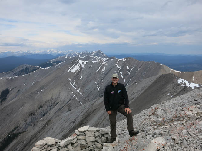
Falls Fire Lookout
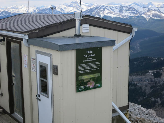
An information sign states the official elevation of the lookout site: 2463 m. My GPS read 2461 m.
The south ridge from the summit.

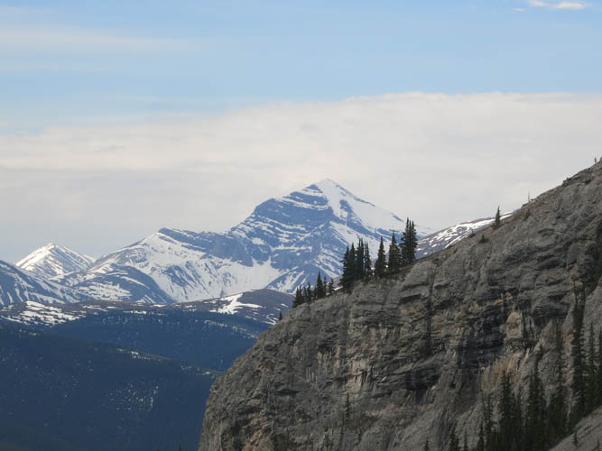
Another shot of Whelk Peak, a beautiful but remote mountain to the SW.
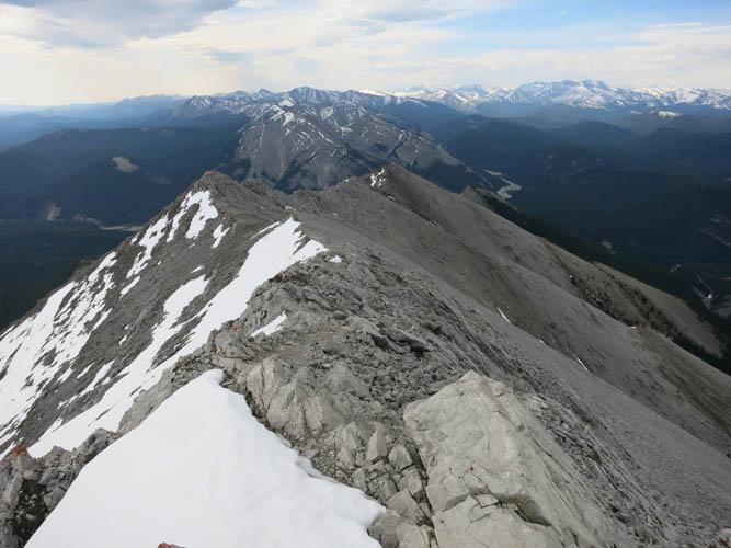
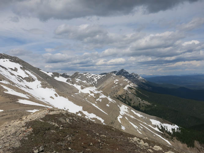
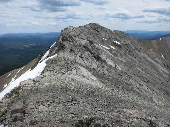
Looking towards the north and the rest of the horseshoe-shaped ridge that I hiked along.

The terrain is fairly gentle wherever there’s soft brown shale.
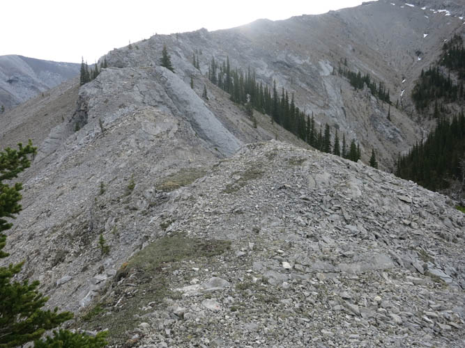
Lots of ups and downs along this ridge!
The edge of the Rockies: looking north, Onion Peak is the tall peak in the shade.
And a look beyond the brown shale at the forested plains to the east.
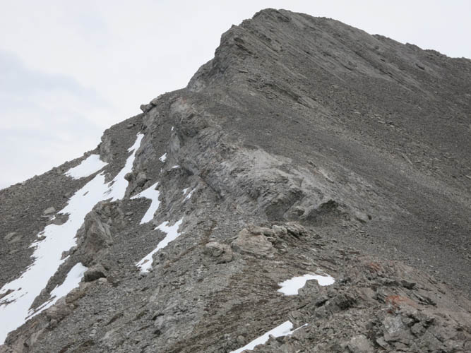
This was one of the bits where the ridge narrows and the scrambling is more challenging (still not on the difficult side, though).
Ram Mountain is quite a distance away from the Front Ranges.
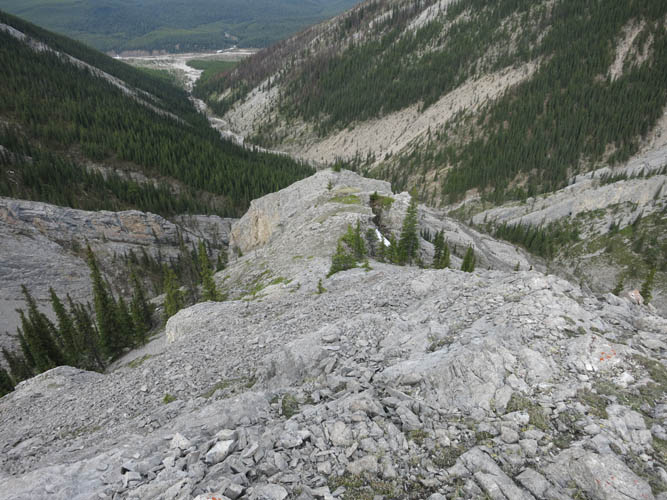
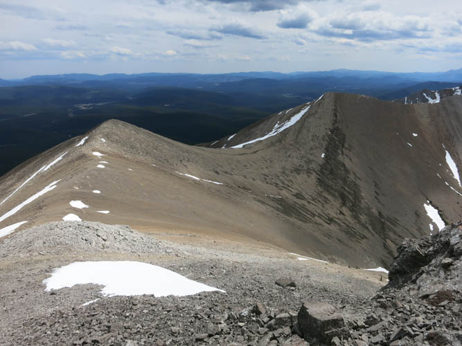
The bowl that is encircled by the horseshoe ridge offers plenty of bail-out descent routes. The Fire Lookout can barely be seen on the high point to the left.
A look back at the second challenging section where the ridge steepens, requiring a bypass on the north side where the snow patches are.
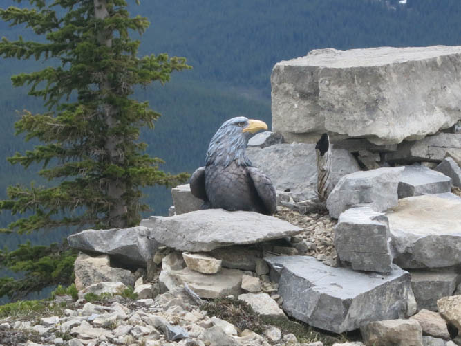
This fake bird of prey almost had me fooled as I carefully approached and took pictures! It’s been placed on a cairn near the western end of the ridge above the burnt forest. I have no idea why anyone would put this up, other than to ward off unwitting hikers!?
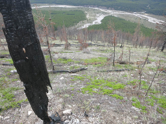
Burnt trees on the last stretch down to the drainage. No bushwhacking and easy hiking all the way down!