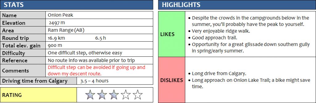
30 May 2017
Solo
Not to be confused with “The Onion” on the Icefields Parkway in Banff, Onion Peak is a relatively minor summit along the Front Ranges of the Ram Range west of Rocky Mountain House. I had never been to this area and wanted to check it out during a spell of gorgeous sunny weather, camping in the Hummingbird Public Land Recreation Area (PLRA) overnight so I could also hike up Falls Lookout the next day.
I was very surprised to find all camping sites completely empty when I arrived at the end of the Hummingbird Road, where there are several official and unofficial spots. I picked a nice place in a sheltered area with fire pits and washrooms nearby and didn’t see a soul in the two days that I was there (except for the fire lookout observer up on the hill!).
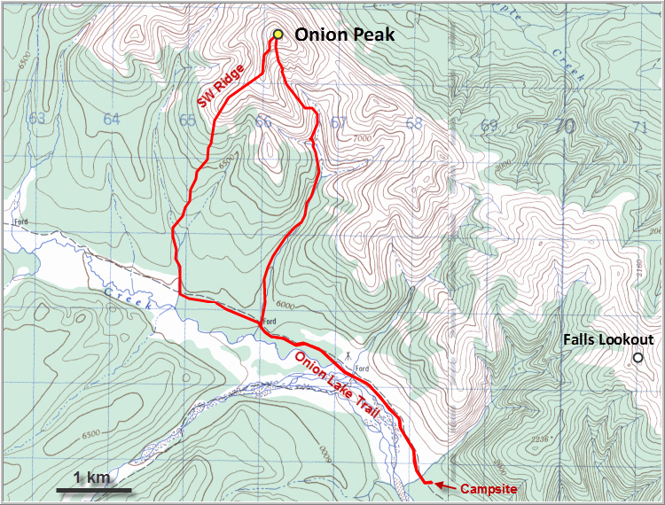
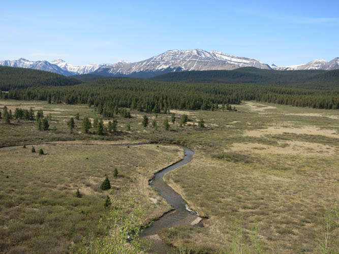
Onion Lake Trail starts just across from the campsites and is reserved for hikers, horses (this is a major staging area for equestrian travel), and starting on July 1st also for OHV’s. Right now at the end of May the area was completely quiet, just the way I like it in nature. The route I had mapped out followed Onion Lake Trail for about 4.5 km to a creek, which I would then hike up to the start of the forested southwest ridge of Onion Peak. The trail is in pretty good shape (it’s more of a dirt road really), so next time I’m coming here I’ll probably bring my bike to shorten the approach in this lovely area. It’s a very scenic valley with flat expanses of grassland intersected by meandering streams, a favourite habitat for abundant deer and geese it seems.
I easily hiked up the creek and then made my way up the gentle ridge through light forest with some mild bushwhacking as there was a bit of deadfall here and there. About an hour after leaving Onion Lake Trail I reached treeline and the rocky part of the ridge – finally some views and some solid rock under my boots! There are several bumps along this ridge and one of the first had a surprise in store: a small cairn containing a register for a geocaching site. It had been placed in August 2015 and didn’t have a single entry in it!
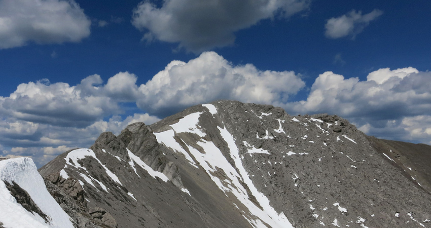
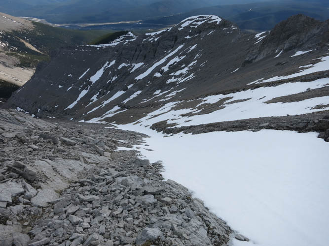
Travel along the ridge was thus far straightforward, with great views to that long line of mostly unnamed peaks to the north and south. About half way along the ridge, my hike came to an abrupt halt at a small drop-off: a 3 m cliff on the ridge crest with considerable exposure on all sides – the crux of my trip. I refused to believe that this could be the end of my trip, for sure there must be a way around it! And as is usually the case if you study the terrain long enough, you find a way through it. It actually only took a few careful moves along the ridge crest to surmount the obstacle, but I certainly appreciated having my scrambling gloves and helmet for the downclimb. Soon after the crux, another bigger obstacle stood in the way: a craggy knob with steep walls on all sides. Thankfully, there was an easy bypass around the right (south) side with just a minor elevation loss. The remainder of the ridge was an easy plod to the summit, where a very weathered cairn with bright orange lichen was waiting for me.
For my proposed loop route I had initially planned to follow the ridge south of the summit to a saddle and over to the next high point, but that ridge proved to be very serrated and difficult to negotiate, with many dicey downclimbs necessary. Not far from the ridge, a snow-filled gully looked very inviting, promising a quick glissade down… it was an easy decision!
The glissade was perfect. Just like a few days earlier when Phil and I enjoyed a terrific bum-slide down a snow slope off Rogan Peak in Waterton, the snow here was in ideal shape for a safe but rapid glissade. I pulled out my ice axe but ended up not needing it as I could slow my descent with my feet. About half way down water appeared under the snow, gushing down in a series of drops carved into the rock. A short stretch of sidesloping on skier’s right to avoid these cliffs brought me to easier terrain where I could descend yet again into the creek bed, which was easily followed out back to Onion Lake Trail.
I really enjoyed this outing, although the scrambling was limited. The approach takes some time and the bushwhacking isn’t fun, but the ridge walk and glissade down together with the views on this little remote peak made it well worth the effort.
DISCLAIMER: Use at your own risk for general guidance only! Do not follow this GPX track blindly but use your own judgement in assessing terrain and choosing the safest route.
Gorgeous views along the Forestry Trunk Road south of Ram Falls.
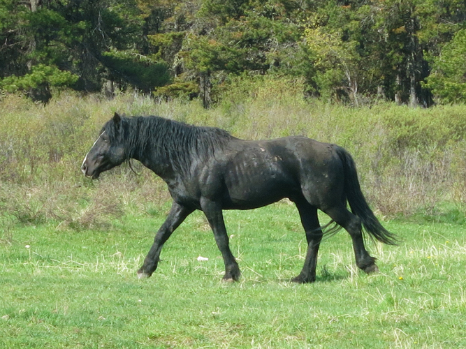
Wild horses are common here. I came across at least three different groups as I was driving along the Forestry Trunk Road, but didn’t see any other car!
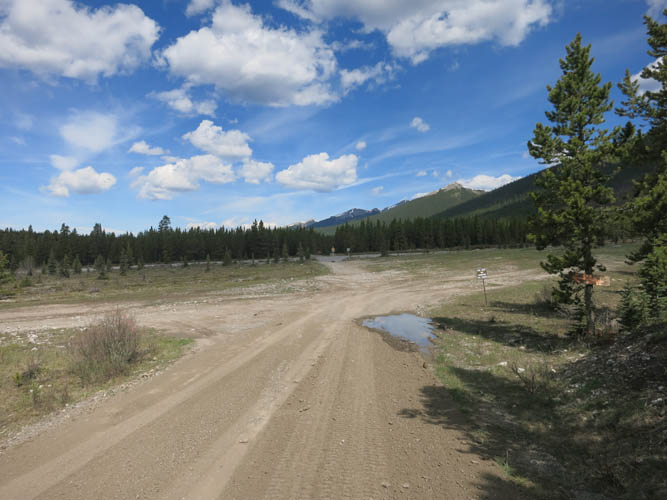
The end of the Hummingbird Road. Across the creek is the trailhead for Onion Lake Trail, reserved for hikers, bicycles, ATV and horse travel.
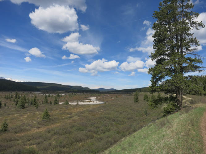
Onion Creek sits in a wide valley. A very peaceful and quiet place.

My first look at Onion Peak from the trail. I would follow the ridge on the left all the way to the summit on the far right.
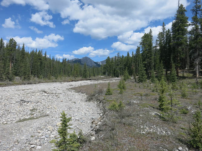
Approach drainage.
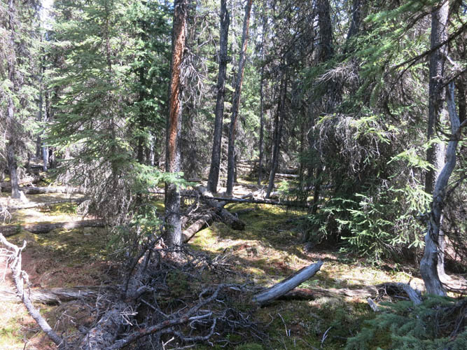
Some minor bushwhacking along the SW ridge.
As soon as I reached the open ridge above treeline, nice views opened up to the south with Falls Fire Lookout at the summit in the middle.
Much of the SW ridge looks like this: very gentle terrain.
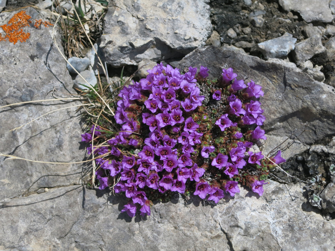
Some rare colours amongst the grey rock.
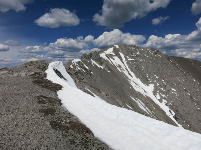
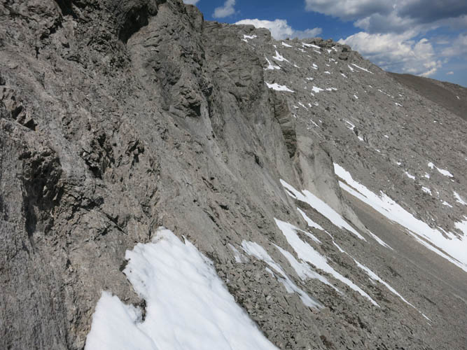
Higher up, the ridge gets more jagged, with the crux coming up shortly.
It’s mostly easy to moderate scrambling here.
The crux: it’s just a few meters, but there’s no easy way to go around this drop off as far as I could see. A few tricky moves requiring caution.
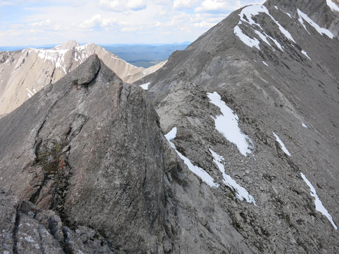
A look back at the cliff band with the crux at the ridge crest.
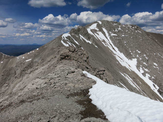
Another obstacle is easily bypassed on the right.
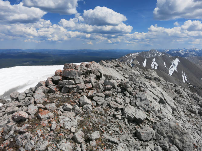
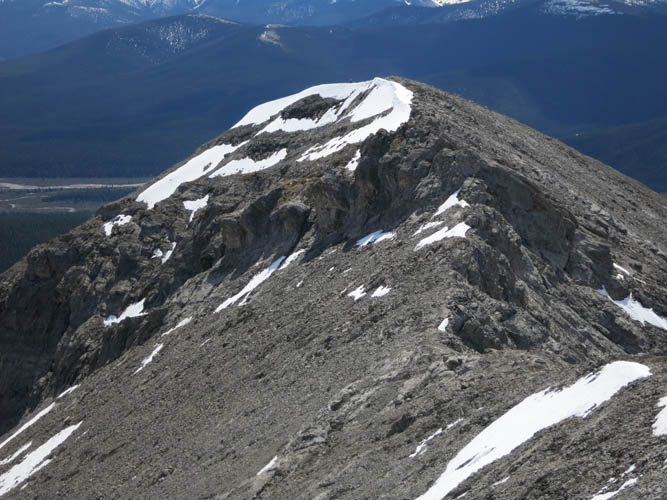
At the summit.
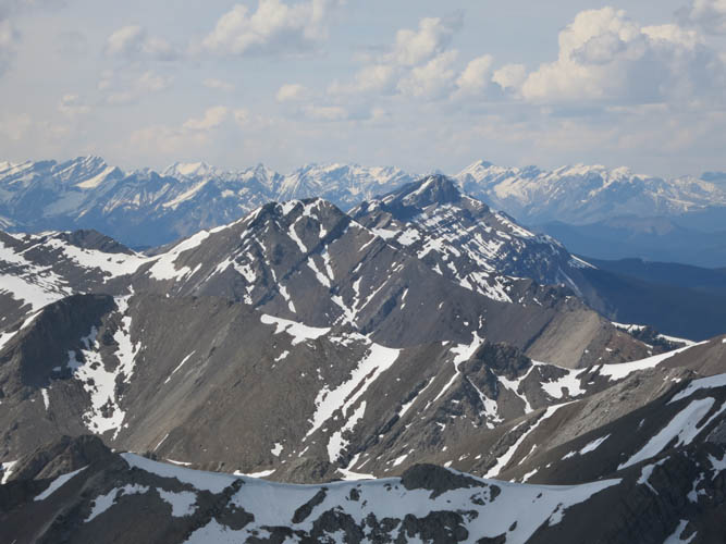
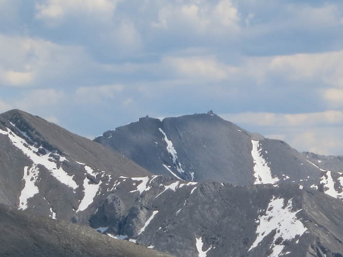
Magnificent views to the north. I think the high point of the brown massif is Kista Peak.
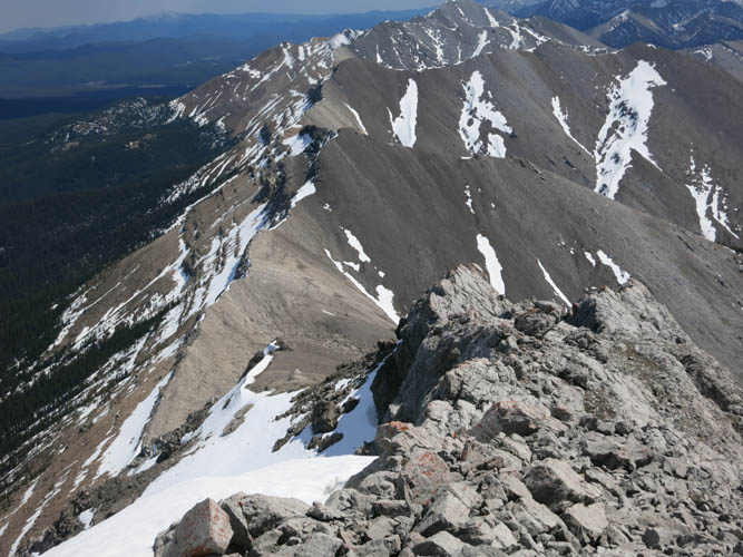
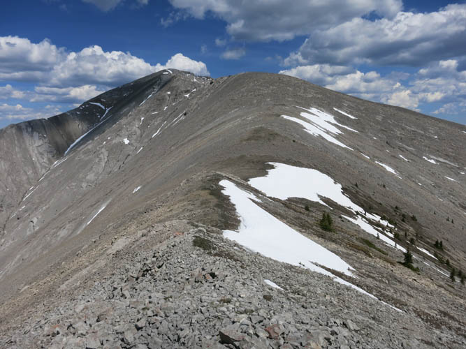
The south ridge is quite broken up and cliffy.
A long stretch of snow in a gully SW of the summit provide an easy and fast way to descend.
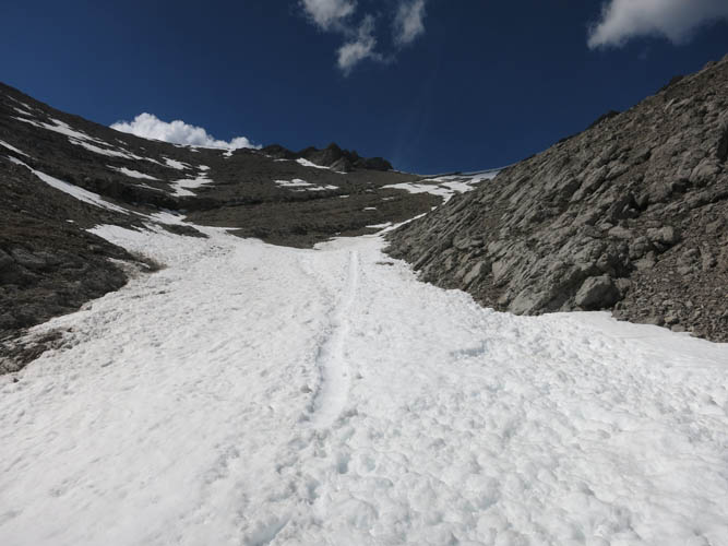
Snow conditions are perfect today!
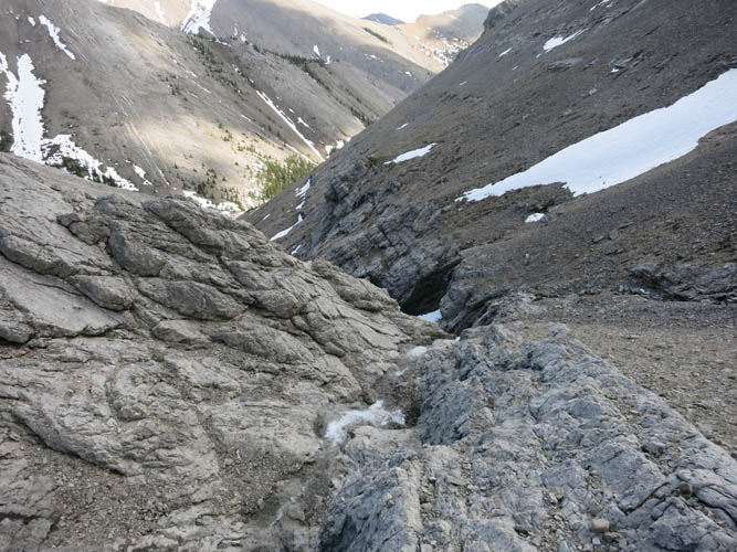
In the lower part of the gully, cliffs with waterfalls appear. Time to sideslope on brown shale on the right side until the cliffs peter out.
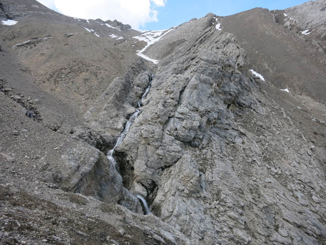
Looking back at the waterfalls in the gully.
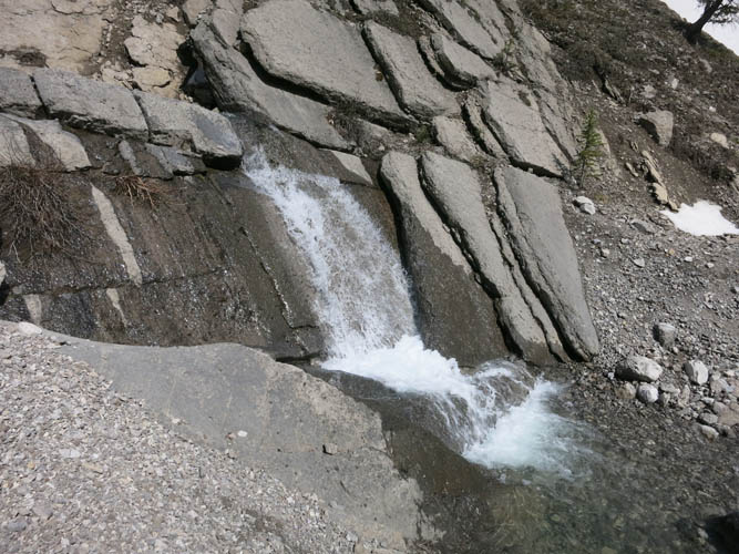
Water running across rock tiles at the bottom of the creek.
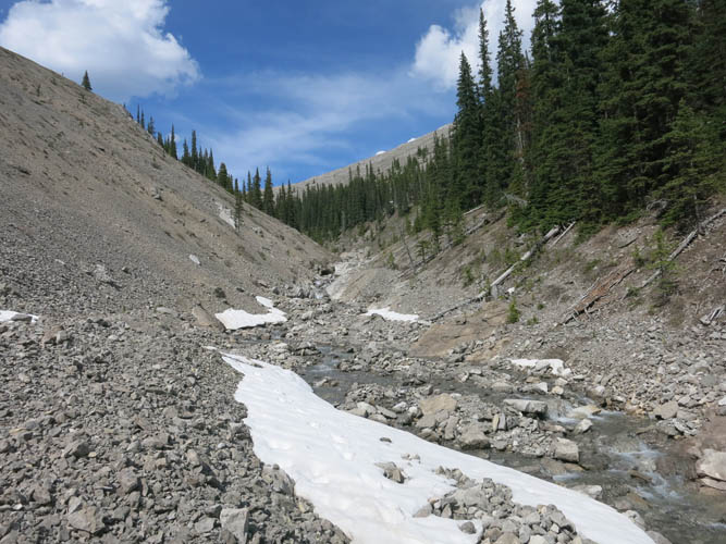
It’s an easy hike out along this drainage.

Onion Lake Trail.