12 June 2017
Solo
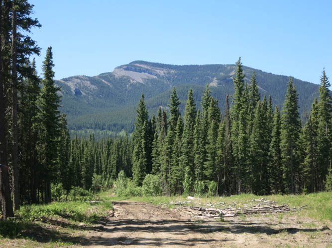
Most hikes described in a guide book have become popular enough for a trail of some sort to have developed over time. Eagle Mountain, featured in The David Thompson Highway Hiking Guide by Jane Ross and Daniel Kyba, appears to be an exception to this rule. Although it was a Monday when I decided to go for a quick hike “along the way” on my drive from Edmonton to Calgary, I can see how this is definitely not a very popular outing, for several reasons.
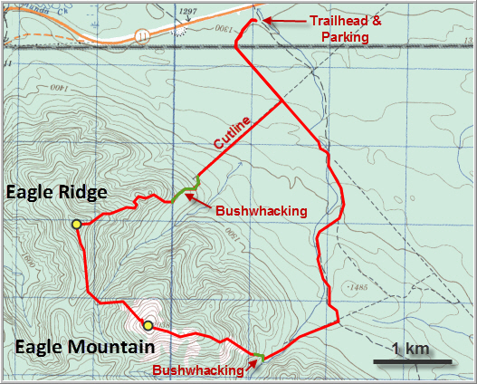
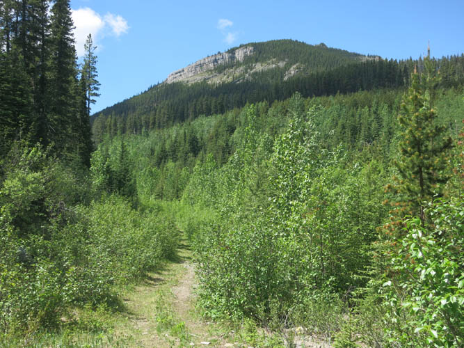
I followed the suggested approach on the eastern side along an old forestry road. All the wooden bridges along this dirt road were taken out recently for safety reasons, but the creek crossings were easy (rock hopping) as water levels were low. The track that heads east-west to the base of Eagle Mountain’s SE ridge is pretty overgrown and was quite boggy at the beginning.
Then the bushwhacking started. I was looking for any indication of a trail, as surely others must’ve done this hike before and left flagging behind or a faint path that might have developed over time? Nothing! It’s a steep grunt up through a cut block, then through light forest and a rocky shoulder to the top of the ridge. I thought maybe I missed the line that you’re supposed to follow up, but even on the summit ridge I couldn’t find a trail. Not that I need one, I was simply baffled by its absence on a hike that’s so close to Nordegg and Red Deer. Once on the ridge, I easily hiked along several open platforms interspersed by a few small patches of fir trees to the summit. There is a large summit cairn, but no register.
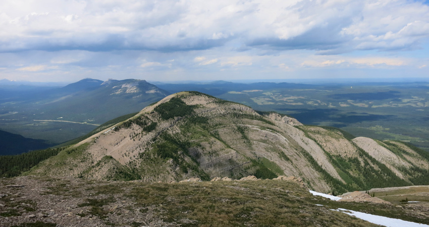
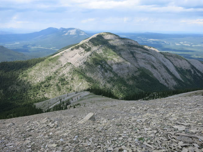
I found the views from the top to be a bit disappointing, which probably has something to do with Eagle’s position away from the Front Ranges, so you don’t get to see those impressive snow-covered bigger mountains up close. It’s also not as high as nearby Ram Mountain, for example, where the views are considerably better in my opinion. The one picture that stood out, however, was that of a beautiful anticline (arch-shaped folded beds) that is beautifully exposed on Eagle Ridge’s steep SE face, directly north of Eagle Mountain. But unless you’re a geologist, I’m not sure how many people will find this exciting… J
A quick and straightforward hike on scree and grass slopes brought me down to the little valley between Eagle Mountain and the ridge to the north. There were a few short cliff bands, all easily broken through as the rock is generally soft and brittle here – I didn’t have to take my hands off my poles.
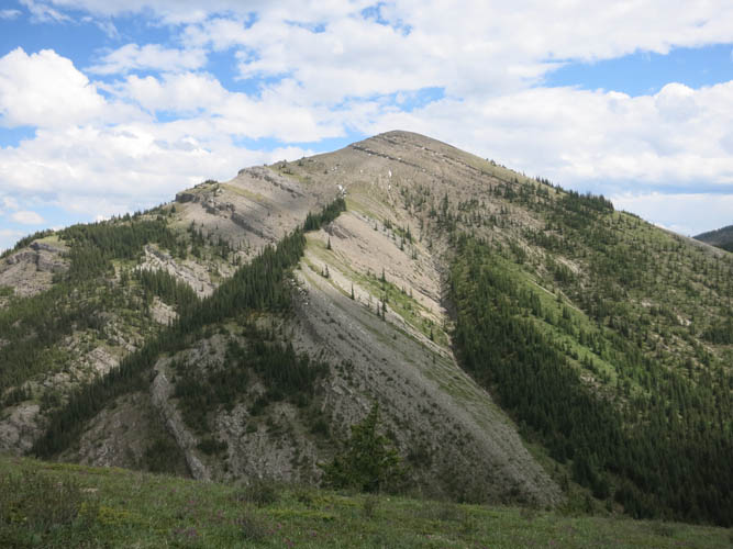
I’m not sure if “Eagle Ridge” is an official or local name for this little northerly outlier of Eagle Mountain. It is mentioned on SummitSearch, so I’m adopting the name here. Eagle Ridge is even more tame and an easy walk up grassy slopes. At an elevation about 80 m lower than Eagle Mountain, it’s broad summit is partially treed and the views are inferior.
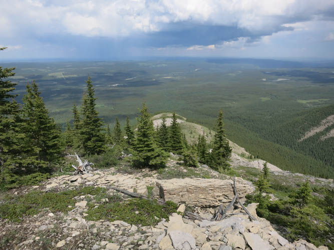
The highlight of the day was an alternate descent down the east ridge, which involved navigating through some steep cliffs (all easy to lower moderate scrambling) and two unexpected breaks in the ridge. One of these v-shaped gullies had a cool little cave in the steep limestone rock face, the perfect place to shelter from rain or an unexpected storm. The rest of the ridge was a pleasant hike mostly on open terrain.
Then came bushwhacking part two! Once at the bottom of the ridge, I entered the trees and had to cut across some rather nasty bush to link up with the cut line I had seen on my map. It was only a few hundred metres, but very slow going, with more deadfall the closer I got to the cut line. It was such a relief to finally reach that line, especially finding out that it is an actively used ATV track. Smooth sailing back down to the old forestry road!
Overall, I don’t think I’d recommend this hike, at least not this particular loop. The approach from the NW side described on SummitSearch is perhaps a more enjoyable way up and down, but I haven’t tried it. Given that there are plenty of other interesting hikes around Nordegg, Eagle Mountain/Ridge probably wouldn’t be my first choice if you’re new to this area.
DISCLAIMER: Use at your own risk for general guidance only! Do not follow this GPX track blindly but use your own judgement in assessing terrain and choosing the safest route.
The old forestry road, with Eagle Ridge in the background. My descent was down the ridge on the left.
Looking west towards Eagle Mountain.
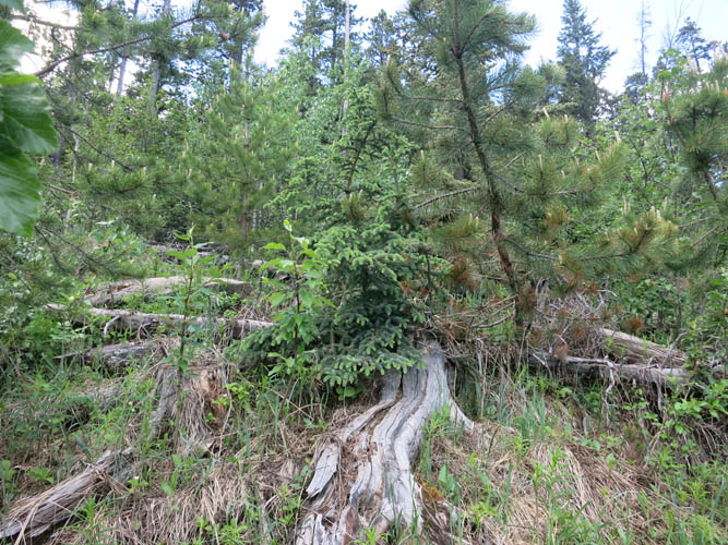
Some mild bushwhacking through a cut block.
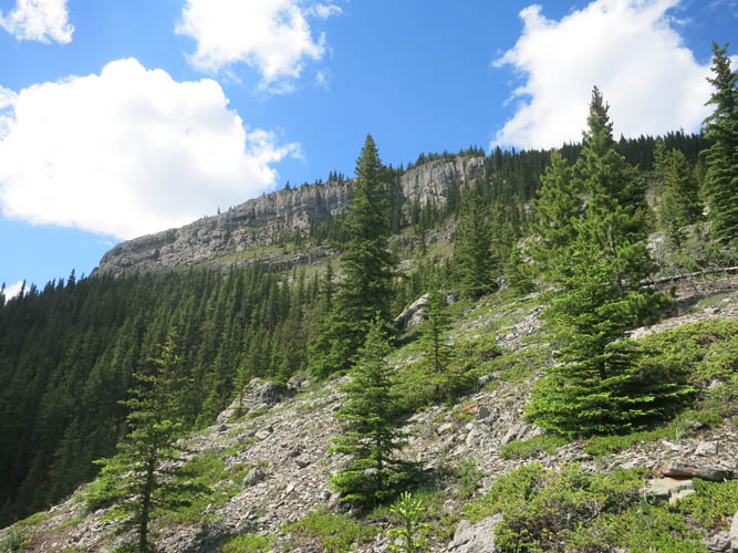
This cliff on Eagle Mountain’s SE side is easily bypassed on the right.
Looking back down the ascent shoulder. The light green area on the left is the cut block that was logged in the past.
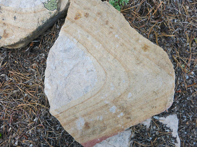
Interesting weathering patterns on rock slabs along the shoulder.
The gentle summit ridge leading to the top of Eagle Mountain.
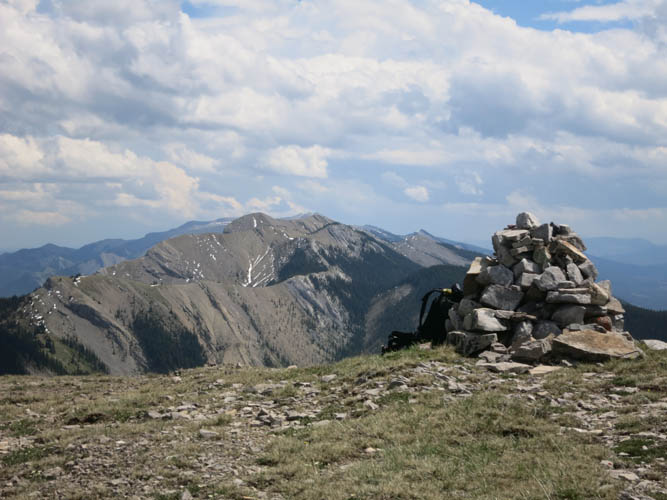
Summit cairn. Behind and to the south is a continuation of the Brazeau Range (not sure what the first mountain is called), with Ram Mountain in the far distance.

A look at the gentle ridge I came up.
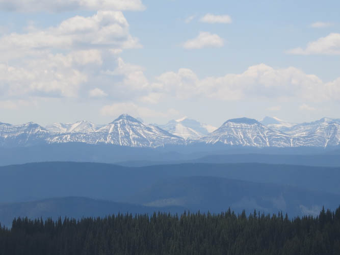
Hazy views of distant Front Range Peaks to the west.
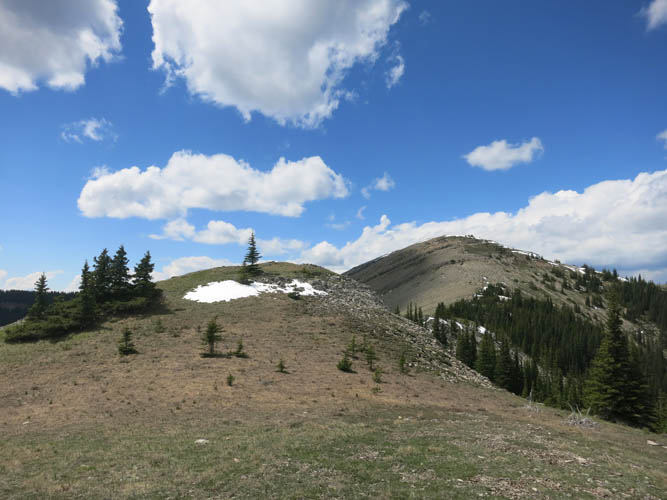
Heading towards Eagle Ridge. The descent off Eagle Mountain is really easy. There’s lots of scree and grassy slopes lower down.
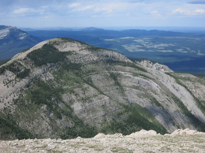
A close-up of Eagle Ridge’s SE face, which exposes convexly folded strata that have formed a beautiful anticline.
Half-way up the ridge, I turn to look back at Eagle Mountain and its easy north slopes.
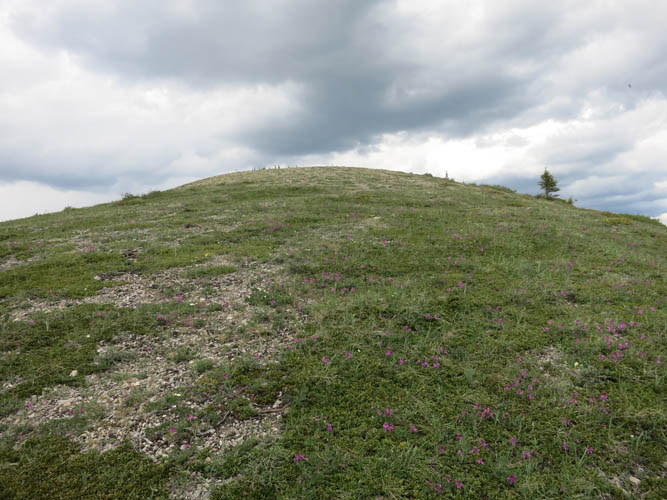
Eagle Ridge – wide and flat.
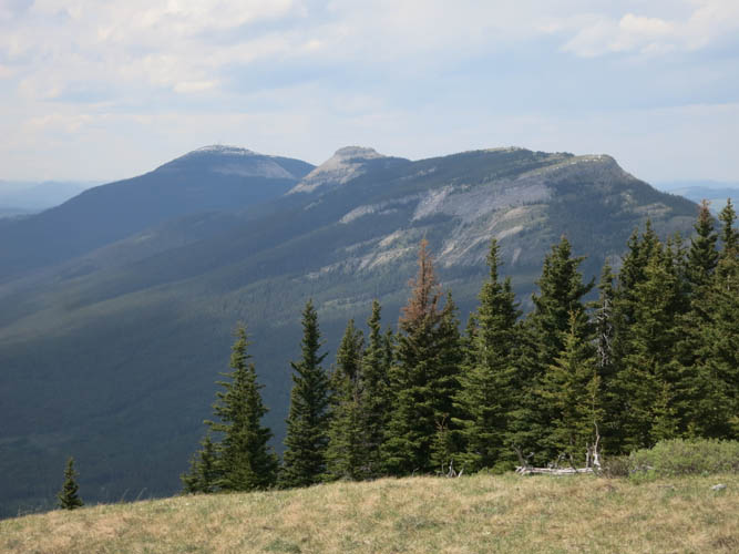
At the top of Eagle Ridge looking north towards Colliseum and Shunda Mountains.
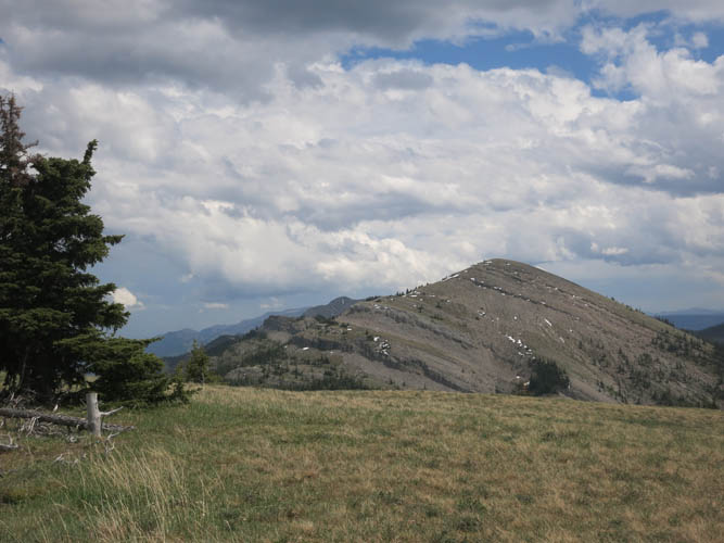
Eagle Mountain is about 80 m higher than the top of Eagle Ridge.
Heading down the east ridge.
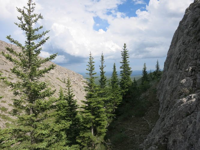
The first v-shaped break in the ridge. This would be a nice place to camp.
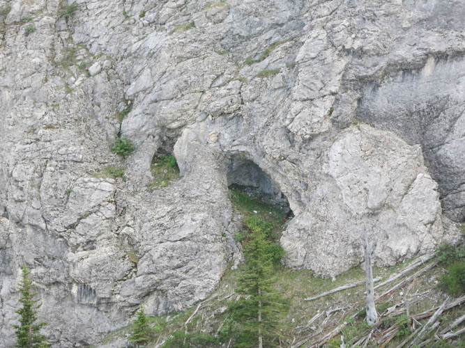
Close-up of a small cave complete with grass floor in the limestone rock face.
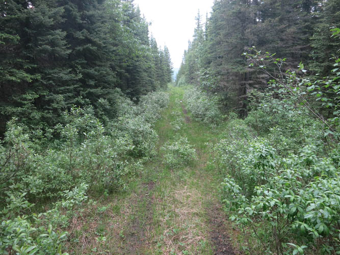
An arrow-straight cut line leads me back to the old forestry road.