8 November 2017
Solo
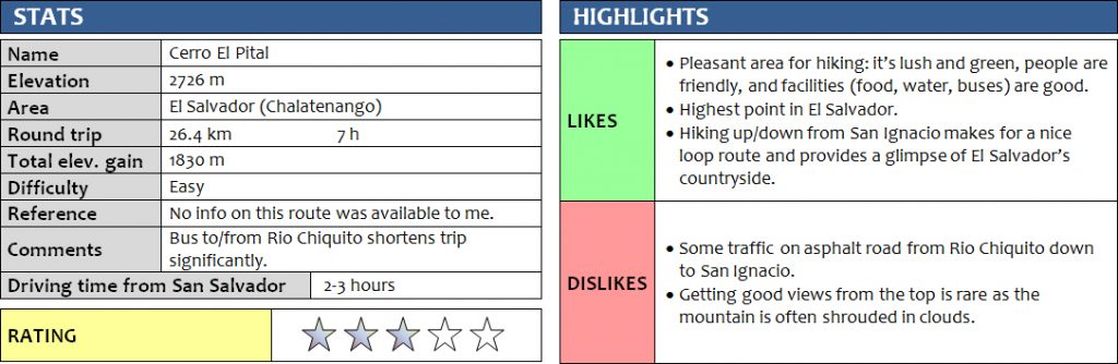
Cerro El Pital is the highest mountain in El Salvador, located right on the border with Honduras in the north of this small Central American country. At 2726 m it’s not a lofty peak, and you can literally drive almost right up to the top. Most people take a bus to the small village of Rio Chiquito and then ascend the remaining 500 m of elevation along the small track through the forest. This being my first hike on my November 2017 Central America trip, I was eager to get some exercise and decided to hike all the way from the valley below at the town of San Ignacio.
From El Salvador’s capital San Salvador, where I was based for the first few days, I took an early morning bus at 6 am to the small town of San Ignacio. It was supposed to take only 2 hours but took 3… the bus – an old US school bus, colourfully repainted and creatively decorated to serve as public transit in Latin America – left on time as scheduled, but picked up so many customers standing by the side of the road that it took forever to make any progress. Moreover, the main highway from San Salvador to the Honduran border at El Poy is just a regular undivided road, so whenever there was a slow truck or some sort of obstacle ahead, we had to wait it out. On the positive side, the entire bus ride cost me a grand total of US$1.70!
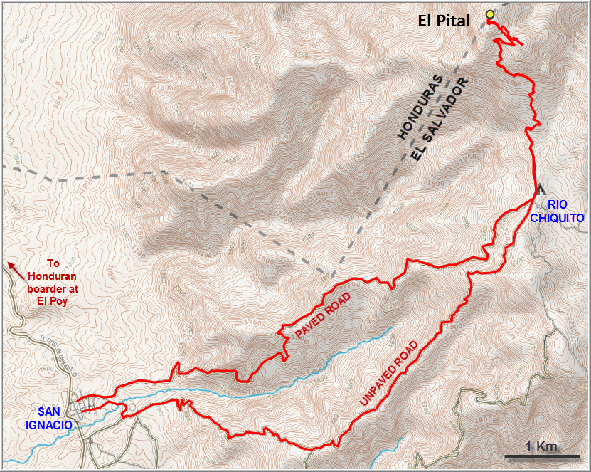
After a nice breakfast of fried eggs, sausage and bread at a little café in San Ignacio, I was on my way at 9:30 am. It’s a good thing I had plotted my planned route on Google Earth and imported the track into my mapping app at home – this made it much easier to navigate the small alleys of the town to find the correct road up the mountainside. I chose to hike up an unpaved secondary road which I was hoping to be quieter. Great choice, this road had no traffic whatsoever; in fact I only saw about a handful of people all the way until I got to Rio Chiquito. The road follows the crest of a small ridge and steadily rises from 1000 m elevation at San Ignacio to 2200 m at Rio Chiquito. Views are limited, however, as much of the road is lined with trees, only offering occasional glimpses of the surrounding landscape. Here and there I would see local farmers tending to their vegetable fields; higher up there were coffee plantations as well. The climate up here in the hills is much cooler and more humid than in the valley. Dense clouds were moving through the trees and I was actually starting to feel a bit cold every time I stopped moving.
In preparation for this vacation I had read a lot about the security situation in El Salvador. Violent crime by gangs including armed robbery and kidnapping is apparently a big problem in the country. Tourists are generally not targeted, but that doesn’t mean that foreigners can count on being safe of course. Accidents do happen and that chance is statistically higher in El Salvador as compared to most other countries in the region. Every source I’ve come across recommends travellers to exercise a high degree of caution while in the country and seek advice about the local security situation first-hand. In my experience, the last point here is the key to travelling safely in countries perceived as dangerous back home: asking as many locals as possible as often as possible to find out what the local security situation is, in what towns/areas/neighborhoods there are potential problems for a gringo, and how the situation has changed lately. Obtaining local and up-to-date information from reliable sources on the ground is the most important step in travelling safely, but of course by its very nature it is also a very fluid process that happens on the go. Having done my due diligence and asked pretty much everyone I’d met so far about hiking safety etc back in San Salvador, I was expecting little to worry about in the San Ignacio/El Pital area. Locals I met in San Ignacio and along the road confirmed this and gave me additional peace of mind: the area was fine to explore during daylight as long as I wasn’t flashing around a valuable camera or a brand-new iPhone X.
In the end, I never encountered any problems at all during my hike – in fact, I had no issues during my entire 2 week vacation in both El Salvador and Guatemala, despite doing almost all my trips unguided and unaccompanied. The biggest dangers, in my view, were:
#1 Traffic: Local drivers are particularly brazen in this part of the world, especially bus drivers who think they own the roads and can just push everyone else off to the side. This is by far the biggest threat to life and limb, although I’ve seen even worse in some African countries (Central African Republic, Chad and Nigeria come to mind…).
#2 Dogs: Yes, dogs. Not usually stray dogs, but aggressive canines guarding houses and farms in rural areas, which makes passing these properties on the roads or trails that run by them an annoyance in the best case or a dangerous undertaking in the worst. This is particularly a problem for solo hikers, especially when several dogs start coming at you.
Problem number 2 was the biggest issue I had today while hiking up to El Pital on the lonely road. It happened at least three times that some angry dogs came running at me from nearby farm houses and, with their owners absent, started to aggressively bark at me at a distance too close for my comfort. The best defense I found was to appear dominant by raising my hiking poles in a threatening manner, to shout back, and to swiftly pass through the area. In one particularly precarious incident I had four dogs wildly running around me, their mouths wide open and drooling with saliva. At this time I was sure glad I had my poles to help me to keep the beasts at bay.
There were no more threatening dogs when I reached the village of Rio Chiquito after 3 hours of hiking. It’s a small settlement but with an astounding number of food stalls, grocery stores and restaurants, all catering towards visitors to El Pital. I didn’t see any tourists and was the only one hiking up the dirt track towards the mountain.
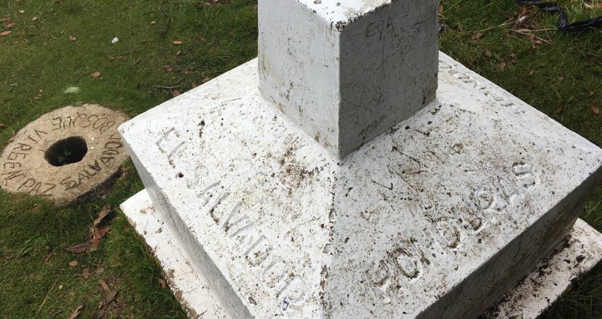
Unfortunately it was a very cloudy day and by the time I got to the top I didn’t have any views whatsoever. A small fenced compound with a telecommunications installation sits just below the summit, guarded by two very aggressive German shepherds (thankfully inside the fence!). The summit itself is marked by a white stone post that demarcates the border between Honduras and El Salvador. It sits right along the border fence, but you’re allowed to cross to the other side where there are picnic tables and benches in the forest. I dropped my bags, had a nice lunch, and when I poked around a bit I noticed that there’s actually a good trail coming up the forest on the Honduran side as well.
Standing around in the clouds at 2700 m was cooling me off quickly and even with a light jacket I soon felt cold, so I started to head back down. At Rio Chiquito, I now had the option of taking a local bus back down to San Ignacio, but somehow I still hadn’t had enough yet and opted to complete my loop hike and walk all the way back down the now paved road, which runs parallel and slightly north of the unpaved road I had come up. There wasn’t much traffic, but the curves are often sharp and you always have to watch for vehicles coming around the corner. For walking, my ascent road is definitely the better choice as there is no traffic at all, but it can get muddy and slippery when it rains. Now that it was drizzling and the ground was wet, the asphalt road was probably the better way to go.
I arrived back down in San Ignacio with a mere 5 minutes to spare before the last bus back to San Salvador arrived at 4:30 pm… just enough time to buy a celebratory Pepsi and change my sweaty shirt so I wouldn’t stink up the bus too much. The return journey only took 2 hours, probably because it was mostly downhill and there were fewer people on the bus now that it was getting late. I noticed that Salvadorians generally don’t like to travel after dark, and by the time I got to the bus terminal in the capital the bus had emptied out almost completely.
A hearty meal of beef steak, roasted potatoes, plantains and coleslaw washed down with Salvadorian craft beer concluded a most enjoyable day trip!
DISCLAIMER: Use at your own risk for general guidance only! Do not follow this GPX track blindly but use your own judgement in assessing terrain and choosing the safest route.
Note: Unfortunately, my camera broke on the first day of my trip so I had to take all photos with my iPhone.
The unpaved dirt road I took on my way up.
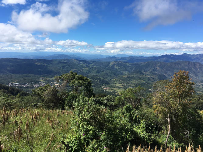
Nice views over El Salvador’s highlands. The small village of La Palma can be seen on the left.
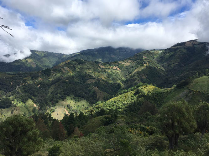
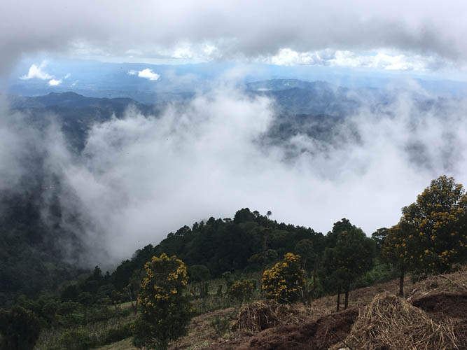
Clouds are moving in fast, covering the summit of El Pital to the NE. Unfortunately, they remain here for the rest of the day. I should’ve started 4 hours earlier!
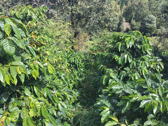
Coffee plantations along the way. El Salvador is famous for its high-quality Arabica coffee beans.
The land is rich and fertile here, with lots of vegetable fields on the lower slopes.
Thick clouds are obscuring the views as I gain elevation.
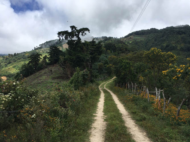
The road is in good shape – at least for walking! There’s virtually no traffic here.
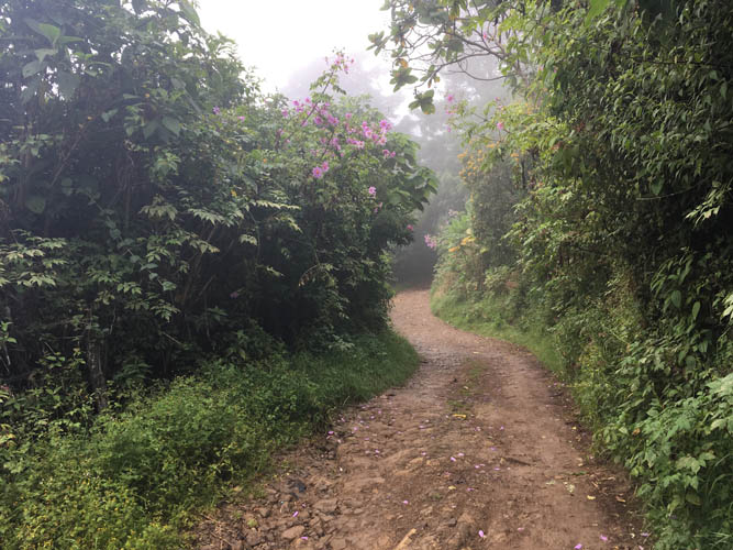
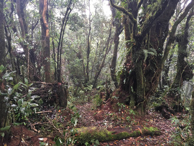
Conditions get more humid as I enter the rain forest higher up.
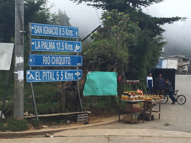
At the junction in Rio Chiquito. From here, it’s another 500 elevation metres and 5.5 km distance to the summit along a track in the forest.
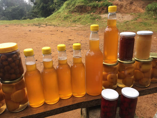
Locals like to see preserved fruits and syrups by the side of the road.

Admission to the park at the top is US$3 for the day. I was the only visitor that afternoon.
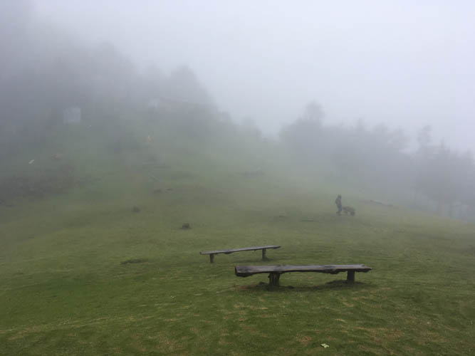
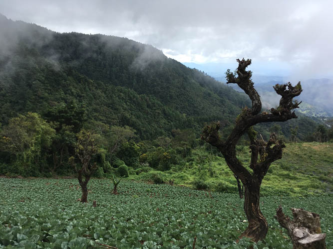
Dense clouds around the summit remind me of a cold November day in Europe. There was a light drizzle and I had to pull out an extra layer to stay warm.
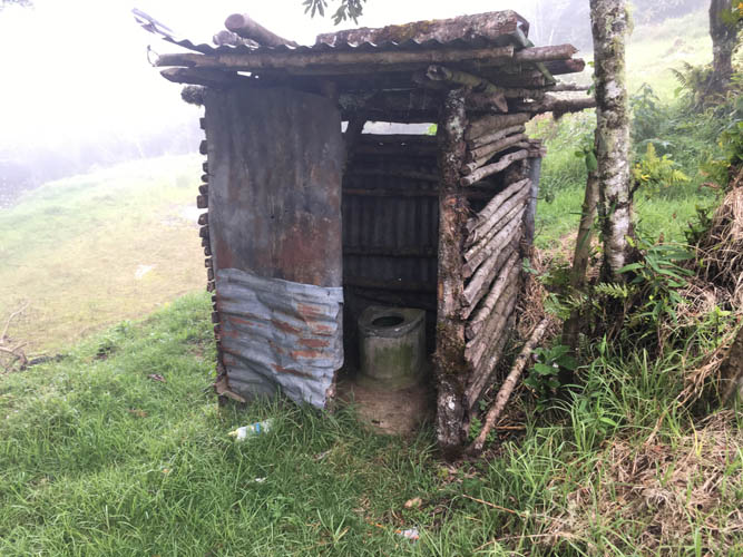
50 metres below the summit: El Salvador’s highest toilet!
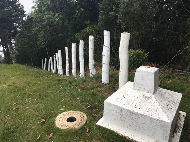
A while stone post marks the summit that sits along the border between El Salvador and Honduras.
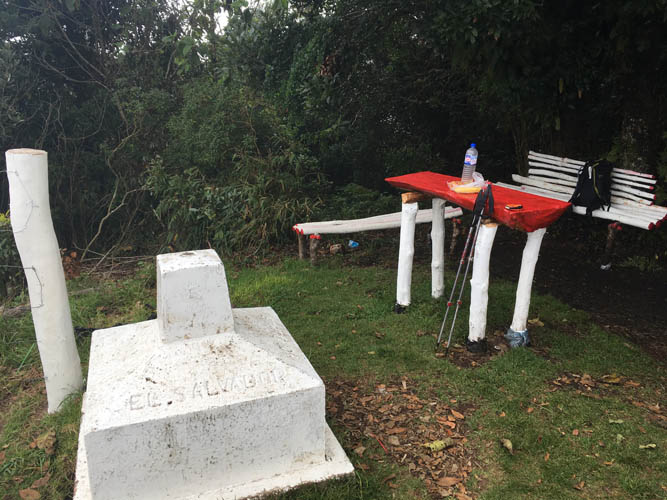
There’s a nice picnic area on the Honduran side.
There seems to be a decent trail leading up to the summit from the Honduran side.
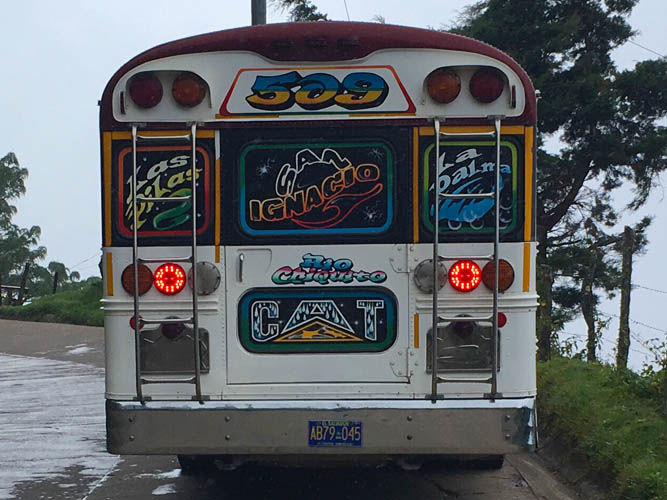
The San Ignacio-Rio Chiquito bus passes me as I hike down the main road.
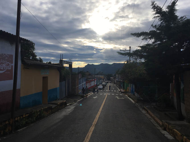
Back in San Ignacio, just in time for the last bus back to San Salvador.