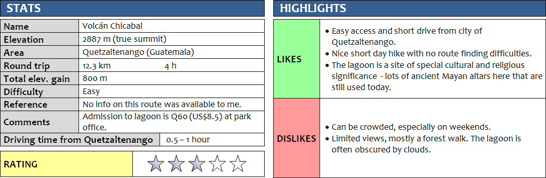
11 November 2017
Solo
Laguna Chicabal is a popular destination for a day trip from Quetzaltenango (aka Xela [SHAY-la]), Guatemala’s second biggest city. Lots of tours are offered by the many tour agencies in town, but it’s safe and easy to do on your own.
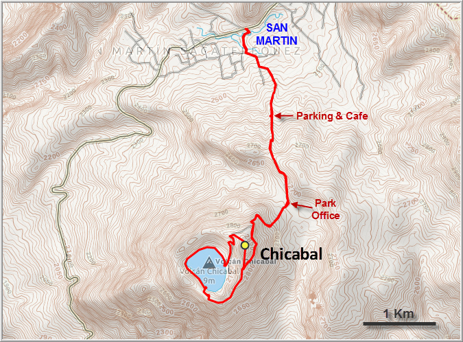
I knew it was a short outing so for my first day in the area it was perfect. A bus going towards Chile Verde took me to the town of San Martin Sacatepequez in about two hours (Q10 = US$1.5); the driver kindly dropped me off right at the start of the road leading up to the lagoon. I had a map of the area on Gaia (my navigation app), which helps but isn’t essential as there are quite a few signs showing the way and the locals in town are very used to tourists going up here and happy to point you in the right direction.
After the first few kilometres of walking up paved roads at the edge of town I arrived at a small parking area with a café and shop, a good place for lunch or a refreshment break. Past this point the road continues and is for 4×4’s only. I ran into two groups of other tourists that were on their way back, but most other people I saw were local Guatemalans coming to the lagoon to visit ancient Mayan altars and pray. The dirt road goes up a small rise, then descends into an open area with fields where the visitor centre is located. Locals have to pay Q10 admission to enter the park here, while foreigners have to dole out a hefty Q50 ($7), which I think is quite discriminatory as this is simply based on foreigner vs. non-foreigner. I’d probably be more understanding for this fee if some of that investment at least went into keeping the place clean – yet there’s litter in many places along the trail.
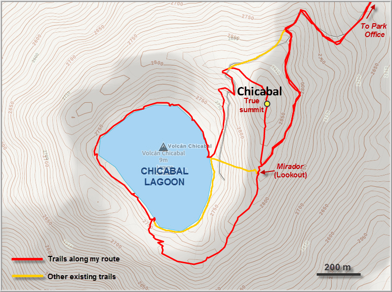
A half-hour walk through the forest brought me to the main mirador (lookout) overlooking the lagoon. A faint trail branches off to the right here, leading up to the true summit of Chicabal. Judging by the overgrown state of this trail, clearly not many people venture up here. Once I arrived at the high point I understood why: there are basically no views from the summit here as the entire top is treed. Rubbish scattered about in the small cleared area made it even less attractive to hang around here. I continued down the other side along another narrow path through the bush and joined up with a good trail that took me down to the lagoon.
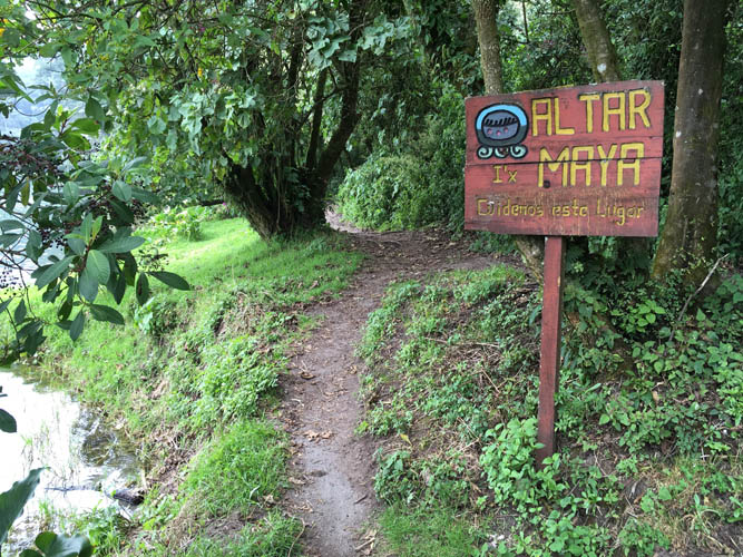
Several large groups of Guatemalans had gathered along the shoreline of the small lagoon, eating, laughing, and holding prayers together. The trail goes all the way around the lagoon and is dotted with Mayan altars and wooden signs explaining the significance of ancient Mayan symbols. Most of the altars are just simple empty patches of grass with maybe a cross or a bench to sit on. Flowers laid by worshippers often adorn these sites. I walked past a group of locals, greeting them with a smile and earning friendly smiles back, and hiked about half-way around the lake where a turn-off took me up to the crater rim and back to the mirador. I didn’t see anyone else along my walk around the lake and it was nice to have some peace and solitude in this beautiful place.
From the lookout I hiked back to my original starting point in town without stopping, which took about 1.5 hours, so overall this is quite a short outing that can be done as a half-day trip. Instead of having to take a 2 hour chicken bus back to Xela, I was lucky to find a ride with a Guatemalan family who was also headed there, cutting down my return journey to a mere 45 minutes.
DISCLAIMER: Use at your own risk for general guidance only! Do not follow this GPX track blindly but use your own judgement in assessing terrain and choosing the safest route.
Note: Unfortunately, my camera broke on the first day of my trip so I had to take all photos with my iPhone.
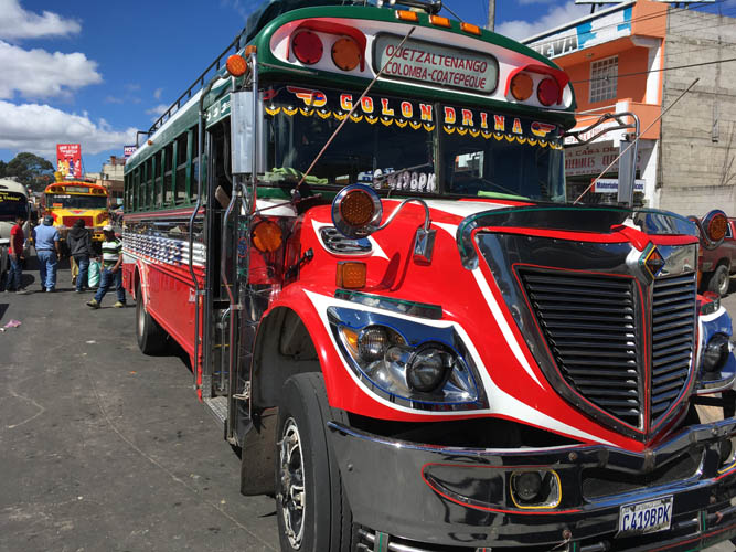
One of the many colourful old school buses at Xela’s Minerva bus terminal. This is my ride to San Martin where the hike begins.
Hiking up the road through San Martin towards the Chicabal volcano.
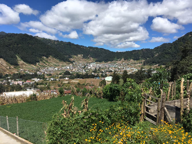
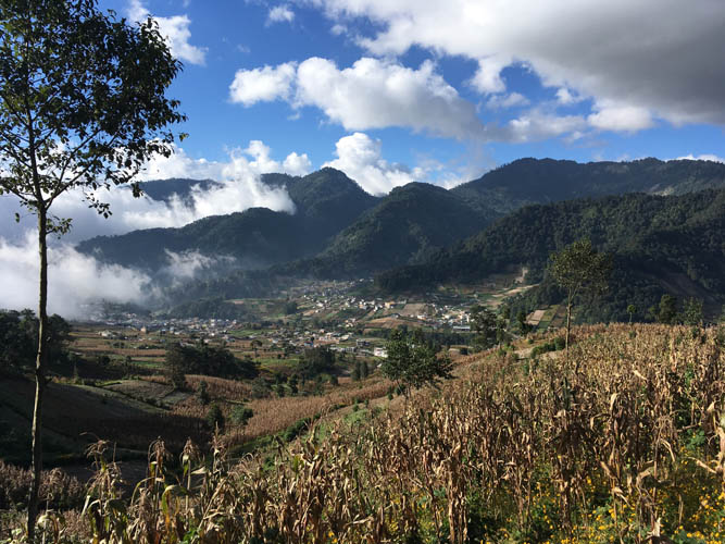
View of San Martin.
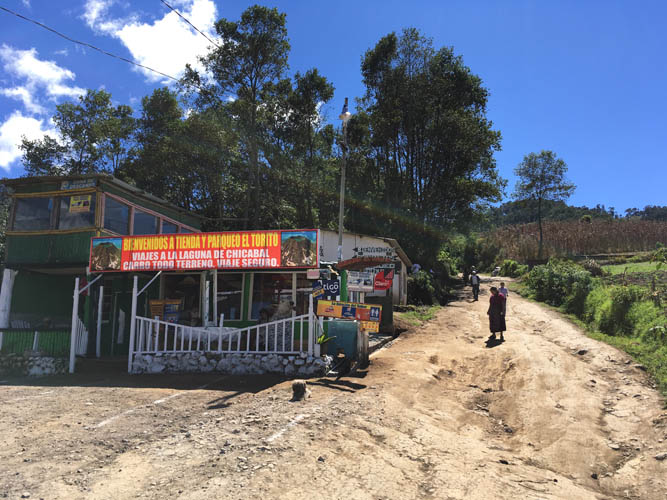
A small cafe and store about half an hour into the hike – a great place to grab some cake or cold drinks.
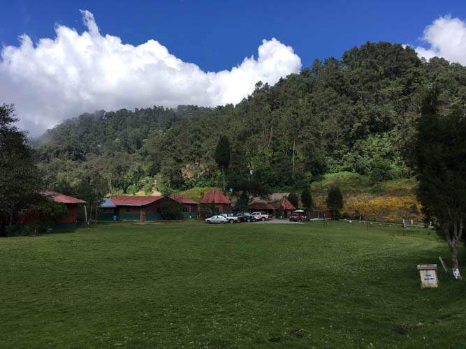
The Chicabal Lagoon park office.
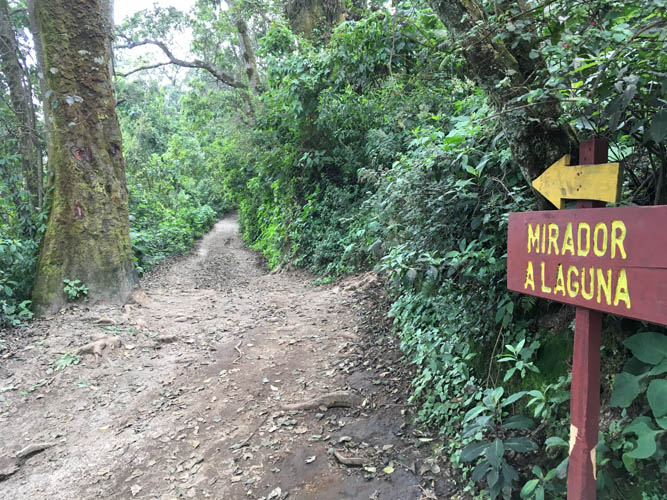
There are plenty of signs showing the way to the lagoon along the wide track.

I run into a group of Guatemalans, all of them loaded with gear. They were planning to camp at the lagoon for the night.
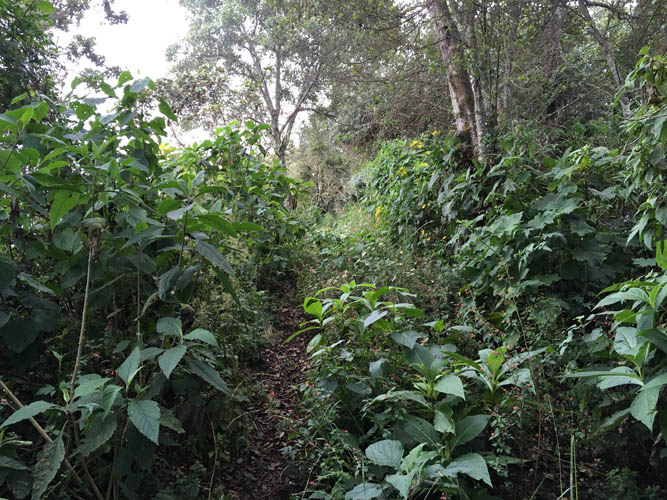
The short stretch from the main track to the true summit is steeper and a bit overgrown.
At the true summit of Chicabal, 2887 m.
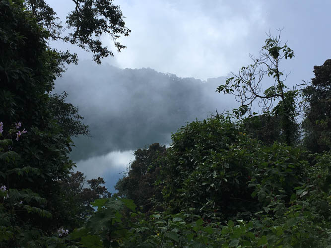
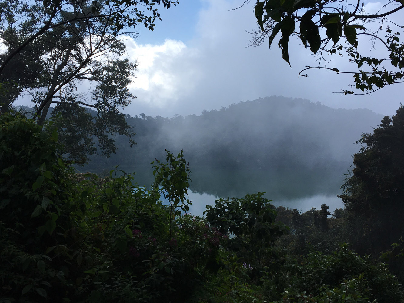
Too bad I don’t have good views of the lagoon today. My fault – I started too late! To increase your chances of cloudless views, you really have to start the hike before 9 am, preferably even earlier.
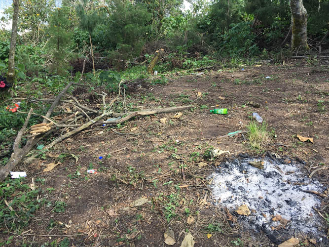
Very few people come up to the actual summit (I didn’t see any today). Sadly, some of those visitors don’t seem to care about keeping the place clean.
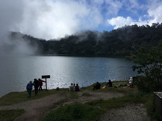
Down at the lagoon, there are tons of people, most of them locals.
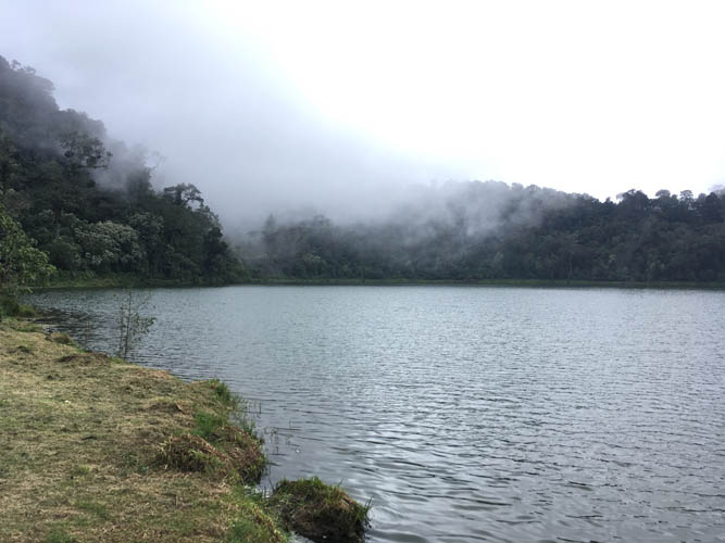
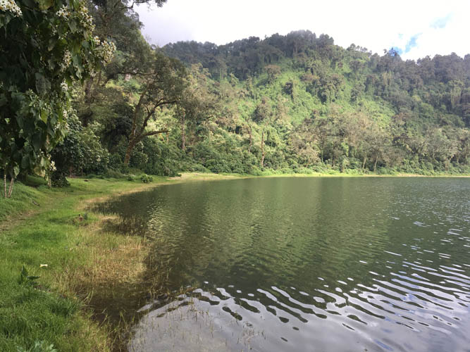
Low-hanging clouds impart an air of mystery to this beautiful place.
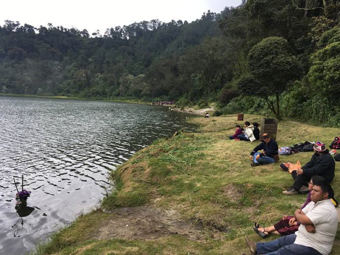
Many indigenous Guatemalans come here to pray and celebrate their ancestry. It’s a popular spot for family weekend trips, too.

Pano of Chicabal Lagoon. Hiking all the way around the lake takes about half an hour.

The significance of some ancient Mayan symbols is explained on wooden signs along the shore. This one means “snake”.
There are numerous ancient Mayan altars.
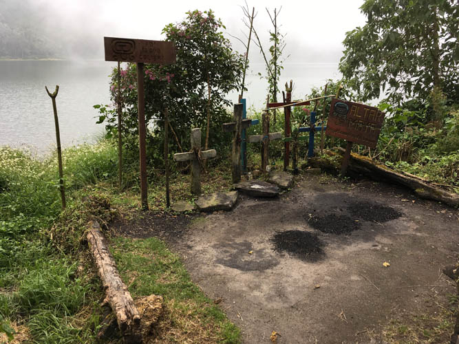
The altars are still used for prayers and ceremonies today.
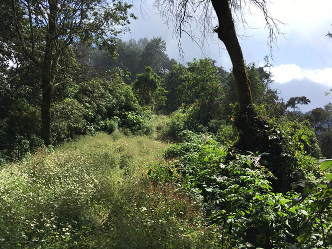
Further away from the main trails, there are no more people and I have the place to myself.
On my way back down, I finally get to enjoy some sun again!
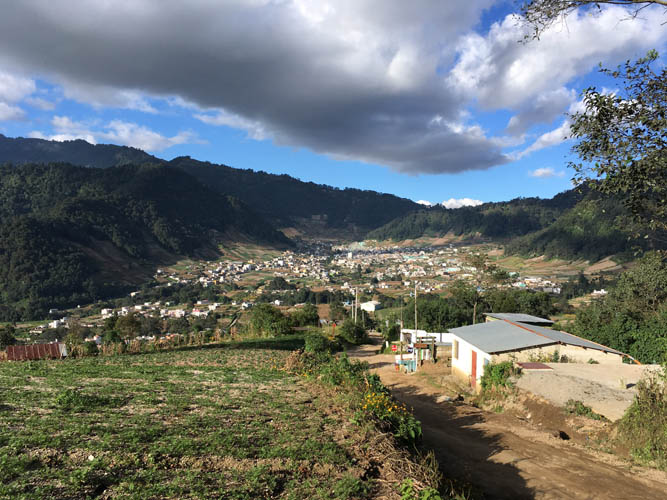
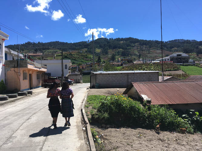
Lovely afternoon walk back to San Martin.