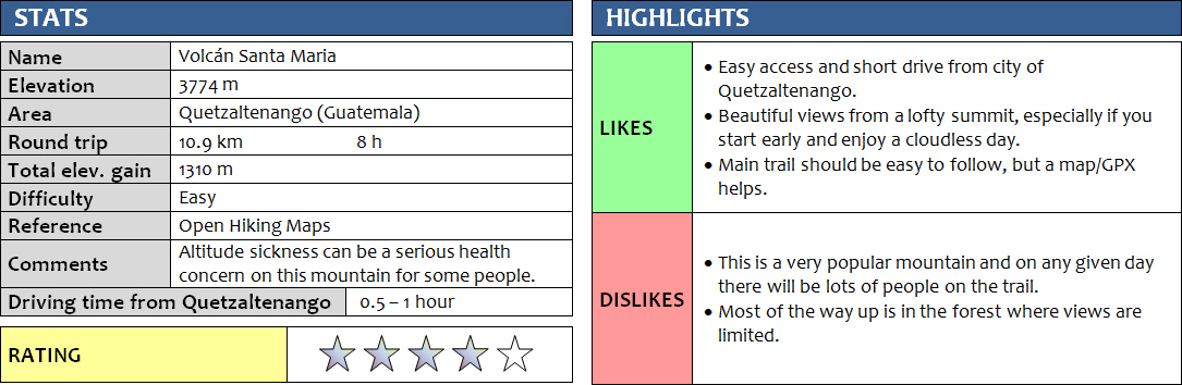
12 November 2017
With Michael
Santa Maria is one of the most often-visited volcanoes in all of Guatemala and undoubtedly the most popular one in the Quetzaltenango area. While many people use the services of a tour company to guide them up, this isn’t really necessary as there are typically so many people on the mountain at any given time that security isn’t much of a concern (but check the current situation first when you go!). Also, the path is so well-trodden, it’s hard to get lost… unless you’re like Michael and me!
We rented a private taxi to drive us from the centre of Quetzaltenango – also called Xela for short – to the trailhead, some 30 minutes away. It was only about US$10 for the ride, so well worth it instead of taking the local chicken buses which would probably take double that time. After munching down a few muffins for breakfast we were on the trail at 6:30 am and headed up at a pretty swift pace, chatting away the morning hours. I had just met Michael at the hotel I was staying at in Xela – a fellow German and very experienced and polyglot traveler, as it turned out, who had lived in and trekked through many interesting places in the world including a 1 ½ year round-the-globe solo backpacking adventure. Needless to say, we had a LOT to talk about!
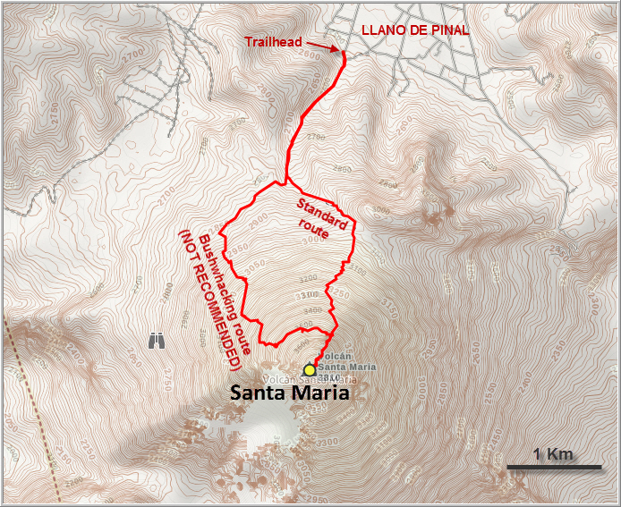
Both of us had a GPX of the route on our phones (recommended if you’re doing this alone), several mapping apps, and I even had my hiking GPS device with me – but of course all of this is useless if you don’t use it! We just kept talking and talking that somehow we must’ve missed a turn somewhere, and instead of following the main trail we ended up heading in a southwesterly direction on a wide track that just kept luring us further and further away from the correct path. The track we were one was in great shape and we were clearly enjoying our conversation, so it was with a great deal of surprise and embarrassment when we finally noticed our mistake…
And this is where mistake #2 came in (you never stop learning!): Instead of turning around and backtracking to the correct trail, we didn’t want to lose the elevation we had already gained and felt (hoped!) that there must be other trails also leading up to the summit. One of these potential trails presented itself right in front of us, and going up here was very tempting… Of course, let’s try it, we thought… what could go wrong!? Well, actually a lot! It should go without saying that following unknown trails through thick rain forest up the side of a volcano is a risky thing to do, especially if you know you’re off the official trail already. For the next 2 hours, we ended up following a myriad of trails that would grow fainter and eventually disappear, leaving us to bushwhack through the brush until we’d stumble upon another “trail” in the middle of nowhere, which would in turn disappear again – usually as quickly as it appeared. The steep sections with thick bush were the nastiest, slowing our progress to near zero speed as our hands and arms pushed and shoved the leafy foliage out of our way. Hundreds of little pea-sized brown seeds were now covering our shirts, their natural velcro-mechanism working perfectly on our synthetic fibres in the name of dissemination.
Eventually, when the bush got so thick and the going so slow that we were left wondering what the hell we were doing out here on the wrong side of the mountain, we found an abandoned trail that slowly but surely took us back to the main path. It was heavily overgrown, so much that we frequently had to crawl on all fours to get through the shrubs, but at least it was a line to follow that headed in the right direction. What a sense of relief it was when we finally saw people and were standing on the beaten trail again!
We took a nice long break, deservedly so as we had just completed the hardest part of the entire day. The rest was a snap compared to what we had been through earlier. After picking most of the tacky seeds off our shirts, we followed the trail straight up and reached the broad summit of Santa Maria in another half an hour.
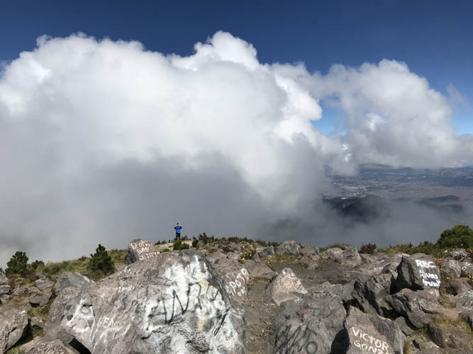
Small groups of Guatemalans were scattered in different parts of the summit area, congregating to pray, chant and worship together. As with most other mountains in Guatemala, Santa Maria is considered sacred by locals and has been used as a place of worship for thousands of years. And I can see why. At close to 3800 m above sea level, it’s easy to feel somewhat elevated in both mind and matter, to feel removed from the stress, the problems, the hustle and bustle that’s going on in the valleys and towns far below you. And the views, needless to say, are nothing short of stunning. Lots of people hike up Santa Maria in the middle of the night so they arrive on time for sunrise, which is undoubtedly the most sublime time to be here. The sight of the nearby Santiaguito, an active lava dome complex that spews up dust clouds in regular intervals, is said to be particularly beautiful. Clouds usually move in by mid-morning and obscure the smaller Santiaguito volcano so we couldn’t see it, but even with a blanket of fluffy white clouds around and below us we still thoroughly enjoyed the views. At times the skies would open up, revealing parts of other neighboring volcanoes and the city of Xela to the north. The ever-changing masses of clouds fading in and out of the mountain below are certainly a special spectacle to watch.
There must’ve been some 30 to 40 people on the summit when we were taking our break around noon, but we encountered even more people as we made our way back down. Most people were in groups and I don’t recall seeing any single hikers at all. Sticking to the correct trail this time (which isn’t difficult if you pay the slightest amount of attention) was a whole lot more pleasant than fighting through the bush! The trail is pretty steep in the upper part, but switchbacks make it easier and you rarely ever have to use your hands. It’s all in the forest, so the views on the trail itself are fairly limited. In muddy/wet conditions, I can see how the trail would get messy pretty fast in certain spots.
By the time we almost got back to the trailhead we had caught up with a group of super friendly hikers from Guatemala City that we had met on our way up. They kindly offered to give us a lift on the back of their truck, which we gladly accepted as it saved us some waiting around for a rickety bus ride.
Santa Maria is definitely a must-do volcano hike when you’re in Xela. It’s doable without a guide if you’re experienced and have a GPX track of the route, otherwise better stick with a group or take a guide. Just don’t expect to be alone on this mountain, especially on the weekends! Although we didn’t witness sunrise vistas on Santa Maria, the views we had were more than worth the effort, including our little detour!
DISCLAIMER: Use at your own risk for general guidance only! Do not follow this GPX track blindly but use your own judgement in assessing terrain and choosing the safest route.
Note: Unfortunately, my camera broke on the first day of my trip so I had to take all photos with my iPhone.
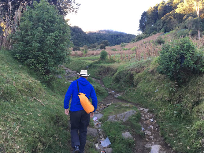
Starting our hike on a wide trail at a very gentle grade.
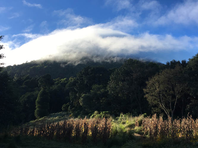
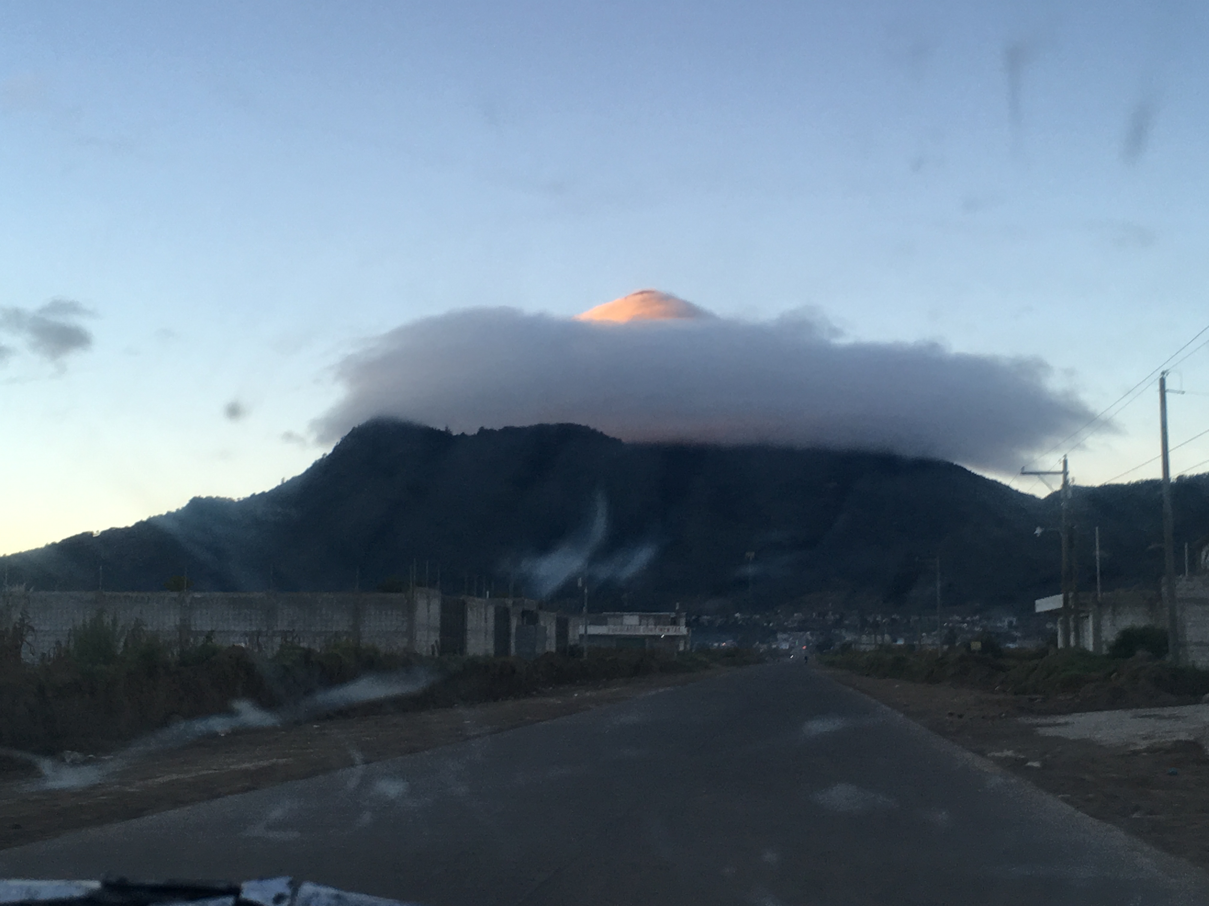
The summit of Santa Maria is already surrounded by clouds.
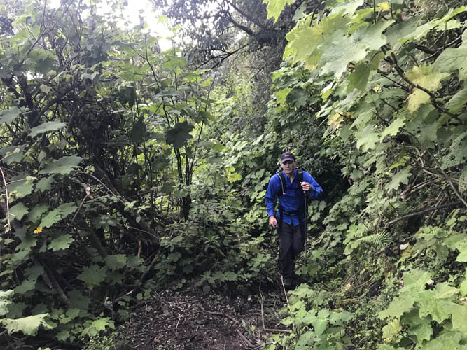
Now we’re off-track and the trail is already narrower. [Photo by Michael]
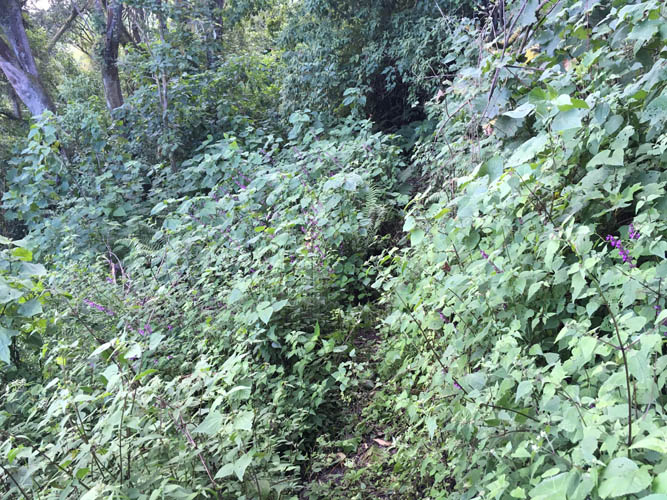
It comes and goes…
… to the point where it completely disappears. Ah, the fun of tropical bushwhacking!

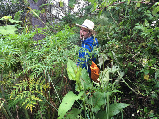
Hundreds of little tacky seeds cover our clothes. They appear to have a particular affinity for synthetic nylon shirts!
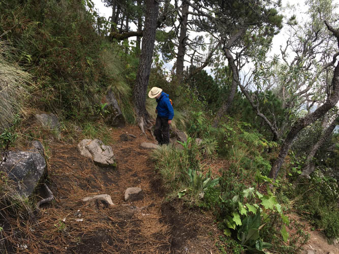
Finally on the main trail again! It leads us through open pine forest that covers the last few hundred metres of the mountain.
On the summit! [Photo by Michael]
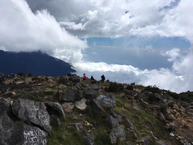
Lots of other people are here on the broad summit today.
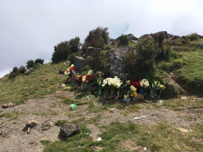
Many Guatemalans lay bouquets of flowers at the summit.
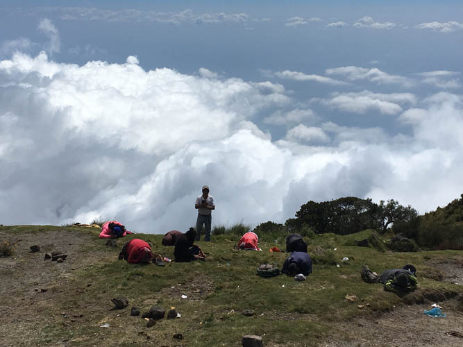
Small groups congregate to pray and sing together.
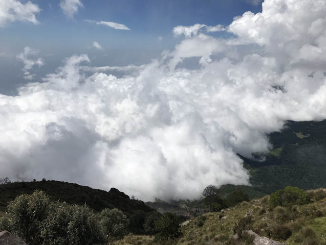
I love the spectacle of massive cloud formations swirling around below us. [Photo by Michael]
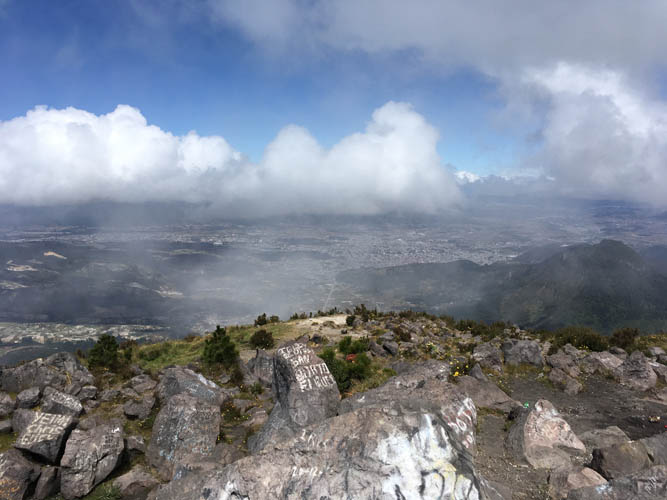
Fleeting views of the city of Xela to the north.
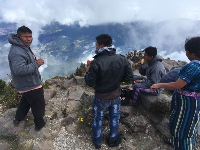
Contrary to us fully geared-up gringo hikers, the locals come up here in jeans, sweaters and sneakers. No special equipment needed!
Views from the summit. [Photo by Michael]
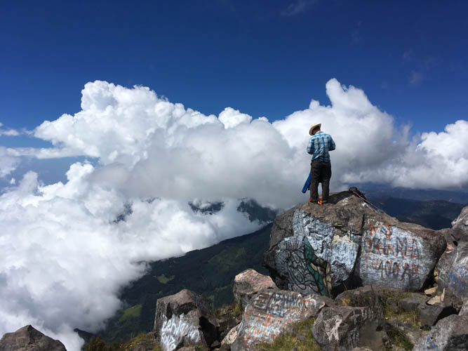
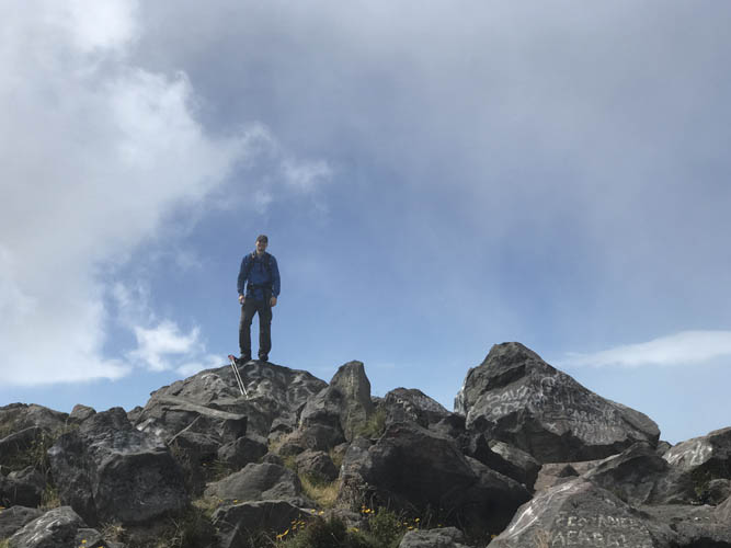
Michael stands atop the high point of this 3774 m volcano.

A local taking a summit nap.
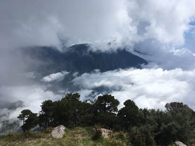
A glimpse of the neighboring Santo Tomás volcano that sits at 3528 m elevation just to the east.
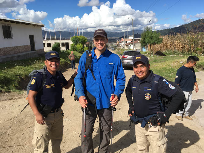
My brief moment of a private police escort back at the trailhead. These two friendly policemen were hired by a group of hikers to accompany them. While having armed guards with you undoubtedly minimizes any security risks, we felt that it’s probably not necessary given the popularity of the hike and the large number of people visiting,