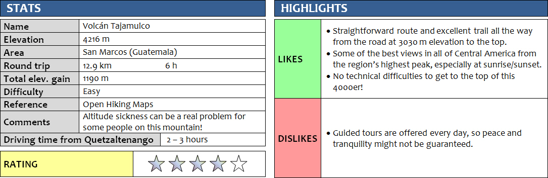
15 November 2017
Solo
As the highest mountain in Guatemala and all of Central America, Tajamulco is surprisingly easy to ascend. In fact, it’s just a high-altitude hike – that’s all it is! Once you’ve spent a few days in the highlands of Guatemala and have become accustomed to the elevation, it should be a pretty straightforward trip and one that you don’t even need a guide for.
Most people appear to book a 2-day trip through one of the many tour agencies in Quetzaltenango (also called “Xela” [SHAY-la]), the advantage being that you get to witness both sunset and sunrise and camp the night at 4000 m elevation on the mountain. I wanted to go at my own pace and decided to just take the public “chicken buses” to the nearby village of Villa Real at the trailhead and hike up in one day on my own. It all worked out perfectly and was actually shorter than I had anticipated.
From Xela, I first took a bus to the city of San Marcos (2h, Q10), then after a half-hour wait another one heading north to Tajamulco to the village of Villa Real (1h, Q6). I did this the afternoon before my climb so I could start early the next day and enjoy cloudless views from the top. Clouds tend to accumulate around the upper part of the mountain around mid-morning, and I thought it’d be a shame if I came all the way to the highest point of Central America without having any views at all.
The simple Hotel Villa Real (Q50 = US$7 a night) serves as the perfect base for a trip up Tajamulco. It’s a noisy place with all the traffic running by and doesn’t have the cleanest rooms, but the location is great and the owner is super friendly. The unmarked restaurant across the street was also an excellent place to load up on carbs the night before and sample some incredibly cheap but very tasty Guatemalan food – I had a big plate of beef steak, fried potatoes, spaghetti, rice with carrots, garnished with lettuce and half an avocado and served with tortillas – all for US$4 (Q30).
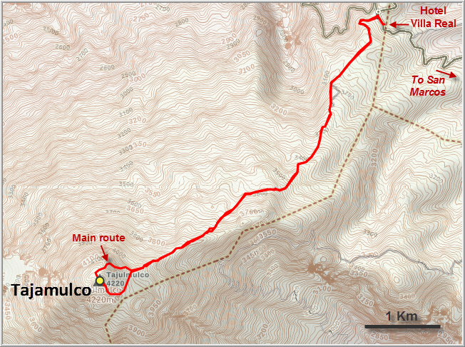
I slept terribly that night, partly because of the traffic noise and partly because a lingering cold was still bothering me, and it was really hard to get up at 3:30 am so I could start my hike at 4 am. The first hour and a half I was hiking in the dark, frequently checking the GPX track I had on my smartphone to make sure I wouldn’t take any wrong turns (as what happened on Santa Maria). The route is pretty straightforward, even in the dark: the first part is along a cobbled street past some farmers’ houses, which then turns into a dirt track that slowly ascends the broad east ridge of Tajamulco. After a few km, the dirt track ends at a small parking area and I now followed a good trail up the ridge through light pine forest and meadows. The trail is so popular, it’s hard to miss and there don’t seem to be any other trails veering off in the wrong direction.
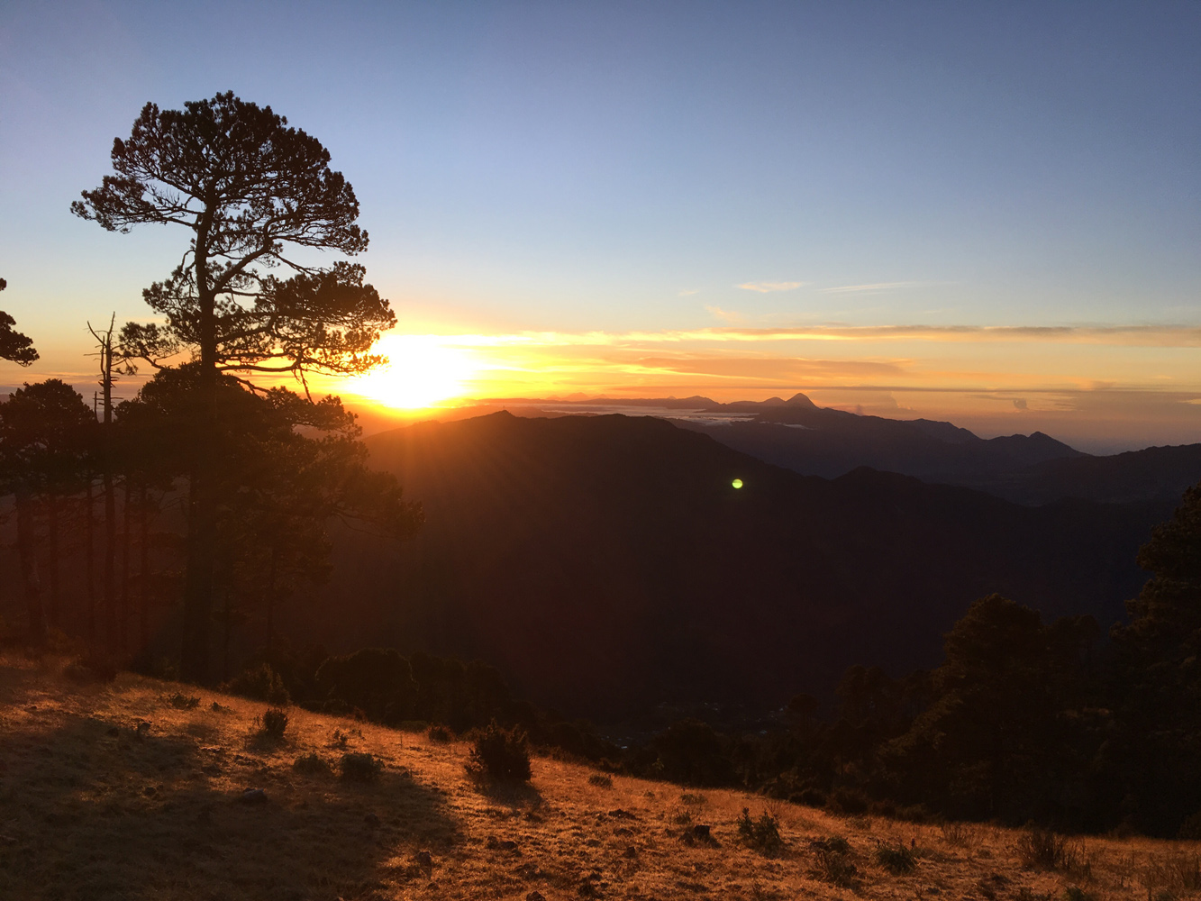
At 5:45 am, just before sunrise, I reached an opening along a small platform on a flat part of the ridge where I could look south for the first time. What a spectacular view, with Santa Maria and smoking Santiaguito sticking out of the clouds in the distance while the sun was slowly coming up! It had been a very chilly night so far and I had to wear all my gear – gloves, puffy and long underwear – but now with the first rays of sunlight I was finally warming up a bit.
The path keeps going southwest along the gentle ridge through open forest and leads up to the summit mass of Tajamulco. I noticed smoke billowing up from the forest in a saddle between the main and a sub-peak to my left. There were some horses tied to trees nearby. It was the camp of a group of tourists that had stayed overnight and was now on the summit enjoying the sunrise. I continued on the main trail that slowly veered right, getting steeper as it rose through more rocky terrain that required the use of hands here and there, but there was never really much scrambling. Now just above the 4000 m mark, I noticed how my breathing got heavier and slower. I had to take short breaks every 5-10 minutes, it was really quite a strange feeling. Slowly, I kept pushing myself and continued the last few hundred metres to the broad summit dome. To my surprise, there was nobody here and I had the summit all to myself!
One big difference between summits in Latin America and Canada or Europe is that there are typically no summit registers on the former. At least I’ve never seen a register where people can leave their name, date and comments on any of the peaks I’ve visited in this region. Tajamulco was no exception, but at least there was a small cairn marking the highest point. I sat down for a thoroughly enjoyable breakfast, taking in 360 degree views around Central America’s highest mountain in the bright morning light. The vast drop down the west side is quite impressive – this is where Guatemala’s highlands end and the flat coastal plains begin. It was a bit hazy to the far west so I couldn’t quite make out the Pacific Ocean, but clear skies to the north granted a fine view of Tacaná, Guatemala’s second highest mountain that sits right at the border with Mexico. And cast onto the ridges and valleys right below Tacaná was the huge dark shadow of Tajamulco – like a mountain projected onto another mountain – a very imposing sight.
The summit cairn looks down on a small, dusty crater that can be visited as well in a few minutes. Rocks at the bottom spelling out the names of people and their lovers attest to the popularity of this place. Unfortunately, the flipside is that there’s also some garbage strewn around the summit, an all-too-common sight on Guatemala’s mountain tops.
I finished my breakfast, re-applied sunscreen (the sun is intense up here!), and then headed down the south side of the summit mass along a vague trail. The terrain is fairly easy up here and you could basically come down anywhere you’d want. After rejoining the main trail and passing by the now noisy camp, where the group had just gathered for breakfast (I must’ve just missed them on the summit), I then simply followed the same route back. Half way down, I ran into a lone Guatemalan woman who was on her way up. Dressed in a simple sweater, rubber boots, and carrying just a small sack, she happily told me that she goes up the mountain regularly in order to pray. She had no water with her and no food! And here I was, fully equipped with camel bag, my 3 litres of water, food, extra granola bars, extra clothing, GPS, etc… I felt like a fool compared to her! She must’ve been in her 40s or 50s and it was impressive to see what the locals here do for “just a hike out”.
It was 10 am when I arrived back at the hotel. With the early start and the lack of sleep I was definitely tired, but surprised at the same time that it had only been a 6-hour trip. After an hour of napping, I decided to take the bus back to Xela instead of continuing on to Tacaná – my cold was getting worse and I just wasn’t feeling it. Another time. I was just happy that Tajamulco had turned out to be such a wonderful outing, and one that ended up being easier and shorter than I had anticipated.
DISCLAIMER: Use at your own risk for general guidance only! Do not follow this GPX track blindly but use your own judgement in assessing terrain and choosing the safest route.
Note: Unfortunately, my camera broke on the first day of my trip so I had to take all photos with my iPhone.
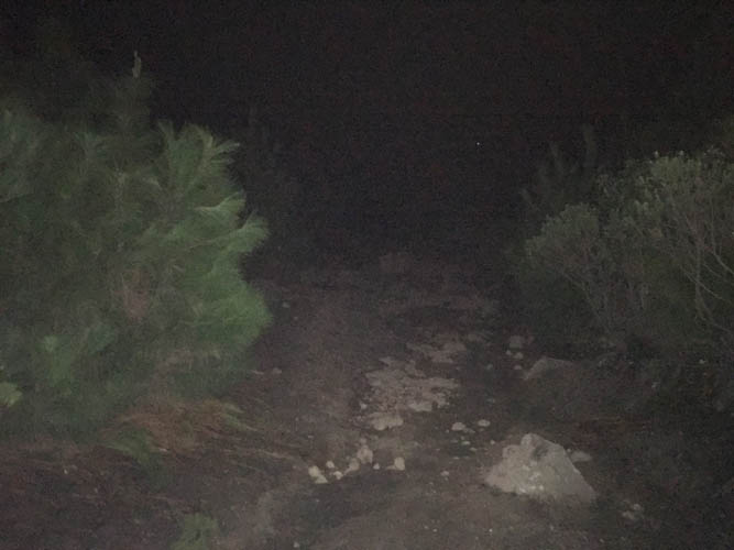
An early morning start (4 am) means that most of the trail looks like this to me for the first hour and a half.
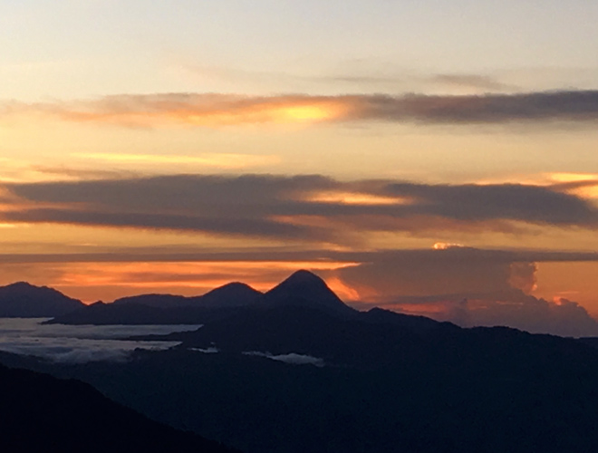
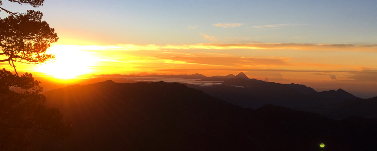
The sun is starting to show its orange morning glow. The tall volcano in the centre is Santa Maria, with Santo Tomás just to its left.

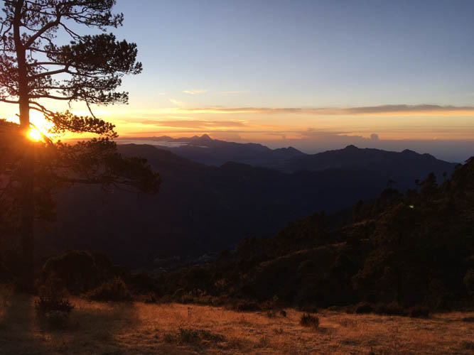
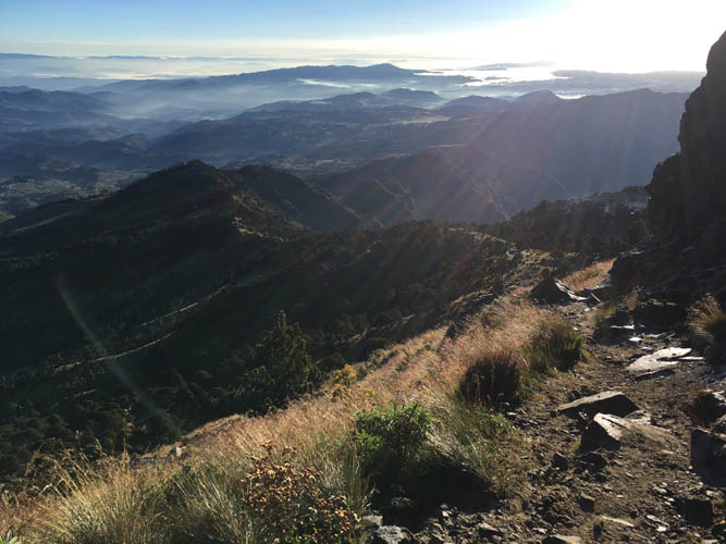
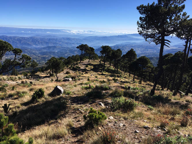
Thankfully, the clouds are all below me at this time. I’m at about 3800 m elevation.
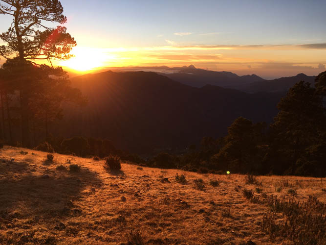
Sunrise! I didn’t quite make it to the top for this magical moment, but I’m glad I was out of the trees to witness it just in time.
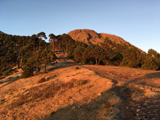
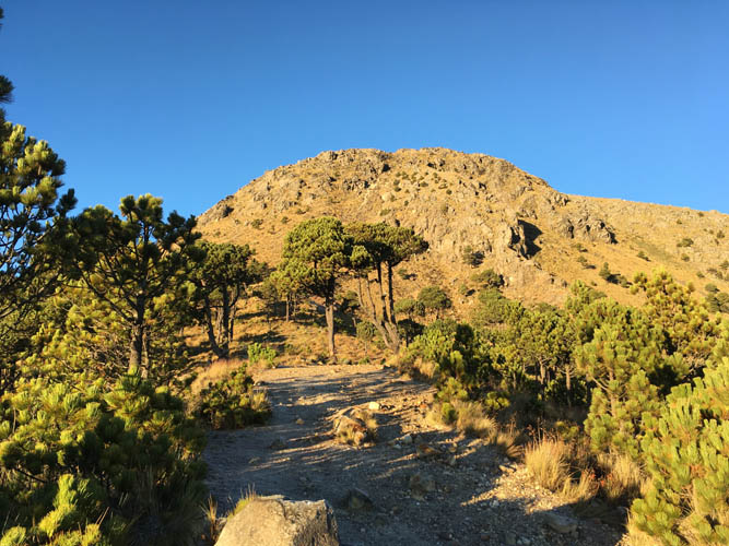
Tajamulco’s main summit mass in the early morning glow. I still have about 400 elevation metres to go.
I just love the warm light. It’s also finally warming up a bit, but I still have to wear my gloves and puffy jacket.
Sunrise pano.
And one more…
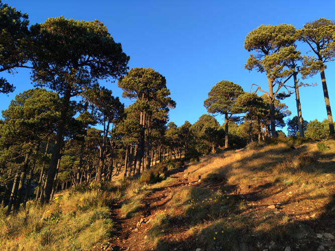
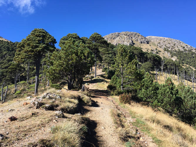
The rest of the way is through tall pine and eucalyptus trees.
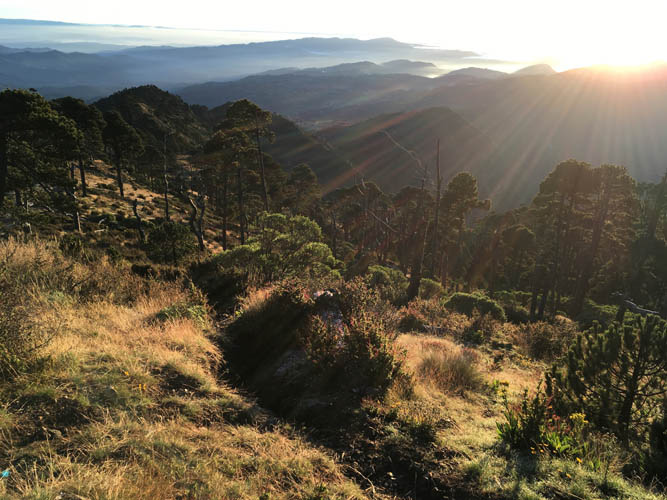
As the sun rays start to spread out, I begin to slow down as my breath gets heaver at 4000 m altitude.
At least the way up is obvious – not much thinking required!

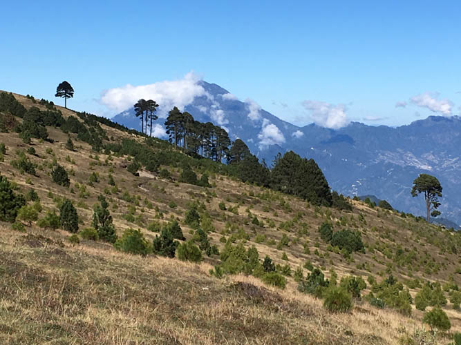
A look back along Tajamulco’s NE ridge.
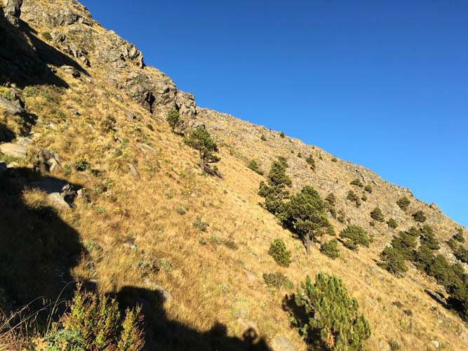
The main route then veers slightly right and heads up the north slopes of the mountain.
Another look back.

At the summit of Tajamulco, Central America’s highest summit.
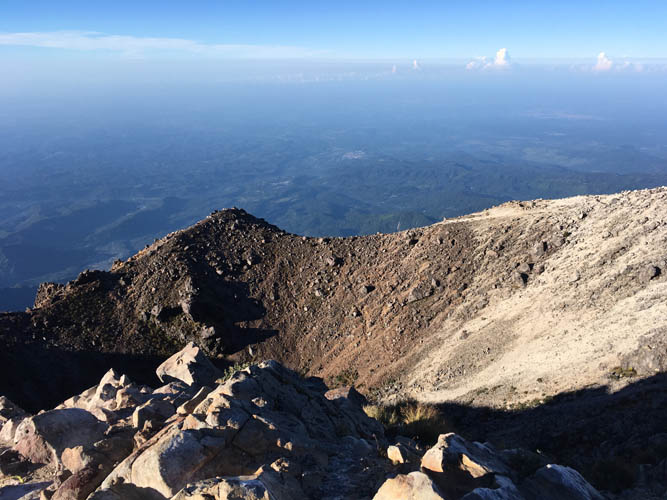
The volcano’s crater is relatively small and barren. Not much vegetation up here.
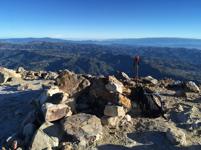
Summit cairn.
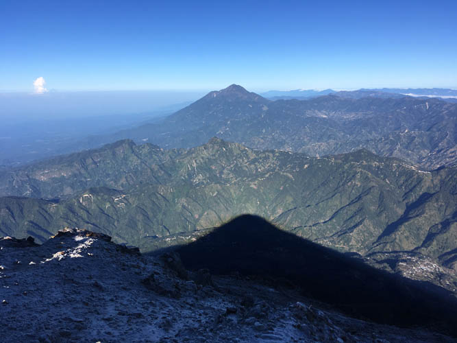
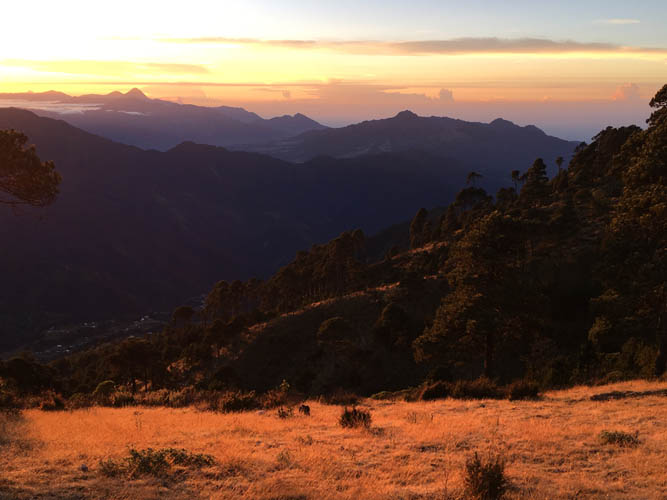
The mountain casts a huge shadow on the valleys below. The eye catcher in the back is Tacaná, also in Guatemala and Central America’s second highest peak at 4060 m.
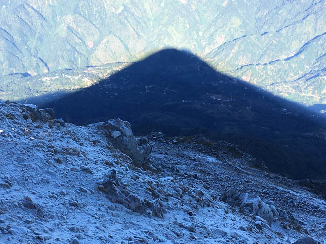
Frost covers the rock where the sun hasn’t touched the mountain yet.
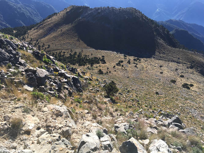
The alternative descent route down the south side of the summit mass.
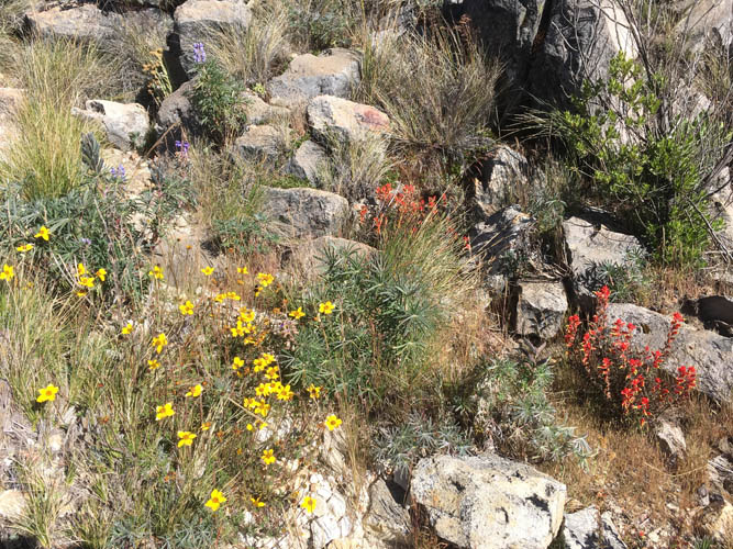
Colourful flowers cover the grassy slopes.
Back into the trees at approx. 4000 m elevation.
Taking a look back at the summit mass. Although it looks like scrambling terrain, it’s an easy hike pretty much all the way to the top.
On my descent, I take another glance at Tacaná to the north.

The only person I met all day: This Guatemalan lady was hiking up all by herself only in rubber boots and sweater, with no food or water. She went up the mountain to pray, and this was her way of making a sacrifice.
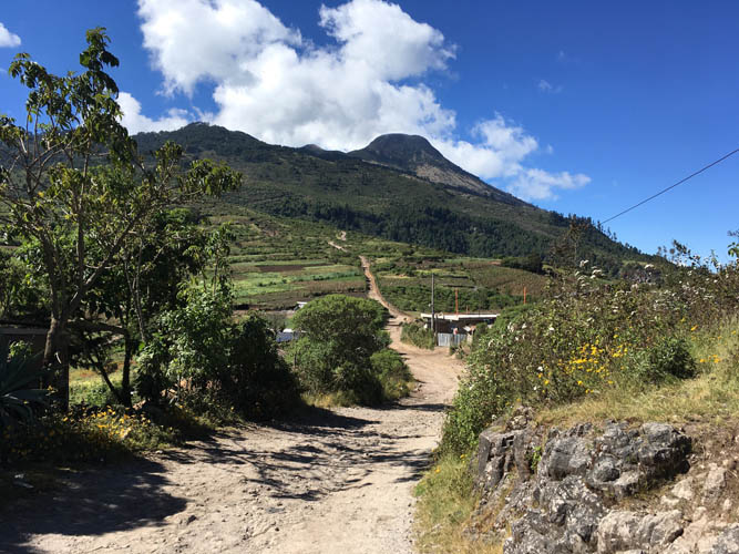
Almost back down at the main road, I turn to take a last look at the mighty Tajamulco.