16 November 2017
Solo
A day after hiking up Tajamulco and still feeling the effects of a debilitating cold I’d been trying to get over for several days now, I decided that a shorter day with a smaller peak was in order for today. Well, it turned out to be neither short, nor was it a smaller peak.
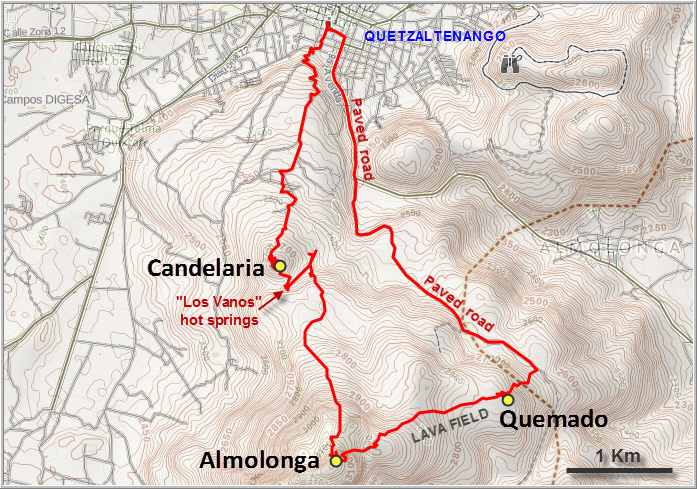
I had heard a lot about Cerro Quemado (meaning “burnt peak”) and seen the name on maps, but was a bit confused as to its exact position in the mountain range just southeast of the city of Quetzaltenango (also called Xela [SHAY-la]). This range appears to have several peaks, which are variably labelled as Quemado, Candelaria and/or Almolonga depending on which map you use as a reference. Most locals refer to the entire massif as “Cerro Quemado”, so I figured the three names are probably just used interchangeably and all refer to the same thing. Quemado is also described as a sacred mountain on some sites I found, with a good trail to the top, and is popular with Guatemalans as a place of pilgrimage where people pray and even hold open-air church services amongst the rocky lava outcrops.
Since I couldn’t find any specific route descriptions or a GPX track of the route up, I decided I’d wing it and simply head south from the centre of Xela city, asking locals along the way for any trails. I got a lot more than I bargained for! It turns out that Cerro Candelaria, Volcán Almolonga, and Cerro Quemado are all separate peaks, with Almolonga being the highest and main summit at 3185 m. Quemado is a sub-peak to the NE of Almolonga and has a good trail going up; it is by far the most popular destination. Lastly, Candelaria appears to be the treed sub-peak between Almolonga and the city of Xela, although I’ve seen other references that place Candelaria as another jagged peak in the lava field right next to Quemado.
From the Central Park in Xela I wandered south, then up a narrow winding road that soon transitioned into a dirt track at the edge of town. There were hardly any people around at this time mid-morning, except for a couple of farmers who were tending to their fields. I chatted with a young guy hauling up sacks of white onions and bundles of green onions into the back of his truck – he happily posed for a picture and confirmed that Cerro Candelaria – the northernmost peak, or more of a bump really – was straight ahead.
A short while after, the dirt tracks I had been following ended in some pastures where a few lonely cows were munching away on the lush grass. Behind the pastures, it the rest of the hill was forested. The pine trees here were so widely spaced that it was easy to just walk up anywhere. That changed a few hundred metres higher, where thick undergrowth appeared and the forest became more lush. I came across a decent path, but it led around the hill instead of straight up – so I had no choice but to bushwhack my way to the top for a few hundred metres. A small stone circle marks the summit, but it’s all overgrown so there really is nothing to see from here – a bit disappointing really.
After bushwhacking my way back to the trail, I followed it for a bit until it fizzled out, then I easily hiked through open forest back down the other side, still going in a southerly direction. At the col between Candelaria and the long ridge leading to Almolonga I received an angry welcome by three barking dogs at a small collection of houses. My usual strategy is to lift my poles and point them in an equally angry and threatening pose back at them, then confidently march through their terrain, which is typically very restricted. I had arrived at the “Los Vanos” hot springs that I had read about – a privately run spa that offers fairly rustic rooms where one can soak in the warm waters coming straight out of the volcanic rock. There seemed to be no guests around, but I had a nice chat with the friendly owner who confirmed that the hill I had just gone up was Candelaria. When I asked about Quemado, he directed me to a seldom-used trail that starts a few hundred metres down the road from his house. It’s unmarked and quite difficult to see from the access road, and I would’ve never found it on my own!
Although the trail looked rather rough and was hard to follow at the very beginning, it changed into a decent path and turned out to be a great choice. For a long time there were no major turn-offs and I was able to easily follow it for hours through light forest, lovely long grass meadows, and later thick jungle as the trail gained elevation. Rare pieces of candy wrapper and other garbage showed that someone had been here not too long ago, but today I didn’t see a soul on this trail. Occasionally, trees would be marked with arrows in faint red or purple paint, but the way was always quite obvious.
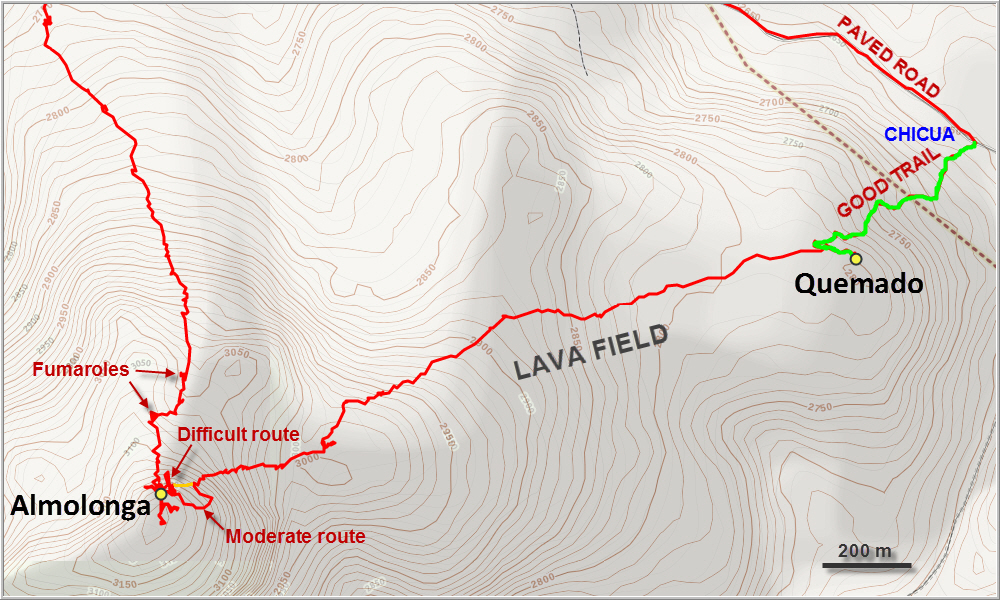
I kept thinking that at some point I must be coming across the “main trail” that everyone else uses, with lots of people on it hiking up Quemado, but this never happened. My trail just kept going and going – up, fortunately. Turning around a corner, I unexpectedly stumbled upon a natural phenomenon I had never seen myself in nature: a fumarole. Fumaroles are basically volcanic vents that emit hot steam and gases, and this one was right in the middle of the lush forest – a reminder that this is not an extinct, but a dormant volcano. The hole was puffing in intervals, very few seconds, and the steam was more warm than hot. But there were more in the distance I could see, creating small clouds that slowly moved through the trees.
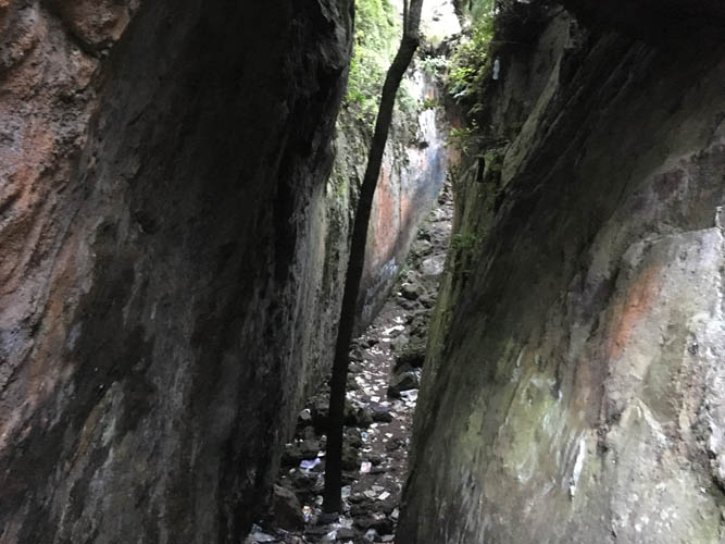
Large blocks of volcanic rock were strewn between the trees and it was lots of fun scrambling up and through them following the faint markers on some of the boulders. Then the trail abruptly ended at a sheer vertical cliff. The smooth rock face was about 20-30 m high and the summit seemed to be just above it. Just as I thought I’d have to contend with not making the main summit today, I discovered that the trail continued below the cliff for a few more metres, leading into a large vertical crack. I put on my gardening gloves and scrambled up the 1-2 m wide opening in the cliff. It was more of a steeply inclined tunnel, really, that led through the rock almost to the top. In the middle of it someone had strategically placed a tree trunk that could be used to climb over a large gap in the rock and up to the top of the cliff. A short walk then led to the summit. It was the summit of Almolonga, as I could now see! Quemado with its countless prayer flags was in the distance to the NE. No wonder I had not found a well-trodden trail or seen anyone!
I tried to find a way south to link up with a track that’s apparently only 500 m away, but all the little trails I found near the summit quickly led me into dead ends. Preferring to avoid a sketchy downclimb of that tree trunk and the tunnel, I searched a bit more around where I came up and promptly found an easier trail down (still of moderate difficulty, though). It was even flagged! Red, black, and green tape was tied to the trees, and sometimes plastic bottles stuck on branches would mark the way. I do wonder, though, why anyone would use green tape to flag a route in a tropical forest… The trail steeply descended through dense bush towards the NE, then wound its way through a patch of large blocks of rocks before losing itself at the start of an extensive lava field. A big, messy area of jagged dark grey rock was now in front of me and I had no idea where I was going. The flags and markers had disappeared, only the occasional dot of pale yellow paint was still visible in this rugged sea of craggy lava. I looked at my watch and realized that I barely had an hour and a half of daylight left. Working my way through the lava was difficult and slow enough with the sun out, but being stuck here in the dark surely wasn’t a comforting thought. And I couldn’t even see exactly where I was heading – there was no trail, no marker in the distance. All I knew was that the summit of Quemado was NE of me, but it was obscured by all the rock and clouds that were hanging low now.
Anyone who’s ever visited a lava field off-trail knows that hiking through this type of terrain is painfully slow. The brittle lava is often unstable and the rock is sharp, so you have to concentrate extra hard not to trip and fall. It really reminded me of the black lava field near Sisters Peak on Ascension Island, although the rock there was even more craggy and contorted. I tried to follow the faint yellow dots as best as I could, and kept losing them, only to find them again. Eventually, after an hour of stumbling through this mess, my concentration waned and I slipped on an unstable boulder. Some scratches on my hands and a bent pole, but nothing serious thankfully. A stern reminder that wandering out here alone in this type of terrain is not a good idea in case something happens!
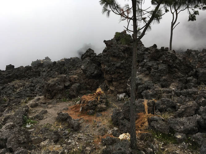
I took a short break to regain my concentration and pushed on towards the summit of Quemado with its many prayer flags now in clear sight. The closer I got, the easier the hiking was, since people seem to spread out from its summit in all directions to find places to lay flowers and pray. Shortly after 5 pm I was standing at the top of Cerro Quemado, thankful to be back on a good trail and happy to see other people. Two very friendly Guatemalan fellows in their 30s approached me and we had a nice long conversation. They told me they had come up here to pray and were staying the night in a makeshift tent, to be as close to God as possible so to speak. Two or three other groups of people were standing on the jagged summit ridge, some citing prayers, others singing loudly. The broad summit is sprinkled with flower bouquets, Guatemalan and Israeli flags, and makeshift altars where people light candles and burn small fires. This makes Cerro Quemado a very unique summit to visit, despite the peak’s relatively low prominence as it’s really just a bump on the northeastern side of the main mountain – Volcán Almolonga.
A very well-worn path leads off the jagged summit ridge, through a narrow cleft in the rock, and down the north side of the peak, past small huts and mini-altars. It was just past sunset now but there were still lots of people out and about. I quickly reached the small village of Canton Chicua at the end of the trail, where I followed the small road back to the city of Quetzaltenango. It was dark now and probably not the safest time to walk around as a lone foreigner here at this hour, but everyone I encountered seemed to be friendly and I never felt unsafe.
Overall a great adventure right at the doorstep of my hotel combining three peaks of various difficulty levels. While Quemado is by far the most popular peak with tons of other people around, Candelaria was a bit of a disappointment (bushwhacking), and Almolonga the biggest surprise with some cool difficult scrambling and rough trails leading past hot volcanic vents. Quemado is recommended for those wanting an easy day out, while Almolonga’s north route is recommended for those with an appetite for bigger adventures. The traverse across the lava field is slow and cumbersome and therefore not recommended.
DISCLAIMER: Use at your own risk for general guidance only! Do not follow this GPX track blindly but use your own judgement in assessing terrain and choosing the safest route.
Note: Unfortunately, my camera broke on the first day of my trip so I had to take all photos with my iPhone.
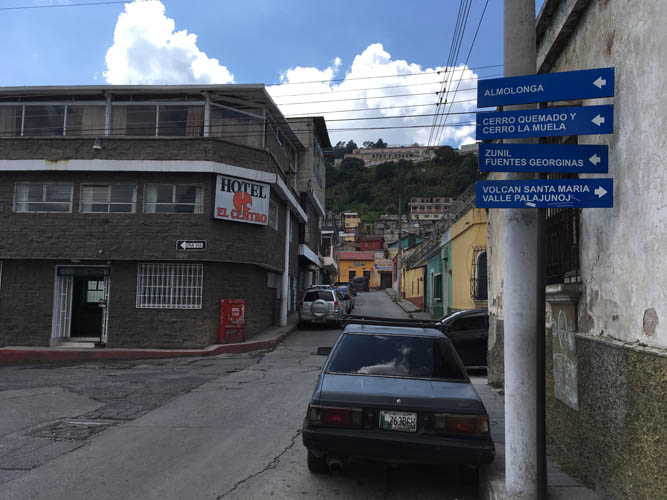
This is one of those rare hikes you can start right in the centre of a major city. Driving directions to Cerro Quemado, amongst others, are signposted!
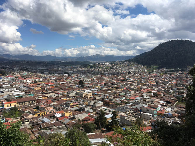
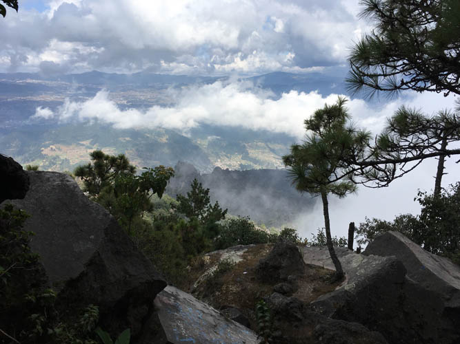
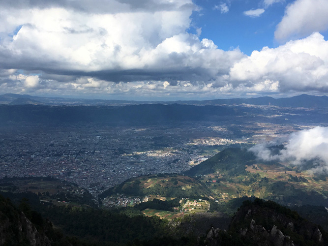
Walking straight south from the Central Park in Quetzaltenango, I gain elevation quickly and soon enjoy good views over the city.
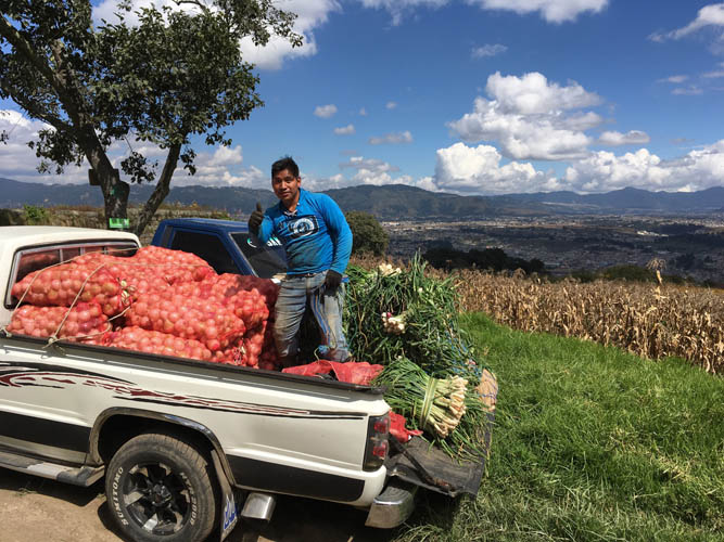
A local farmer with a load of fresh onions.
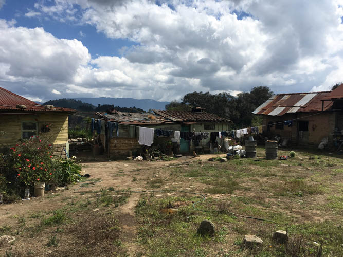
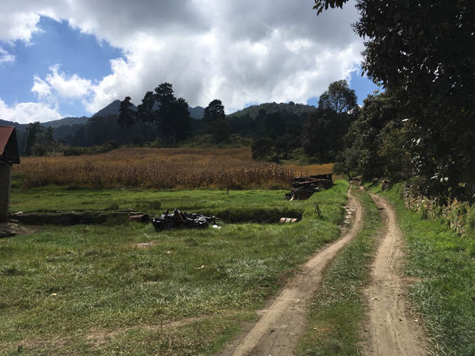
Small farming community at the edge of Xela.
A track leads south towards Cerro Candelaria.

The rather unimpressive summit of Cerro Candelaria, completely covered in trees. No views here!
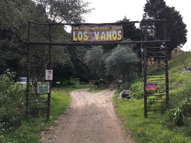
A short walk south from Candelaria’s summit, I stumble upon the “Los Vanos” hot springs. This place doesn’t look quite as inviting as the more famous Fuentes Georginas hot springs near Zunil, but would probably still make for a very relaxing rest stop after a long hike.
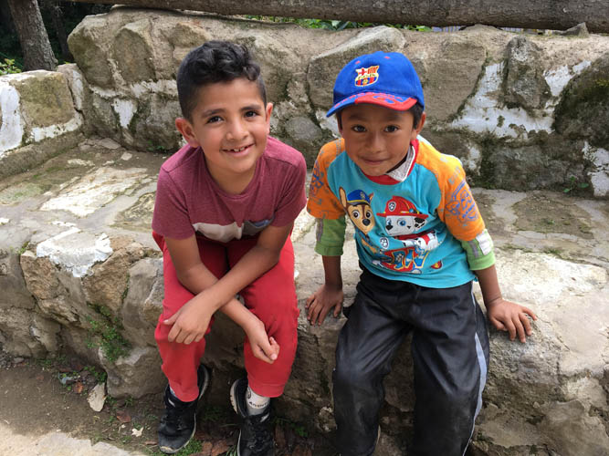
Two young Guatemalan boys.
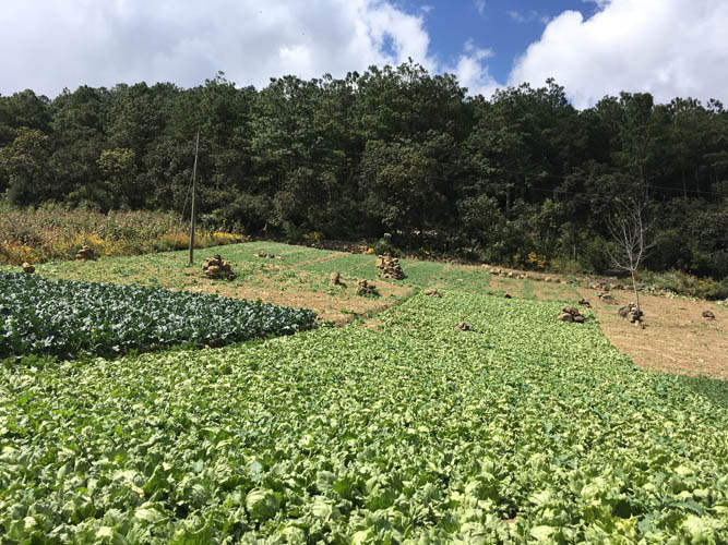
The lower slopes of Cerro Candelaria are farmed extensively; it’s all rich volcanic soil that makes for good arable land.
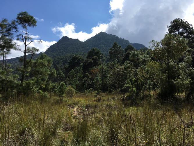
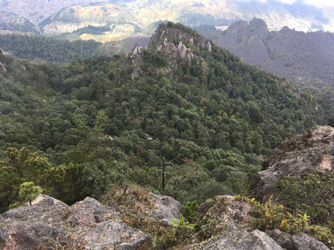
The much higher Almolonga volcano comes into view.
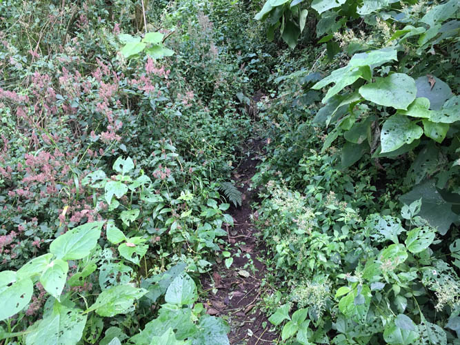
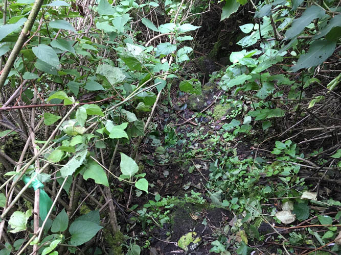
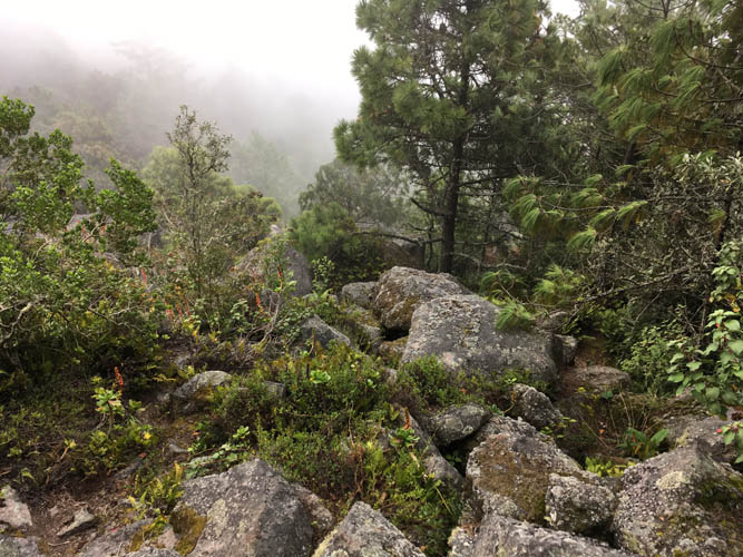
I follow a good trail through increasingly dense vegetation.
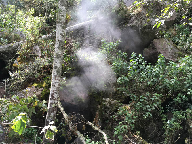
Steam vents from a small hole in the ground – a fumarole.
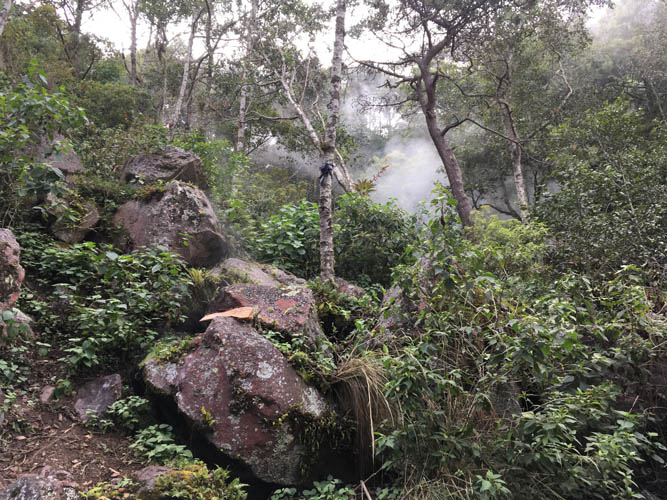
More fumaroles in the jungle ahead.
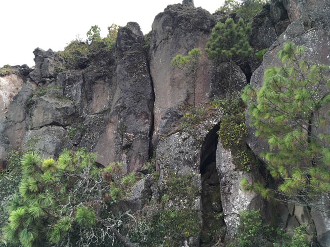
Just below the summit I finally emerge from the forest.

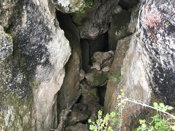
A huge vertical wall separates me from the summit above.
The faint path takes me to this vertical crack – it seems this is the only way up (I later discovered an easier way down just to the left of this wall).
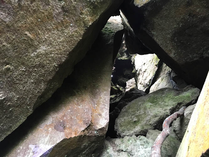
Scrambling through the crack.
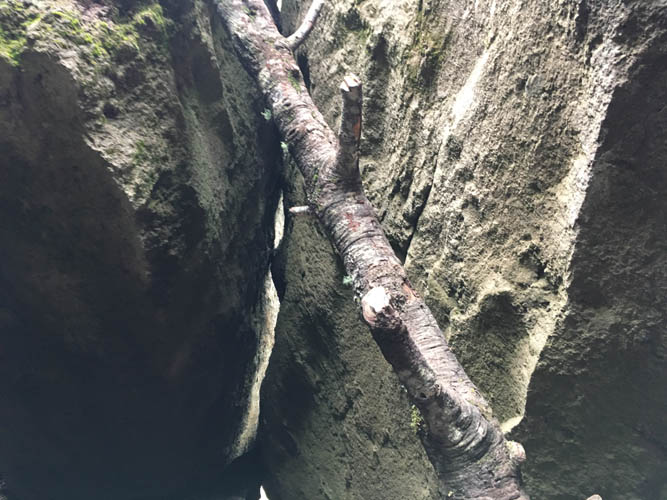
Somebody placed a tree trunk in the upper part of the crack so you can clamber over a large gap to make it to the top of the cliff.
Looking back down the crack with the tree trunk. It’s a bit of a wobbly affair!
Views over Quetzaltenango from the summit of Almolonga.
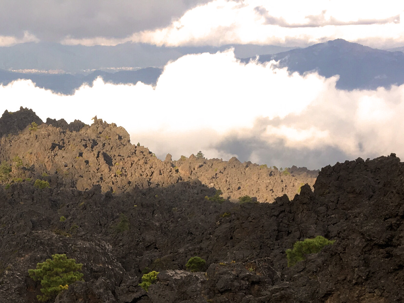
The start of the grey lava field can be seen in the upper right corner below me to the NE.
A decent trail leads down the NE side of the summit, avoiding the difficult crack in the cliff. The trail is flagged here and there, but I really wonder why anyone would use GREEN tape to flag a trail in the jungle! (lower left corner)
As I lose elevation, large bolders start to appear and route finding becomes a challenge. The clouds don’t make it any easier!

A rare example of a (semi-)fresh rock outcrop. Volcanic rock tends to weather quickly in the tropical climate. This is likely a type of granite with phenocrysts (chunks of host rock) floating in the matrix.
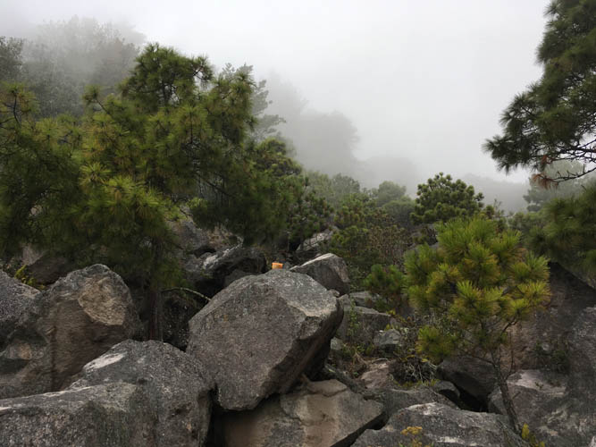
My pace slows down as I spend more and more time trying to follow the trail… The orange plastic cup on the rock in the middle here is a rare example of a good marker showing the way.
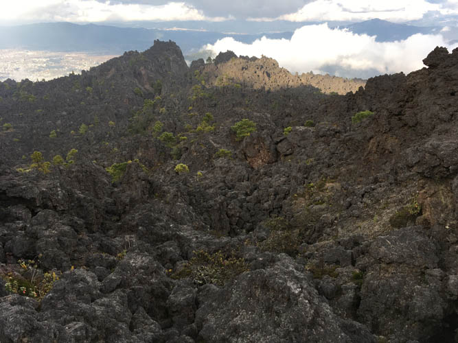
I leave the forest behind me and enter a wide plain of barren lava. There is no more trail, just a line of very faint yellow dots on the rock that are very difficult to follow.
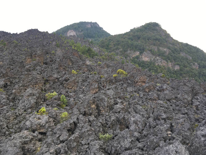
Looking back at Almolonga (left).
Cerro Quemado is somewhere in the clouds.
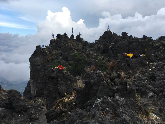
The summit of Cerro Quemado with its many flags and flowers.
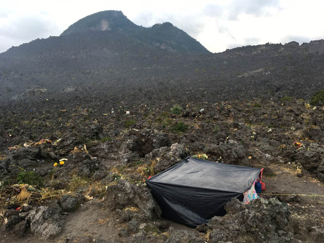
Some people sleep on the mountain in makeshift tents. Almolonga looms in the background, with the expansive lava field in between.
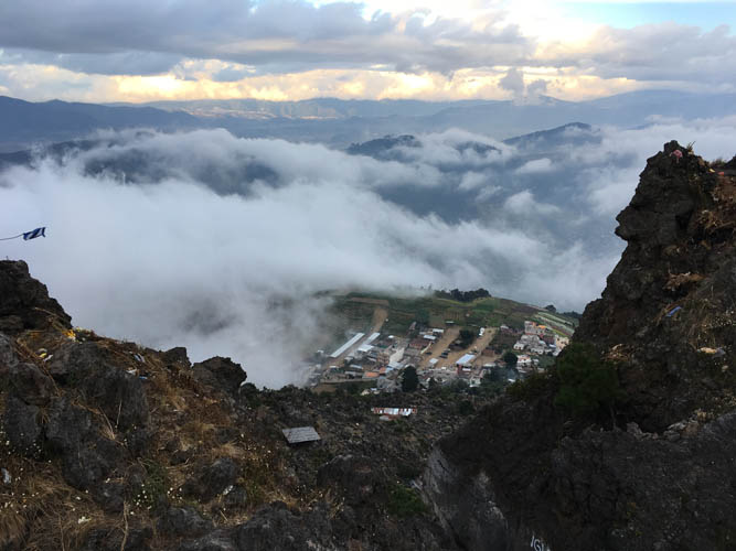
The small village of Chicua is just below the summit of Quemado.
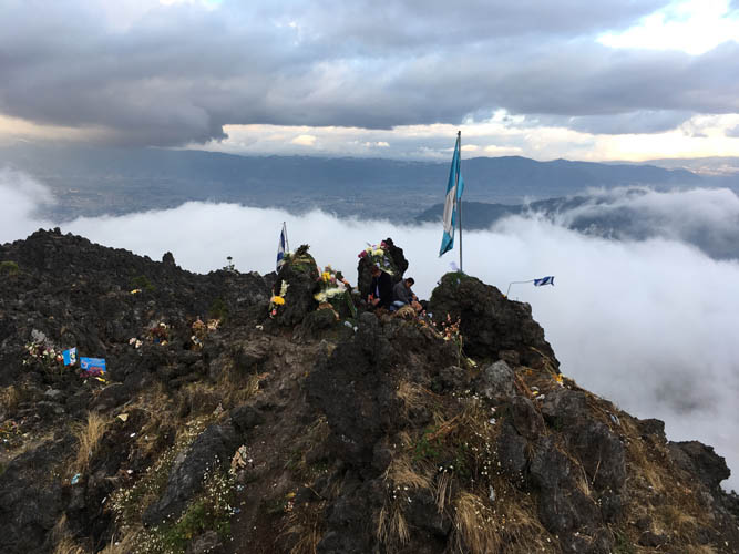
Guatemalans come up here to pray and sing.
There is a good trail that leads back down to the village. Near the top, the trail goes through a narrow gap in the rock. I saw lots of people on this trail, all local Guatemalans.
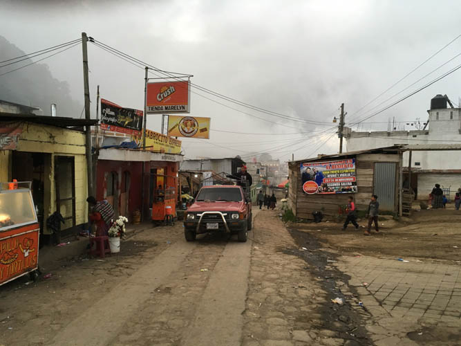
The short trail ends in the village of Chicua, where some well-deserved refreshments await. However, it’s still a 4.5 km hike from here back to the centre of Quetzaltenango. The road is paved, so a taxi would be the obvious alternative if you’ve had enough by then.