4 March 2016
With Priyesh
End Mountain has long been on my radar, especially because it’s along the line of mountains that I can see from my apartment in Calgary. After completing a thoroughly enjoyable loop to Association Peak with Richard a year ago, I decided that this year I would slog up neighboring End Mountain – a recent trip report by Phil on ClubTread gave me a further push, as he described a new option to gain the summit directly via the east slopes. I also liked the idea of hiking across reserve land along Old Fort Creek, which would be a more interesting and slightly shorter approach than going over the Yamnuska east shoulder. For this, a permit from the Stoney Nakoda First Nation is required, but we had no problems obtaining one. Priyesh joined me on this trip and his company made the outing simply delightful. This was our first big trip together with just the two of us and I learnt that not only was this boy one hell of a powerful hiking machine that made me lose my breath, he was also the most uplifting, fun and cheerful climbing partners to be around!
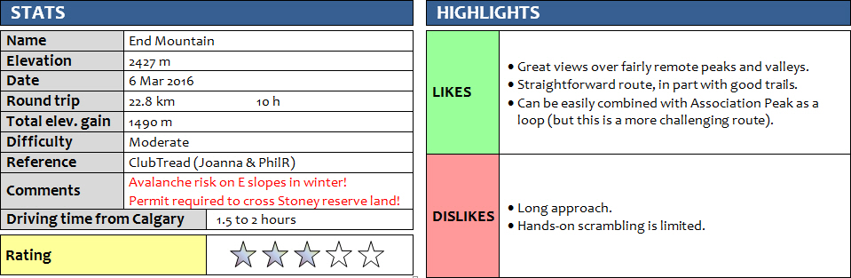
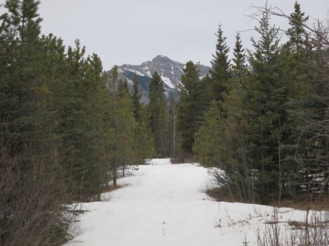
We parked at the entrance to the Stoney Nakoda Resort on Highway 1A just west of the Yamnuska parking lot. Across from this entrance is a gravel road that goes north for a few hundred metres, then takes a sharp left turn and follows a good mud road for a while. At the end of this road we ran into a local from the reserve who had set up camp here with his friends who were already out hunting. He and his son were just getting out of their tent and seemed to welcome the opportunity for an early morning chat with us. After some friendly banter, they wished us well for our hike and we were on our way, following a good network of paths that after a few km led us to Old Fort Creek. Everything was covered in a foot of snow, which was a bit tedious and slowed us down. Just before reaching the creek, after a sharp turn in the forest, we unexpectedly ran into a group of hunters on horseback. The three appeared just as surprised as us, but after a friendly good morning and an explanation of what we were doing here, they warmed up and gladly showed us their hunting rifles. They were going after cougars, bears (yes, they were out of hibernation very early this year!), deer,… anything really. A stern warning to watch out for cougars who apparently lurk high up in the trees, waiting to pounce on their prey, kept us wondering for a while just how serious this danger is.
Old Fort Creek was easy to travel along. Water levels were low, so the stream was easy to hop and flat gravel on the sides made for pleasant hiking. We found the path that goes up the right (north) bank of the creek bed (it’s not obvious; best to have a GPS track to locate this turn) and followed an excellent trail through light forest all the way to the col between Association Peak and Association Hill. This was my first time on this trail and I was really surprised to see how good it is. Once over the col, the trail turned into a broad, defunct logging road that led slightly downhill but directly at the grassy eastern access hills leading up the eastern side of End Mountain. We left the logging road just as it turned east and then fought our way through deep snow in a drainage originating from the eastern cliffs along Association Peak and End Mountain. After the drainage we hiked up grassy and forested slopes to a large impressive rock fin that nicely serves as an orientation marker. Just to climber’s right (north) of the fin’s base is a steep gully that can be scrambled up. Deepish snow filled the gully centre, so we resorted to some moderate to difficult scrambling on rock just on the right side of the gully. Above the gully to our left an impressive rock window came into sight, with views of End Mountains step-like cliffs and Association Peak to the south. After exploring the window and taking a short break, we continued up on the rubbly slopes – mostly moderate terrain – directly to the summit without any difficulties. The sun had come out just in time for our visit at the top and the skies opened up around us. I love the views of the area to the north and west from here: there are many little known peaks and unclimbed crags in this vast region that covers partly the Ghost and partly the Fairholme Range. The summit register had quite a few new entries from recent trips, and there’s no doubt there will be many more to come now that this mountain is so well-documented in various trip reports.
On return, we carefully retraced our tracks down the rubbly, snow-covered slopes and then slowly glissaded the easier parts where there was no significant danger of rock fall or sliding off a cliff. The avalanche danger was low on this day and we had ascended and descended early enough before the snow could start melting, but I can imagine that under different conditions these may well be risky slopes to travel on. Once past the rock fin, the weather changed and it even started to rain a bit later on – the mountains behind us had almost completely disappeared within less than half an hour. Another example of how volatile weather conditions can be and you really have to be prepared for any type of weather when heading out to the mountains.
We finished this very enjoyable outing in about 10 hours, but were somewhat regretful of not having done the whole loop to include Association Peak. It was our first big hike together so I didn’t want to push it. Energy levels were still high as we plodded back through the reserve land, and it was only 5:30 pm by the time we got back to the car, so we probably should’ve just gone for it. Anyone planning to do End Mountain I would recommend to do it as a clockwise loop starting with Association first.
ROUTE MAP
DISCLAIMER: Use at your own risk for general guidance only! Do not follow this GPX track blindly but use your own judgement in assessing terrain and choosing the safest route.
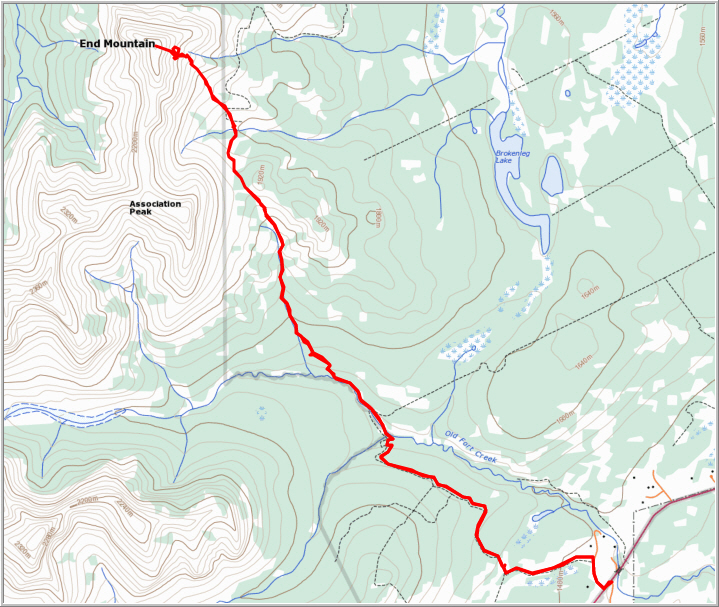
On the approach through Stoney Nakoda reserve land. End Mountain can be seen in the distance.
Hunters from the Stoney Nakoda First Nation.
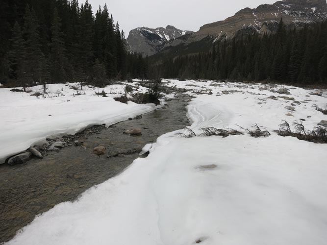
Old Fort Creek still has snow and ice in places, but travel is easy.

A good trail leads from Old Fort Creek to the col between Association Peak and Association Hill.
Looking back (south) from near the col.
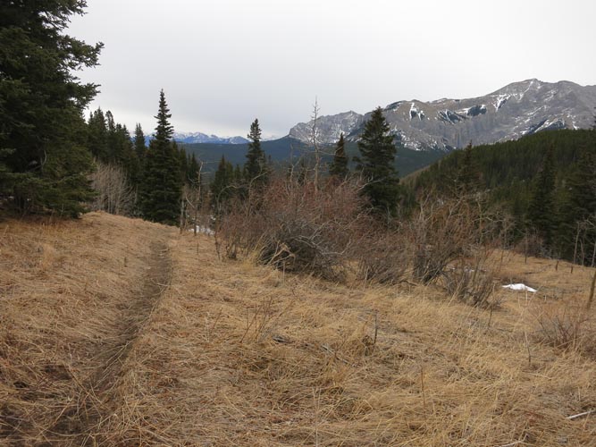
This old logging road heads in the direction of the objective (End Mountain just left of centre). Making a sharp left at this turn would lead up to Association Peak.

Looking back toward Association Peak on a cloudy morning.
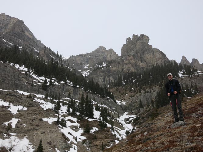
We headed toward the big rock fin (just above and left of me), then circumvented it on the right and headed straight up.
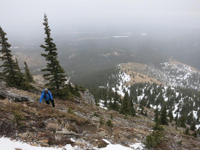
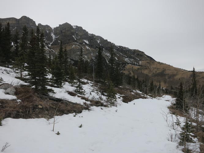
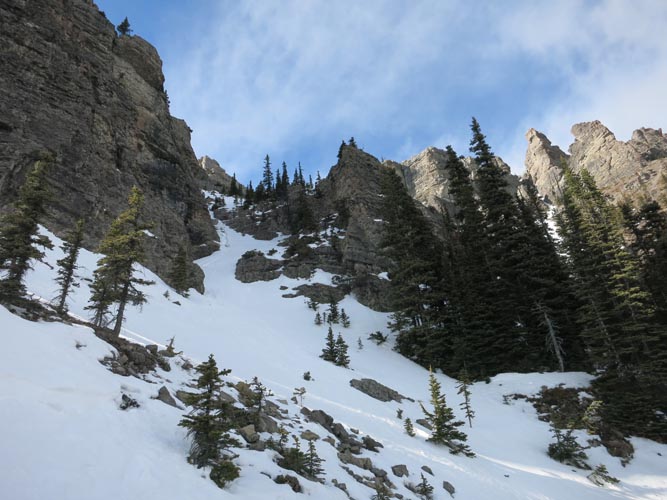
The lower part of the eastern slopes is quite steep in places.
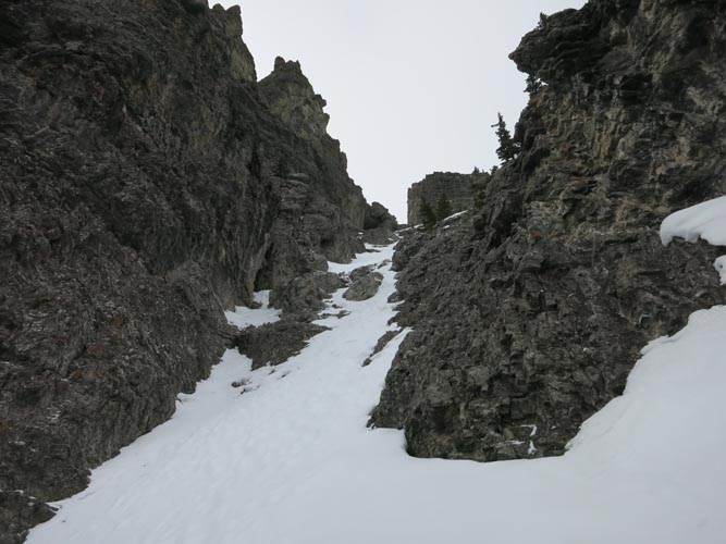
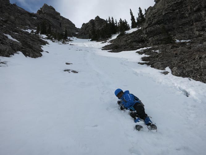
This is the gully immediately to the right of the rock fin. We ascended it mostly on rocky parts on the right side, and slowly descended in the snow on return (warning: can be avalanche prone!).
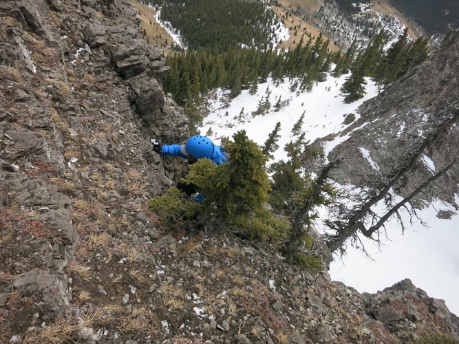
Climbing up steep rock on the side of the gully.
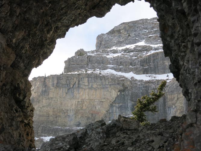
A neat window just above the rock fin with views of the SW cliffs of End Mountain.

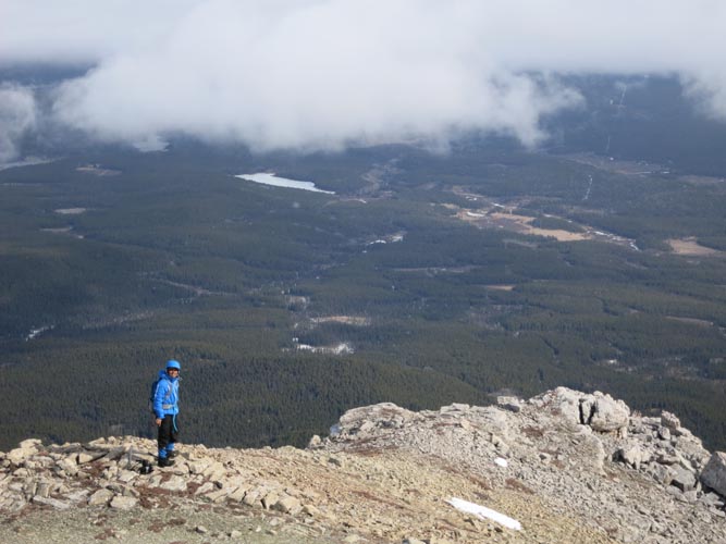
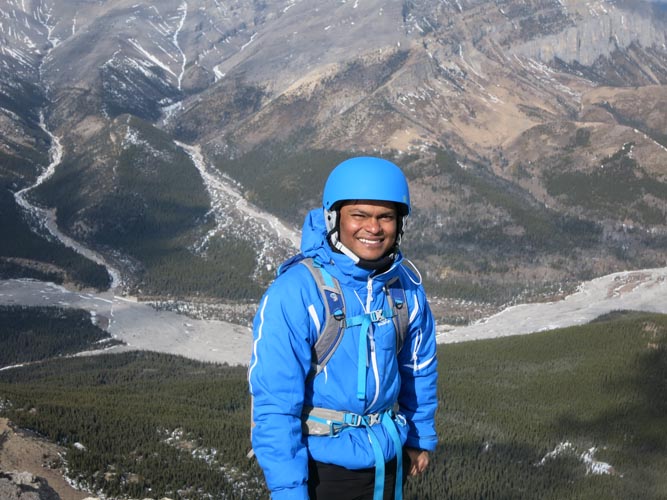
Priyesh in the rock window.
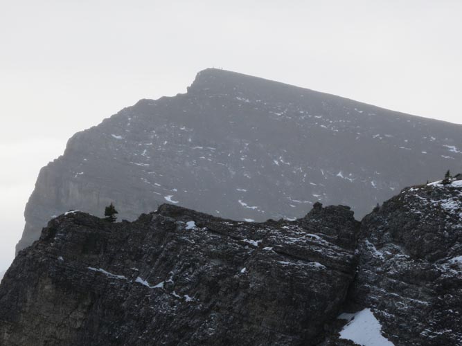
Looking south at Association Peak. Three scramblers can be seen at the summit.

The upper snow-covered slopes. Broken Leg Lake is visible just left of the rock fin.
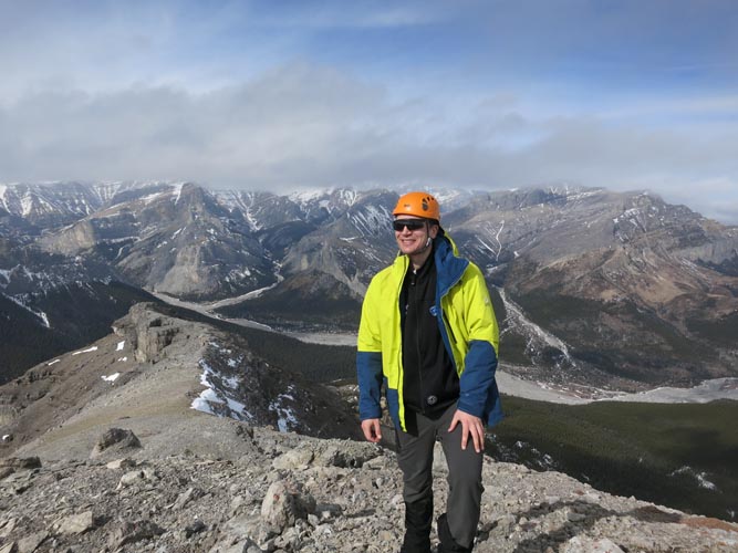
View from the summit to the east: the clouds are moving away – perfect timing!
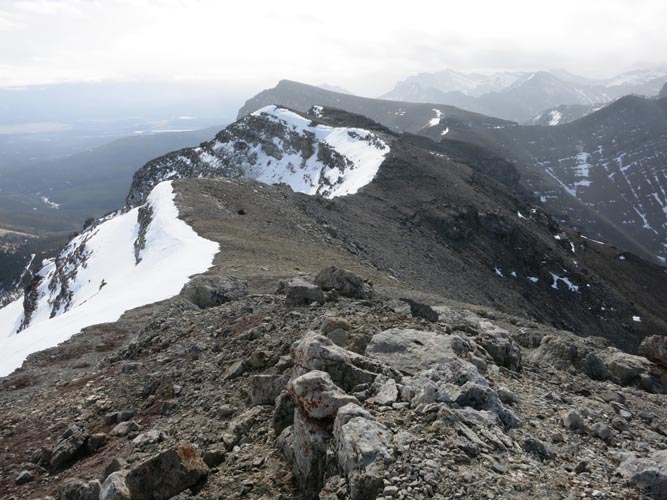
Views of the long, undulating ridge to the south.
Looking north, where the seldom visited valley of the South Ghost River offers countless opportunities to explore.
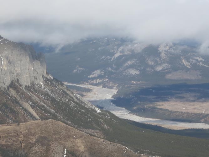
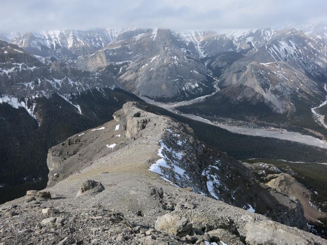
To the north is the Ghost River, with the steep cliffs of Phantom Crag on the left and Black Rock Mountain covered in clouds on the right.
Carefully glissading short stretches of snow on the return.
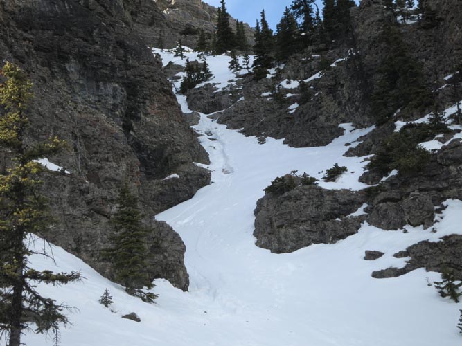
Our tracks are visible in the snow gully.
One last look back at our access gully. The big rock mass on the left forms part of the rock fin.
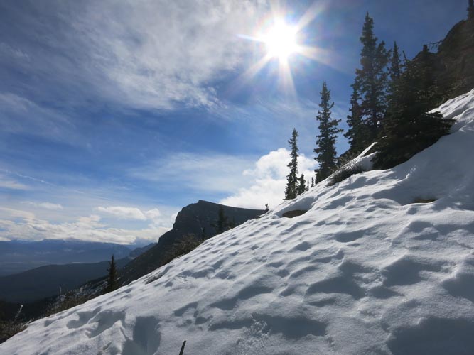
Beautiful winter weather!
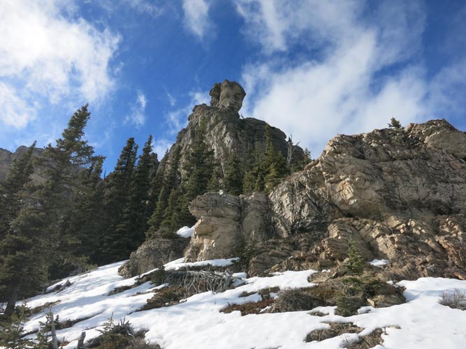
The rock fin that served as our point of orientation, now in splendid sunlight.
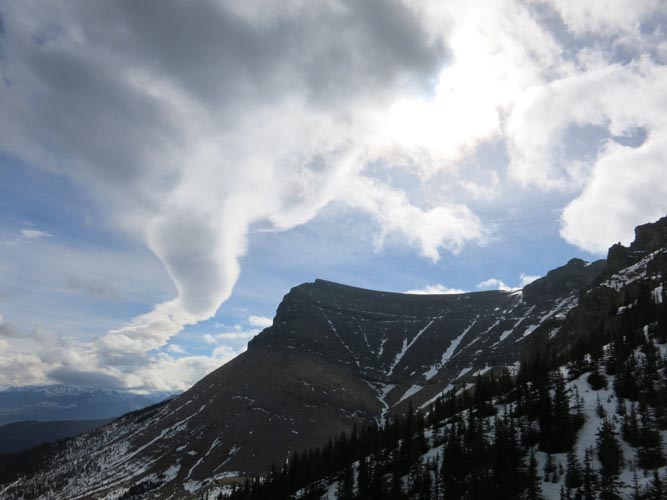
Magnificent cloud formations in a north-south line parallel to the Front Ranges, with Association Peak forming the very edge.
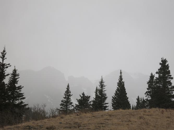
The clouds soon take over the entire sky and it briefly starts to rain in the afternoon. End Mountain is completely socked in.
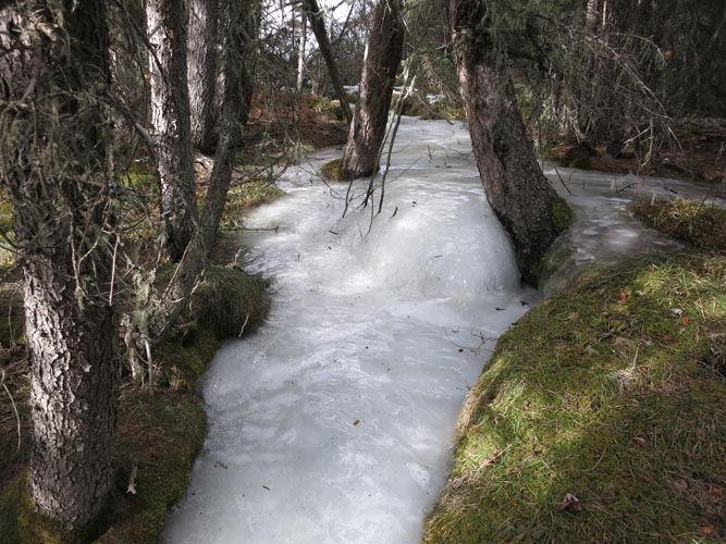
A small creek on the way back, completely frozen.
IN MEMORIAM: Priyesh Menon
My dear friend and hiking partner Priyesh passed away in a tragic accident on Mount Lawson in Kananaskis on May 23rd, 2016. He was only 30 years old. He touched on countless lives with his most generous and loving spirit that will be remembered by many, many people in Canada, India and around the world. Like many other hikers and scramblers from Calgary, I feel hugely honoured to have met him and to have had the chance to hike with him. To preserve some of the beautiful moments we shared, I have decided to keep the reports of my trips with him on my site (after consultation with his family). We would like people to remember him for who he was: the most joyful, uplifting, kind, and selfless boy who never stopped smiling. As many of his fellow-hikers recounted, he had the unique ability to bring people together and bring positivity into their lives. There was genuine happiness wherever he was. A true ray of sunshine in our world! Thank you, Priyesh, for enriching our lives. You will be dearly missed.