High Rock Range, AB, Canada
5 September 2021
With Vern
Rubble and wind
Of the two destinations that Vern and I went for today, I think it’s safe to say we both enjoyed Mount Scrimger far more. Mount Etherington was somewhat anticlimactic. The winds had also picked up again so that certainly played a role in us not having such a great time on our second peak of the day.
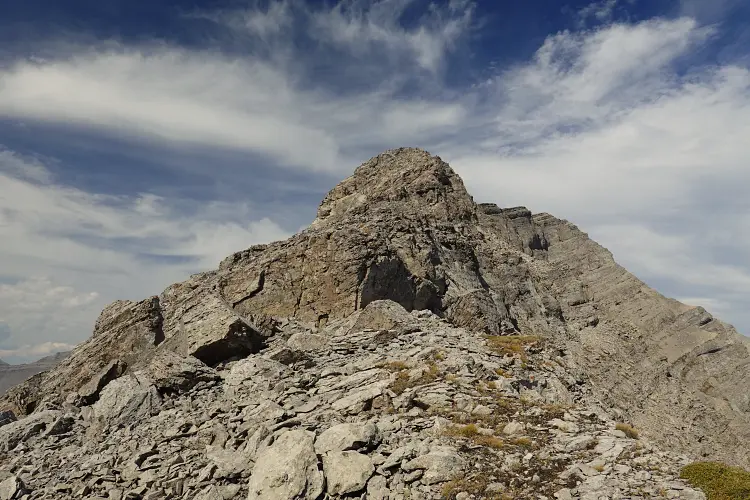
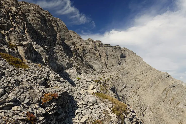
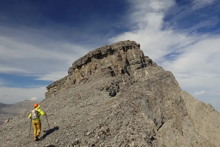
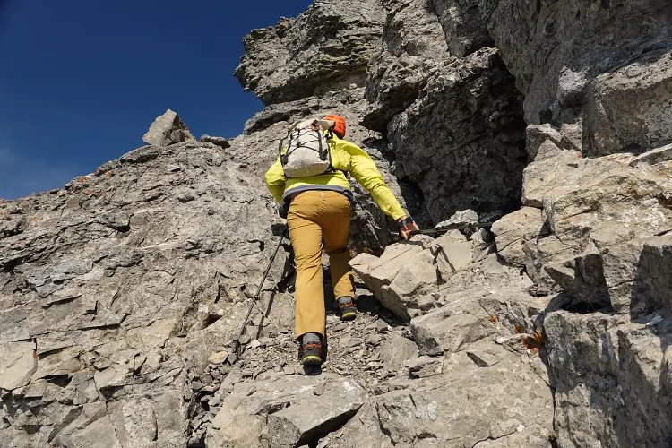
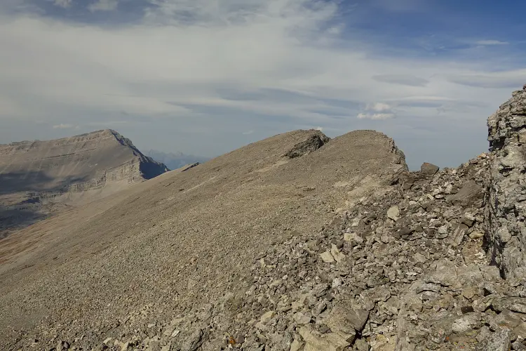
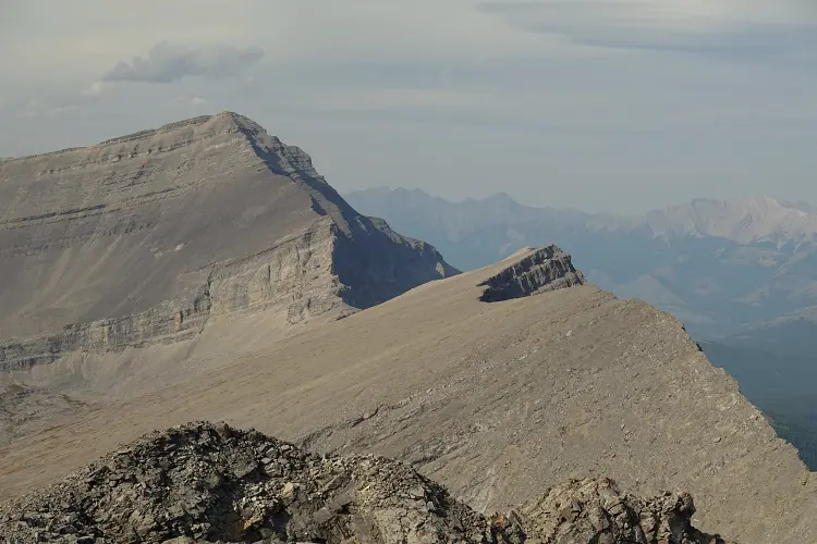
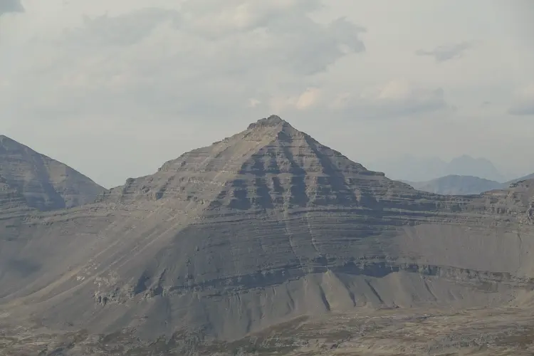
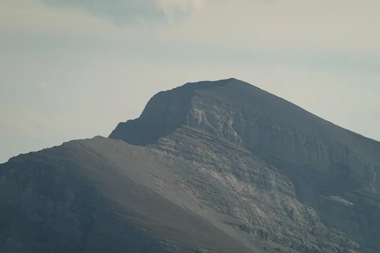
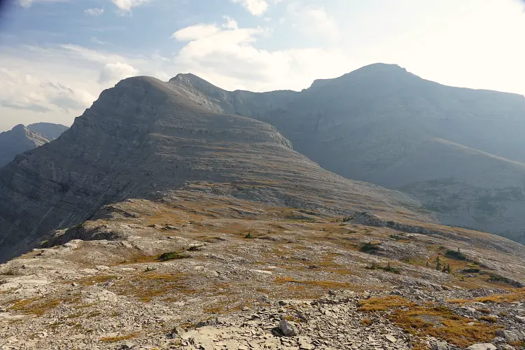
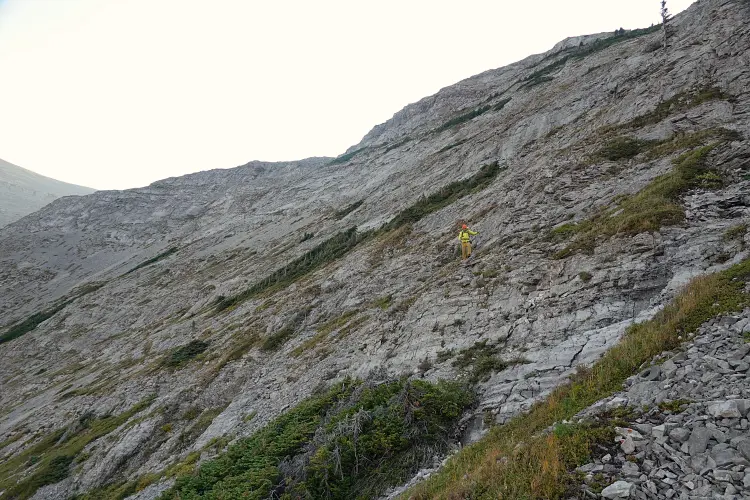
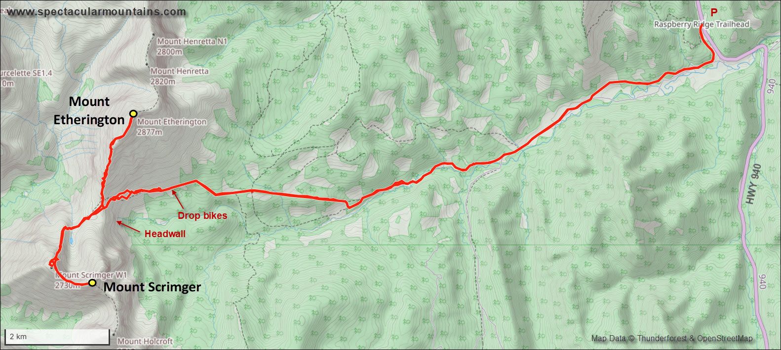
The route up Mount Etherington is pretty simple. From the Etherington-Scrimger col we worked our way up the south ridge, which looks more intimidating from a distance but really is no more than easy to perhaps lower moderate scrambling. There a several small rock bands and steps that can typically be tackled head on or circumvented on the left (west) side, with one bypass on the east face where there is an obvious game trail along a wide ledge for about 30 m before you scramble back up the ridge crest. Shortly after that, about half way up the south ridge, we encountered a more serious vertical wall about 20-30 m high. There may be a climber’s route up this wall, but a safer bet is to contour below it around the west side until it becomes broken up and you can trudge up heaps of rubble back to the ridge crest. We first tried to break through this cliff a bit too soon and had to retreat at a small rock overhang in a gully, then found a much easier route only 50-100 m further north. There weren’t any cairns and no trails have formed in the rubble yet, which shows how unpopular this mountain (still) is. I’m not surprised – the approach to get here is long and there are more interesting objectives elsewhere.
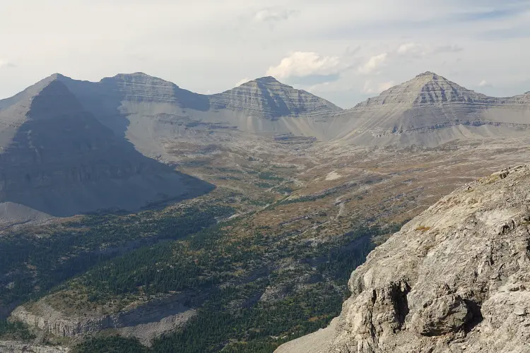
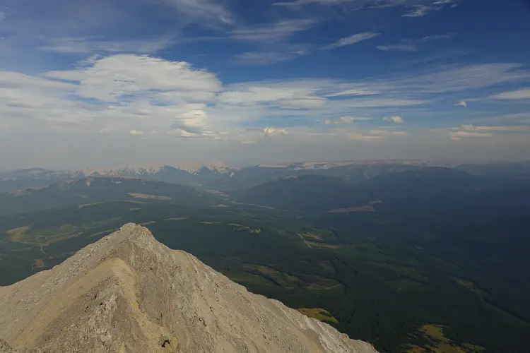
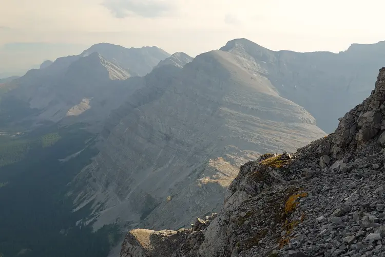
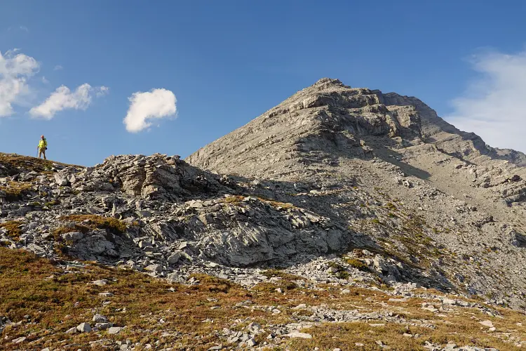
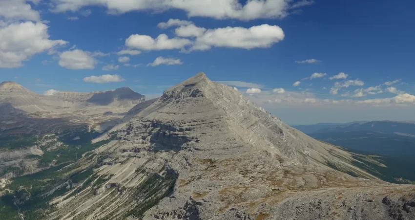
After slogging back to the ridge top, it was still quite a distance to the summit but the terrain was easy. We stumbled like drunks as strong gusts pushed us around, a draining experience and you can’t even talk because the wind is so noisy! The reward at the end was a beautiful panoramic view of the rarely visited Henretta basin to the west, a broad cirque of alpine meadows and creeks surrounded by a series of also rarely visited mountains including Gill, Courcelette, Aldridge, Cornwell and Baril. Vern and I had talked about also tagging on Henretta Peak to the north of Mount Etherington, a minor and unofficially named summit, but we didn’t feel like dealing with even more rubble and wind for another three hours today.
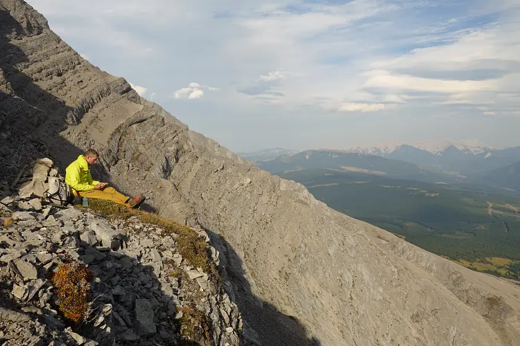
We made our way back along the same route and took a nice break along the goat trail on the wind-sheltered east side of the ridge where we even had cell phone reception. The hike to our bikes at the seismic line was pretty quick and then we were in for a super fast and thrilling ride back to the car. I wiped out right at the beginning where the trail was still rough and full of deep holes hidden in the grass, but thankfully I wasn’t going too fast here and got away with a few scratches. These are the times when you’re reminded that wearing your scrambling helmet for the bike ride is probably a smart idea!
This was a great two-peak combo in a fairly long day. Mount Scrimger is arguably the more challenging and more interesting objective, while Mount Etherington is slightly easier to access, with both peaks offering great views of a remote corner of the Canadian Rockies.
Be sure to check out Vern’s report for this trip!
|
Elevation: |
2870 m (Mount Etherington) |
|
Elevation gain: |
2170 m |
|
Time: |
11.0 h |
|
Distance: |
37.7 km (of which ca. 25 km by bike) |
|
Easy to moderate (Kane), T3-T4 (SAC) |
|
|
Activity: |
Hiking & scrambling |
|
Reference: |
Own routefinding |
|
Comments: |
Stats above are for both Scrimger & Etherington |
|
Personal rating: |
3 (out of 5) |
NOTE: This GPX track is for personal use only. Commercial use/re-use or publication of this track on printed or digital media including but not limited to platforms, apps and websites such as AllTrails, Gaia, and OSM, requires written permission.
DISCLAIMER: Use at your own risk for general guidance only! Do not follow this GPX track blindly but use your own judgement in assessing terrain and choosing the safest route. Please read the full disclaimer here.