Mount Robson Prov. Park, BC, Canada
25 July 2025
With Keegan
Alpine adventure above Berg Lake
Berg Lake is one of those iconic multi-day hikes in Canada that many people dream of but only few actually set out to do. After several years of closure due to catastrophic flooding in 2021 that destroyed parts of the trail, the Berg Lake Trail officially opened again in late June 2025. My buddy Keegan had snagged a 5-day booking for July and, lucky for me, I was able to fill in for a friend who couldn’t make it. It’s not often that I can just take 5 days off with short notice, but this was an opportunity I didn’t want to miss. A big thank you to Keegan for making this happen and inviting me along!!
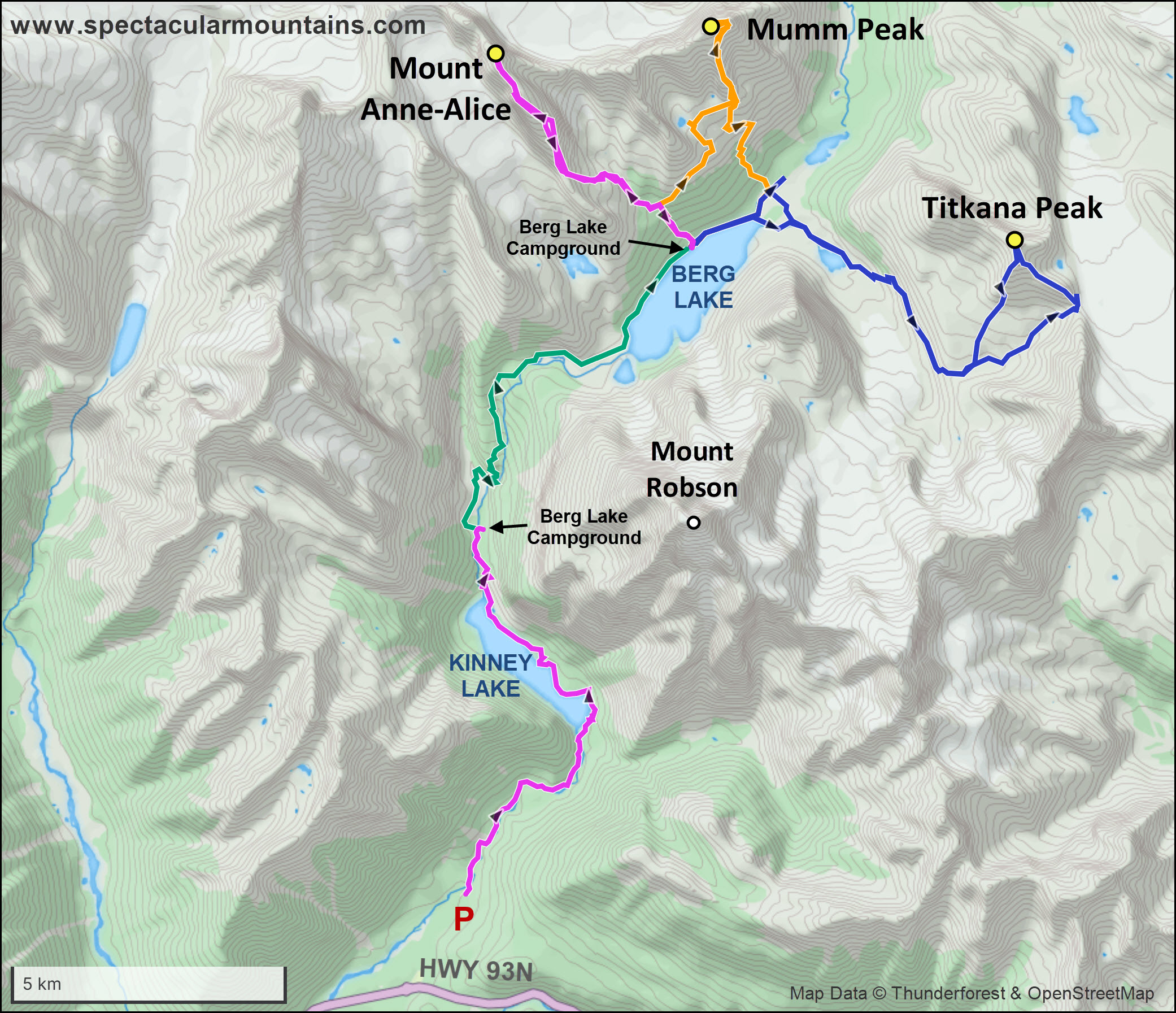
After driving the 5.5 hours from Calgary via Jasper to the Mount Robson visitor centre, we checked in, got our tent tags, and set off in the early afternoon, each with heavy 22 kg packs on our backs. Yes, I have yet to learn the art of ultralight (or even light!) backpacking, but I’m working on it… I keep on thinking that all this extra weight makes me stronger, but that is clearly a fallacy.
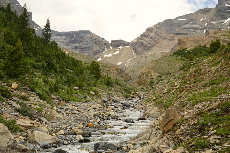
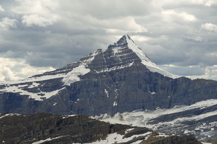
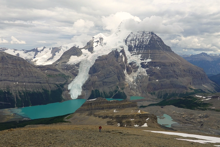
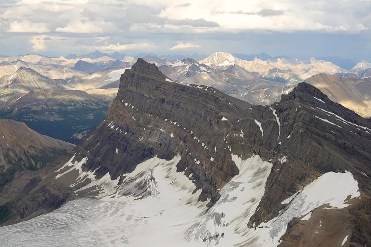
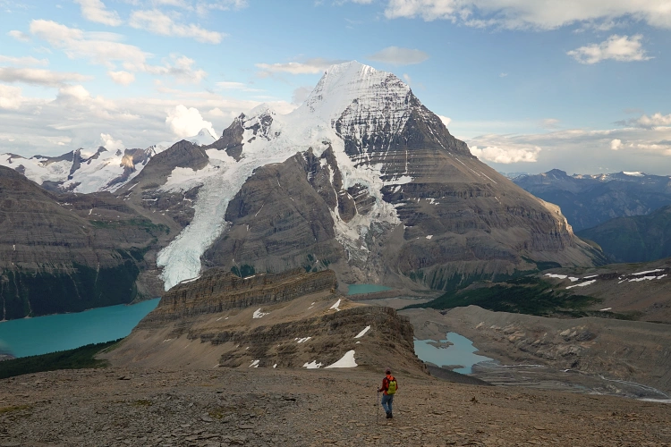
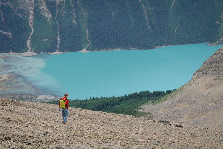
Keegan had booked Whitehorn Campground for the first night, which meant we only had to hike about 11.5 km on our first day. Much of this route is flat and the first half, to Kinney Lake, is actually a wide track (an old road) teeming with day visitors all keen to see the splendour of the lake’s turquoise waters. Past the lake there were some ups and downs and an interesting short section in the mostly dried out river flats, and after around 3.5 hours and ca. 410 m cumulative elevation gain we reached the well-frequented Whitehorn Campground. This is a neat little campground in quite a spectacular setting, nestled below the steep lower limestone cliffs of Mount Robson (whose summit can’t be seen from here) and with a view of Whitehorn Mountain (3395 m) on the other side. Mount Robson is of course the highest peak in the Canadian Rockies at 3954 m.
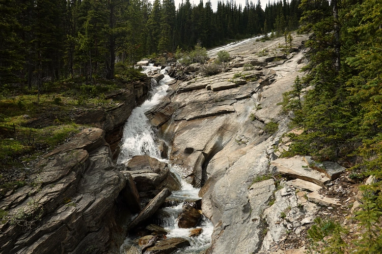
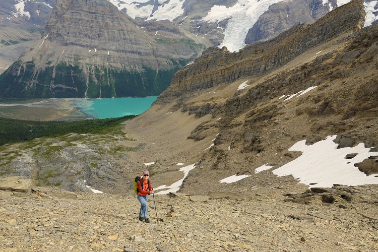
On the second day we hiked up the remaining 10 km from Whitehorn Campground to Berg Lake Campground in the morning, passing though the spectacular Valley of a Thousand Falls. It was a steep grind in parts, but the trail was in excellent condition and all the water crossings were bridged. Arriving at Berg Lake Campground, we realized we still had the whole afternoon ahead of us with no particular plans other than to hang around the lake. The weather had cleared up and looked promising, so why not give Mount Anne-Alice a go!?
This mountain is named after Anne MacLean Chesser and Alice Wright, who scaled the peak in 1939 and found no evidence of a summit cairn. With no route beta and just a crude line drawn on our map based on satellite images, we thought the worst that could happen is we would get turned around by dense bush or a cliff on the ridge. Despite a few challenges that looked difficult to overcome at first, everything actually turned out quite nicely on this trip. [Note: I later discovered that Anne-Alice is featured in A Peakbagger’s Guide to the Canadian Rockies: North by Ben Nearingburg and Eric Coulthard, where it is described as a mountaineering objective.]
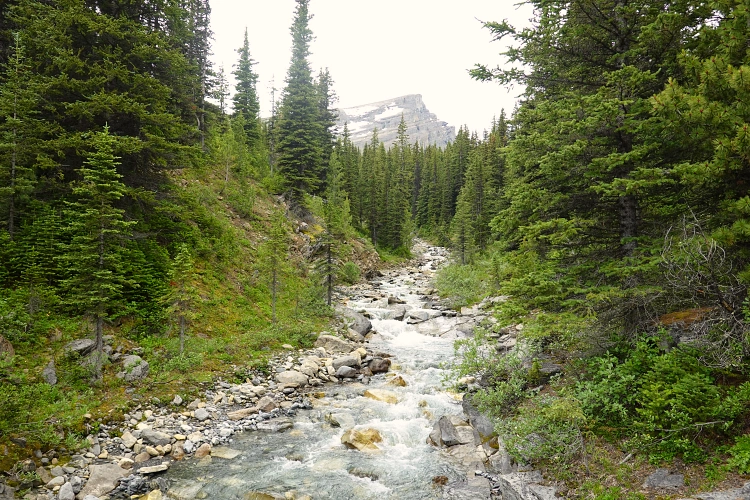
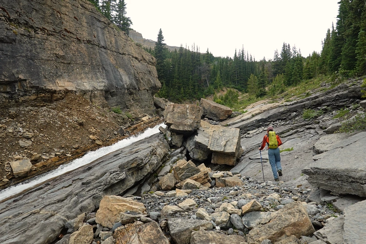
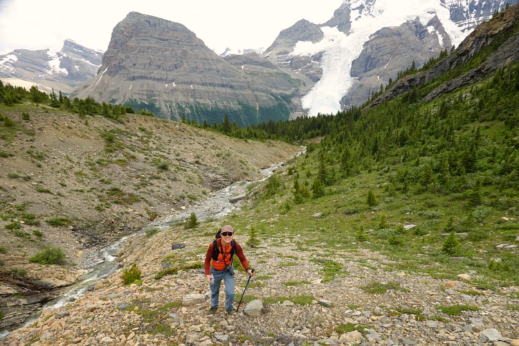
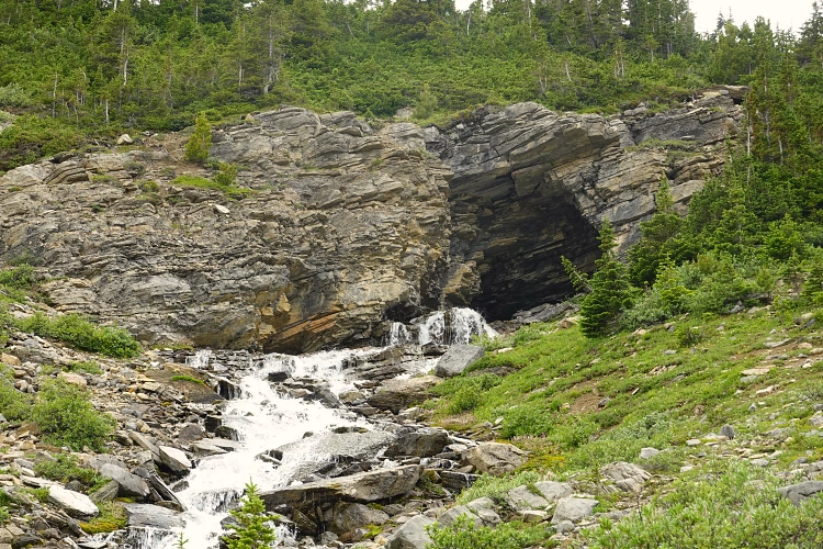
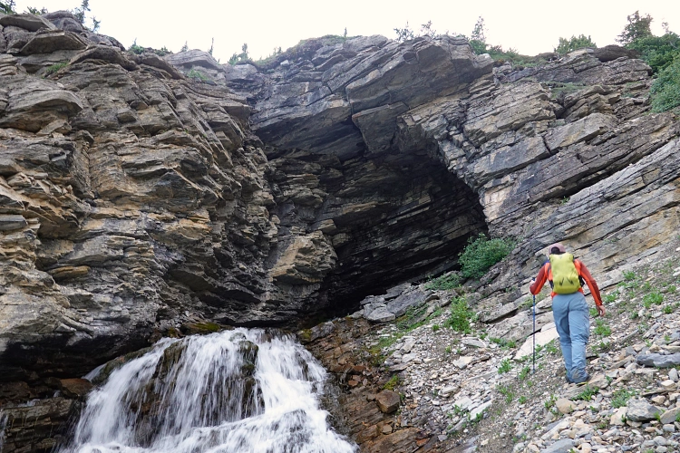
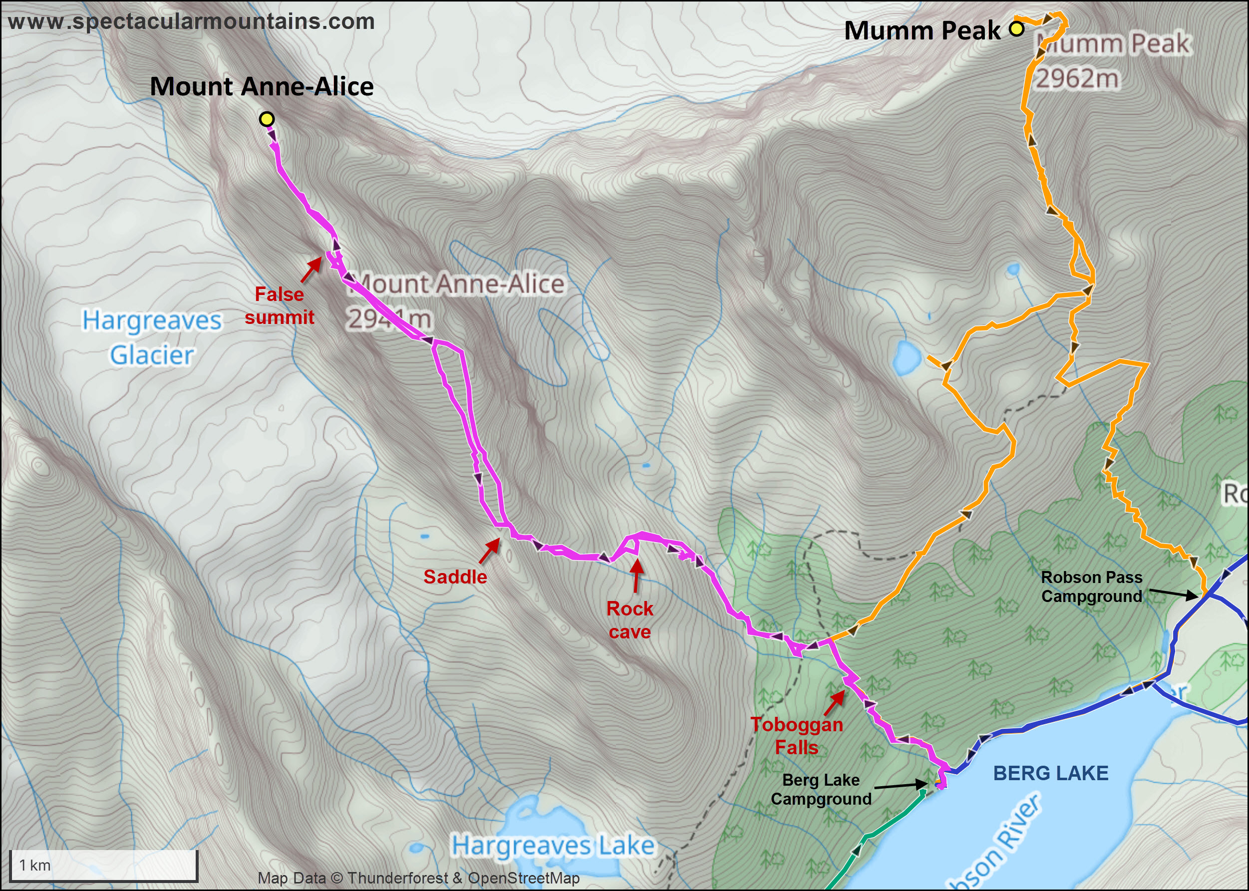
From Berg Lake Campground, we headed up the trail to Toboggan Falls, which are definitely worth a visit on their own! Shortly after the falls, at a 4-way junction, we turned left towards Hargreaves Basin and followed that trail for a couple hundred metres to a bridge across a creek. We left the trail here and entered the bush on the side of the creek. It was pretty bad! Our spirits were low and at this point I though we had only a 30% chance of actually making it up the mountain. There is no way we could sustain this type of bush for very long, too slow and cumbersome was our progress.
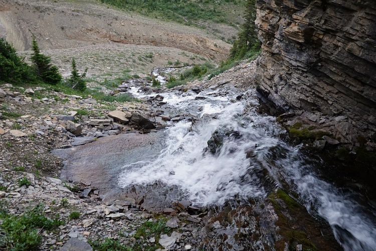
Keegan suggested rock-hopping up the creek, which was running pretty high and could only be crossed in a few places. Why not, how much worse could it be than the bush!? It was, in fact, much better as Keegan expertly led a good route up the side of the creek on boulders and slabs, right next to the water, with only a few crossings necessary. After about half an hour the trees disappeared and we were able to walk up open slopes of grass and talus. Where the creek split, we followed the left arm for a bit until it completely disappeared in a small rock cave! What a neat place to see – the creek literally gushed out of the rock inside the little cave, a perfect place to refill our water reservoirs.
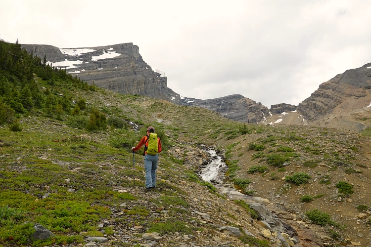
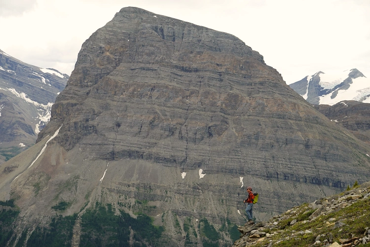
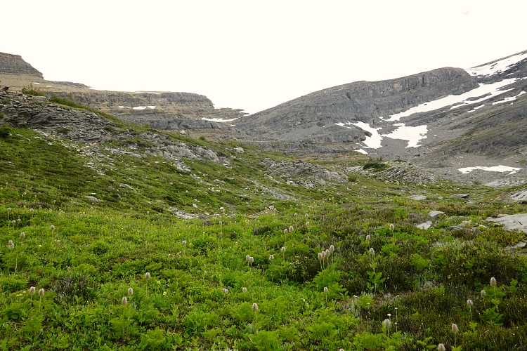
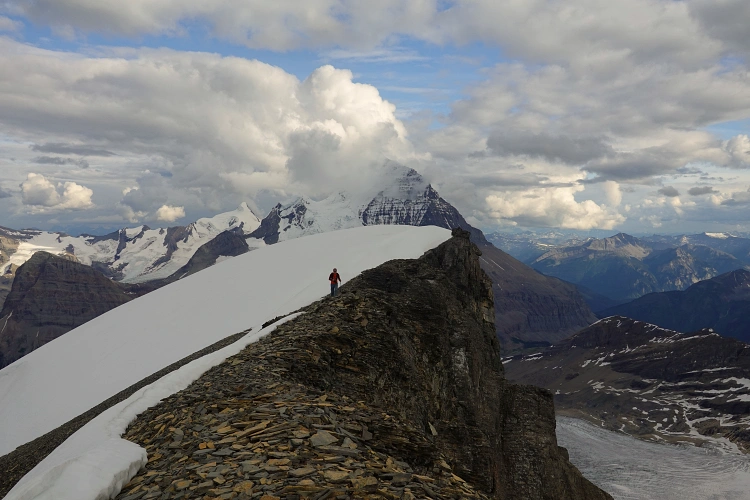
Above the cave we continued across a broad, grassy alpine basin, aiming towards a saddle in the long south ridge of Mount Anne-Alice. The lower part of the ridge (south of the saddle) has a huge vertical drop off before the saddle and is thus not an option. Reaching the saddle was easy – some boulders, a bit of scree, a couple of easy snow patches and we were up. I can imagine that with more snow around this might be trickier and would require an ice axe and/or crampons.
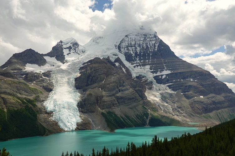
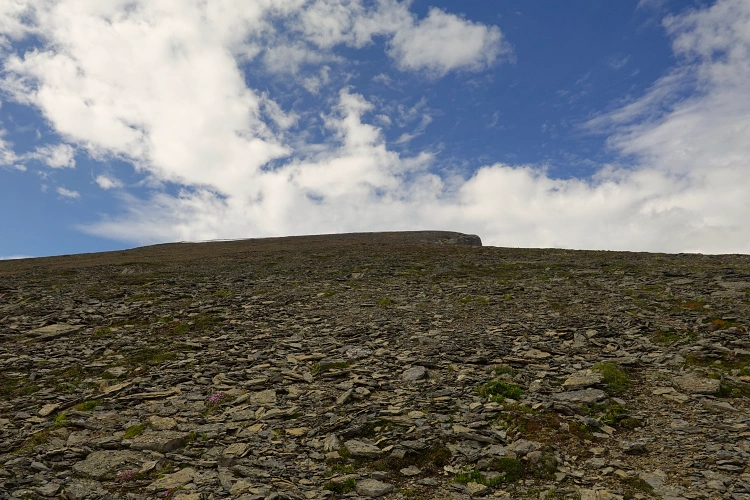
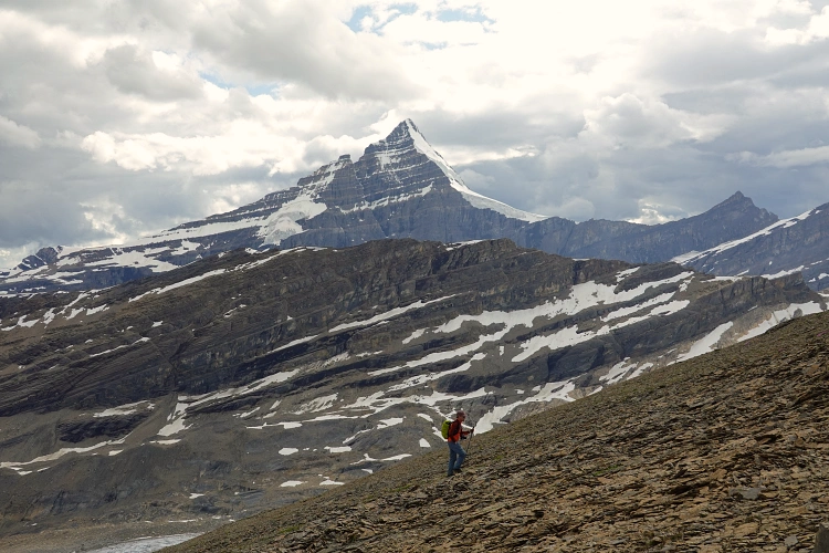
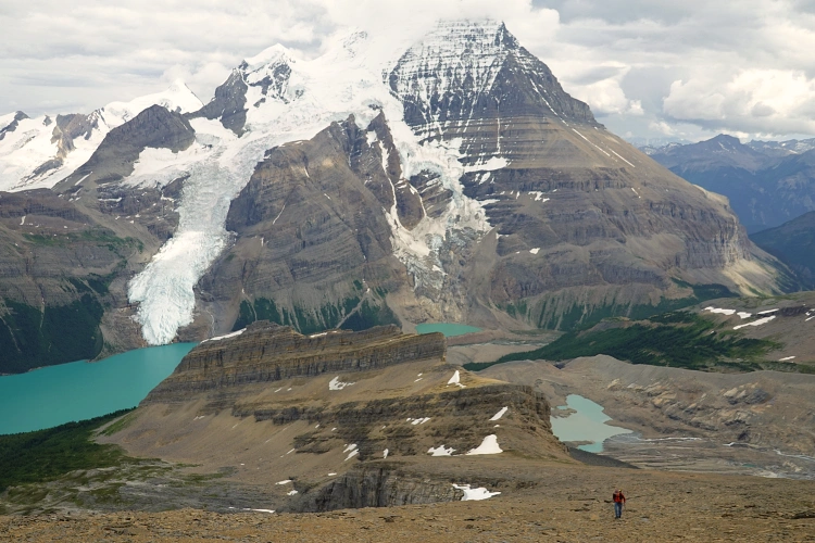
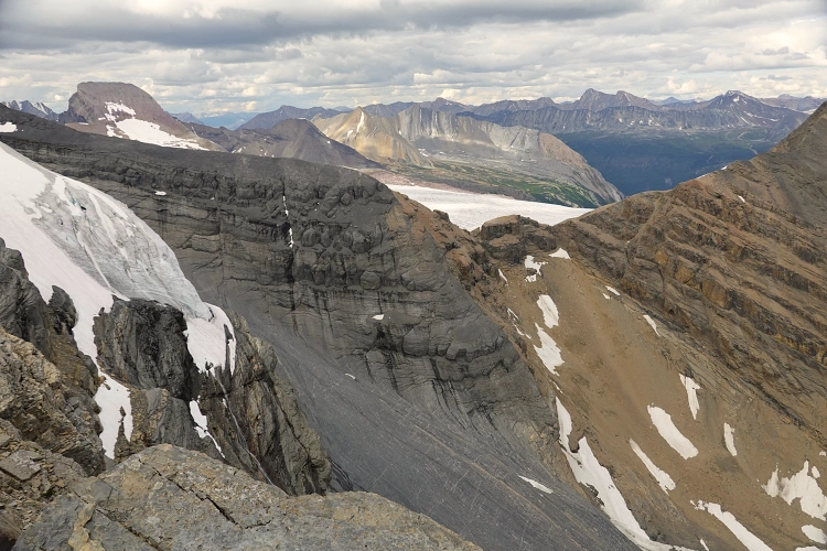
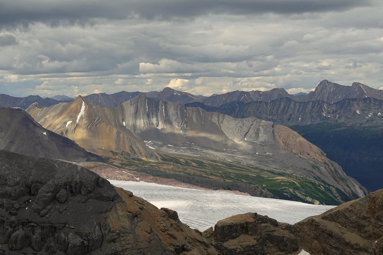
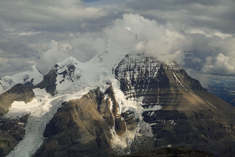
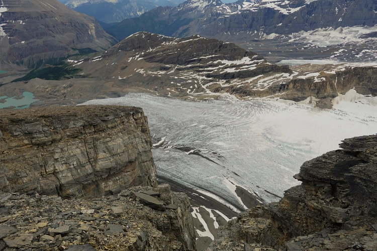
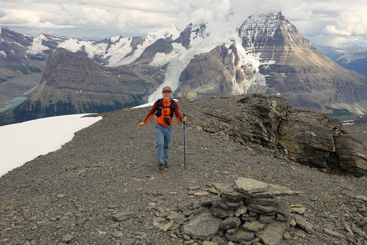
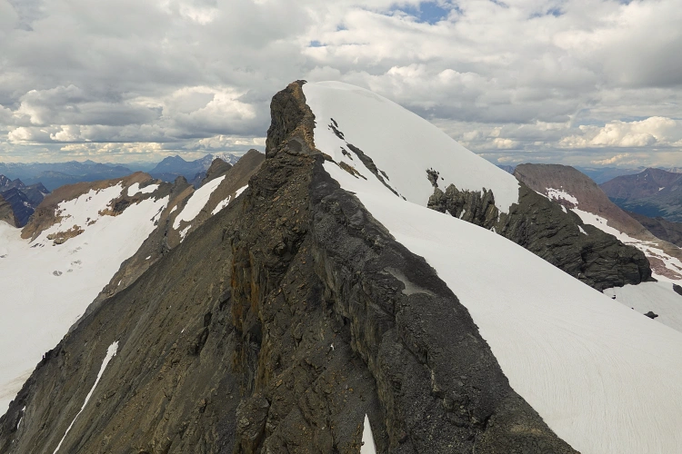
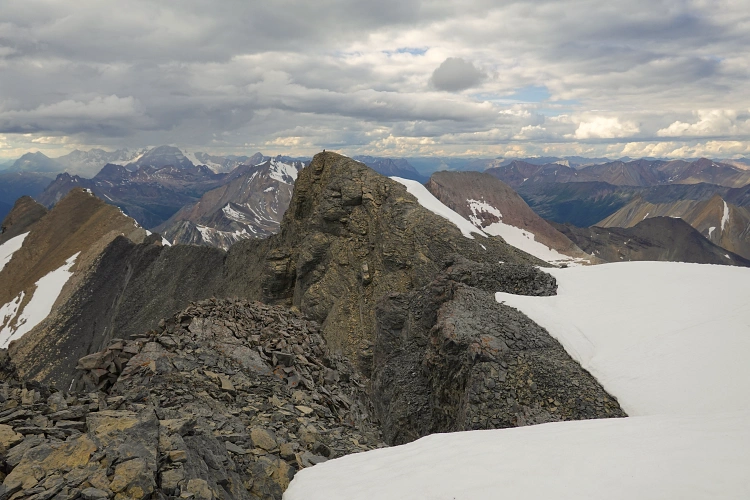
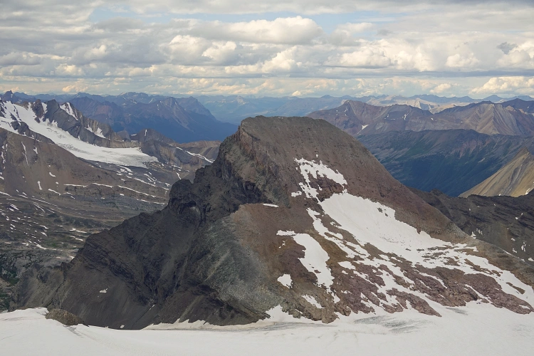
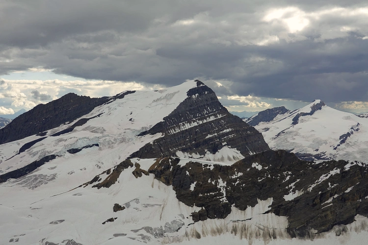
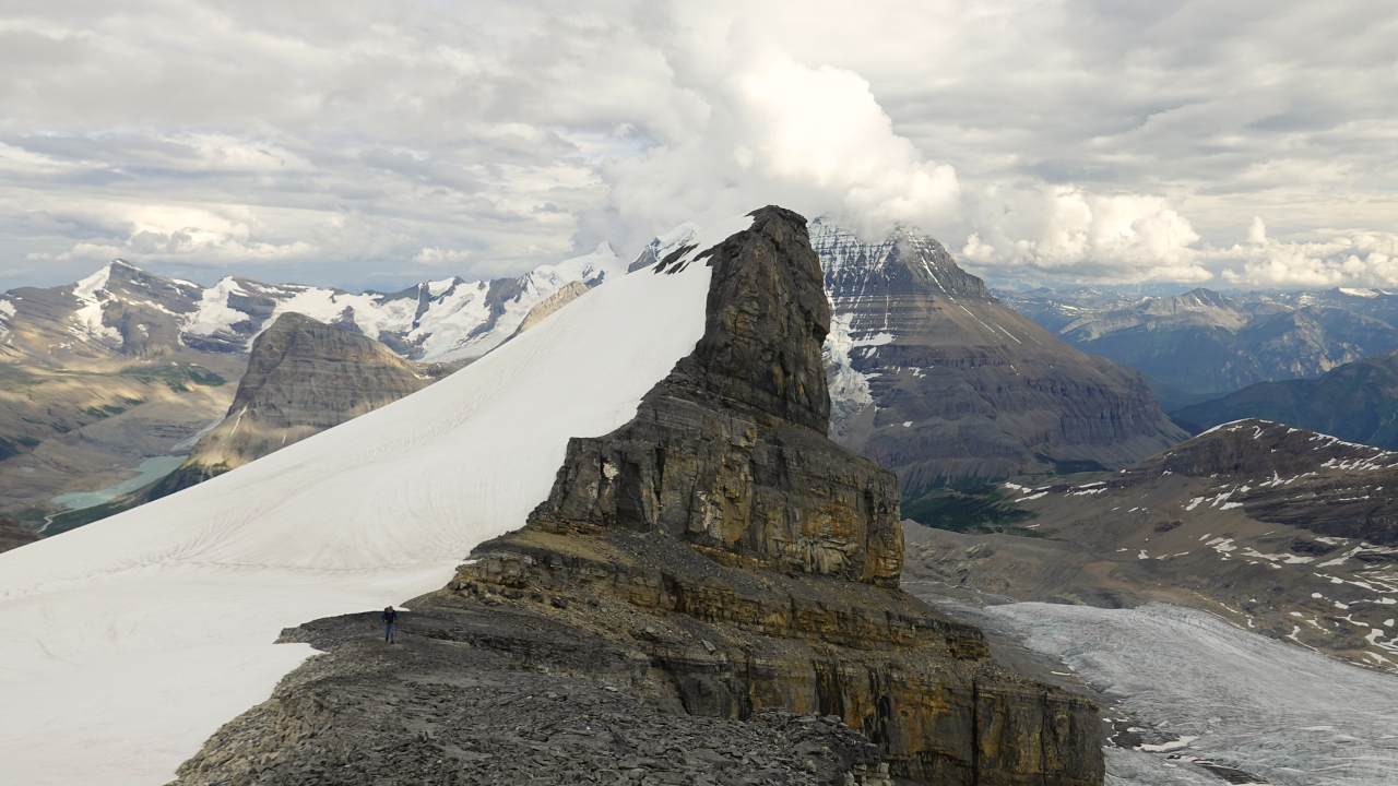
At the saddle we turned north towards the remainder of the ridge and stared at one giant, never-ending slope that rises into the distance at a steady angle. The slog up this slope is 2 km long and took us to a cairned summit… a false summit as it turns out. At this point the ridge crest abruptly ends in a vertical cliff just north of the false summit. The true summit is another 800 m further north, past a huge dip in the ridge that is filled with a thick layer of snow dropping off to the east, while to the west there is a sharp drop straight down to the Hargreaves Glacier. Evaluating the terrain, we decided it was safe to cross the snow at a point where it shallowed sufficiently, easily leading into the dip between the summits.
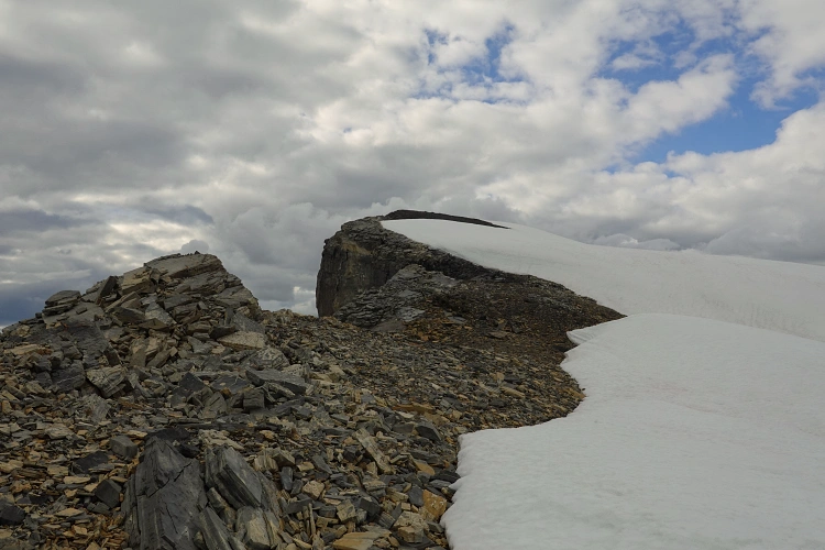
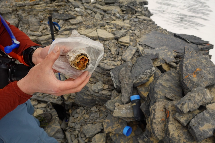
Conditions were good – the snow was sticky and firm, and the angle not too steep. In any other type of condition you might well need some mountaineering gear (and skills) to cross these slopes. Past the dip we transitioned to good rock on the ridge crest again and climbed the remaining metres to the true summit, also adorned with a small cairn. The old ACC register inside the cairn contained the wet, soggy remains of a small booklet and a broken pencil… so sad to see yet another example of PVC pipe failure.
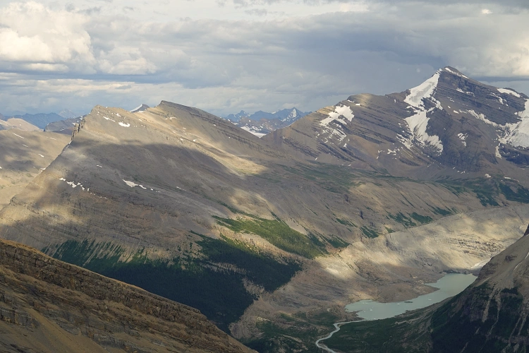
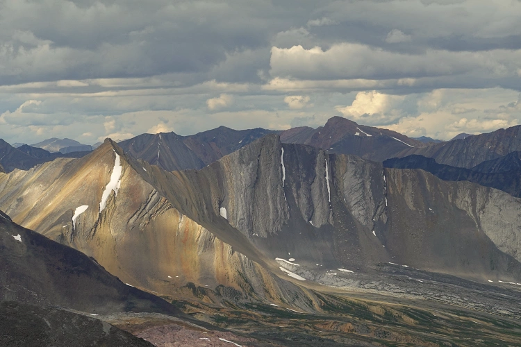
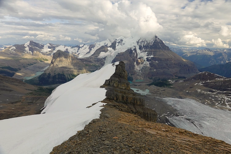
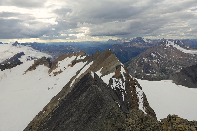
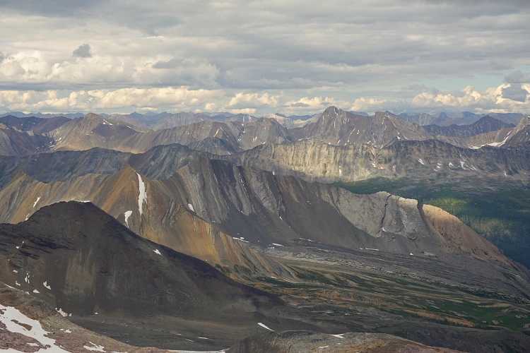
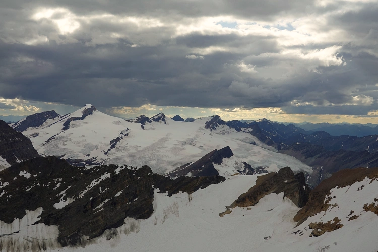
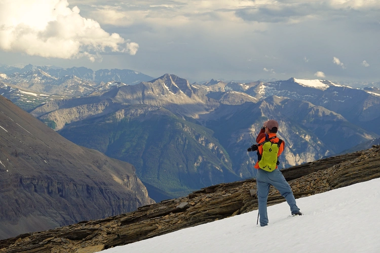
The views were just incredible. Dark clouds rolled in and the temperature dropped quickly, making us feel like we were on some remote and epic mountaineering adventure, especially being surrounded by snow fields, vertical drop-offs, and huge glaciers on all sides. Numerous beautiful peaks dot the horizon to the north, east and west, with Whitehorn Mountain, Mount Phillips, and Gendarme Mountain taking centre stage. The ridge continuing to Mumm Peak looked impressive and scary at the same time. There is literally a thousand metre vertical abyss off that ridge with a massive glacier below. Stunning.
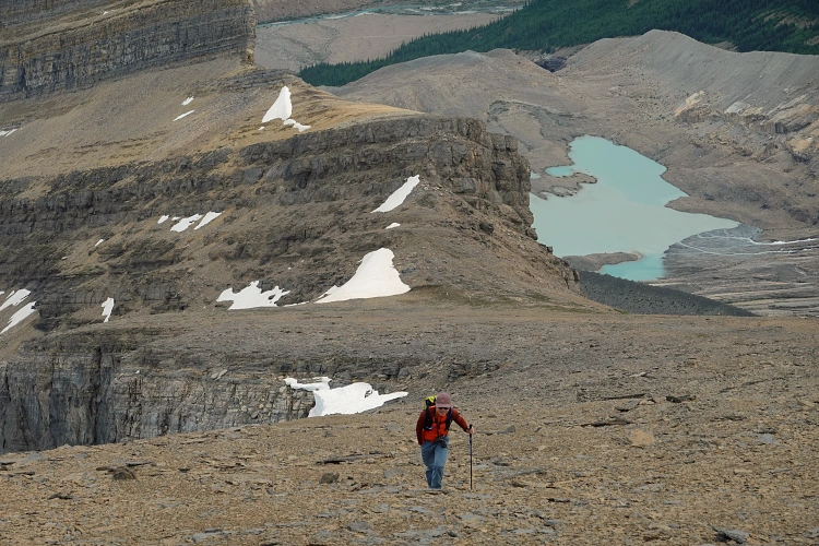
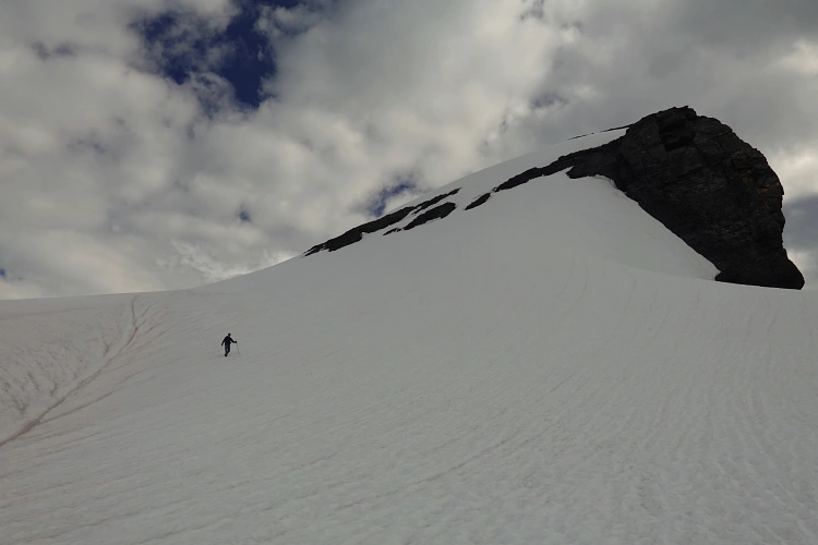
For our return, thankfully, all we had to do is retrace our steps. Some of the snowfields in the upper part of the mountain significantly sped up our descent and were easy on the knees at the same time. Magnificent views of Mount Robson and Berg Lake in the late afternoon light followed us all the way down. We were back at the campground after about 8 hours. A super enjoyable high alpine adventure!
Next day: Snowbird Pass and Titkana Peak
|
Elevation: |
3031 m |
|
Elevation gain: |
1520 m |
|
Time: |
8.0 h |
|
Distance: |
13.6 km |
|
Difficulty level: |
Moderate (Kane), T4 (SAC) |
|
Comments: |
Stats from/to Berg Lake Campground. Snow and ice on the final summit ridge may require ice axe/crampons. |
|
Reference: |
Own routefinding |
|
Personal rating: |
4 (out of 5) |
NOTE: This GPX track is for personal use only. Commercial use/re-use or publication of this track on printed or digital media including but not limited to platforms, apps and websites such as AllTrails, Gaia, and OSM, requires written permission.
DISCLAIMER: Use at your own risk for general guidance only! Do not follow this GPX track blindly but use your own judgement in assessing terrain and choosing the safest route. Please read the full disclaimer here.