Mount Robson Prov. Park, BC, Canada
27 July 2025
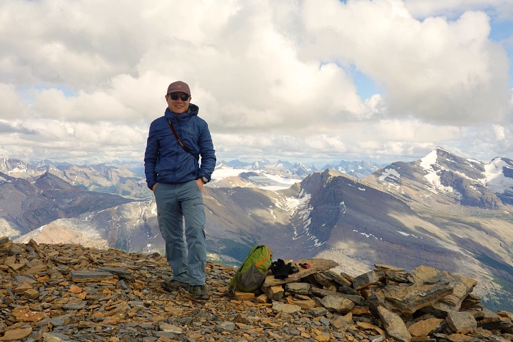
With Keegan
Tricky climb with fantastic views of Berg Lake
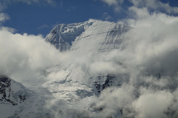
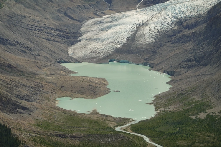
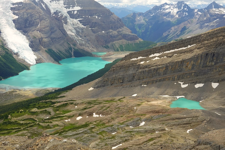
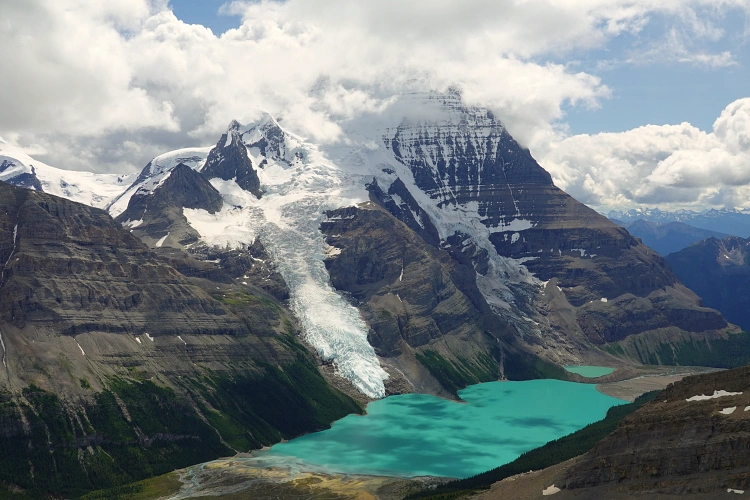
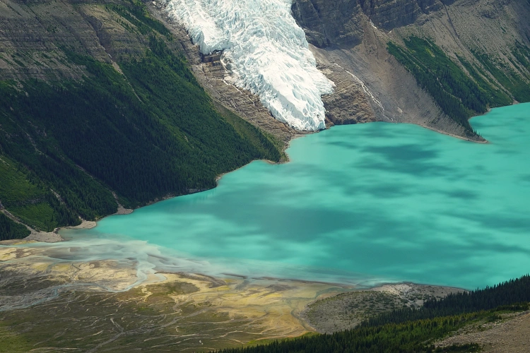
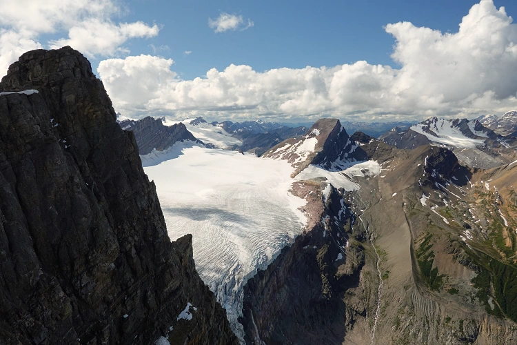
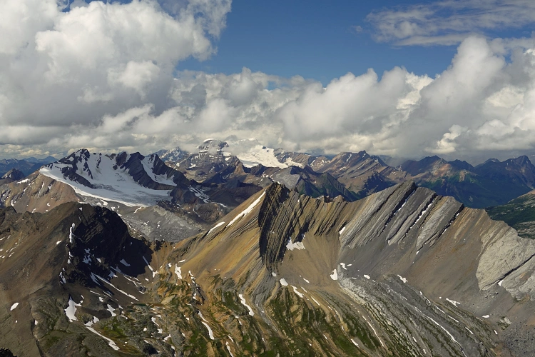
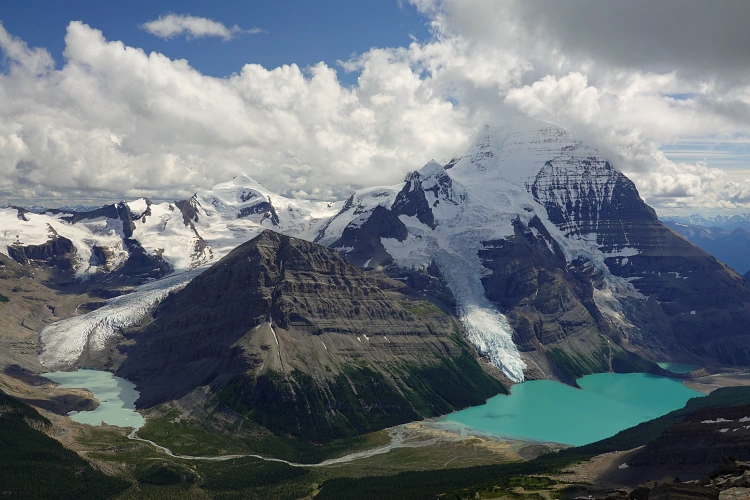
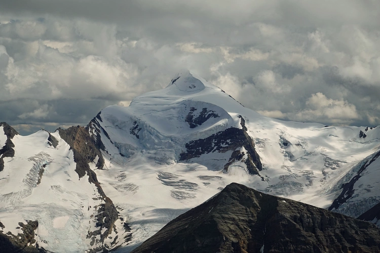
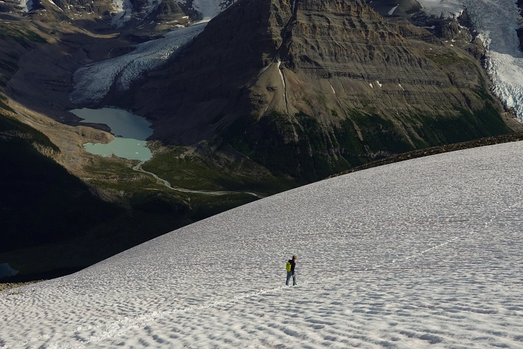
Named after British climber Arnold Louis Mumm (1859–1927), this peak sits at just under 3000 m and offers splendid views of Berg Lake below. Keegan and I agreed that the views from Mumm Peak were by far the best we’ve had on our entire 5-day tour, but of course we also had clear sunny weather which wasn’t the case on our other climbs (Mount Anne-Alice and Titkana Peak).
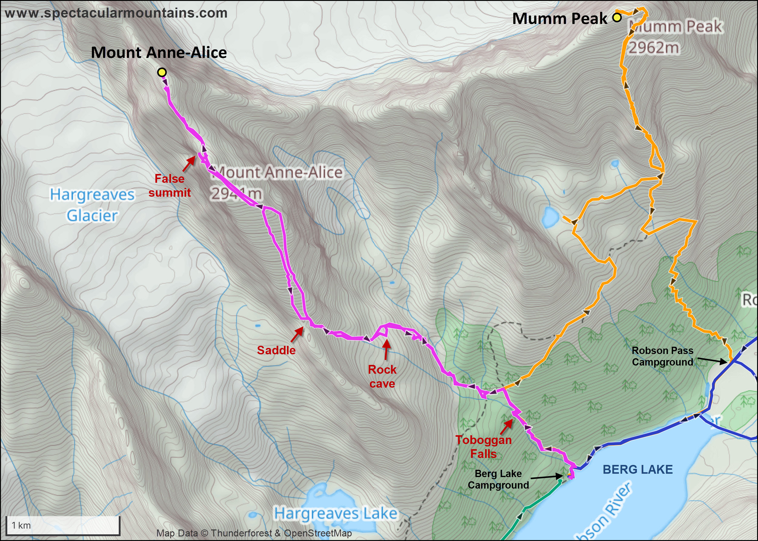
We originally didn’t plan on ascending Mumm Peak. But with an extra day of unexpectedly friendly weather, we decided to add another scramble on our last full day at Berg Lake. There isn’t much info out there on Mumm, with the exception of Vern’s site that has a great trip report for this peak. In his account he warns of a difficult chimney with overhanging chockstone requiring some risky moves on west side of the summit tower. In the hopes of avoiding this, we were firmly committed to exploring the eastern side of the summit tower. Long story short: it worked, but was still difficult!
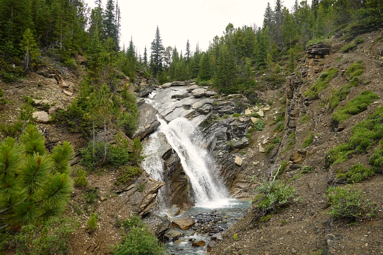
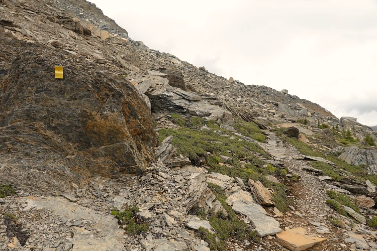
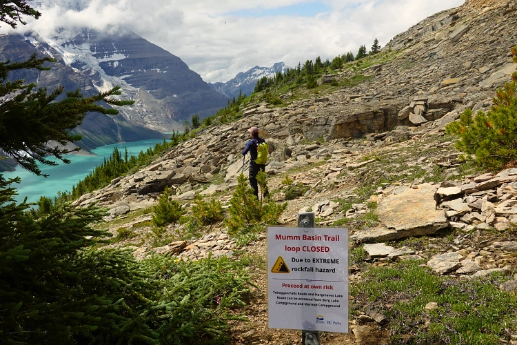
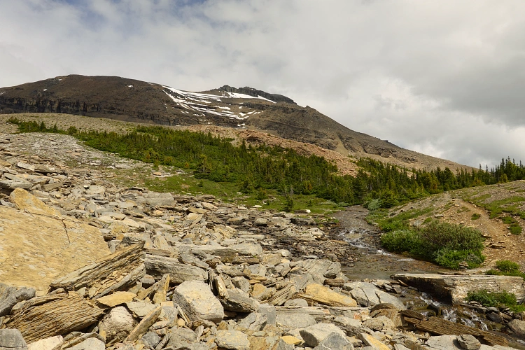
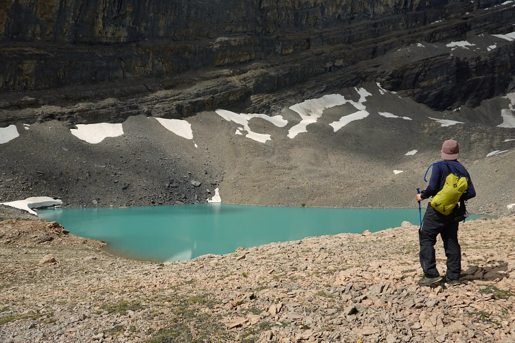
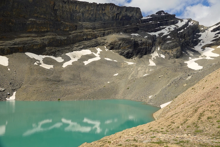
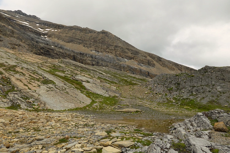
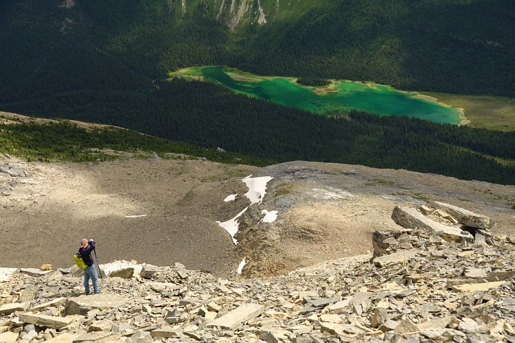
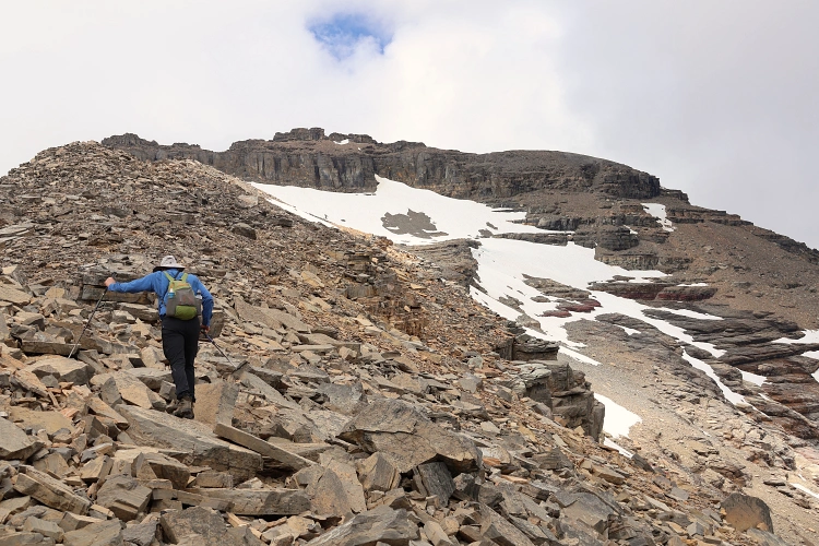
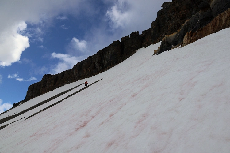
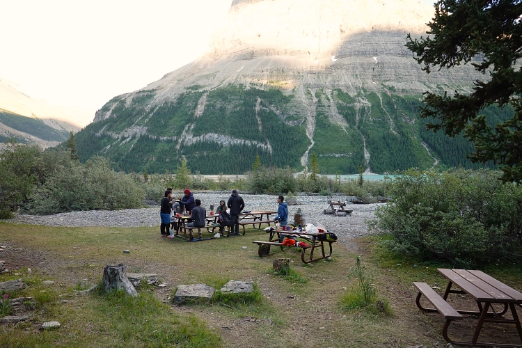
Starting out from our base at Berg Lake Campground, we headed up the now familiar trail past Toboggan Falls (same approach as for Mount Anne-Alice), then turned right up the trail to Mumm Basin. The trail is officially closed here as there is a short section where rock fall has obliterated the path, but the sign also said “Proceed at your own risk”, so we soldiered on. The section of eroded trail was actually fun as we hopped over huge angular rock chunks, but some of the blocks can be unstable and you definitely don’t want to fall into the deep gaps and cracks between them. After picking up the trail again on the other side of the debris field, we enjoyed a nice wander up the lovely Mumm Basin and made a short detour off the trail to visit a small beautiful alpine lake surrounded by vertical cliffs and featuring vibrant hues of turquoise. From the lake we hiked across grass and rock to the start of a rib that runs south from the summit mass.
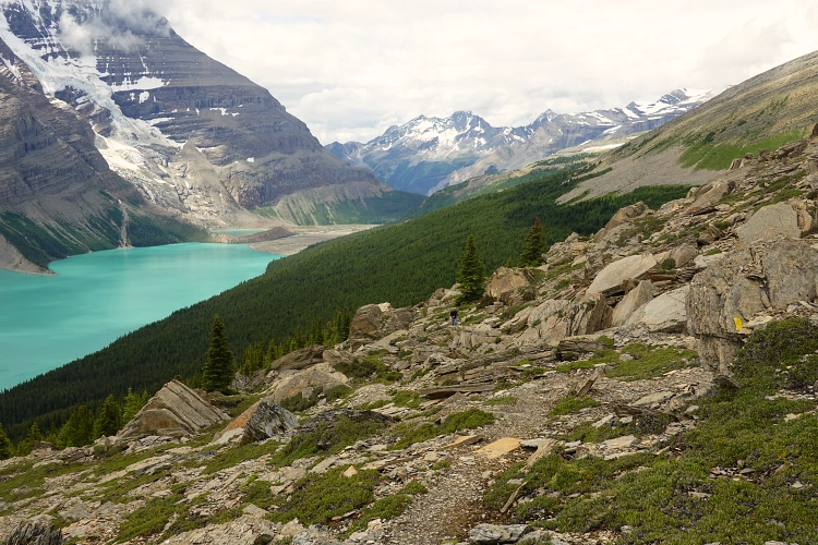
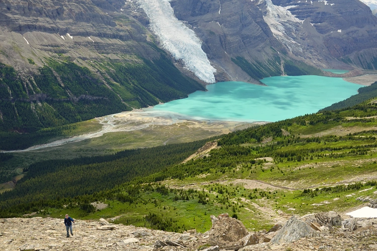
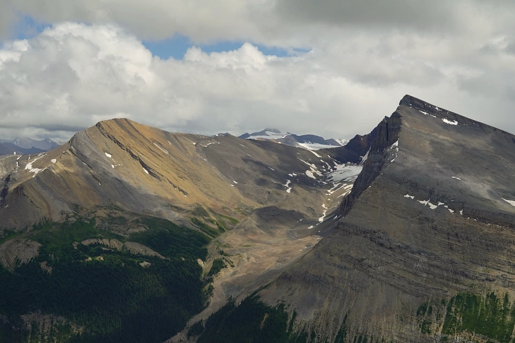
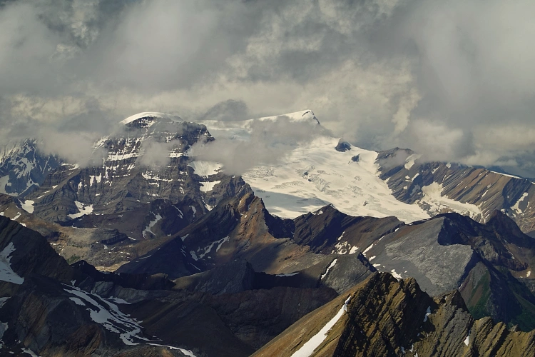
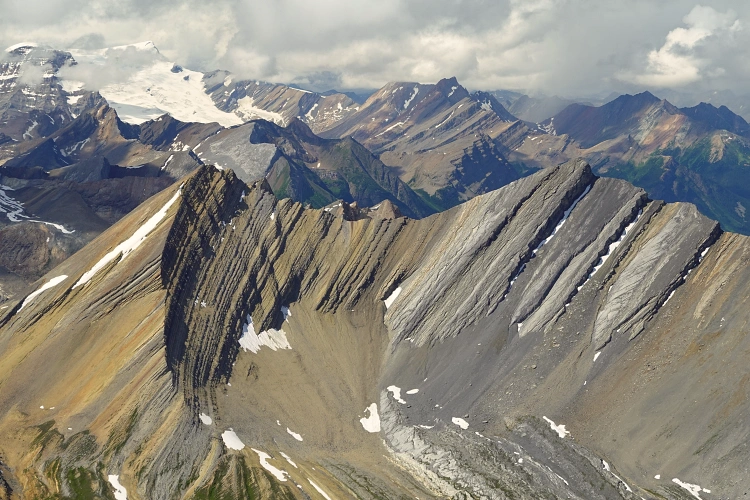
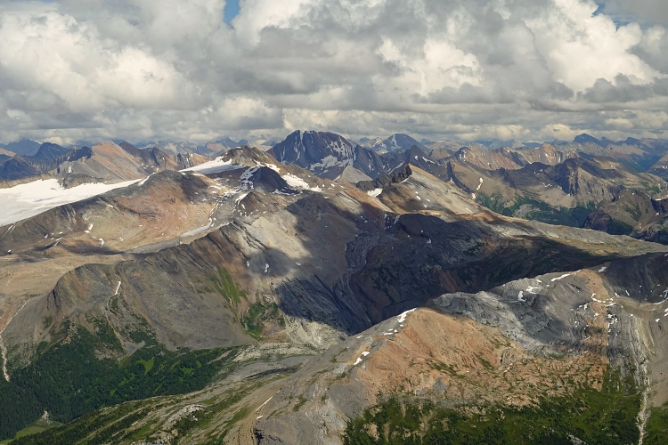
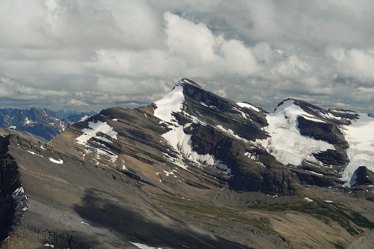
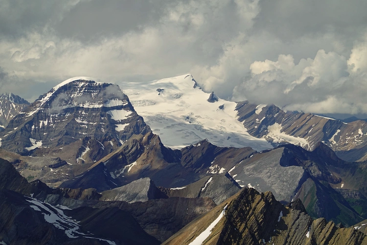
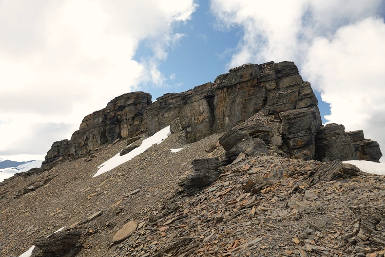
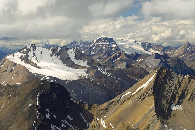
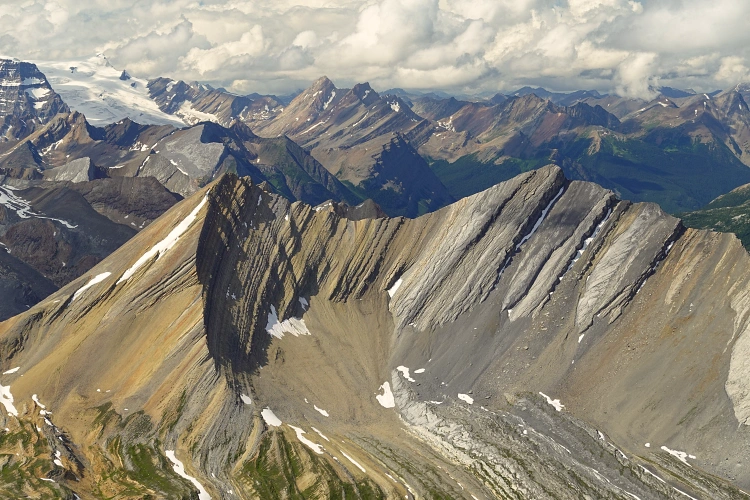
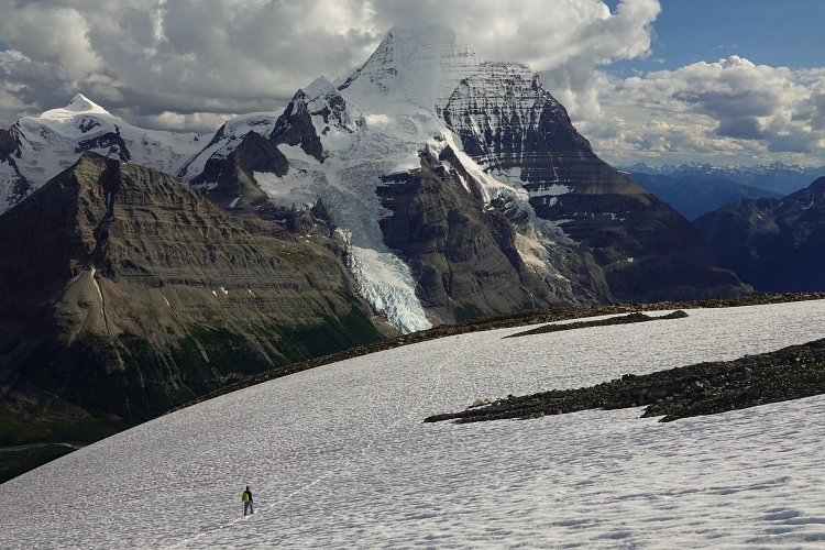
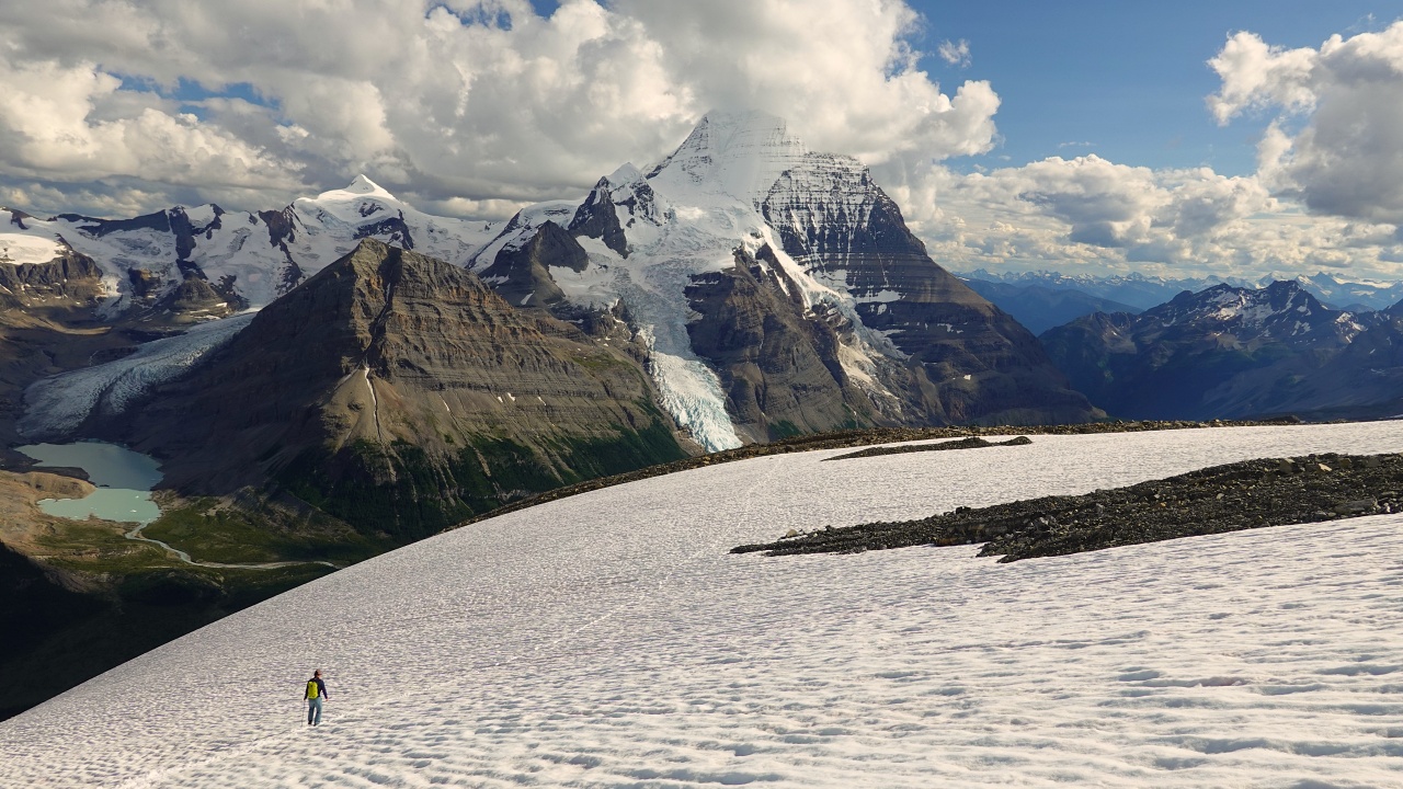
This section was a grind and took some work! Lots of rubble, some loose choss, and a relentless grade. We gained elevation very quickly here and every time we took a break, we turned around to marvel at the valley below filled with glaciers and lakes, with Mount Robson in the background. The views just got better and better!
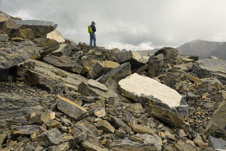
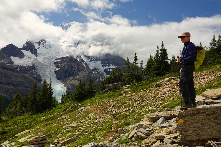
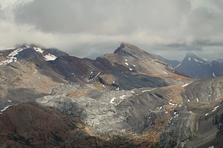
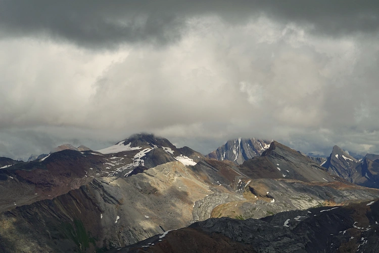
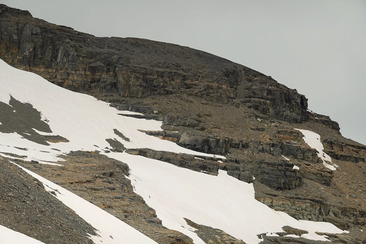
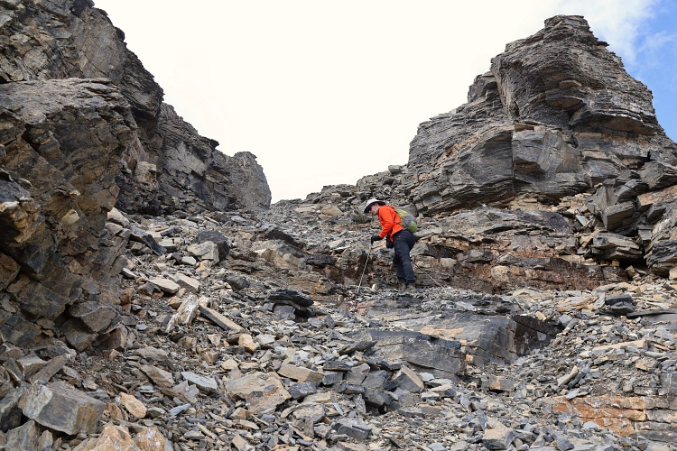
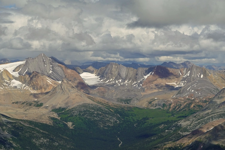
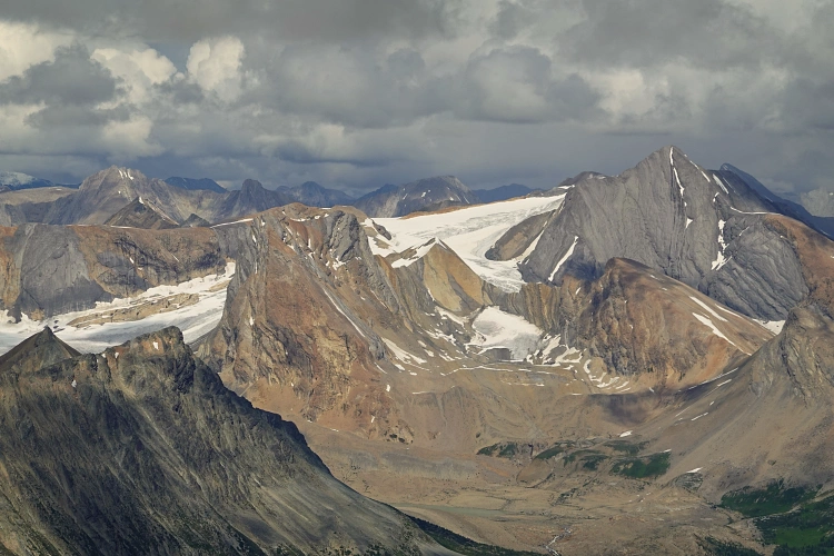
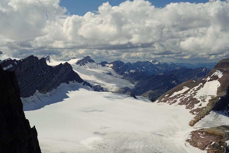
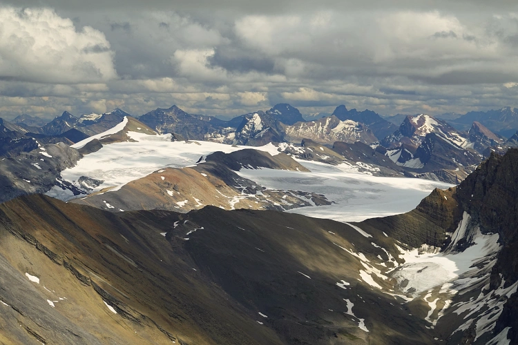
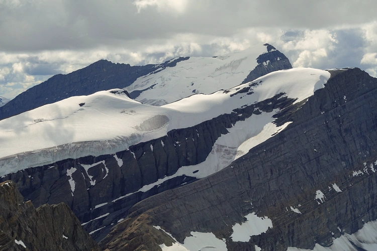
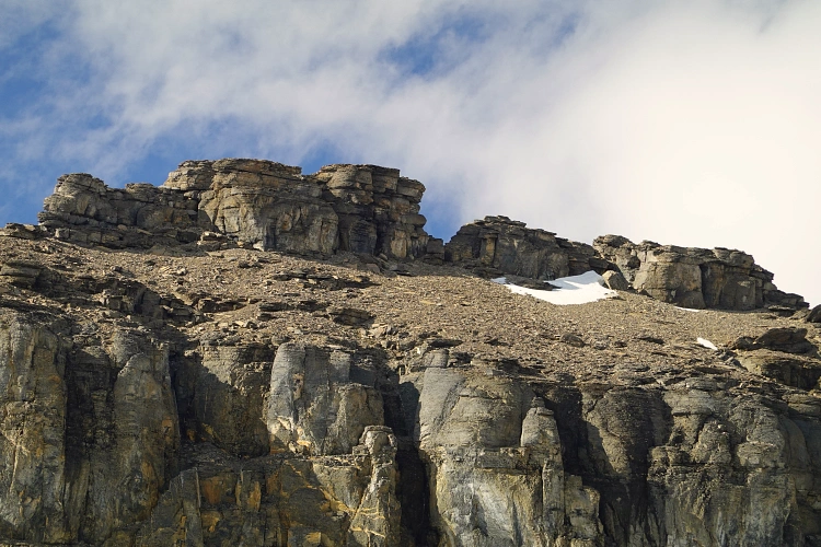
Near the summit mass we angled right, crossed some easy snow patches, then scrambled up a horribly loose weakness breaking through the lower main cliff band. This is where ideally you’d want to have helmets (which I fully admit we should’ve had, but didn’t), as the danger of rock fall is significant if you’re in a party of two or more. Above the rubbly gully we emerged on a high point on the summit ridge where we took our first peek down the other side to the north: incredible views of an unnamed lake framed by colourful mountain ranges and glaciers as far as the eye could see. This viewpoint was by far the best we’ve had and made all the hard work of getting here worth it.
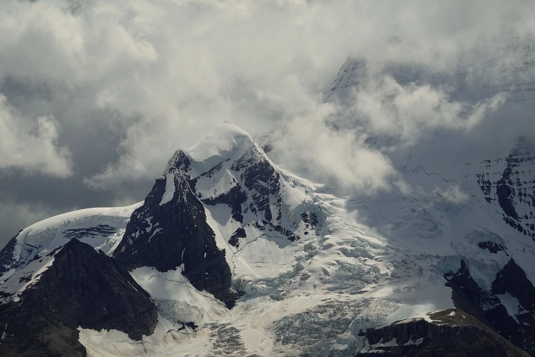
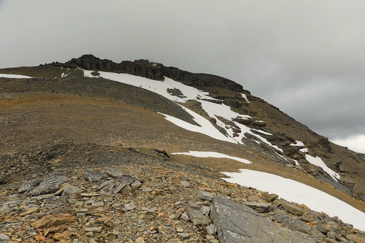
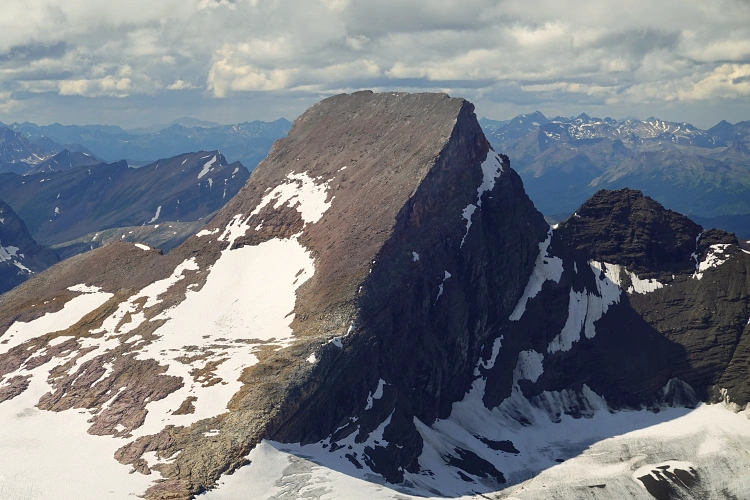
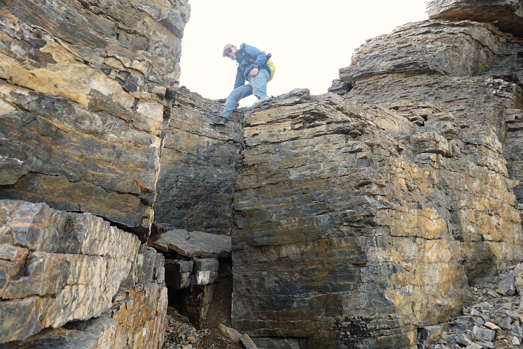
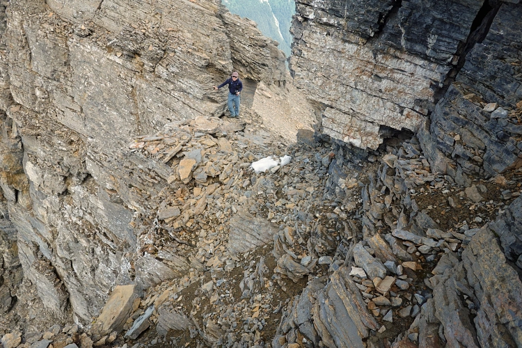
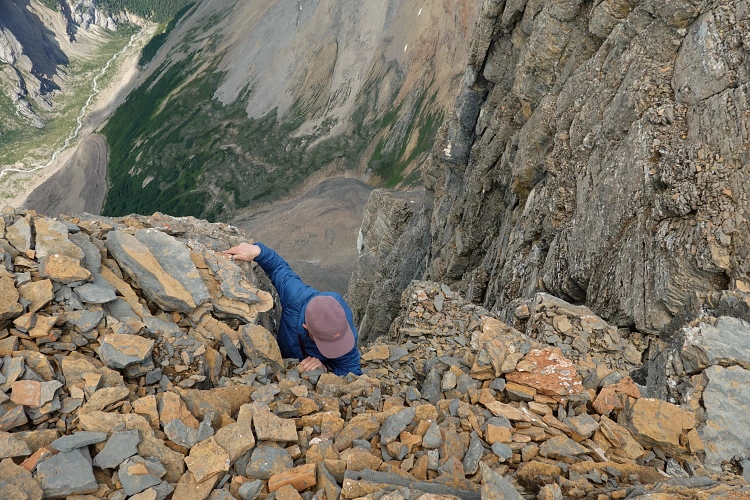
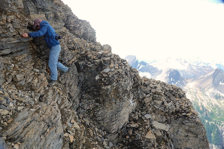
The summit was a short distance to the west, but what we saw didn’t look easy. There was some difficult scrambling to get up the next cliff band, and more to get half-way up the third and final one. Now we were literally less than 10 metres below the summit cairn. The last hurdle was a short (3-4 m) but extremely exposed traverse on the north side of the ridge, followed by a scramble up a loose gully. The ‘traverse’ only involved a few steps and the foot holds were reasonably large, but they were covered in rubble and the entire rock face here looked somewhat loose and rotten. We took our time to clear some of the rubble off the rock and slowly make our way across, trying not to think about the 1000 m drop below us.
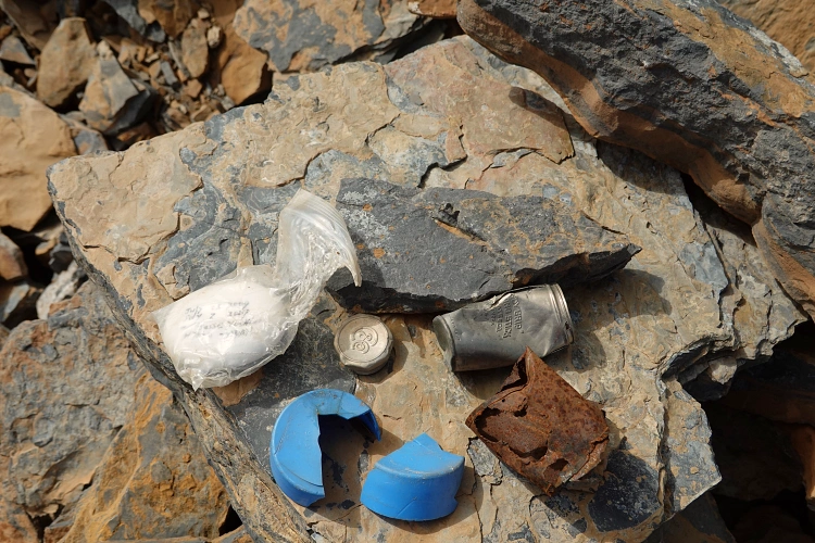
The summit cairn contained the broken remains of several registers, including the all too familiar black PVC pipe, an old aluminum container from probably the 1920s or 30s, and a neat little white pebble with the name of a Japanese climber written on it (ascents in 2007 and 2009). The underside bore these wise words: “Time is not gliding away. It’s building up in your mind.“
After a short summit stay we slowly downclimbed all difficult sections and retraced our steps down to the trail in Mumm Basin, using the snow patches to speed up our descent. We took the eastern part of the Mumm Basin Trail down to Robson Pass Campground and then joined the main Berg Lake Trail to get back to our camp.
Mumm Peak is a really nice but challenging day climb from Berg Lake if you don’t mind some tedious rubble on the ascent ridge. For those not into difficult scrambling, going to the summit ridge on the east or west side of the summit tower is enough to offer fantastic panoramic views down the other side. The true summit is only advisable if you’re comfortable with some difficult scrambling, a few 5.4 moves, and a short section of extreme exposure. The latter is definitely not a good idea if the rock is wet or snowy, so only do this in favourable weather conditions.
|
Elevation: |
2964 m |
|
Elevation gain: |
1400 m |
|
Time: |
10.0 h |
|
Distance: |
14.3 km |
|
Difficulty level: |
Difficult (Kane), T6 (SAC) |
|
Comments: |
Stats are from/to Berg Lake Campground. Extreme exposure and a few short sections of 5.4 climbing. |
|
Reference: |
Own routefinding for this route |
|
Personal rating: |
4 (out of 5) |
NOTE: This GPX track is for personal use only. Commercial use/re-use or publication of this track on printed or digital media including but not limited to platforms, apps and websites such as AllTrails, Gaia, and OSM, requires written permission.
DISCLAIMER: Use at your own risk for general guidance only! Do not follow this GPX track blindly but use your own judgement in assessing terrain and choosing the safest route. Please read the full disclaimer here.