Jasper National Park, AB, Canada
1 September 2025
Solo
Jasper’s most delicious mountain
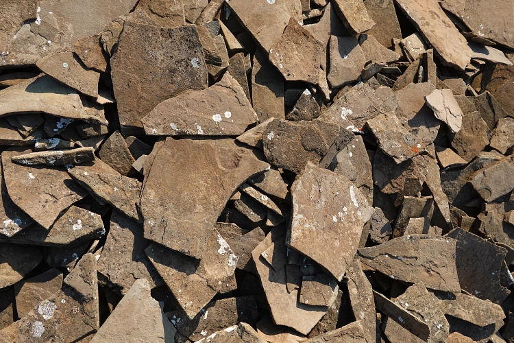
Yes, believe it or not, there is an officially named mountain called “Chocolate Mountain” in one of Canada’s national parks! It takes at least two days to get to from the nearest road and, as a result, is almost never climbed. I couldn’t find an official explanation of the name origin, but I suspect the name stems from the abundant brown, “chocolate”-coloured shale and siltstone that make up the bulk of this mountain.
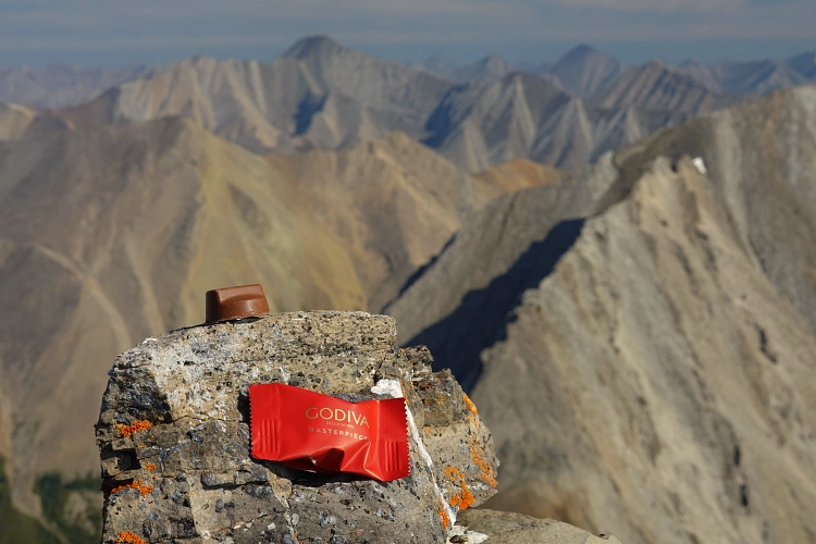
Chocolate Mountain has been on my radar for years, not only for its appealing name, but even more so as I’ve been known to be a massive chocophile since childhood (to the point that I even entered the Guinness Book of Records as a teenager with what was then the largest chocolate wrapper collection in the world – yes, pretty nerdy I know 🙂 ). So of course I had to climb this delicious-sounding mountain at some point, no matter how remote. Vern Dewit and I had been making loose plans years ago, which never materialized as we were both busy chasing other objectives. This long weekend a weather and time window finally opened up for me (it’s rare these days for me to have more than 3 consecutive days available), but unfortunately with the short notice neither Vern nor my buddy Adam were available, the only two friends I could think of that would possibly be up for such an endeavour. Who else would want to slog 30+ km a day, mostly off-trail and in unknown terrain, bushwhack up alder-infested creeks, trudge across rubble and scree slopes, and climb 1800 m elevation for four days in a row?
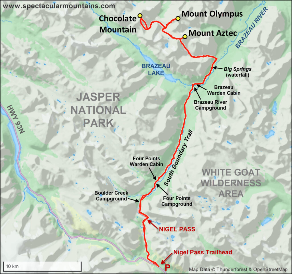
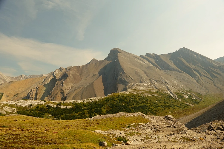
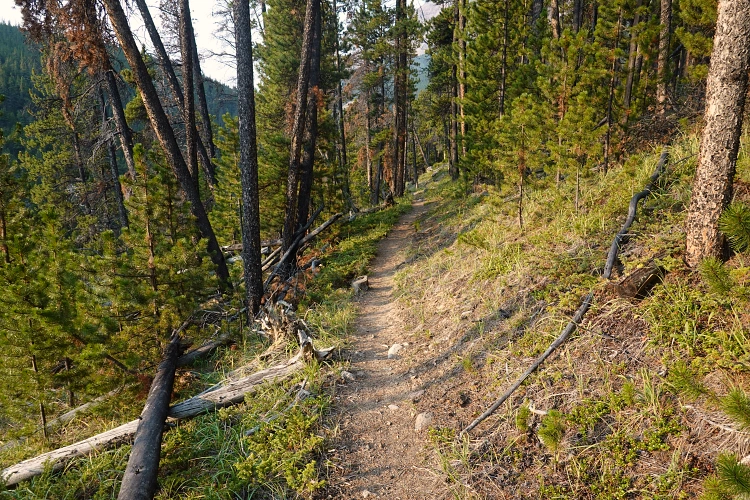
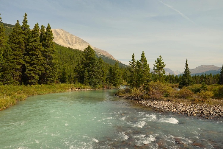
There are two logical approaches to Chocolate Mountain, both from the Icefields Parkway (Hwy 93N). The first is via Poboktan Creek Trail, then off-trail over an unnamed high mountain pass to the north of Poboktan Pass, down a long valley to the Northwest Brazeau River, and up another smaller pass on the east side of the river. I contemplated doing this approach for a long time but ultimately chose the second option, an approach via Nigel Pass Trail further south, then along the South Boundary Trail along the Brazeau River, followed by off-trail hiking up a drainage and high pass near Mount Aztec and into unnamed valleys to the north. This route is longer but has the advantage of having more of the approach on a trail, plus it would allow me to tag on a couple of other mountains as well – Mount Aztec and Mount Olympus. Of course you could combine the two routes, but then you’d need two cars or hitchhike between trailheads.
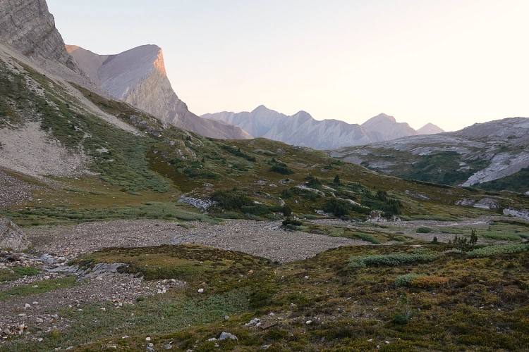
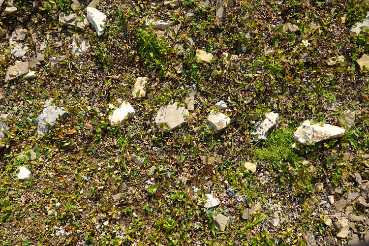
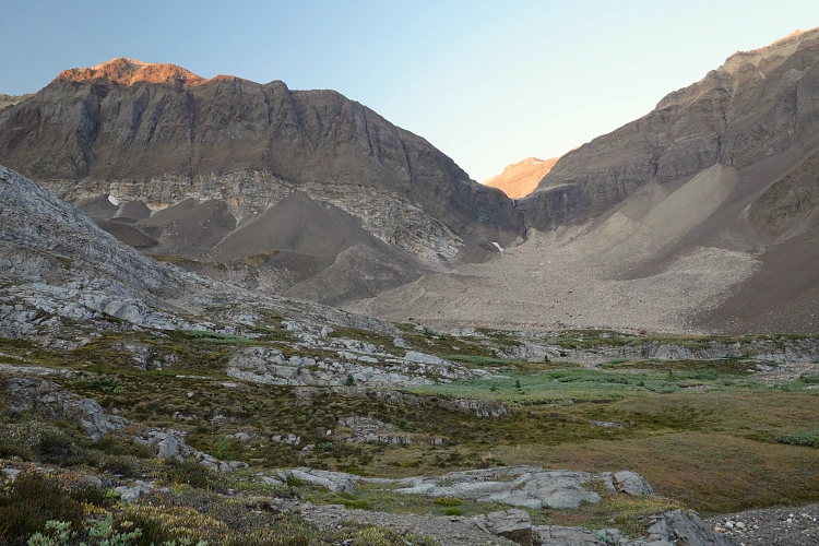
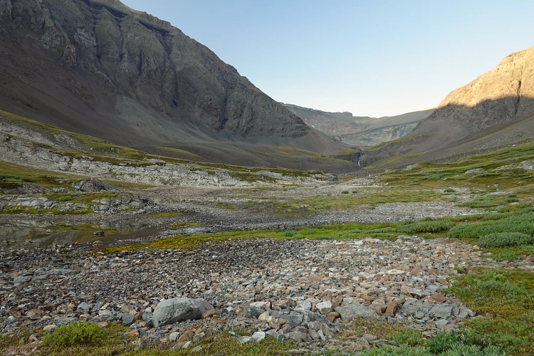
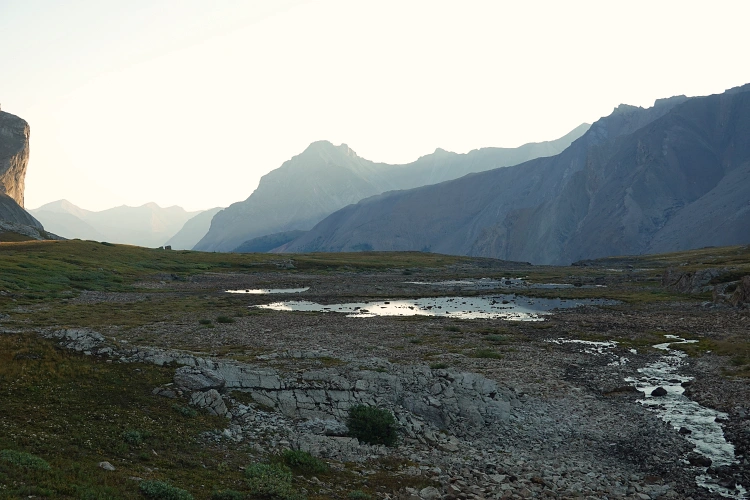
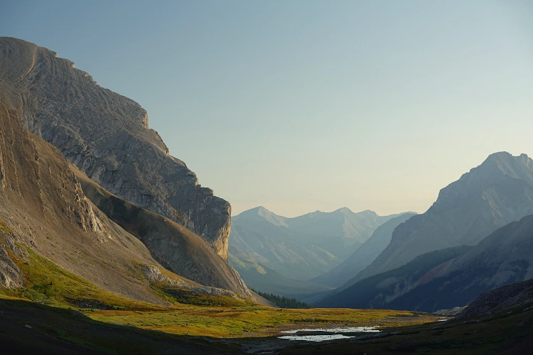
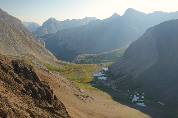
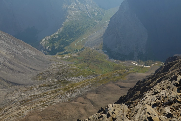
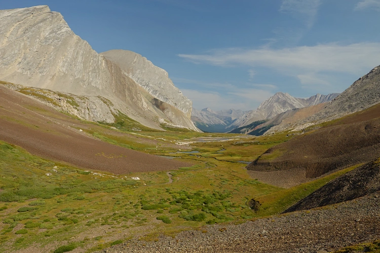
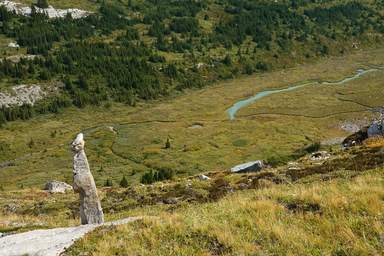
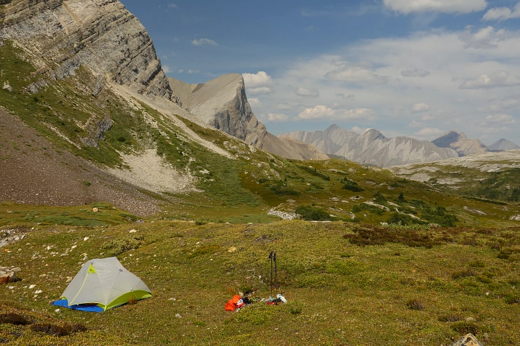
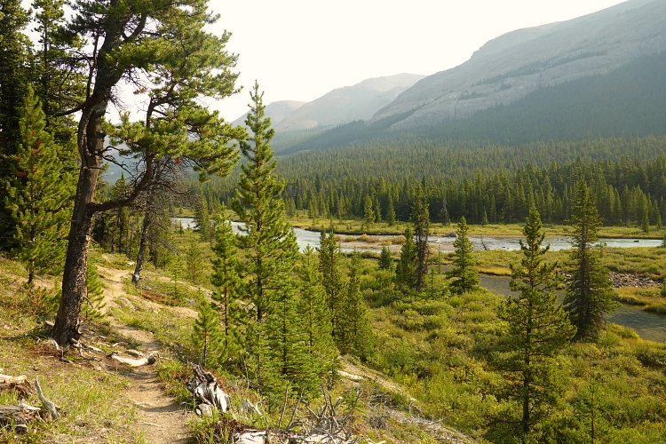
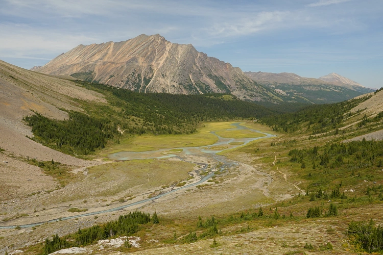
I’ve described the long approach in detail in my Mount Aztec and Mount Olympus trip reports, which cover the first two days of this four-day backpacking adventure. My basecamp for Chocolate Mountain was high up at 2300 m in a broad alpine valley, well above treeline, in a lovely meadowy area with lush green grass near a creek fed by a glacier higher up. What struck me was that in the entire valley, plus the valleys I travelled through to get to Chocolate Mountain, there were absolutely zero remnants of human presence – no cairns, fire rings, or markers. One possible exception to this was an odd arrangement of at least 10 stones in the ground, spaced out evenly and forming a straight line… I came across this near my tent, possibly an old indigenous marker?
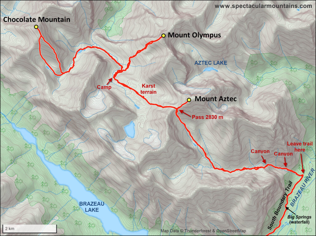
After a good night’s sleep I awoke quite refreshed on Sep 1st and was on my way with my little day pack just after 7 am. The route from my campsite that I had roughly mapped out based on satellite pictures took me to the bottom of the valley between Olympus and Chocolate, north along this valley, then up another valley to the west where I could reach the bottom of Chocolate Mountain’s south ridge, which looked easy to ascend. I had no idea how difficult or bushy this route would be, which was actually one of the hardest things mentally when you’re exploring alone for several days and have no-one to discuss things with. Well, the lucky stars aligned for me once again and I can thankfully say that the route worked out perfectly. I didn’t even need my old creek-crossing sneakers I had lugged all the way up here, not even once!
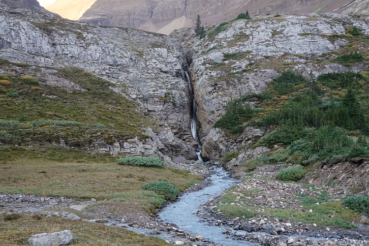
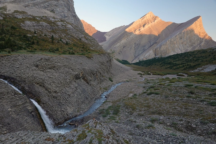
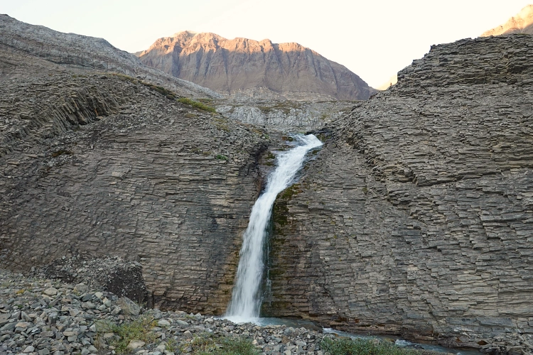
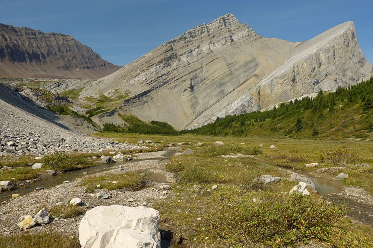
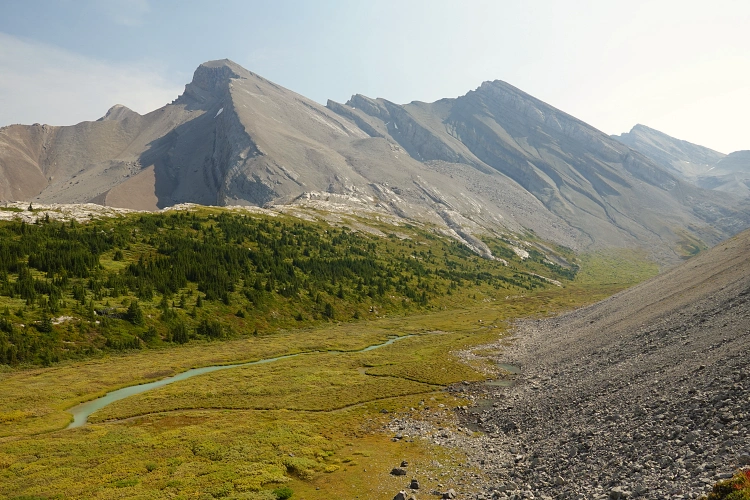
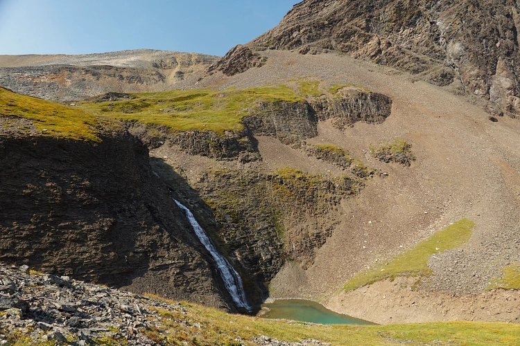
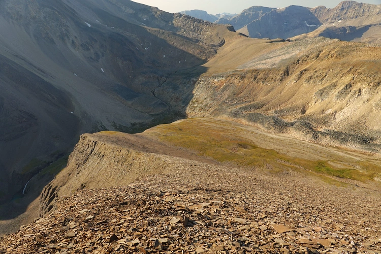
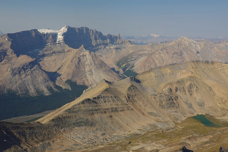
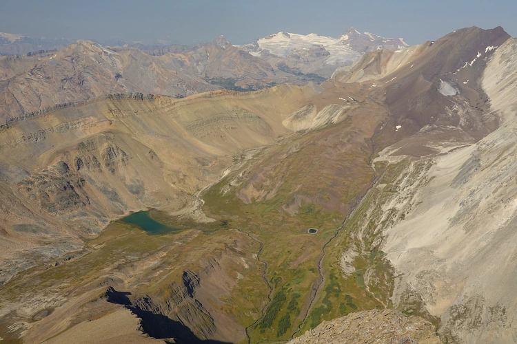
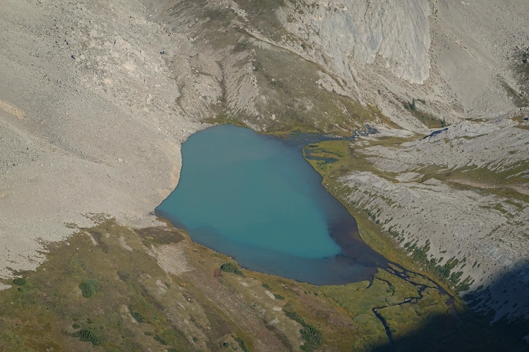
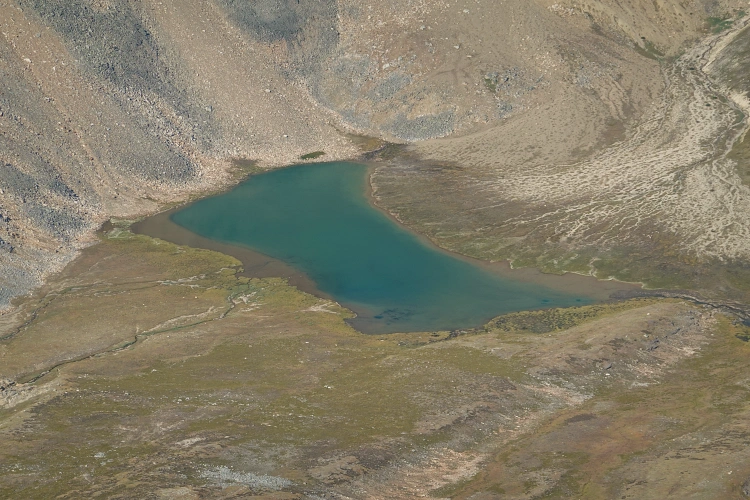
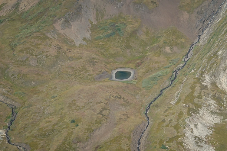
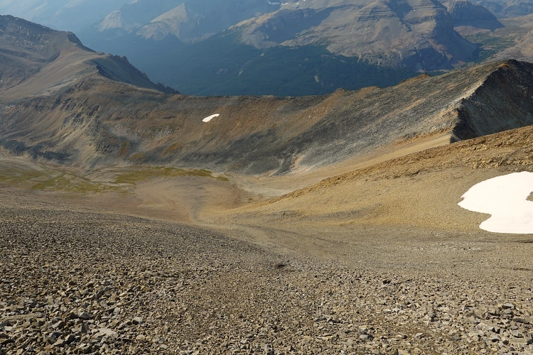
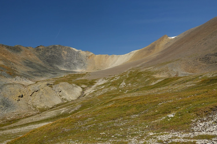
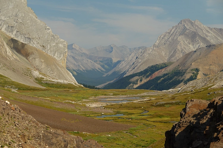
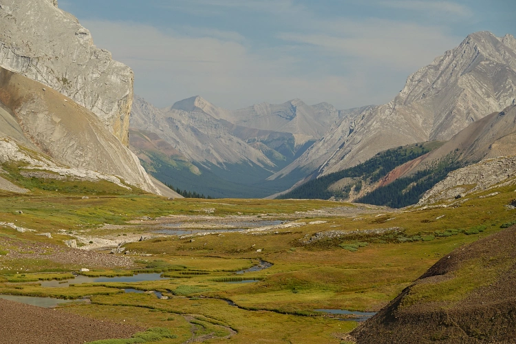
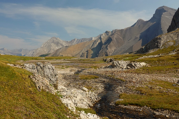
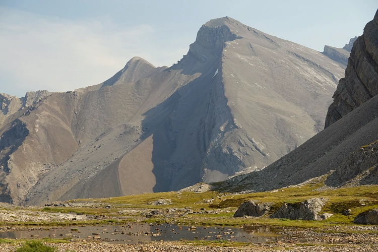
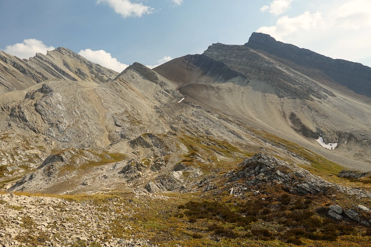
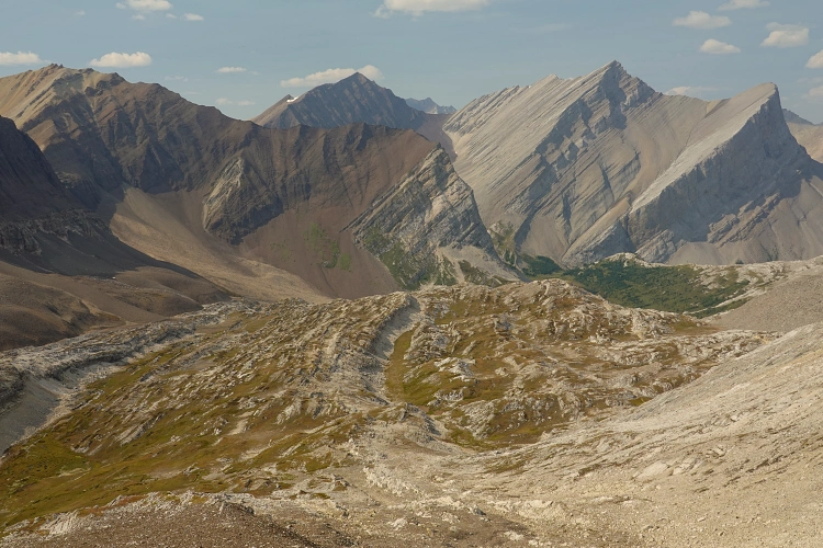
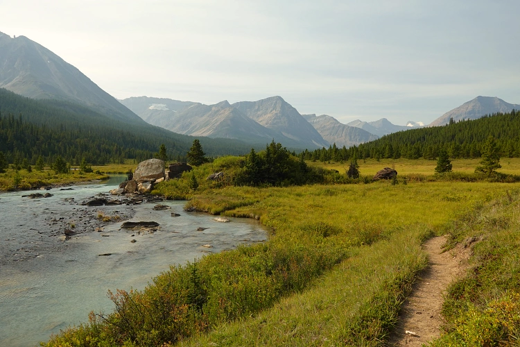
The headwall between my tent and valley bottom had a beautiful waterfall gushing down the middle. At its base the terrain flattened out and I was able to easily stroll along the west side of the creek on grassy ground, avoiding all of the shrubs on the other side of the valley. I made quick progress as I walked north to the start of the next valley coming in from the left. Again there was a lower headwall that was easily climbed, partly on grass and partly up rocky ribs, with faint game trails pointing to the path of least resistance up and over the various bumps. I entered a beautiful valley with a meandering creek and some small, shallow ponds in the middle. Now, my worries and concerns had all but dissipated… I felt this special bliss of being really privileged to see such a pristine and awe-inspiring landscape, one that few ever get to see. Skirting around the north side of the ponds, I got to the upper headwall which was attained by way of a goat trail across scree on the south side. Another small waterfall running down the middle gave me certainty that there were plenty of re-fueling stations on the way – essential on a hot day like today (31 degrees forecast for Jasper!). At the top of the higher headwall I filled up my two 1 litre bottles one last time and then started the climb of the long south ridge of Chocolate Mountain.
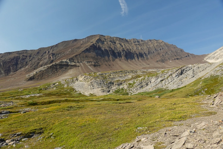
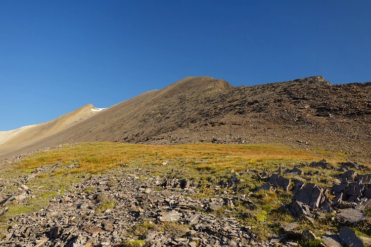
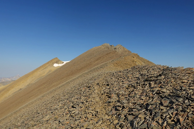
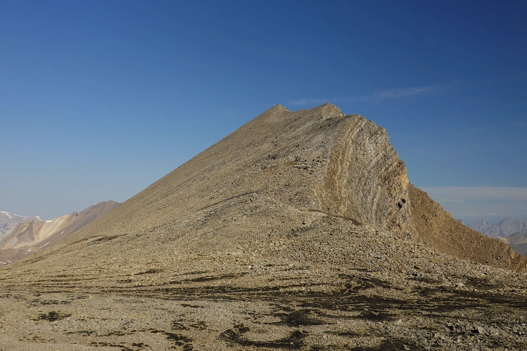
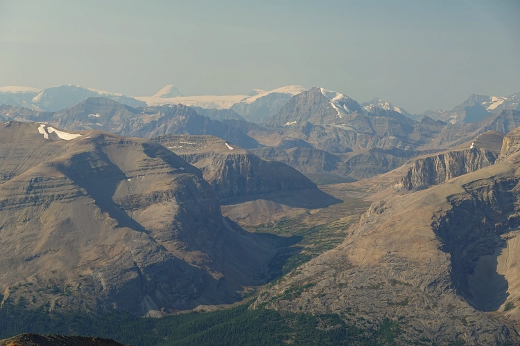
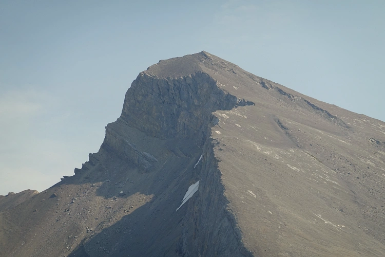
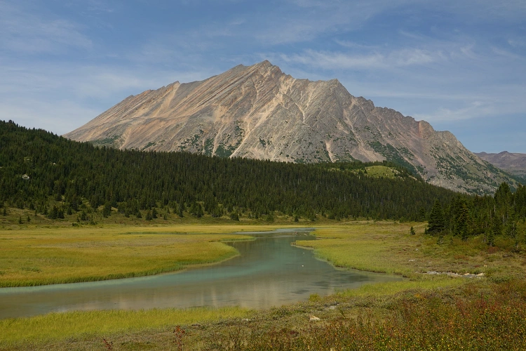
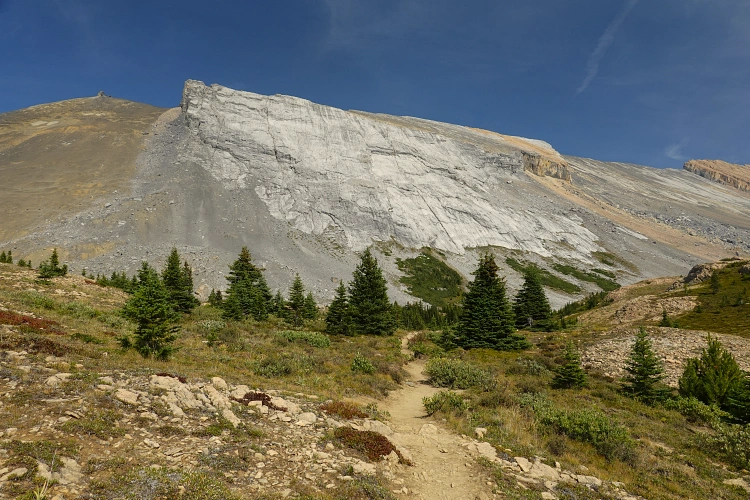
Almost the entire mountain is made up of medium to dark brown shale and siltstone, with a few layers of white limestone interbedded on the east side. The colours certainly do the name justice, even if we’re throwing some white chocolate into the mix :). More importantly for climbers, the presence of brown shale of course also means that there are likely not going to be any major difficulties. Shale is relatively soft and tends to break down and erode much more easily than other rock types, but it can also be loose and unpleasant. To my surprise, there was a fairly good goat trail right on the ridge crest and all I had to do is follow it almost all the way to the summit. It was an easy walk and I thoroughly enjoyed the views of the many unnamed peaks and distant glaciers on this gorgeous sunny day.
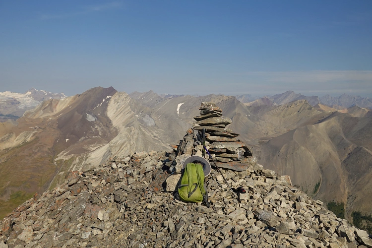
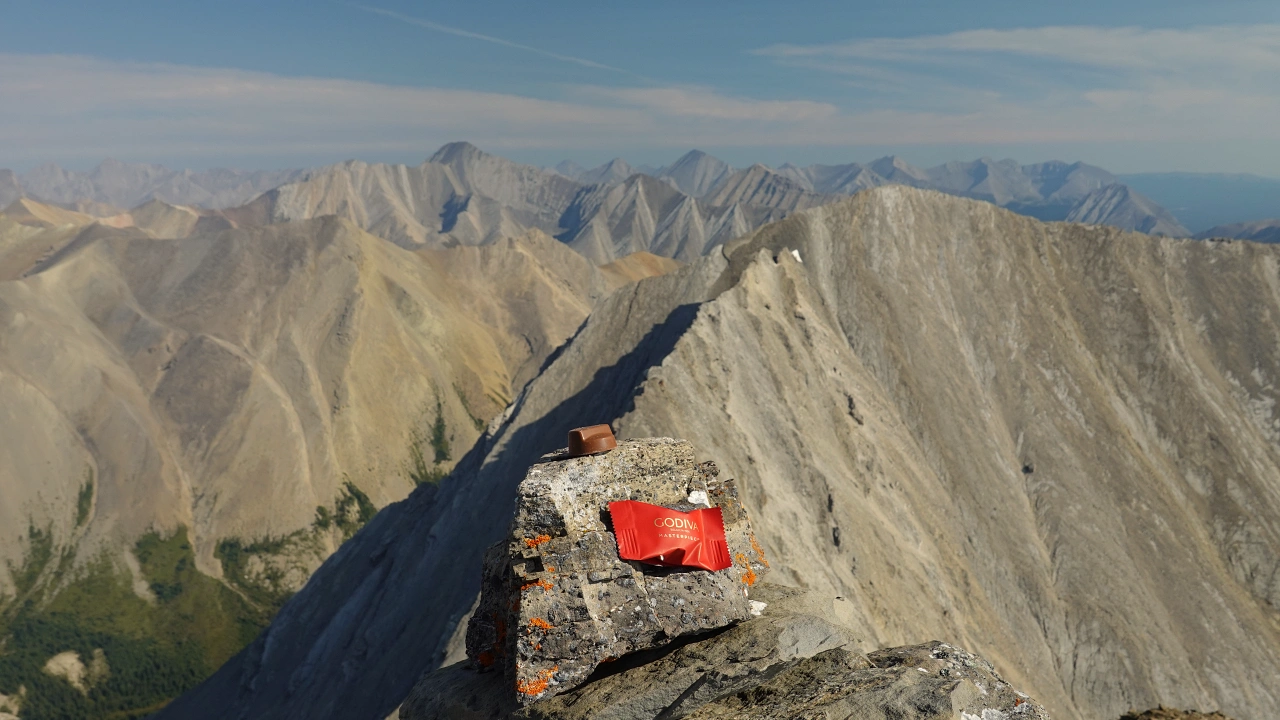
Arriving at the summit shortly after 10:30 am another surprise awaited: crowning the summit was a big cairn – it looked quite old and may have been built by an early surveyor’s party. Tucked away inside the cairn I found a new-looking register: two fellow adventurers had climbed the mountain in 2020 via the west side from Poboktan Creek Trail. I guess I’m not the only one who loves chocolate this much!
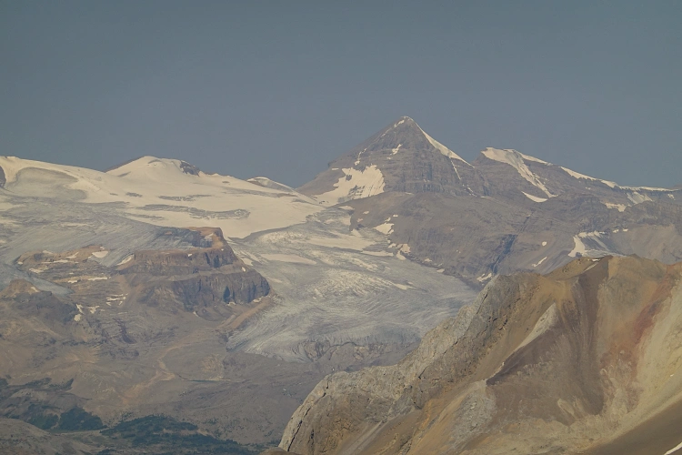
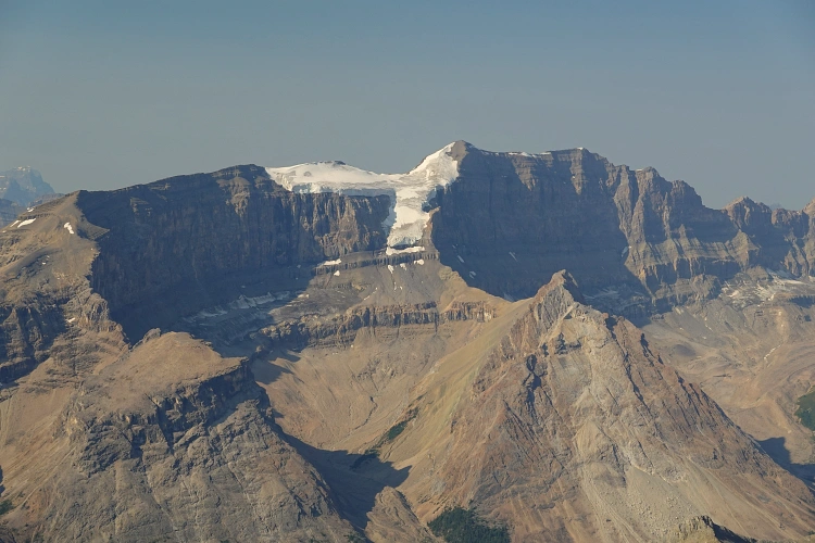
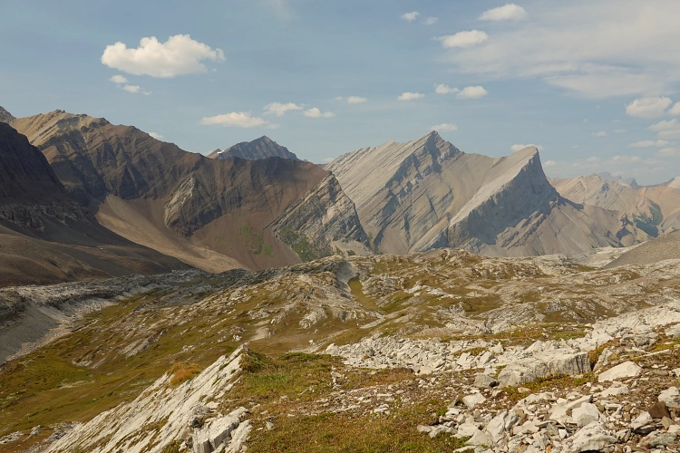
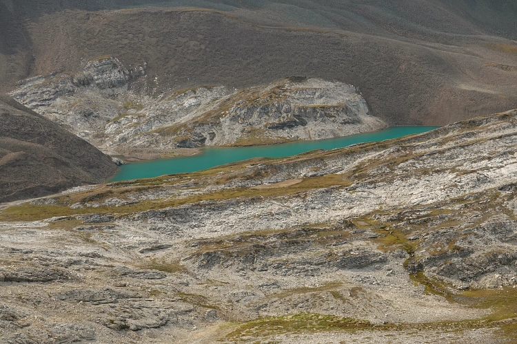
I spent a good 45 minutes at the summit taking lots of pictures of the many unknown (to me) peaks, alpine lakes, and empty valleys. Unexpectedly, I caught some intermittent cell phone reception as the skies were super clear and was able to make a short call home. After enjoying a much-deserved piece of chocolate, I started my descent, knowing full well that I still had most of my day ahead of me if I wanted to make it back in two days.
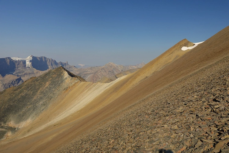
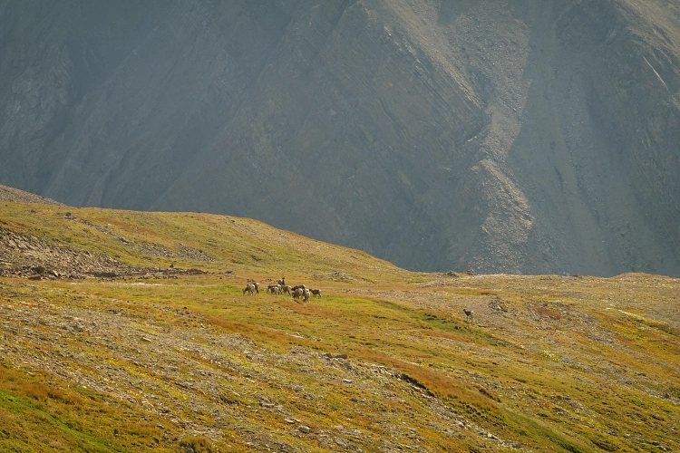
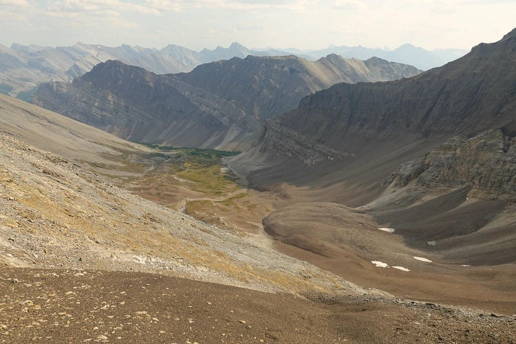
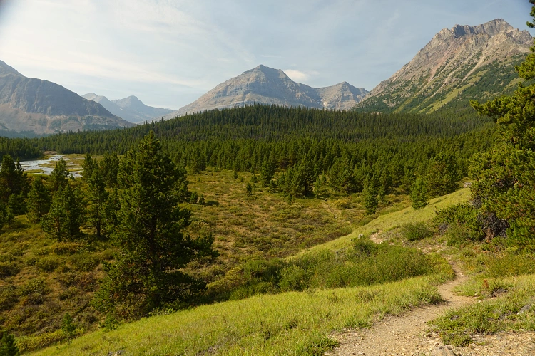
The brown shale that featured an easy goat trail on the south ridge also provided a delightfully soft scree slope on the southwest side of Chocolate Mountain, allowing for a quick and convenient descent into the broad upper valley southwest of the peak. At the base of the scree the terrain transitioned into gentle grassy slopes where a large herd of goats was grazing on the side of the valley. They didn’t seem too bothered by my presence but kept a healthy distance as I ambled down the open valley back to the start of the south ridge, connecting with my ascent route from the morning. I certainly felt much more relieved now that I just had to retrace my steps back to my tent, knowing that the route was straightforward and enjoyable at the same time. With the sun at a very different angle now, I couldn’t help but stop frequently to take lots of photos of this wondrous place.
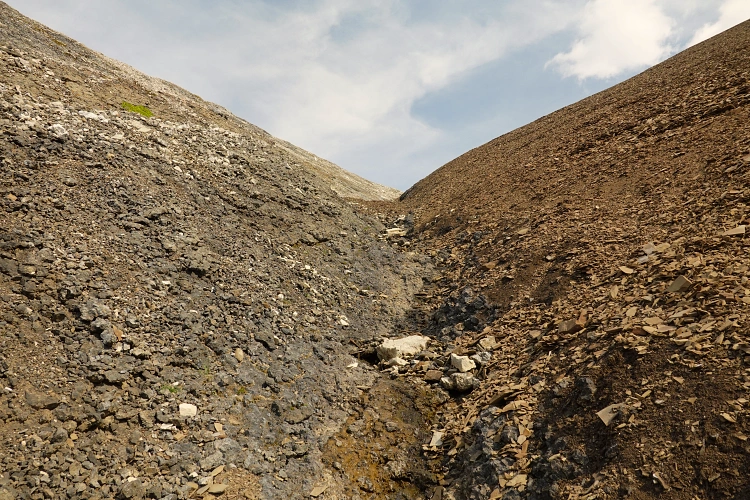
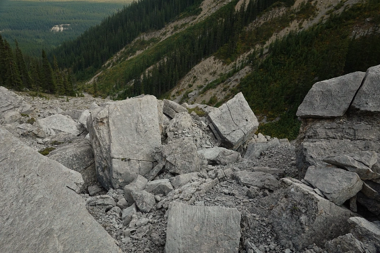
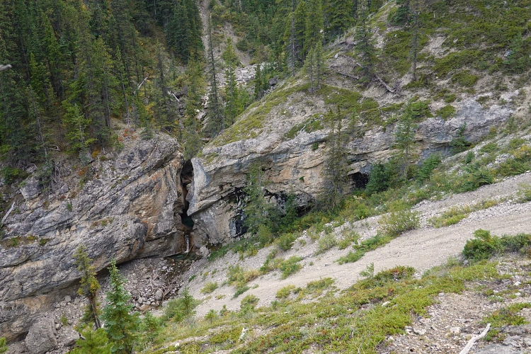
I got back to my campsite around 2 pm, my food stash still intact in the bear-proof bag sitting on a large boulder nearby. After a relaxing lunch break, I took apart my tent, packed up my big bag, and started the long return journey. Once again, knowing the terrain and exactly which way to go, how to bypass certain obstacles, and knowing what to expect, is such a huge relief and so much easier on the mind (and body). The mental challenge was 90% done at this point, the physical was a matter of putting one foot in front of the other and forcing myself to take enough breaks. Leaving the beautiful karst valley behind me and slogging back up to the Aztec pass was tough but I broke it down into small steps and made sure I picked the best line on competent rock in the middle of the drainage as opposed to steep rubble or loose scree on the sides. Half-way up I encountered a good flow of crystal clear water coming out of the rock, a welcome reprieve from the heat and much-needed source of hydration.
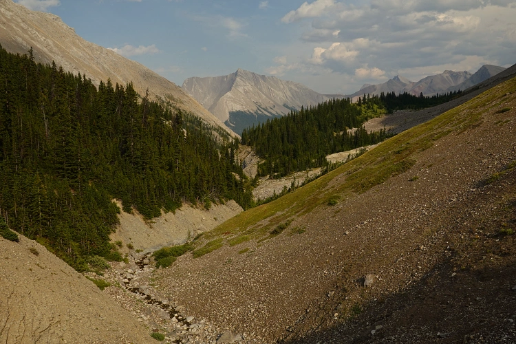
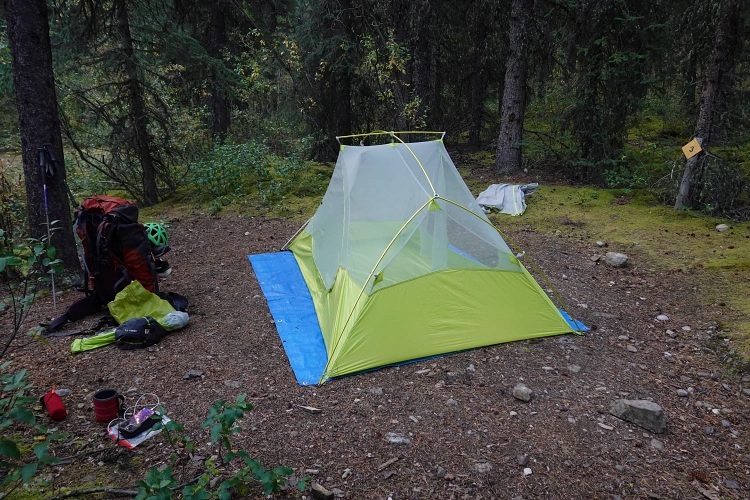
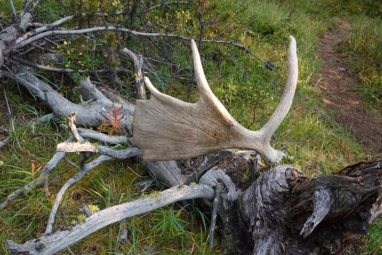
The slopes south of the pass are mostly covered in soft brown scree, which I could tell makes life easier for local game as well… the relatively fresh bear tracks I saw the day earlier could be seen in the mud, and I was wary that these magnificent beasts might be roaming somewhere in the valley below me. Calling out frequently, I fortunately didn’t encounter anymore wildlife other than some fat marmots and shy pikas. The remainder of the descent down the valley back to the trail was tedious and tiring, although much easier on the mind now that I knew the optimal route to follow. The sidesloping on rubble to avoid the two narrow canyons was especially hard on my already very sore feet, and downward travel wasn’t much faster than going up. Around 6 pm I finally made it back to the South Boundary Trail. Shortly after, as I was quietly trudging along in the forest, a huge black bear popped up right on the trail in front of me. It seemed flustered and quickly scurried away, in the same direction I was travelling. Now I had no choice but to yell out every 10 seconds as I completed the final few kilometres back to Brazeau River backcountry campground where I set up camp for my last night.
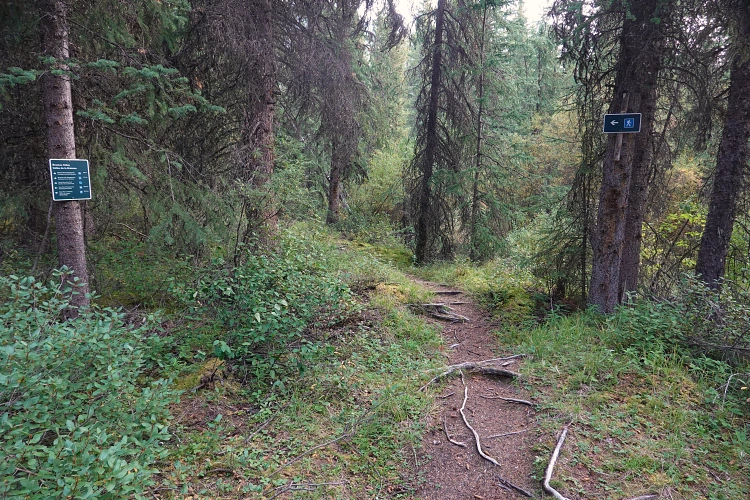
The final day – day 4 – was relatively easy. All I had was 30 km of straightforward trail hiking with a much lighter pack than when I came in. Still, I definitely felt the toils of the last few days and consequently wasn’t quite as energetic, plus my feet were throbbing with pain. I decided to only carry about a litre of water in my hydration pack, filling up at creeks along the way instead of lugging up too much water. There were still 900 m of elevation to overcome as I passed by Four Points and Boulder Creek backcountry campgrounds, continued to Nigel Pass, and then hiked the remaining 7.6 km from there back to my car.
This was a fantastic adventure with unique impressions that will stay with me forever. Nonetheless, it was also one of the hardest trips I’ve ever done. The mental strain of travelling alone through unknown and remote backcountry terrain that I didn’t know would work out was significant, knowing that you only have yourself to rely on and that you can never take a break and “defer” to a climbing partner. You constantly have to be focused and keep all your senses switched on high, so there is very little time to let your mind rest. Physically, it was also a big undertaking, at least for me now that I am in my late 40s I could feel the toll it was taking on my body. It was a total of 110 km and 5000 m elevation gain in four consecutive days, so I guess I shouldn’t be too surprised that I was pretty bagged at the end. But in the end, it was an exciting and enjoyable experience that was all worth the effort!
|
Elevation: |
3052 m |
|
Elevation gain: |
1570 m (2110 m loss) |
|
Time: |
13.0 h |
|
Distance: |
27.0 km |
|
Difficulty level: |
Easy (Kane), T3 (SAC) |
|
Comments: |
Stats are from camp (in valley W of Olympus) to Chocolate Mtn summit to Brazeau River campground. |
|
Reference: |
Own routefinding |
|
Personal rating: |
4 (out of 5) |