Elkford, BC, Canada
24 September 2021
Solo
Beautiful ridge walk with a tough approach
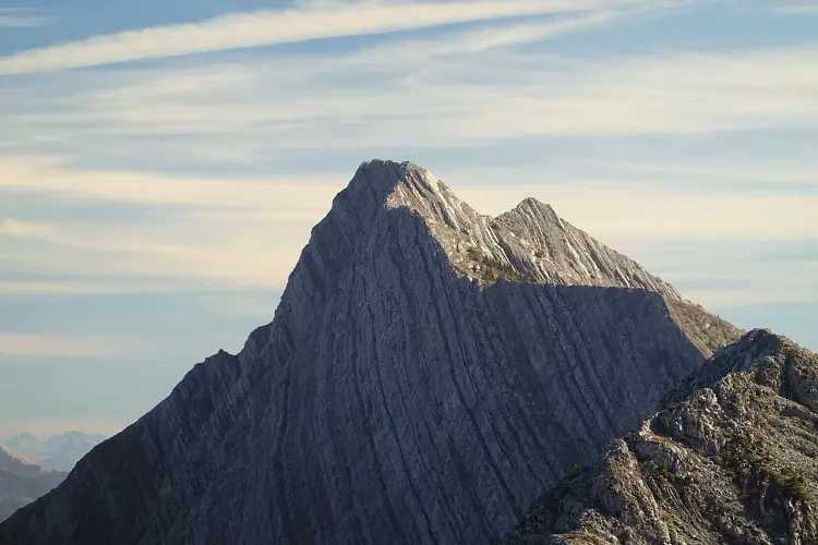
Most people probably haven’t heard of Gaff Peak, a high point that sits on the northern part of Erickson Ridge north of the Crowsnest area. While you can access the peak by going up Mount Erickson first and then doing an ultra-long plod along Erickson Ridge, a quicker way to get to Gaff is from the Grave Creek Road to the north.
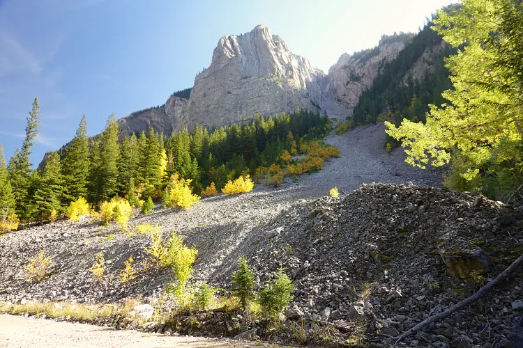
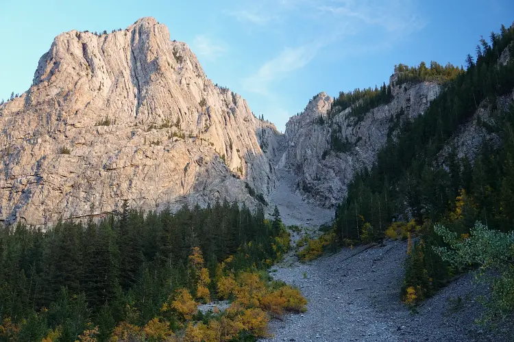
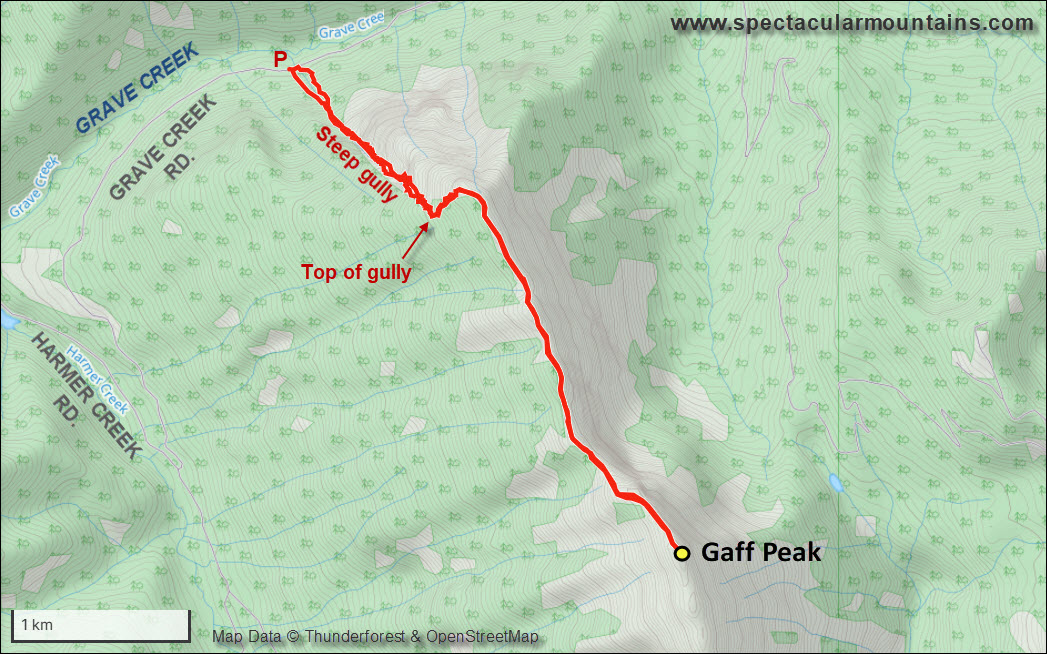
This was the first destination of my 3-day getaway to the Elkford area in late September, for which my main goal was to climb Mount Secord and Mount Domke in the Highrock Range. It took me almost 4 hours to drive from Calgary via Sparwood to the Line Creek Rd turnoff, then south along the Grave Lake Rd and Harmer Rd, eventually turning east to drive up the Grave Creek Rd. I parked right where an obvious rubble drainage spills onto the road from the right – the northern terminus of the ridge. No stopping is permitted along this section of road in winter due to avalanche risk, but you wouldn’t want to climb this route in winter anyway!
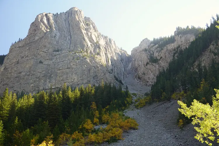
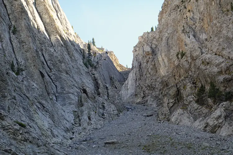
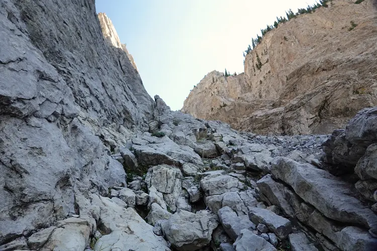
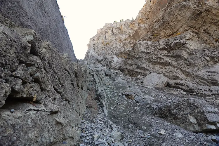
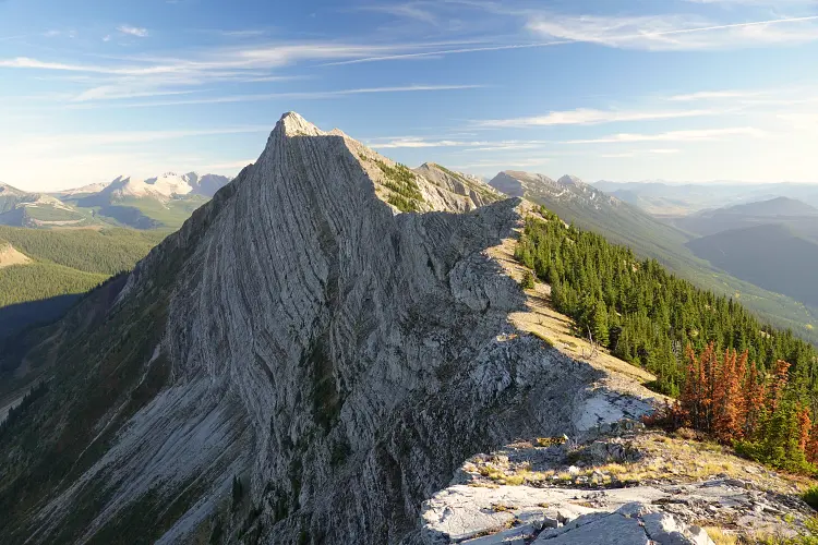
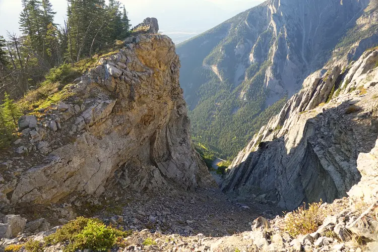
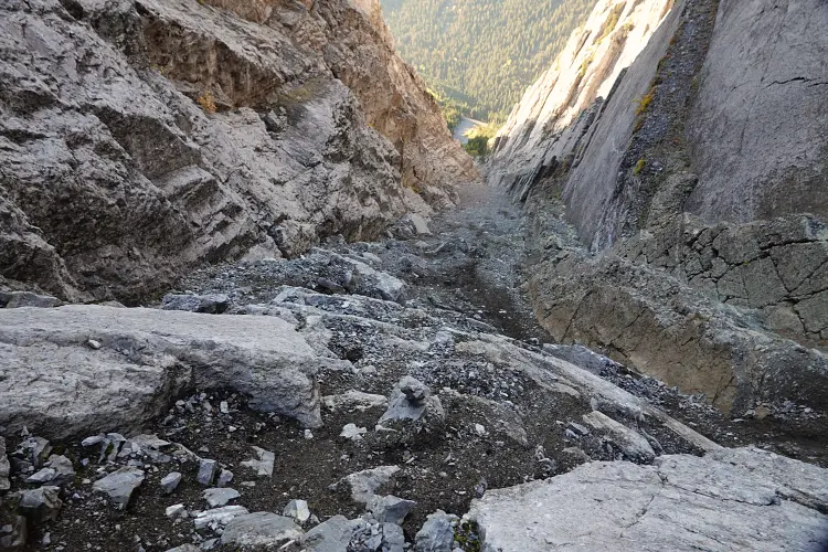
The approach on this route is a tough one: the rubbly drainage rises for more than 500 elevation meters straight up and narrows into a canyon-like gully higher up with steep walls on either side and tons of loose debris and chockstones. This is one where you’d definitely NEVER want to have anyone else below you as rocks are bound to start bouncing down on both ascent and descent – that’s how horribly loose the rubble is. I slowly worked my way up, using bits of hardened dirt and larger, more stable rock chunks for traction. In the upper part I had to zig-zag around some huge chockstones that at first glance seemed to bar any further progress. It’s no more than moderate scrambling here, but the danger of rock fall is considerable (helmet is a must, protective gloves very helpful).
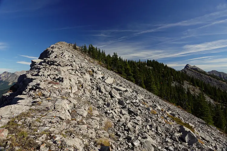
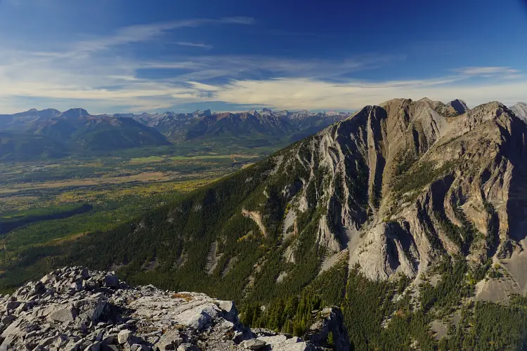
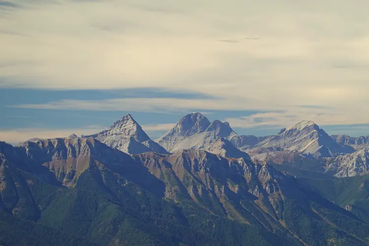
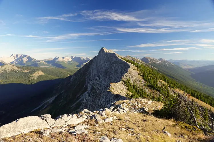
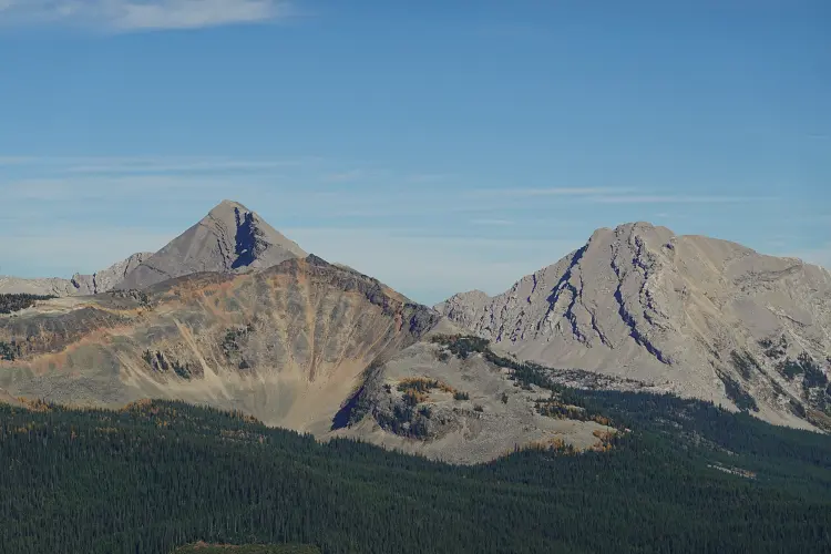
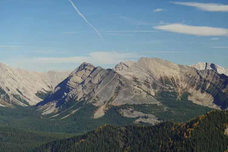
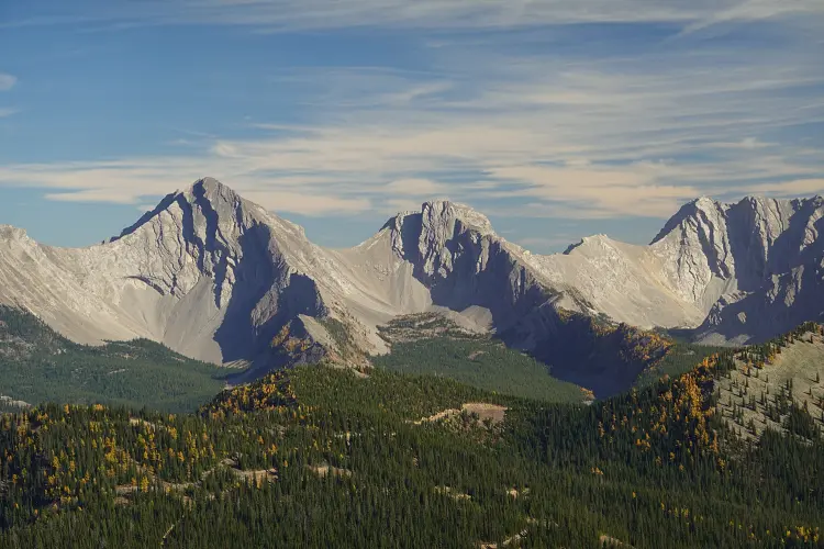
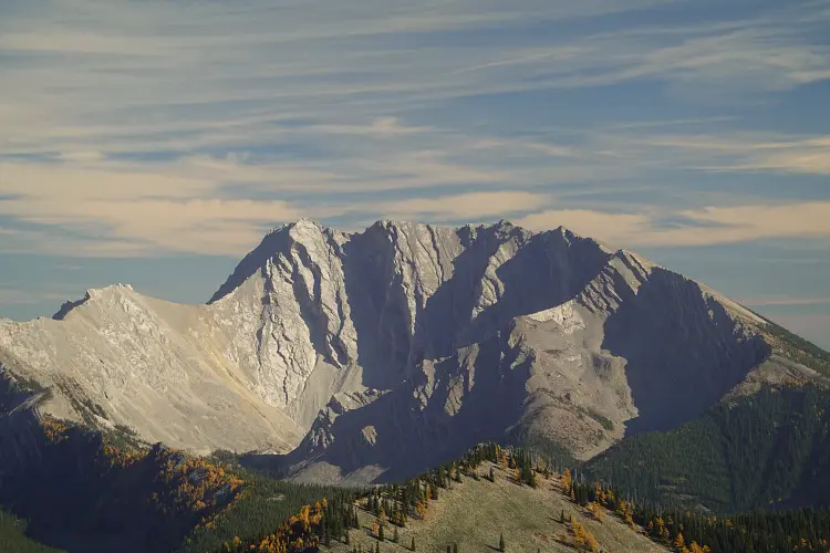
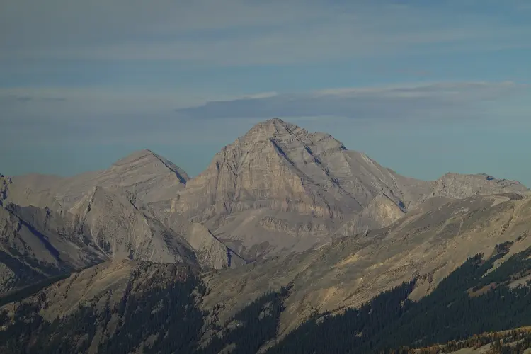
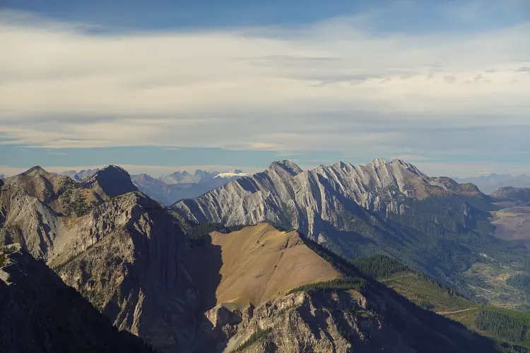
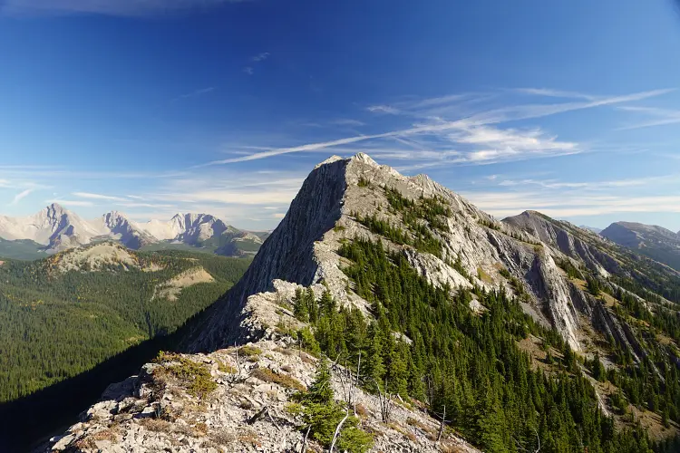
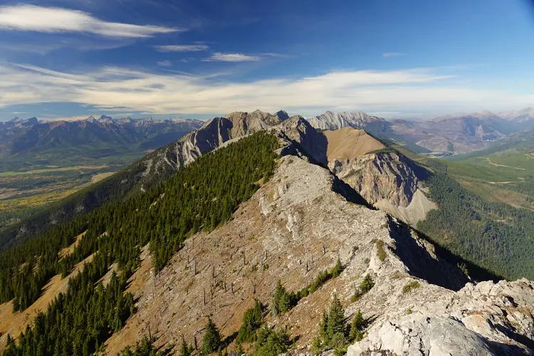
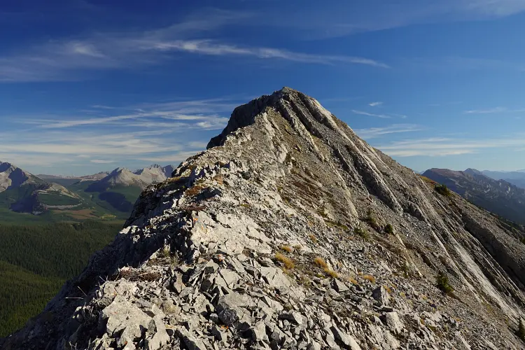
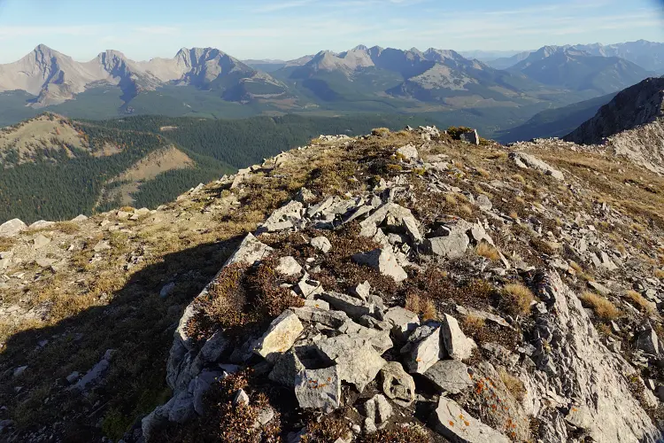
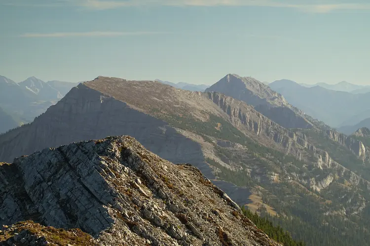
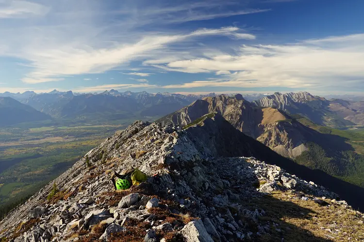
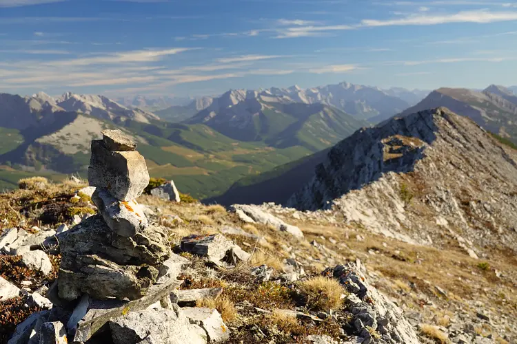
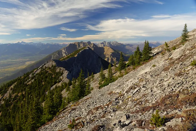
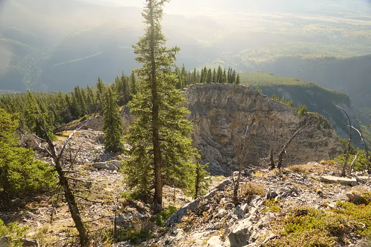
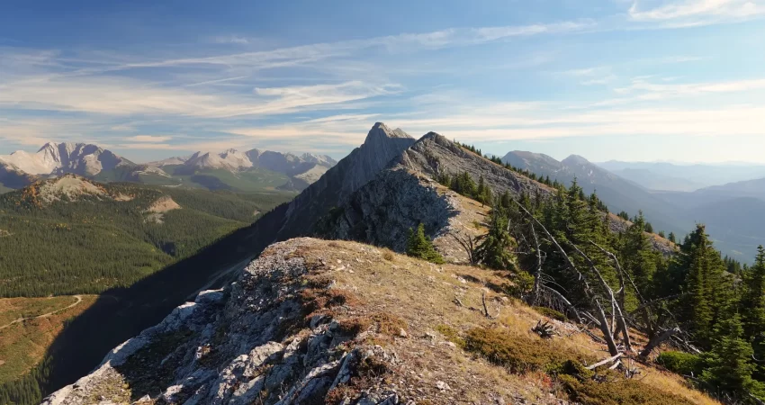
At the top of the gully much easier terrain awaits. I hiked through light forest to the top of the ridge where beautiful views of the High Rock Range and the Crown to the west opened up. Sheep Mountain lies immediately to the north and the perspective from up here is really unique. The summit of Gaff Peak is about 3 km south of here and I thoroughly enjoyed the long walk along the undulating ridge. A few easy scramble steps here and there, other than that it was just a hike that takes advantage of good sheep trails on the ridge crest or just off it on the west side.
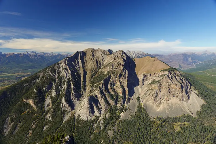
The east side of the ridge is surprisingly steep, a near-vertical drop of a few hundred metres. I initially thought of accessing Gaff Peak via the east side but it didn’t look easily accessible from up here. After a few ups and downs along the ridge I trudged up to the broad summit with a diminutive cairn (no register) at the top.
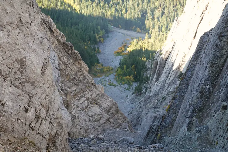
My return was pretty fast, although I really had to take my time in the upper part of the gully. I kept dislodging rocks that made a hell of a noise as they tumbled down the chute, creating an eerie echo off the steep containing walls. In the lower part where the gully opened up I left the rubble as soon as I could and hiked down mossy forest on the right side, which was much easier on the feet and would certainly be preferable on ascent as well.
I got back to my van just before 7 PM with enough time left to drive higher up the road as far as I could and found a perfect car camping site near my planned route for Mount Secord and Mount Domke the next day.
|
Elevation: |
2494 m |
|
Elevation gain: |
1270 m |
|
Time: |
5.0 h |
|
Distance: |
9.1 km |
|
Difficulty level: |
Moderate (Kane), T4 (SAC) |
|
Comments: |
Serious danger of rock fall in ascent gully! |
|
Reference: |
No info was available to me prior to trip |
|
Personal rating: |
4 (out of 5) |
NOTE: This GPX track is for personal use only. Commercial use/re-use or publication of this track on printed or digital media including but not limited to platforms, apps and websites such as AllTrails, Gaia, and OSM, requires written permission.
DISCLAIMER: Use at your own risk for general guidance only! Do not follow this GPX track blindly but use your own judgement in assessing terrain and choosing the safest route. Please read the full disclaimer here.