Ghost, AB, Canada
29 July 2023
With Adam
Fantastic outing with Adam to a rarely climbed front range peak in the Ghost. We had some info from David P. Jones’s guidbook (Rockies Central) who had climbed it with Rick Collier in adverse conditions years ago, plus Vern’s latest trip report from February 2023 (yes, a bold winter ascent, and an eventful one at that!) which is a great resource even if we chose to use a slightly different route in the end.
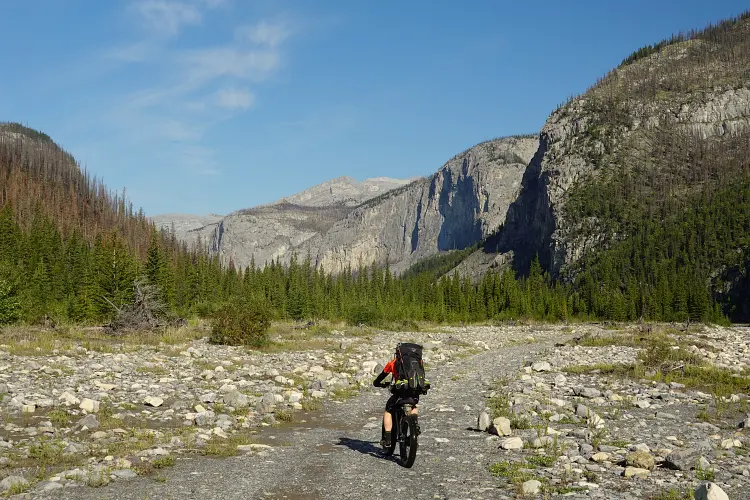
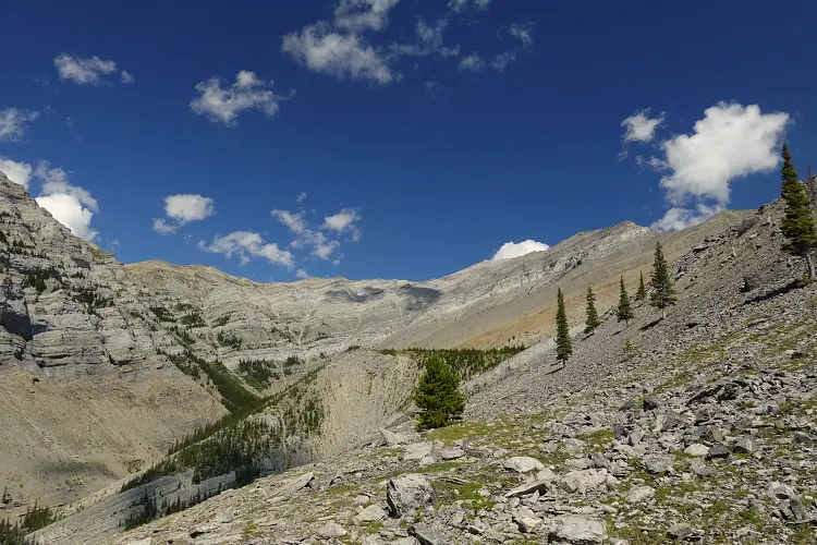
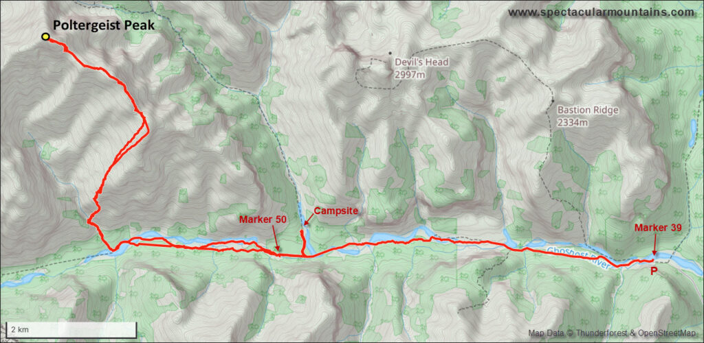
Adam braved all the crossings of the Ghost River with his rugged truck all the way to marker 39, which is as far as motorized traffic can go in the summer. We continued by bike, counting at least 7 additional river crossings until we got to the end of the maintained track/cutline. There are plenty of camping opportunities along the way and we chose a really nice one just a couple hundred metres off to the north that Trevor and I had come across on our way to Astral Peak as our camp where dropped our overnight gear. Since Poltergeist is quite a ways in, it makes sense to do this as an overnight trip combining it with an objective nearby (e.g. Phantom Crag, Devil’s Head, Orient Point, Bastion Ridge).
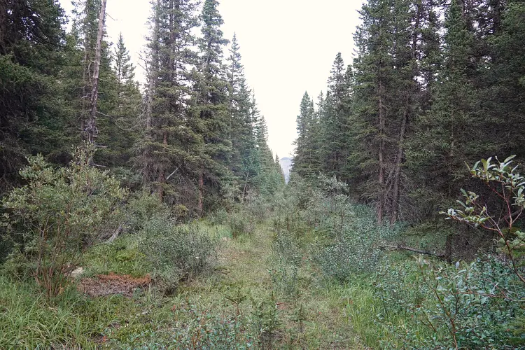
The trial beyond the OHV track is seldom travelled and very faint. Although it follows the old cutline that was made decades ago for seismic surveys, that cutline is mostly overgrown and washed out today where it crosses the river bed in several places. After several hours of biking and hiking, we reached the start of the drainage that comes off the SW side of Poltergeist Peak.
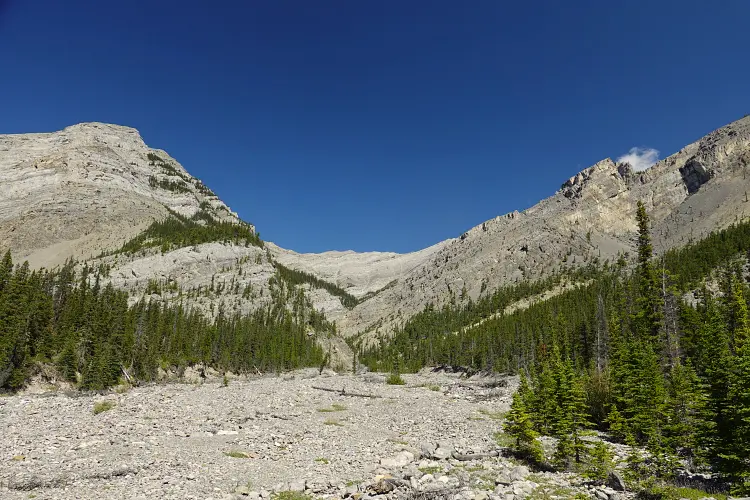
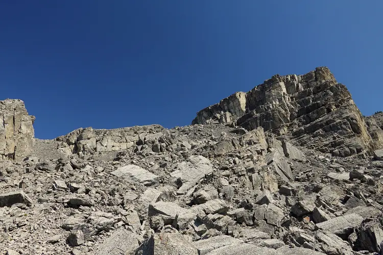
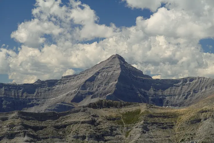
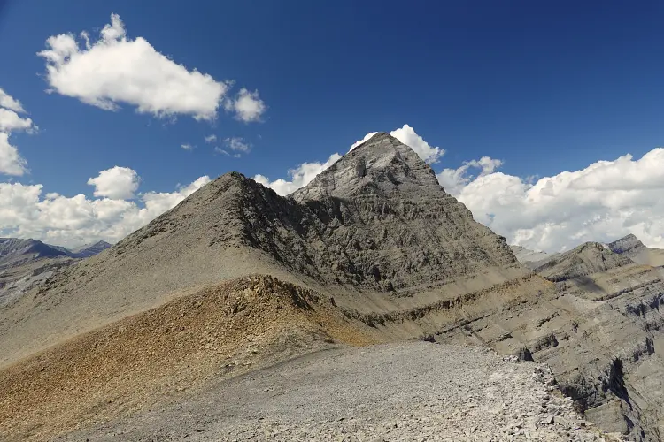
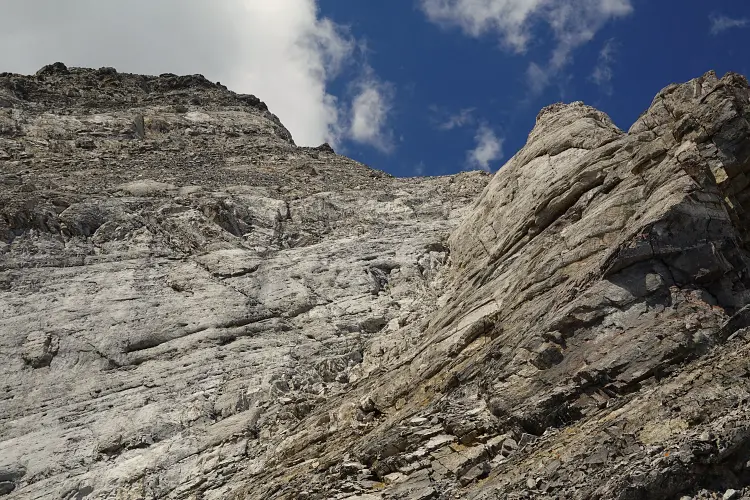
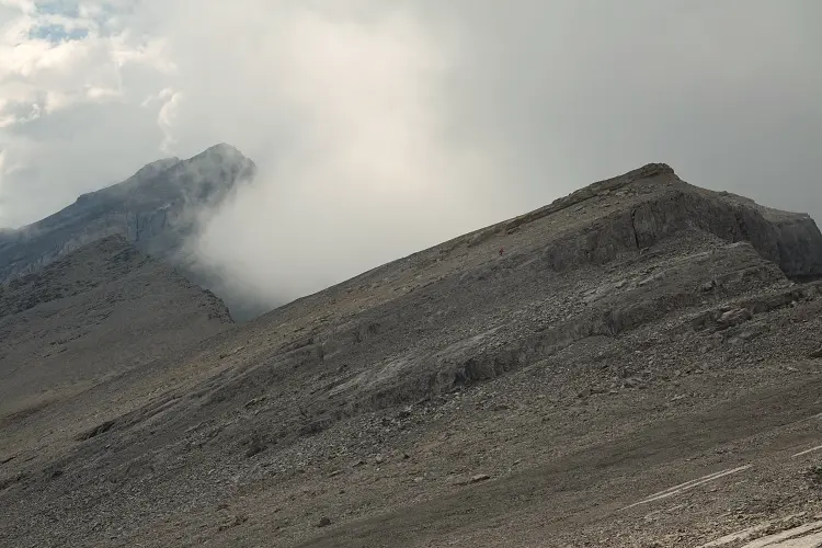
We changed out our wet river crossing sneakers to sturdy mountain boots and trudged up the rubbly drainage until we reached the entrance to a small valley encircled by a horseshoe-shaped ridge with Poltergeist Peak on the far north side. The steep slopes to the right looked inviting, so we went straight up – a mix of rubble and talus, with broken up cliffs to negotiate, which eventually led us to the south ridge, followed by along trudge up grass and rubble to gain the southeast ridge.
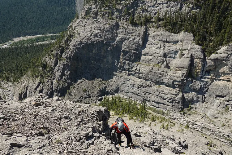
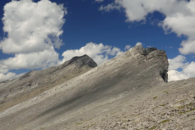
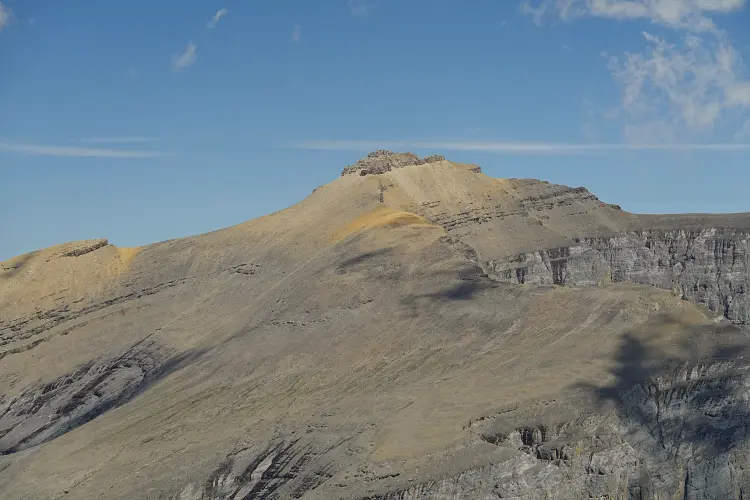
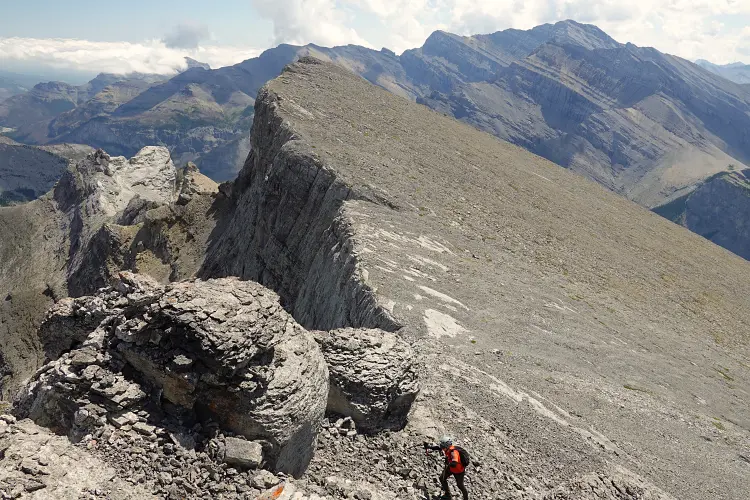
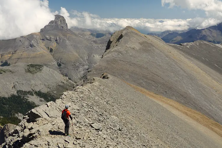
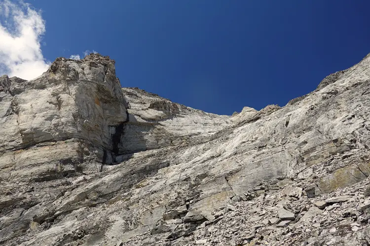
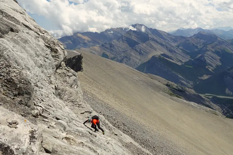
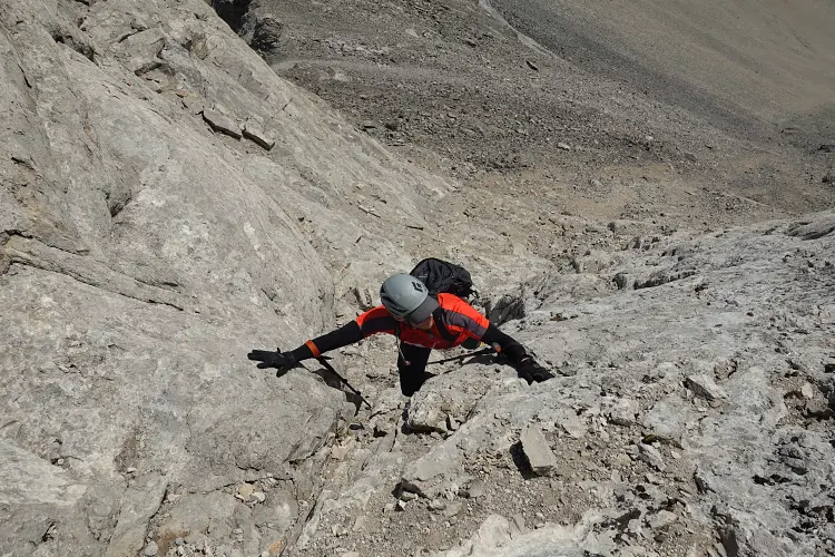
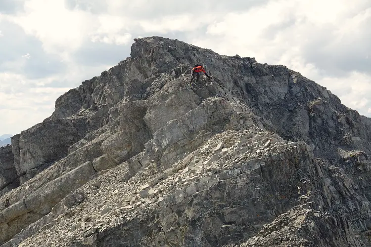
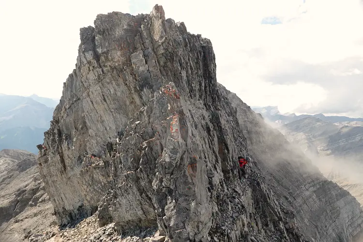
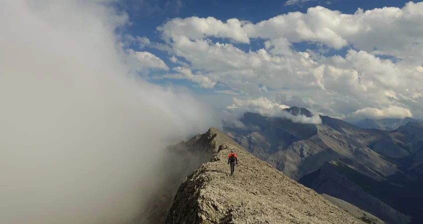
Now the real scrambling began. The remaining ridge presented several cliff bands that we scrambled straight up or bypassed on either side, with the finale waiting at the summit block. A huge light grey cliff band stands in the way here, but thankfully there is a chute that can be scrambled up (and down) just to the left of the ridge crest. It’s steep, but the rock is solid and the holds good. Past this obstacle, a second crux presents itself further up, this time composed of crumbly sandstone. We used narrow ledges on the right for some 10-15 metres before climbing back up the crest, although sidesloping around the left would’ve been easier (but more time-consuming). After tiptoeing another 100 m on the crumbly ridge we reached the highest point of Poltergeist Peak adorned by a small cairn. We were fully expecting a register left by either Jones/Collier or Vern’s party but found nothing… Without recalling exact dates, we left a little plastic canister and wrote down what we could remember. These registers are often a futile affair – it’s fun to see who’s been up a summit recently (or not), but often the canisters don’t last very long and some folks of course don’t bother putting in their names. Only hardcore metal registers, like Ephraim Roberts‘s ammo boxes, seem to stand the test of time…
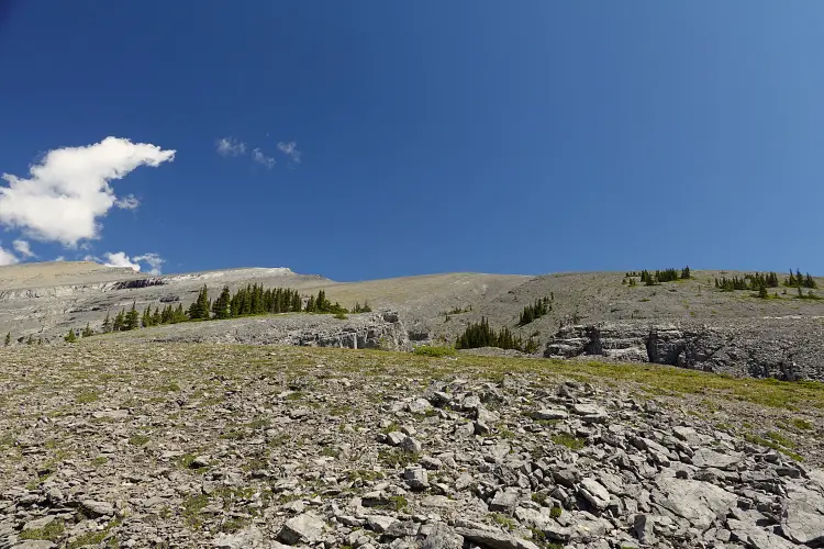
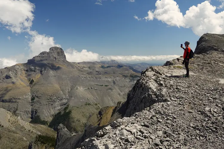
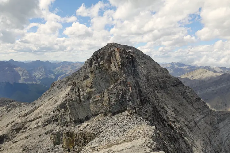
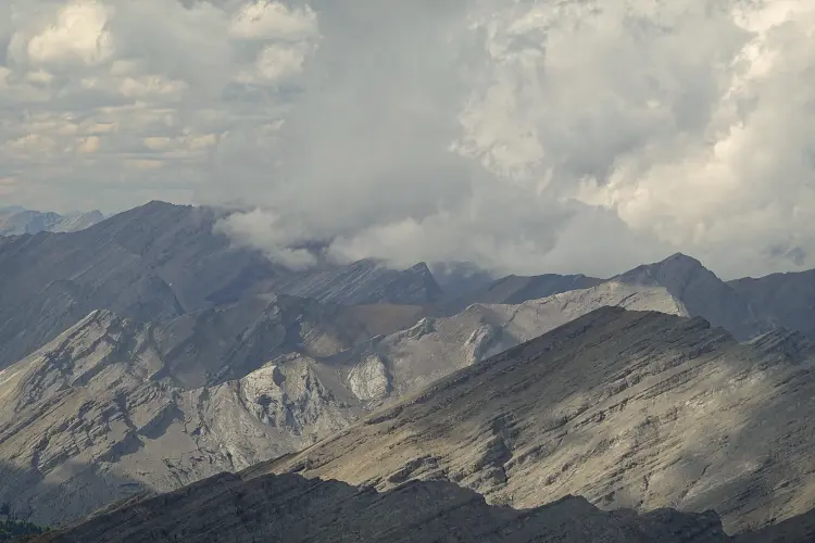
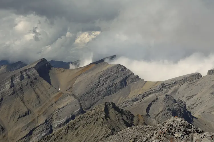
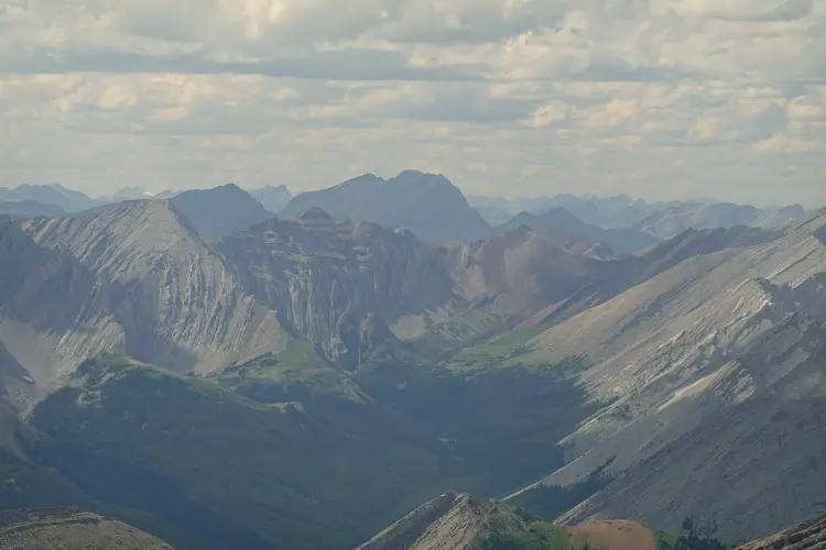
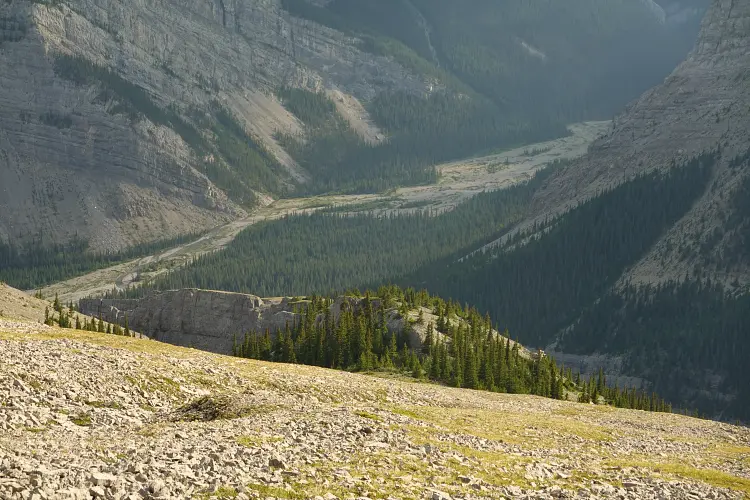
The summit grants sweeping views over a huge part of the Ghost, the Fairholme Range to the south, and Banff National Park to the west. After a much-deserved break we headed back down the same way we came up. The two cruxes were actually easier than we expected, but care was still required on the upper crumbly part of the ridge. When we got back to camp we were actually quite glad the day was over without having to spend another couple of hours riding our bikes through the river back to the car and then driving back to the city.
This is not a small objective and it’s fairly remote, and it’s not to be underestimated despite being on the easy to moderate scrambling difficulty scale. A very memorable trip and big thanks to Adam for tackling this with me! See his impressions here.
NOTE: This GPX track is for personal use only. Commercial use/re-use or publication of this track on printed or digital media including but not limited to platforms, apps and websites such as AllTrails, Gaia, and OSM, requires written permission.
DISCLAIMER: Use at your own risk for general guidance only! Do not follow this GPX track blindly but use your own judgement in assessing terrain and choosing the safest route. Please read the full disclaimer here.