High Rock Range, AB, Canada
5 September 2021
With Vern
A new route up a rarely ascended peak on the Continental Divide
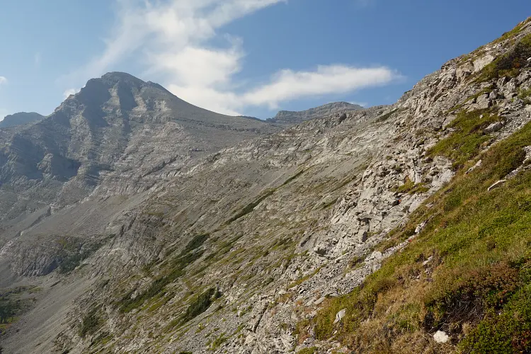
We had no idea what to expect from Mount Scrimger, a prominent but rarely ascended peak straddling the AB-BC boundary on the Continental Divide. It is named after General Scrimger, who hailed from Quebec and fought in the Second World War. There is not much info out there on how to climb the mountain other than the famous Rick Collier’s report, which describes some very difficult terrain on the north side of the summit block.
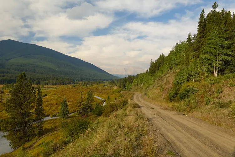
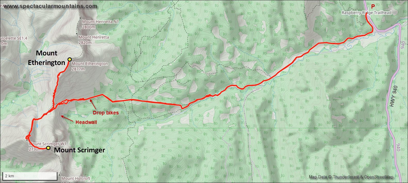
Neither Vern nor I had done the approach to the Etherington-Scrimger col before and we were pleasantly surprised how well it went. We started out at the gated Lost Mine logging road on highway 940 (Forestry Trunk Rd), the same trailhead for Raspberry Ridge or the west approach for Mount Farquhar. Biking in along the various logging roads and snowmobiling tracks was a blast and generally very efficient as these tracks are all maintained. There was only one short boggy section and the two bridges over Cataract Creek were both in great shape, leaving our feet dry on the approach. The bike ride was fun and fast and took us almost directly to the base of the col! To be honest, if it wasn’t for Vern pushing me a bit I probably would’ve dropped my bike sooner, just before the last steep rise where the trail is much more bumpy and single-track.
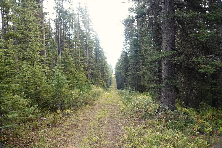
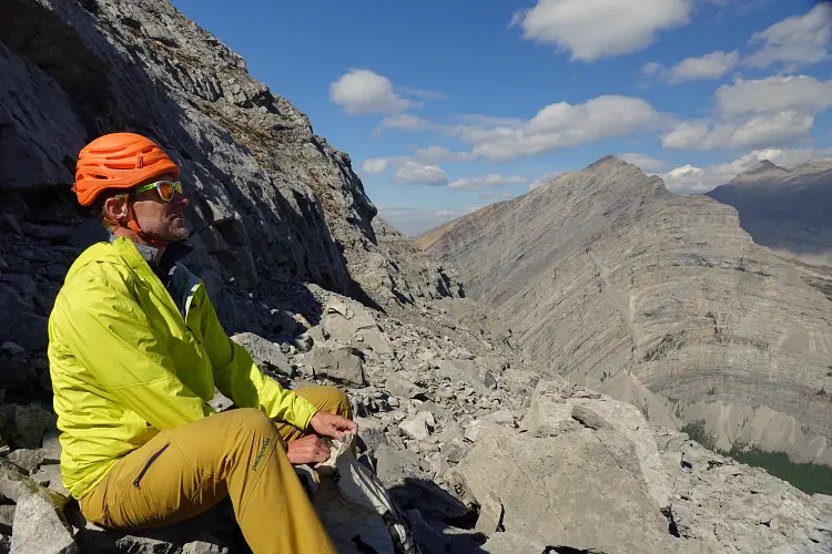
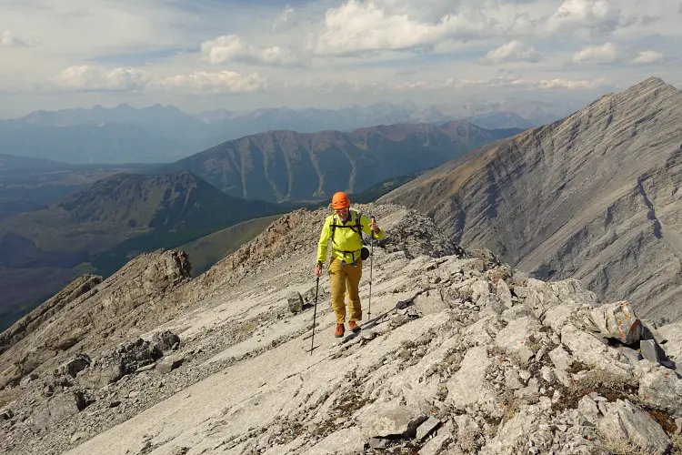
The last stretch of the approach is on an old seismic line that was basically drawn with a ruler from east to west right to the end of the forest. At the first big washout we dropped our bikes and continued on foot, easily making our way up to the broad col. Vern took a more direct but steeper route while I made a steadily rising traverse around the right side – either route worked just fine. The one annoying thing that would follow us around for the whole day was the strong wind. Before we even reached the top of the col the gusts were so strong they blew off Vern’s sun glasses at one point and made us put on extra layers. Of course the winds only got stronger one we were fully exposed on the wide saddle.
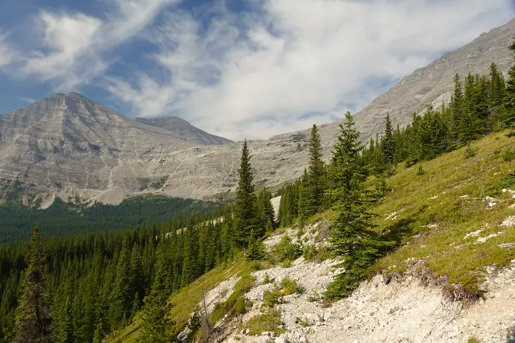
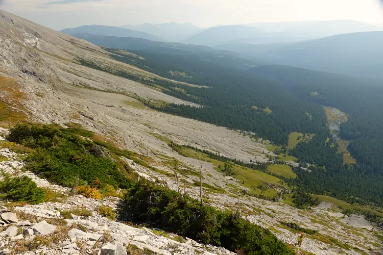
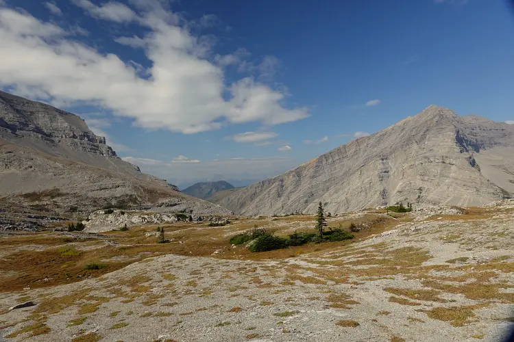
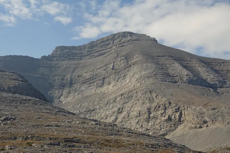
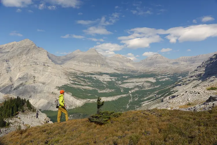
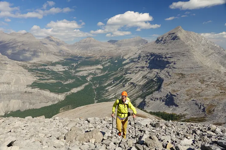
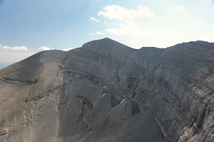
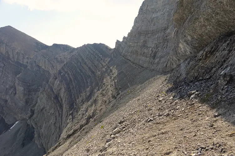
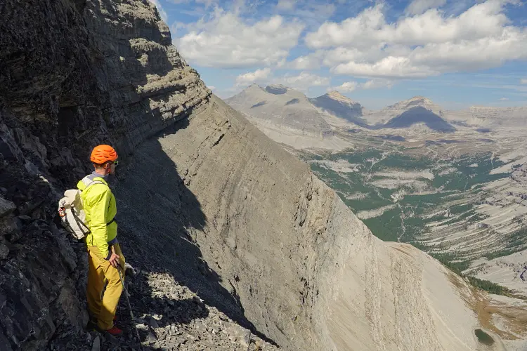
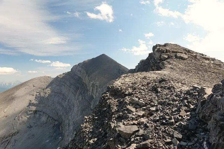
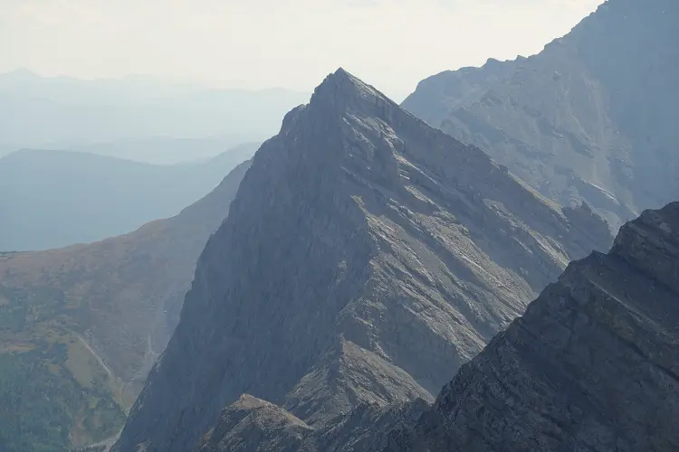
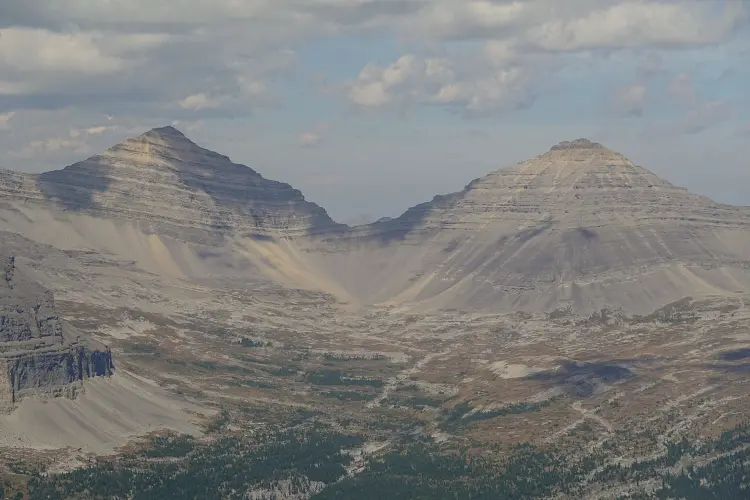
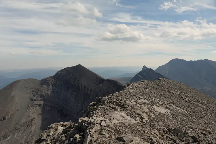
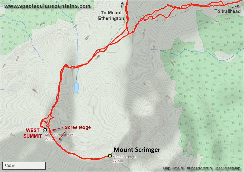
This is an absolutely beautiful place! Gentle meadows interspersed with rock ribs and the odd stand of spruce, overlooking Henretta Creek to the west and the vast alpine basin between Courcelette Peak, Mount Cornwell and Mount Etherington to the north. We took a short break and studied the broad Scrimger massif which consists of two separate summit blocks: the official summit on the Divide to the east and a sub-peak of about the same height to the west. Knowing what difficulties Rick Collier encountered on the obvious north ridge leading to the official summit, we were keen to scope out a different route… and we did. I remember looking up to the west peak and spotting an easily accessible, N-S running scree ledge that might connect up with the col between the two peaks. Vern immediately agreed to try it out and we were both excited to see that not only did it work, it also was no more than moderate scrambling. After crossing the meadows and easily scrambling up the rib that comes off the north side of the west peak (sounds confusing but the map below should make it a lot clearer!), about three quarters of the way up we turned south onto the scree ledge which we followed all the way to the col. The ledge sits between vertical cliffs above and below so there is some exposure in places and the scree can be unstable, but it wasn’t too bad and faint goat tracks here and there gave us some reassurance that it would work. An added bonus was that we were completely wind-sheltered along the traverse.
Once at the col, it was a simple and short hike up a gently angled slope to the east peak, the official summit of Mount Scrimger at 2888 m. There was a cairn but we couldn’t find the original register that Rick’s party would’ve left behind.
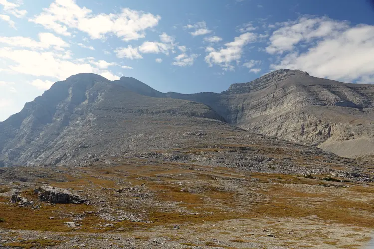
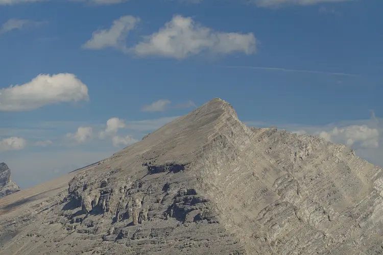
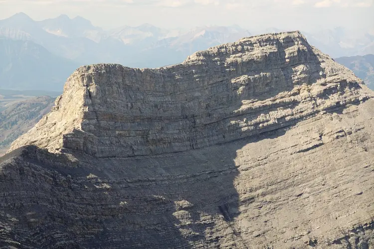
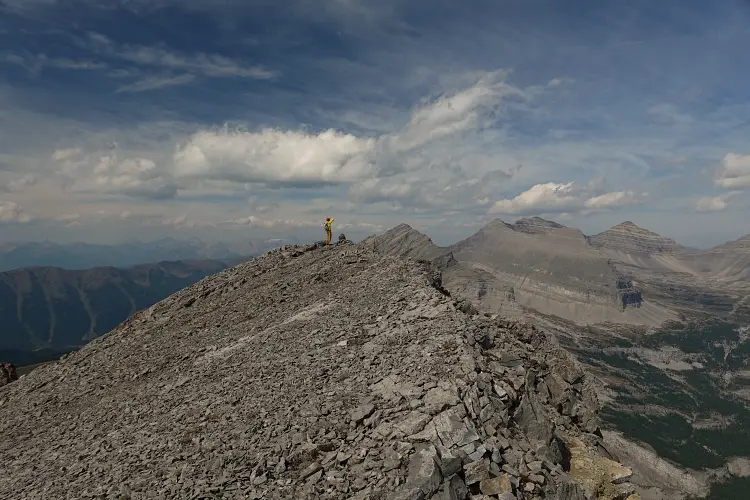
We almost didn’t do it, but on return after completing the ledge traverse again we decided to make a quick detour and climb up the west summit as well. We found a small cairn at its summit and briefly chatted about how it seemed almost of equal elevation to the official summit… Now that I have my GPS stats at home I can confirm that the west peak actually seems to be higher, but only by about 1 m! Typical for many mountains in this area, the panorama includes everything from craggy and dramatic limestone peaks north and south to sweeping views over the foothills to the east to the ungainly sight of several coal mines to the west in BC.
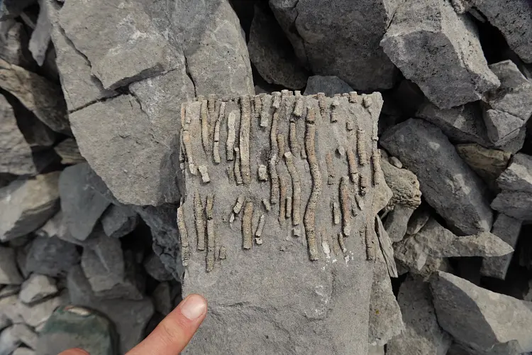
On the way back down to the Etherington-Scrimger col we took a short break when Vern stumbled upon a really interesting piece of rock: a small chunk with a colony of string-like corals preserved in situ, probably of Mississippian age (about 350 million years old) – see photo below. Corals are common in many formations of the Rockies of course, but to see such a well-preserved example is rare.
Back at the col we set our eyes to our second objective of the day: Mount Etherington. All in all I have to say I really enjoyed our Mount Scrimger trip (much more so than Etherington!). The approach is excellent, the landscape spectacular, and there are enough challenges to keep things interesting.
Be sure to check out Vern’s report for this trip!
|
Elevation: |
2753 m (Mount Scrimger) 2754 m (west summit of Mount Scrimger) 2870 m (Mount Etherington) |
|
Elevation gain: |
2170 m |
|
Time: |
11.0 h |
|
Distance: |
37.7 km (of which ca. 25 km by bike) |
|
Easy to moderate (Kane), T3-T4 (SAC) |
|
|
Activity: |
Hiking & scrambling |
|
Reference: |
Own routefinding |
|
Comments: |
Stats above are for both Scrimger & Etherington |
|
Personal rating: |
4 (out of 5) |
NOTE: This GPX track is for personal use only. Commercial use/re-use or publication of this track on printed or digital media including but not limited to platforms, apps and websites such as AllTrails, Gaia, and OSM, requires written permission.
DISCLAIMER: Use at your own risk for general guidance only! Do not follow this GPX track blindly but use your own judgement in assessing terrain and choosing the safest route. Please read the full disclaimer here.