Yoho National Park, BC, Canada
23 August 2025
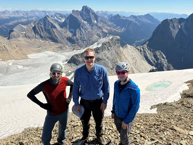
With Alan, Graeme, Katie and Darren
A big beautiful pile of rubble
When my friend Alan first suggested doing Mount Vaux together, I initially hesitated. From the description in Scrambles in the Rocky Mountains and the few but very helpful trip reports I had read (e.g. Vern’s, Haldan’s, and this one by Nick), I knew this mountain was notorious for endless heaps of loose rock and rubble. Yet I also knew the views from this lofty peak at over 3300 m elevation would be stellar, especially on a gorgeous bluebird day such as the one that was forecast. My inner peakbagger convinced me to go and I was glad I did! With Alan’s buddy Graeme, another super competent mountaineer, joining us we were the perfect team to tackle this beast – not too large of a group, but enough to support and entertain each other.
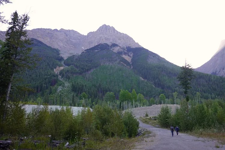
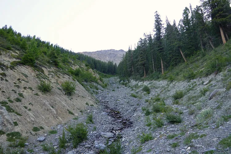
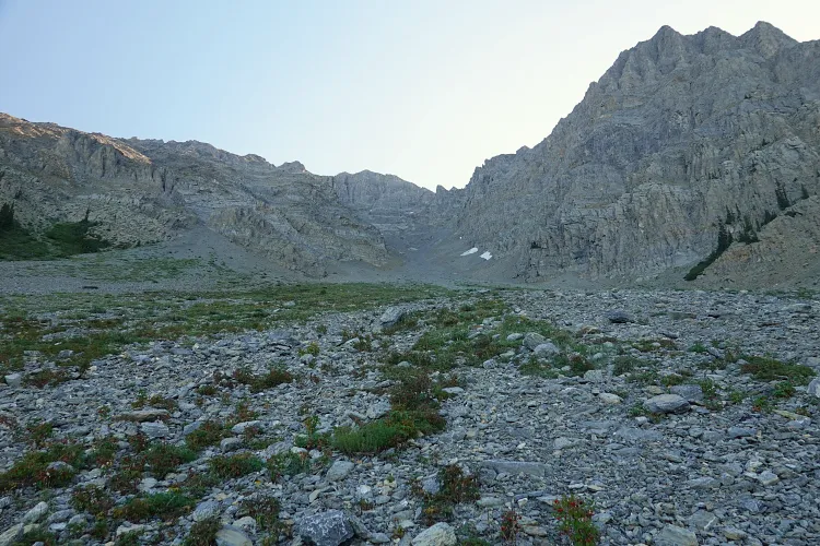
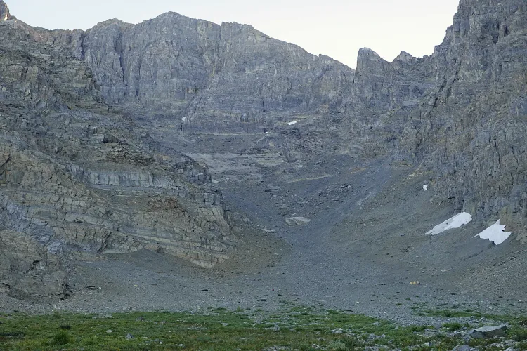
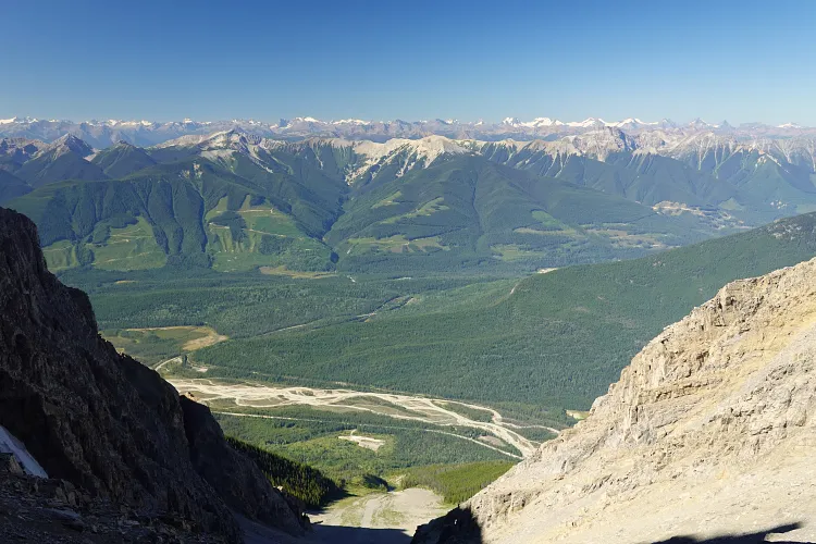
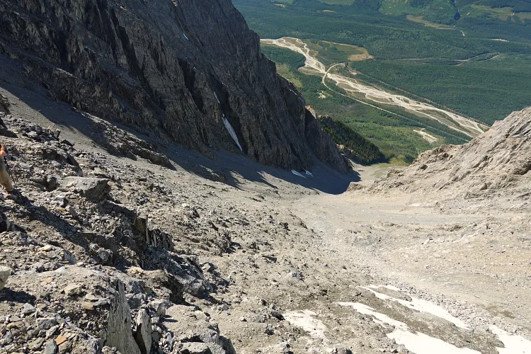
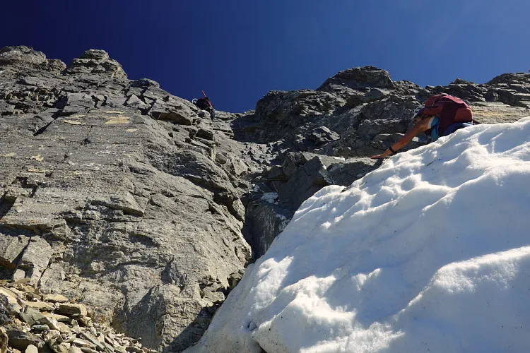
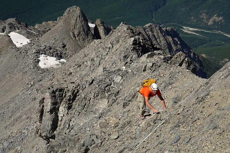
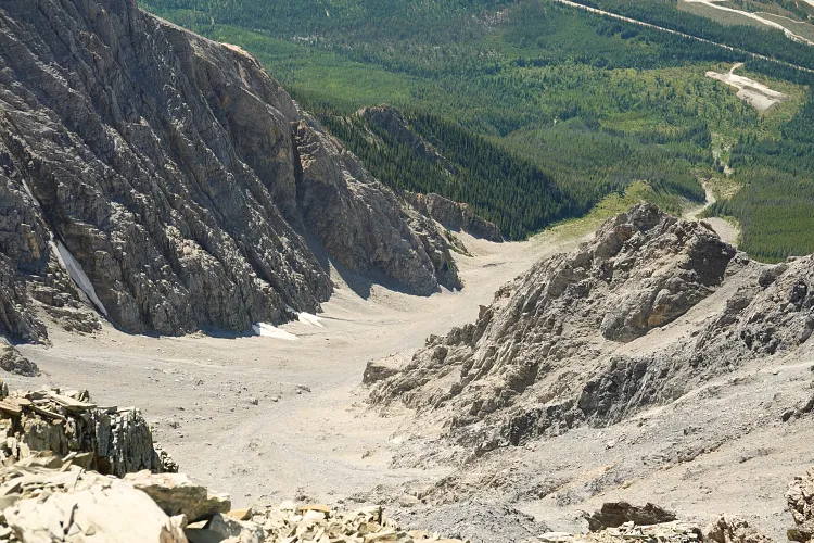
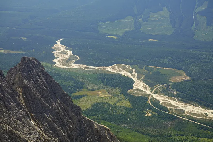
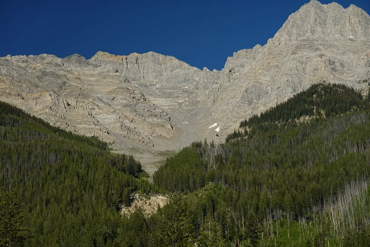
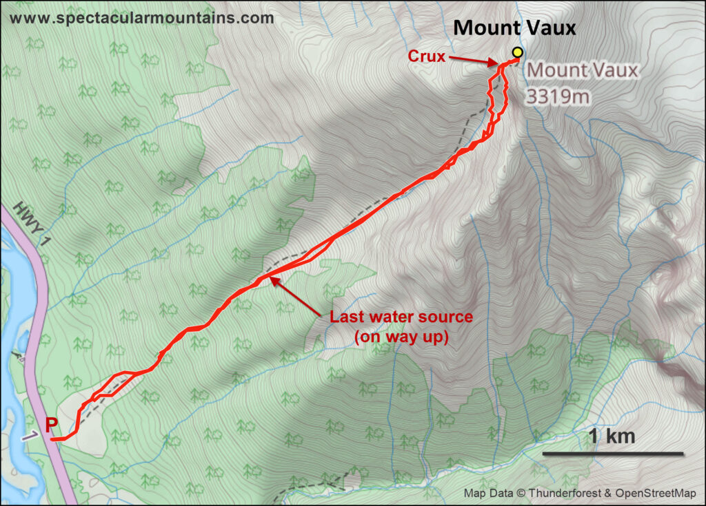
The “parking lot” at Mount Vaux’s trailhead is tiny, just about big enough for two cars. And surprise – there was a truck sitting there when we arrived, which initially raised some concerns among us. This is definitely a mountain where you do NOT want to have a group above you (or below you). The route up Mount Vaux is basically one giant drainage that is narrower and curving near the base, then changes into broad slopes of steep rubble higher up before ending at the summit block with a 15 m crux wall followed by some scrambling on loose terrain. The “danger zone” with steep rubbly slopes, where it becomes difficult if not impossible to avoid cascading boulders from above, starts about half way up the approach.
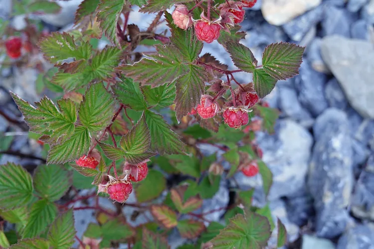
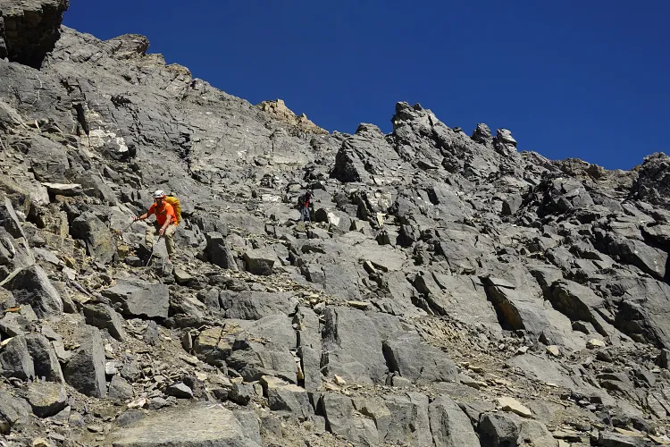
Alan and Graeme set a blistering pace as we worked our way through the shrubs and rubble of the lower avalanche slopes, then worked our way up the drainage and onto the broad slope that flattens out a bit. It was here, among small bushels of beautiful red wild raspberries that we spotted another party higher up the drainage. All three of us intuitively decided to forgo any breaks at this point and kick into high gear as we were trying to catch up with the party ahead of us. There is no way we wanted to be caught in a barrage of accidental rockfall from above, and the best course of action in this situation was to either let them go and keep a healthy distance, or move up and climb the rest of the route together.
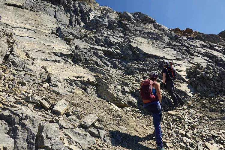
Thankfully, our new friends saw us too and slowed down to let us join them. It was Katie and Darren, two experienced scramblers, whom we’d never met before but who were so friendly and approachable that we instantly formed one solid team, climbing the rest of the mountain together. Not only was this safer, it was also more fun and entertaining as we chatted away and exchanged stories!
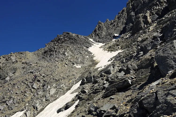
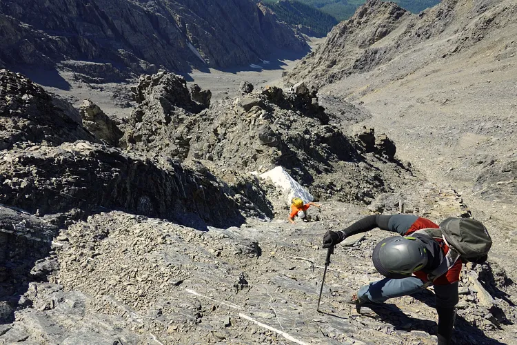
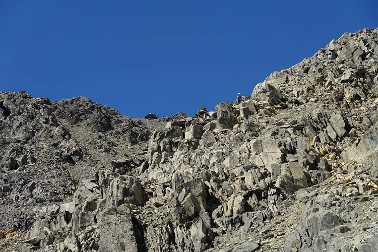
And it was just in time, as we were about to hit the horribly loose section of the upper drainage where rockfall was basically unavoidable. We spread out a bit, everyone picking their own line, and whenever a few of us grouped together we stuck very close to each other to prevent rocks from gaining momentum when we triggered some “shots”. There were a couple of old snow patches, but the snow was too hard to ascend safely. It was pretty much “pick your own poison” here.
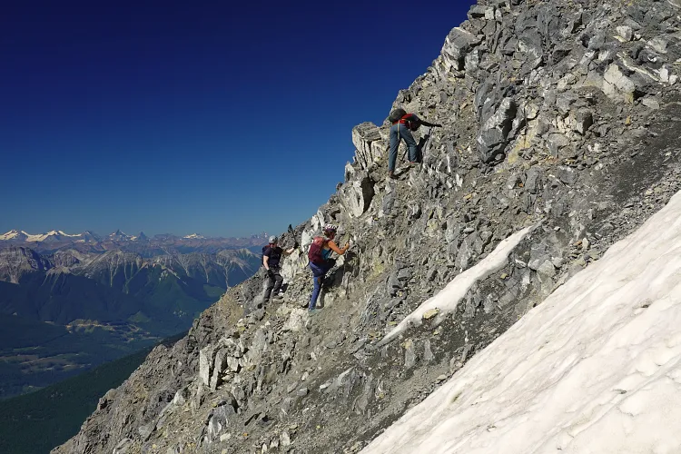
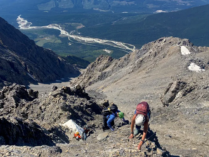
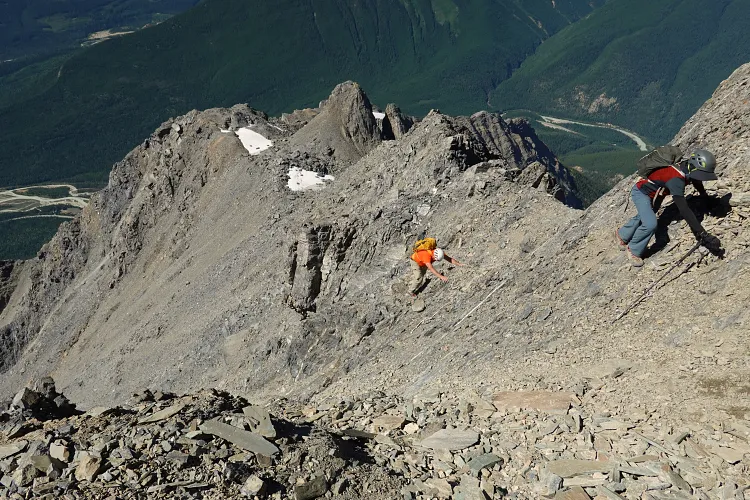
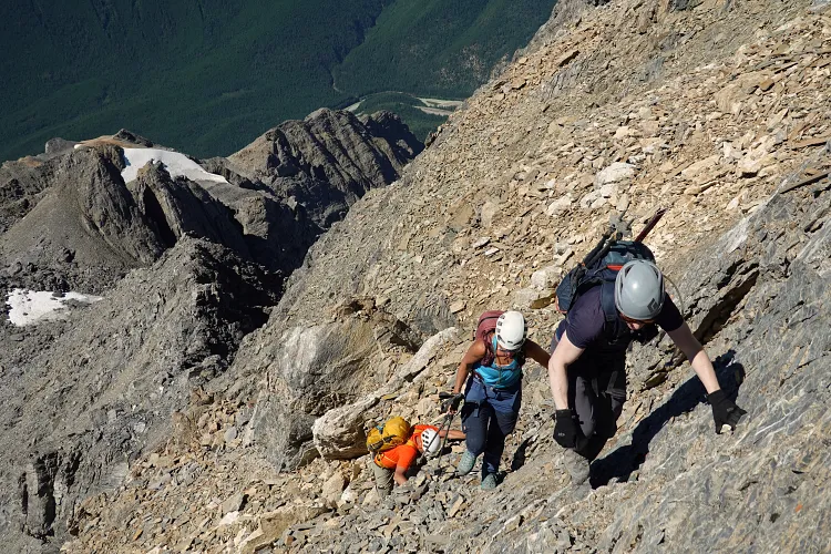
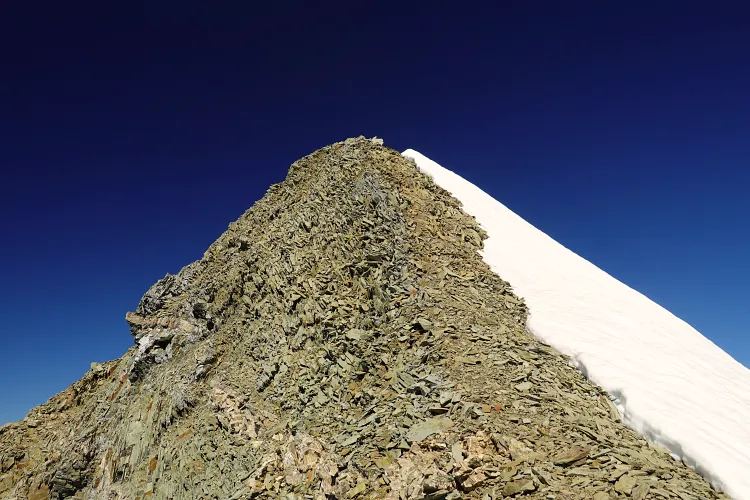
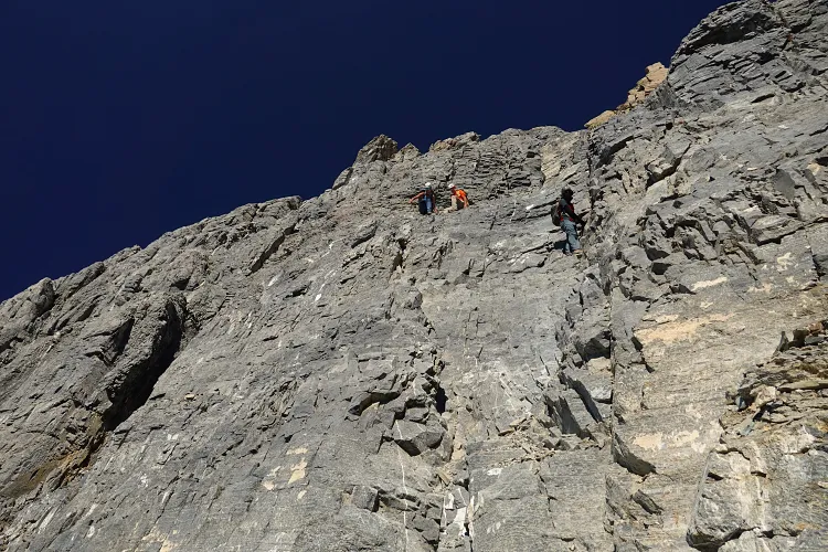
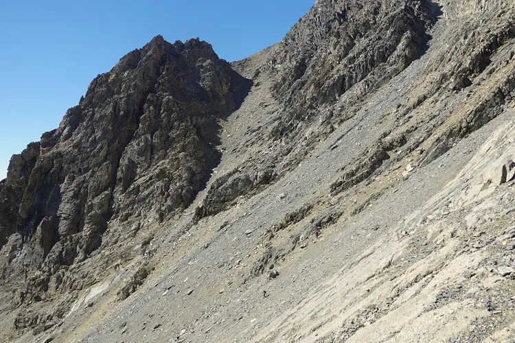
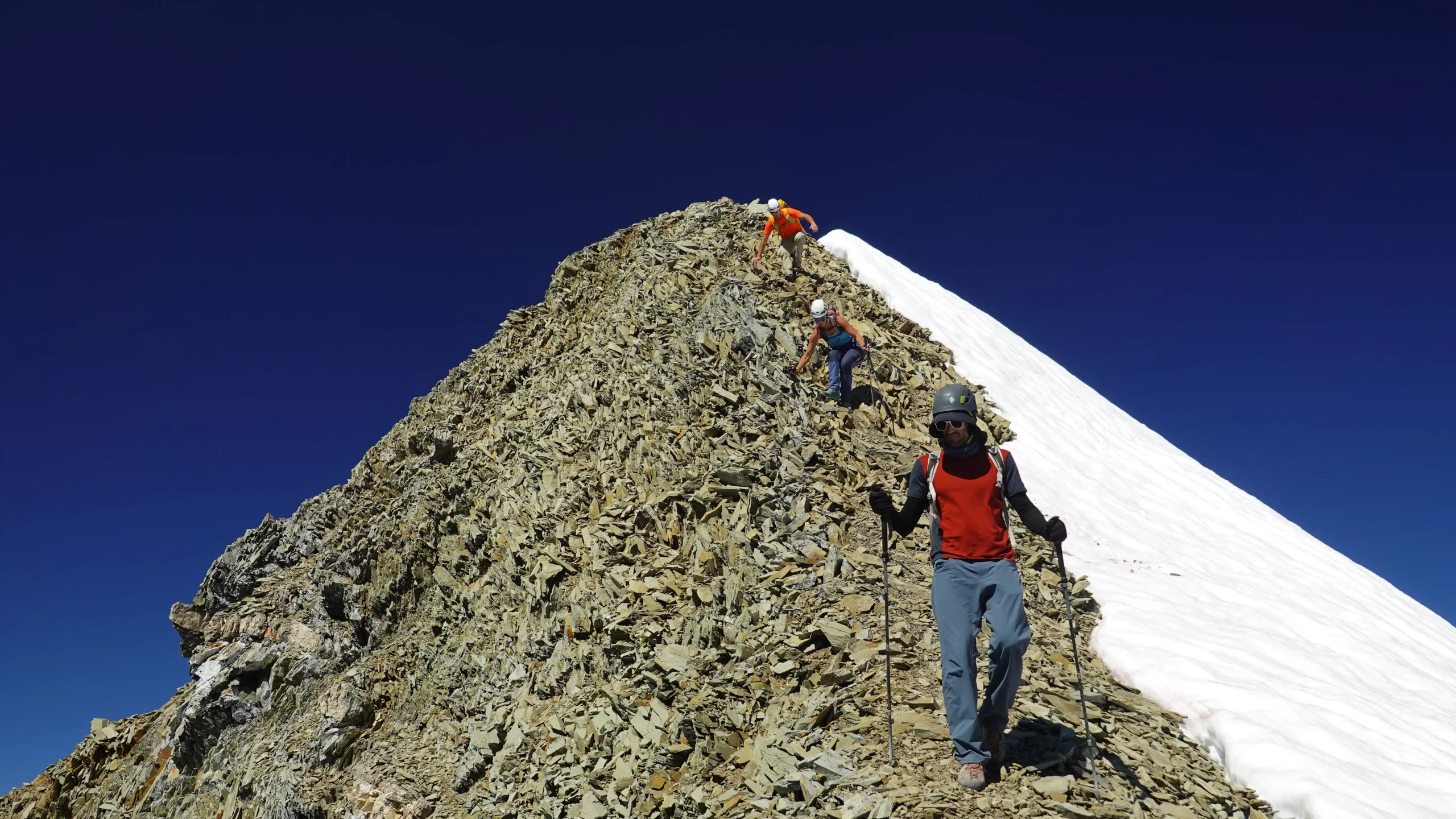
Eventually, we finished the rubble slog and arrived at the crux wall. As commented by previous parties, it looked worse than it really is. The rock here is fairly solid (though always test all holds!), and with the exception of a few short awkward moves, it’s mostly upper moderate to lower difficult scrambling. We all agreed that this was the most enjoyable part of the ascent. Above the crux, we had to diagonally climb higher across steep slopes filled with rubble, with the occasional cairn pointing the way. This stretch still required extreme caution with rockfall being the main hazard.
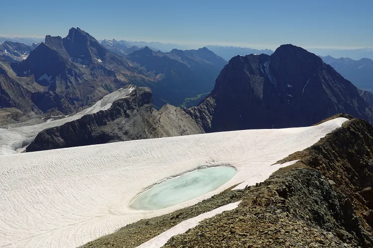
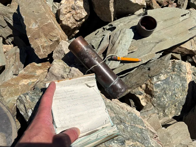
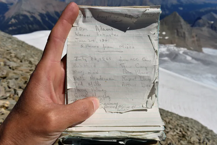
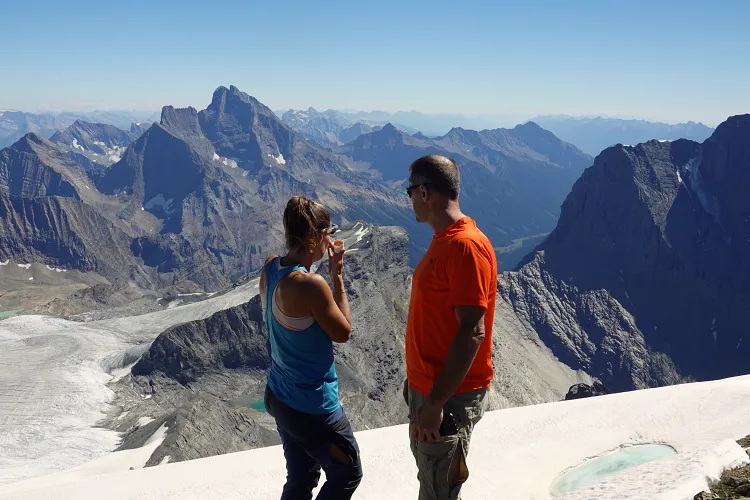
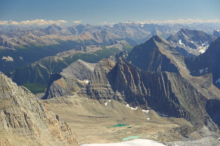
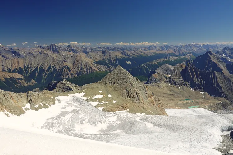
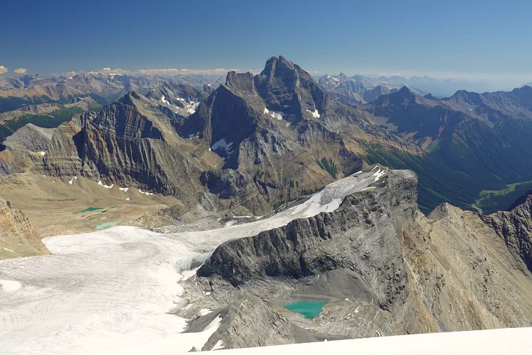
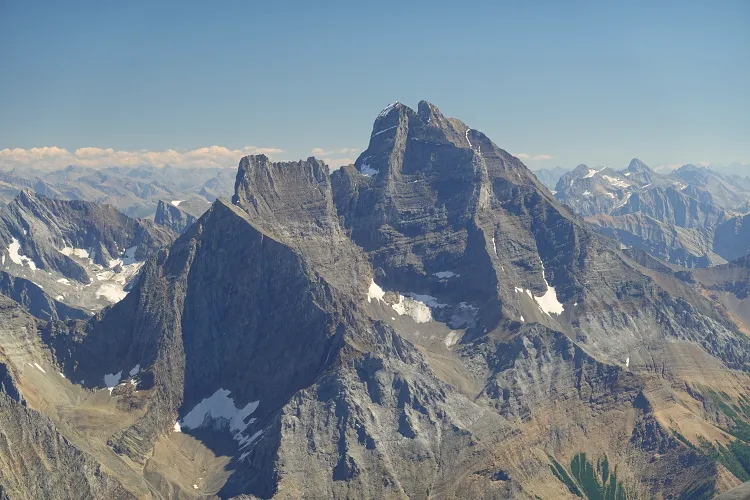
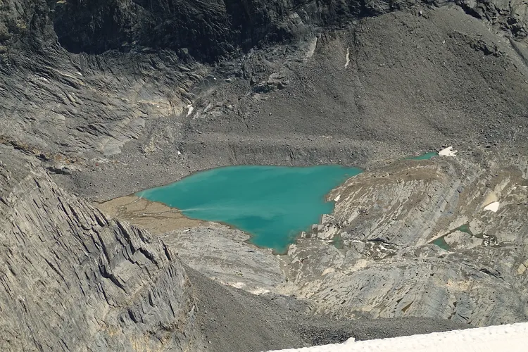
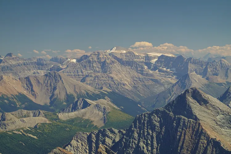
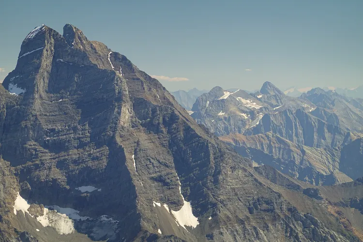
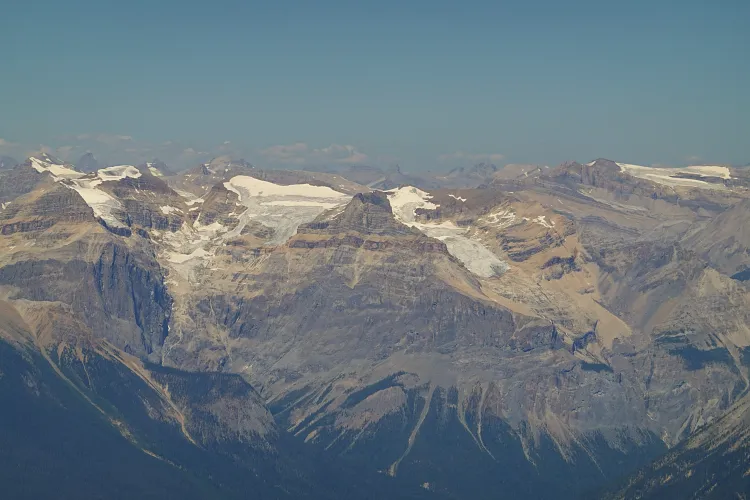
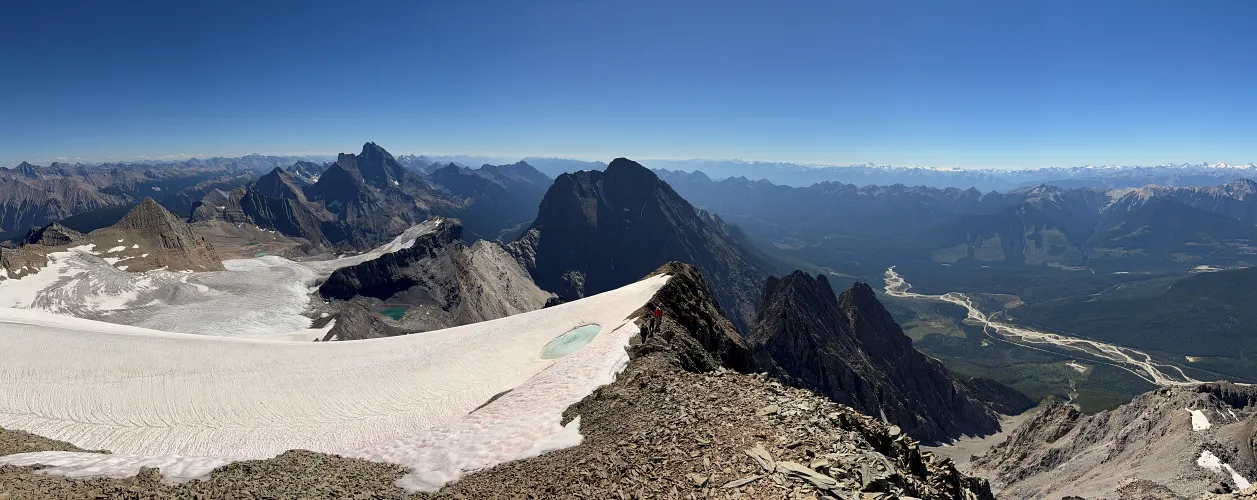
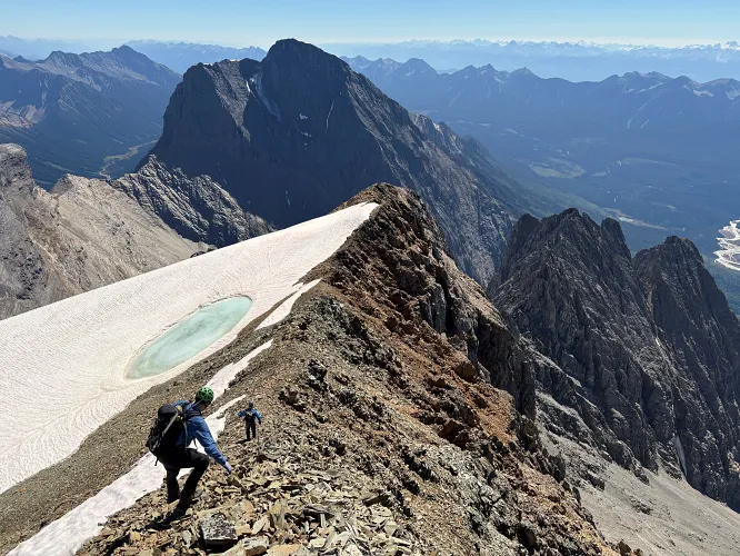
We topped out at the summit ridge with the most amazing vistas opening up in front of us: bright white glaciers, turquoise-blue lakes, and a sea of brown and black mountains filling the horizon as far as the eye could see. What a massive wow-effect! And the summit was now within reach, a short trudge on the rubbly but easy ridge crest. The old copper register tucked away in the summit cairn had us all excited (I’ve only ever seen a copper register on Mount Potts in Kananaskis), especially since it contained the original booklet with the 1961 entry by the first ascent party!
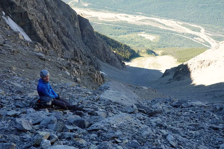
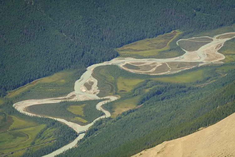
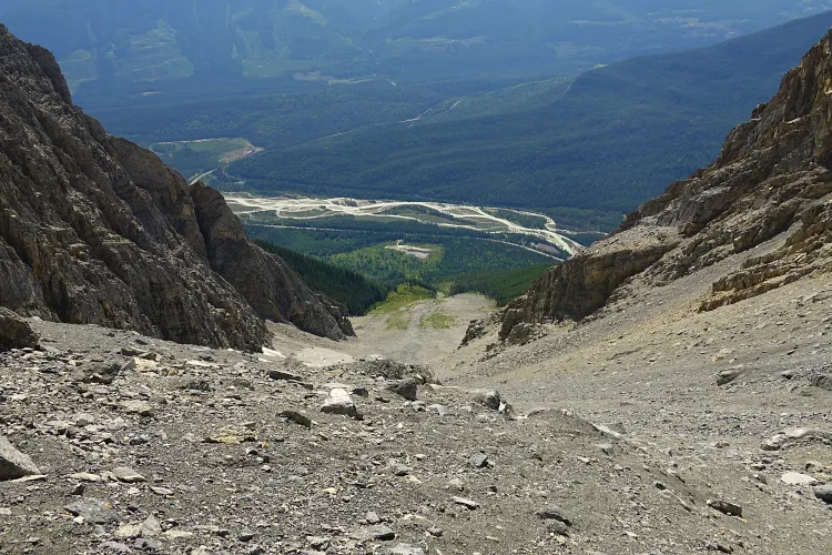
It was calm, sunny, and hot – a rare phenomenon on a lofty peak in the Rockies, and we only reluctantly embarked on the descent after a long summit break. The crux wasn’t much harder on the way down as we knew what to expect and simply took our time finding the best holds. The steep rubble slopes were definitely the most dangerous part once again and we tried our best to spread out horizontally to avoid hitting each other with microwave-sized boulders. The terrain was so terribly unstable that I think almost everyone in our group had a little mishap at least once, either slipping, taking a bum slide, or even breaking a pole (sorry, Darren!). As we slowly descended, the barren drainage started to heat up in the glaring afternoon sun and I was sweating profusely… it was scorching hot! Note that the drainage only appears to hold water in the lower part, so if you’re counting on re-filling your bottles, be sure to stop at the last observed waterflow (just below the flatter slope with the raspberries). It was refreshing to dip my hat in the cold creek here and splash some water in my face before continuing down, with a whopping 1000 elevation meters to lose still. We all made it down to the parking area ok, but I must admit my feet were definitely hurting after dealing with so much rubble all day.
If you’re comfortable with difficult scrambling and a big, physically demanding day with heaps of loose rubble as the price to pay for gorgeous big mountain views, then Mount Vaux is for you! Otherwise, I’d say don’t bother – there are too many other, easier to attain objectives in Yoho and beyond to deserve your time and attention.
|
Elevation: |
3319 m |
|
Elevation gain: |
2200 m |
|
Time: |
10.5 h |
|
Distance: |
10.1 km |
|
Difficulty level: |
Difficult (Kane), T6 (SAC) |
|
Comments: |
Extremely loose ascent slopes; helmets are a must and gloves are recommended. |
|
Reference: |
Kane |
|
Personal rating: |
3 (out of 5) |
NOTE: This GPX track is for personal use only. Commercial use/re-use or publication of this track on printed or digital media including but not limited to platforms, apps and websites such as AllTrails, Gaia, and OSM, requires written permission.
DISCLAIMER: Use at your own risk for general guidance only! Do not follow this GPX track blindly but use your own judgement in assessing terrain and choosing the safest route. Please read the full disclaimer here.