Ghost, AB
11 November 2016
With Richard
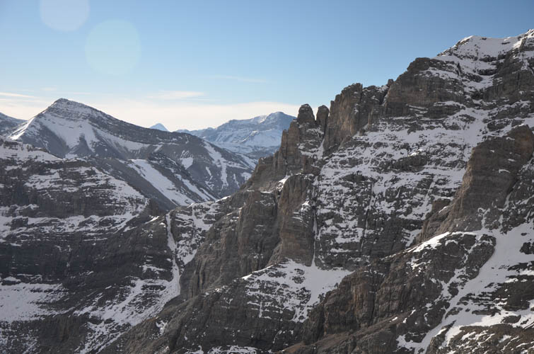
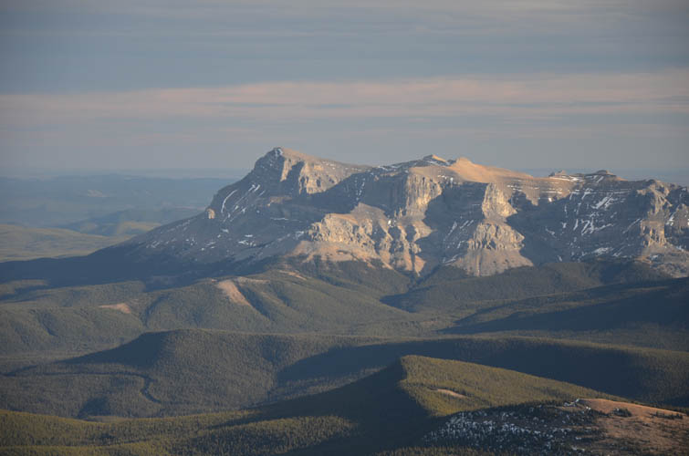
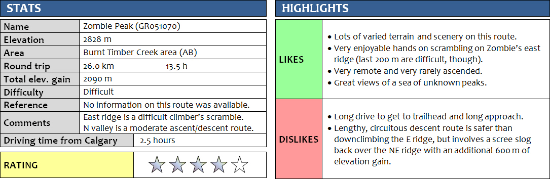
Zombie Peak has always had a special appeal to me. Not only because of its intriguing name, but also because of its remoteness and because there is almost no information available on how to ascend this mountain, and of course I love a good exploration challenge. Richard and I had read about a Calgary meetup group led by Brandon Boulier who had ascended this peak via the north/northeast valley on an overnight trip in 2013, but exactly how and where was unknown to us. Given that the Panther River access road into this area is in excellent shape (without snow/ice it is suitable for a regular car), we speculated that there might be a shorter access route to Zombie Peak via an old wellsite road directly to the east.
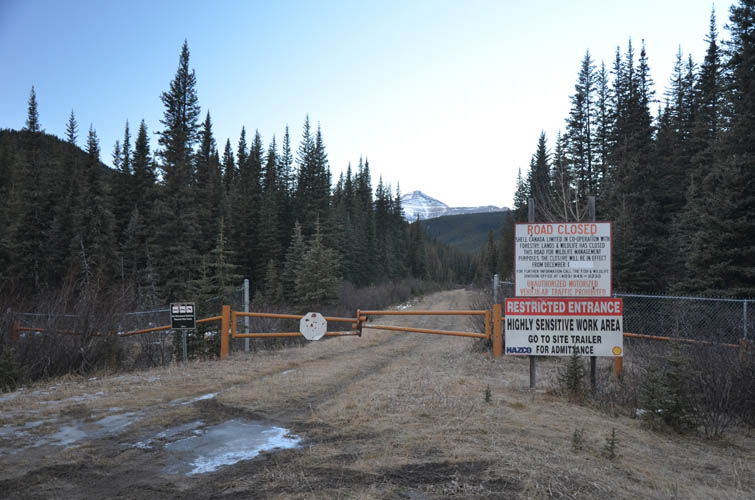
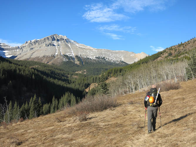
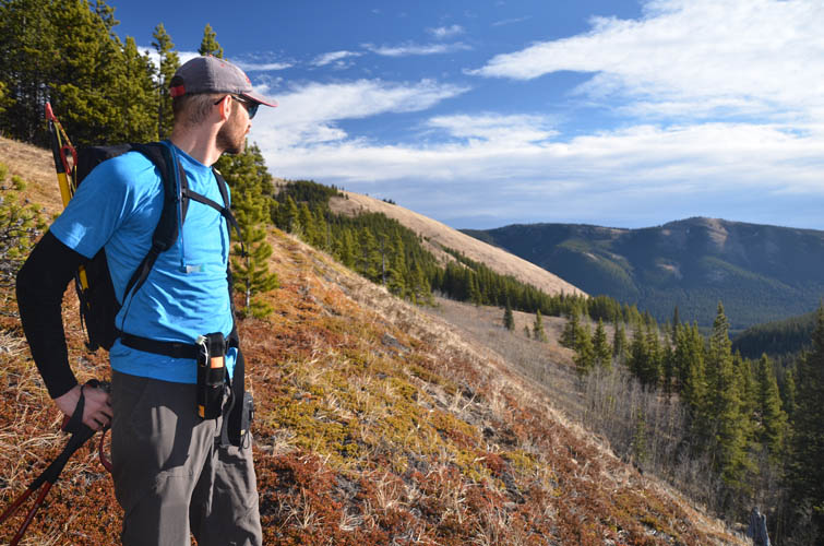
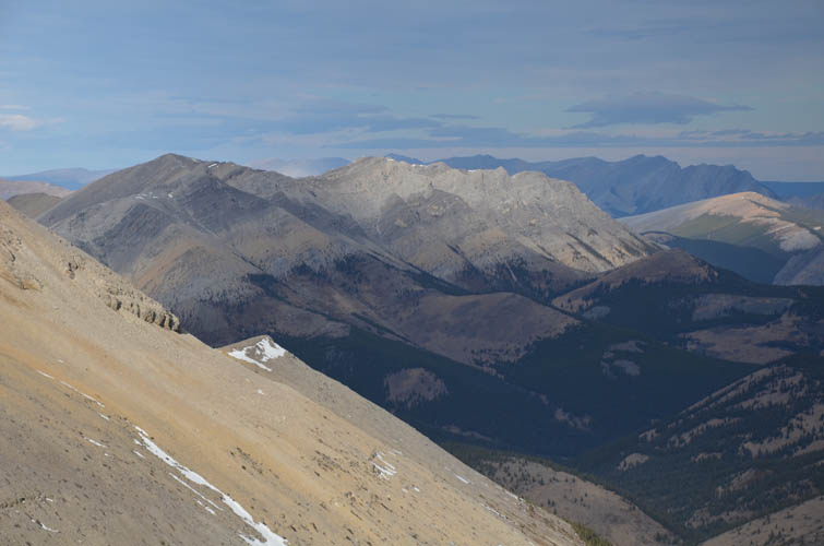
We parked our car at the start of the Shell wellsite road, which as expected was gated and closed to motorized traffic. This 4 km-road is in great shape and next time I go to this area I’ll make sure to bring my bike. There were three small crossings over Burnt Timber Creek along the way, but we managed to hop over rocks every time. The road ends at an abandoned wellsite and just before that a very good wagon trail continues along the north side of the creek. Shortly after passing a fenced camp complete with canvas tents and hummock, the path deteriorated and we started heading up the right (north) side of the valley through light forest and meadows towards the side creek coming down from near Zombie Peak. We were lucky to run across a faint horse trail here, some 50-100 m above the bottom of the side valley. The trail wasn’t easy to follow and we kept losing it as we hiked over gentle grassy slopes, but we were glad we weren’t down in the creek bed where there was a lot more bush as well as canyon-like features. It was an unbelievably hot day for mid-November: it felt like 20 degrees and we were still hot while hiking in t-shirts! The golden meadows, deep green forest and bright blue sky made everything glow like it was a glorious summer day. We were thoroughly enjoying this hike!
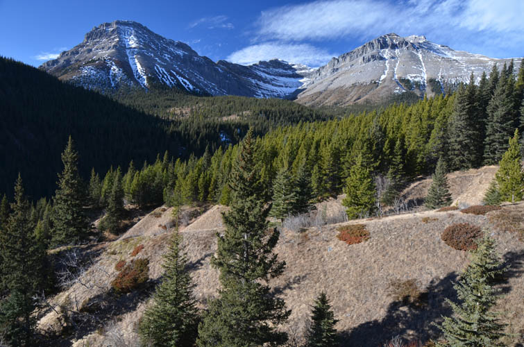
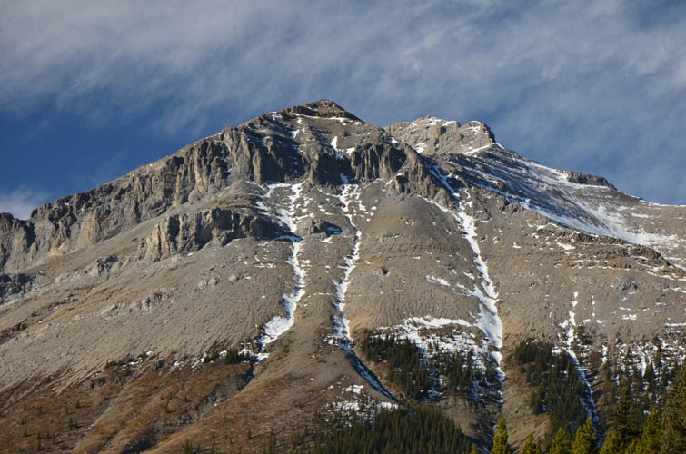
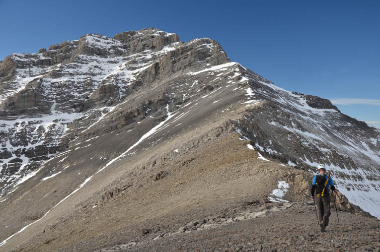
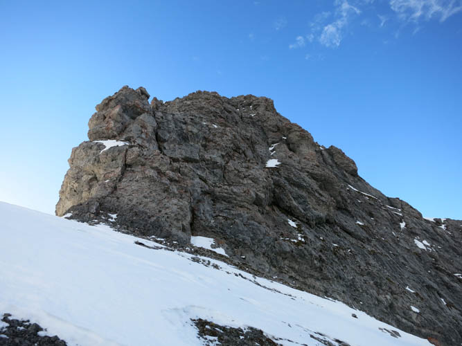
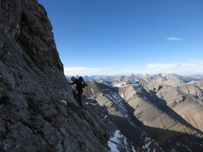
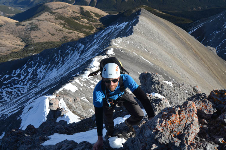
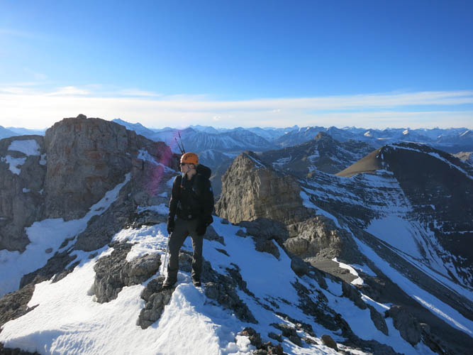
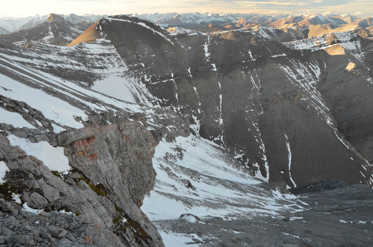
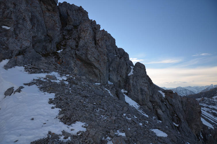
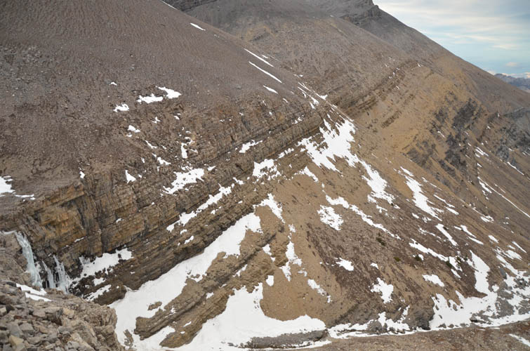
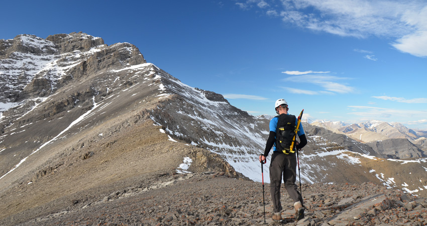
Near the end of the side valley we traversed left over a bump to gain the start of Zombie Peak’s east ridge. It looked steep but feasible from below. And indeed, it was an absolutely delightful moderate scramble on good, solid rock, directly up the spine of the ridge. We topped out on a flat part of the ridge and had the summit tower in full view close-up for the first time: it now looked a lot more intimidating! Sure enough, as we approached, it looked like this was the end of the line for us here. Huge vertical cliffs were drawn around the summit mass like a curtain that can’t be opened. We looked around all sides but there simply was no way up. The only remotely feasible route was to tackle the cliff head-on and then zig-zag our way up along narrow ledges and weaknesses through the cliff… perhaps.
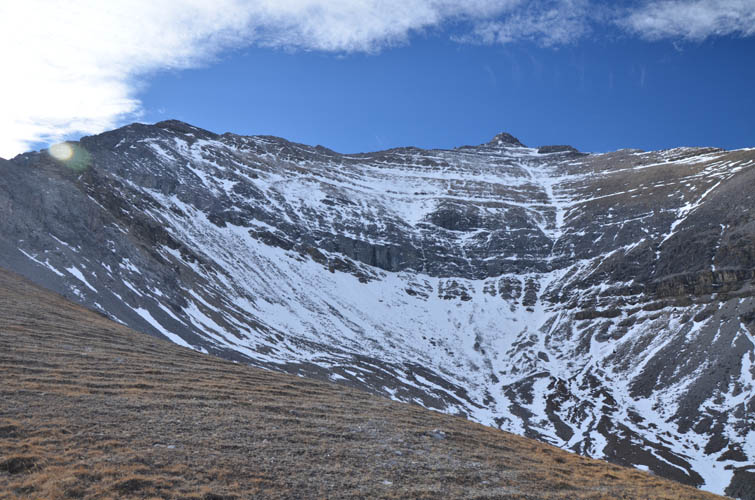
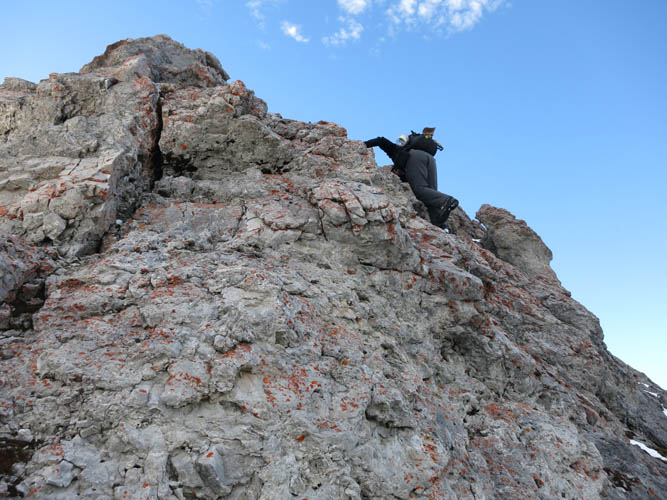
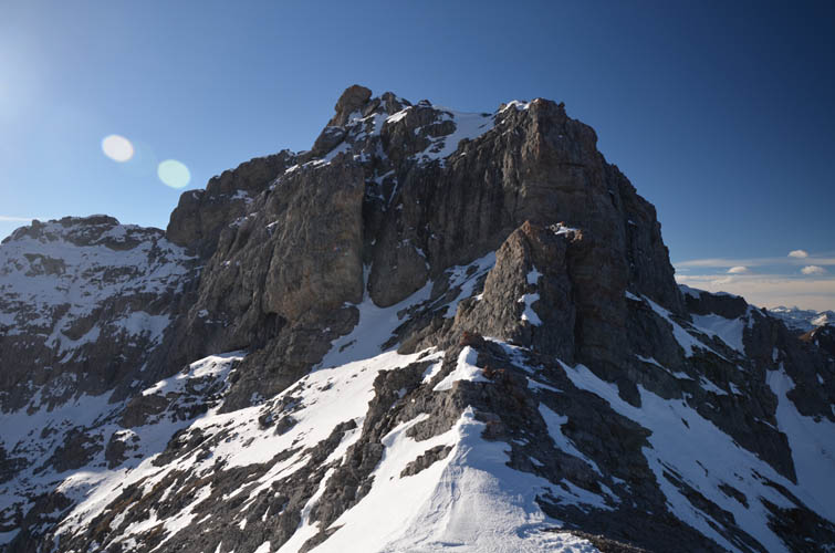
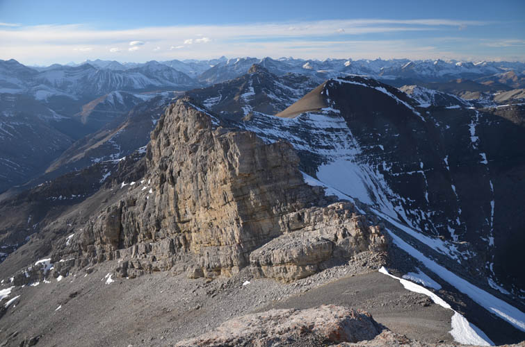
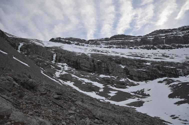
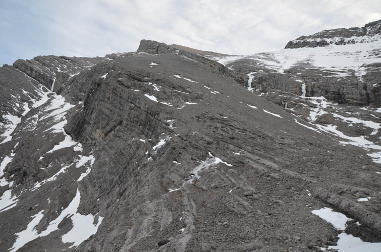
There were no other choices, so we decided to give it a go. It was steep and there was significant exposure, but the rock was generally firm and the holds were good. The first few metres were the steepest, then a ledge went around the right side to a wide crack that led straight up and onto another steep nose that we had to carefully climb. Finally we were above the huge cliff. The ridge now flattened out again for some 40 m, but to our disappointment we were now staring at yet another large cliff guarding the uppermost summit tower. Perhaps our journey would end here after all!? Surprisingly, we found a large, neatly stacked cairn at this spot here – somebody, we wondered, must’ve found a good way to get here. After a much-needed energy break, we decided to investigate the cliff in front of us in more detail and promptly found a narrow ramp hidden behind one part of the cliff, unseen from below. That ramp elegantly carved through the cliffs around the right side and up to the final slope leading to the summit. We were so relieved when we reached the two pointy rock slabs jutting out of the ridge, a double summit! Neither had a summit cairn, and the northern one was slightly higher at 2828 m according to my GPS. This is interesting, because that’s a good 50 m higher than what Google states (and that is by no means an authoritative reference of course!). We built a small cairn and placed a register, but our joy at having made the summit was soon muted by thoughts about the descent.
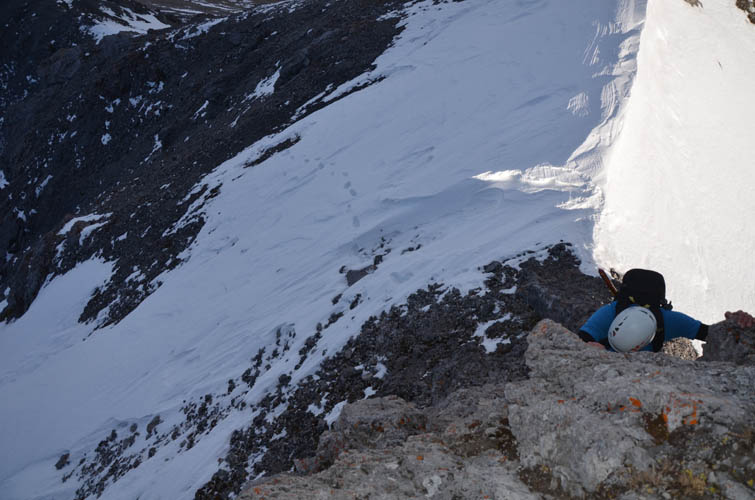
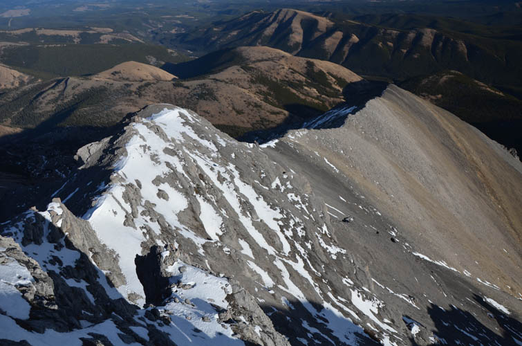
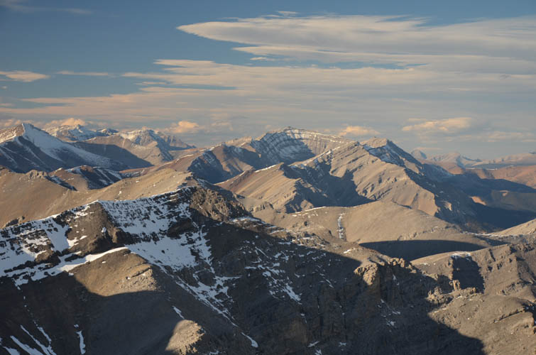
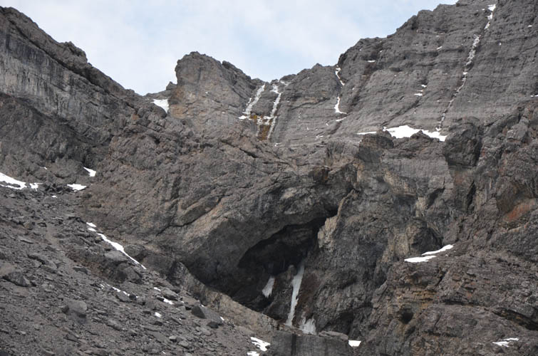
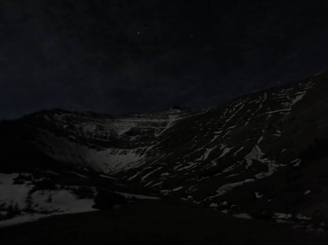
Although we could’ve gone back the same way, which would’ve involved some very delicate and steep scrambling, we opted to explore an alternative descent route down the NE to try to circumvent the cliffbands. Soon after descending a few hundred metres and working our way down a steep cliff, another cliffband appeared, but this one was massive! A 20-30 m sheer vertical drop opened up in front of us, running diagonally down into the north valley. Angry-looking overhangs and fantastical frozen waterfalls appeared along the drop-off… not a place we wanted to hang around! We stopped to re-evaluate our options: 1) go back and re-ascend a few hundred metres to near the summit just to be faced with a steep and difficult downclimb, or 2) keep descending above the massive cliff into the north valley and try to find a way around it on the other side of the valley where the cliff appeared to run straight into steep slopes of brown shale. It was already 4pm by now and we only had about an hour and a half of daylight left. After some discussion, we both agreed on option 2 – keep descending. It is deceiving how steep the shale slope on the other side of the valley looked at first, for as we lost elevation and came closer the slope looked more and more manageable and in the end was an easy hurdle to overcome. Another surprise cliffband followed, which we bypassed in the same manner – on the much gentler slopes to the north, then we finally hit the bottom of the valley. Of course this was the wrong valley, so to get back to our approach route we had to re-ascend the NE ridge on miserable scree for another hour, now under the massive cliffs that had barred our progress earlier. This was probably the toughest part of our day, having to put an additional 600 elevation metres behind us on absolutely terrible loose chunky scree and steep, icy snow patches just to get back on track. By the time we reached the top of this ridge, daylight had vanished and the distant lights of Sundre and even Calgary appeared on the horizon in front of us. It was a strange but curiously exciting feeling to be out here in the dark with the summit of Zombie Peak right in front of our eyes.
We put our headlights on and followed the NE ridge down for a short distance, then headed straight down the soft scree on the other side to get back to the east valley. There was one more obstacle and of course it was another cliff, the theme of the day! It was near the bottom of the slope and a bit tricky to downclimb in the dark, but we took our time and broke it down, which made it relatively straightforward. Down in the valley we looked back up and realized we had been lucky to find a way through as the cliff didn’t look so friendly in most other places.
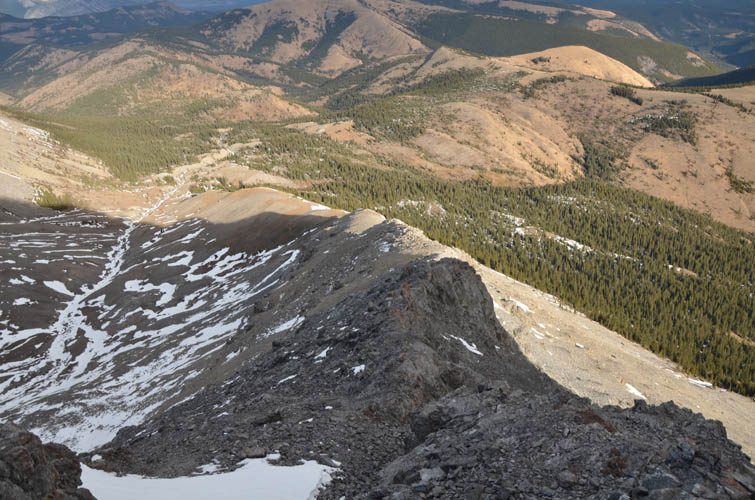
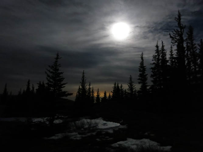
Instead of taking the faint horse trail back to Burnt Timber Creek, we decided to follow a gentle ridge that took us directly to the wellsite and the start of the good road. The ridge had quite a few ups and downs but consisted mostly of open grassy terrain and was a pleasure to hike along. The last four hours of our day were thus in the dark and we were really feeling our legs by now. However, we also enjoyed a bright moon, warm temperatures and almost no wind, making this a very special night hike back to our car. We arrived just before 10 pm. It was a long day, with lots and lots of route finding and many challenges, but that’s also what made it so rewarding in the end.
Note: An ascent up the east ridge and following the same route back down will significantly cut down on total return time, distance and elevation gain. However, the last 200 m to the summit are a difficult climber’s scramble on very steep and exposed terrain, so be confident in your scrambling/climbing skills if choosing this route. You may want to bring a rope, especially for the descent.
NOTE: This GPX track is for personal use only. Commercial use/re-use or publication of this track on printed or digital media including but not limited to platforms, apps and websites such as AllTrails, Gaia, and OSM, requires written permission.
DISCLAIMER: Use at your own risk for general guidance only! Do not follow this GPX track blindly but use your own judgement in assessing terrain and choosing the safest route. Please read the full disclaimer here.