29 September 2017
With Trevor
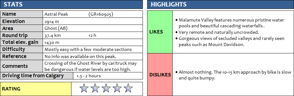
Astral Peak is one of those rare examples in the southern Canadian Rockies of a mountain that nobody seems to know anything about – or perhaps nobody cares about. With no published routes or reports of any ascents, it is admittedly exactly this exploration potential that attracted Trevor and me in our quest to climb it. Situated in the Ghost Wilderness Area, Astral Peak is simply too remote to be on the radar of hikers and scramblers seeking a nice outing for the day. Even the two seasoned climbers we met in the morning as they prepared for a climb of nearby Devil’s Head had never heard of our objective.
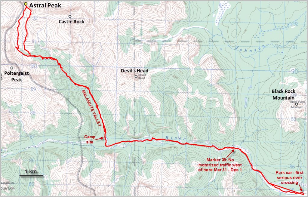
Of course, remote and unknown objectives don’t have to be difficult. The crux of the day wasn’t on the mountain, it was on the drive in. Trevor’s Acura MDX is a higher clearance vehicle but a full-sized truck or jeep is what’s really needed to navigate the rough road in the Ghost River bed. We easily made it through ankle-deep water at the initial crossing at the base of the “Big Hill” (17 km in along the TransAlta road from Hwy 40N) and then managed to drive north for another 2.4 km before another crossing where the water was too deep for our liking.
We proceeded by bike along the old road, which is in decent enough shape but makes for quite a bumpy ride overall. After about 4 km and perhaps three or four river crossings we came to a small pull-out in the middle of the river valley with an inconspicuous sign (Junction 39) advising motorists that further travel along the road is only allowed between December 1st and March 31st, so we couldn’t have driven much farther than we did anyway. The road continues NW and then W through islands of forest, crossing the river multiple times. While Trevor was smart enough to bring his waders and just nonchalantly walked through the water, I got my feet wet almost every time (old sneakers helped immensely!) as bolder hopping was next to impossible and riding through the water was fun but rarely blessed with success.
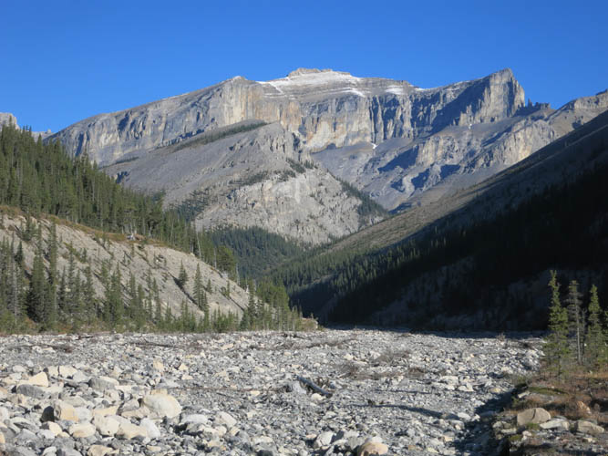
About 1 hour and 45 minutes after leaving the car, we arrived at a nice improvised campsite marking the entrance to Malamute Valley along Claw Creek. We ditched our bikes and headed up the broad, rubble-strewn creek in a northward direction. The hiking was fairly easy here and facilitated first by an old, partially washed out path on the left side, and later by small grassy islands that made the walk a bit more comfortable. This is a really scenic valley right from the start: a huge vertical wall of limestone high up to the left simply looks formidable to say the least, plus there are a series of majestic rock buttresses jutting out from Poltergeist Peak’s east side that accompanied us along the way. Soon the valley narrowed and small waterfalls started to appear – one after the other. There were small cliffs with canyon-like features and the water was gushing down small chutes and slides into picturesque pools of all shapes and forms, some up to 6 m wide and 3 or 4 m deep. The crystal-clear to turquoise water was mesmerizing to look at, its brilliance amplified by the bright morning sun on this beautiful cloudless day. Thankfully, none of the waterfalls posed much of a problem to us hikers as there was always an easy way around them through the forest on the right or left side. We usually found ourselves back in the creek after such detours as the creek- and boulder-hopping was fun and entertaining – so entertaining in fact that we didn’t even realize how much progress we had made over the last few hours.
The valley splits higher up with the left branch veering towards Poltergeist Peak while the main valley heads north towards Castle Rock. We finally sat down for our first proper snack break, and we really needed it – we’d been going for 4 hours and still had another 8 to go!
After lunch, as soon as we entered the left branch of the valley, we enjoyed some of the best scrambling of the entire day. A series of stair-step rock faces and cliffs next to several cascading waterfalls offered fantastic hands-on scrambling on solid rock with lots of great holds. Wherever the cliffs got too steep and in some cases overhanging, we bypassed the obstacles through the woods on either side. This section was so much fun that we were almost a bit disappointed when the valley floor flattened out and the waterfalls disappeared after a few hundred metres. Now it was just a long trudge along a boulder-filled creek bed to the col between Poltergeist and Astral, all at a very gentle angle but over quite a distance (3 km from our lunch spot). It’s probably good to know that even up here in the upper creek there was still a small stream of water in places.
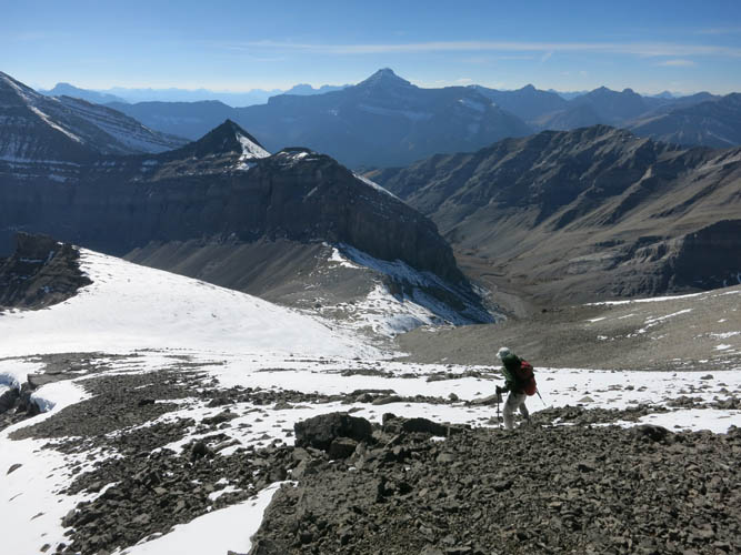
Small jagged rock fins greeted us on the flat saddle – another special place where majestic views of all kinds of unnamed peaks to the north and northwest opened up. Looking northeast, it was now obvious that the rest of the ascent to Astral Peak would basically just be a walk up. There is a serious cliff band coming in from the left, but it gradually peters out towards the summit ridge. No more obstacles! After all these hours bashing up the valley we definitely felt a big sense of relief.
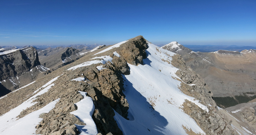
Some 30 minutes after leaving the col we arrived at the short summit ridge. We couldn’t find anything resembling a cairn (in fact we hadn’t seen any cairns all day), so we dropped our gear and joyfully each built not one, but two! – and placed a small register at the high point, which my GPS registered at 2914 m.
I had previously considered combining an ascent up nearby Mount Davidson with Astral Peak, but looking at the valley separating the two, it was now obvious that going up Astral from the north or northwest would be much more than a scramble. Steep cliff bands surround the southern side of this valley, so we probably ended up taking the most feasible or at least the easiest route to Astral Peak. Not far to the east, Castle Rock looks quite enticing with its wide open SW slopes and the small, craggy summit crown. This vantage point also offers unique views of the backside of Devil’s Head, which no doubt is one of the most impressive sights in the whole area. Also impressive but more daunting to look at is the long ridge connecting the col to Poltergeist Peak – that mountain’s east face is a sheer vertical drop, and the ridge itself is craggy and doesn’t look very inviting.
On our return we chose to stick to the fairly gentle and undulating south ridge of Astral Peak for as long as we could before re-entering the forest and coming back down to the creek. This worked out really well and was perfect for a little variation in our route. For the rest of the trip we had no trouble retracing our steps and made it back to the car just before dusk.
This was a fabulous outing that both Trevor and I would rate as one of the best this year – and possibly a top ten overall. Of course the flawless weather played a big part, as did the satisfaction of succeeding with an unknown route in terra incognita. Perhaps under different conditions we wouldn’t have enjoyed it nearly as much, who knows. Regardless, for us it was a really special trip and one we’ll remember for a long time to come.
Note: Our stated trip time of 12 hours is probably on the short end given that everything worked out without a hitch and we travelled at a pretty decent pace. A more reasonable estimate would be around 13-15 hours.
DISCLAIMER: Use at your own risk for general guidance only! Do not follow this GPX track blindly but use your own judgement in assessing terrain and choosing the safest route. Please read the full disclaimer here.

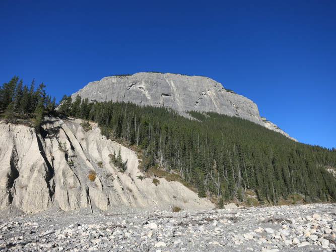
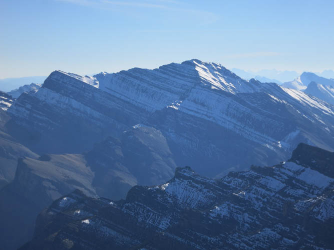
Phantom Crag‘s steep cliffs in the early morning glow.
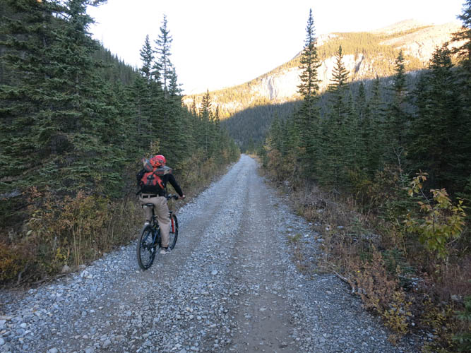
The old Ghost River road – this section here is in abnormally good shape!
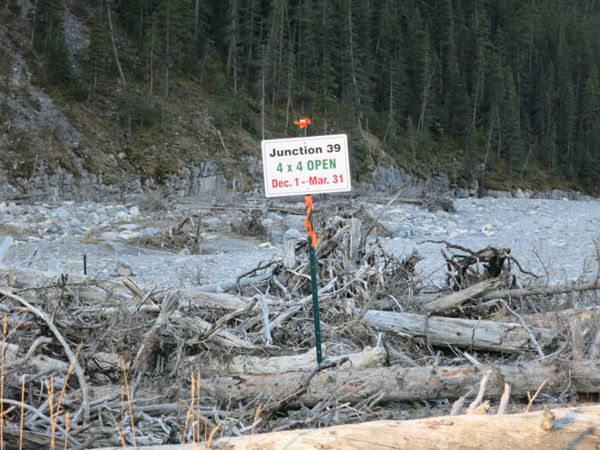
Junction 39: no further travel by truck or ATV between April and end November.
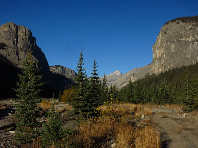
Mount Aylmer’s distinctive pointy summit appears as we head west.
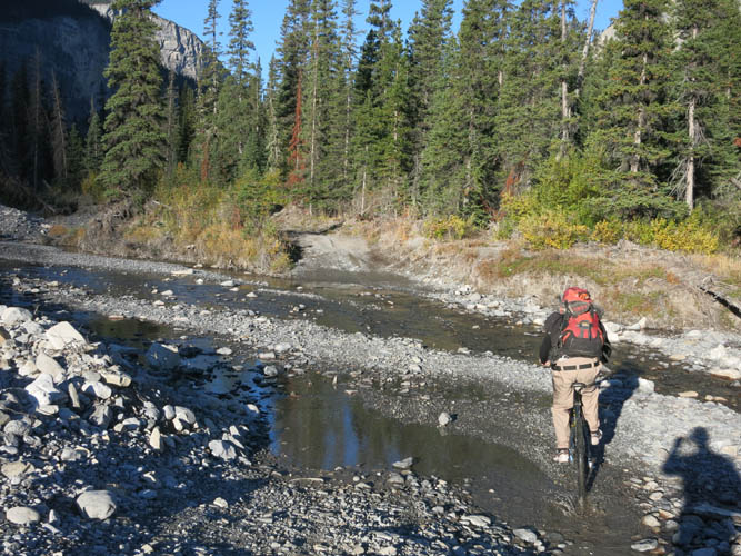
Some river crossings, like this one, were doable by riding through them.
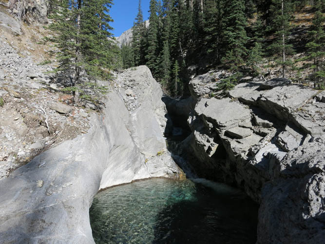
Looking north into Malamute Valley and Castle Rock in the distance.
Steep limestone cliffs tower above us.
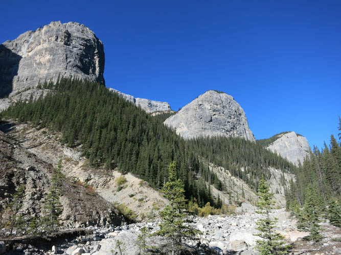
Impressive rock buttresses on the east side of Poltergeist Peak.
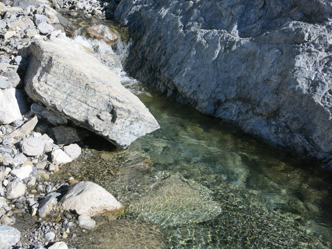
Small pools with crystal clear water start to appear.
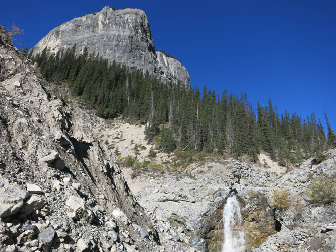
And waterfalls, lots of them!
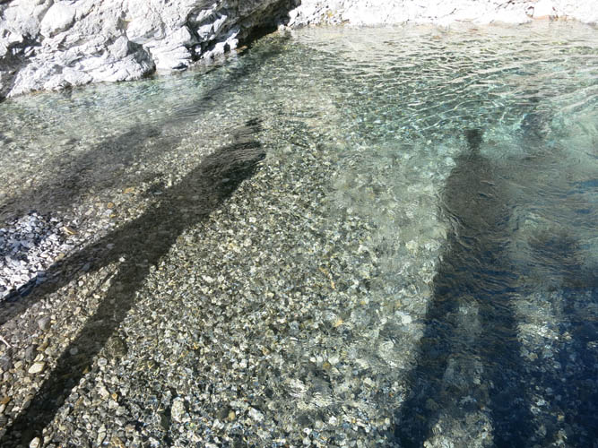
The only thing missing is a nice sandy beach :).
It’s lovely to be hiking alongside the gushing water.
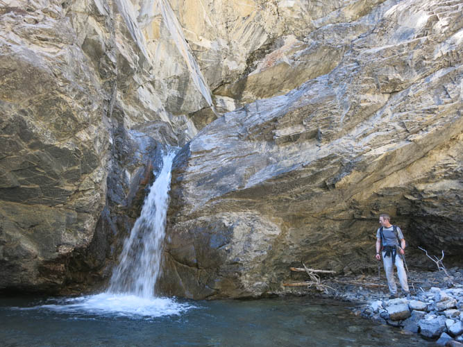
Trevor admiring one of the waterfalls with an overhanging cliff behind.
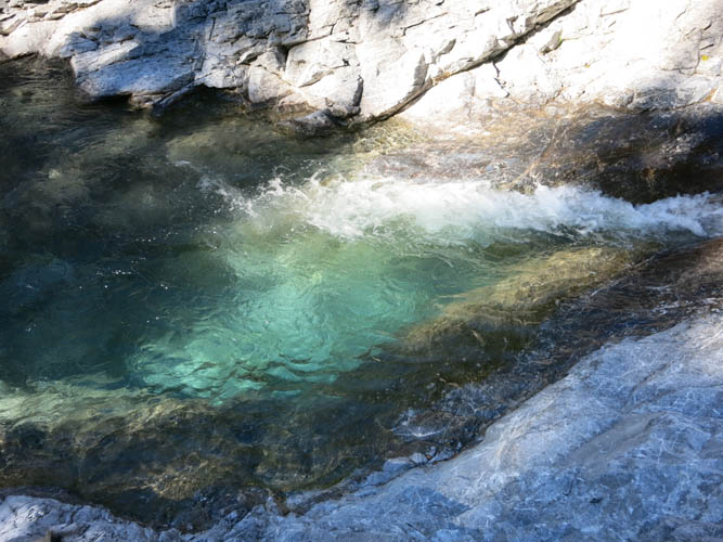
If it wasn’t so chilly, it’d be so tempting to jump in!
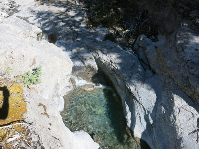
The pools and falls make this valley very picturesque.
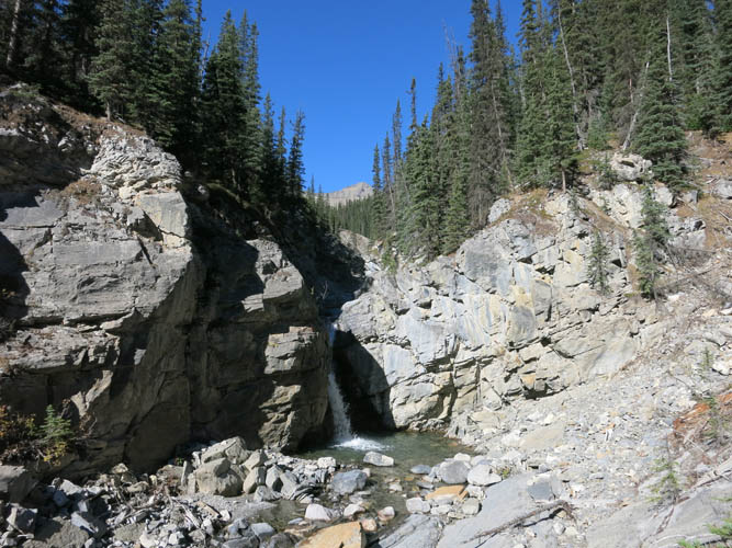
All of the waterfalls can be easily circumvented.
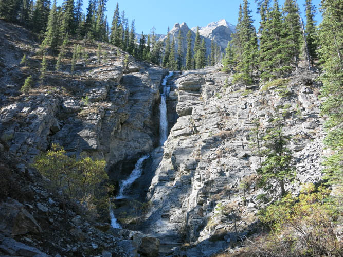
Cascading waterfalls higher up in the valley as we turn into the left branch.
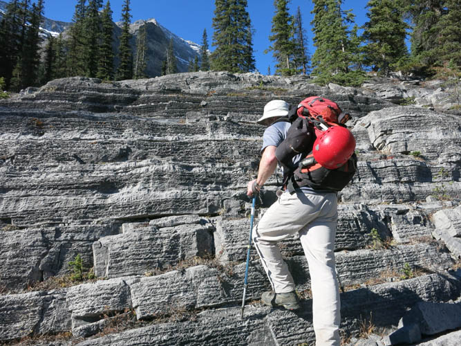
Looks like a natural staircase, doesn’t it!?
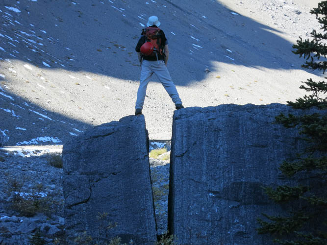
This big chunk of rock in the upper valley had a perfect split – as if cut by a knife.

The upper valley below the steep north ridge of Poltergeist Peak [photo by Trevor].
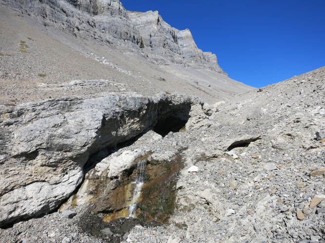
Even up here, water is seeping out of the rock.
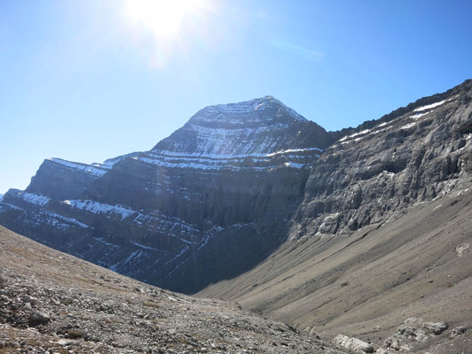
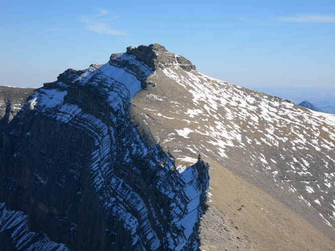
Poltergeist Peak (looking south).
Heading up to the col between Poltergeist and Astral.
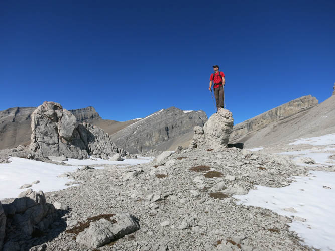
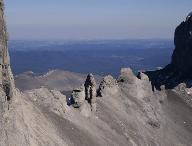
Rock fins at the col make for great photo opportunities.
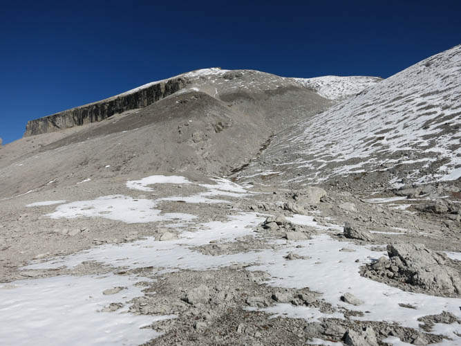
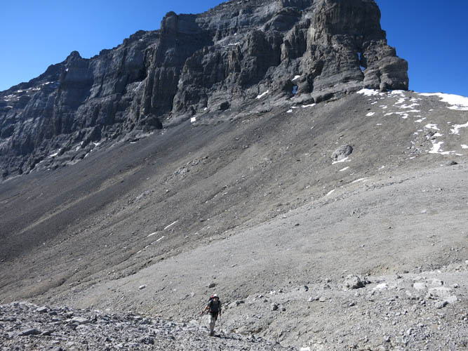
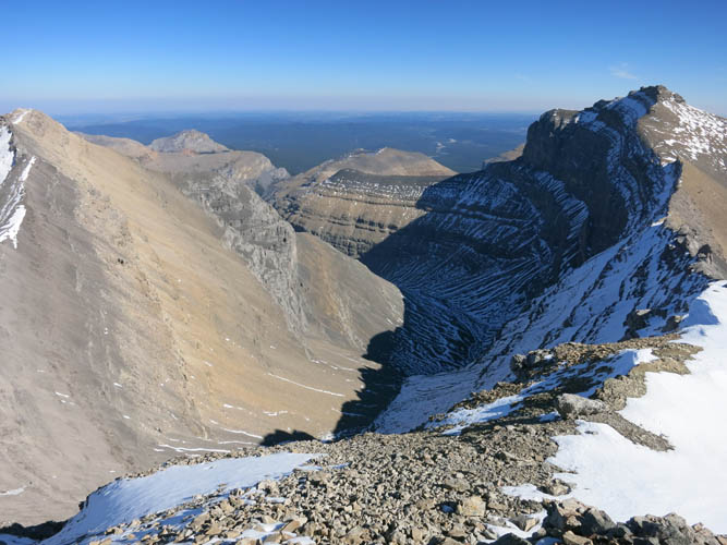
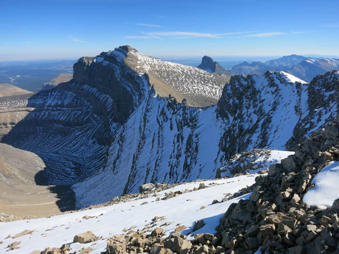
The remainder of the route from the col: the vertical cliff band that comes in from the left gradually diminishes near the summit ridge.
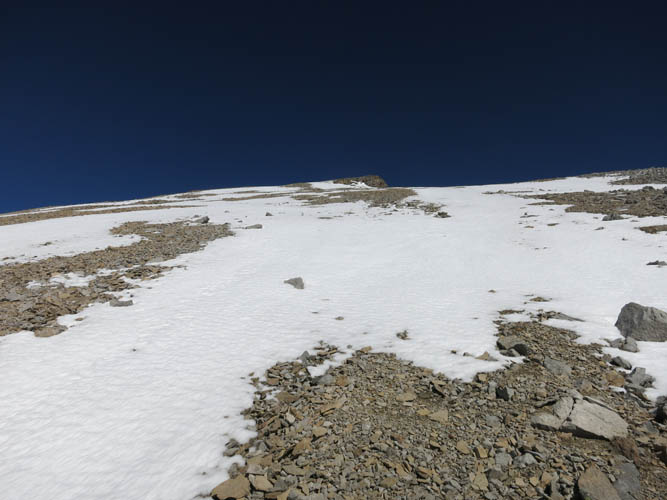
The last half an hour is just a slog up a steep slope.
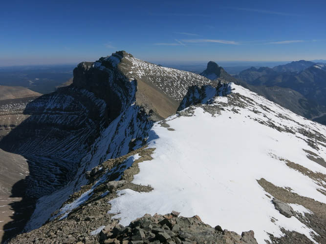
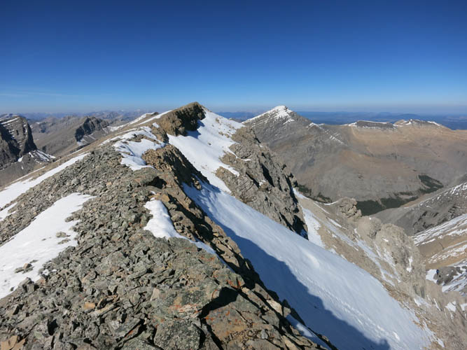
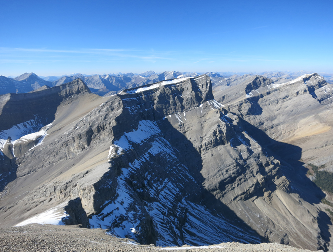
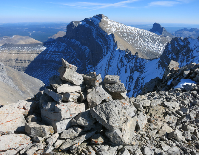
Fantastic views from the summit ridge! In the distance are Devil’s Head (right) and Castle Rock (left).
Close-up of Castle Rock.
Looking back down to the col and Poltergeist Peak (left of centre).
A perfect day to enjoy such views!
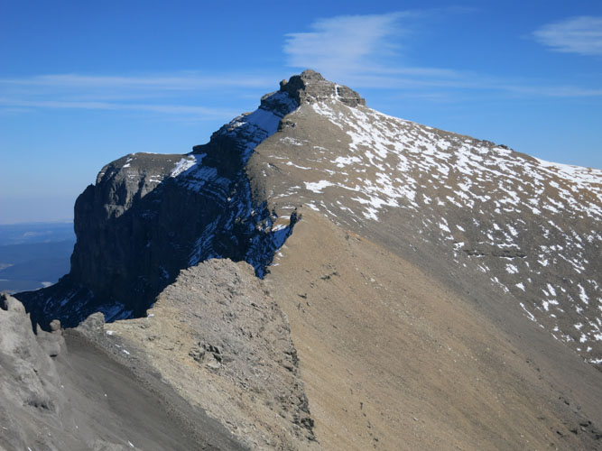
The short summit ridge with the high point of Astral Peak at the end.
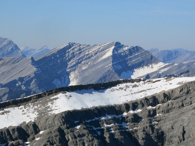
Mount Costigan to the south.
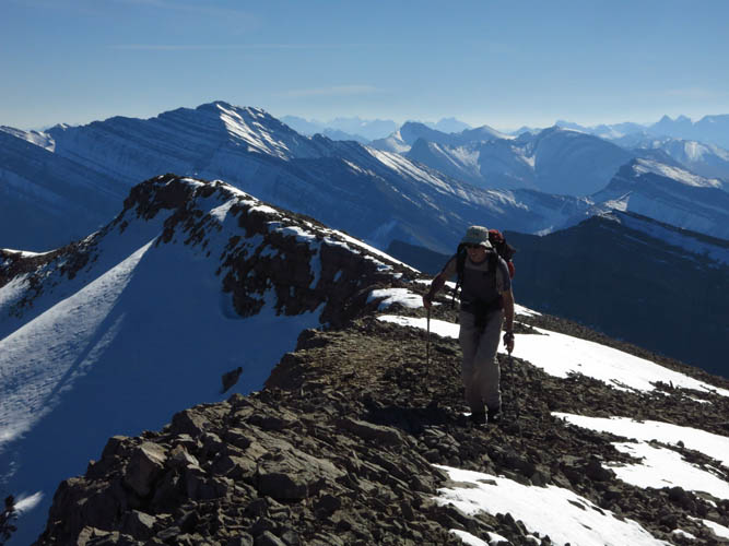
Trevor coming up the ridge.
A look at the connecting ridge between Astral and Castle Rock – looks steep and craggy!
Views to the NW. Lots of unnamed peaks here.
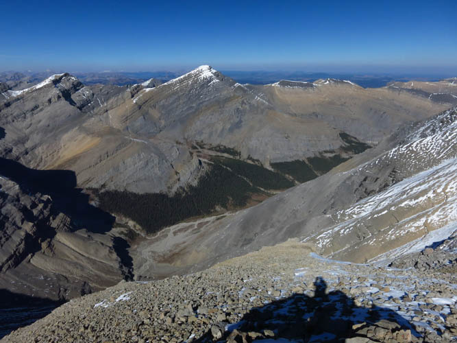
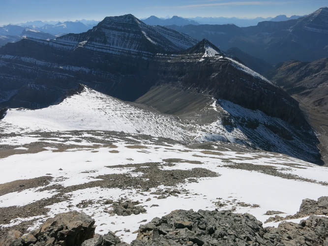
The valley to the north has snow-capped Mount Davidson at its end.
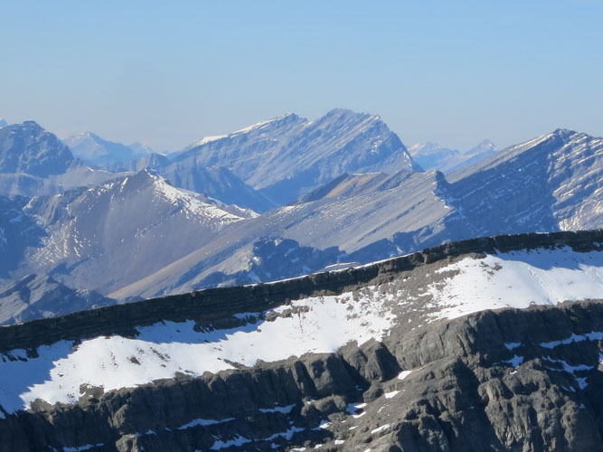
Puma Peak is quite a distance away to the NW.
Our freshly built summit cairn.
Descending along the undulating south ridge.
Another look at Castle Rock – it does look a little like a castle, but only a small one!
Bizarre gendarmes and rock fins along the ridge between Astral and Castle Rock.
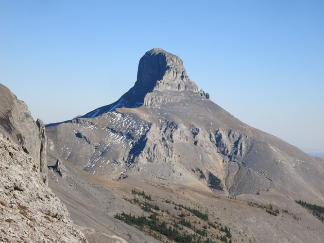
The majestic Devil’s Head.
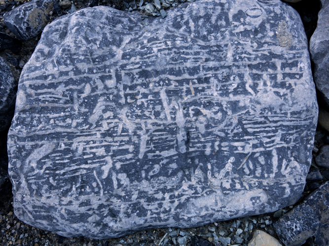
We found this strange-looking slab of rock in the creek bed. What appears like an ancient inscription is probably just an assemblage of trace fossils preserved in the rock.