6 October 2017
With Trevor & Vern
A week earlier Trevor and I had ventured up the remote Astral Peak in the Ghost area where we had enjoyed a clear sunny day with gorgeous views of many neighboring summits unknown to us. One peak in particular – Castle Rock – was particularly fascinating to look at and we wondered if it was as straightforward to ascend as it looked. Our hike up Malamute Valley had been so much fun that we decided to pay the area another visit and see if we could scout out a route to the top of Castle Rock. After all, we knew exactly how to do the approach and knew the water levels in the river. The many bypasses necessary to navigate our way around waterfalls and chutes in Malamute Valley were also still fresh in our minds. When we told Vern about our plans, he didn’t hesitate much and jumped on the opportunity to explore an area that even he hasn’t explored much (which is indeed rare to find!).
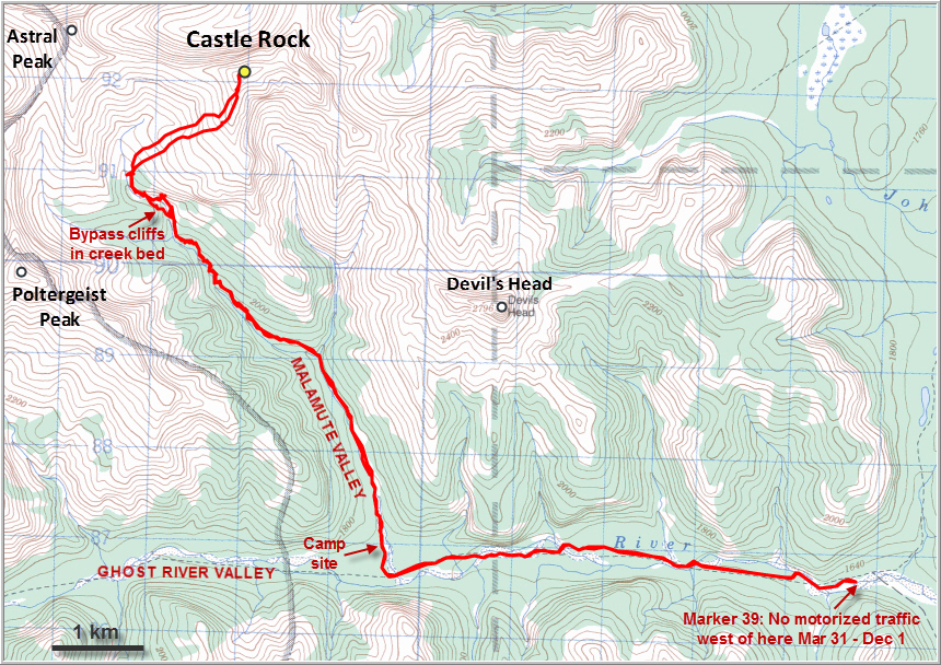
For a long trip like this we had to maximize the available daylight so just like the week earlier we drove out on the TransAlta road in the dark, down the “Big Hill”, and along the old gravel road in the Ghost River bed. Having a proper 4×4 truck made the approach a lot easier this time and we were able to drive all the way to Junction 39. Beyond this point, motorized traffic is only allowed between Dec 1st and March 31st.
We unloaded our bicycles and continued down the old road for another 5.2 km just as the sun was rising. Looking west down the Ghost River valley with the tip of Mount Aylmer bathed in the warm orange morning light was a beautiful sight. Of course we were the only ones around (on the way back we spotted one hardy Westphalia van near the old road plus a couple of trucks later on).
The bikes were great for a fairly speedy approach, although once again I was slowing everyone down with my old two-wheeler. Both Vern and Trevor had brought waders, which kept their feet dry during the dozen or so water crossings on the way in. For me, old sneakers and socks had to do, but knowing what was in store somehow made the cold water a little less painful…
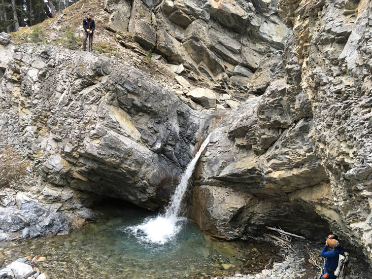
Once at the entrance to Malamute Valley, we basically followed the same route to our previous “lunch spot” that marks the turn-off to another smaller valley leading up to Astral Peak (see that trip report for additional details). There are numerous small and medium-sized waterfalls and lots of pretty water-carved features like pools, slides and grooves in the rock where the valley narrows. While these features slowed down your progress significantly, they are also what made the journey up this valley so interesting. It’s just a lot of fun trying to find a route around these obstacles and it’s really never too difficult to spot an easy bypass in the forest or along ledges on either the right or left side. Nonetheless, there are a few sections that are quite steep, with some exposure, and some parts require moderate scrambling across small rock steps and washouts. Our memory from our trip up Astral a week earlier served us fairly well such that we were able to pick the most efficient route most of the time.
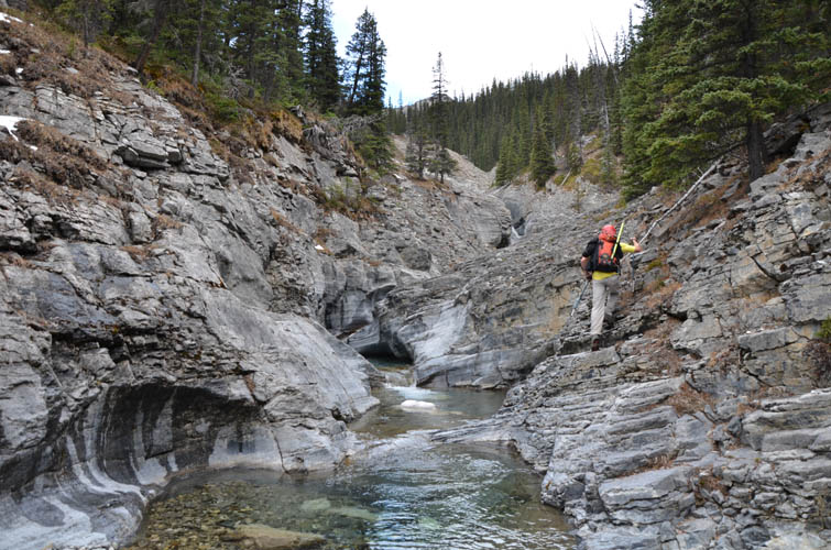
Vern seemed to be really enjoying himself in this valley, and although his polarizer broke into pieces right at the beginning he was still busy taking picture after picture! Trevor and I were also happy to be back in this magical place. Despite having been here just a few days earlier, the valley had lost none of its appeal to us – on the contrary, we were marvelling at its splendour just the same and actually noticed a lot of things we had missed before. There is a plethora of highly interesting geological features including a variety of fossils (corals, bivalves, burrows, etc.) and a very well exposed miniature anticline. A portion of the creek also runs along a major unconformity that probably represents a thrust fault, with friable black shale on one side and solid limestone and dolostone on the other.
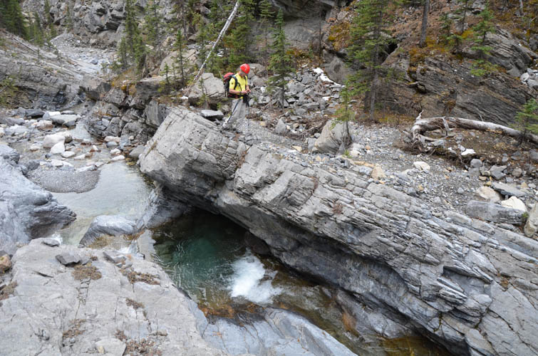
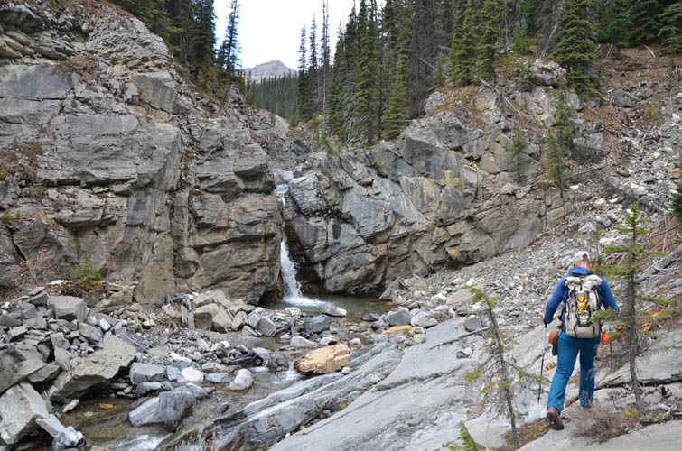
After a good break at the “lunch spot”, where the side valley to Astral starts, we continued north in the main valley past a conspicuous outcrop of eroded river deposits on the left side. Huge chunks of angular boulders, reminiscent of giant sugar cubes, are precariously baked together in muddy sediment here, seemingly waiting to crumble at any time – not a good spot to hang around too long! The valley soon narrowed considerably, turning into a rocky canyon with steep walls on either side. A small waterfall with steep cliffs all around marked the end of the road in the valley floor. We backtracked a few metres and then climbed up a steep rocky slope on the left (west) side, perhaps some 30-40 metres of elevation, until we were on easier terrain and could sideslope NW and back down into the creek bed. The steep slope definitely involved some difficult scrambling with exposure, but the holds were plentiful and the rock generally solid. We avoided this section on the return, choosing to stick to the edge of the trees high above the canyon instead. From high up the slope we could also clearly see that the other side of the valley would’ve been a no-go as Vern had correctly predicted: the right (east) side of the canyon may look feasible up close, but the ledges are downsloping and many end abruptly against vertical walls or dangerous drop-offs.
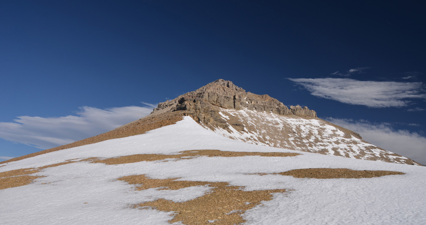
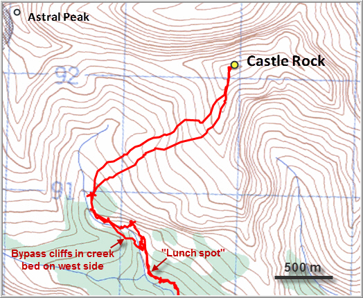
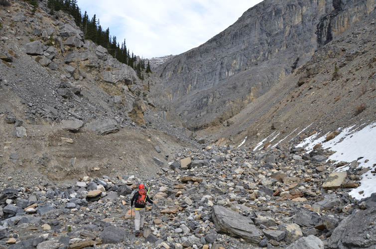
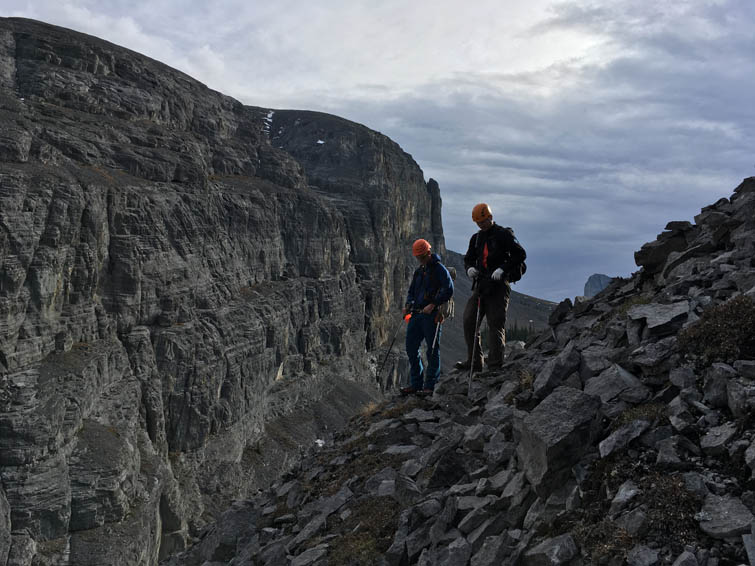
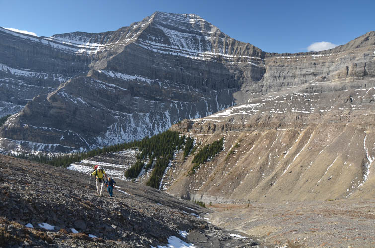
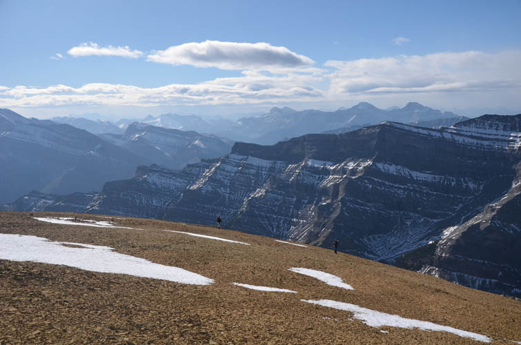
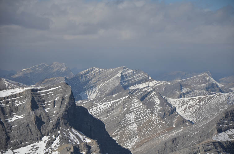
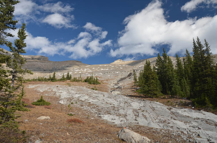
Once we had overcome the steep canyon-like part of the valley, the rest was dead easy. A pleasant walk up the flat creek bed led us to a small grassy knob (the perfect place for another snack break!), from where a broad drainage took us straight up to the south ridge, almost directly below the summit tower. While we could hike up the drainage in t-shirts under beautiful sunny skies, the winds that greeted us on the ridge were so ferocious that they almost blew us off and made us put on two more layers plus gloves and toque! The views, however, were fantastic just as expected: Poltergeist Peak to the SW, Astral to the west, and the distinctive Devil’s Head far to the east. Beyond Blackrock Mountain, which looks rather diminutive from up here, the skyline of Calgary can be seen on the horizon to the east.
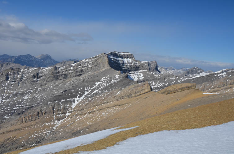
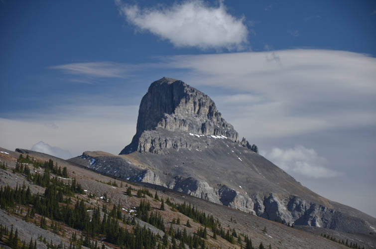
Castle Rock’s summit tower bears only a very vague resemblance to a castle and I think the name is a bit too grand for this mountain, especially compared to its namesakes in Banff (Castle Mountain) and southern Alberta (Castle Peak) which are arguably more imposing. The summit tower is a short and enjoyable scramble of moderate difficulty, with many different possibilities to get to the summit. One of them is a short, snow-filled gully that we used on our descent; it appears deceptively steep from neighboring Astral Peak, but is really quite harmless. Castle Rock hardly ever sees any visitors, so there’s lots of loose rubble and some crumbly rock to pay attention to. We were quite surprised to find a decent-sized summit cairn at the top. The bone-chilling wind didn’t allow us to fully soak in the views and we quickly hurried back down into the valley to seek shelter. I even had to pull out my big mittens and Trevor was using hand warmers, that’s how brutal the force of an intense wind can be!
The return was fast and just as enjoyable as the ascent, except for the last couple of hours when dark clouds moved in and a light drizzle made us pull out our rain gear and stow away the cameras. Somehow, though, I don’t mind clouds and rain so much in the Ghost… it adds an air of mystery to the area’s majestic landscape, and of course it’s always easier to finish up a trip with the satisfaction of having made the summit than when you start out your day not knowing what’s to come. Another brilliant adventure with excellent company.
Please see Vern’s trip excellent report on our Castle Rock trip with more details and, of course, plenty of outstanding photos!
Note: Although our round-trip time is given as 10 hours below, a more realistic estimate for most parties would be perhaps 11-14 hours since we were already familiar with the approach and knew the terrain along most of the route.
DISCLAIMER: Use at your own risk for general guidance only! Do not follow this GPX track blindly but use your own judgement in assessing terrain and choosing the safest route. Please read the full disclaimer here.
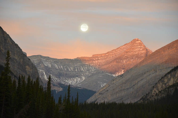
Early morning twilight: Mount Aylmer is illuminated by both the moon and the rising sun as we head west up the Ghost River valley.
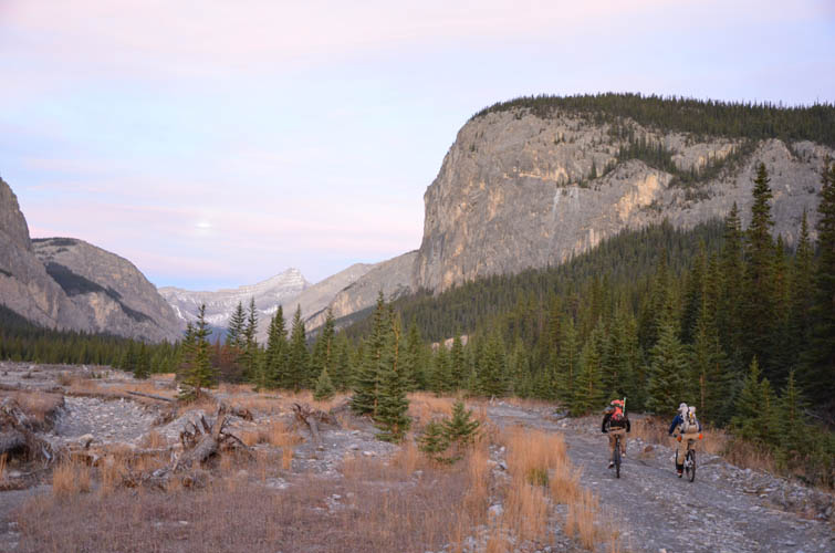
Biking along the old gravel road.
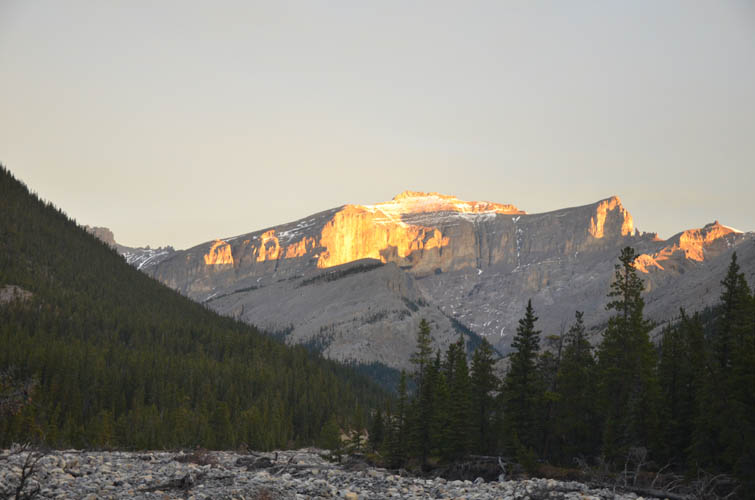
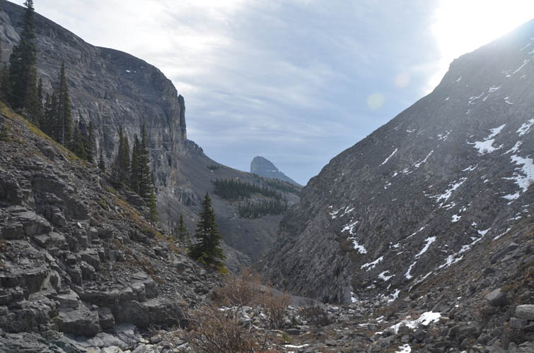
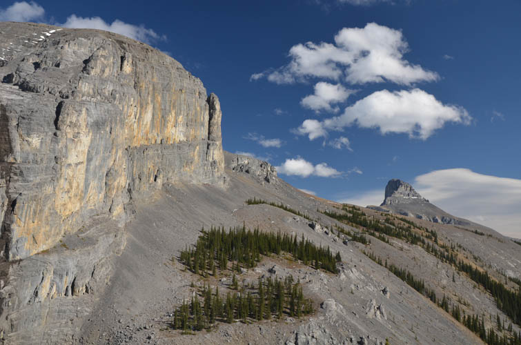
Castle Rock appears like a golden crown at the entrance to Malamute Valley. Our route takes us around the left side of the massive vertical cliff.
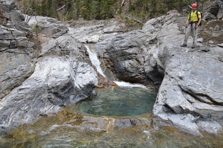
Beautiful water pools in Malamute Valley.
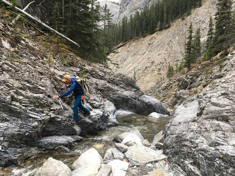
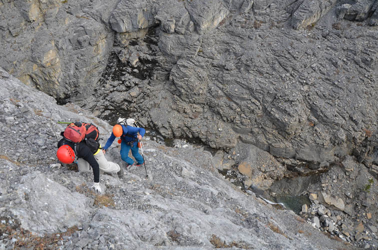
Most obstacles are easily circumvented, but in some places the valley flanks are steep and rocky, necessitating some moderate scrambling moves.
Much of the route is straightforward and entertaining at the same time.
This waterfall is bypassed on the right (east) side.
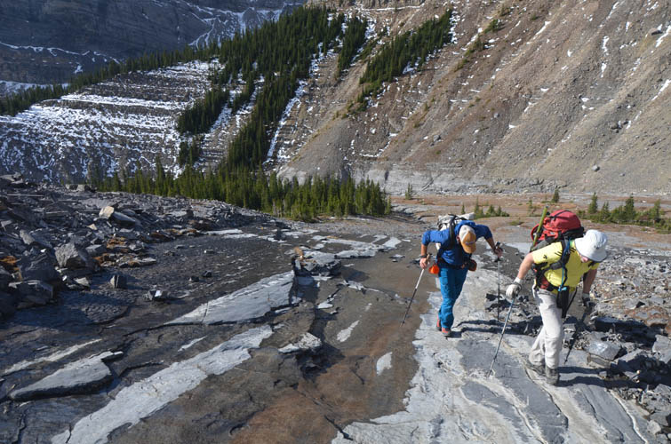
Lots of fun rock steps and slabs along the creek here.
It’s hard not to take pictures! [Photo by Trevor]
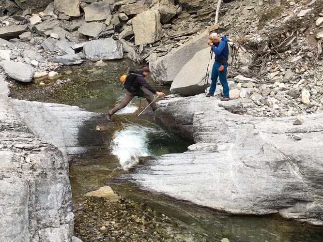
Looks like I’m jumping straight into a puddle… but I just about made it. The rock can definitely be very slippery when wet! [Photo by Trevor]
Heading north from the “lunch spot” along a wider section of the valley.
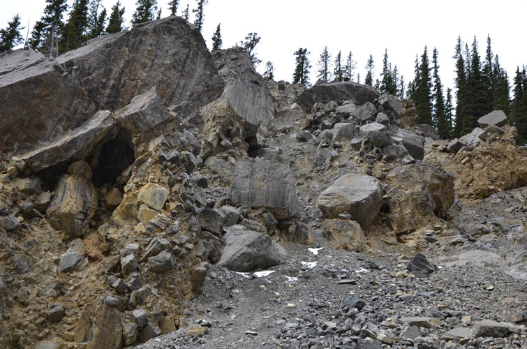
“Giant sugar cubes” – these boulders are suspended in crumbly mud and gravel and look like they are about to tumble down at any moment.
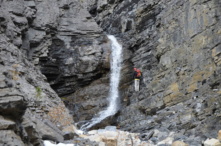
The end of the road in Malamute Valley: Trevor tries to scramble up the right side of the waterfall but it’s just too steep.
We head up the left (west) side instead. It’s still very steep and quite exposed, but the rock is solid. This section is entirely avoidable by gaining the left bank a few hundred metres earlier (near the sugar cubes).
The massive vertical cliff that barred our progress in the valley. [Photo by Trevor]
Vern sidesloping back down into the upper easy part of the valley.
Looking back down the valley, Devil’s Head pokes out like a sore thumb.
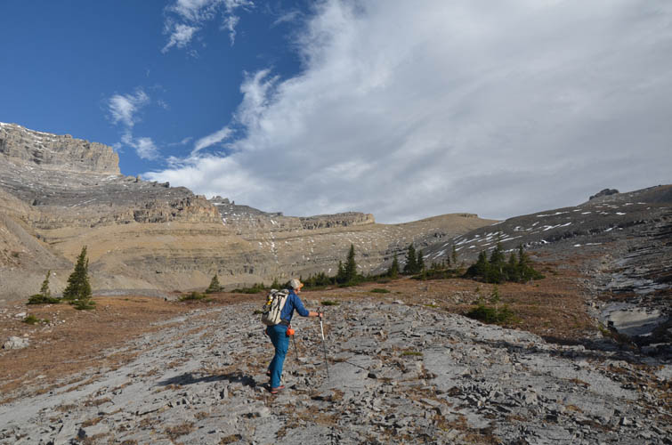
Pleasant hiking up gentle slopes below the brown cliffs of Astral Peak.
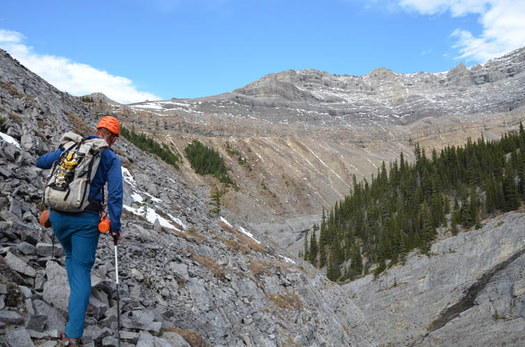
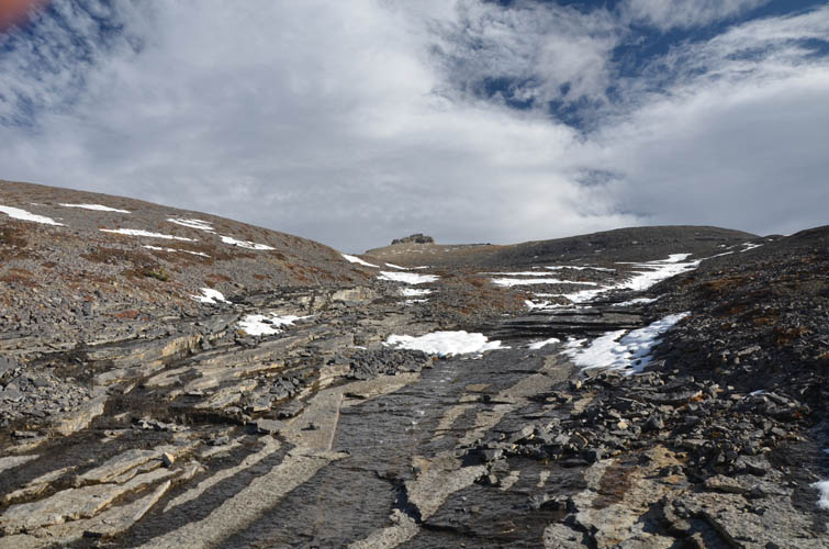
A broad drainage with smooth slabs offers an easy way straight up to Castle Rock’s south ridge.
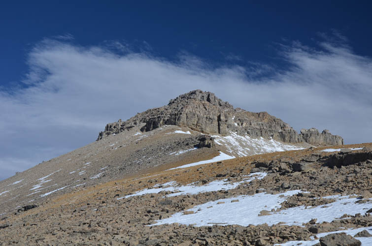
The summit tower appears.
Poltergeist Peak in the background.
The summit tower of Castle Rock. The left (west) side offers easy to moderate scrambling terrain to reach the high point. It was crazy windy up here and we simply couldn’t find a sheltered spot anywhere, so we just kept up the pace and didn’t take a break until we got back down to the valley.
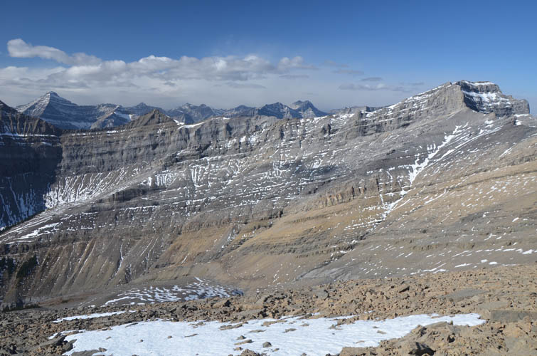
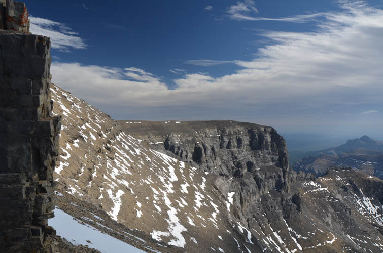
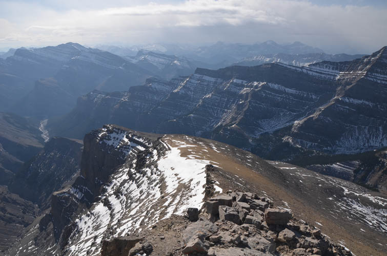
The south ridge of Astral Peak (summit on far right) is flanked by steep cliffs that thwart any attempts to connect the two summits via a scramble traverse.

Trevor looks tiny under the imposing east face of Poltergeist Peak.
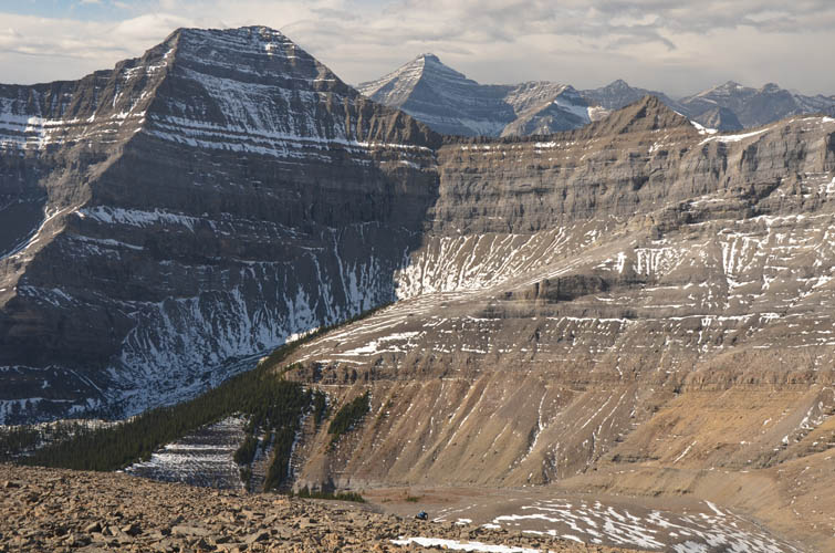
Poltergeist Peak (left), with Mount Aylmer in the distance to the right.
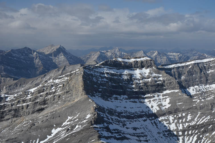
Castle Rock’s broad south ridge.
Another look at the connecting ridge between Castle Rock and Astral Peak.
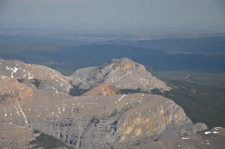
Blackrock Mountain appears as a small bump far to the east.
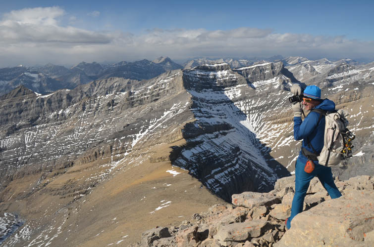
Vern is trying hard to take pictures while steadying himself in the strong wind gusts that threaten to blow us off the summit.
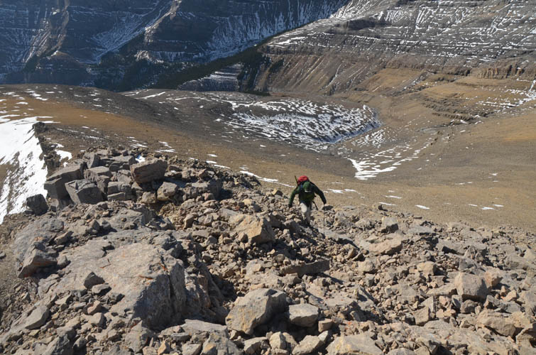
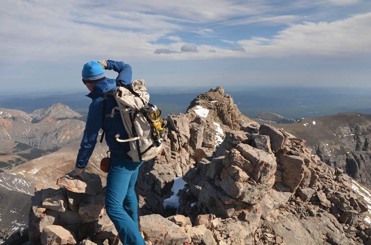
Trevor scrambling up the last few metres to the summit.
Looking back down the south ridge where we came from. The big broad mountain on the left is Mount Costigan.
The western slopes of Castle Rock are generally flat and gentle. There are a few unseen minor cliff bands on the lower right in this picture, which is why we followed a drainage to the south ridge first.
Mount Oliver (centre) and Puma Peak (behind and left).

Mandatory shot of Devil’s Head. Blackrock Mountain (left) looks tiny in comparison.
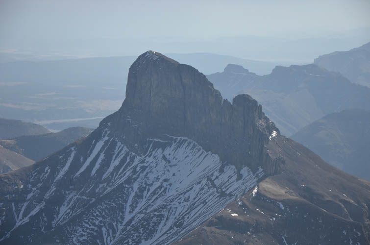
Close-up of Devil’s Head.
Another small front range “outlier” to the NE, “Sheep’s Claw“.
Vern in his element: exploration and photography!
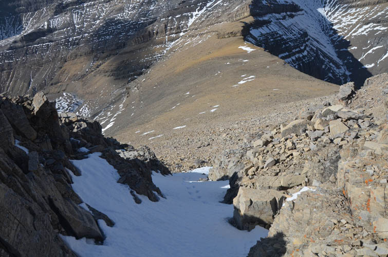
The short snow-filled gully that we used to get off the summit tower.
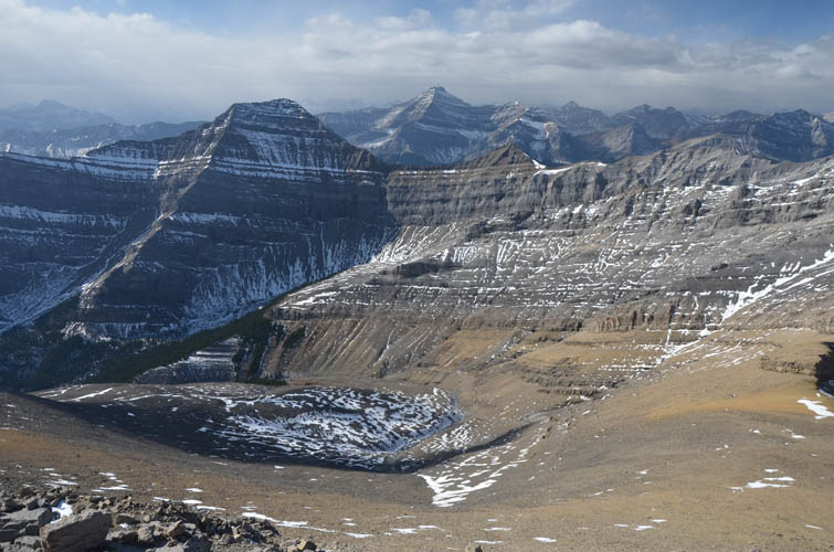
Looking back up the broad drainage with Castle Rock’s summit mass behind.
Back at the massive cliff that made us detour around the west side of the valley. This must be a prime spot for ice climbing in the winter.
Devil’s Head
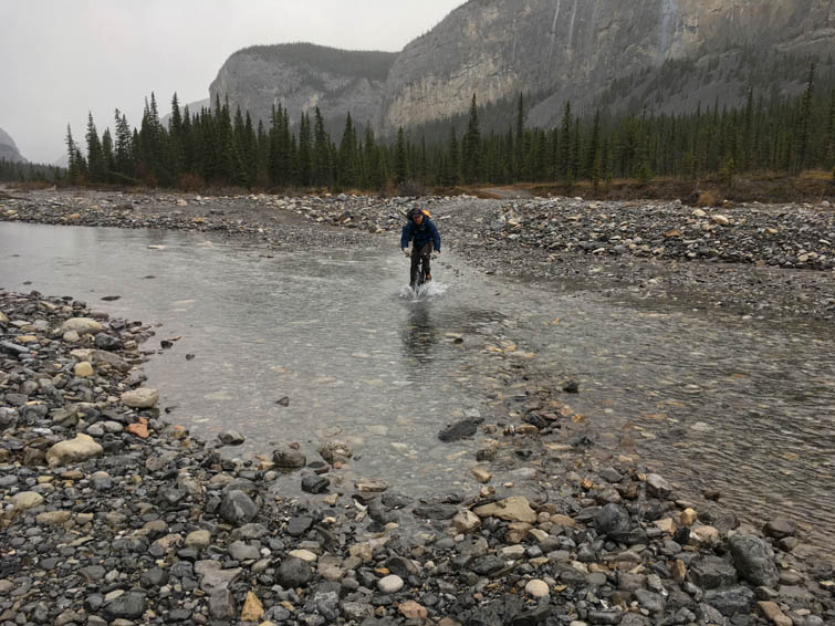
Cycling back through the Ghost River in the rain. We weren’t usually as successful as this riding through the water… most of the time we made it about half way and then had to wade!