29 June 2017
Solo
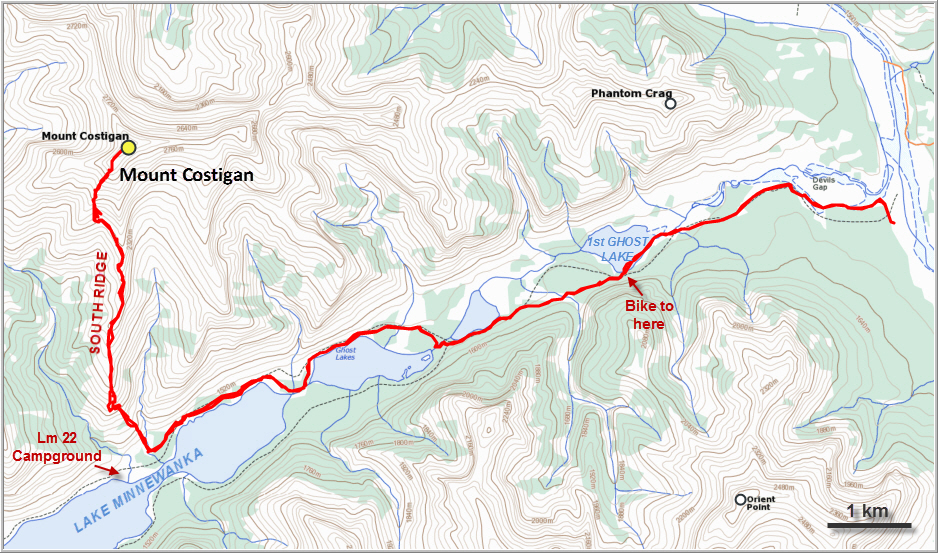
Mount Costigan is one of the highest mountains in the Ghost area and has several well-documented ice climbing routes around its approach valleys and buttresses. As a scrambling objective, curiously, the mountain has been largely overlooked. Although it can be reached via a good path along the north shore of Lake Minnewanka, the approach takes a long time and there are no trails on the mountain itself. Perhaps more telling is the fact that there aren’t any detailed published routes to the summit, in contrast to nearby Mount Aylmer which is covered in Kane’s Scrambles in the Canadian Rocky Mountains. As a result, Aylmer sees many ascents every year and has a beaten path leading all the way to the top.
Armed with some beta from Raff’s ascent of Mount Costigan in 2014 and a Rocky Mountain Rambler’s report from 2008, I knew I could look forward to an adventure trying to find my way up this sizeable peak. And a fine adventure it was!
I was lucky to find two temporary bridges over the Ghost River due to construction going on at the end of the TransAlta Road, which saved me a frigid crossing on foot and I was able to drive a bit closer (but not all the way) to Banff National Park boundary at Devil’s Gap. It was a chilly but beautiful clear morning when I unloaded my bicycle at 7:30 am to start the bumpy ride. The first kilometers to the park boundary are really rough, but then the riding gets easier and pedalling across the dried out Ghost Lake is a joy.
From the first Ghost Lake, I followed the very good path on the southern embankment that Richard and I had taken on our successful attempt up Saddle Peak. At the split past the second Ghost Lake, I took the right branch where the trail crosses the water (rock hopping) and then goes along the northern side of the lakes.
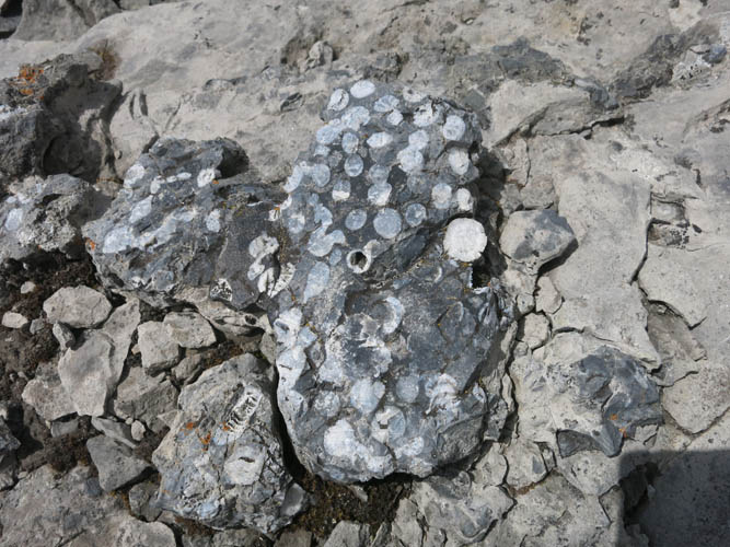
After about 2 ½ hours I reached the start of Costigan’s south ridge. I felt like I really needed to take a good break and eat something, and I hadn’t even started climbing the mountain yet! Well, day light hours are long in late June and I had plenty of food with me, so there was no need to worry. Just before reaching the Lm 22 campground at a drainage, I left the path and went straight up a steep slope interspersed with some deadfall, aiming at a small cave feature. A short traverse under the cave to the left took me up the south ridge proper. While building a cairn here, I found a really interesting fossil embedded in the rock: a lobster-like claw encased in crinoids (remains of ancient sea-lilies), something I had never seen before – see photo below.
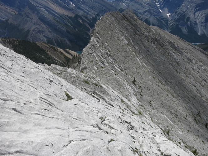
The south ridge is mostly an easy hike, and a very enjoyable one! There are wonderful views of the deep blue waters of Lake Minnewanka every time you turn around, and the neighboring ridges and valleys to the left and right are equally scenic. At some point higher up after gaining significant elevation, the ridge becomes more involved and I had to negotiate several short drop-offs and one large slanted rock slab that looked impassable from a distance but in the end a faint goat trail pointed at an elegant way through. I think most of the drop-offs and the slabs are probably avoidable by dropping down and sidesloping on the western side.
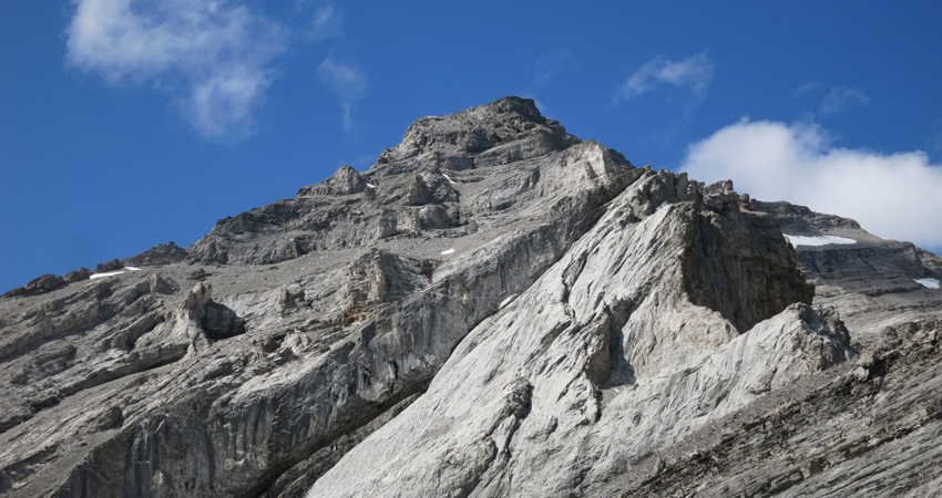
The south ridge eventually ends in a huge vertical cliff band that continues down into the valley, seemingly blocking any further progress. By now the clouds that had been obscuring the summit mass of Mount Costigan finally lifted and I was able to see what lay ahead. It looked pretty messy! A complicated mixture of ramps, cliffs and scree chutes with no clear line through. But the closer I got, the more obvious the route became. Just before reaching the vertical wall on the ridge, I veered left and sidesloped through scree and boulders towards a prominent gully with a black overhang in the cliff band. Here, a few metres to the left below a small waterfall (more of a trickle), there was a break in the cliff requiring a few moderate scrambling steps. This was also the last point where I could fill up my water bottle!
After breaking through the cliff, I easily scrambled along scree-covered ramps and rock ribs to where the south and southwest ridges join. There were still a few hundred metres of elevation to be climbed at this point and when I looked up the summit mass from here, it again looked like complicated terrain where one could easily get dead-ended. I wondered if I should traverse further to the left as previous parties seem to have done, but in the end decided to try to go straight up. I picked a line along or near the ridge crest and built a few cairns to help me find my way back. There were lots of short ramps and chutes to weave through, but thankfully it all worked out well and I was soon on the summit ridge with the summit cairn in sight.
One thing that Raff pointed out in his account is that this ridge is crumbly and loose, and he certainly wasn’t kidding! There are a few short cliffs that need to be downclimbed, but the worst is just before the actual summit, where the ridge appears to be crumbling away and a few awkward moves are necessary to scramble along a very narrow and exposed spine down to a notch (on my return, I found a way to bypass the crux only metres away by scrambling up a narrow ledge on the south side of the ridge). I wouldn’t be surprised if in a few years some parts of this narrow and crumbly ridge have broken off or collapsed entirely.
After 7 hours ascent time, I finally stood on the summit of Mount Costigan, taking in the views I had sought after: distant peaks in the Ghost to the north, including Devil’s Head, Astral Peak and Mount Davidson but most of them unnamed, as well as more familiar faces like Mount Aylmer and a good look at our previous year’s ascent route up Saddle Peak. And of course the skyline of Calgary was also visible in the distance. As expected, the summit register contained mostly blank (and, unfortunately, wet) pages with the names of only three ascent parties since the first recorded climb by Don Forest, Gordon Scruggs and Glen Boles on June 6th, 1972.
The dozen or so cairns I had built on my way up were of huge help to me in retracing my route because many of the scree ramps and cliffs look so confusingly similar. Back at the vertical cliff band, I paused to fill up my water supply at the small waterfall, fed by what looked like a tiny patch of remaining snow a few metres above me. The snow was melting fast in the hot afternoon sun, and I was standing right underneath that chunk of melting snow and ice…CLUNK!!! Two laptop-sized pieces broke off and one of them hit my leg, it was hard as a rock. What a stupid mistake! I immediately shuffled to the side, out of the danger zone, away from the time-bomb looming above me. Of course I should’ve never stopped in a place like this, not to mention fill up my water bottle! I had been too focussed on refreshing my dry mouth with some ice cold water after a successful summit, and this momentary lapse in concentration could’ve easily led to an accident. Had the entire patch slid off, I would’ve been knocked off my feet and probably seriously hurt, or worse. I guess you never stop learning and this is definitely one of those “lesson learnt” experiences.
After that wake-up call, I re-gained my focus on the way ahead and actually really enjoyed the rest of the descent. The hike back along the ridge was very pleasant, albeit long and hard on the feet on the steep, chossy lower slopes. It was a relief to be back on the Lake Minnewanka trail, not to mention seeing my car again after this formidable 13 hour adventure!
DISCLAIMER: Use at your own risk for general guidance only! Do not follow this GPX track blindly but use your own judgement in assessing terrain and choosing the safest route. Please read the full disclaimer here.
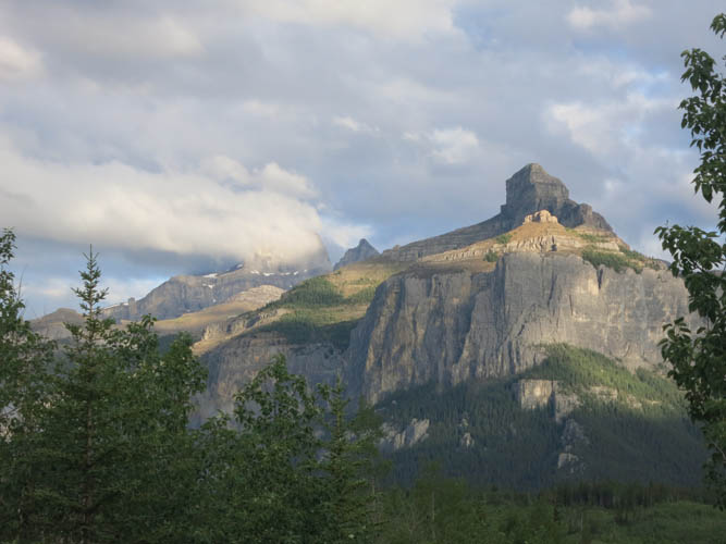
I can never get enough of the dramatic cliffs that make Phantom Crag look like a fortress.
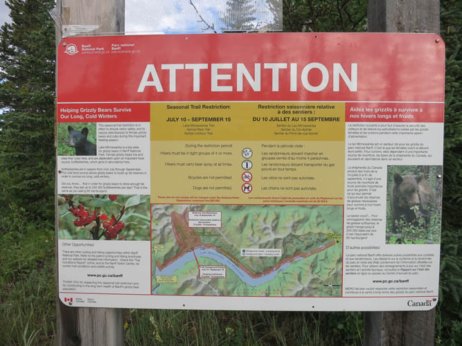
A sign at the entrance to Banff National Park advises of the seasonal group restrictions in place along the shores of Lake Minnewanka and surroundings between July 10 and September 15: hike in groups of at least 4 and carry bear spray, no biking, no dogs.
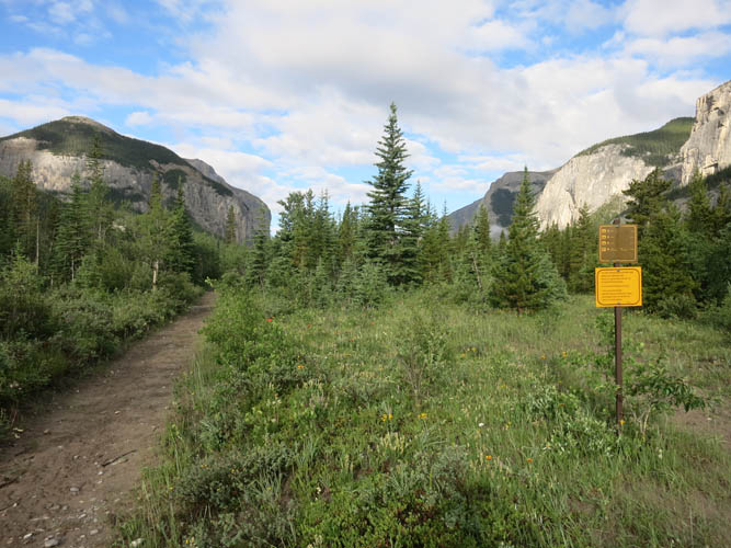
An excellent hiking/horse trail leads into Devil’s Gap.
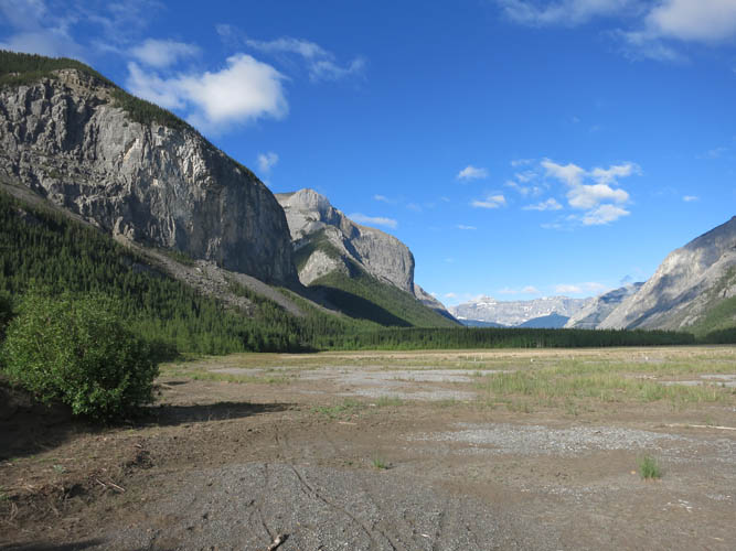
The dried up bed of the first (easternmost) Ghost Lake.
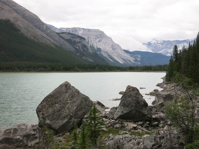
Along the northern shore trail of Lake Minnewanka.
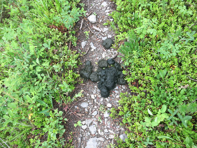
Fresh bear scat: this is prime grizzly habitat!

Up the lower slopes of Costigan’s south ridge. The cave feature I was aiming for can just be seen in the centre near the the top. I traversed left under the cave to gain the ridge crest.
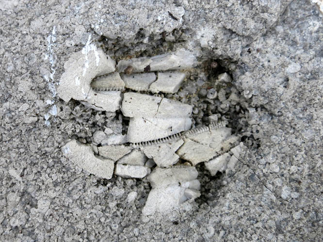
Interesting fossils here: a claw embedded in crinoids.
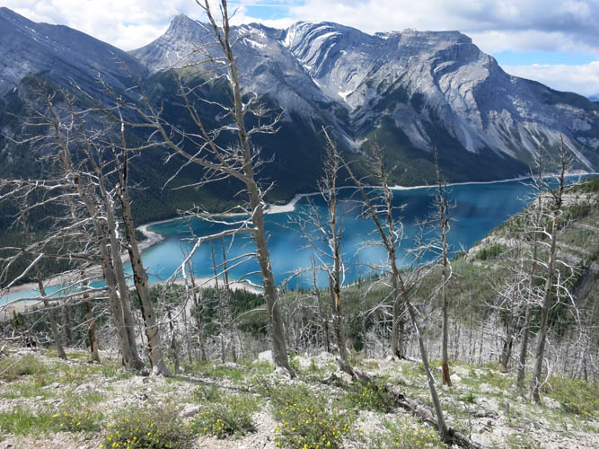
Views of Lake Minnewanka start to open up as I gain elevation on the south ridge.
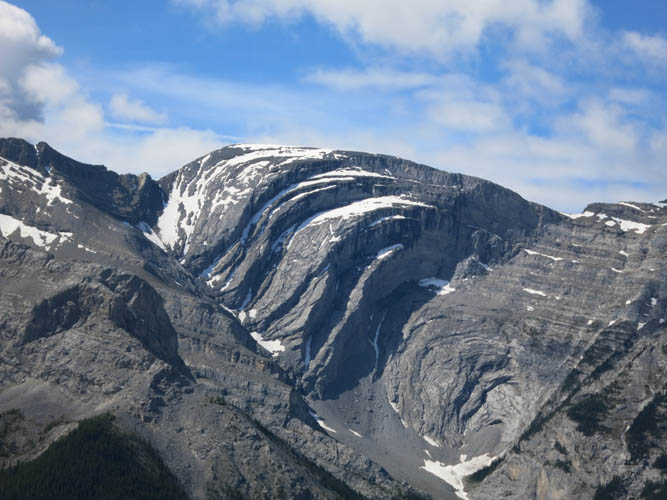
A close-up of large folded strata on the northern end of Carrot Peak across the lake.

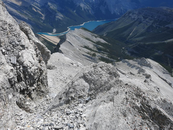
The narrows as seen from the ridge.
Saddle Peak on the other side of Lake Minnewanka is a massive bulging mountain.
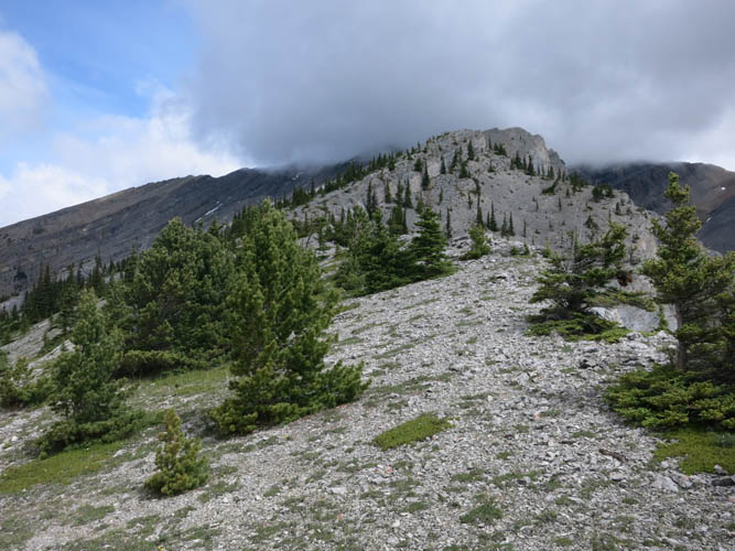
Pleasant hiking along the easy lower part of the ridge.
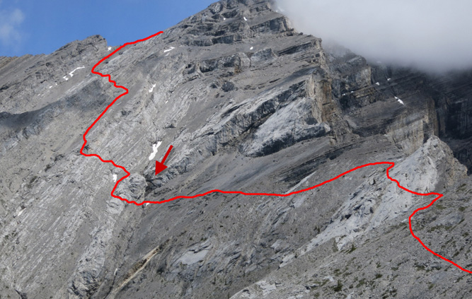
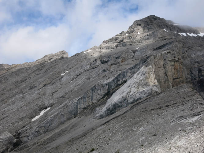
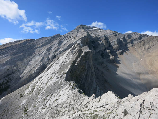
My approximate route in the upper part of Costigan’s south ridge. The key here is a black overhang (arrow) in the main gully. Below and to the left of this overhang there is a break through the prominent rock band that cuts across the entire slope here. The large light grey slab on the right is steep but can be contoured around in the middle.
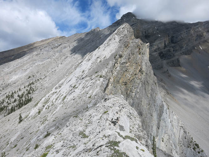
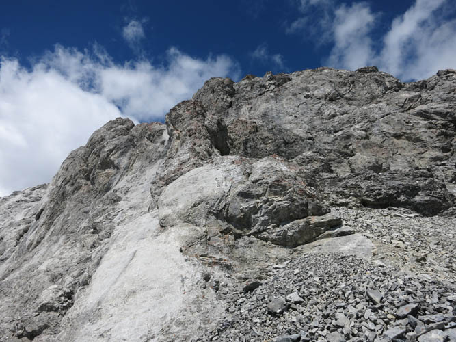
Approaching the large grey slab. It’s mostly moderate scrambling with a few difficult steps.
Looking back down the ridge from the slab.
There are several steep breaks and drop-offs along the ridge, but most are easily circumvented.
Sidesloping across rubble towards the black overhang in the lower left hand corner.
Past the overhang, it’s moderate scrambling all the way to the summit ridge.

Looking back at the south ridge, with the many rock ribs and scree chutes below me.

A close-up of Saddle Peak to the south. The only feasible ascent route for this mountain is the long gully/drainage on the right.
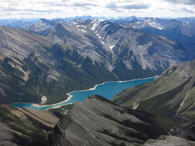
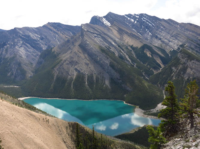
Beautiful views of Lake Minnewanka from up here!
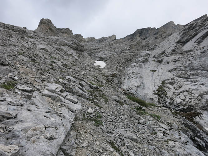
More complicated terrain to navigate to get to the summit ridge. I basically zig-zag my way through, following the path of least resistance. There are lots of possibilities and it’s easy to get dead-ended.
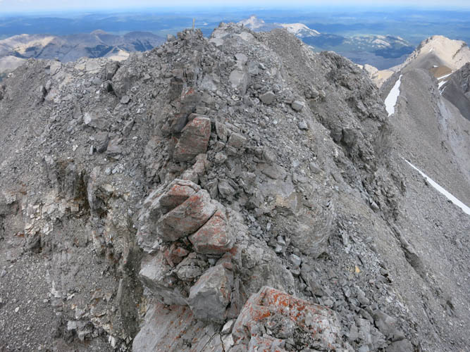
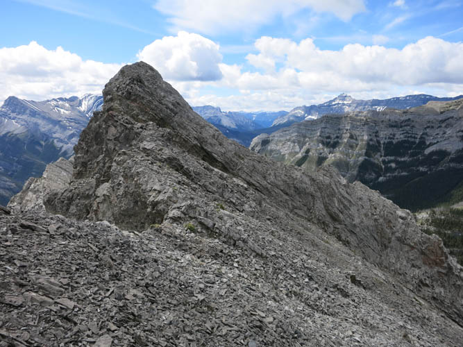
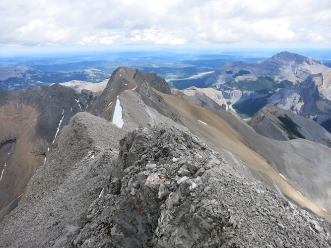
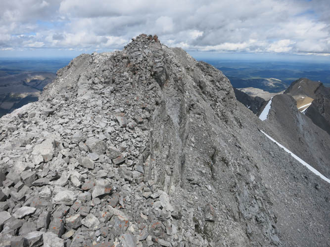
The crumbly summit ridge, with Costigan’s summit cairn at the end.
Taking a look back at the crux.
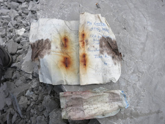
The register reveals a poorly preserved notepad. First recorded ascent was by Forest, Scruggs and Boles in 1972.
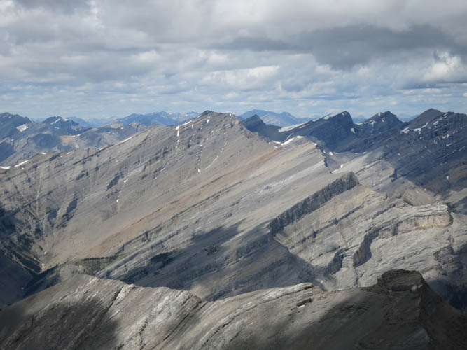
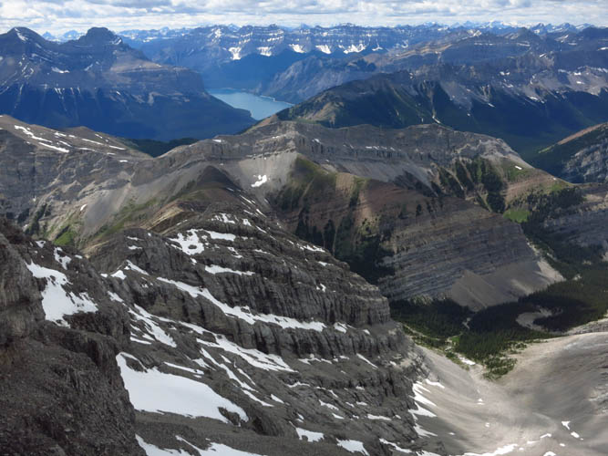
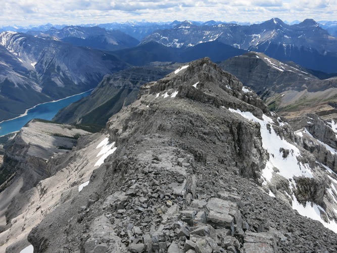
The continuation of the ridge to the east is craggy and has lots of steep drop-offs.
This stately mountain to the NW is Poltergeist Peak. In the distance on the far right side is Astral Peak.

A look down the spectacular Ghost River valley.
Orient Point is also quite impressive from this vantage point.
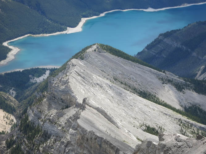
This is Costigan’s south ridge that I hiked up. The coastline of Lake Minnewanka almost looks like a tropical sandy beach!
Lake Minnewanka continues for quite a distance to the west.
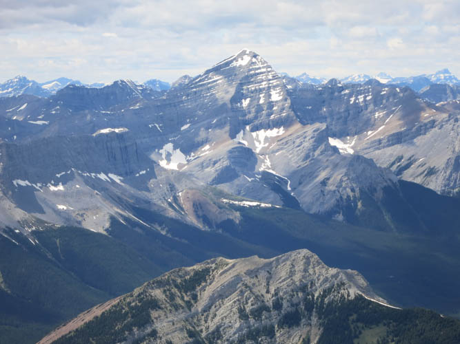
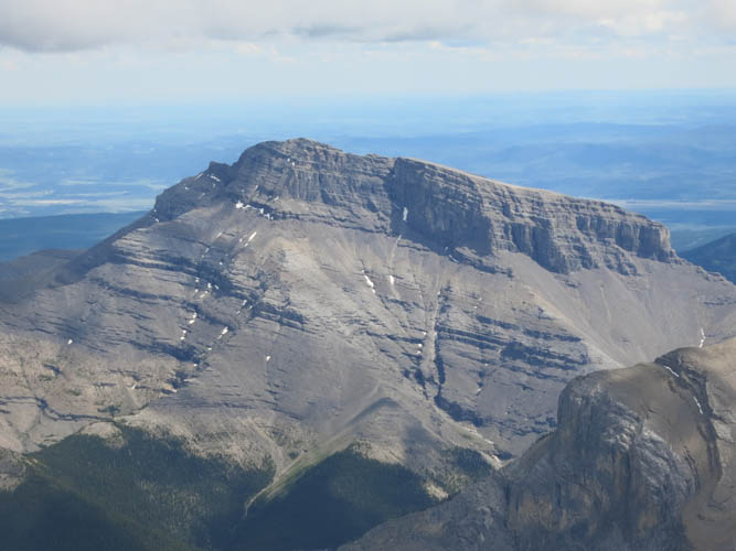
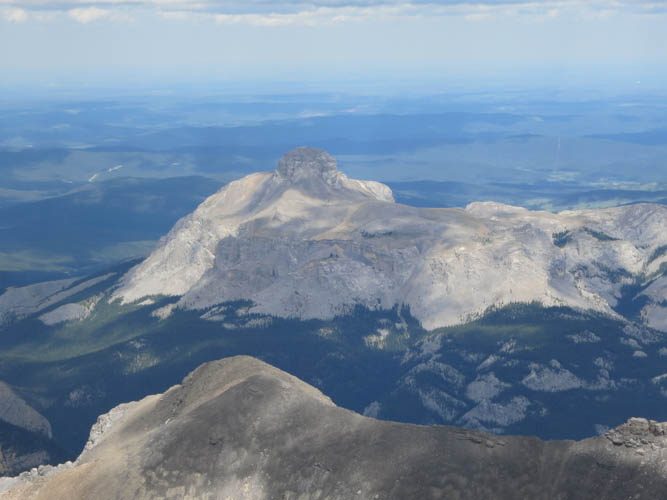
The striking Mount Aylmer is the tallest in the area at 3162 m!
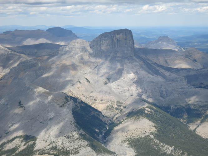
But Devil’s Head to the NE is the most eye-catching!
Further to the NE, Blackrock Mountain looks like a lonely island in the prairie sea.
On my way back, I use a narrow ledge on the south side of the ridge to bypass the crumbliest section. This is looking back to the east, with the ledge on the right side.
The rest of the summit ridge is largely a stroll, with a few moderate steps here and there.
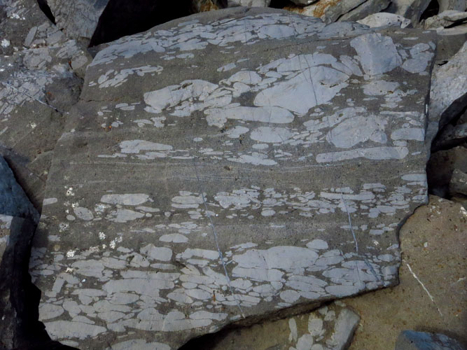
Lots of interesting rock up here, too! This is a siltstone with several layers of elongated pebbles of various sizes, possibly part of a channel lag.
And a very different type of rock only a few metres away: a coral-rich limestone.
Heading back down the chutes and ledges.
An anomaly among all the grey rock!
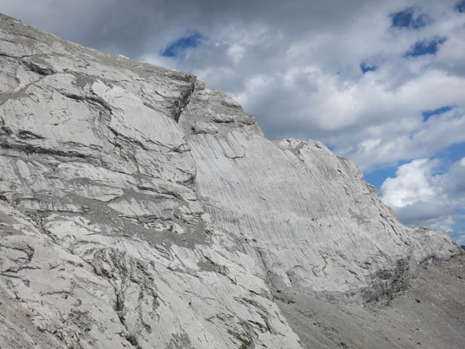
These huge smooth slabs are part of the major rock band in the upper part of the south ridge.
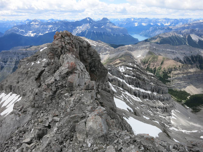
Now that I’m past the difficult upper ridge, I pause to take a last glance at this breathtaking mountain.
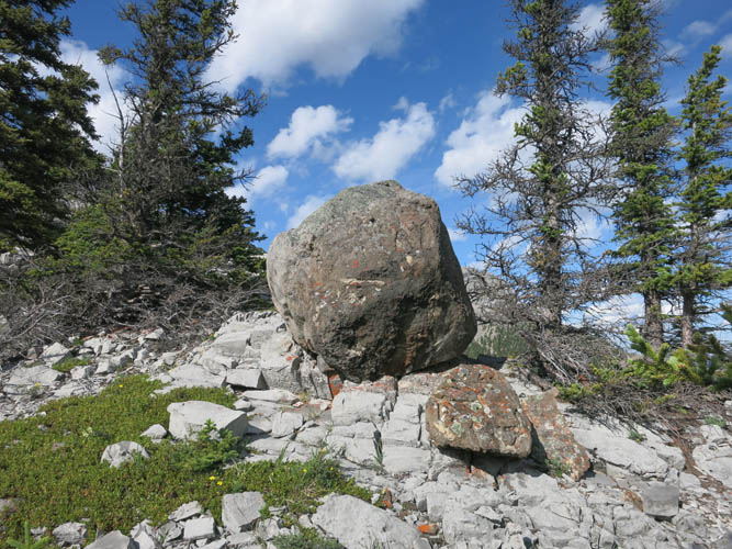
Two brown boulders, completely out of place in all the grey limestone, near the end of the south ridge.