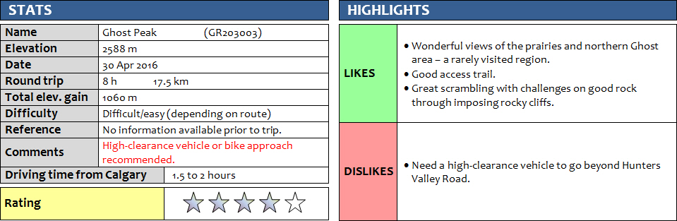
30 April 2016
With Priyesh
This is one of the very few mountains that I had absolutely no information on before setting out – no online trip reports, published routes, recorded summit ascents, not even a name for the peak – but one that turned out to be straightforward and easily accessible on a good trail almost all the way. And it was thoroughly enjoyable on top of that! Of course, Priyesh was the one who couldn’t wait to join me on this adventure into the unknown.
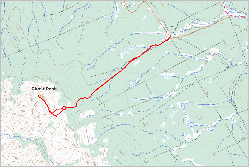
Ghost Peak lies in an area that is rarely visited: the northern end of the Ghost right at the very northern end of the long line of peaks that can be seen from Calgary. I’ve seen it many times from the Ya Ha Tinda area as a pointy promontory that sticks out right where the Front Ranges take a sharp turn to the west. My research before the trip indicated that several gravel roads leading west from the Forestry Trunk Road (Highway 22) may get me a good distance into the area, but we had no idea whether these roads were passable and even open to private vehicles. Many roads in this area were built by oil companies to provide access to wellsites and are gated off.
It turned out that my concerns were unfounded and Priyesh, who was ever so positive and encouraging, kept me motivated to keep driving along these roads. We continued for a good 8 km without having to use the bikes we brought just in case. Coming from Calgary along Hwy 22 we first turned left onto Hunters Valley Road and followed it for about 5 km (a good gravel road doable in a normal car), then left again onto a private but accessible road where a high-clearance vehicle is probably a necessity as it’s a bit rough and there are deep grooves in the road right at the beginning. After another 3 km on this private road we came to Fallentimber Creek and parked in a flat pull-out area just before a blue bridge that runs over the creek.
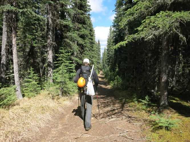
A decent track runs right along Fallentimber Creek through boggy meadows and light forest for several kilometers before turning into a very good muddy path that follows a straight line through the forest. On satellite images and maps of the area, this line seems to abruptly end in the middle of the forest – an indication that this was probably a seismic line that was shot for exploration purposes. We followed the cut-line and were delighted to see that the path didn’t end here but continued to slowly wind its way through the forest all the way to the col that sits between Ghost Peak and a subsidiary peak just to the south. There were no other footprints on the trail, but tire marks (in addition to empty beer cans and other garbage we found on the trail) gave away the popularity amongst annoying dirt bikers that come here despite all motorized traffic being prohibited in this area. Although the trail is pretty good in most places, I think our bicycles would’ve been of limited use due to the many boggy areas further down the creek.
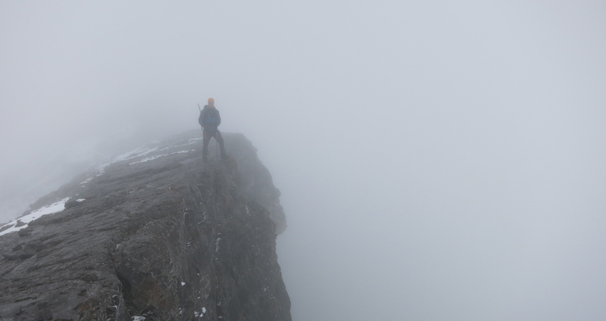
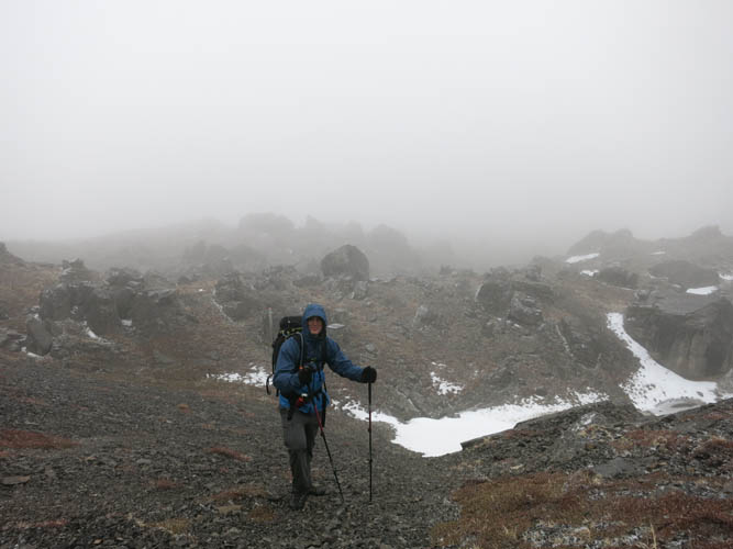
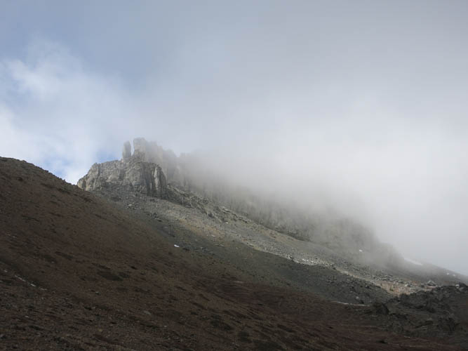
After some 3 hours, we reached the col but couldn’t see very far due to the low cloud cover. The wafts of cloud drifting over the rolling terrain and through big chunks of rock that had fallen off the steep east cliffs of Ghost Peak made the whole area look eerie and gave it an uncanny feel. It really reminded me of my outing to Phantom Crag, also in the Ghost area, with Richard a couple of years ago. At the col we turned right and all we could see were some craggy cliff bands with a myriad of chutes and gullies in between, everything else to the left and right and behind was shrouded in mist. There was only one way to find out if there was a scramble route through these cliffs, so we decided to go for it and head up the path of least resistance. Surprisingly, this worked out really well, all the way to the top of the cliffy area. A light cover of snow and ice made clambering up the steep gullies with large blocks of rock tricky in places, but it was a good challenge and the rock was generally solid. Overall I would probably rate it as difficult scrambling in this section and routefinding skills are certainly required as there was no trail to follow and no cairns (we built a few to help us on our way back). The entire section, however, is avoidable as we saw on our return trip – if you circumvent the cliffs far enough to climber’s left, there are easy/moderate but tedious scree slopes that you can take straight up to the summit. [Edit Nov 2017: Recent trips by Matthew Hobbs and others confirm that this alternate route via the backside is indeed possible and in the easy to moderate scrambling realm.]
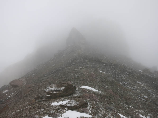
Above the cliffs, it was an easy and enjoyable ridge walk all the way to the summit. To our great surprise, there was a huge summit cairn greeting us at the top, and even a large plastic canister containing a register and a variety of items, some of them broken. A sticker on the canister indicated that this was a remote geocaching site. Unfortunately, there was ice inside the canister and most of the items were stuck to the bottom and some appeared to be in poor shape. A small booklet named the mountain as “Ghost Peak Summit” but almost all the pages were stuck together so we couldn’t verify when it was placed there or who was the last visitor. We found a spot to sign the register, removed some of the ice, and put everything back together. The views from the summit are probably magnificent – if you have no clouds around you that is! On this day, however, all we could see was white snow and white clouds around us, nothing else. A good reason to come back another time on a sunny summer day! And this is definitely a trip I would do again. It feels remote to be out here in this beautiful area and there are many more valleys and ridges to explore, so I know I will be back.
ROUTE MAP
DISCLAIMER: Use at your own risk for general guidance only! Do not follow this GPX track blindly but use your own judgement in assessing terrain and choosing the safest route. Please read the full disclaimer here.
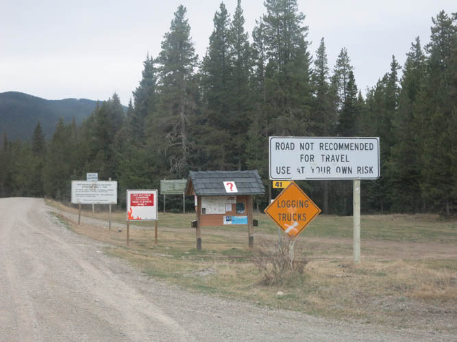
Start of Hunters Valley Road.
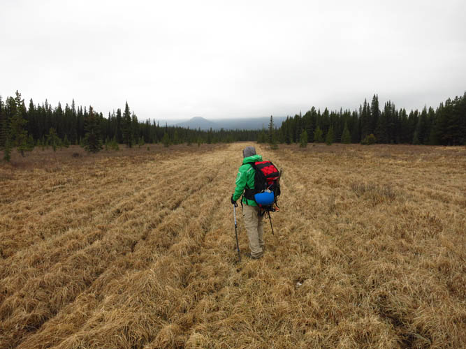
Early morning approach on the flat plains surrounding Fallentimber Creek. Our objective Ghost Peak is obscured by clouds in the distance.
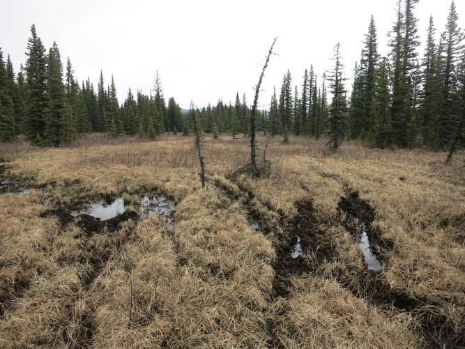
The approach is initially boggy in places, but travel is easy.
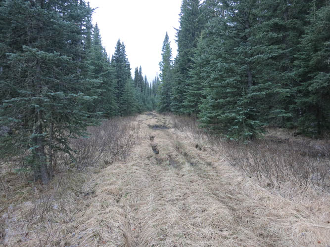
A good trail heads straight in the direction of the mountains. This is probably a former seismic cut line.
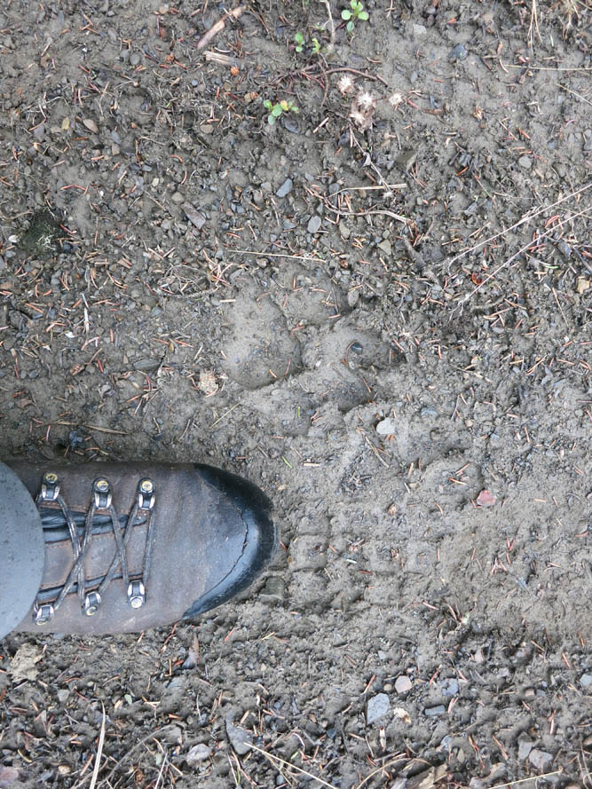
Cougar paw prints (?) alongside treadmarks of a dirt bike (although offroading is not permitted here).
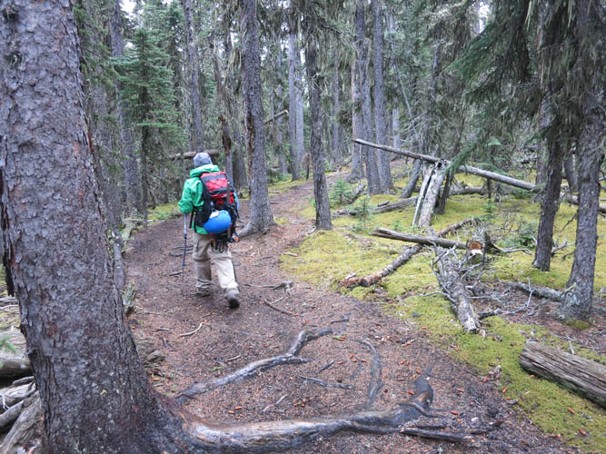
A good trail continues through the forest all the way to the base of the mountain.
An interesting jumble of rocks at the basal scree slope of Ghost Peak.
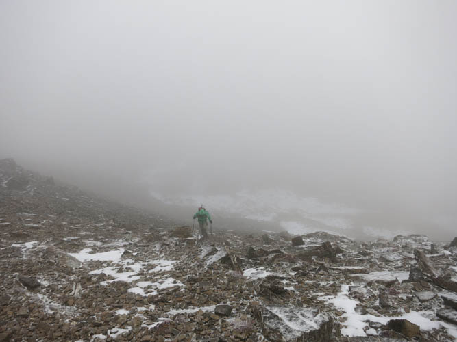
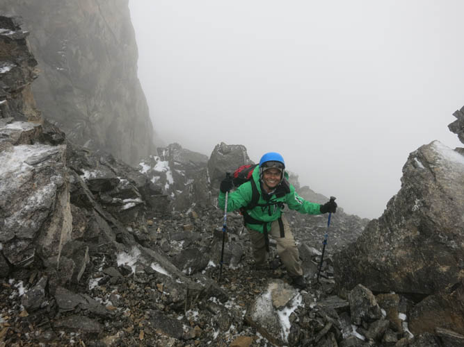
Priyesh heading up the scree slope, chased by low-lying clouds.
From the col, we headed right (N) toward the craggy cliffs of the barely visible mountain.
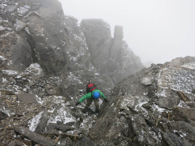
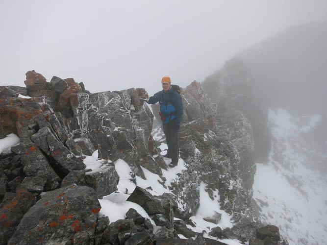
Lots of routefinding through the cliffs, but all manageable once you break it down.
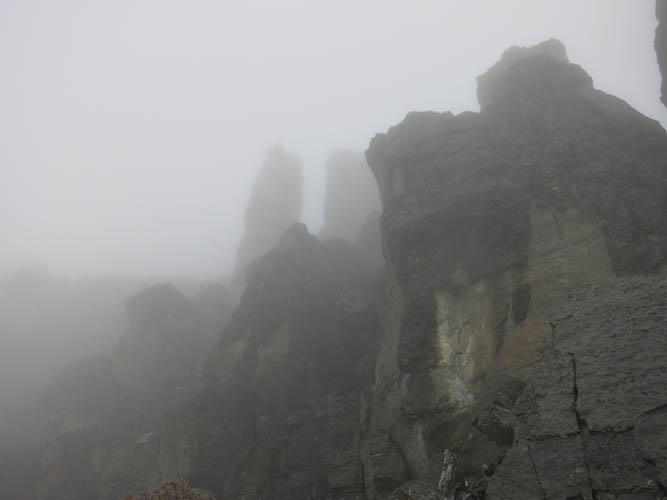
The towers and cliffbands in front of us looked imposing, if not downright daunting and eerie in the clouds!
Shattered rock.
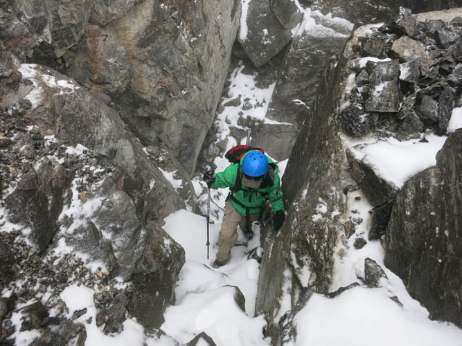
Finding a line through the rock required some searching but there was always a way.
A smile of sunshine amongst the dark grey rock 🙂
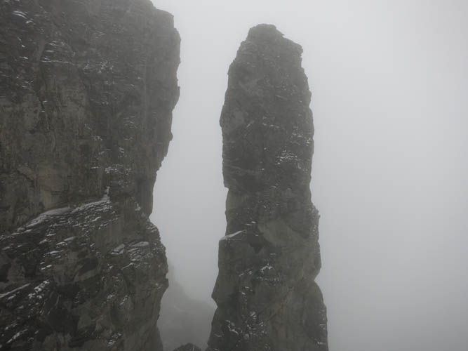
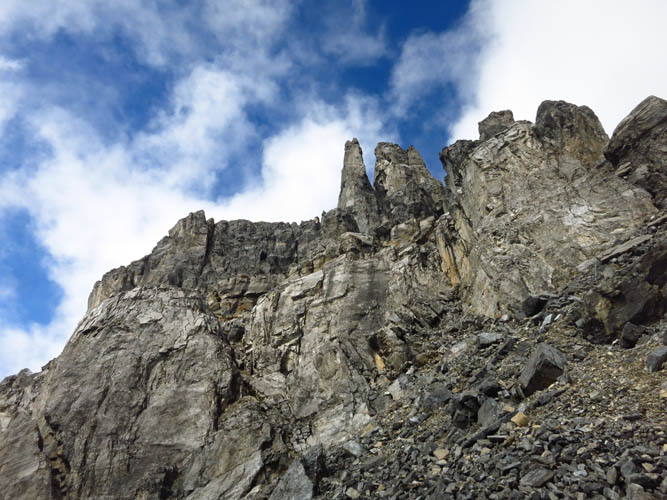
Passing an impressive pinnacle on the way up.
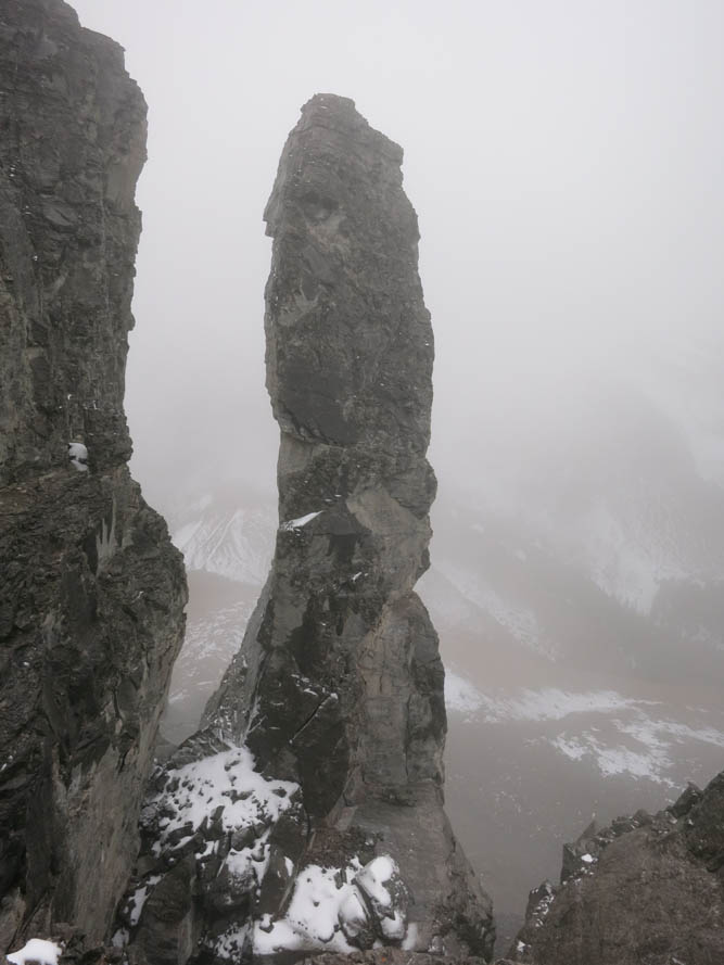
Like a slender candle, the stand-alone tower must be at least 15-20 m high.

Coming up seemingly out of nowhere…
We are still in the middle of the clouds as we come closer to the summit.
“Frosted rock”
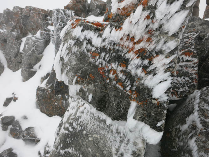
Wind has shaped the snow into frost patterns on the eastern escarpment of the ridge.
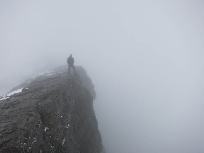
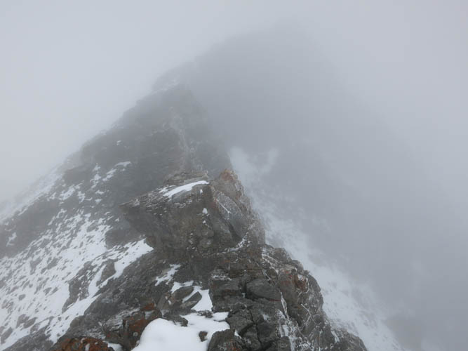
What an eerie ridge walk!
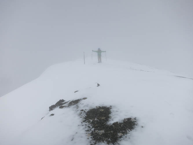
Finally at the summit!
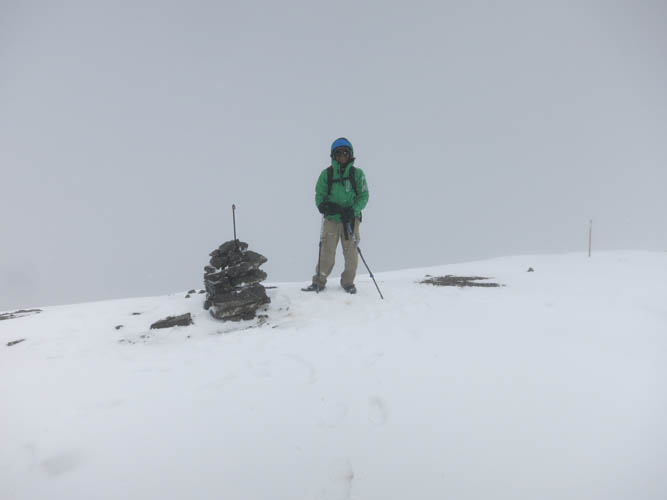
Priyesh at the summit cairn. As you can see, we’re enjoying spectacular views all around 🙂
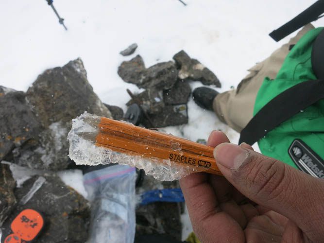
The frozen contents of the solid plastic canister stashed inside the summit cairn.

On the way down, Priyesh explores an interesting cleft that has formed in the cliffs.
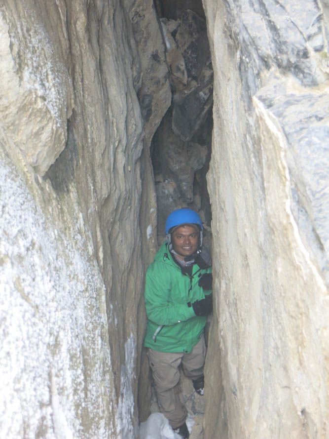
Priyesh the hiker, mountaineer and cave explorer!
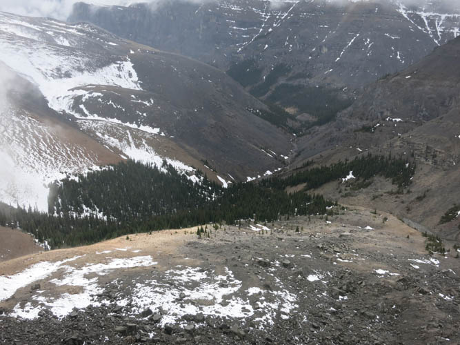
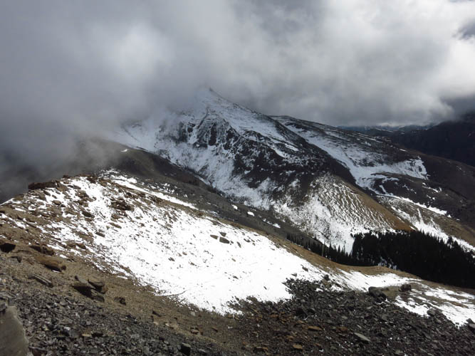
As we descend, the clouds open up revealing the small, isolated valley to the SW below.
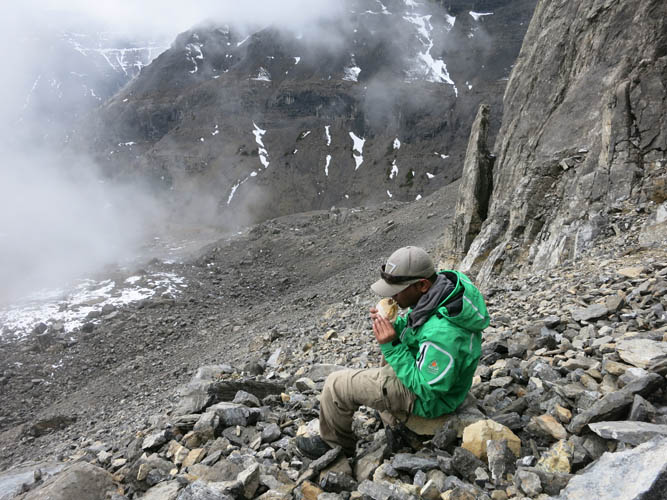
Perfect time for a well-deserved lunch break.
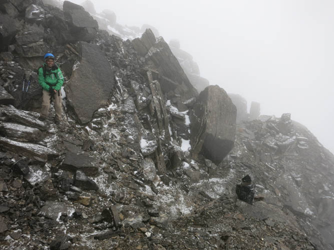
A look back at the cliffs we had to zig-zag our way through.
Slow-moving clouds make for dramatic effects in the mountainscape.
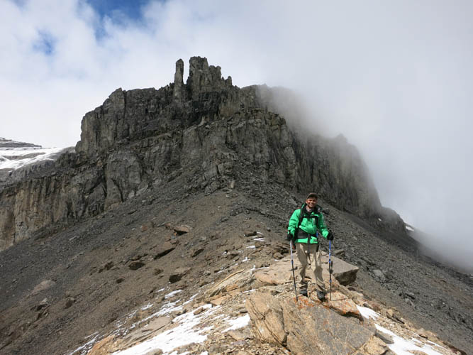
Priyesh with Ghost Peak behind.
On the way back into the prairies, Ghost Peak disappears once again in the clouds.
The weather finally clears up as we head back on the cut line.
This is where we came from!
One last close up of the east face of Ghost Peak.
IN MEMORIAM: Priyesh Menon
My dear friend and hiking partner Priyesh passed away in a tragic accident on Mount Lawson in Kananaskis on May 23rd, 2016. He was only 30 years old. He touched on countless lives with his most generous and loving spirit that will be remembered by many, many people in Canada, India and around the world. Like many other hikers and scramblers from Calgary, I feel hugely honoured to have met him and to have had the chance to hike with him. To preserve some of the beautiful moments we shared, I have decided to keep the reports of my trips with him on my site (after consultation with his family). We would like people to remember him for who he was: the most joyful, uplifting, kind, and selfless boy who never stopped smiling. As many of his fellow-hikers recounted, he had the unique ability to bring people together and bring positivity into their lives. There was genuine happiness wherever he was. A true ray of sunshine in our world! Thank you, Priyesh, for enriching our lives. You will be dearly missed.