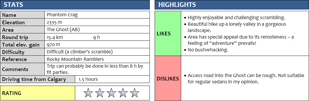
23 August 2014
With Richard
This trip was as ghostly as it could get – not only because of the name of the area (The Ghost) and the mountain, but more so because of a persistent dense white fog that shrouded the upper reaches of the mountains and gave the whole trip an air of silent mystery. The lack of people and signs of human activity added to the eeriness. This is definitely one of those trips that I’ll remember for its sense of remoteness and wilderness.
Richard and I didn’t even know which mountain we were going to climb the night before. All we knew was that we had a truck rental available to us, so we decided to make full use of the truck and head somewhere where only high-clearance vehicles can get. The Ghost area was perfect for this – I had only been there once before to do the east summit of Orient Point in 2011, and I’ve been longing to return ever since.
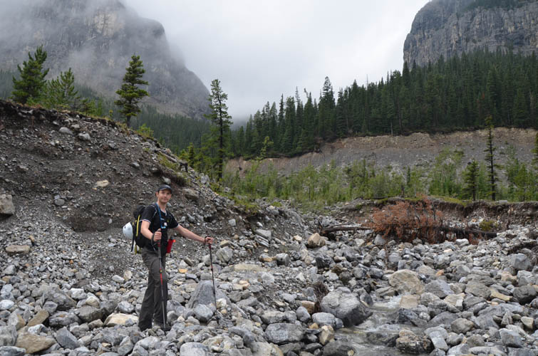
The trip started with a pleasant surprise – the Transalta Road, normally known for enormous potholes and very slow going, had been upgraded recently, making the drive to the “Big Hill” quite a bit smoother and quicker. We even saw some regular cars that made it all the way to this point. We parked our truck at the bottom of the hill and crossed the Ghost River on foot – it was about 1-2 feet deep but only about 5-10 m wide. There were other trucks we saw later that had crossed the river without problems, but with our limited river crossing experience we didn’t want to risk getting stuck in quick sand.
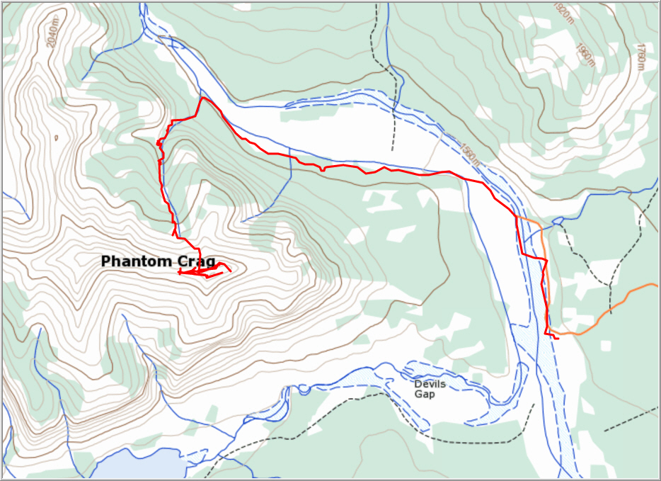
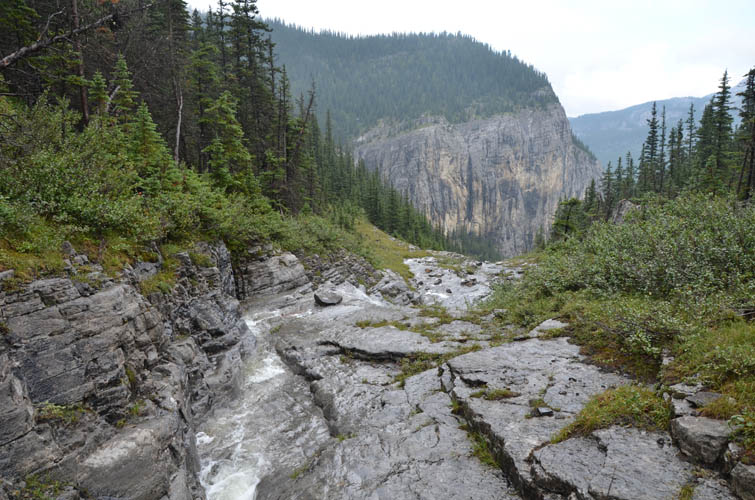
We hiked about 4.5 km towards the N and NW along the river bed, first on an the elevated dam road in the middle of the river, and later on a faint trail on the south bank when the road turned to cross the water again. The ascent drainage for Phantom Crag lies to the NNW of the summit – it is an obvious creek drainage with boulders and rubble that spill out onto the flat plains of the Ghost River bed. Bits and pieces of trails used by climbers to access vertical cliffs a few hundred metres up the gully made the going easy and straightforward. We soon hit a small waterfall where the creek narrowed to a canyon. Unusual for this time of the year, water was gushing down but it was still possible to hop around the water masses albeit with a bit of getting wet.
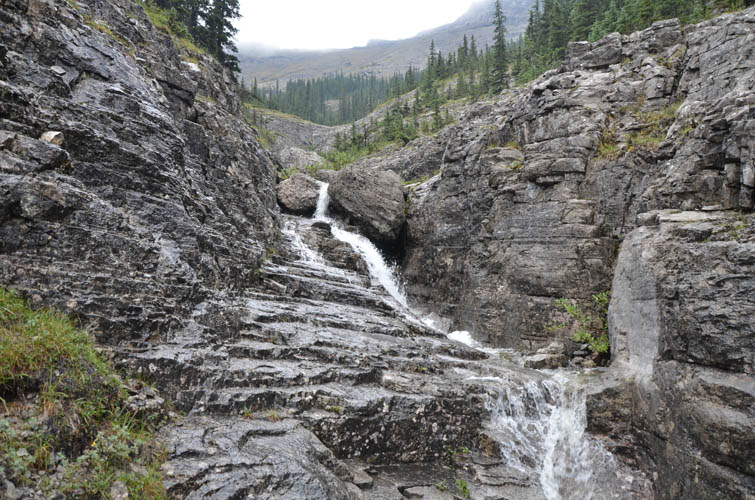
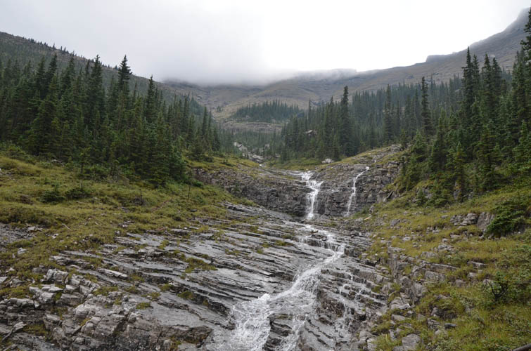
Where the creek split we took climber’s left – some 30-40 metres before the left creek branch, there is actually a bit of a path that leads up a steep rubbly slope and continues to the first cliff band beside a picturesque waterfall. Here, the path stopped. Overcoming this cliff band required caution and a few tricky moves as the rock was wet, but in dry conditions this is probably no more than moderate scrambling. A second minor cliff band soon followed but again posed no problems. We rejoined the gully which by now had numerous miniature waterfalls and step-like cascades flowing all over it.
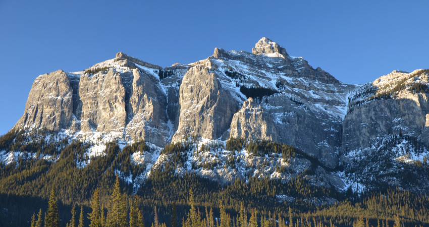
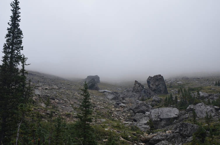
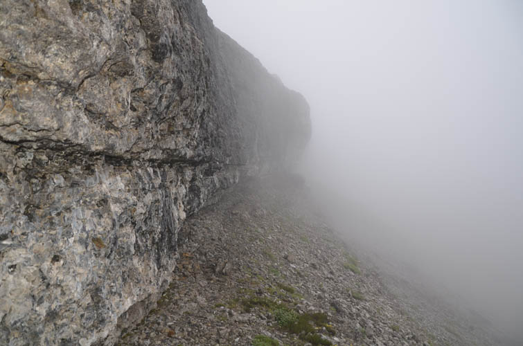
The landscape here is nothing short of stunning – truly untouched wilderness with the sort of magical enchanted aura that reminds you of fairy tale sceneries. A touch of mystery was added by low hanging clouds and dense fog that would fade in and out, blurring the outlines of the crags and pinnacles around us. Higher up, we took climber’s left where the creek split again; by now it was completely dry. Grassy slopes led up to a massive 10-20 m high cliff band at the summit mass– the main obstacle to ascending Phantom Crag. We checked out several narrow cracks that seemed to offer possible routes up. While each looked doable at first, the actual climb up a wet and near-vertical rock face turned out to be beyond our comfort level, not to mention the downclimb later on which would undoubtedly be more difficult. After all, we wanted to climb this as a scramble, which meant that anything that required the use of a rope would not fall into our route options anymore. (We also had not brought any rope.) Traversing along this huge cliff face all the way to its eastern edge we found several other steep cracks, but none that we felt comfortable with, so we decided to scan the cliff for possible routes towards the west. Almost at the far westernmost edge a more manageable way up presented itself and we took the challenge. This is probably still in the realm of a difficult climber’s scramble, but far better than any of the other options further east.
Once above the cliff it was a short hike across flat step-like plateaus interrupted by brief moderate scrambles to the summit. The register bore only two entries: that of an ACC party who placed the register in October 2008 and an RMRA’s party ascent in June 2010. Unfortunately the views were all but blocked by dense white fog, which made us feel like we were floating on a rock ship somewhere in the sky.
An absolutely wonderful trip up a little peak with plenty of good scrambling challenges, gorgeous scenery, and the added benefit of no bushwhacking. The return for the relatively small effort in ascending this mountain certainly makes it stand out for me.
Edit May 2018: Chris Johnson kindly informed me that the summit register is now missing as he discovered on his successful ascent on May 5th. The plastic tube is still there, so bring a new notepad and pencil if you want to sign your name. Chris and his party also used a short rope to climb the crux cliff band, so it might be a good idea to bring a rope just in case, especially if the rock is wet.
DISCLAIMER: Use at your own risk for general guidance only! Do not follow this GPX track blindly but use your own judgement in assessing terrain and choosing the safest route. Please see the full disclaimer here.
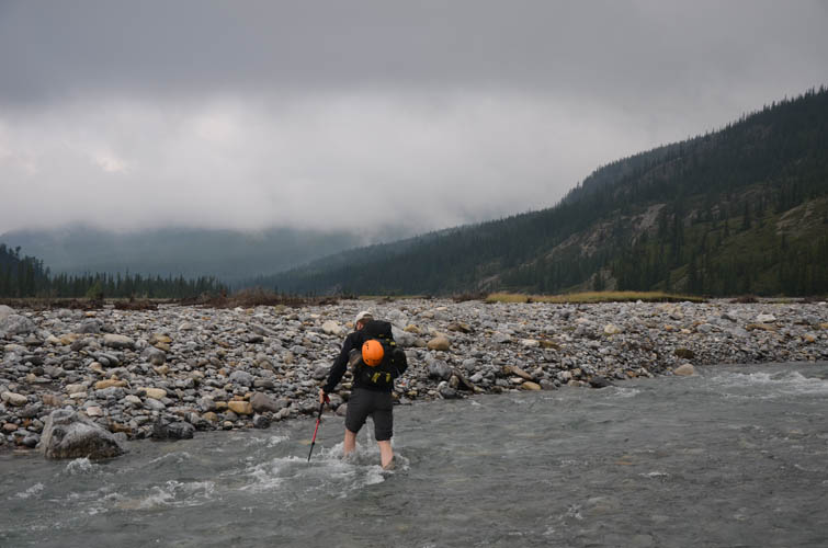
Crossing the Ghost River. [Photo by Richard]
This is the start of the ascent drainage from where we left the Ghost River bed.
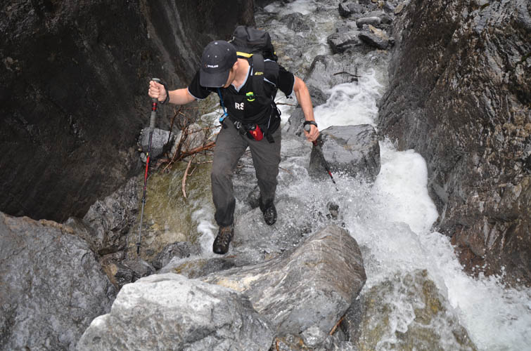
Wet boulder hopping!
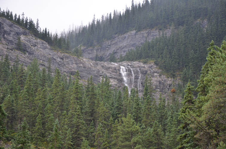
The headwall complete with waterfall. We scrambled up to the left of the waterfall.
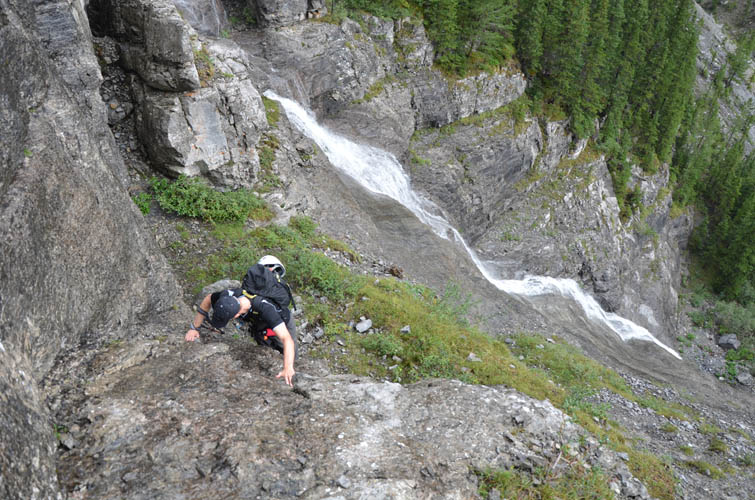
Richard about to tackle the first in a series of cliffs next to the waterfall.
Just above the headwall in the upper valley.
More neat terrain, just like a staircase. There was certainly no shortage of water on this day.
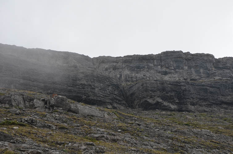
The upper valley opens up, Phantom Crag shrouded in mist.

A fairy tale landscape.
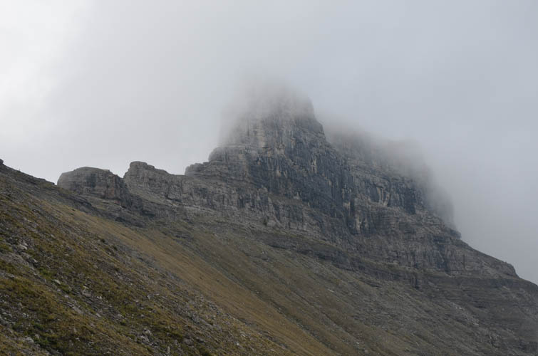
A wall of clouds, with the summit block of Phantom Crag hiding in the middle of it.
The main cliffband that guards the summit mass. We tried the crack seen here in the middle, but it was wet, slippery and steep – not a good idea without ropes.
The western and higher extension of Phantom Crag.

Occasionally we caught glimpses of the Ghost River to the north.
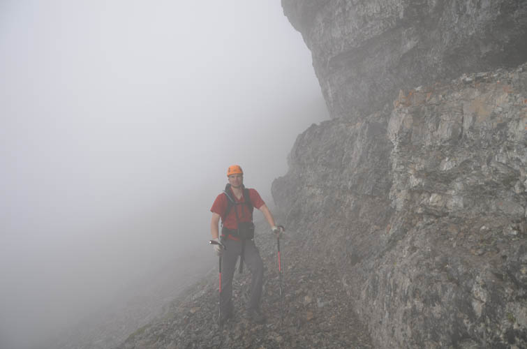
In the mist: scouting out possible weaknesses along the main cliffband. [Photo by Richard]
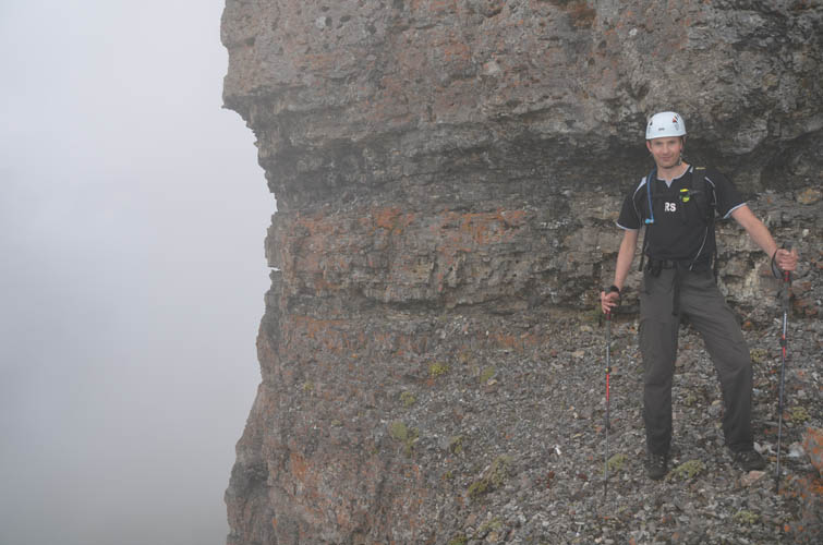
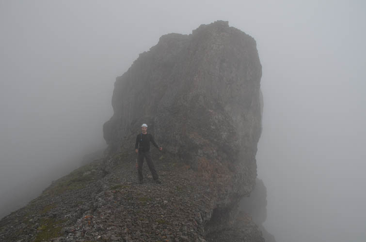
Richard posing at the eastern end of the cliffband… no feasible route here!
So we traversed below the cliff all the way to its western end.
At the western end of the summit buttress where we found a route up.
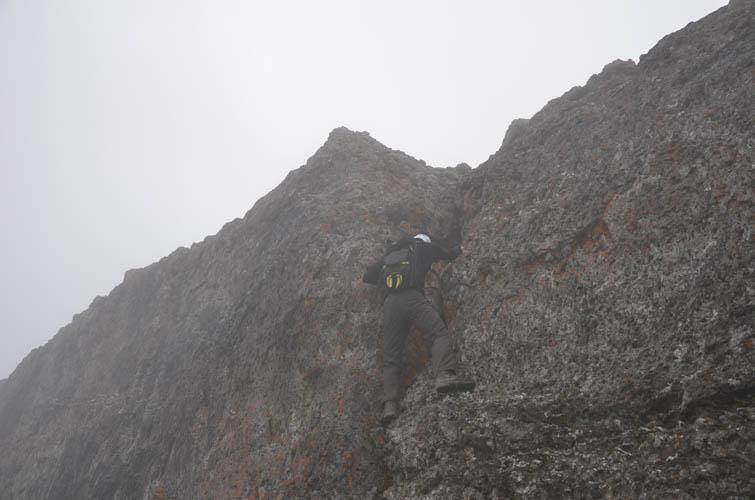
Richard scrambling up the “easiest” crack we found through the cliffband.
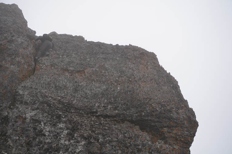
Almost at the top!
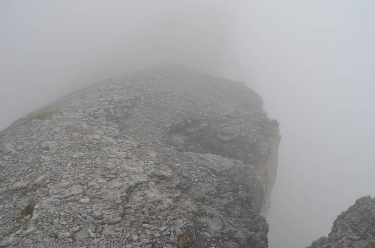
Nearing the summit.
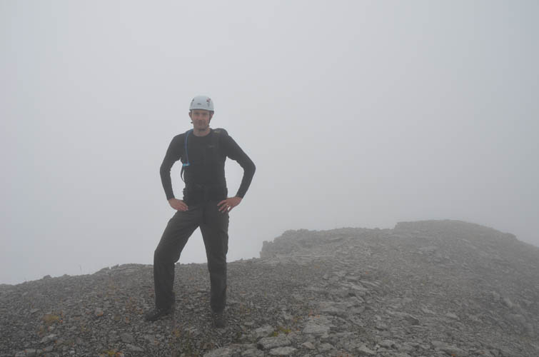
Richard at the summit of Phantom Crag, taking in the beautiful views around us 🙂
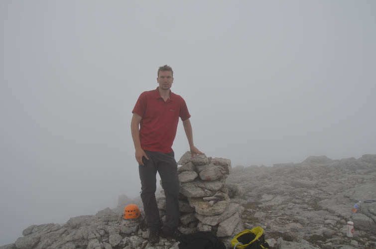
Me at the summit cairn. [Photo by Richard]

You can’t always get the timing right: at the end of our trip, Phantom Crag finally frees itself from the clouds as the sun comes out. The truck in the river valley is from a more adventurous driver than myself: while I didn’t dare cross the water, many others successfully did.