24 August 2013
Solo
This was an exploratory trip to scope out a route to the elusive South Ghost Peak that is shown on Google Maps as one of the highest peaks in the area. It is also mentioned on the Bivouac.com website but no accounts of ascents or attempts could be found on the internet or anywhere else. I’ve always had an interest in exploring remote, unheard-of peaks. South Ghost Peak is one of those strange mountains that are tantalizingly close to Calgary but there’s absolutely no information out there in publications or the internet. (Edit June 2016: The Rocky Mountain Ramblers also successfully ascended the peak in May 2016 via Exshaw Pass. This is now the only other published ascent I’m aware of.)
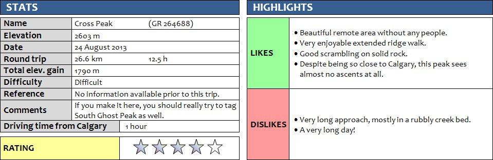
I finally took a chance and headed up Jura Creek one Saturday morning at 8 am – far too late of course for such a long and unpredictable outing given that I only had a topo map but no other information. The small parking lot at Jura Creek trailhead is now completely cleaned up after the floods of June 2013, with a new artificial gravel ditch plus gravel road leading to the creek entrance from highway 1A. I followed the regular hiking trail that leads high above the creek canyon first, then quickly descends down into the creek bed and stays in the creek for about 40 minutes to False Fault Pools. The trail is washed out in the creek bed itself, but still exists in the flat grassy sections that appear from time to time on the right or the left side. After the pools, the trail is mostly absent and you have to tramp over gravel and boulders for the most part all the way to the end of the valley. You can use short grassy sections that sometimes pop up to make it easier on the feet. Towards the end of the valley, the creek gets narrower and now flows a trickle of water over large brown platy shale beds. It will take about 2.5 to 3 hours up to this point. Now the angle steepens but you can continue to hike right in the V-shaped gully past a minor junction where you have a choice of turning left (N to NW) up steepish grey cliffs or right (NE) along the more prominent gully. Take the right branch and work your way up the main gully until loose brown shale appears on your left. Here you should follow the boundary between brown shale and grey rock all the way up the slope until you hit the craggy ridge. You should reach a point where you can’t continue left (W) along the ridge because of difficult steep cliffs that would be too dicey to downclimb. I didn’t go the proper way and lost valuable time by following the main gully that turns right (E) and heading up to the double summit of Morrowmount. After reaching Morrowmount north summit I then had to descend down to the col just west of this mountain toward an intermediate peak (which I believe Andrew Nugara calls “Morrowshaw Peak”). From here, at first glance it looked like there was no way to get up onto the long sinuous ridge that would eventually lead to South Ghost Peak, because of steep cliffs guarding the ridge crest. However, more detailed study of the E face of this long ridge revealed that there may be a way to bypass the cliffs and scramble up along a series of ledges.
And that’s exactly how it turned out to be – I descended towards the NW from the small col at the edge of the orange shale, losing perhaps 50 to 100 m of elevation, but then eventually worked my way up again on this steepish slope, all the time heading north and parallel to the N-S ridge. This involved some sidesloping on loose rock and at times tiptoeing along narrow, grassy ledges that continued for quite a ways just below a thick, white rock band that consists of a particularly resistant limestone and forms a steep wall all along the mountain. It really didn’t look like there were any obvious weaknesses to overcome this rock band from my initial vantage point, but I simply kept going and eventually found a way up, right before a nasty overhang where my journey would’ve ended abruptly. Going up the upper dark grey rock band involved a few tricky moves with good, solid holds and a fair bit of exposure. After a few more zig-zags along ledges I made it up to the ridge crest and continued on easy but partially exposed terrain towards the summit of “Cross Peak”. This is not an official name, but in my opinion the peak is significant enough to be referred to with a name instead of just GR coordinates. I called it Cross Peak because it looks like a cross on google maps. Incredibly, there was even cell phone reception here! There was a very weathered, rather diminutive cairn at Cross Peak and my GPS read 2603 m while my watch read 3:30 pm – my set time for turn-around. Even though I now had South Ghost Peak in plain sight right in front of me for the first time, I had to abort my mission so close to my goal.
I reluctantly retreated and went back the same way I came, knowing that this was unfinished business… And of course I returned a week later to complete the mission and successfully ascend South Ghost Peak.
DISCLAIMER: Use at your own risk for general guidance only! Do not follow this GPX track blindly but use your own judgement in assessing terrain and choosing the safest route.
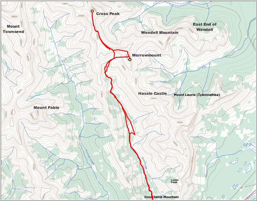
Early morning approach in Jura Creek near False Fault Pools.
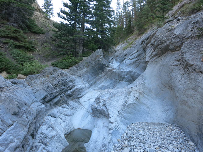
Most of Jura Creek is a wide rubble field. Hassle Castle on the right.
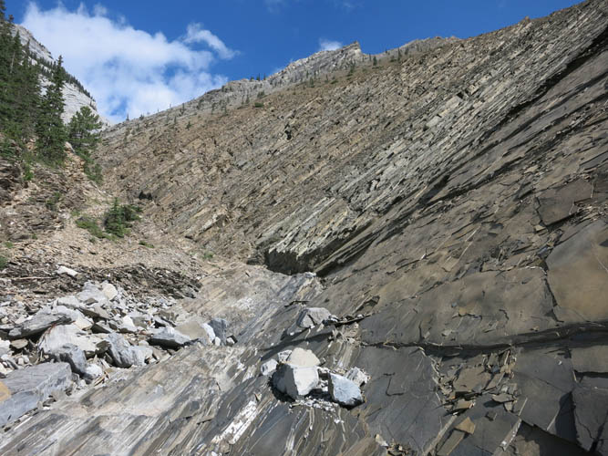
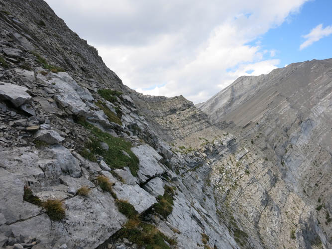
In the upper reaches of the valley, fissile brown shale makes for an interesting change in scenery .

There are no major obstacles, but short detours to the right or left of the creek bed are sometimes necessary.
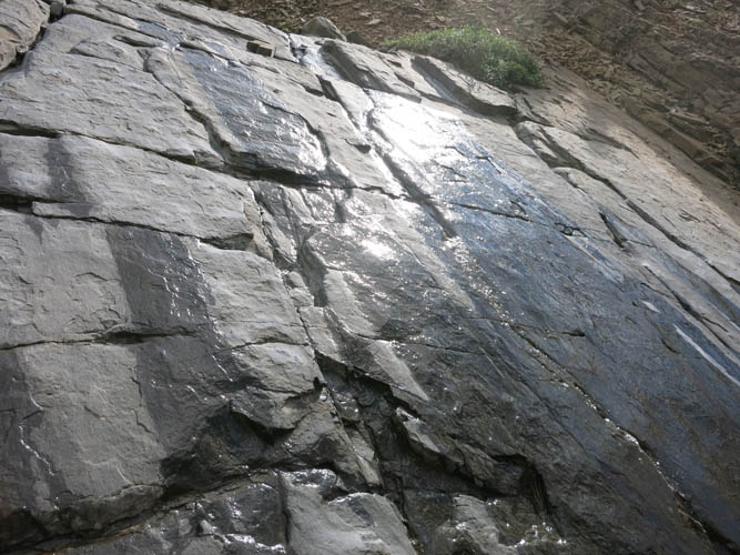
Water seeping out of cracks and joints in smooth slabs of shale.

Looking back down the upper part of Jura Creek.
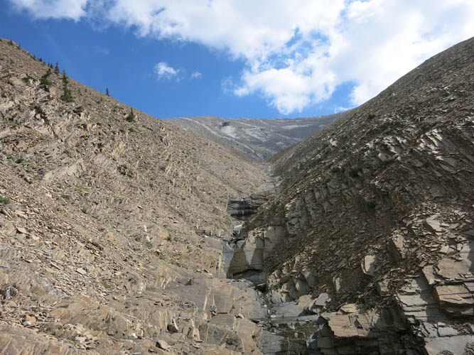
Nearing the upper end of the creek – Morrowmount beckons on the horizon (now looking east).
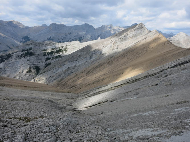
View back down to the west from near the top of Morrowmount.
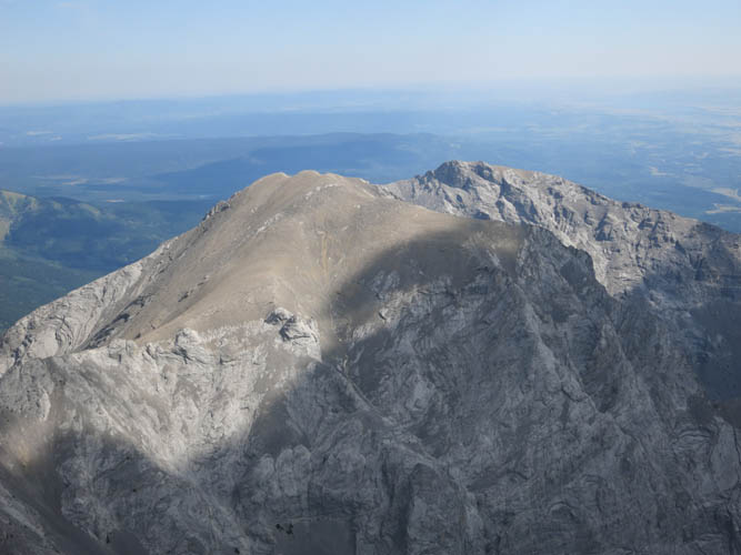
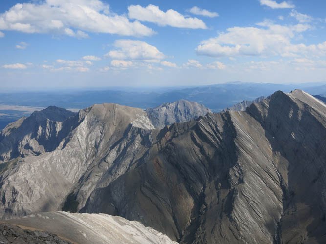
Wendell Mountain and the prairies behind as seen from Morrowmount.
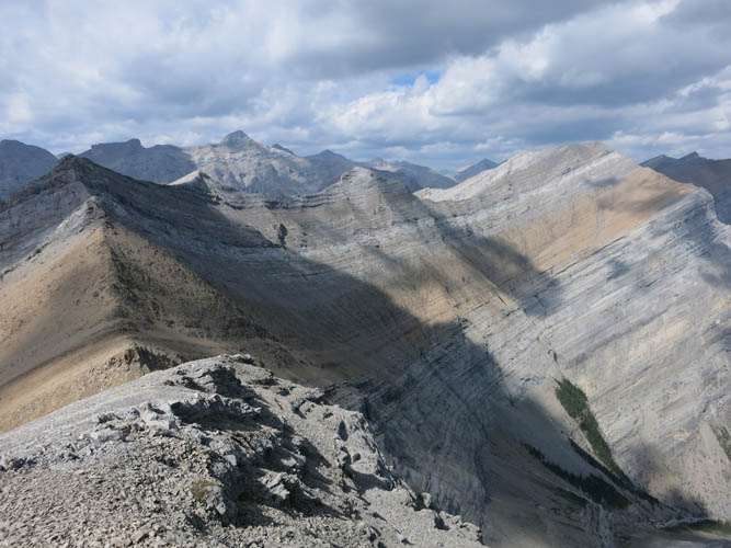
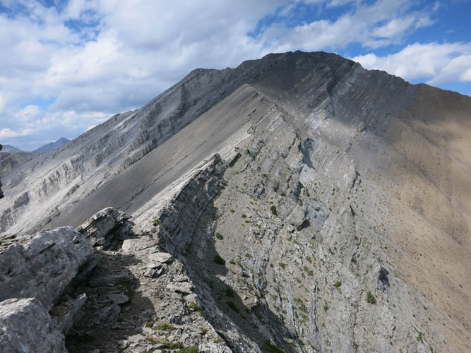
The way ahead to Cross Peak (on right): the first half of the route follows ledges on east facing aspects of this ridge just above the brown shale band.
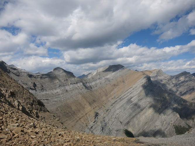
Another view of the route ahead. The summit of Cross Peak is in the shadow of clouds, just to the right of centre.
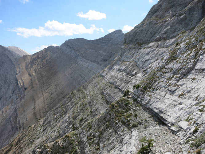
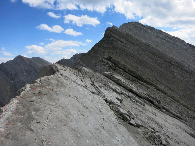
Looking back along one of the weaknesses in the escarpment where I came from. I started this route at the notch below the big cloud.
Steep scrambling is required to gain the ridge crest.
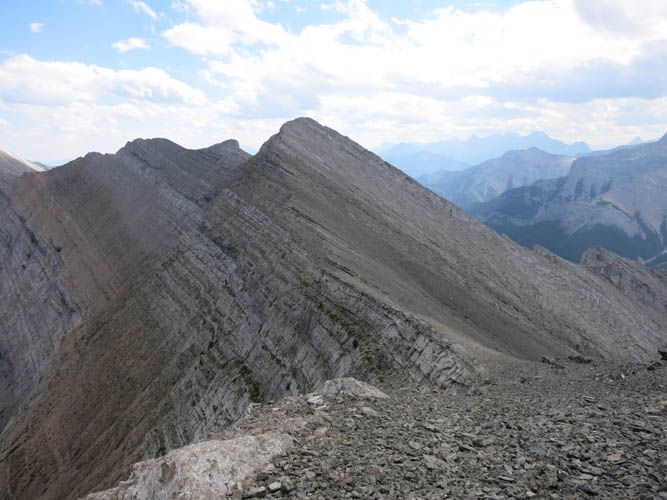
The remainder of the route follows the crest of the ridge to the summit of Cross Peak.
Looking back at some steep slabs I just crossed.
View back (south) from the summit.
Looking SE from the summit of Cross Peak: Wendell Mountain (the broad mound of brown shale on the left), Yanmuska in the centre back, and the double summit of Morrowmount on the right.
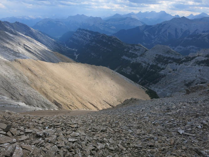
This is the easy shale slope I took on the way back from the notch after traversing the ridge and ledges. The long valley of Jura Creek lies ahead.